Signs Tagged With Distance Marker
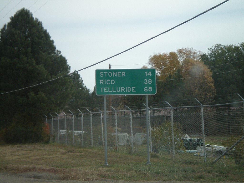
CO-145 - Distance Marker
Distance marker on CO-145 east of Dolores. Distances to Rico, Stoner, and Telluride.
Taken 10-21-2008
 Dolores
Montezuma County
Colorado
United States
Dolores
Montezuma County
Colorado
United States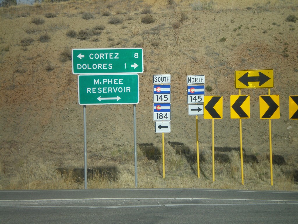
CO-84 West at CO-145
CO-184 west at CO-145 to Delores and Cortez. CO-184 west joins CO-145 south.
Taken 10-21-2008
 Dolores
Montezuma County
Colorado
United States
Dolores
Montezuma County
Colorado
United States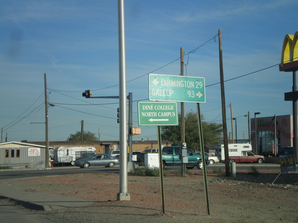
US-64 East at US-491
US-64 east at US-491. Use US-491 south for Gallup. US-491 north joins US-64 through Shiprock.
Taken 10-18-2008

 Shiprock
San Juan County
New Mexico
United States
Shiprock
San Juan County
New Mexico
United States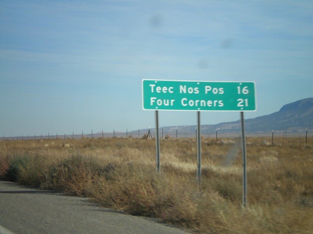
US-160 East - Distance Marker
Distance marker on US-160 east to Teec Nos Pos and Four Corners.
Taken 10-18-2008
 Red Mesa
Apache County
Arizona
United States
Red Mesa
Apache County
Arizona
United States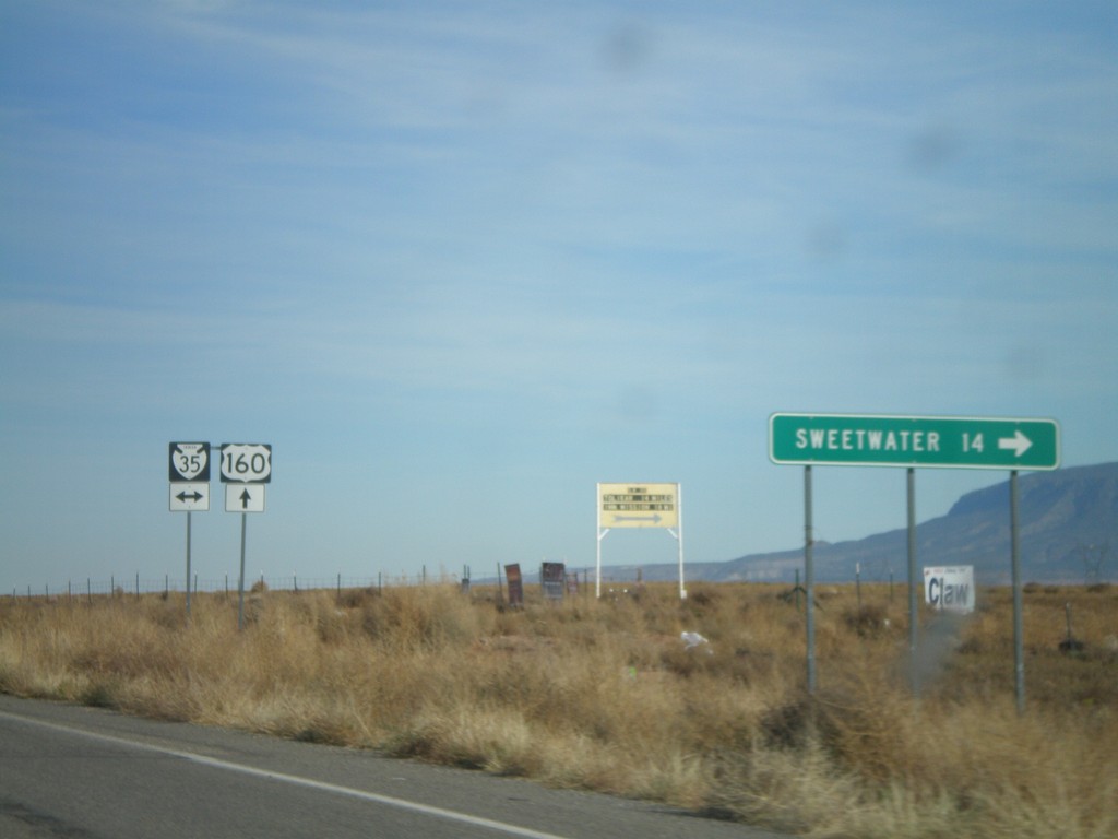
US-160 East at BIA-35
US-160 east at BIA-35. Sweetwater is 14 miles to the south on BIA-35.
Taken 10-18-2008
 Red Mesa
Apache County
Arizona
United States
Red Mesa
Apache County
Arizona
United States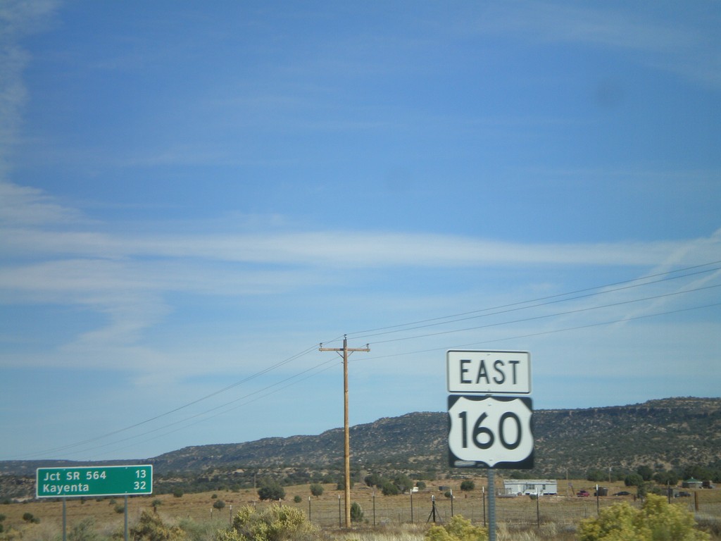
US-160 East - Shield and Distance Marker
Distance marker on US-160 east of AZ-98. Distance given to Jct. SR-564 and Kayenta. US-160 shield in foreground.
Taken 10-18-2008
Shonto
Navajo County
Arizona
United States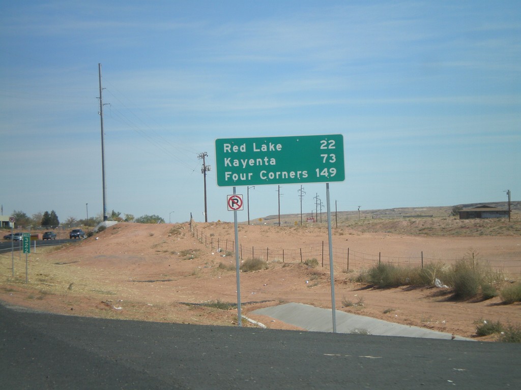
US-160 East - Distance Marker
US-160 east of AZ-264 junction. Distance marker to Red Lake, Kayenta, and Four Corners.
Taken 10-18-2008
 Tuba City
Coconino County
Arizona
United States
Tuba City
Coconino County
Arizona
United States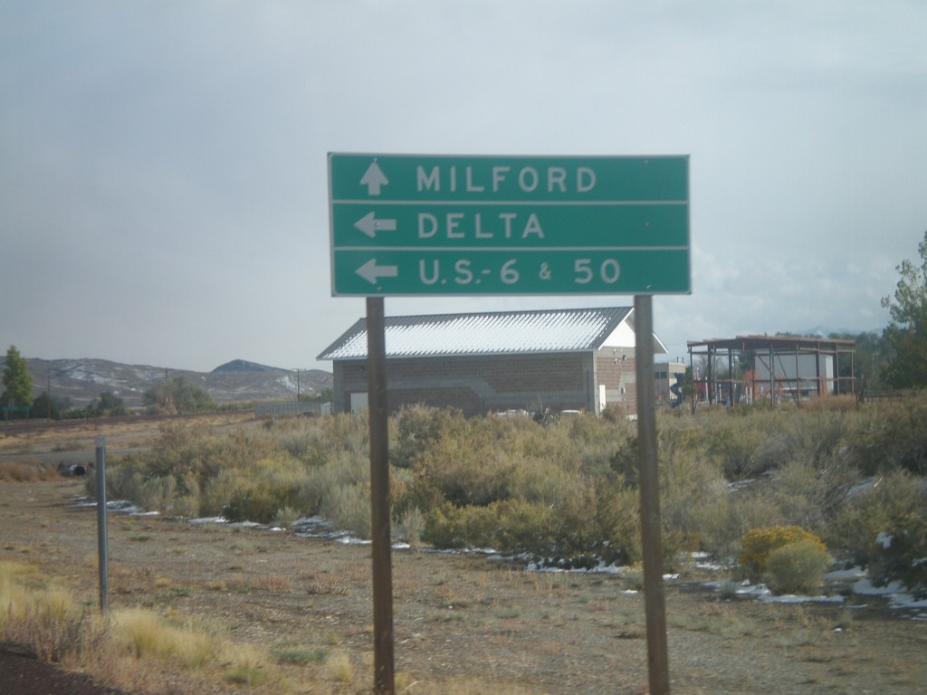
UT-21 East at UT-159
UT-21 east approaching UT-159 north to US-6/US-50 and Delta.
Taken 10-11-2008

 Garrison
Millard County
Utah
United States
Garrison
Millard County
Utah
United States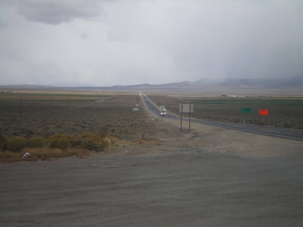
US-93 North - Distance Marker
Distance marker on US-93 north. Distance to Currie, Wells, and Twin Falls (Idaho).
Taken 10-11-2008

 Ely
White Pine County
Nevada
United States
Ely
White Pine County
Nevada
United States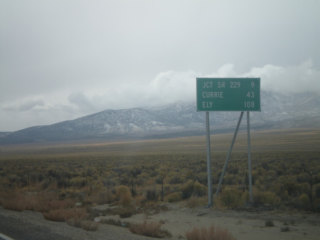
US-93 South - Distance Marker
Distance marker on US-93 south. Distance to Jct. SR-229, Currie, and Ely.
Taken 10-11-2008
Wells
Elko County
Nevada
United States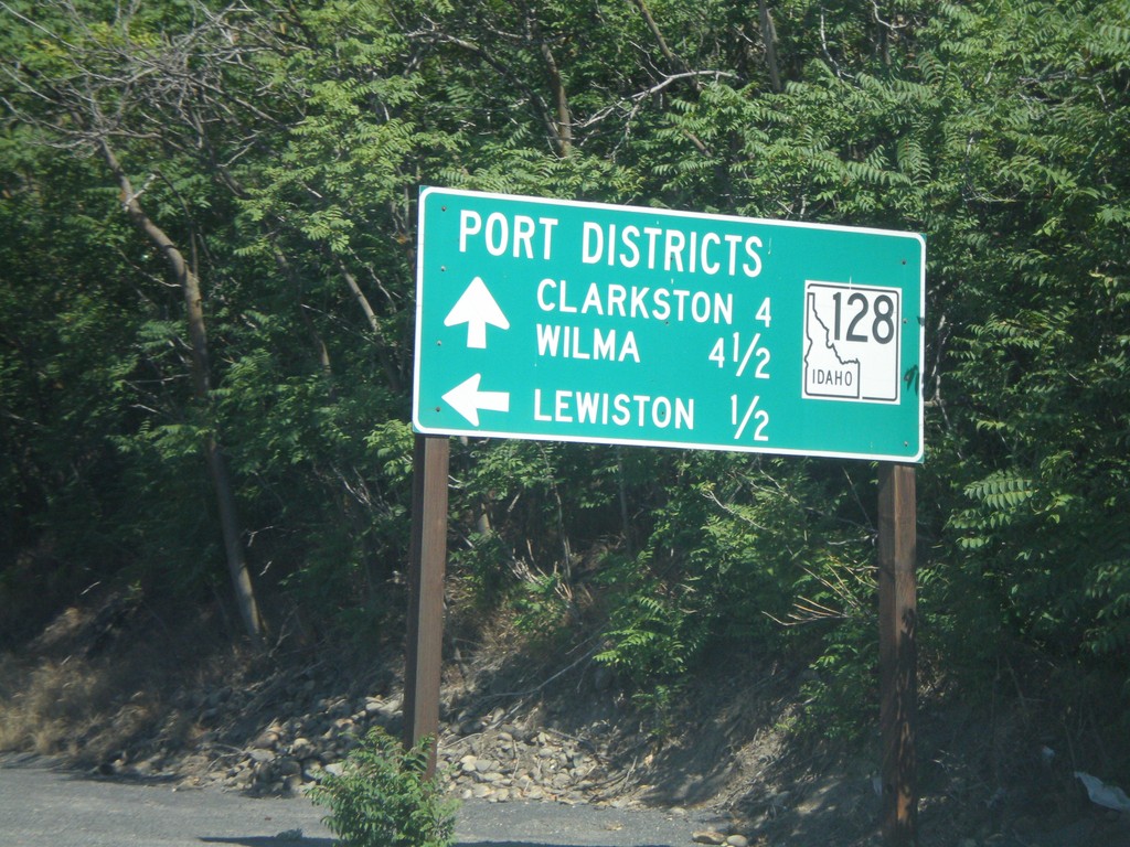
ID-128 West - Port Districts
ID-128 at the Port of Lewiston. Continue ahead for the Ports of Clarkston (WA) and Wilma (WA).
Taken 07-27-2008
 Lewiston
Nez Perce County
Idaho
United States
Lewiston
Nez Perce County
Idaho
United States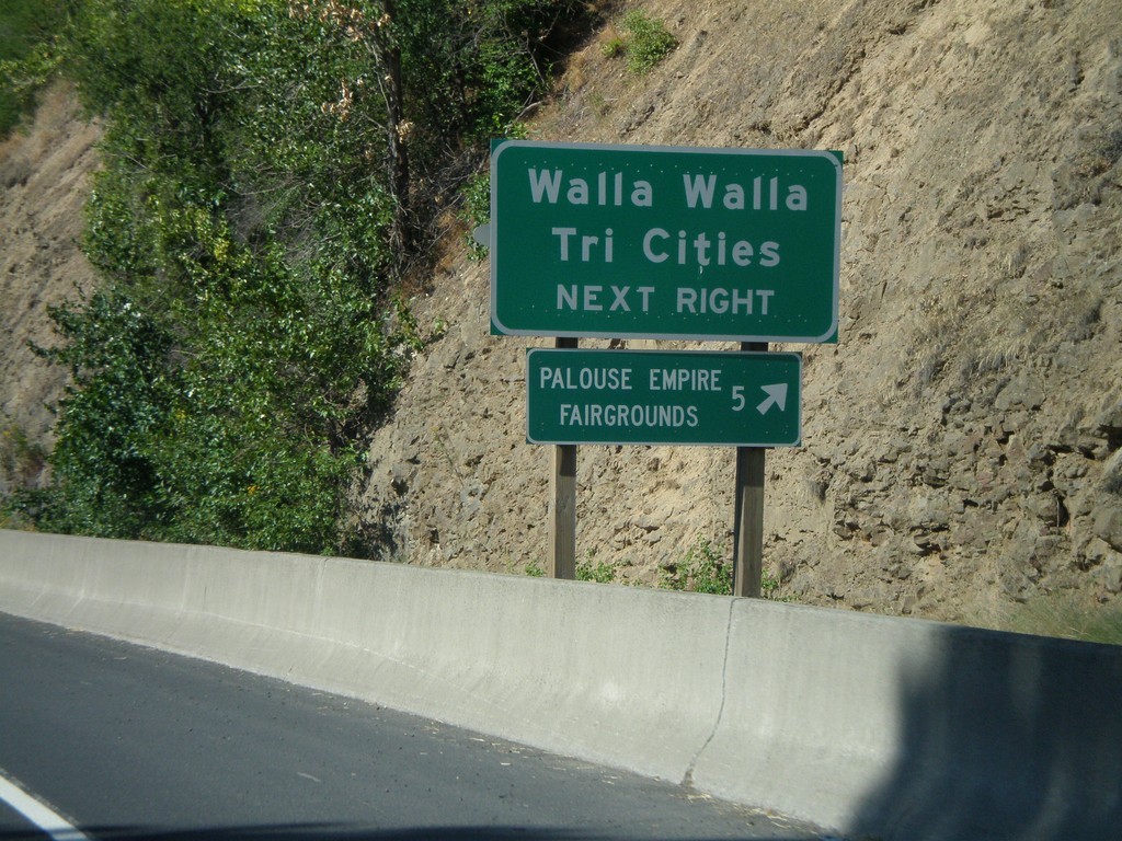
US-195 South Approaching WA-26
US-195 south approaching WA-26 west. Use WA-26 for Walla Walla and the Tri Cities.
Taken 07-27-2008

 Colfax
Whitman County
Washington
United States
Colfax
Whitman County
Washington
United States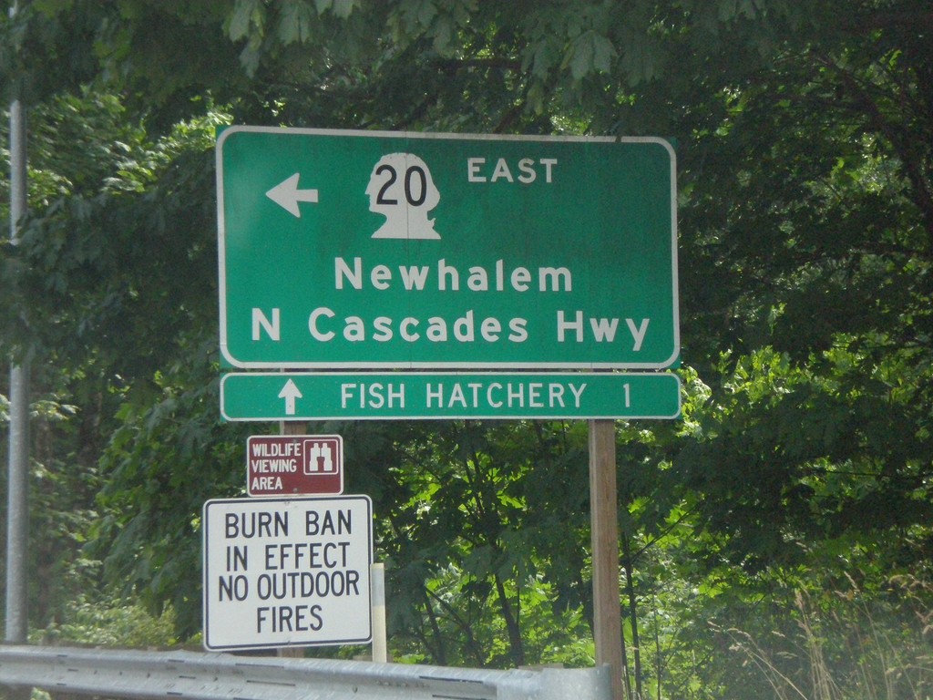
WA-20 East at Cascade River Road
WA-20 East at Cascade River Road. Turn left on WA-20 for Newhalem and North Cascade Highway.
Taken 07-26-2008
 Marblemount
Skagit County
Washington
United States
Marblemount
Skagit County
Washington
United States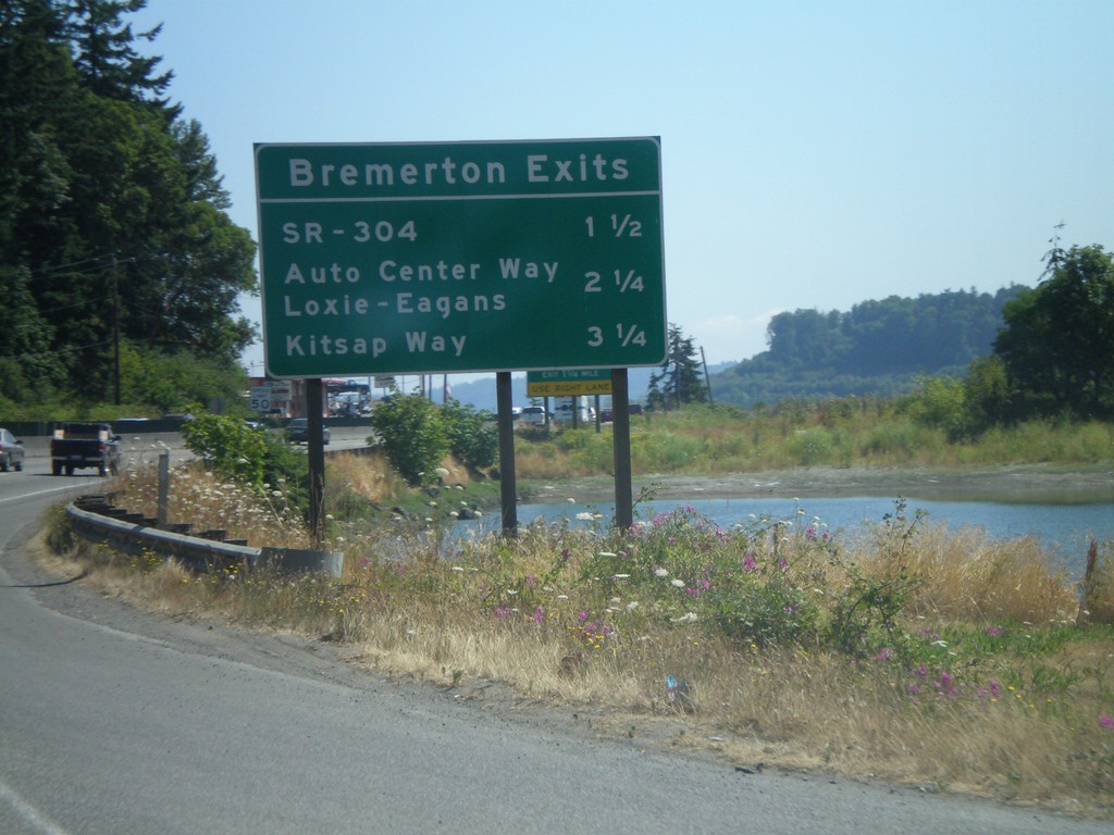
WA-3 North - Bremerton Exits
Bremerton exits on WA-3 north.
Taken 07-24-2008
 Bremerton
Kitsap County
Washington
United States
Bremerton
Kitsap County
Washington
United States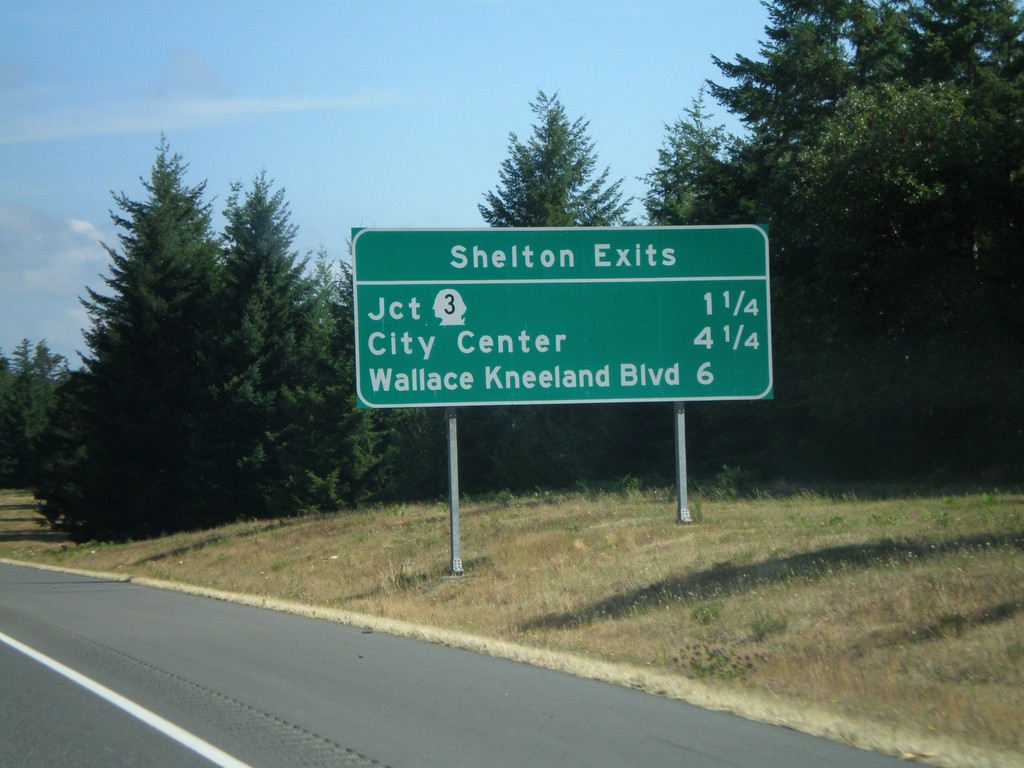
US-101 North - Shelton Exits
Shelton Exits on US-101 north.
Taken 07-24-2008
 Shelton
Mason County
Washington
United States
Shelton
Mason County
Washington
United States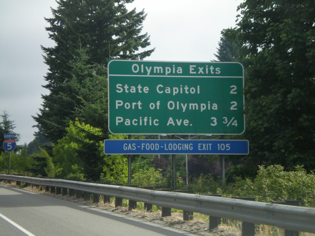
I-5 North - Olympia Exits
Olympia exits on I-5 north.
Taken 07-24-2008
 Tumwater
Thurston County
Washington
United States
Tumwater
Thurston County
Washington
United States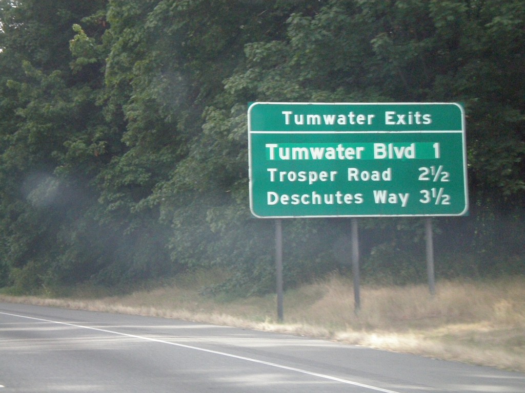
I-5 North - Tumwater Exits
Tumwater Exits on I-5 north. Tumwater is a suburb of Olympia.
Taken 07-24-2008
Tumwater
Thurston County
Washington
United States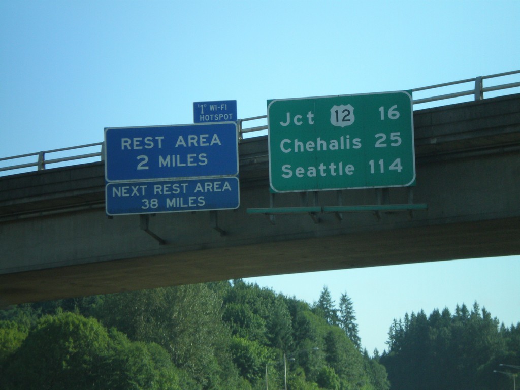
I-5 North - Distance Overhead
I-5 overhead with distance marker to US-12, Chehalis, and Seattle. Rest Area with Wi-Fi access in 2 miles.
Taken 07-24-2008
Castle Rock
Cowlitz County
Washington
United States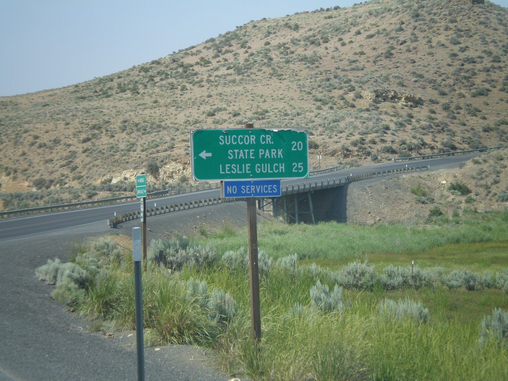
US-95 North at Succor Creek
US-95 north at turnoff to Succor Creek State Park and Leslie Gulch.
Taken 07-07-2008
 Sheaville
Malheur County
Oregon
United States
Sheaville
Malheur County
Oregon
United States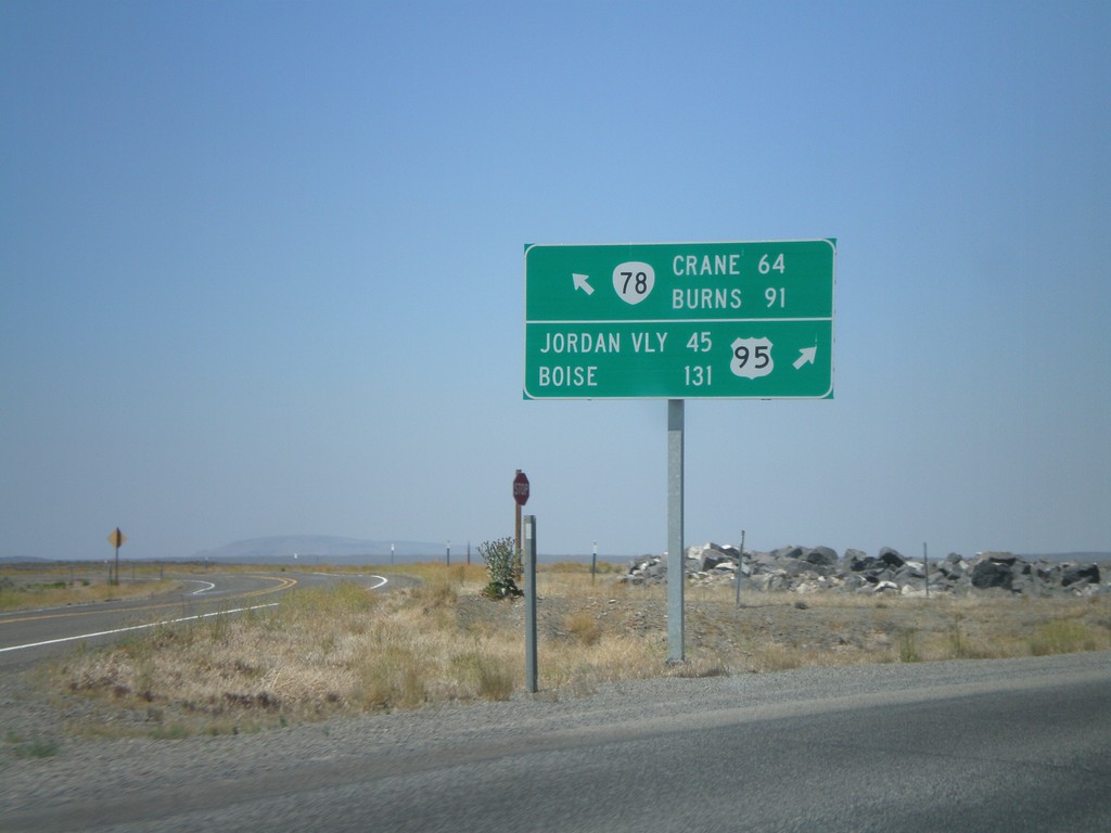
US-95 North at OR-78 West
US-95 north at OR-78 west. Merge left for OR-78 to Burns and Crane. Merge right for US-95 to Jordan Valley and Boise.
Taken 07-07-2008
 Jordan Valley
Malheur County
Oregon
United States
Jordan Valley
Malheur County
Oregon
United States
I-80 East - Reno Exits
Exits on I-80 east near Reno.
Taken 07-07-2008
 Reno
Washoe County
Nevada
United States
Reno
Washoe County
Nevada
United States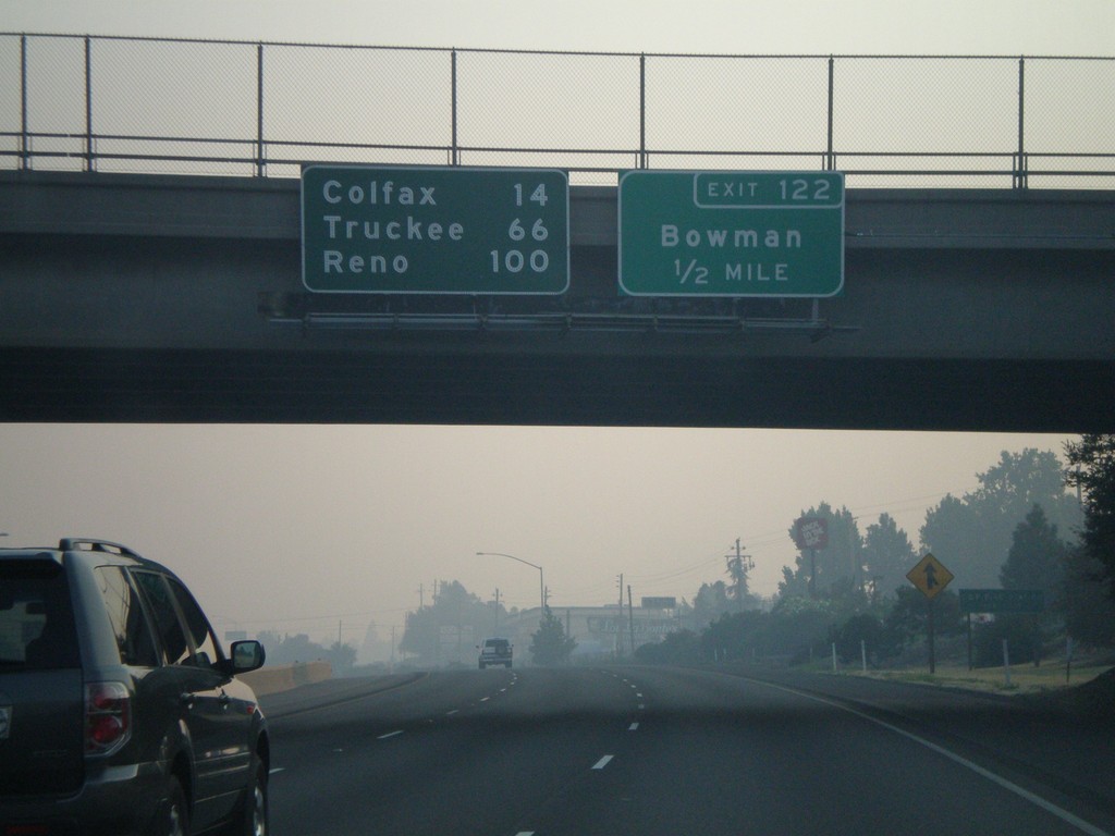
I-80 East Exit 122
I-80 east approaching Exit 122 - Bowman. Overhead distance marker to Colfax, Truckee, and Reno.
Taken 07-07-2008
Auburn
Placer County
California
United States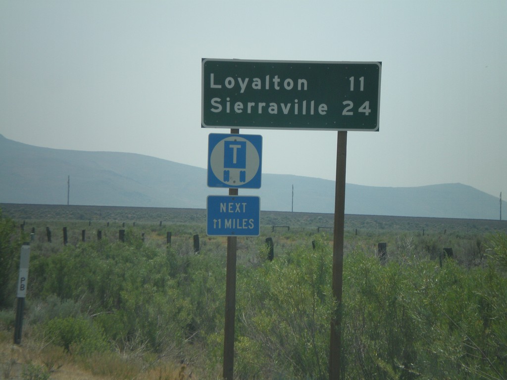
CA-49 South - Distance Marker
First distance marker on CA-49 south to Loyalton and Sierraville.
Taken 07-03-2008
 Chilcoot-Vinton
Plumas County
California
United States
Chilcoot-Vinton
Plumas County
California
United States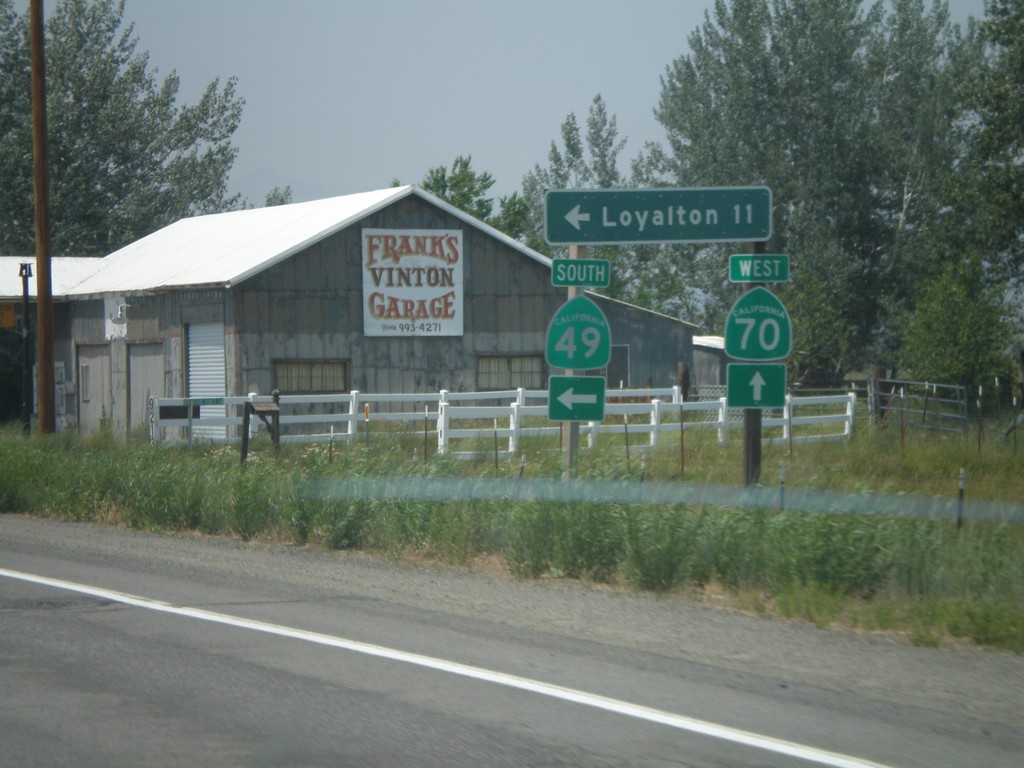
CA-70 West at CA-49 South
CA-70 west at CA-49 south to Loyalton. This is the northern beginning of CA-49 which goes through the California Gold Country.
Taken 07-03-2008
 Chilcoot-Vinton
Plumas County
California
United States
Chilcoot-Vinton
Plumas County
California
United States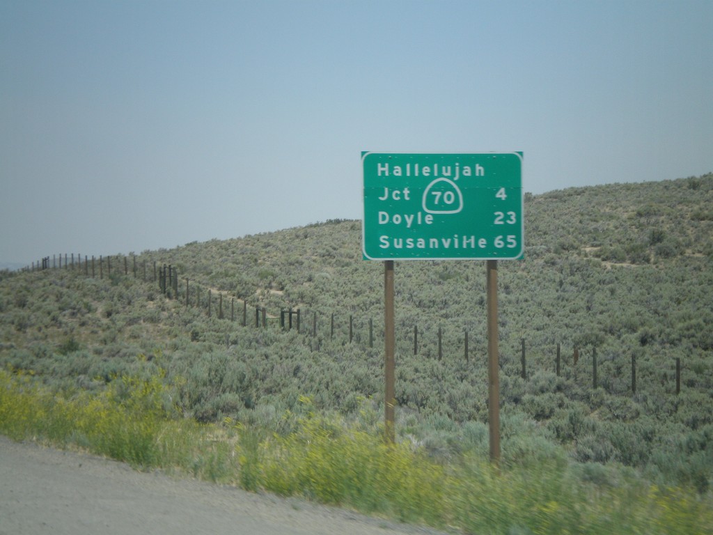
US-395 North - Distance Marker
Distance marker on US-395 north to CA-70 Jct (Hallelujah Junction), Doyle, and Susanville. This is the first distance marker on US-395 inside of California.
Taken 07-03-2008
 Chilcoot-Vinton
Plumas County
California
United States
Chilcoot-Vinton
Plumas County
California
United States