Signs Tagged With Distance Marker
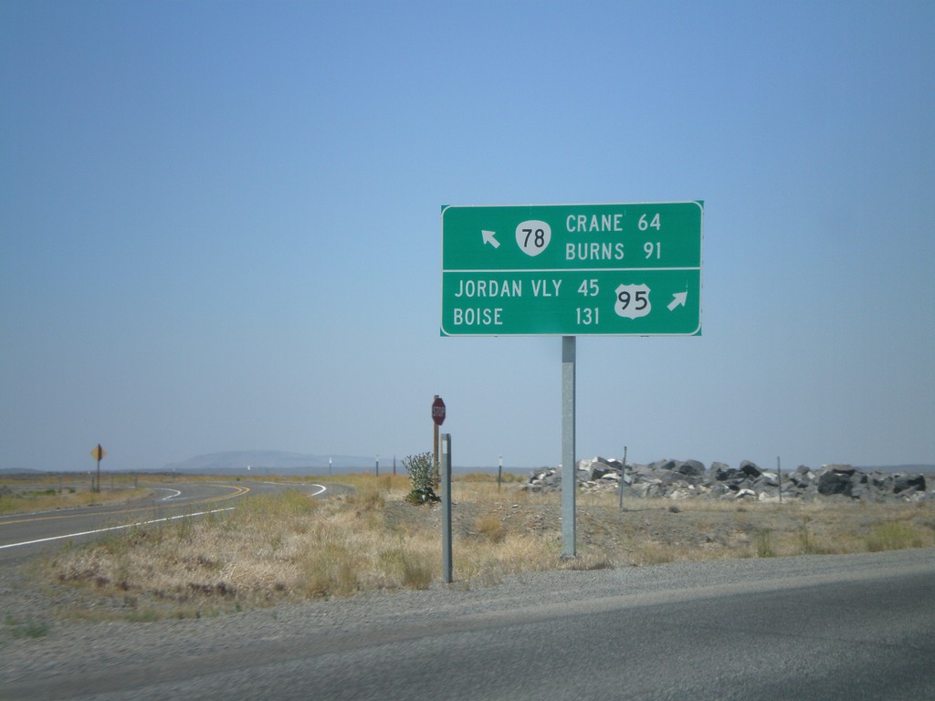
US-95 North at OR-78 West
US-95 north at OR-78 west. Merge left for OR-78 to Burns and Crane. Merge right for US-95 to Jordan Valley and Boise.
Taken 07-07-2008

 Jordan Valley
Malheur County
Oregon
United States
Jordan Valley
Malheur County
Oregon
United States
I-80 East - Reno Exits
Exits on I-80 east near Reno.
Taken 07-07-2008
 Reno
Washoe County
Nevada
United States
Reno
Washoe County
Nevada
United States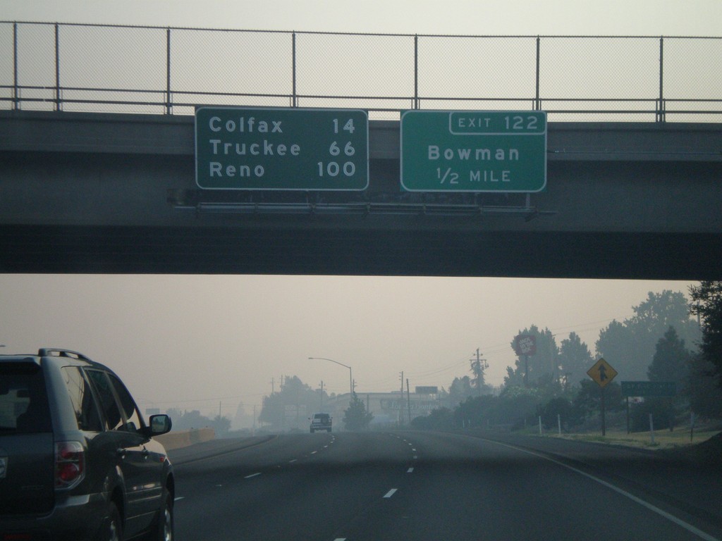
I-80 East Exit 122
I-80 east approaching Exit 122 - Bowman. Overhead distance marker to Colfax, Truckee, and Reno.
Taken 07-07-2008
Auburn
Placer County
California
United States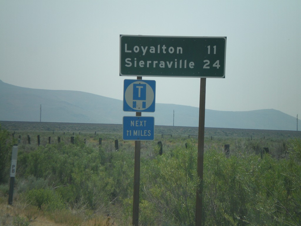
CA-49 South - Distance Marker
First distance marker on CA-49 south to Loyalton and Sierraville.
Taken 07-03-2008
 Chilcoot-Vinton
Plumas County
California
United States
Chilcoot-Vinton
Plumas County
California
United States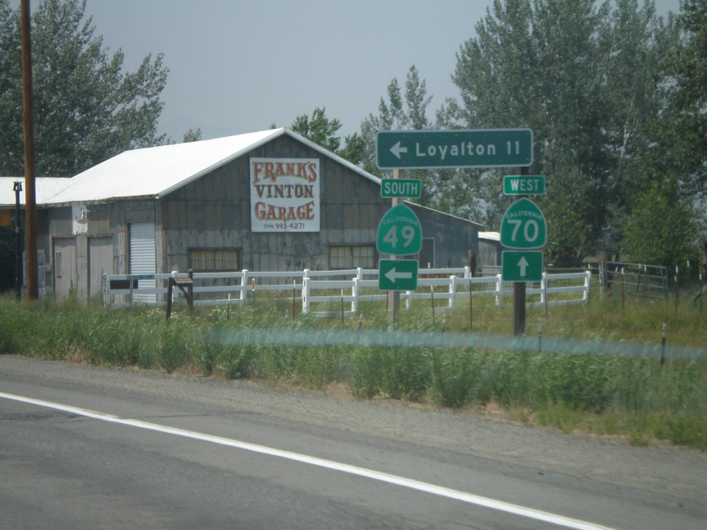
CA-70 West at CA-49 South
CA-70 west at CA-49 south to Loyalton. This is the northern beginning of CA-49 which goes through the California Gold Country.
Taken 07-03-2008
 Chilcoot-Vinton
Plumas County
California
United States
Chilcoot-Vinton
Plumas County
California
United States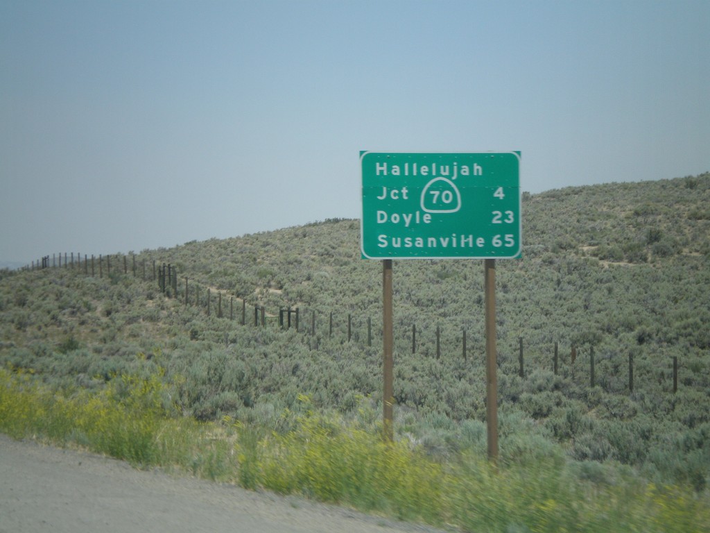
US-395 North - Distance Marker
Distance marker on US-395 north to CA-70 Jct (Hallelujah Junction), Doyle, and Susanville. This is the first distance marker on US-395 inside of California.
Taken 07-03-2008
 Chilcoot-Vinton
Plumas County
California
United States
Chilcoot-Vinton
Plumas County
California
United States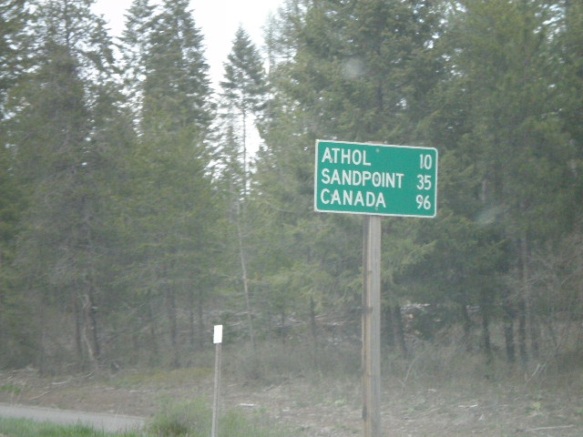
US-95 North - Distance Marker
Distance marker on US-95 north to Athol, Sandpoint, and Canada.
Taken 05-06-2008
Garwood
Kootenai County
Idaho
United States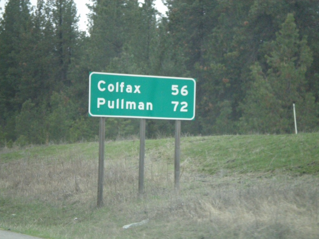
US-195 South - Distance Marker
Begin of US-195 south at I-90. First distance marker on US-195 to Colfax and Pullman.
Taken 04-14-2008
 Spokane
 County
Washington
United States
Spokane
Spokane County
Washington
United States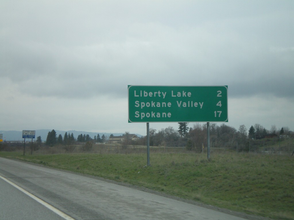
I-90 West - Distance Marker
First distance marker on I-90 west in Washington. The old distance marker had Seattle for the last city. The current one is to Liberty Lake, Spokane Valley, and Spokane.
Taken 04-14-2008
 Liberty Lake
Spokane County
Washington
United States
Liberty Lake
Spokane County
Washington
United States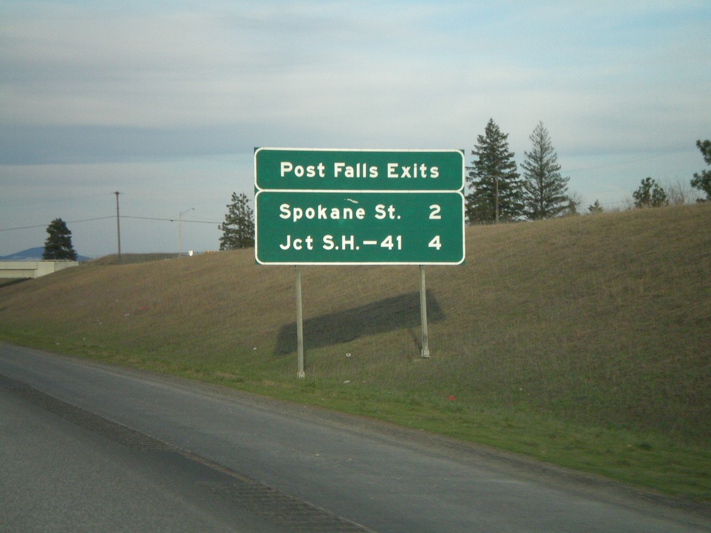
I-90 East - Post Falls Exits
Post Falls exits on I-90 east - Spokane St. and Jct. ID-41.
Taken 04-13-2008
Post Falls
Kootenai County
Idaho
United States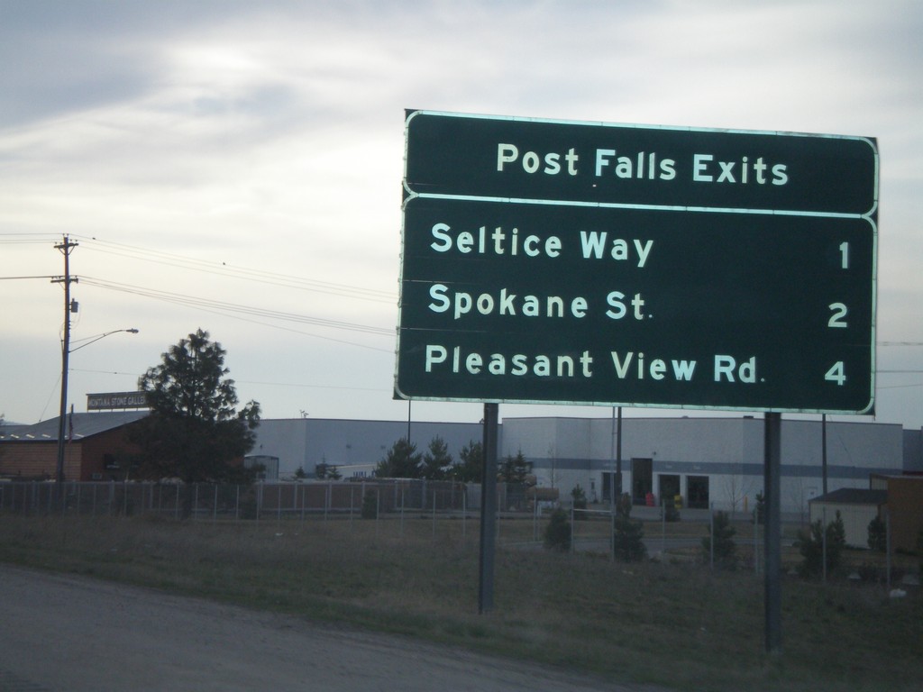
I-90 West - Post Falls Exits
Post Falls exits on I-90 west. Next three exits: Seltice Way, Spokane St., and Pleasant View Road.
Taken 04-13-2008
Post Falls
Kootenai County
Idaho
United States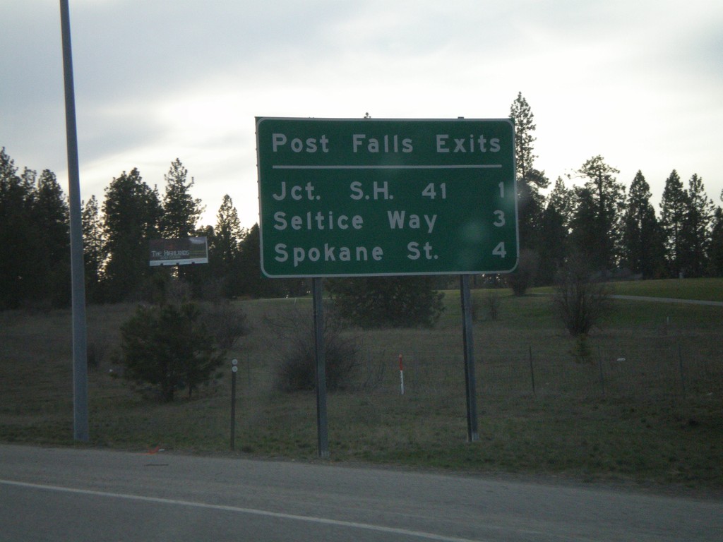
I-90 West - Post Falls Exits
Post Falls exits on I-90 West - Next 3 exits, Jct. SH-41, Seltice Way, and Spokane St.
Taken 04-13-2008
Post Falls
Kootenai County
Idaho
United States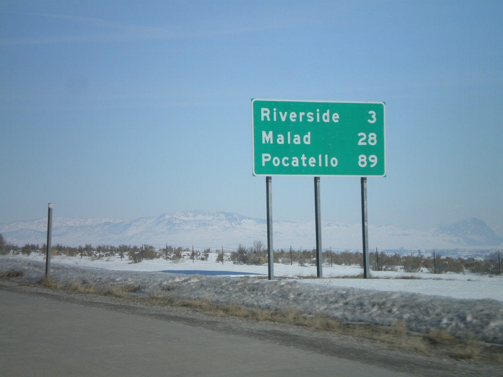
I-15 North - Distance Marker
Distance marker on I-15 north to Riverside, Malad, and Pocatello. This is the first distance marker north of the I-15/I-84 split.
Taken 02-17-2008
 Garland
Box Elder County
Utah
United States
Garland
Box Elder County
Utah
United States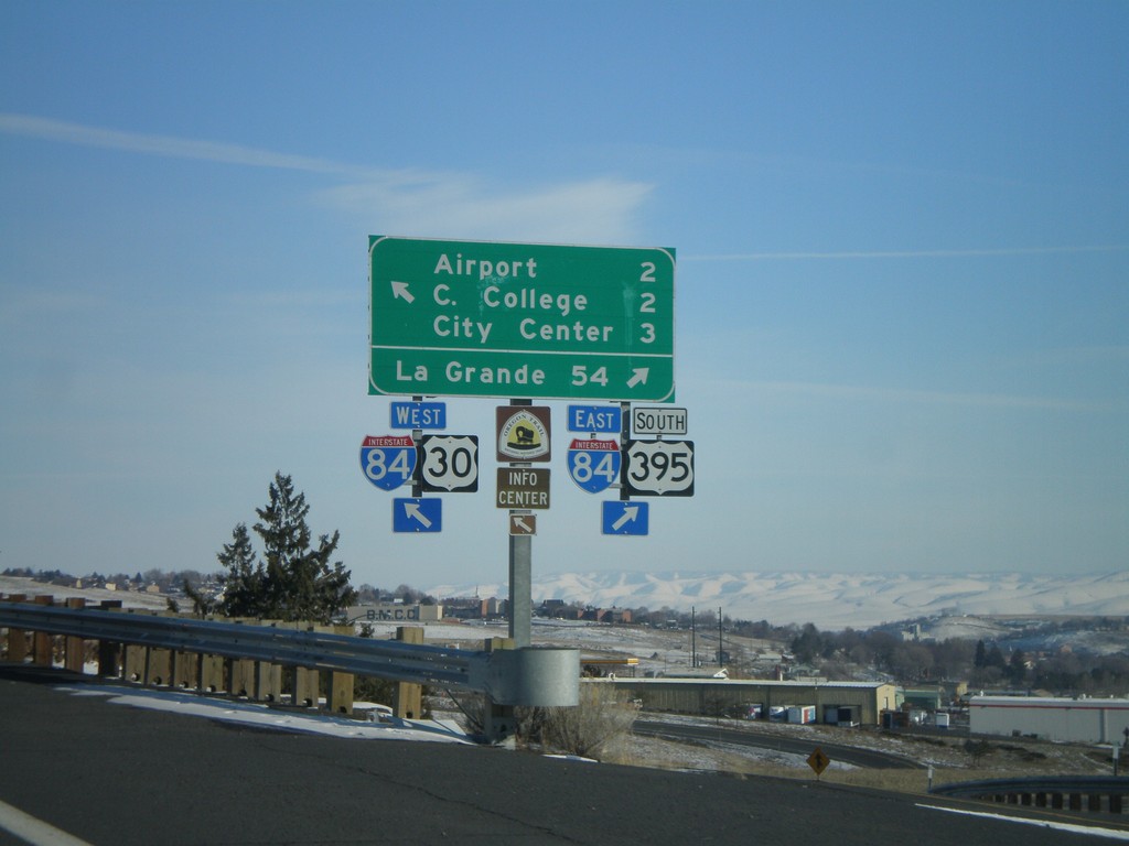
US-30 at I-84/US-395 Exit 207 Onramp
US-30 east at I-84 (Exit 207) onramp. Merge right for I-84 East/US-395 South to La Grande; continue over freeway for I-84/US-30 West/US-395 North, and for (Pendleton) Airport, (Blue Mountain) Community College, and (Pendleton) City Center.
Taken 01-22-2008

 Pendleton
Umatilla County
Oregon
United States
Pendleton
Umatilla County
Oregon
United States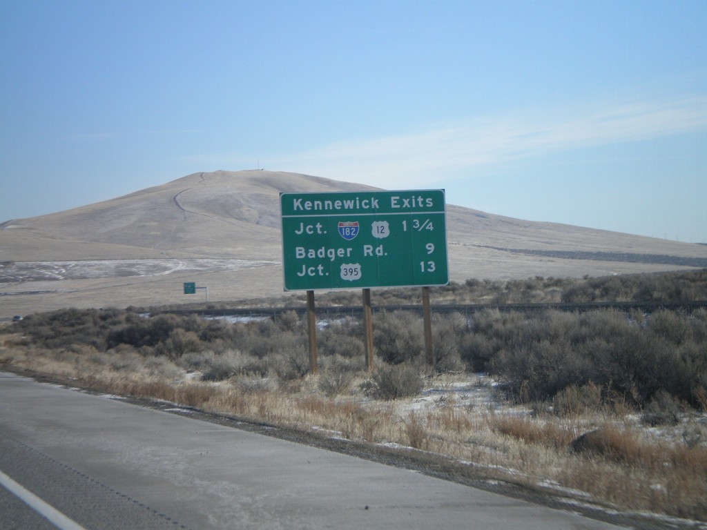
I-82 East - Kennewick Exits
Kennewick Exits on I-82 east.
Taken 01-22-2008

 Benton City
Benton County
Washington
United States
Benton City
Benton County
Washington
United States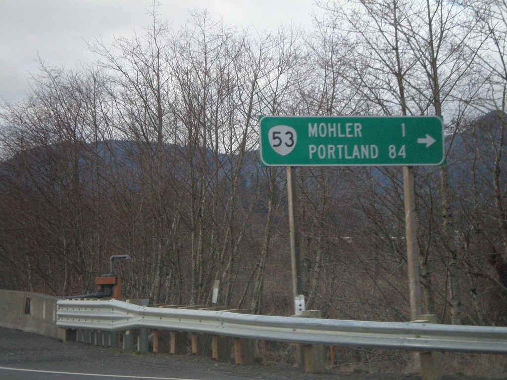
US-101 North at OR-53
US-101 north at OR-53 north to Mohler and Portland.
Taken 01-20-2008

 Wheeler
Tillamook County
Oregon
United States
Wheeler
Tillamook County
Oregon
United States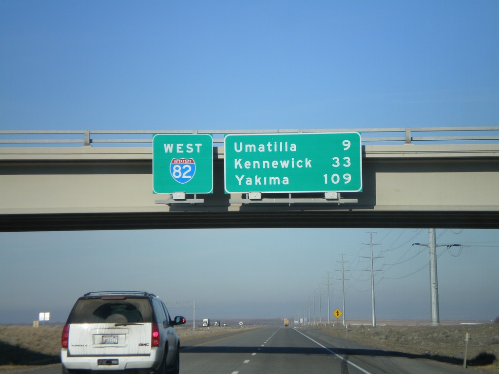
I-82 West - Overhead and Distance Marker
Distance marker on I-82 west. Distance to Umatilla, Kennewick (WA) and Yakima (WA).
Taken 01-18-2008
Hermiston
Umatilla County
Oregon
United States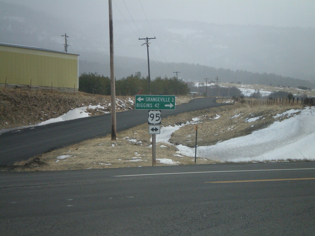
Johnson Lane at US-95 to Grangeville and Riggins
Johnson Lane south at US-95 to Grangeville and Riggins. Johnson Lane is a cutoff that shaves a few miles of driving on US-95 and avoids the town of Grangeville.
Taken 12-26-2007
Grangeville
Idaho County
Idaho
United States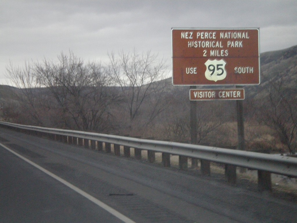
US-12 East/US-95 South - Nez Perce National Historical Park
US-95 South/US-12 East approaching the US-12/US-95 Split. Use US-95 south for the Nez Perce National Historic Park.
Taken 12-26-2007
Lewiston
Nez Perce County
Idaho
United States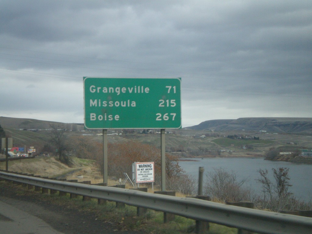
US-12 East/US-95 South - Distance Marker
Distance marker on US-95 South/US-12 East to Grangeville, Missoula (MT - via US-12), and Boise. The Clearwater River is on the right side of the picture.
Taken 12-26-2007
Lewiston
Nez Perce County
Idaho
United States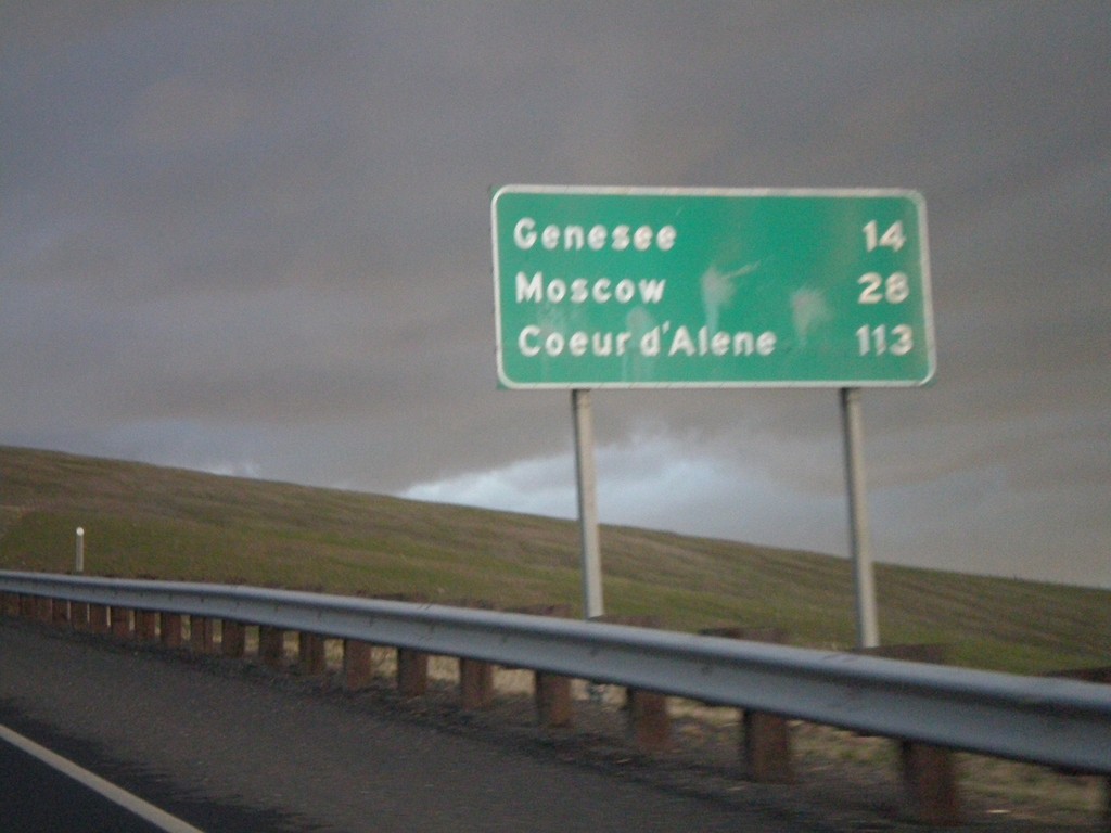
US-95 North - Distance Marker
Distance Marker on US-95 north to Genesee, Moscow, and Coeur d’Alene on Lewiston Hill.
Taken 12-24-2007
Lewiston
Nez Perce County
Idaho
United States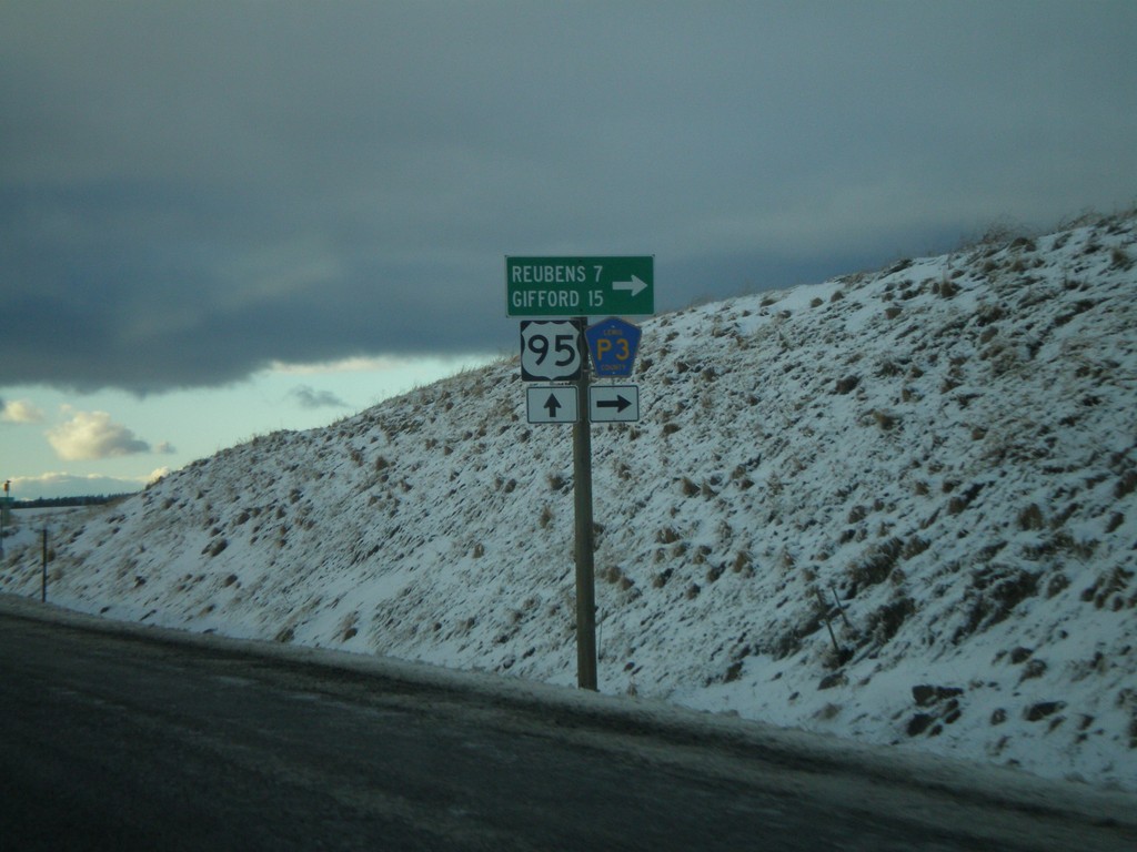
US-95 North At Lewis County Road P3
US-95 north at Lewis County Road P3 to Reubens and Gifford.
Taken 12-24-2007
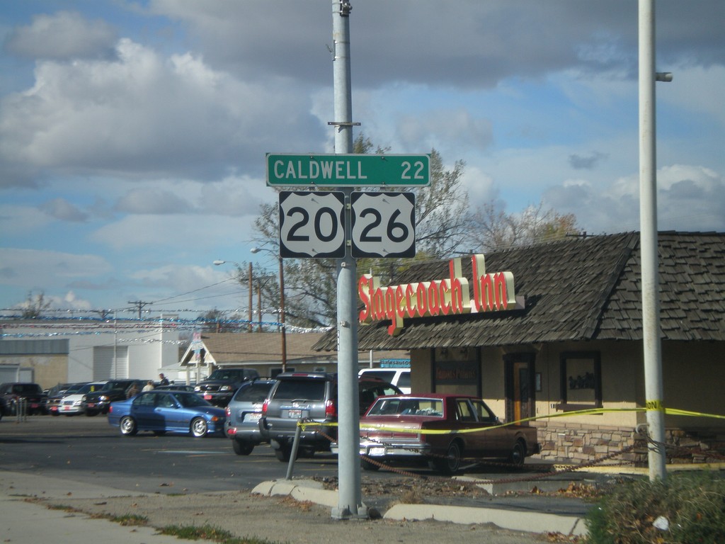
US-20/US-26 West - Distance Marker
Distance marker on US-20/US-26 West (Chinden Blvd.) to Caldwell.
Taken 10-20-2007

 Garden City
Ada County
Idaho
United States
Garden City
Ada County
Idaho
United States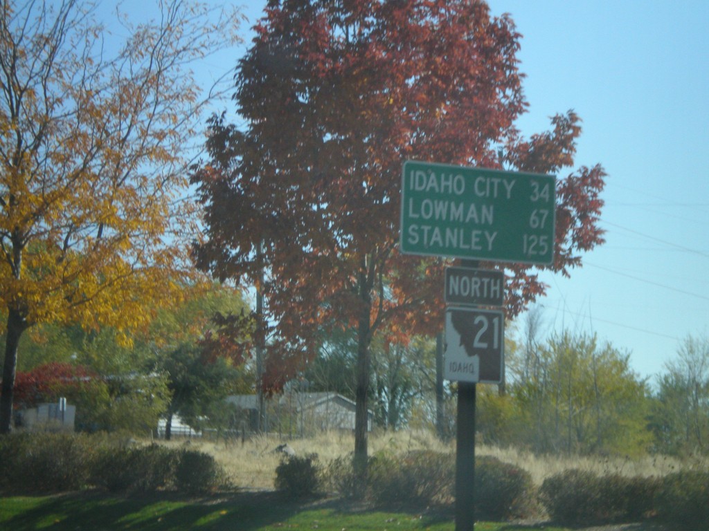
ID-21 North - Distance Marker
First distance marker on ID-21 North to Idaho City, Lowman, and Stanley.
Taken 10-13-2007
 Boise
Ada County
Idaho
United States
Boise
Ada County
Idaho
United States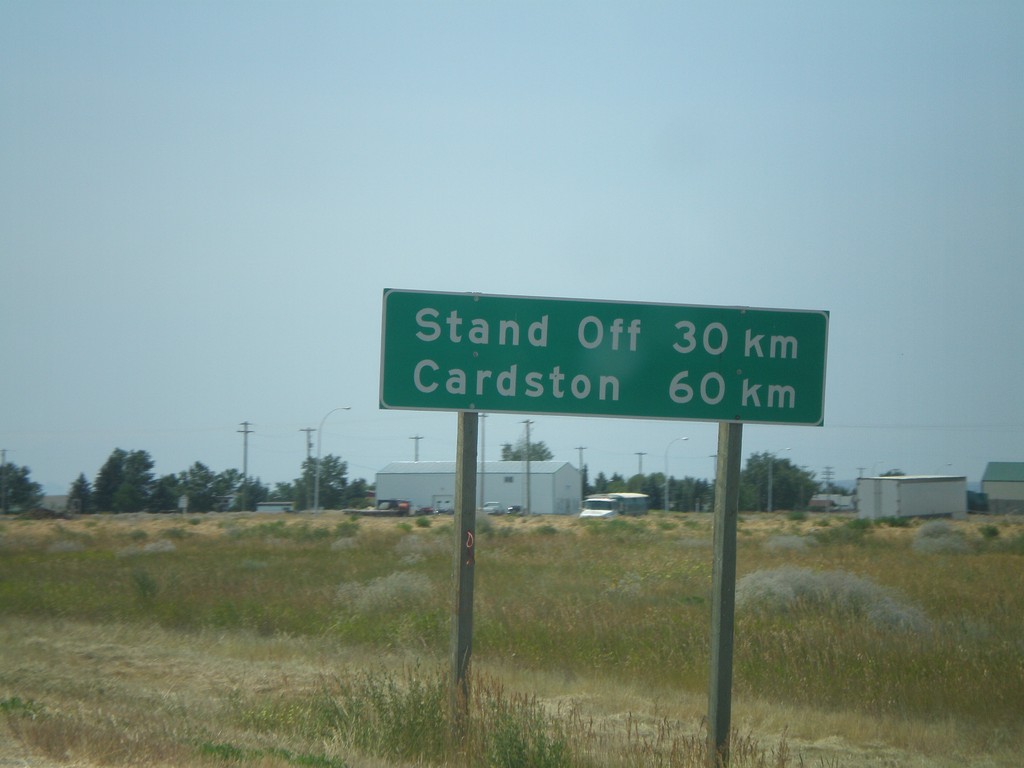
Distance Marker on AB-2 South
Distance marker on AB-2 south of AB-3, to Stand Off and Cardston.
Taken 07-19-2007
 Fort Macleod
Willow Creek No. 26
Alberta
Canada
Fort Macleod
Willow Creek No. 26
Alberta
Canada