Signs Tagged With Distance Marker
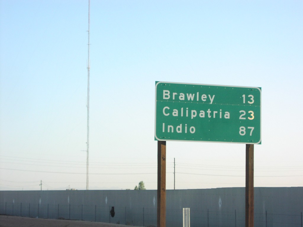
CA-111 North - Distance Marker
CA-111 north to Brawley, Calipatria, and Indio, just north of Evan Hewes Hwy.
Taken 03-01-2007
 El Centro
Imperial County
California
United States
El Centro
Imperial County
California
United States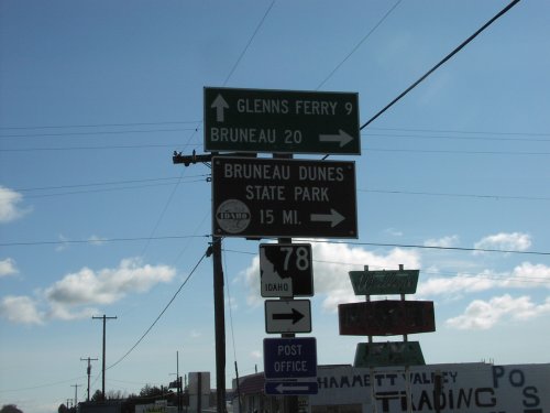
BL-84 East at ID-78
BL-84 east at ID-78 south to Bruneau, and Bruneau Dunes State Park. ID-78 follows the south side of the Snake River to Marsing.
Taken 03-01-2007

 Hammett
Elmore County
Idaho
United States
Hammett
Elmore County
Idaho
United States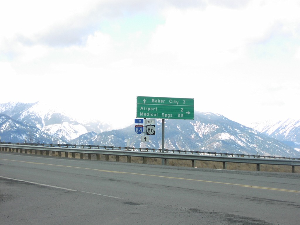
OR-86 West at I-84
OR-86 west at OR-203 (not signed) to Medical Springs and Airport.
Taken 02-01-2007

 Baker City
Baker County
Oregon
United States
Baker City
Baker County
Oregon
United States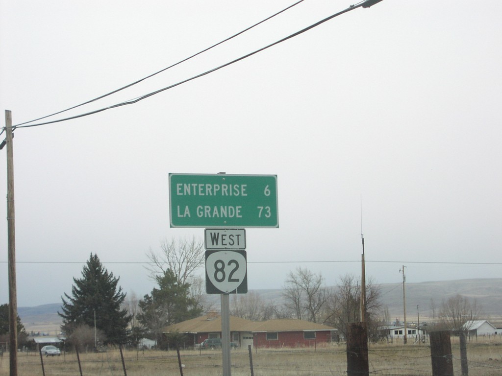
OR-82 West - Distance Marker
Distance marker on OR-82 west to Enterprise and La Grande.
Taken 02-01-2007
 Joseph
Wallowa County
Oregon
United States
Joseph
Wallowa County
Oregon
United States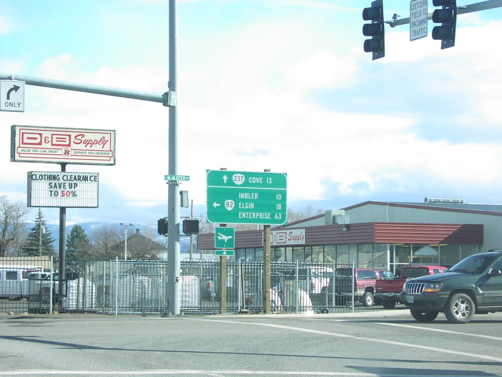
OR-82 East at OR-237
OR-82 east at OR-237 to Cove.
Taken 02-01-2007
 Island City
Union County
Oregon
United States
Island City
Union County
Oregon
United States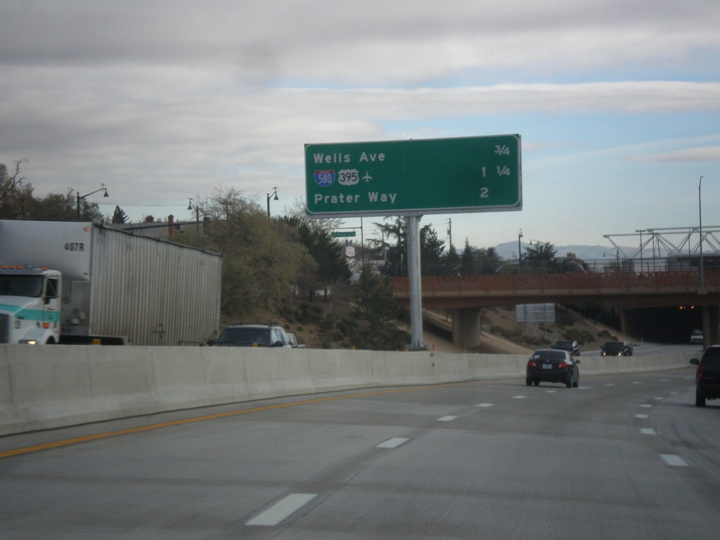
I-80 East - Reno/Sparks Exits
Next 3 Reno/Sparks exits on I-80 East: Wells Ave., I-580/US-395, Prater Way.
Taken 01-24-2007


 Reno
Washoe County
Nevada
United States
Reno
Washoe County
Nevada
United States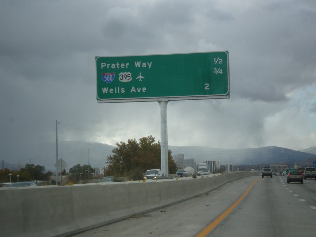
I-80 West - Distance Marker
Distance marker for next three Sparks/Reno area exits on I-80 west. Distance to Prater Way, US-395/I-580, Wells Ave.
Taken 01-21-2007
Sparks
Washoe County
Nevada
United States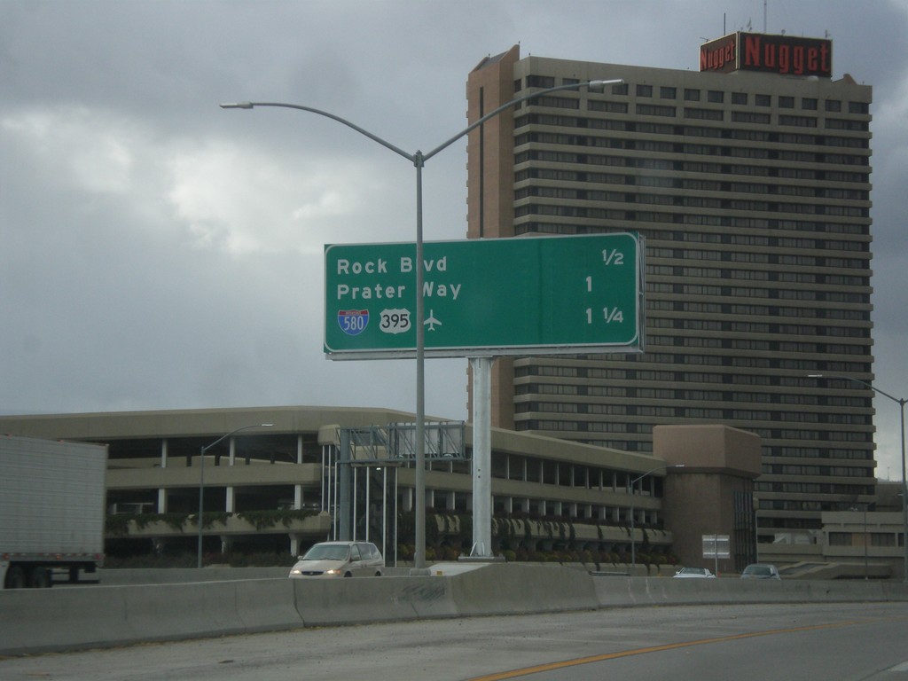
I-80 West - Distance Marker
Distance marker for next three Sparks/Reno exits on I-80 west: Rock Blvd., Prater Way, and US-395/I-580.
Taken 01-21-2007
Sparks
Washoe County
Nevada
United States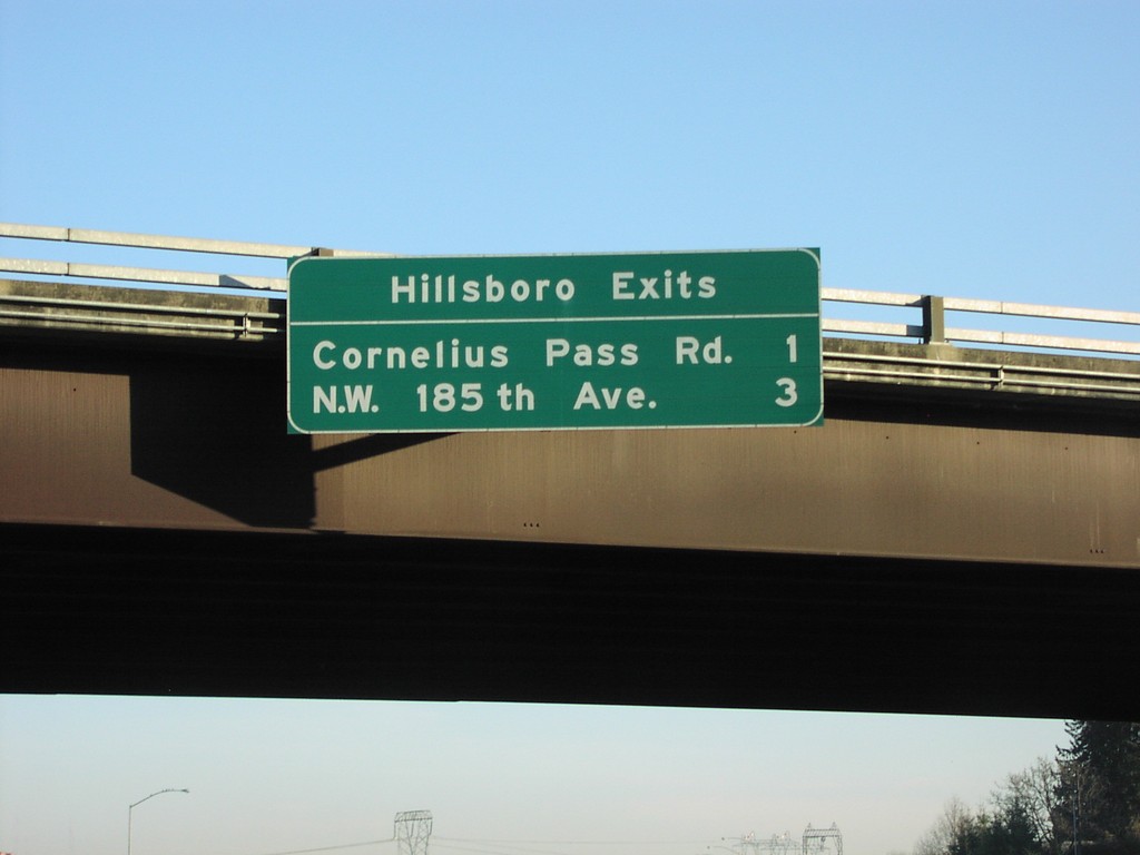
US-26 East - Hillsboro Exits
Distance marker overhead on US-26 east, Hillsboro Exits: Corneilus Pass Road/NW 185th Ave.
Taken 01-01-2007
 Hillsboro
Washington County
Oregon
United States
Hillsboro
Washington County
Oregon
United States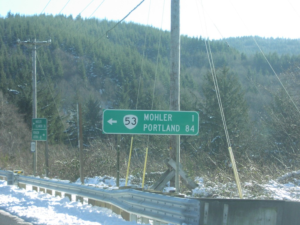
US-101 South at OR-53 North
US-101 south at OR-53 to Mohler and Portland.
Taken 01-01-2007

 Wheeler
Tillamook County
Oregon
United States
Wheeler
Tillamook County
Oregon
United States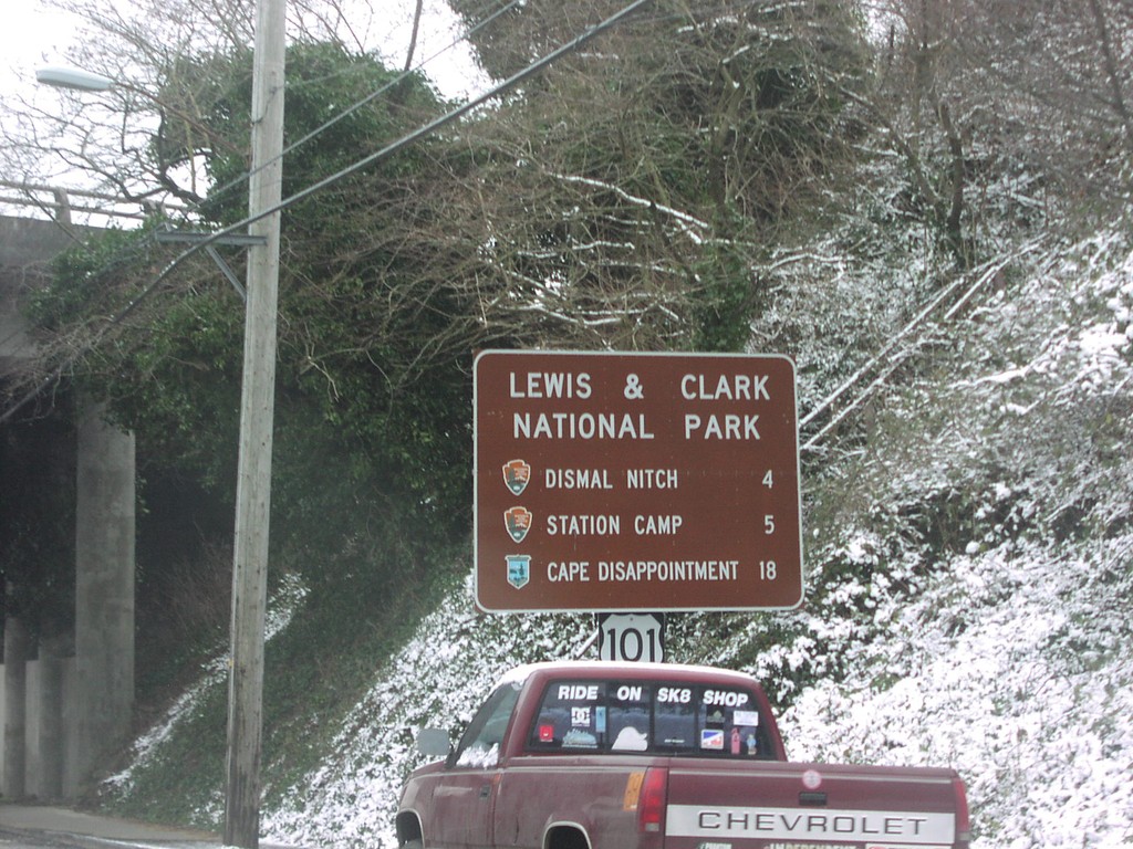
US-101 North at US-30 - Lewis and Clark NP
US-101 north approaching US-30 - Lewis and Clark National Park Sites on US-101 north.
Taken 01-01-2007
 Astoria
Clatsop County
Oregon
United States
Astoria
Clatsop County
Oregon
United States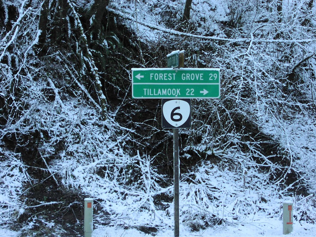
OR-6 - Tillamook State Forest
OR-6 to Tillamook and Forest Grove in the Tillamook State Forest.
Taken 01-01-2007
 Tillamook
 County
Oregon
United States
Tillamook
Tillamook County
Oregon
United States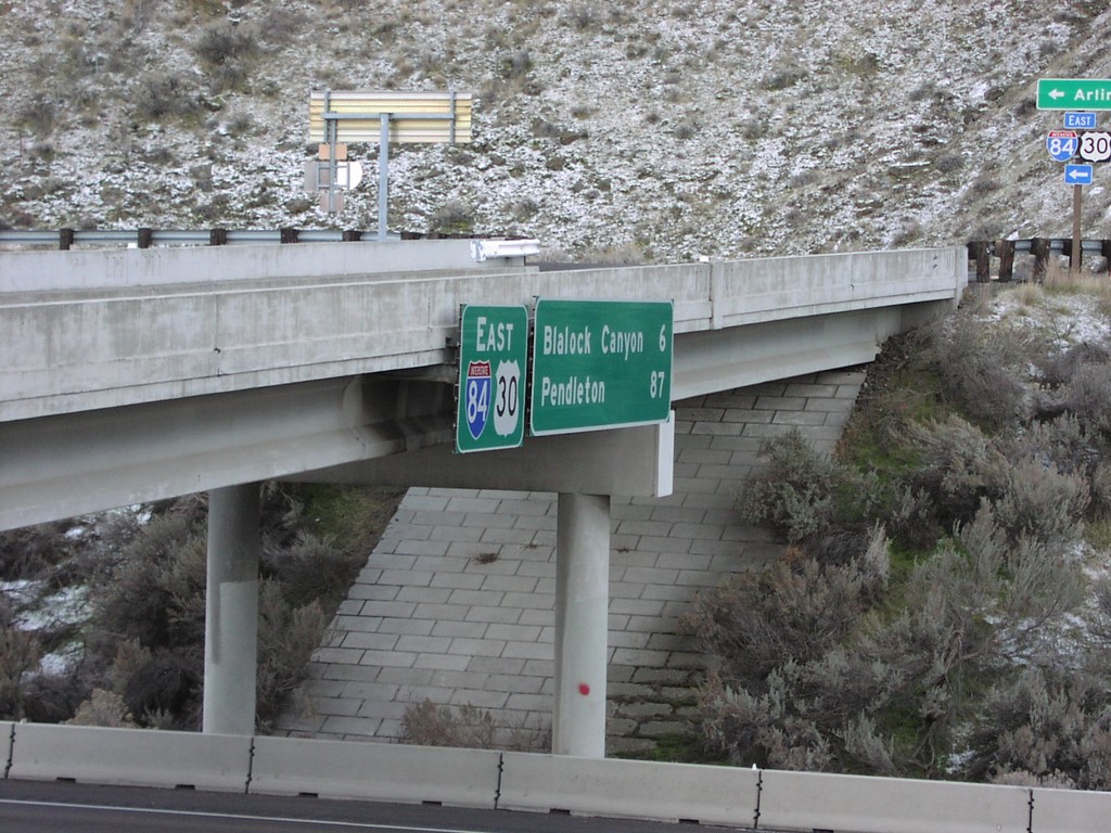
I-84/US-30 East - Distance Marker at Exit 123
Distance marker on I-84/US-30 east to Blalock Canyon and Pendleton.
Taken 01-01-2007
Arlington
Gilliam County
Oregon
United States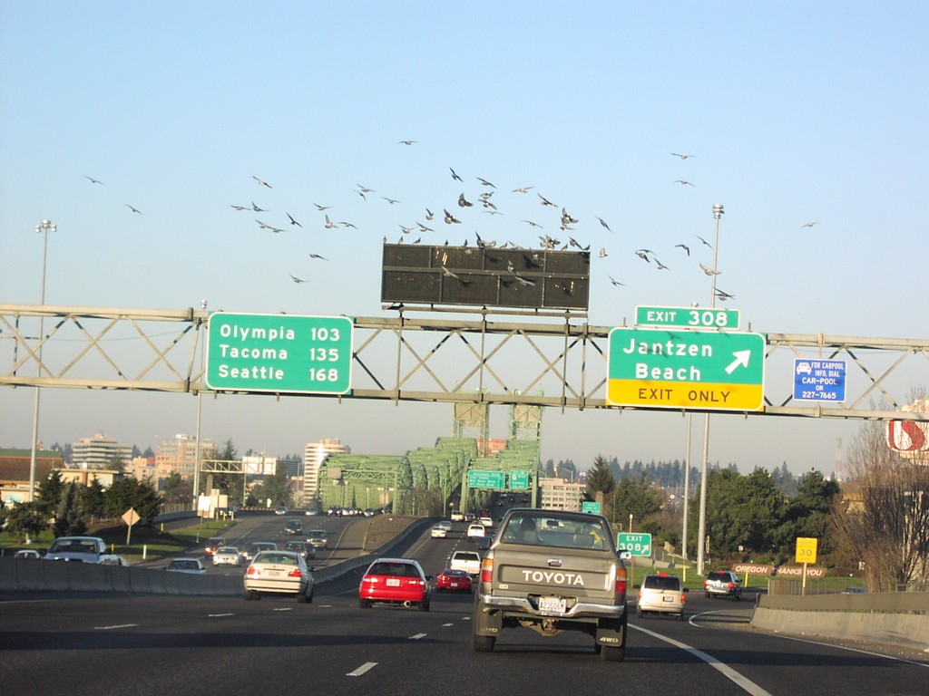
I-5 North Exit 308 - Last Oregon Exit
I-5 north at Exit 308, Janzten Beach. Exit 308 is the last exit in Oregon on I-5. Distance marker showing distance to Olympia, Tacoma, and Seattle.
Taken 01-01-2007
 Portland
Multnomah County
Oregon
United States
Portland
Multnomah County
Oregon
United States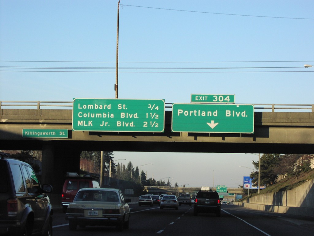
I-5 North Exit 304
I-5 north approaching Exit 304, Portland Blvd. Overhead for next three exits.
Taken 01-01-2007
Portland
Multnomah County
Oregon
United States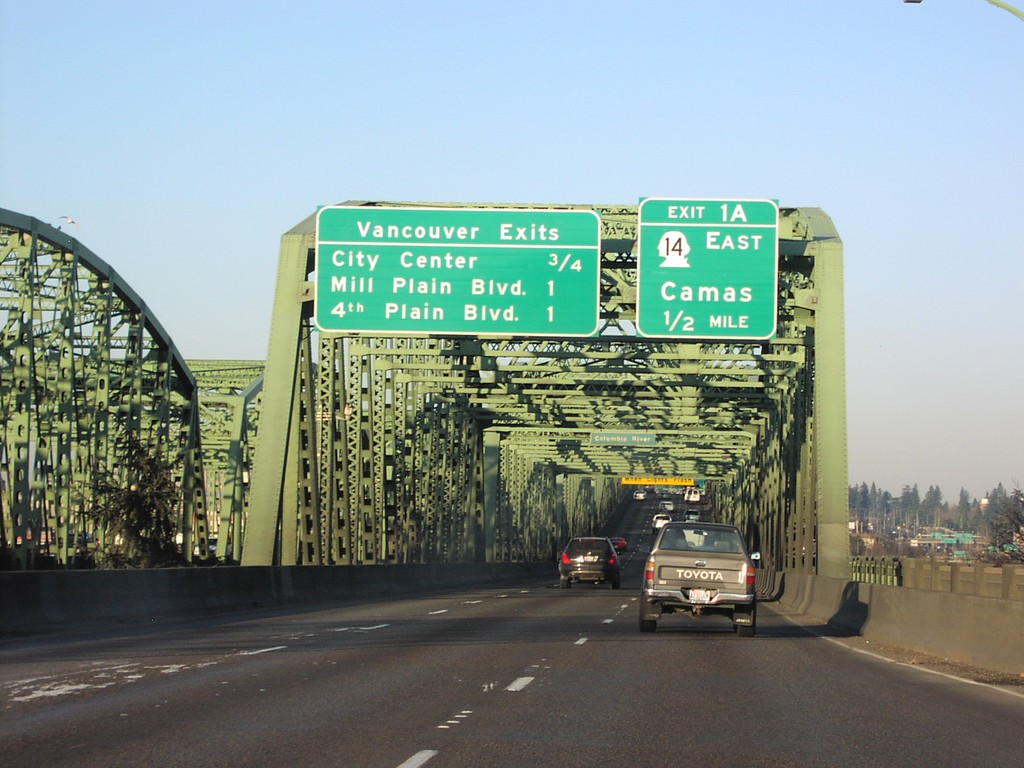
I-5 North Exit 1A/Vancouver Exits
I-5 north approaching Exit 1A (WA) WA-14/Camas, and overhead for next three Vancouver exits. Taken at foot of Interstate Bridge on the Columbia River.
Taken 01-01-2007
 Portland
Multnomah County
Oregon
United States
Portland
Multnomah County
Oregon
United States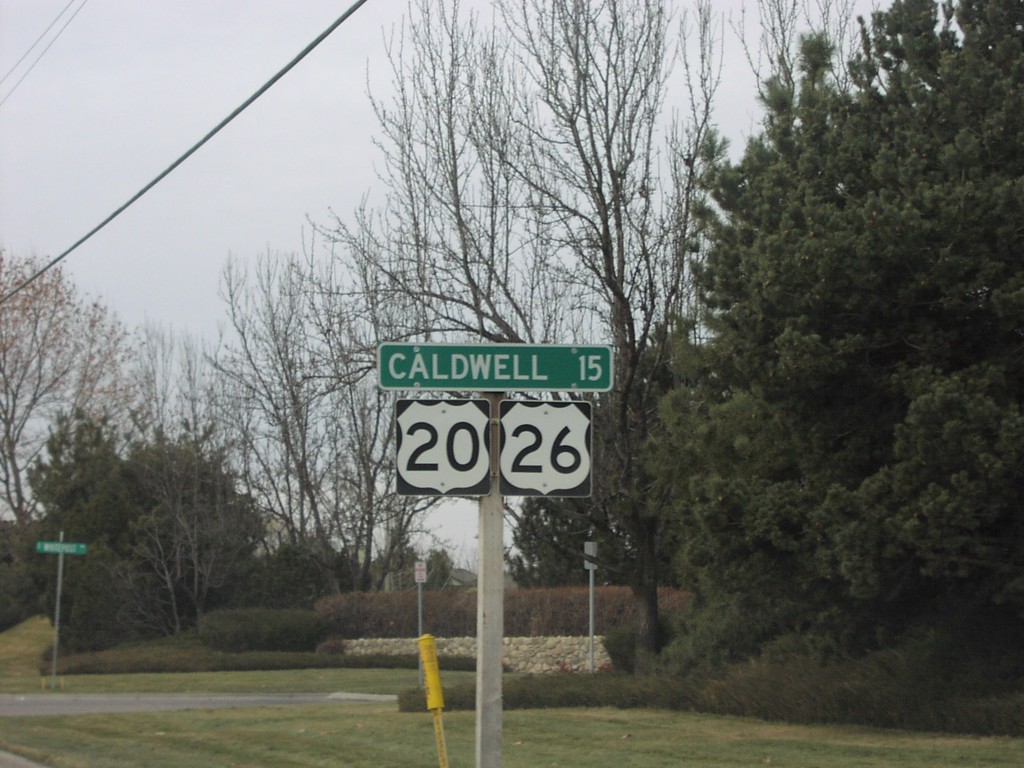
US-20/US-26 West - Distance Marker
Distance marker to Caldwell on US-20/US-26 west after ID-55 junction.
Taken 12-01-2006
 Boise
Ada County
Idaho
United States
Boise
Ada County
Idaho
United States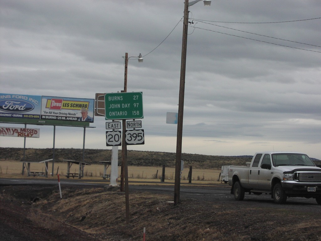
US-20 East/US-395 North - Riley
US-20 East/US-395 North - Distance Marker. Distance to Burns, John Day, and Ontario.
Taken 12-01-2006
Riley
Harney County
Oregon
United States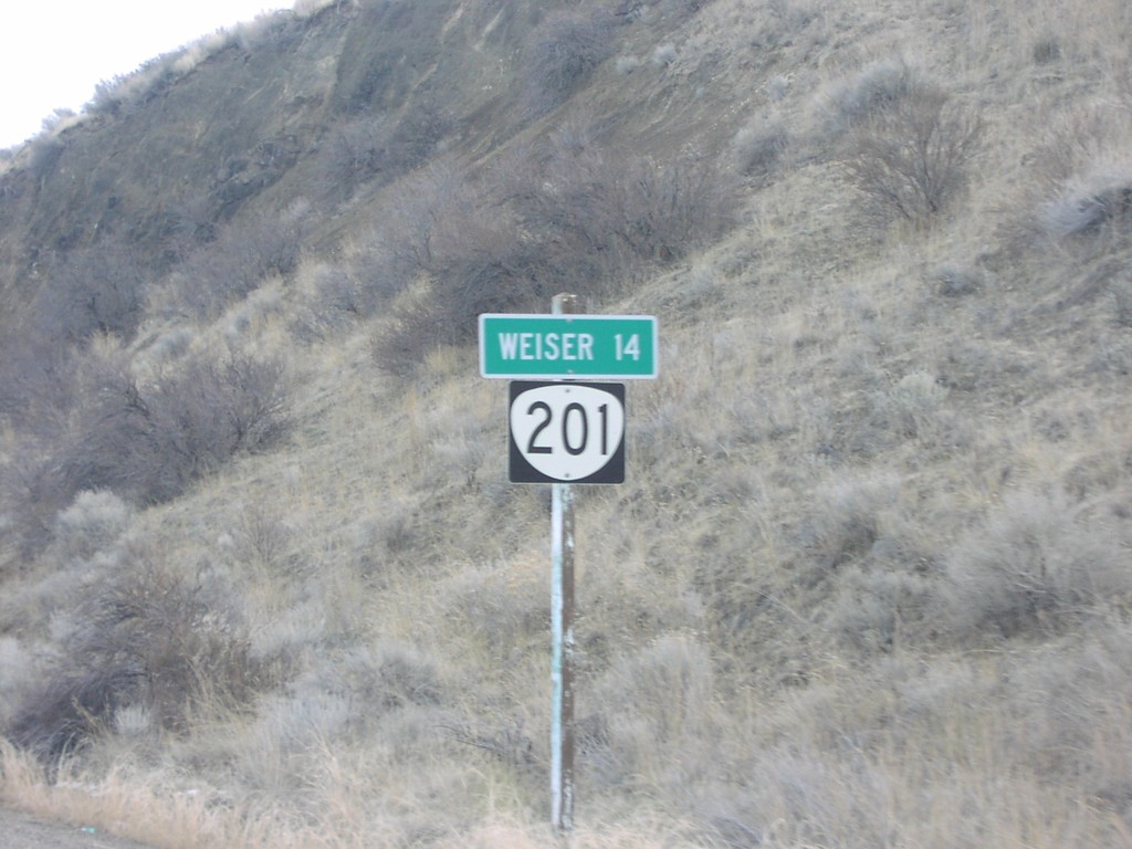
OR-201 South - Distance Marker
First distance marker on OR-201 south. Distance to Weiser, 14 miles.
Taken 12-01-2006
 Huntington
Malheur County
Oregon
United States
Huntington
Malheur County
Oregon
United States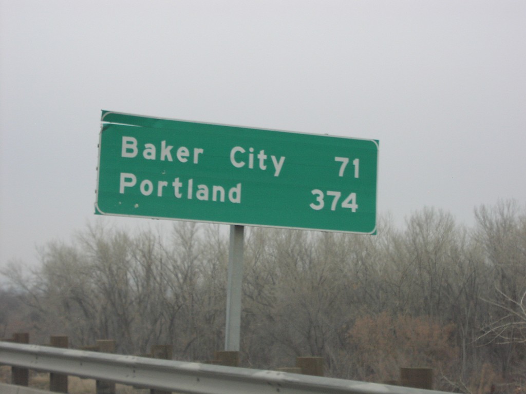
I-84 West - Distance Marker
I-84 west at first Oregon distance marker on I-84 to Baker City and Portland (371 miles).
Taken 12-01-2006
Ontario
Malheur County
Oregon
United States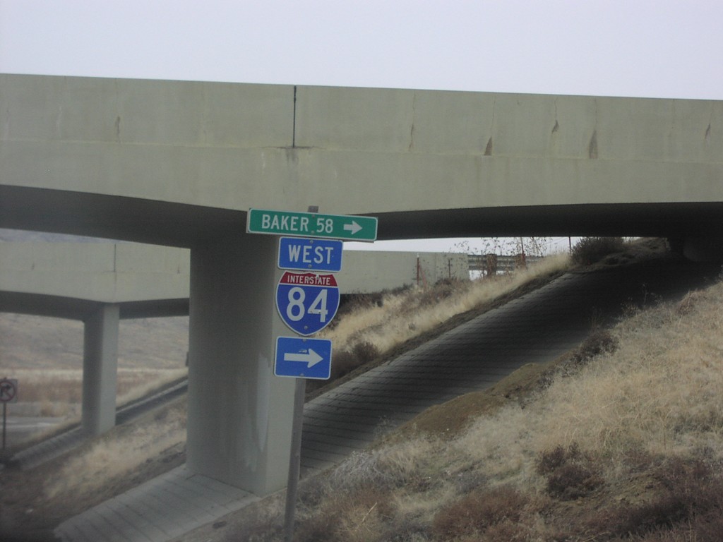
I-84 Onramp Exit 362
Moores Hollow Road at I-84 West to Baker, 58 miles.
Taken 12-01-2006
Ontario
Malheur County
Oregon
United States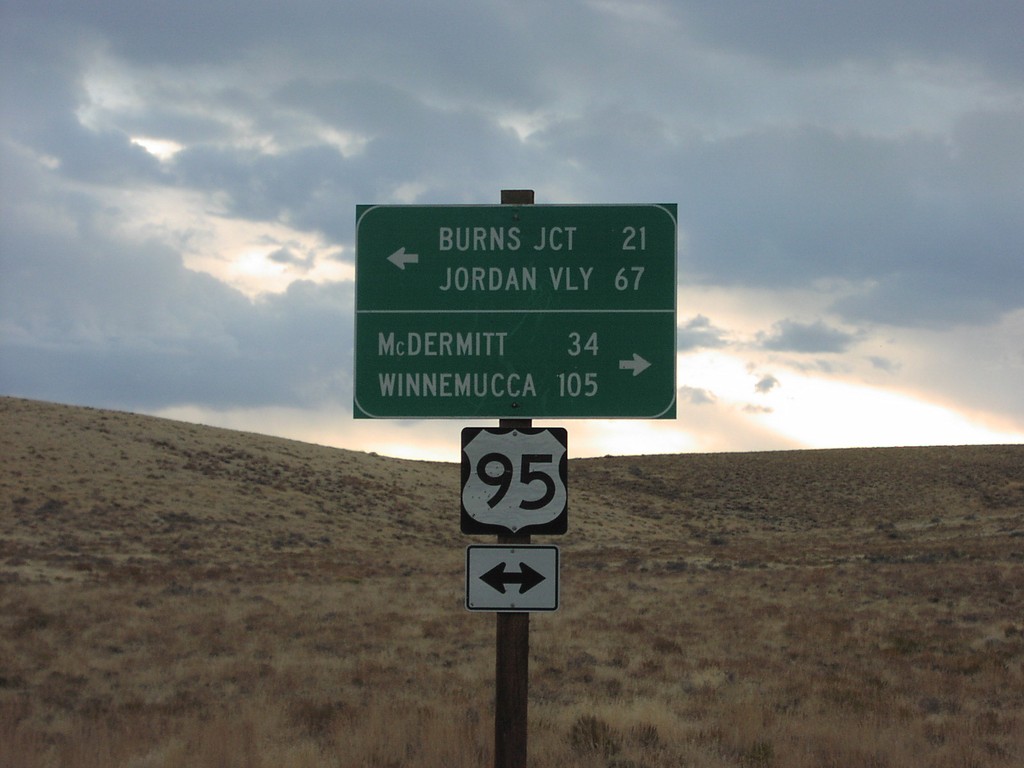
US-95 - Whitehorse Ranch Rd
US-95 at end of Whitehorse Ranch Road. US-95 north to Burns Jct and Jordan Valley; south to McDermitt and Winnemucca.
Taken 10-01-2006
 Basque
Malheur County
Oregon
United States
Basque
Malheur County
Oregon
United States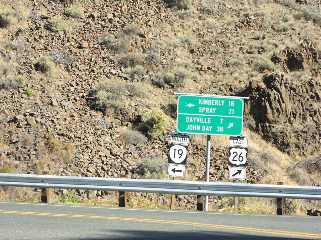
US-26 East at OR-19
US-26 east at OR-19 north to Kimberly and Spray.
Taken 10-01-2006
 Dayville
Grant County
Oregon
United States
Dayville
Grant County
Oregon
United States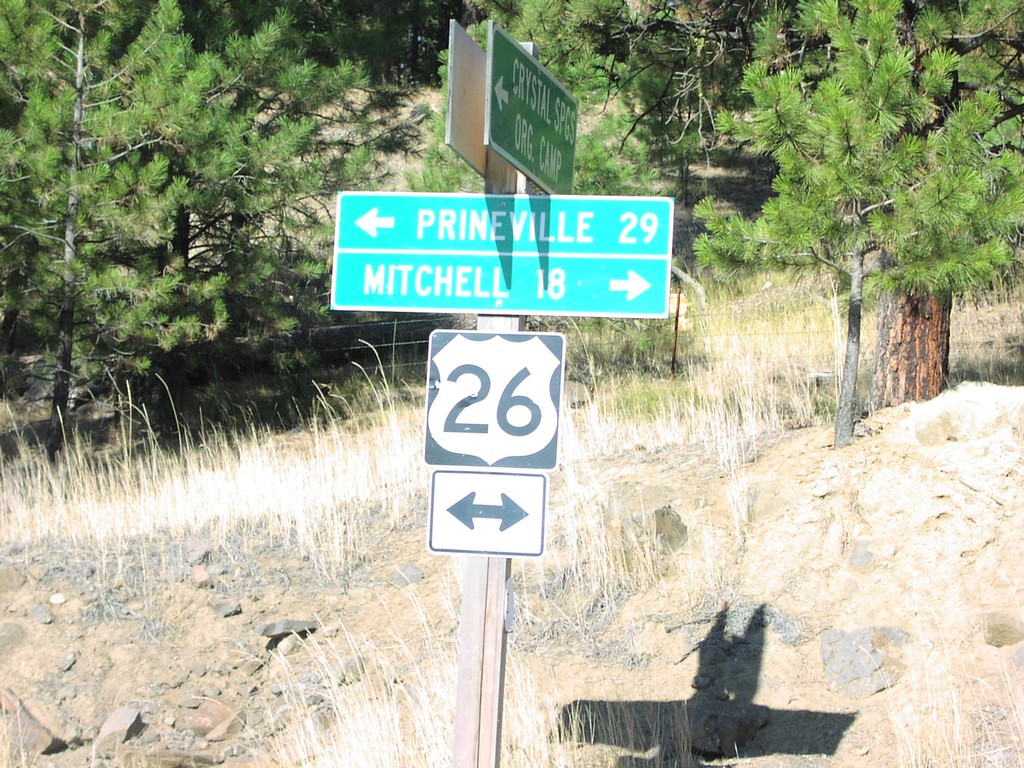
US-26 - Crystal Springs Camp Rd
US-26 west to Prineville; east to Mitchell at end of Crystal Springs Camp Road.
Taken 10-01-2006
Prineville
Crook County
Oregon
United States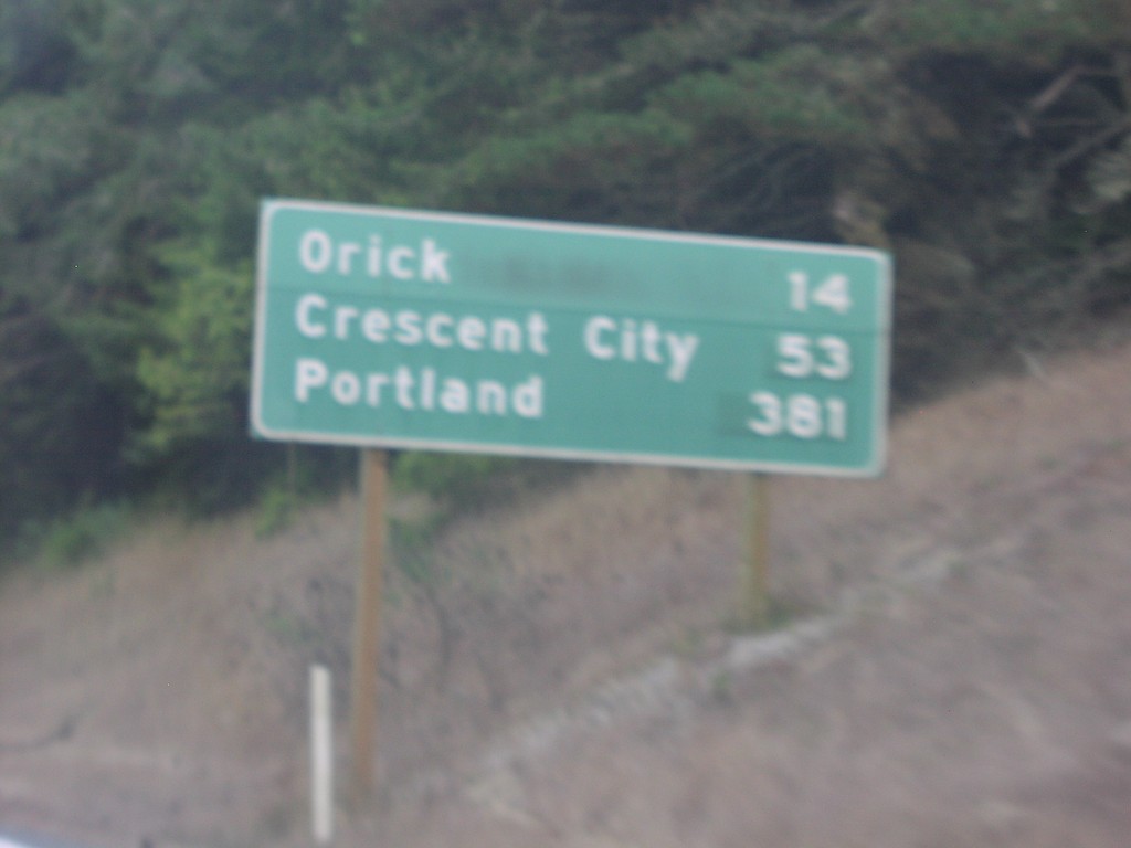
US-101 North Distance Marker
Distance marker on US-101 north to Orick, Crescent City, and Portland.
Taken 10-01-2006
Trinidad
Humboldt County
California
United States