Signs Tagged With Distance Marker
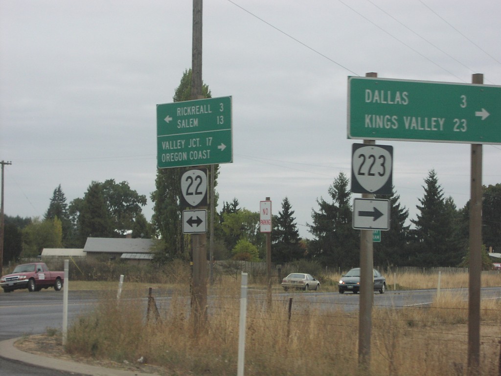
OR-22 East at OR-223
OR-22 east to Rickreall and Salem at OR-223 south to Dallas and Kings Valley.
Taken 10-01-2006

 Dallas
Polk County
Oregon
United States
Dallas
Polk County
Oregon
United States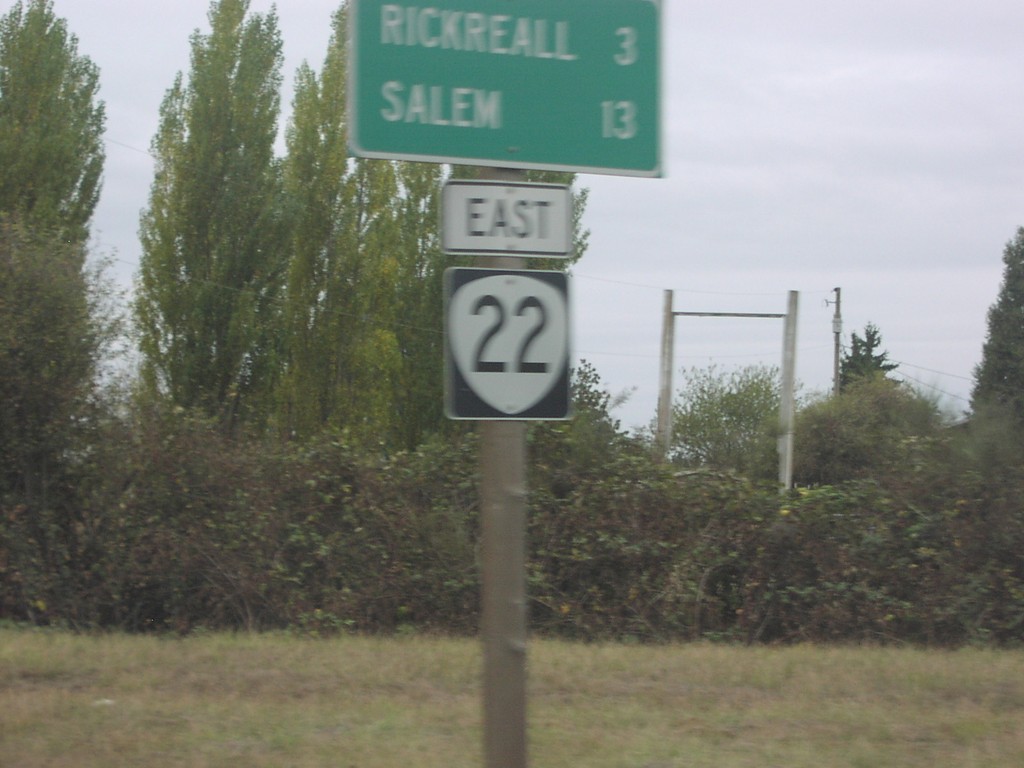
OR-22 East - Distance Marker
Distance marker on OR-22 east to Rickreall and Salem.
Taken 10-01-2006
Dallas
Polk County
Oregon
United States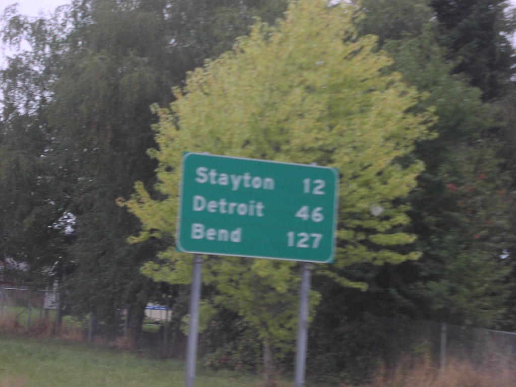
OR-22 East - Distance Marker
Distance marker on OR-22 east to Stayton, Detroit, and Bend.
Taken 10-01-2006
Salem
Marion County
Oregon
United States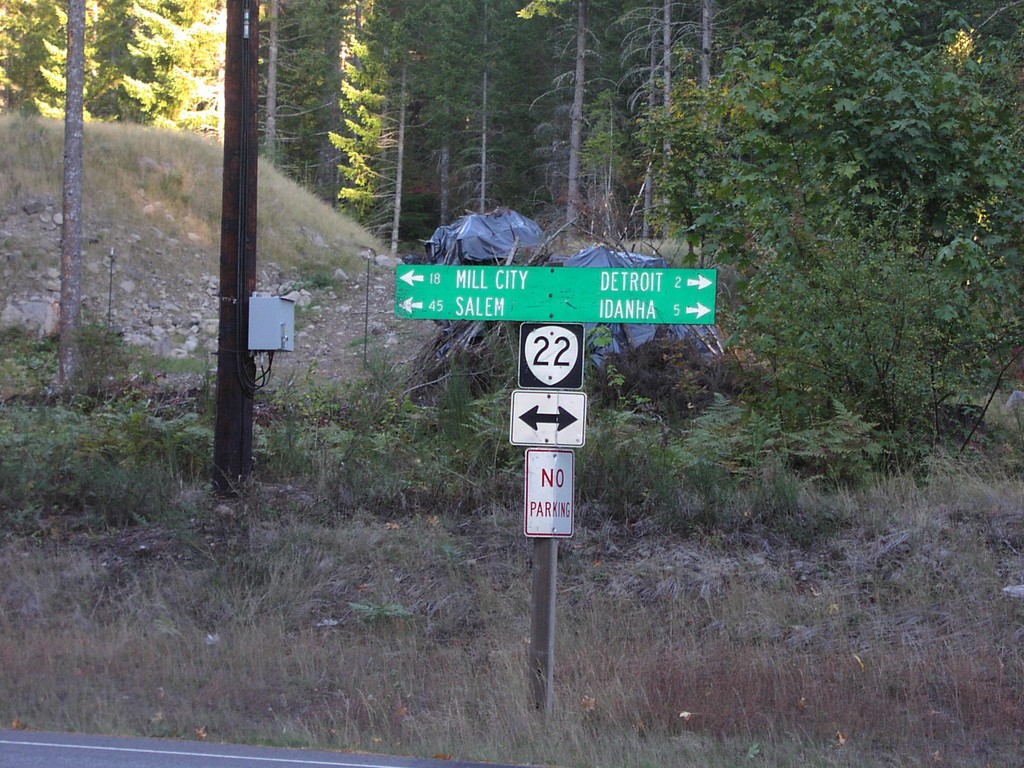
OR-22 - Detroit Lake StatePark
OR-22 west to Salem and Mill City; east to Detroit and Idanha at Detroit Lake State Park.
Taken 10-01-2006
Detroit
Marion County
Oregon
United States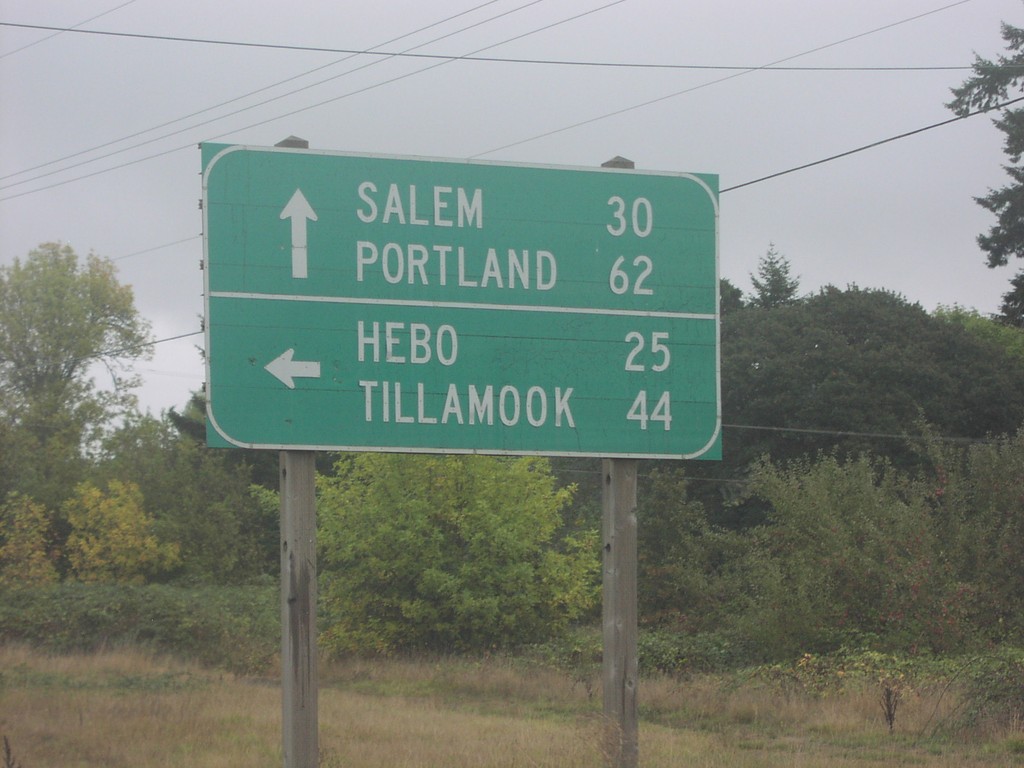
OR-18 East at OR-22
OR-18 east at OR-22 west to Hebo and Tillamook. OR-18/OR-22 east continue on to Portland and Salem.
Taken 10-01-2006
 Grand Ronde
Polk County
Oregon
United States
Grand Ronde
Polk County
Oregon
United States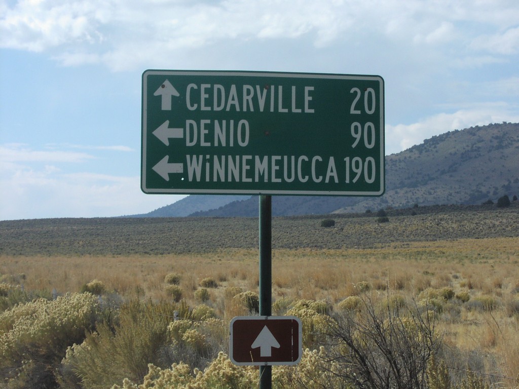
NV-8A/NV-34 Jct.
NV-34 south at NV-8A. NV-8A/NV-34 west to Cedarville, NV-8A east to Denio and Winnemucca.
Taken 10-01-2006

 Vya
Washoe County
Nevada
United States
Vya
Washoe County
Nevada
United States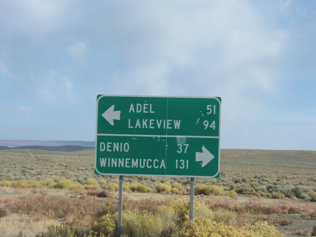
End NV-8A at NV-140
End NV-8A at NV-140. NV-140 west to Adel and Lakeview; east to Denio and Winnemucca.
Taken 10-01-2006
 Humboldt County
Nevada
United States
Humboldt County
Nevada
United States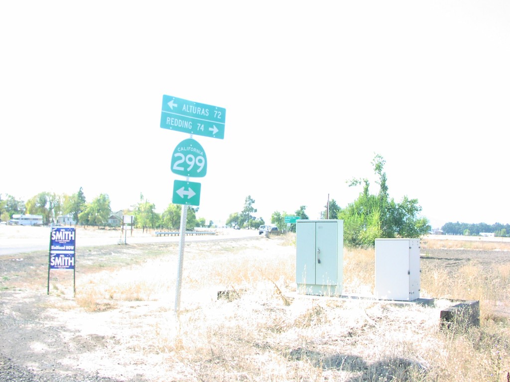
End CR-A19 at CA-299 Jct
End CR-A19 at CA-299 to Alturas and Redding.
Taken 10-01-2006

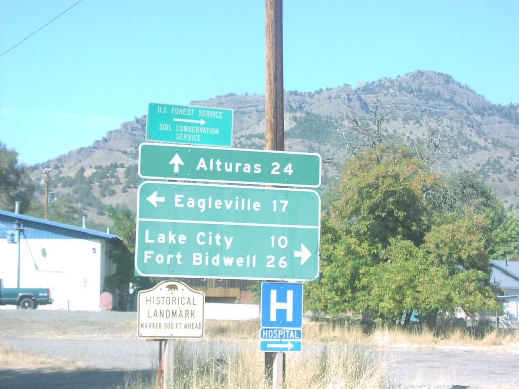
CA-299 West at Suprise Valley Road
CA-299 west at Surprise Valley Road north to Fort Bidwell, south to Eagleville.
Taken 10-01-2006
Alturas
Modoc County
California
United States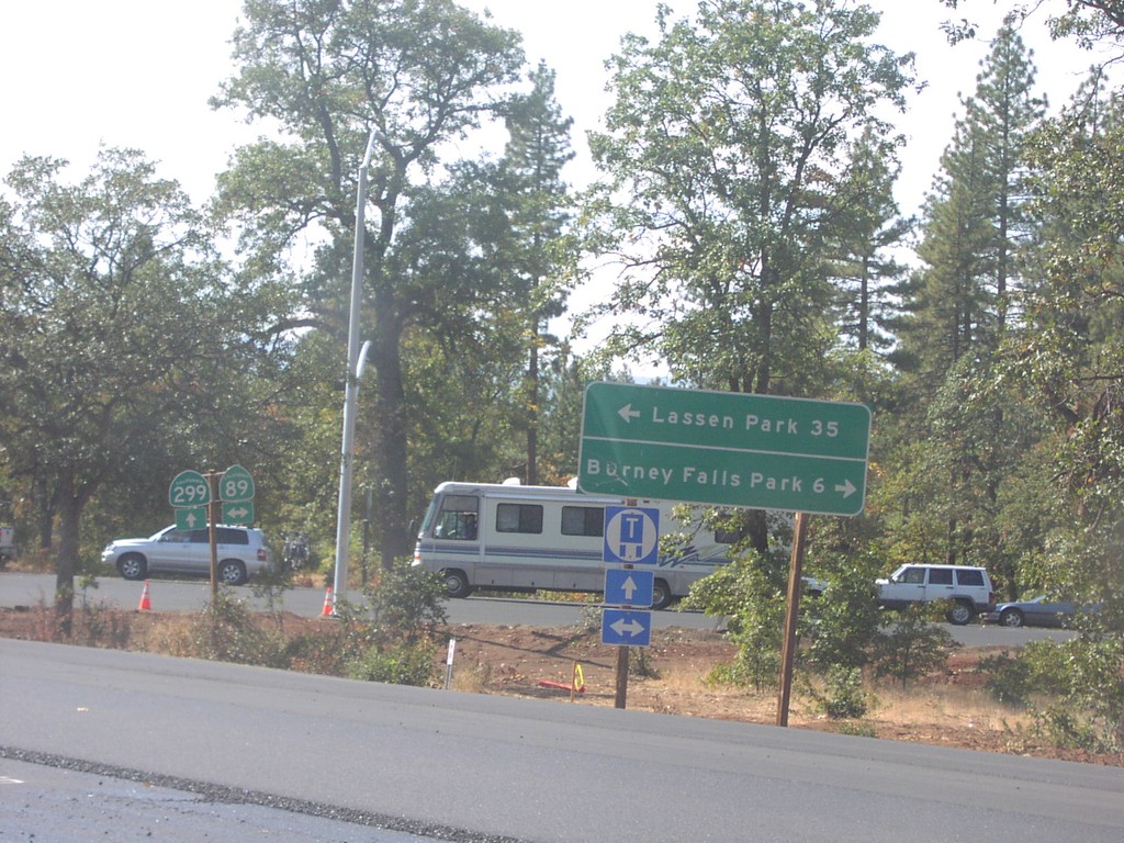
CA-299 West at CA-89
CA-299 west at CA-89 north to Burney Falls State Park, and south to Lassen Park.
Taken 10-01-2006
 Cassel
Shasta County
California
United States
Cassel
Shasta County
California
United States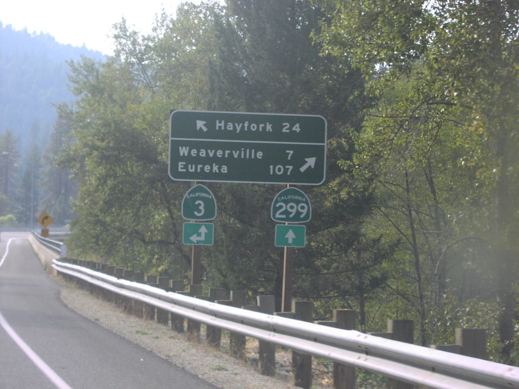
CA-299 West at CA-3
CA-299 west approaching CA-3 south to Hayfork. CA-3 north joins CA-299 west to Weaverville.
Taken 10-01-2006
 Douglas City
Trinity County
California
United States
Douglas City
Trinity County
California
United States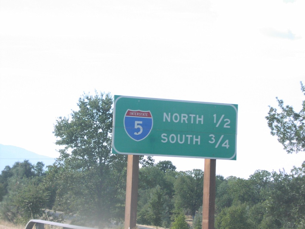
CA-299 West Approaching I-5
CA-299 west approaching I-5 North, 1/2 mile; I-5 South, 3/4 mile.
Taken 10-01-2006
 Redding
Shasta County
California
United States
Redding
Shasta County
California
United States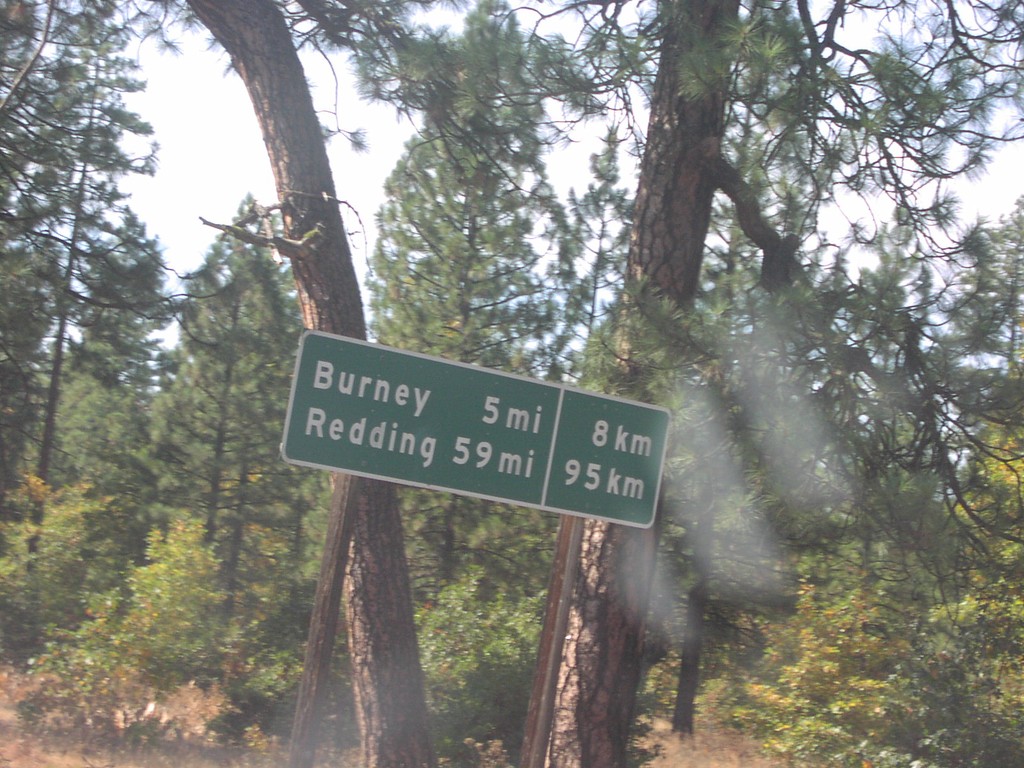
CA-299 West - Distance Marker
Distance marker in imperial and metric units on CA-299 west to Burney and Redding.
Taken 10-01-2006
Four Corners
Shasta County
California
United States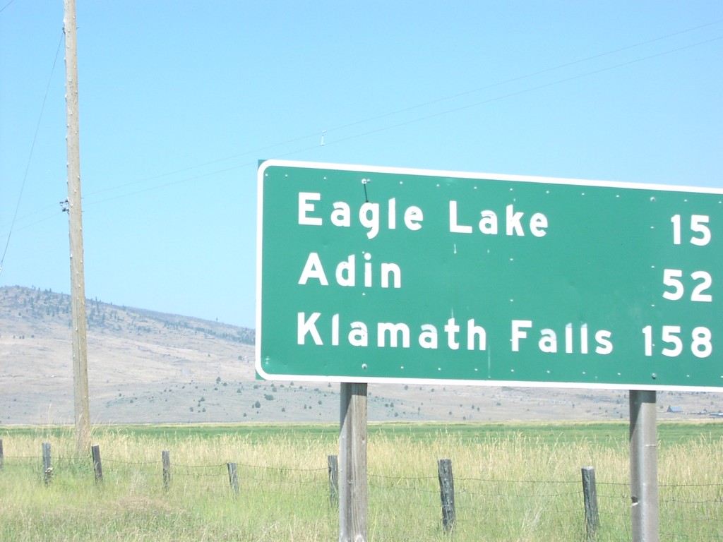
CA-139 north - Distance Marker
Distance marker on CA-139 north to Eagle Lake, Adin, and Klamath Falls.
Taken 10-01-2006
 Susanville
Lassen County
California
United States
Susanville
Lassen County
California
United States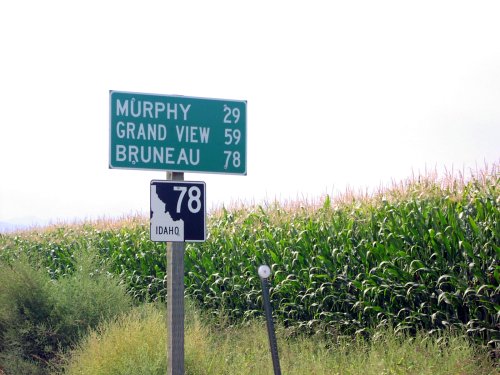
ID-78 East - Distance Marker
ID-78 east to Murphy, Grand View, and Murphy just south of Marsing.
Taken 09-01-2006
 Marsing
Owyhee County
Idaho
United States
Marsing
Owyhee County
Idaho
United States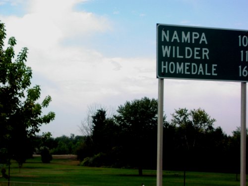
ID-19 West - Distance Marker
Distance marker on ID-19 west/BL-84 east to Nampa, Wilder, and Homedale.
Taken 09-01-2006

 Caldwell
Canyon County
Idaho
United States
Caldwell
Canyon County
Idaho
United States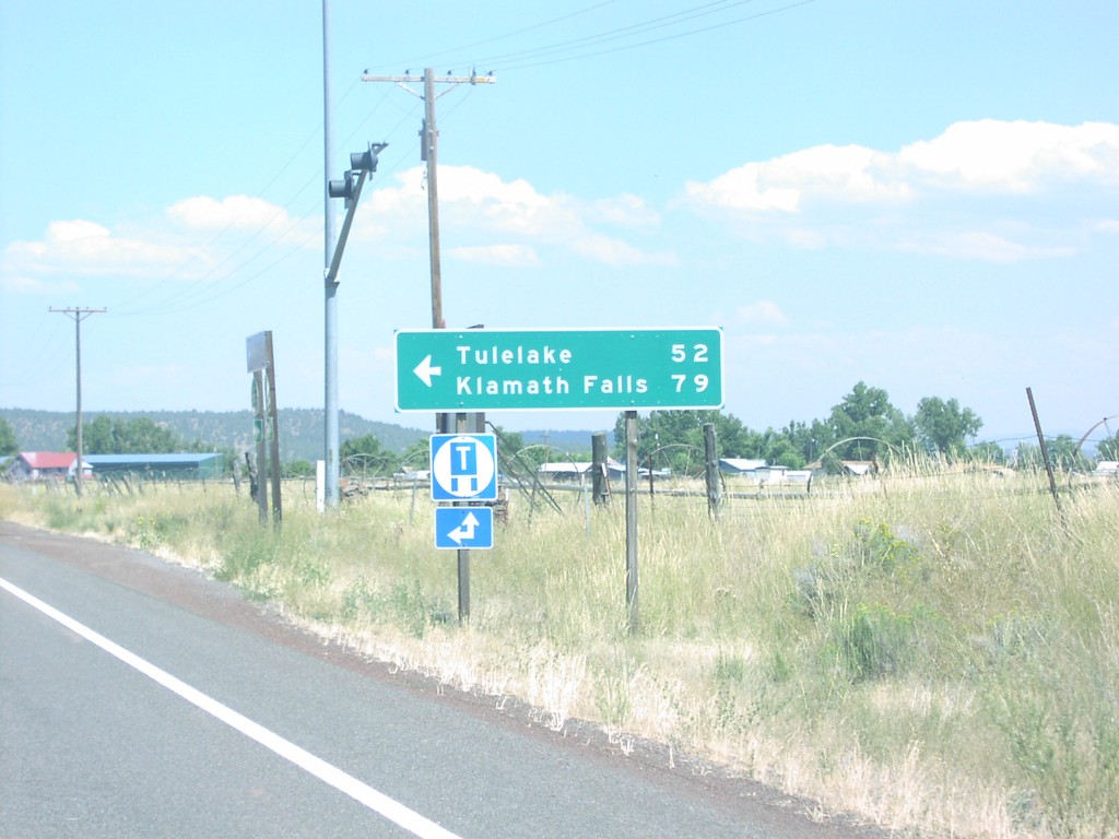
CA-299 East/CA-139 North at CA-139 North
CA-299 East/CA-139 North at CA-139 north to Tulelake and Klamath Falls.
Taken 08-01-2006
Canby
Modoc County
California
United States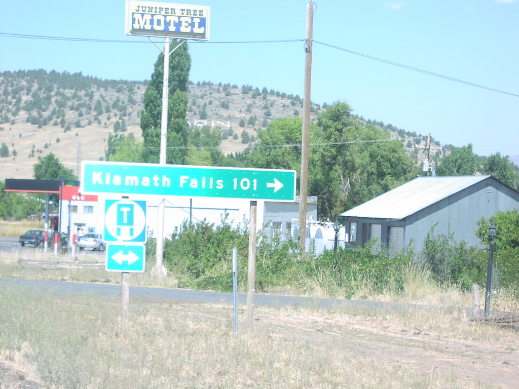
CA-139 North at CA-299 in Aden
CA-139 north approaching CA-299. Klamath Falls, 101 miles, on CA-139 North/CA-299 East.
Taken 08-01-2006
Adin
Modoc County
California
United States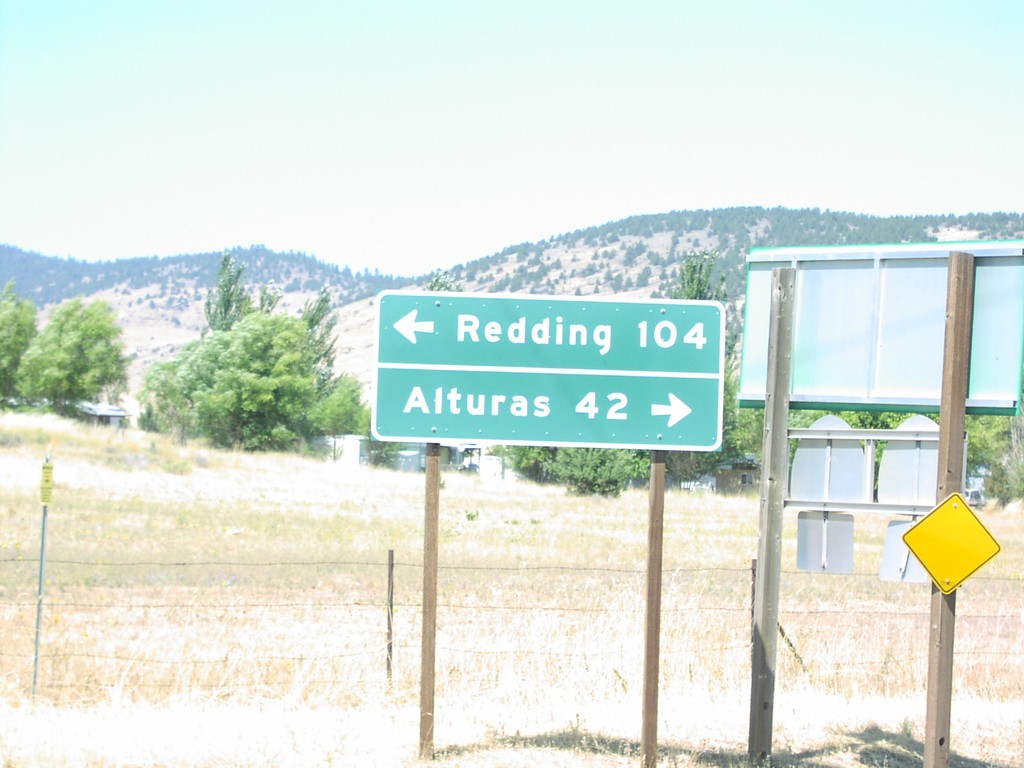
CA-139 North at CA-299
CA-139 north at CA-299 west to Redding, and east to Alturas.
Taken 08-01-2006
Adin
Modoc County
California
United States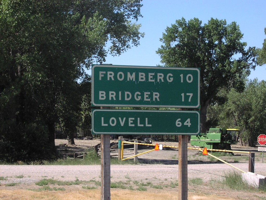
US-310 South Distance Marker
Distance marker on US-310 south to Fromberg, Bridger, and Lovell, just south of US-212.
Taken 07-01-2006
 Joliet
Carbon County
Montana
United States
Joliet
Carbon County
Montana
United States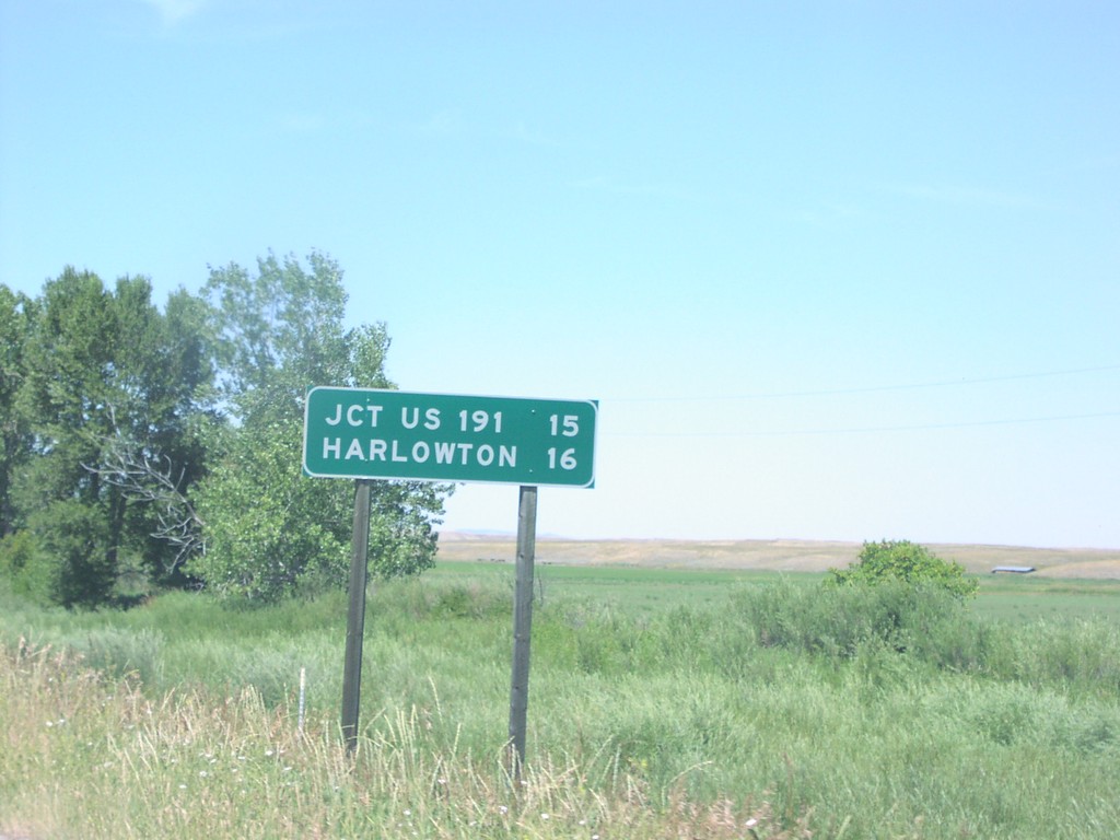
US-12 West/MT-3 North Distance Marker
Distance marker on US-12 west to US-191 Jct. and Harlowton, west of MTS-297.
Taken 07-01-2006

 Shawmut
Wheatland County
Montana
United States
Shawmut
Wheatland County
Montana
United States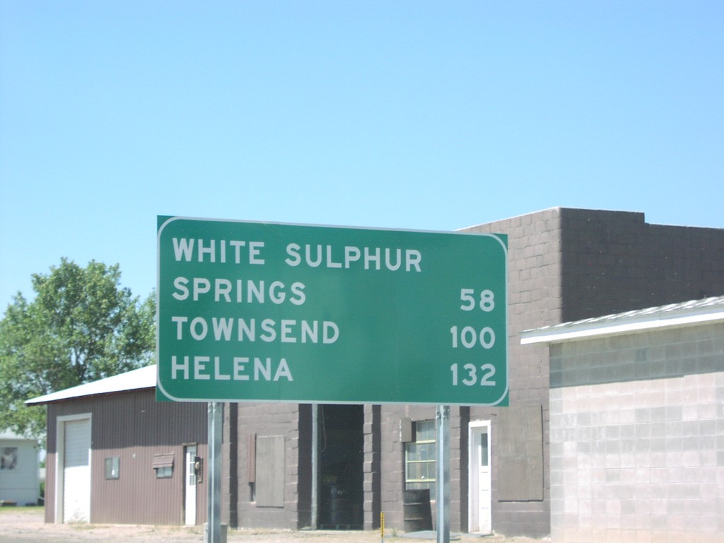
US-12 West Distance Marker
Distance marker on US-12 to White Sulphur Springs, Townsend, and Helena, just west of Harlowton.
Taken 07-01-2006
Harlowton
Wheatland County
Montana
United States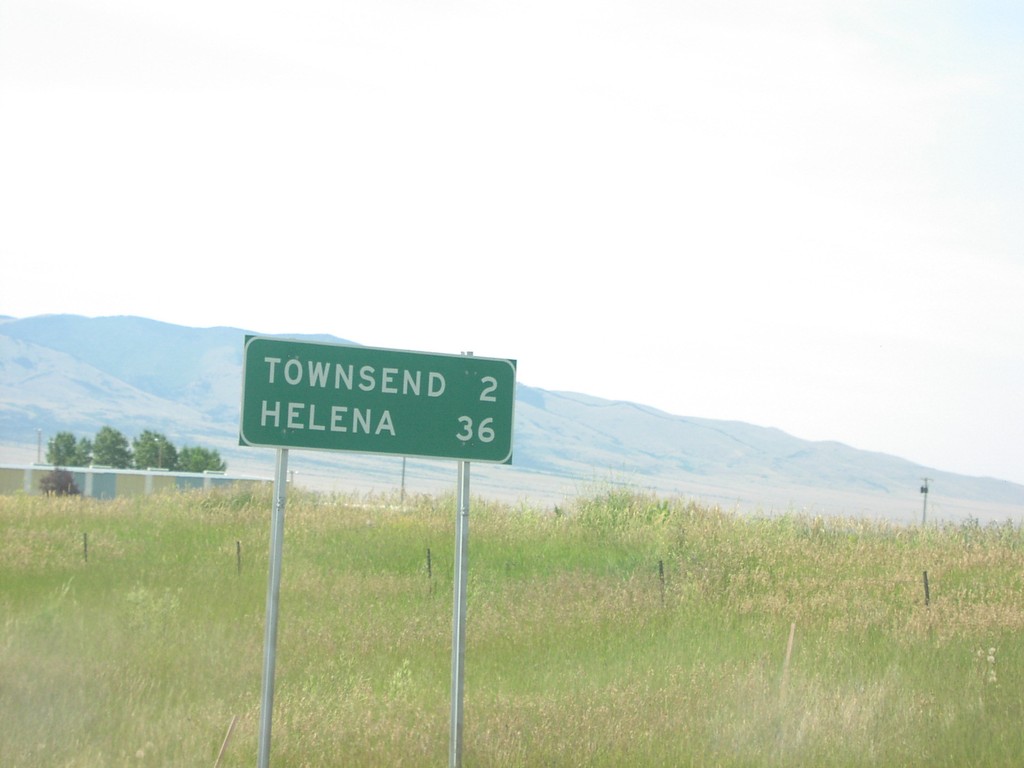
US-12 West Distance Marker
Distance marker on US-12 west to Townsend and Helena, just west of MTS-284.
Taken 07-01-2006
Townsend
Broadwater County
Montana
United States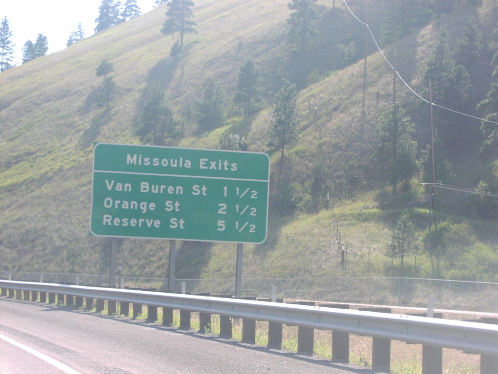
Missoula Exits on I-90 West
Missoula Exits on I-90 west.
Taken 07-01-2006

 Missoula
 County
Montana
United States
Missoula
Missoula County
Montana
United States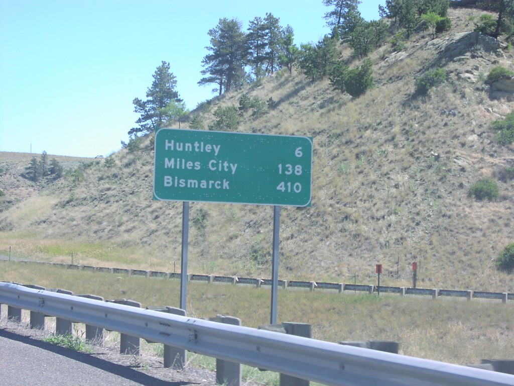
I-94 East Distance Marker
First distance marker on I-94 east to Huntley, Miles City, and Bismarck.
Taken 07-01-2006
 Lockwood
Yellowstone County
Montana
United States
Lockwood
Yellowstone County
Montana
United States