Signs Tagged With Distance Marker
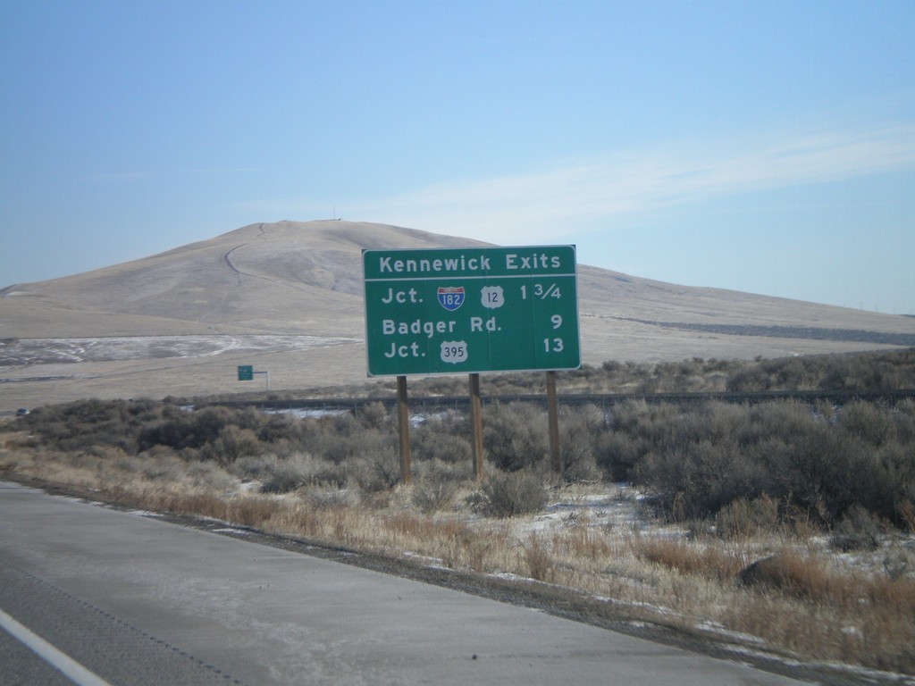
I-82 East - Kennewick Exits
Kennewick Exits on I-82 east.
Taken 01-22-2008

 Benton City
Benton County
Washington
United States
Benton City
Benton County
Washington
United States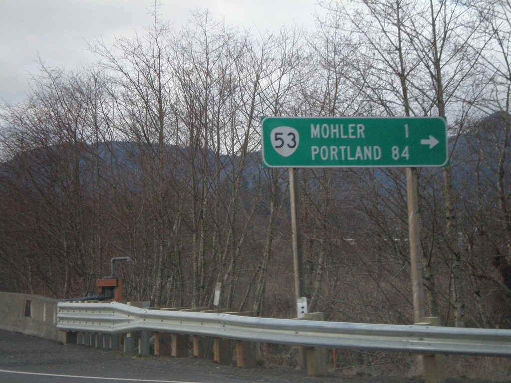
US-101 North at OR-53
US-101 north at OR-53 north to Mohler and Portland.
Taken 01-20-2008

 Wheeler
Tillamook County
Oregon
United States
Wheeler
Tillamook County
Oregon
United States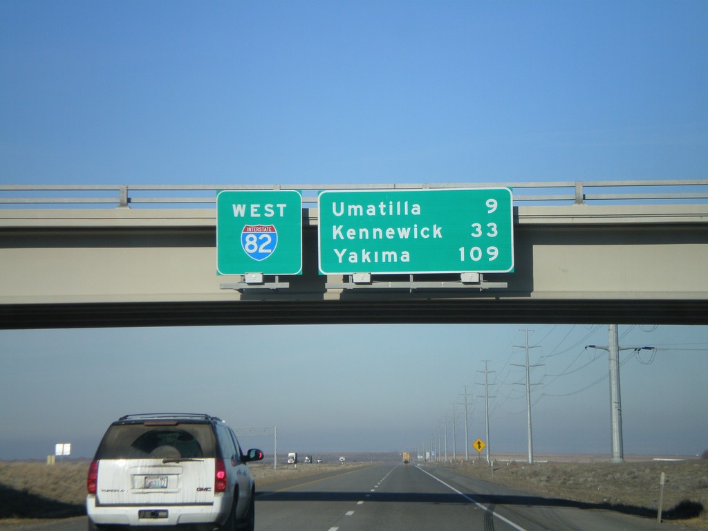
I-82 West - Overhead and Distance Marker
Distance marker on I-82 west. Distance to Umatilla, Kennewick (WA) and Yakima (WA).
Taken 01-18-2008
Hermiston
Umatilla County
Oregon
United States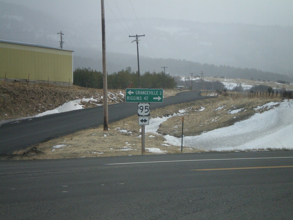
Johnson Lane at US-95 to Grangeville and Riggins
Johnson Lane south at US-95 to Grangeville and Riggins. Johnson Lane is a cutoff that shaves a few miles of driving on US-95 and avoids the town of Grangeville.
Taken 12-26-2007
 Grangeville
Idaho County
Idaho
United States
Grangeville
Idaho County
Idaho
United States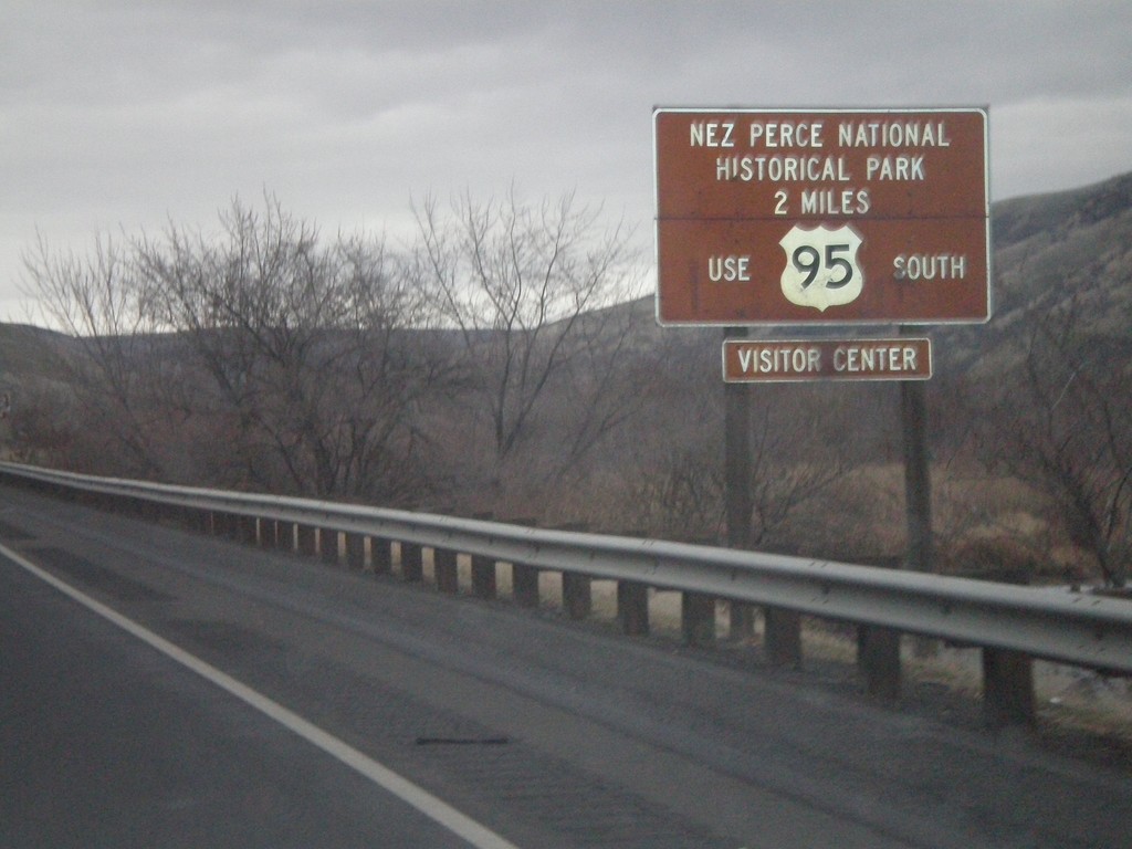
US-12 East/US-95 South - Nez Perce National Historical Park
US-95 South/US-12 East approaching the US-12/US-95 Split. Use US-95 south for the Nez Perce National Historic Park.
Taken 12-26-2007
Lewiston
Nez Perce County
Idaho
United States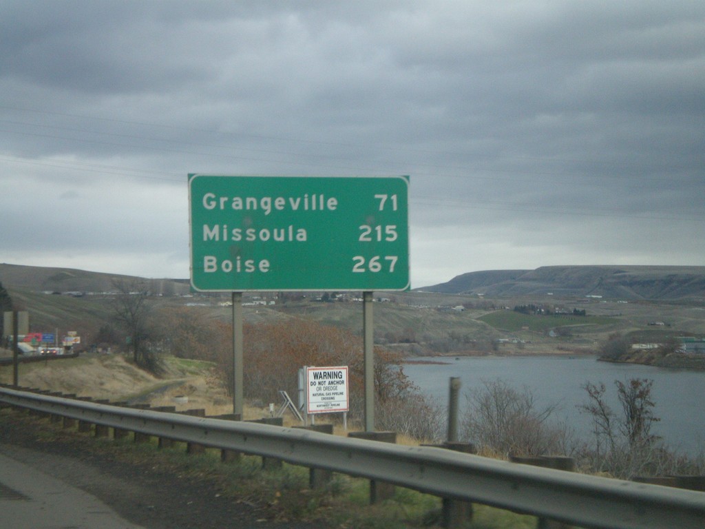
US-12 East/US-95 South - Distance Marker
Distance marker on US-95 South/US-12 East to Grangeville, Missoula (MT - via US-12), and Boise. The Clearwater River is on the right side of the picture.
Taken 12-26-2007
Lewiston
Nez Perce County
Idaho
United States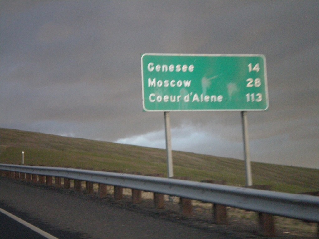
US-95 North - Distance Marker
Distance Marker on US-95 north to Genesee, Moscow, and Coeur d’Alene on Lewiston Hill.
Taken 12-24-2007
Lewiston
Nez Perce County
Idaho
United States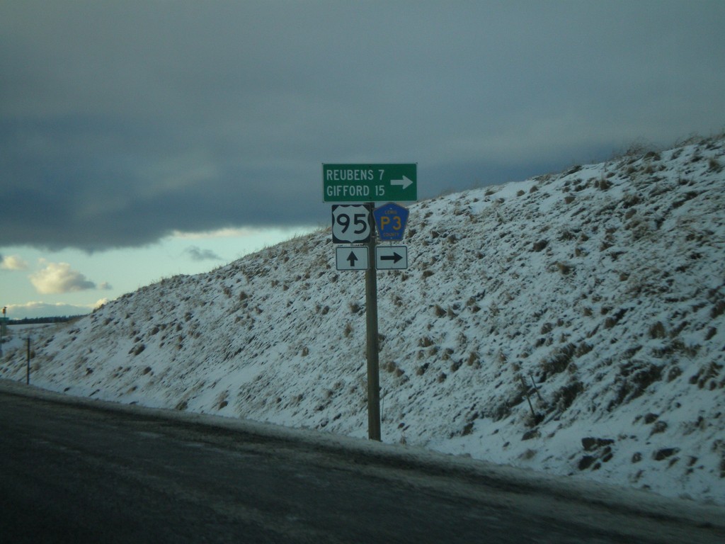
US-95 North At Lewis County Road P3
US-95 north at Lewis County Road P3 to Reubens and Gifford.
Taken 12-24-2007
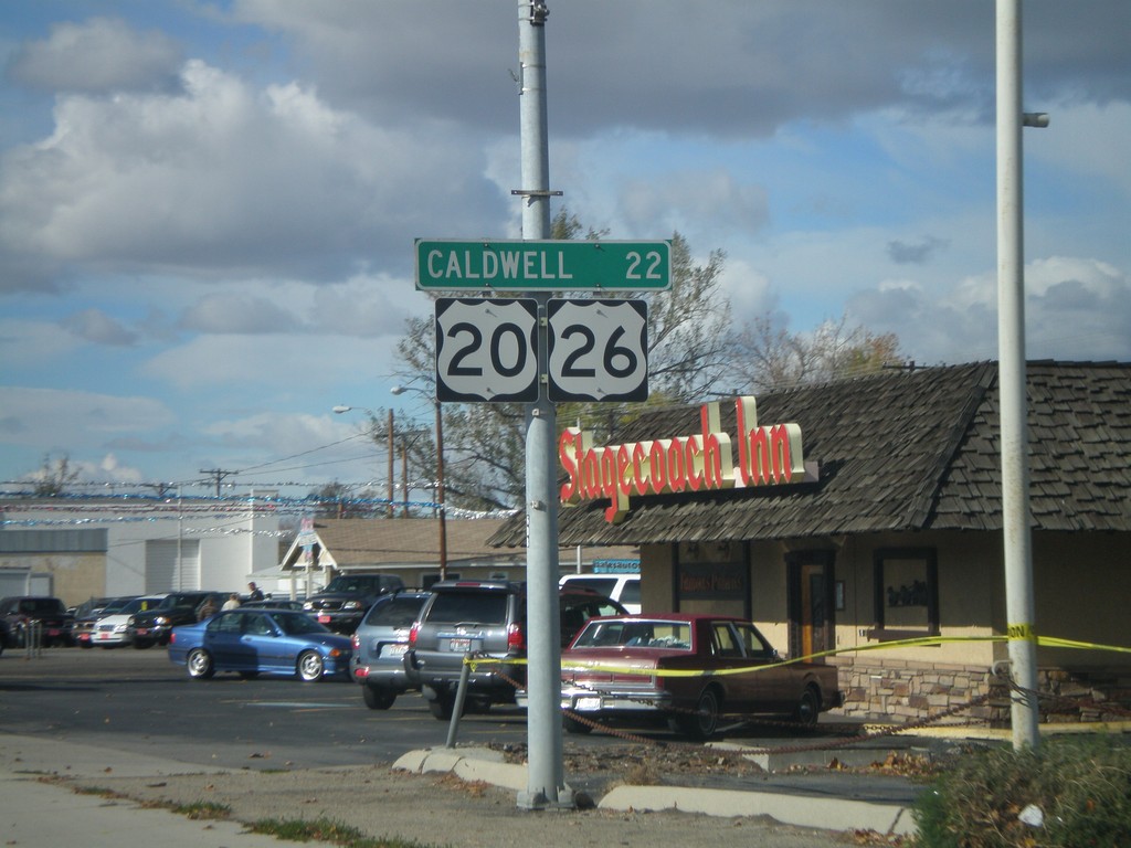
US-20/US-26 West - Distance Marker
Distance marker on US-20/US-26 West (Chinden Blvd.) to Caldwell.
Taken 10-20-2007

 Garden City
Ada County
Idaho
United States
Garden City
Ada County
Idaho
United States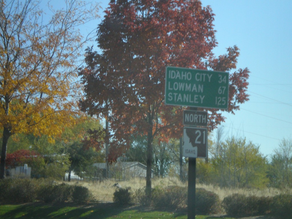
ID-21 North - Distance Marker
First distance marker on ID-21 North to Idaho City, Lowman, and Stanley.
Taken 10-13-2007
 Boise
Ada County
Idaho
United States
Boise
Ada County
Idaho
United States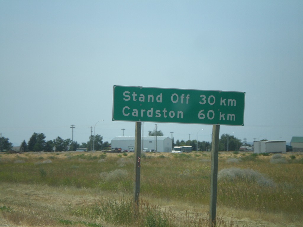
Distance Marker on AB-2 South
Distance marker on AB-2 south of AB-3, to Stand Off and Cardston.
Taken 07-19-2007
 Fort Macleod
Willow Creek No. 26
Alberta
Canada
Fort Macleod
Willow Creek No. 26
Alberta
Canada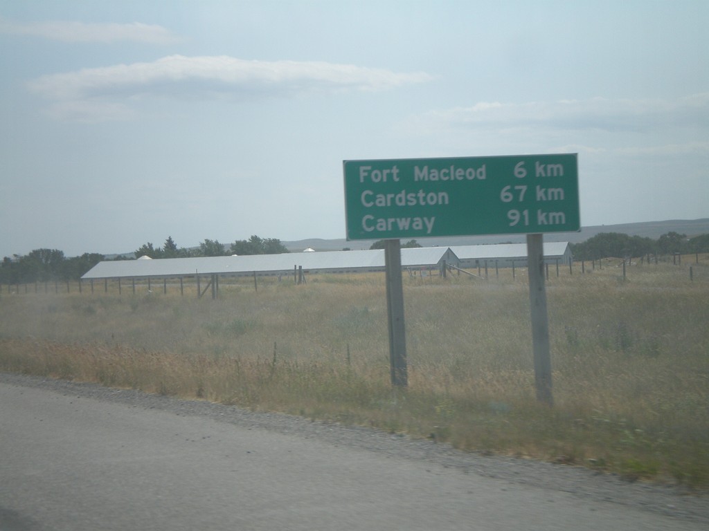
Distance Marker on AB-2 South
Distance marker on AB-2 south to Fort Macleod, Cardston, and Carway, south of ABS-785.
Taken 07-19-2007
Fort Macleod
Willow Creek No. 26
Alberta
Canada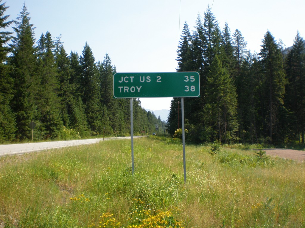
MT-56 North - Distance Marker
Begin MT-56 north to Troy and US-2.
Taken 07-16-2007
 Noxon
Sanders County
Montana
United States
Noxon
Sanders County
Montana
United States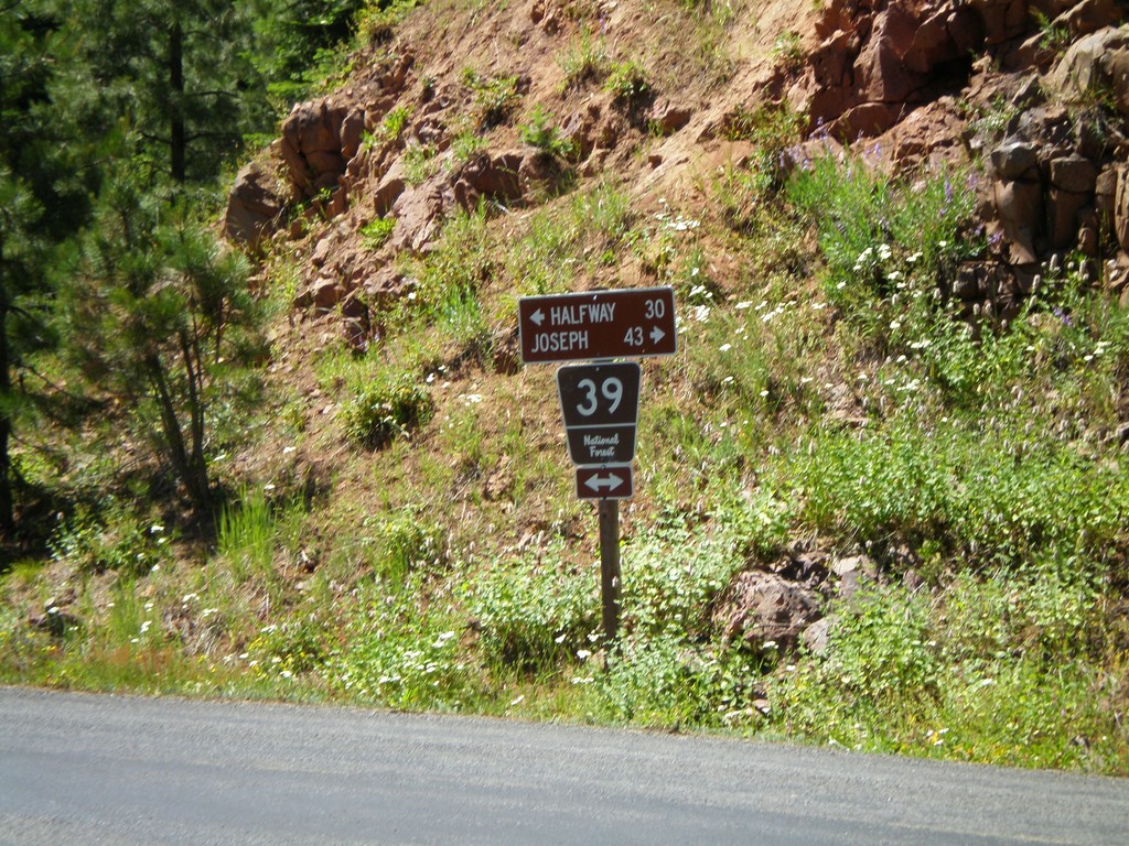
NFH-39 Hells Canyon Lookout Rd
NFH-39 to Halfway and Joseph at end of road to Hells Canyon Overlook.
Taken 06-30-2007
End NFH-39 OR-86 Jct.
End NFH-39 south at OR-86 to Oxbow and Halfway.
Taken 06-30-2007
 Halfway
Baker County
Oregon
United States
Halfway
Baker County
Oregon
United States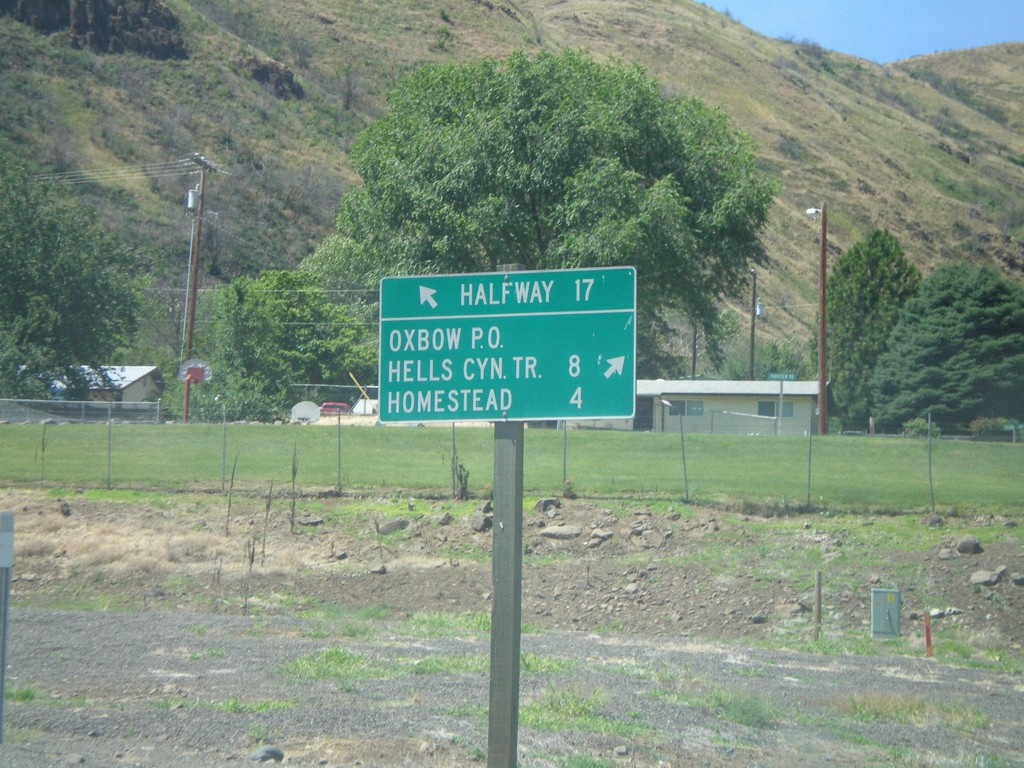
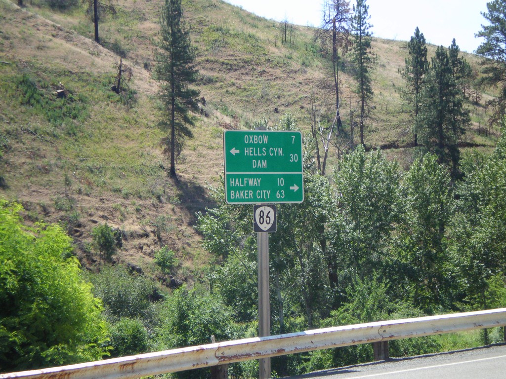
OR-86 at Idaho Power Road
OR-86 west at Idaho Power Road north to Homestead, Hells Canyon Trail, and Oxbow P.O.
Taken 06-30-2007
Halfway
Baker County
Oregon
United States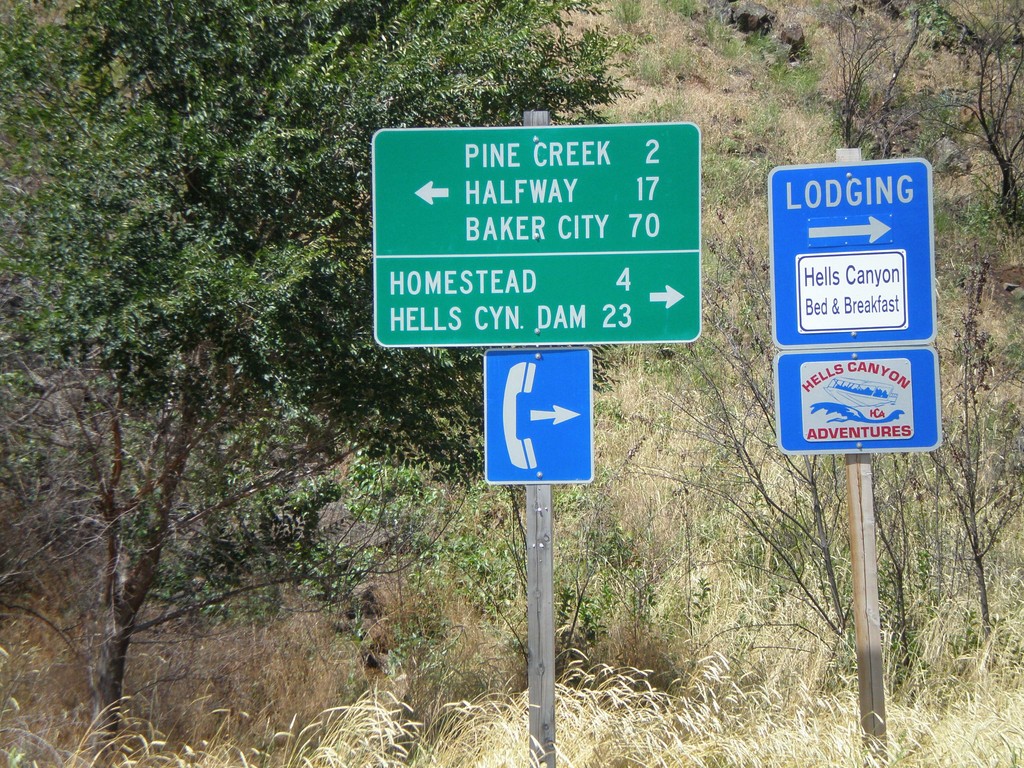
End Brownlee-Oxbow Hwy. at OR-86
End Brownlee-Oxbow Highway at OR-86 to Homestead and Baker City.
Taken 06-30-2007
Oxbow
Baker County
Oregon
United States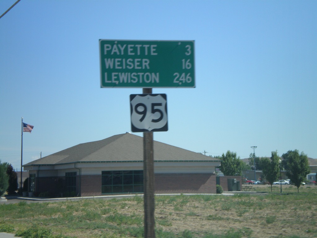
Distance Marker on US-95 North - Fruitland
US-95 north - distance marker. Distance to Payette, Weiser, and Lewiston.
Taken 06-30-2007
Fruitland
Payette County
Idaho
United States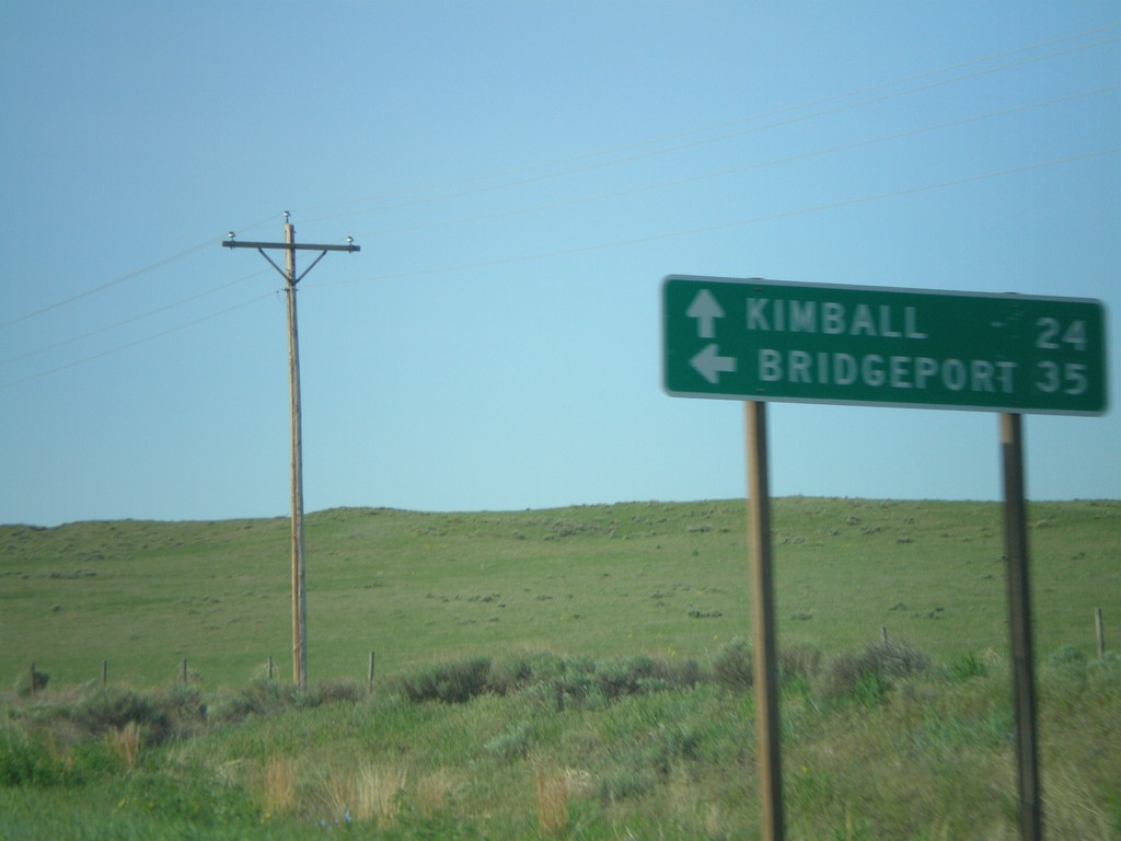
NE-71 South/NE-88 East at Split
NE-71/NE-88 south to Kimball at NE-88 east to Bridgeport.
Taken 05-27-2007

 Harrisburg
Banner County
Nebraska
United States
Harrisburg
Banner County
Nebraska
United States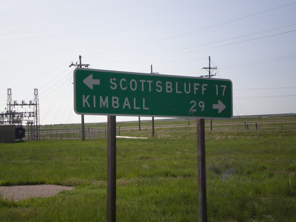
NE-88 East at NE-71
NE-88 east at NE-71 north to Scottsbluff and south to Kimball.
Taken 05-27-2007
Harrisburg
Banner County
Nebraska
United States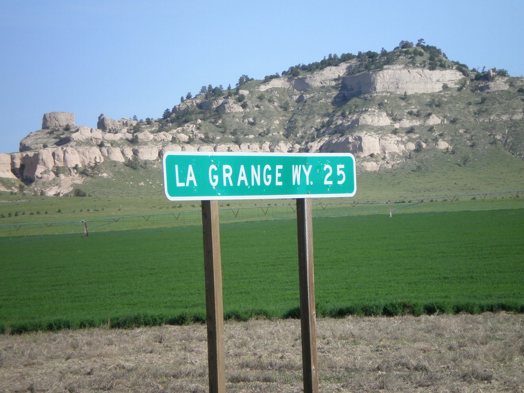
NE-88 West - Distance Marker
Distance marker to LaGrange (WY), on NE-88 west of NE-71.
Taken 05-27-2007
Harrisburg
Banner County
Nebraska
United States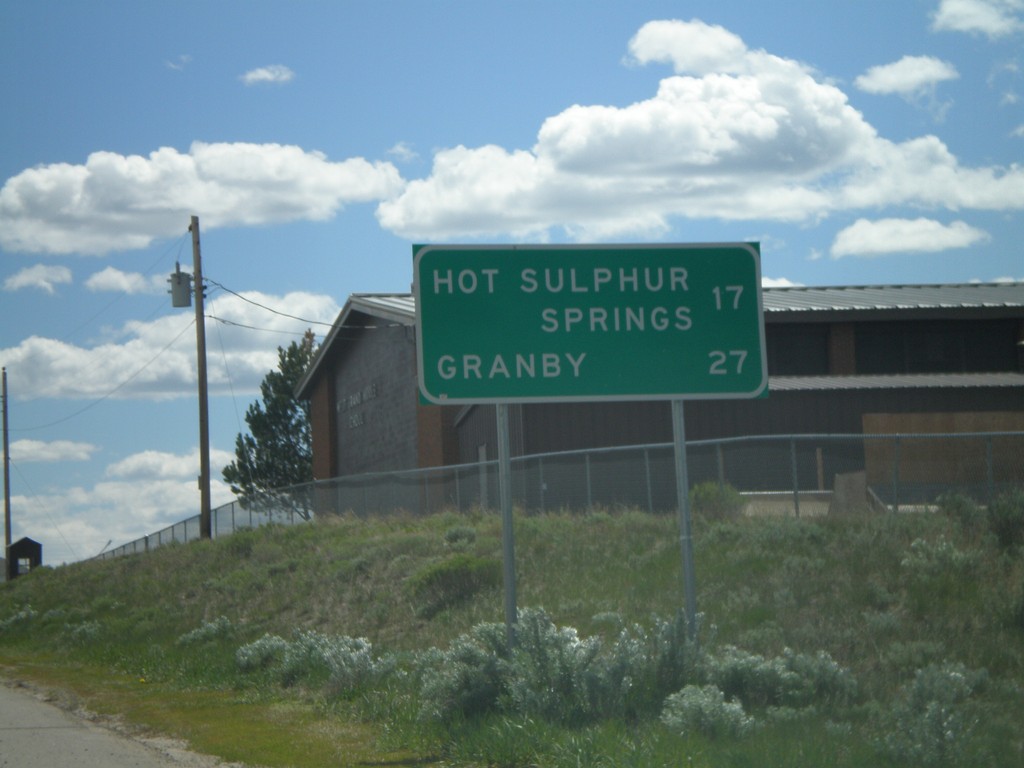
US-40 East - Distance Marker
Distance marker on US-40 east to Hot Sulphur Springs and Granby.
Taken 05-25-2007
 Kremmling
Grand County
Colorado
United States
Kremmling
Grand County
Colorado
United States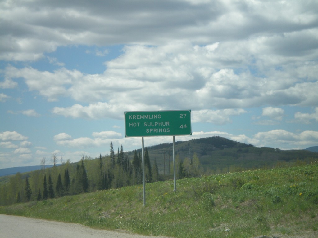
US-40 East - Distance Marker
Distance marker on US-40 east to Kremmling and Hot Sulphur Springs on Muddy Pass.
Taken 05-25-2007
Kremmling
Grand County
Colorado
United States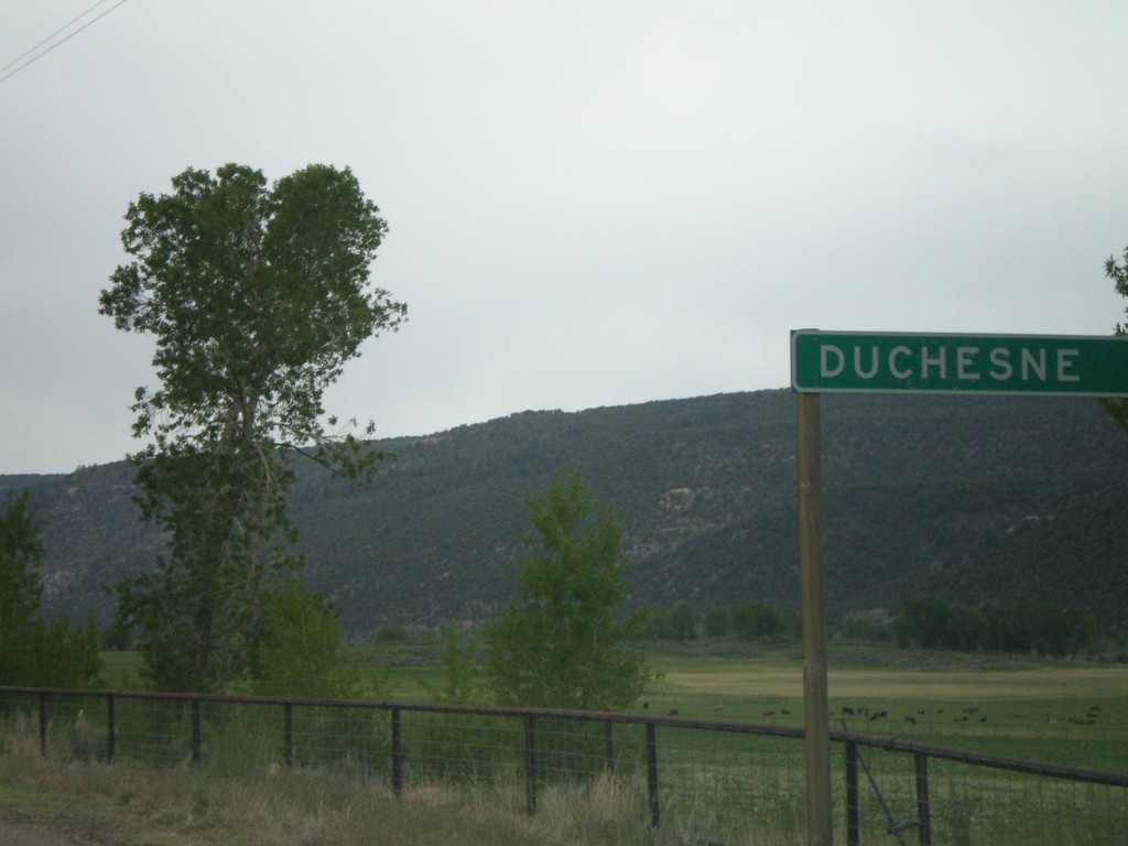
UT-35 East - Distance Marker
Distance marker to Duchesne east of UT-208 on UT-35.
Taken 05-24-2007

 Tabiona
Duchesne County
Utah
United States
Tabiona
Duchesne County
Utah
United States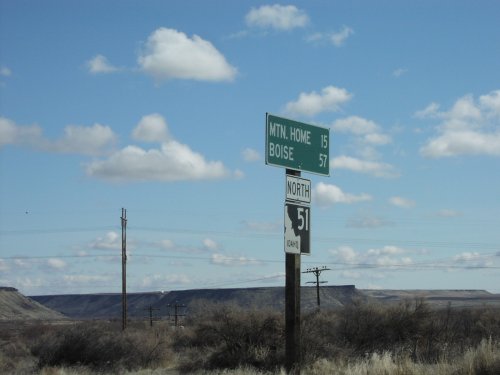
ID-51 North - Distance Marker
Distance marker on ID-51 north to Mountain Home and Boise.
Taken 03-01-2007
 Bruneau
Owyhee County
Idaho
United States
Bruneau
Owyhee County
Idaho
United States