Signs Tagged With Distance Marker
I-80 West Distance Marker
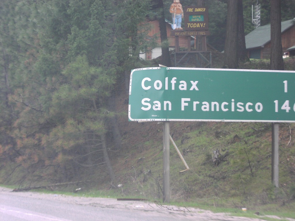
Distance marker on I-80 west of Alta IC. Colfax, and San Francisco.
Taken 04-01-2006
 Dutch Flat
Placer County
California
United States
Dutch Flat
Placer County
California
United States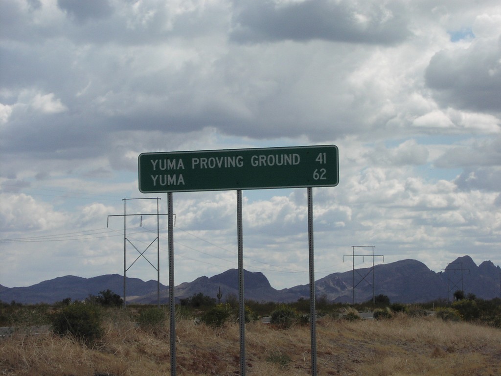
US-95 South - Distance Marker
US-95 south to Yuma Proving Ground and Yuma
Taken 03-01-2006
 Yuma
Yuma County
Arizona
United States
Yuma
Yuma County
Arizona
United States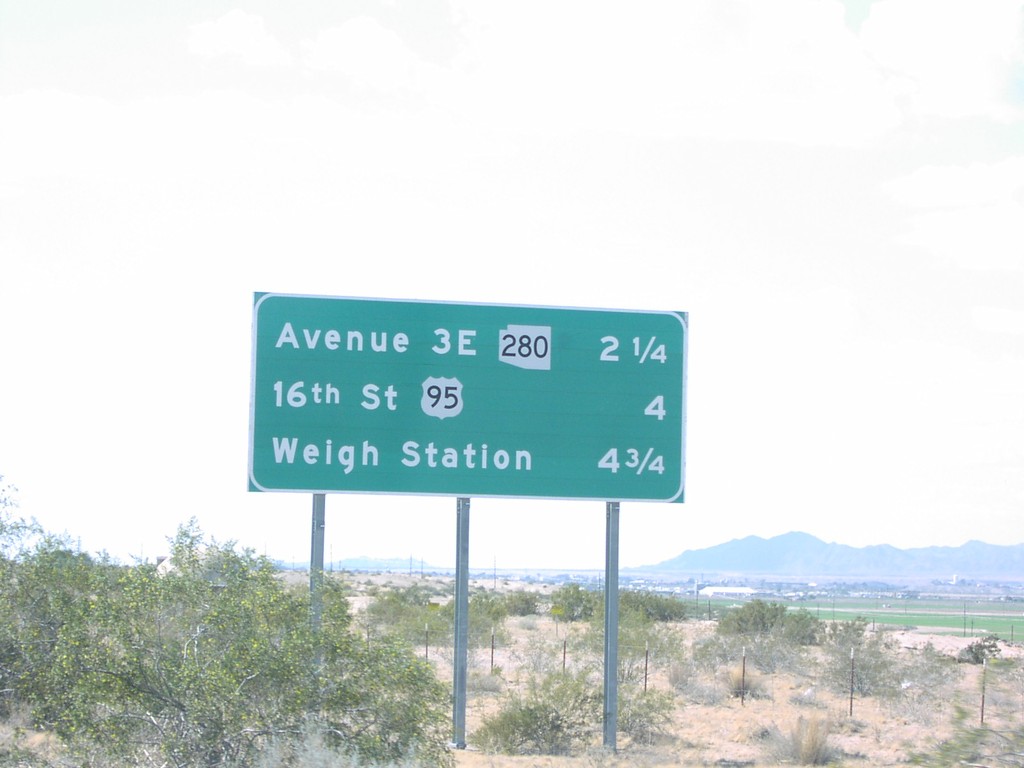
I-8 West Distance Marker
I-8 west next 3 exits: AZ-280, US-95, and Weigh Station
Taken 03-01-2006
 Yuma
Yuma County
Arizona
United States
Yuma
Yuma County
Arizona
United States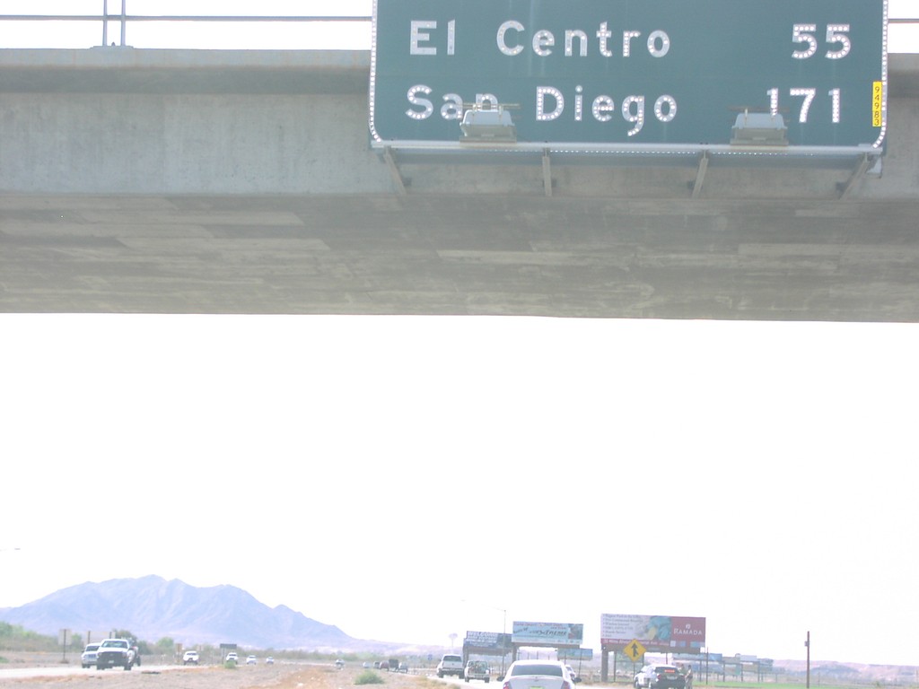
I-8 West - Distance Marker
Distance marker on Winterhaven overpass to El Centro and San Diego, on I-8 west
Taken 03-01-2006
Winterhaven
Imperial County
California
United States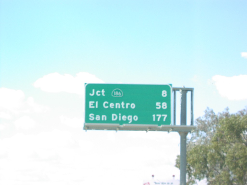
I-8 West - Distance Marker
Distance marker on I-8 west to CA-186, El Centro, and San Diego just east of Arizona-California Line
Taken 03-01-2006
Yuma
Yuma County
Arizona
United States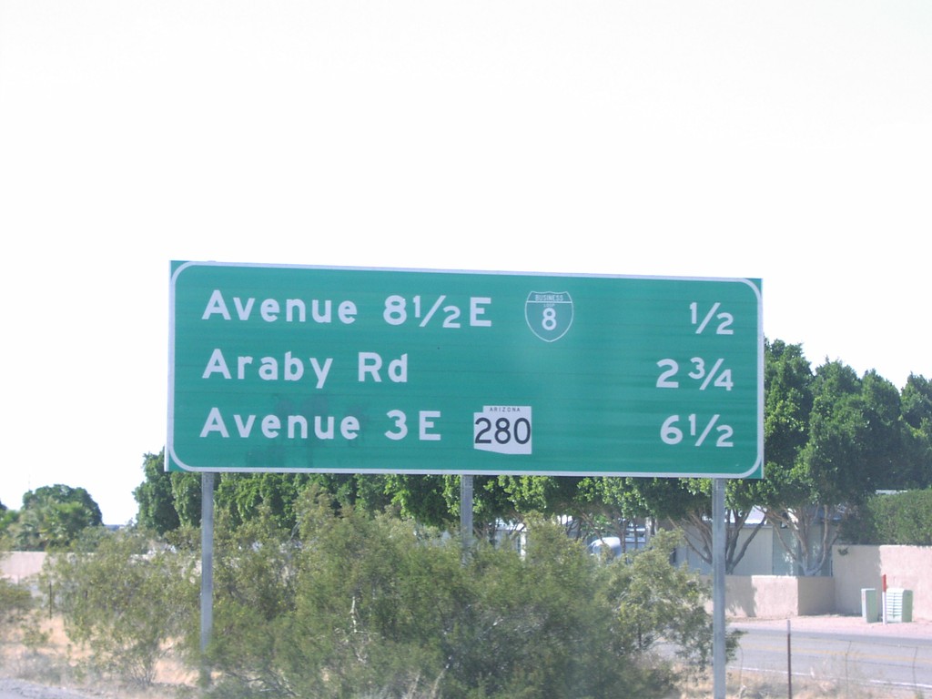
I-8 West - Distance Marker
Next 3 exits on I-8 west, BL-8, Araby Rd., and AZ-280
Taken 03-01-2006
Yuma
Yuma County
Arizona
United States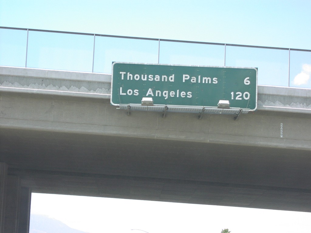
I-10 West - Distance Marker
I-10 west at Exit 137, distance marker to 1000 Palms and Los Angeles.
Taken 03-01-2006
 Palm Desert
Riverside County
California
United States
Palm Desert
Riverside County
California
United States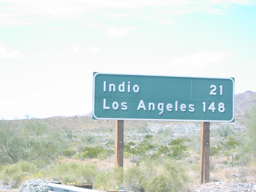
I-10 West - Distance Marker
I-10 west to Indio and Los Angeles.
Taken 03-01-2006
Cactus City
Riverside County
California
United States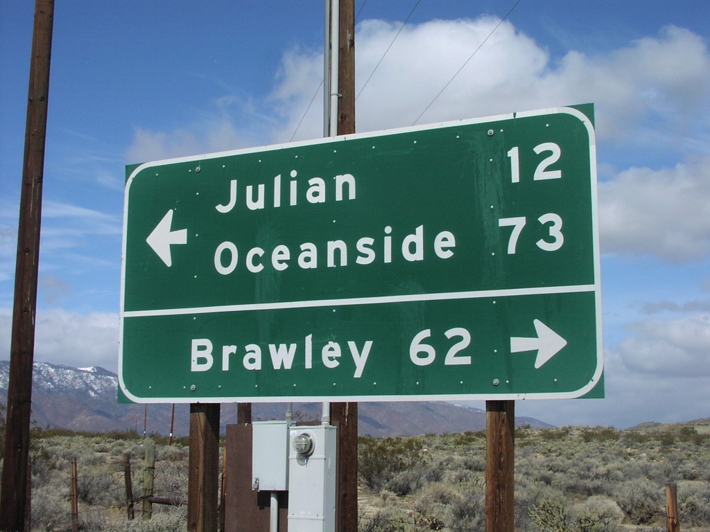
End CR-S2 North at CA-78
End CR-S2 north at CA-78 to Julian, Oceanside, and Brawley.
Taken 03-01-2006

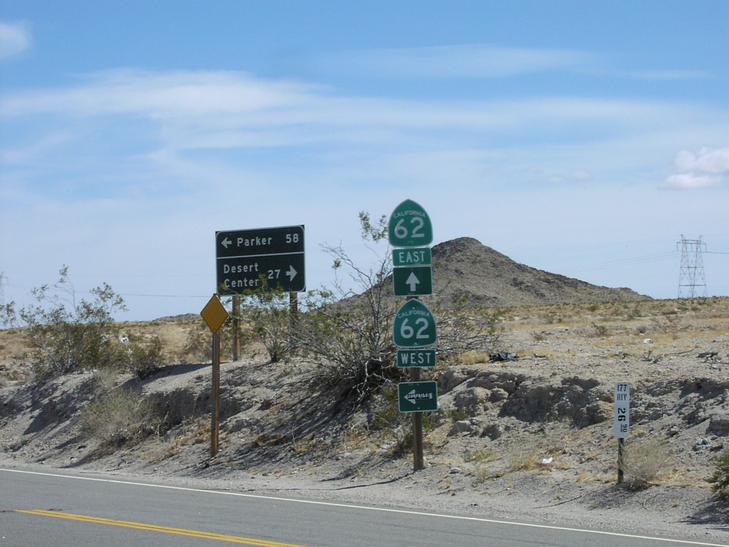
End CA-177 North at CA-62
End CA-177 north at CA-62
Taken 03-01-2006

 Riverside County
California
United States
Riverside County
California
United States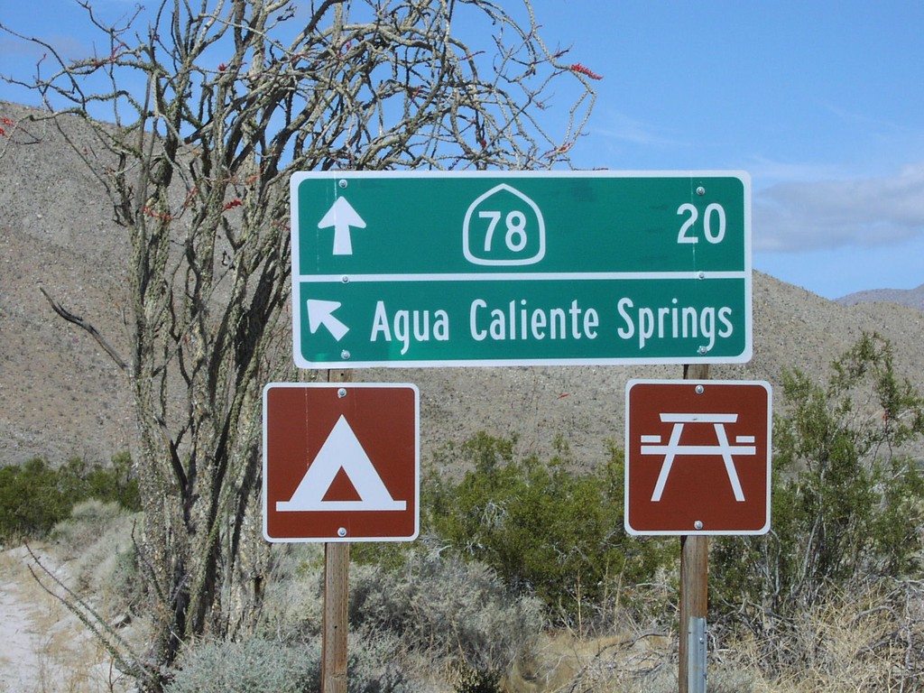
CR-S2 North - Agua Caliente Hot Springs
CR-S2 north at Agua Caliente Springs
Taken 03-01-2006
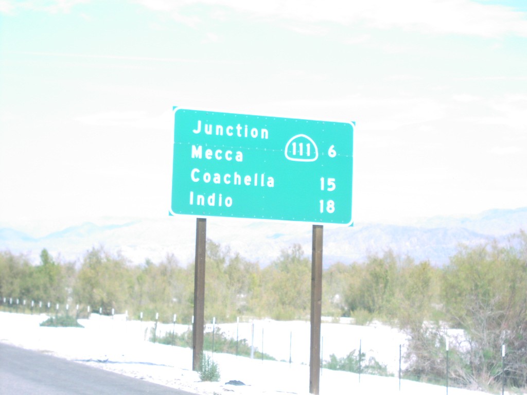
CA-86S North - Distance Marker
CA-86S north to CA-111, Coachella, and Indio.
Taken 03-01-2006

 Thermal
Riverside County
California
United States
Thermal
Riverside County
California
United States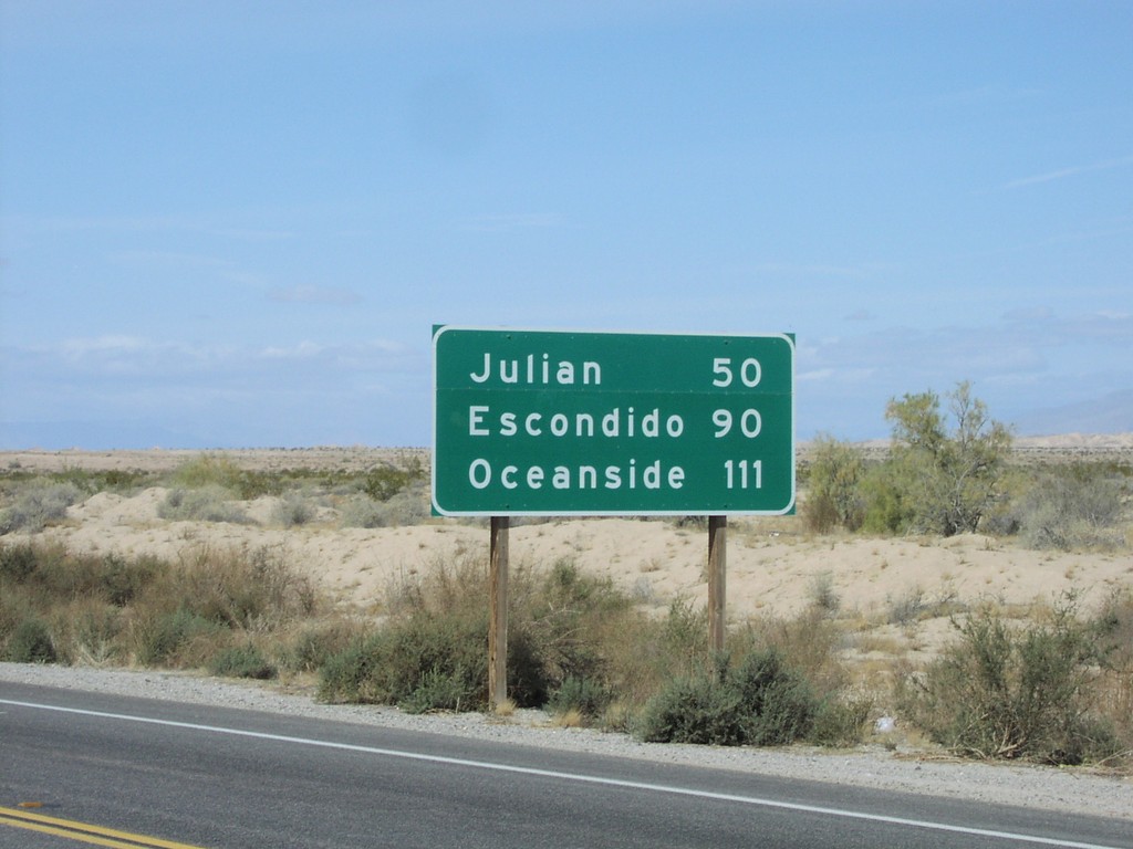
CA-78 West - Distance Marker
CA-78 west to Julian, Escondido, and Oceanside just west of CA-86.
Taken 03-01-2006
 Borrego Springs
Imperial County
California
United States
Borrego Springs
Imperial County
California
United States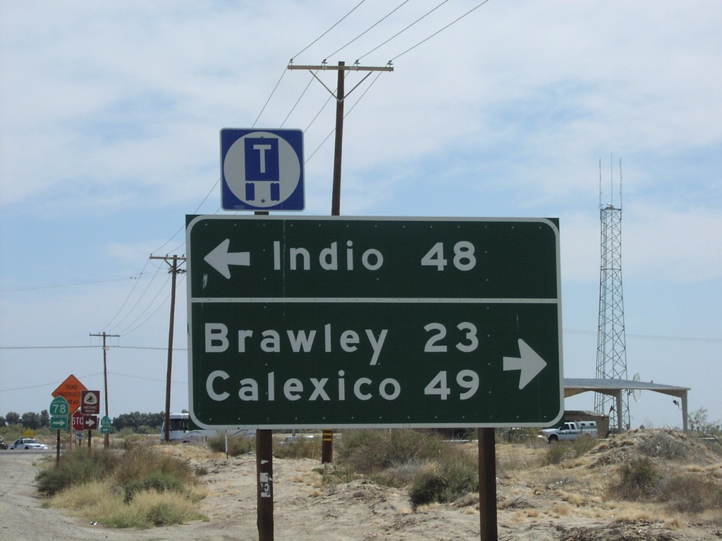
CA-78 East at CA-86
CA-78 east at CA-86 to Indio, Brawley, and Calexico. Building at right side of picture (behind sign - in front of antenna) is a border patrol checkpoint.
Taken 03-01-2006
Borrego Springs
Imperial County
California
United States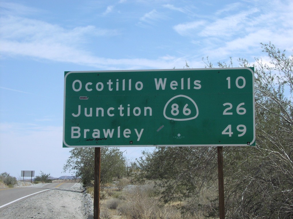
CA-78 East - Distance Marker
CA-78 east to Ocotillo Wells, CA-86, and Brawley.
Taken 03-01-2006
Borrego Springs
San Diego County
California
United States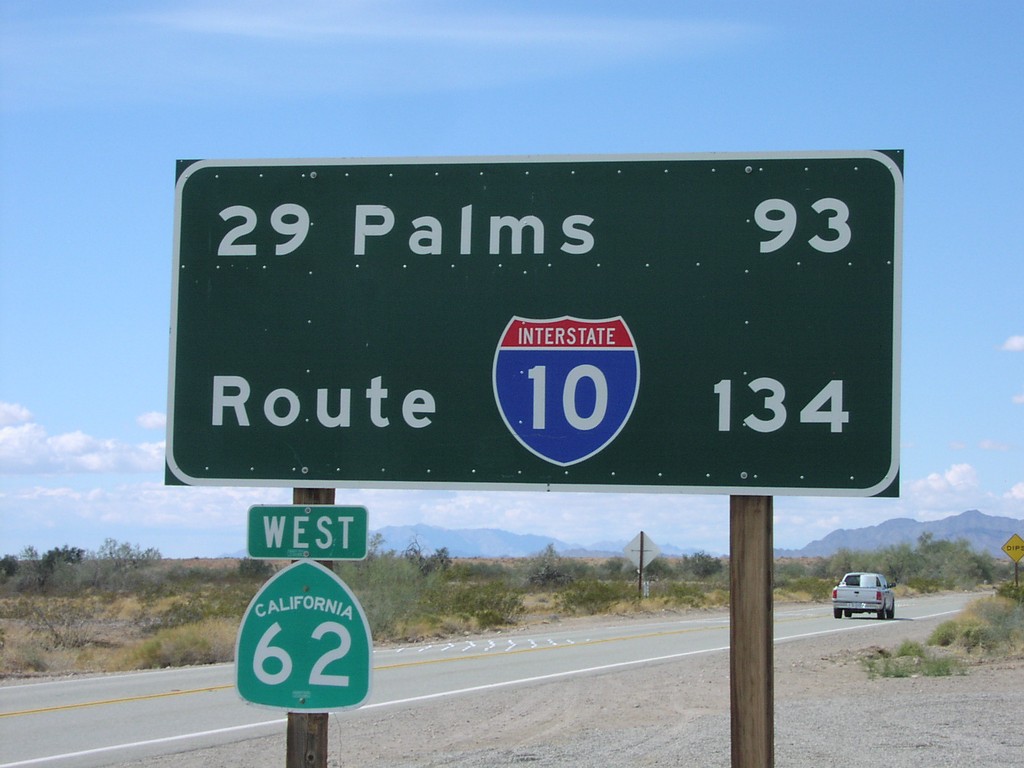
CA-62 West - Distance Marker
Distance marker on CA-62 west to 29 Palms and I-10. Taken just west of US-95 junction.
Taken 03-01-2006
Vidal Junction
San Bernardino County
California
United States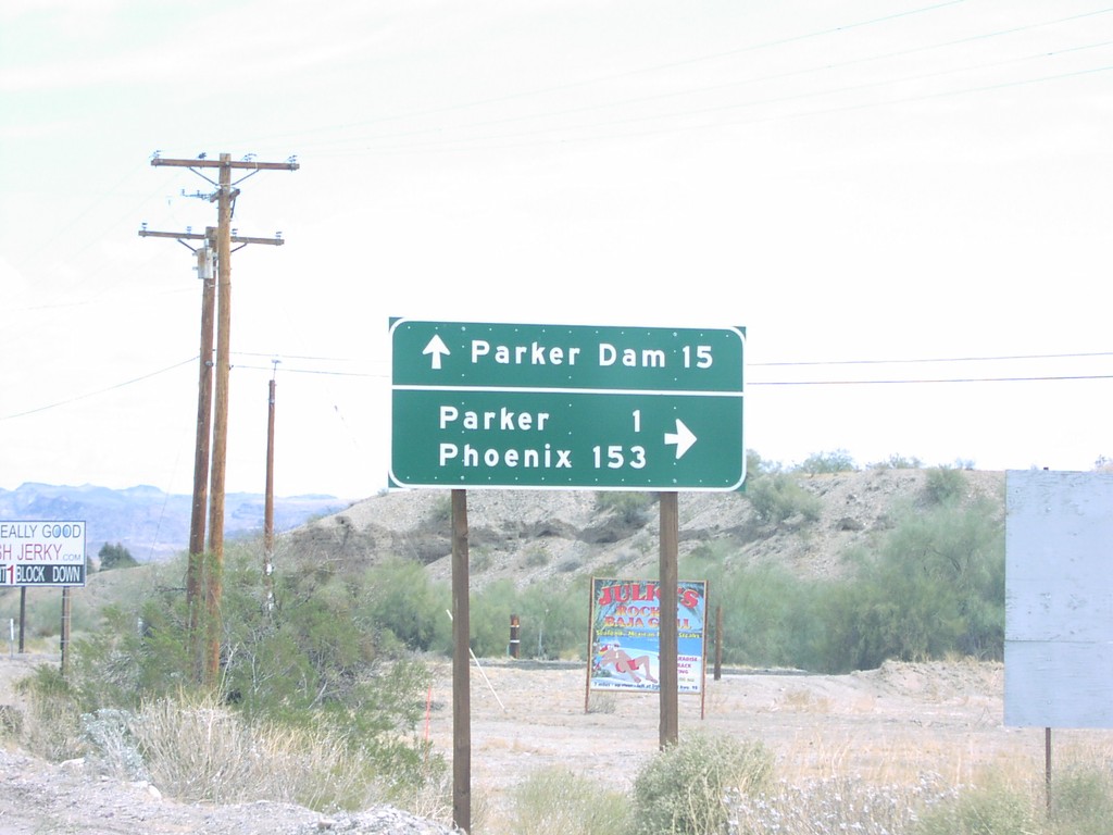
CA-62 East at Parker Dam Jct.
CA-62 east at Parker Dam Road to Parker Dam.
Taken 03-01-2006
Bluewater
San Bernardino County
California
United States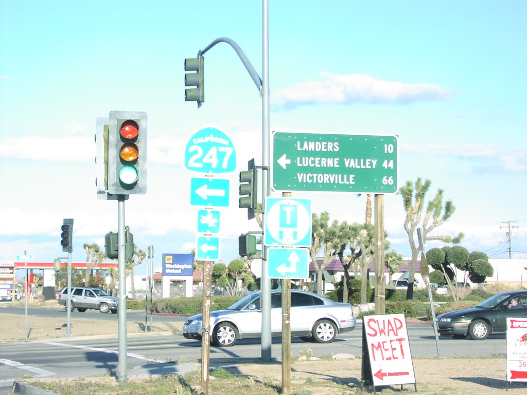
CA-62 East at CA-247 North
CA-62 east at CA-247 north to Landers, Lucerne Valley, and Victorville
Taken 03-01-2006
 Yucca Valley
San Bernardino County
California
United States
Yucca Valley
San Bernardino County
California
United States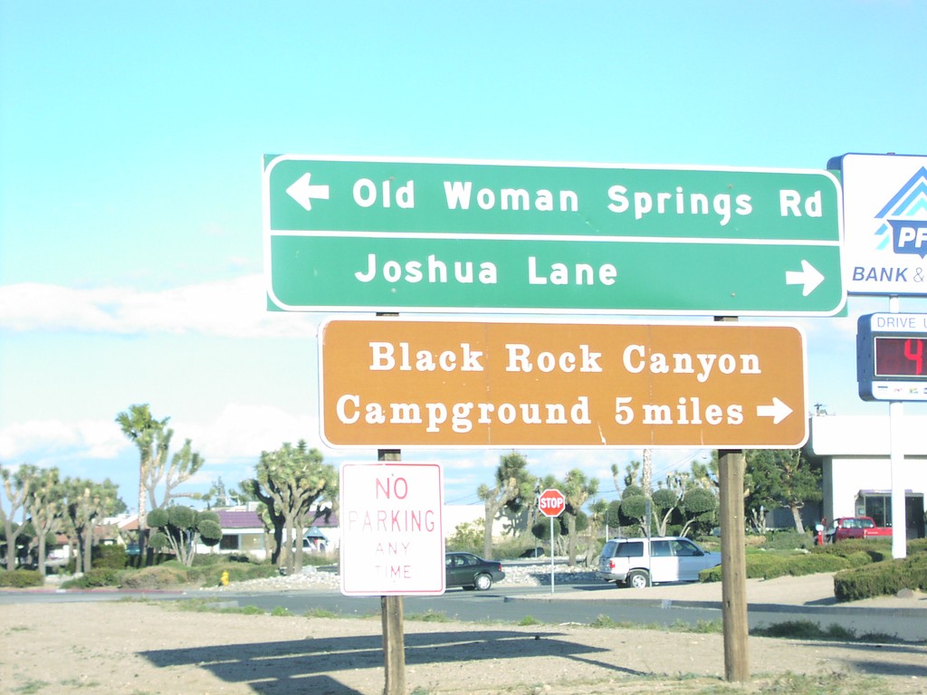
CA-62 East at CA-247 North
CA-62 east approaching CA-247 North/Old Woman Springs Road
Taken 03-01-2006
Yucca Valley
San Bernardino County
California
United States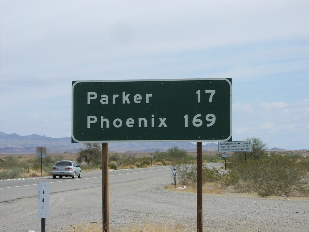
CA-62 East - Distance Marker
CA-62 east distance marker to Parker (AZ) and Phoenix (AZ), just east of US-95.
Taken 03-01-2006
Vidal Junction
San Bernardino County
California
United States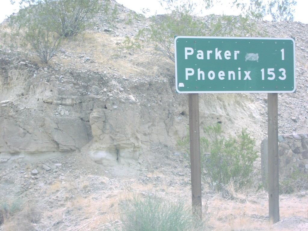
CA-62 East - Distance Marker
CA-62 east to Parker (AZ) and Phoenix (AZ) east of Parker Dam Road junction.
Taken 03-01-2006
Bluewater
San Bernardino County
California
United States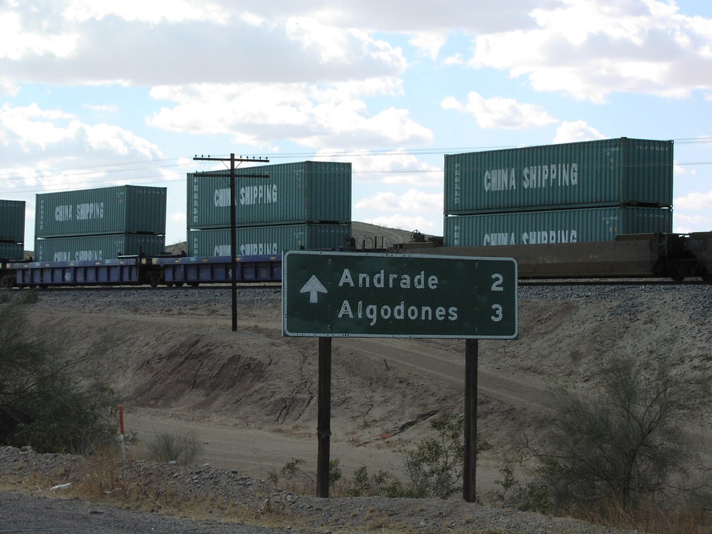
CA-186 South - Distance Marker
Begin CA-186 south at I-8 to Andrade (California) and Algodones (Mexico).
Taken 03-01-2006
 Winterhaven
Imperial County
California
United States
Winterhaven
Imperial County
California
United States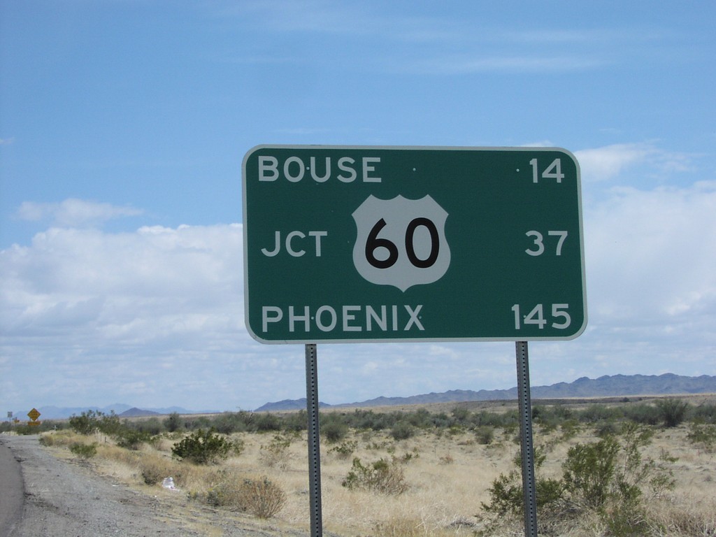
AZ-72 East - Distance Marker
AZ-72 east to Bouse, US-60, and Phoenix, just east of AZ-95.
Taken 03-01-2006
 Bouse
La Paz County
Arizona
United States
Bouse
La Paz County
Arizona
United States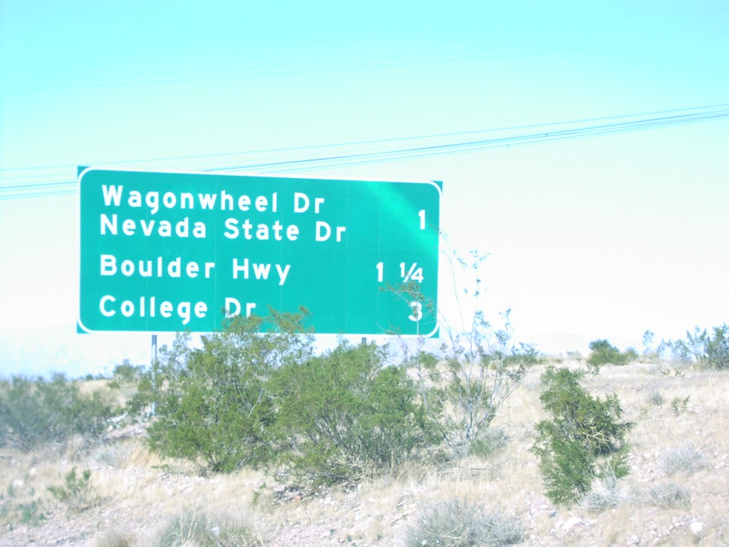
US-95/US-93 North - Henderson Exits
US-93/US-95 North, next 3 Henderson exits: Wagonwheel Drive/Boulder Hwy/College Dr
Taken 02-01-2006
 Henderson
Clark County
Nevada
United States
Henderson
Clark County
Nevada
United States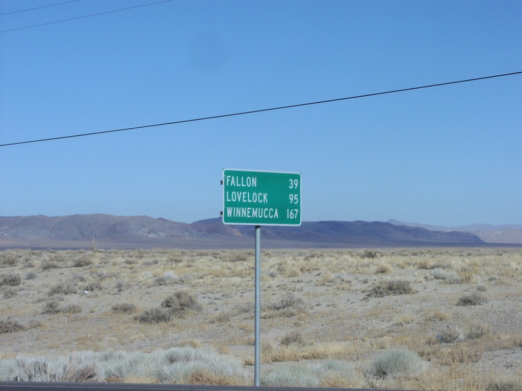
US-95 North Distance Marker
Distance marker on US-95 just north of US-95A junction to Fallon, Lovelock, and Winnemucca
Taken 02-01-2006
Schurz
Mineral County
Nevada
United States