Signs Tagged With Distance Marker
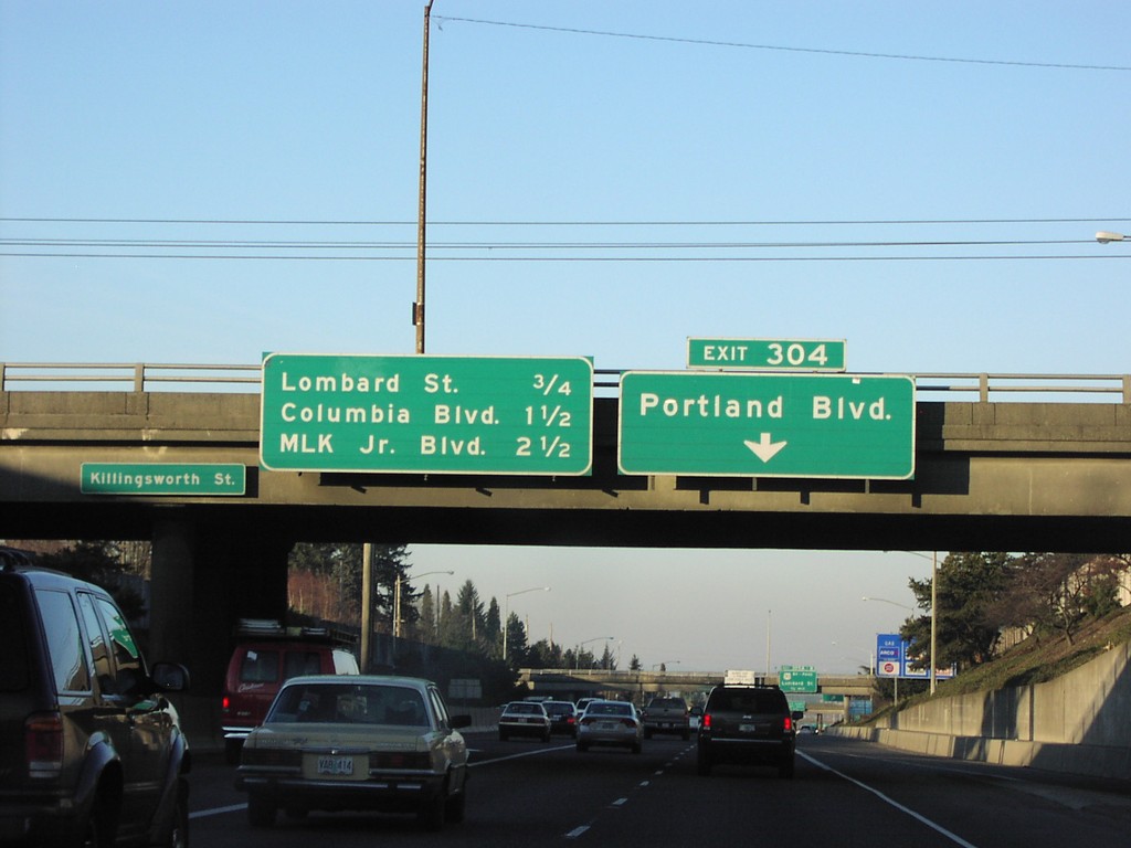
I-5 North Exit 304
I-5 north approaching Exit 304, Portland Blvd. Overhead for next three exits.
Taken 01-01-2007
 Portland
Multnomah County
Oregon
United States
Portland
Multnomah County
Oregon
United States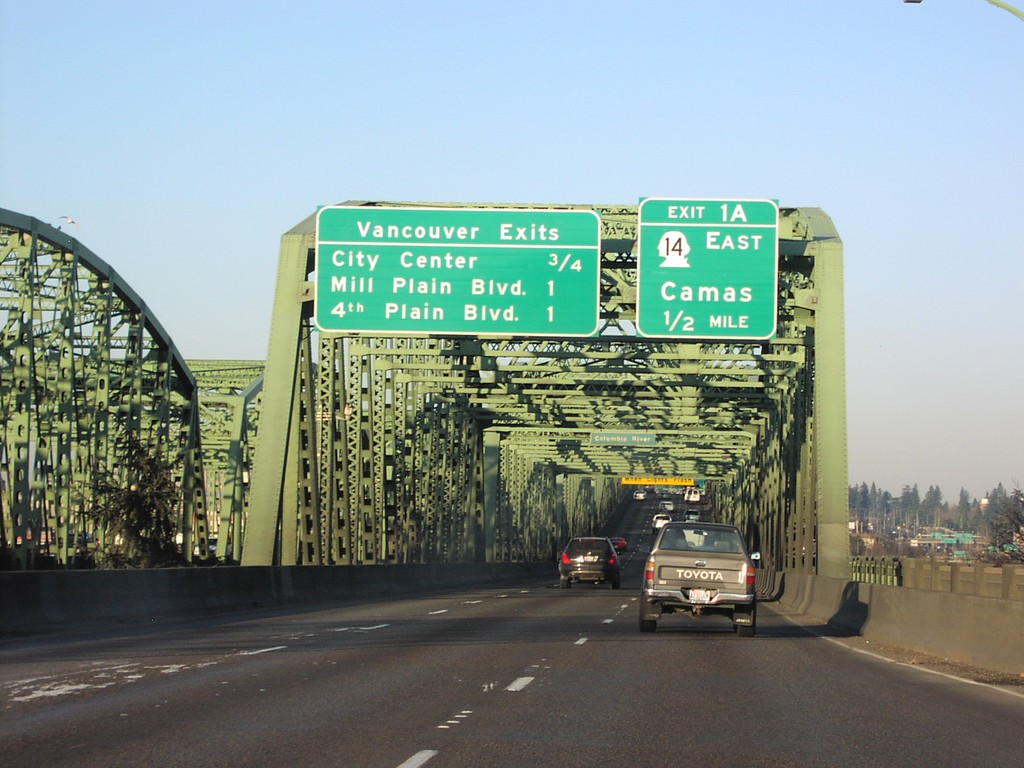
I-5 North Exit 1A/Vancouver Exits
I-5 north approaching Exit 1A (WA) WA-14/Camas, and overhead for next three Vancouver exits. Taken at foot of Interstate Bridge on the Columbia River.
Taken 01-01-2007
 Portland
Multnomah County
Oregon
United States
Portland
Multnomah County
Oregon
United States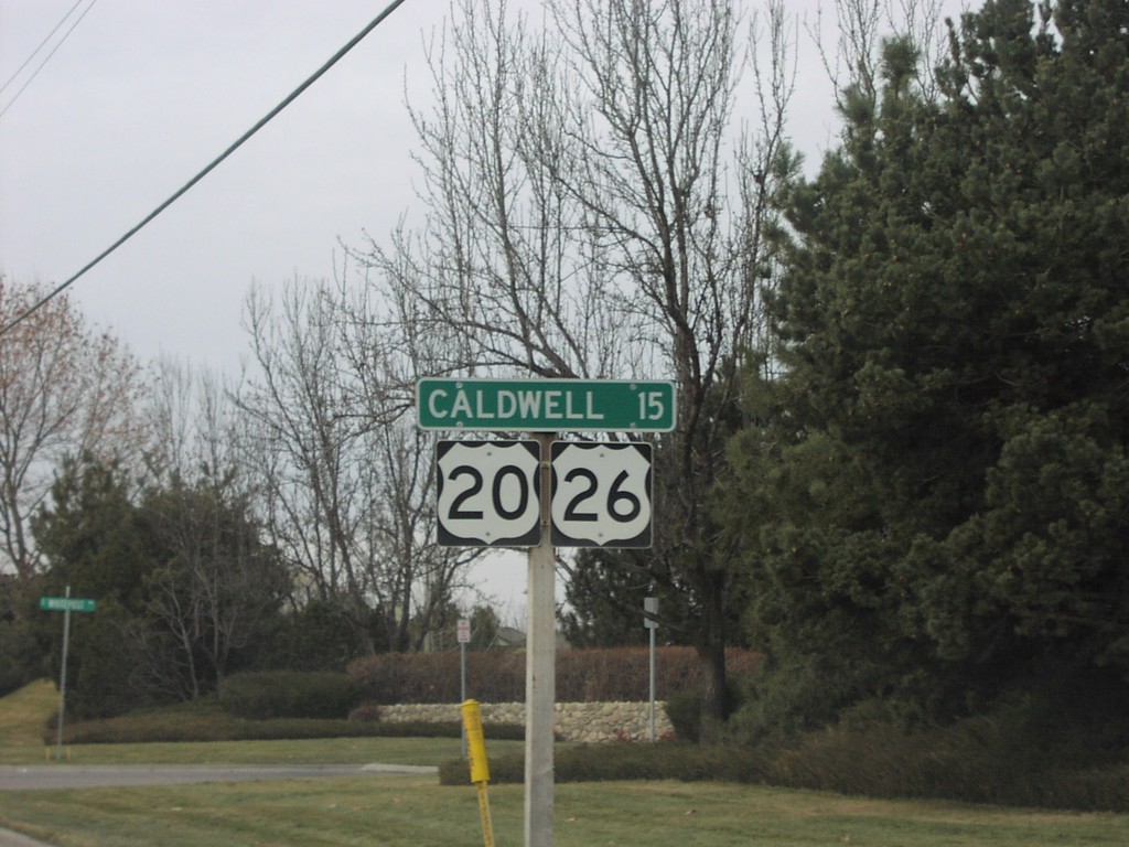
US-20/US-26 West - Distance Marker
Distance marker to Caldwell on US-20/US-26 west after ID-55 junction.
Taken 12-01-2006

 Boise
Ada County
Idaho
United States
Boise
Ada County
Idaho
United States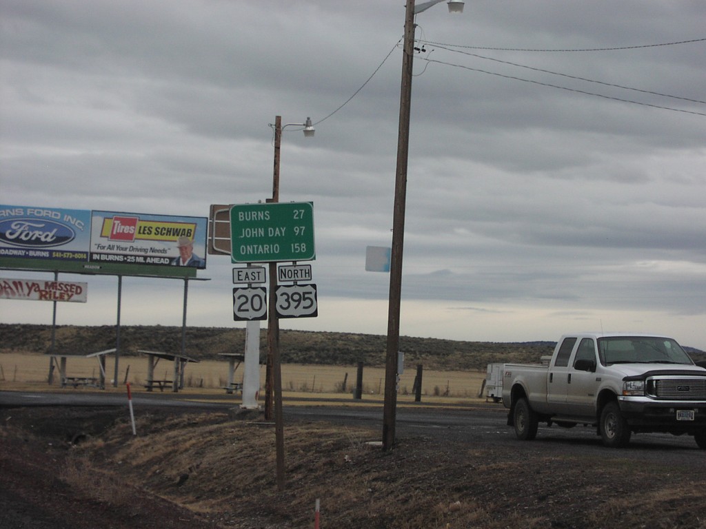
US-20 East/US-395 North - Riley
US-20 East/US-395 North - Distance Marker. Distance to Burns, John Day, and Ontario.
Taken 12-01-2006
 Riley
Harney County
Oregon
United States
Riley
Harney County
Oregon
United States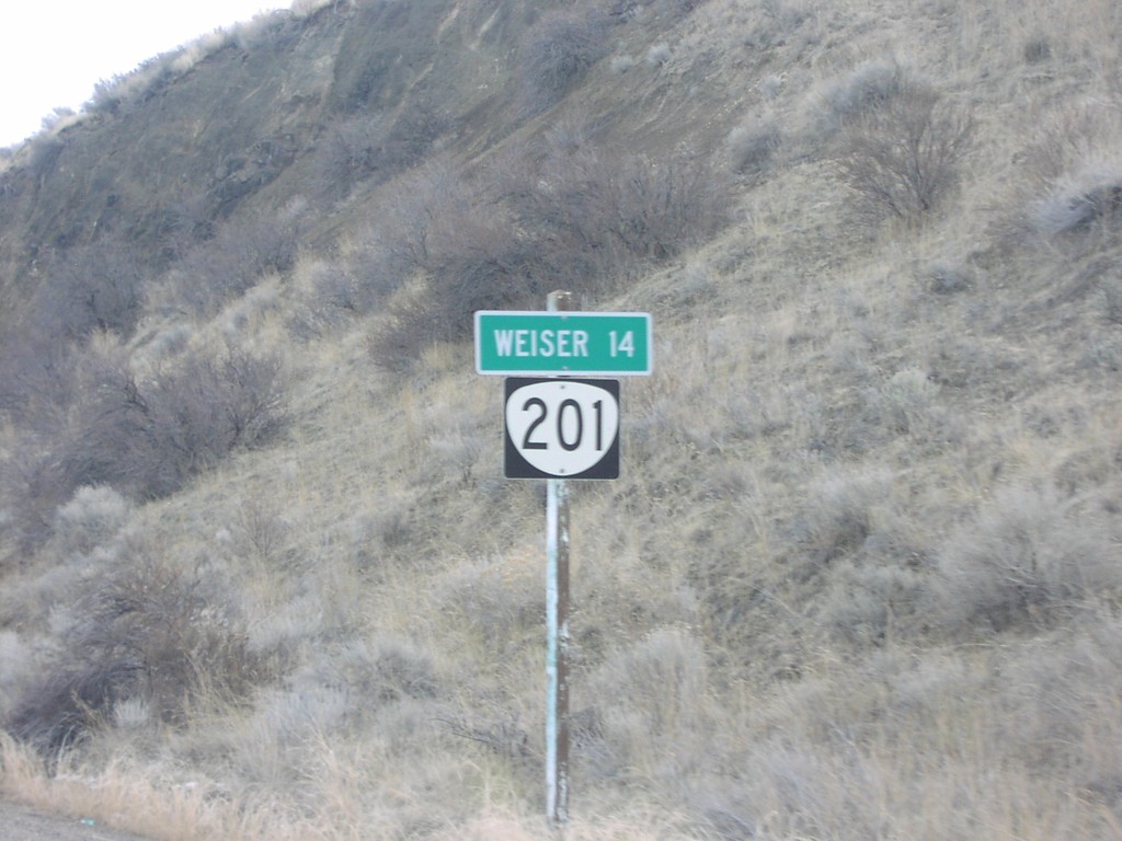
OR-201 South - Distance Marker
First distance marker on OR-201 south. Distance to Weiser, 14 miles.
Taken 12-01-2006
 Huntington
Malheur County
Oregon
United States
Huntington
Malheur County
Oregon
United States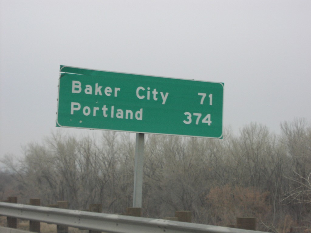
I-84 West - Distance Marker
I-84 west at first Oregon distance marker on I-84 to Baker City and Portland (371 miles).
Taken 12-01-2006
 Ontario
Malheur County
Oregon
United States
Ontario
Malheur County
Oregon
United States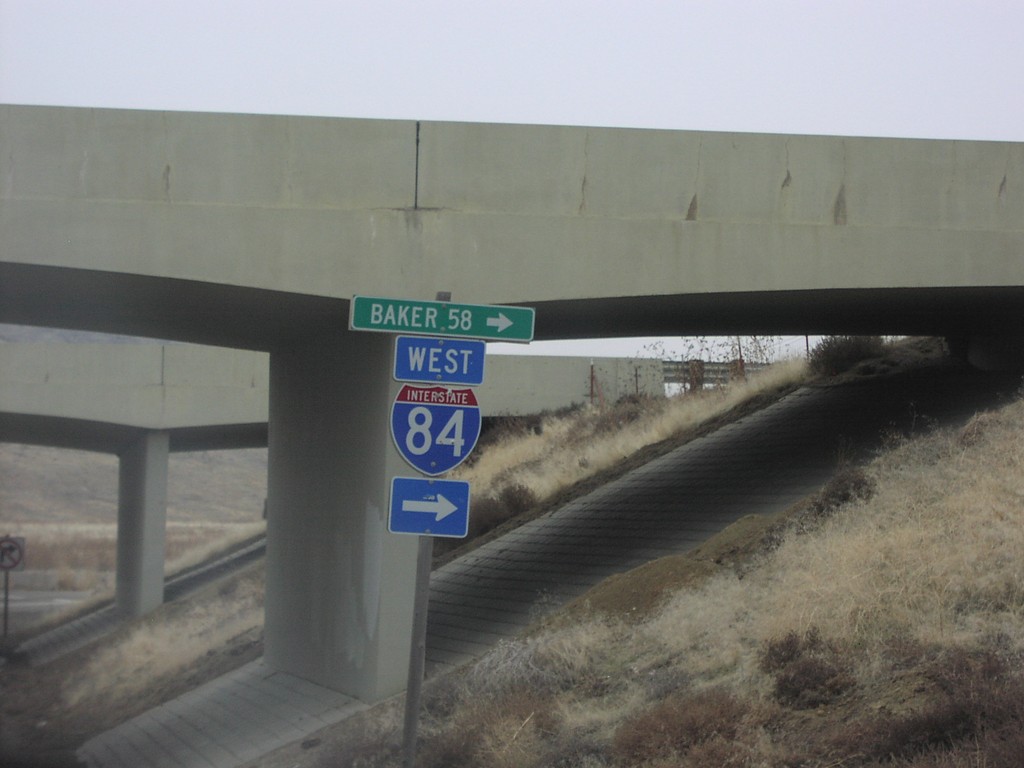
I-84 Onramp Exit 362
Moores Hollow Road at I-84 West to Baker, 58 miles.
Taken 12-01-2006
Ontario
Malheur County
Oregon
United States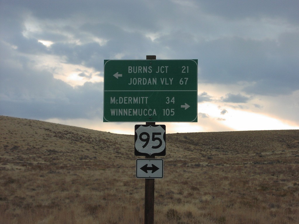
US-95 - Whitehorse Ranch Rd
US-95 at end of Whitehorse Ranch Road. US-95 north to Burns Jct and Jordan Valley; south to McDermitt and Winnemucca.
Taken 10-01-2006
 Basque
Malheur County
Oregon
United States
Basque
Malheur County
Oregon
United States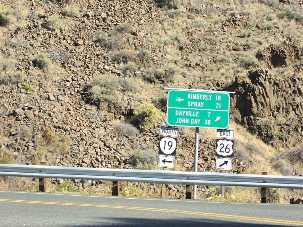
US-26 East at OR-19
US-26 east at OR-19 north to Kimberly and Spray.
Taken 10-01-2006
 Dayville
Grant County
Oregon
United States
Dayville
Grant County
Oregon
United States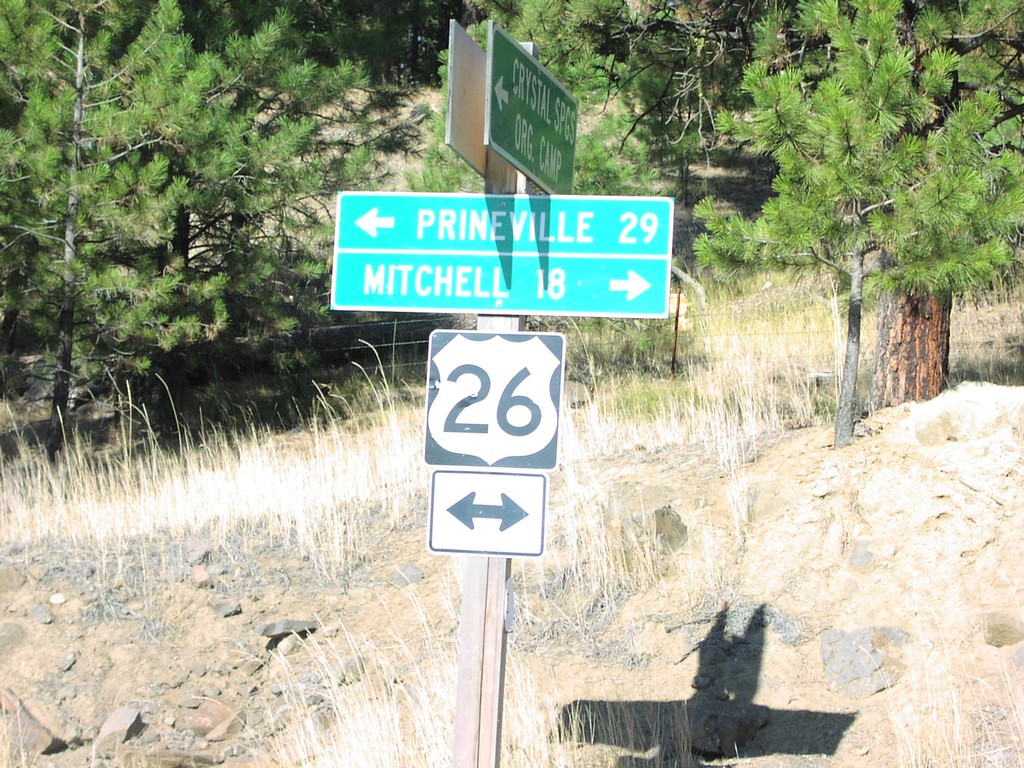
US-26 - Crystal Springs Camp Rd
US-26 west to Prineville; east to Mitchell at end of Crystal Springs Camp Road.
Taken 10-01-2006
Prineville
Crook County
Oregon
United States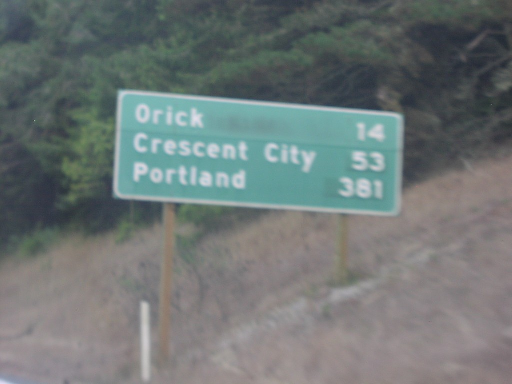
US-101 North Distance Marker
Distance marker on US-101 north to Orick, Crescent City, and Portland.
Taken 10-01-2006
 Trinidad
Humboldt County
California
United States
Trinidad
Humboldt County
California
United States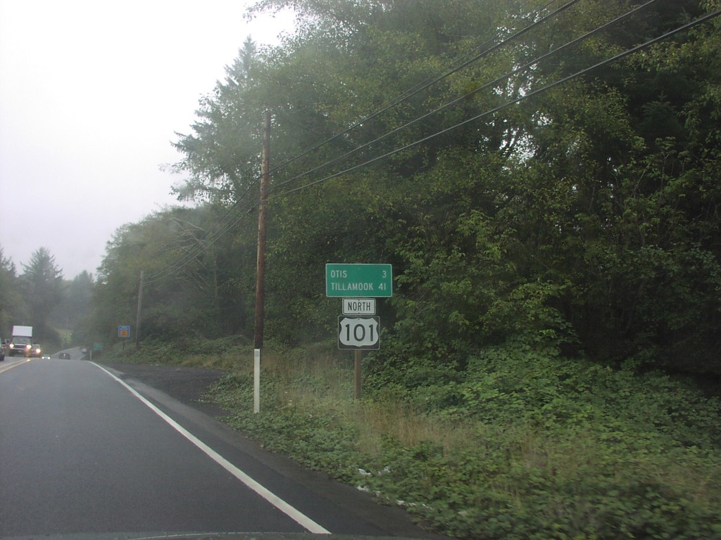
US-101 North - Distance Marker
Distance marker on US-101 north to Otis and Tillamook.
Taken 10-01-2006
Neotsu
Lincoln County
Oregon
United States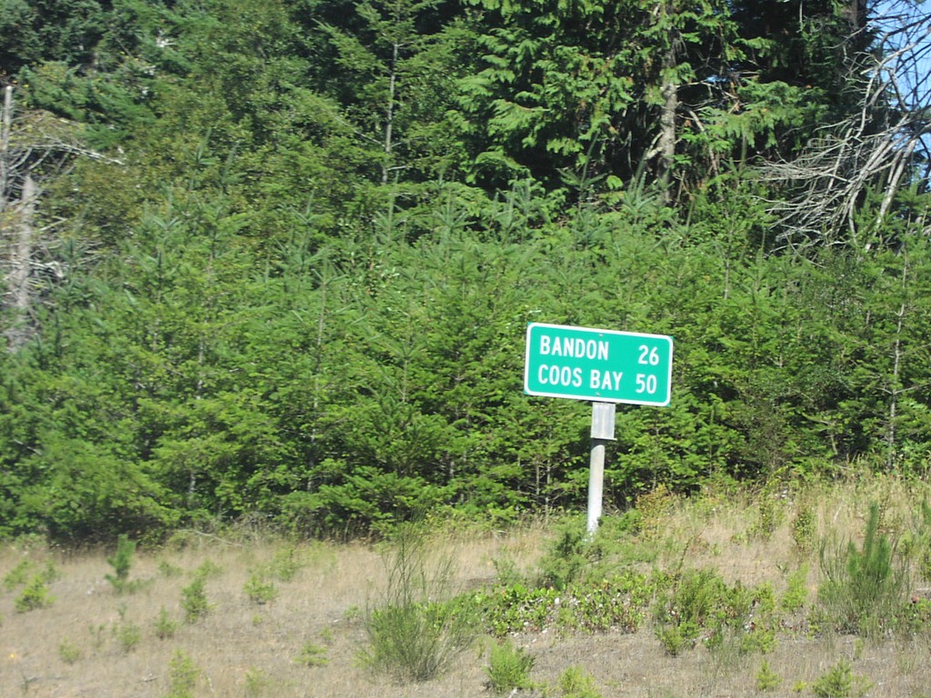
US-101 North - Distance Marker
Distance marker on US-101 north to Bandon and Coos Bay.
Taken 10-01-2006
Port Orford
Curry County
Oregon
United States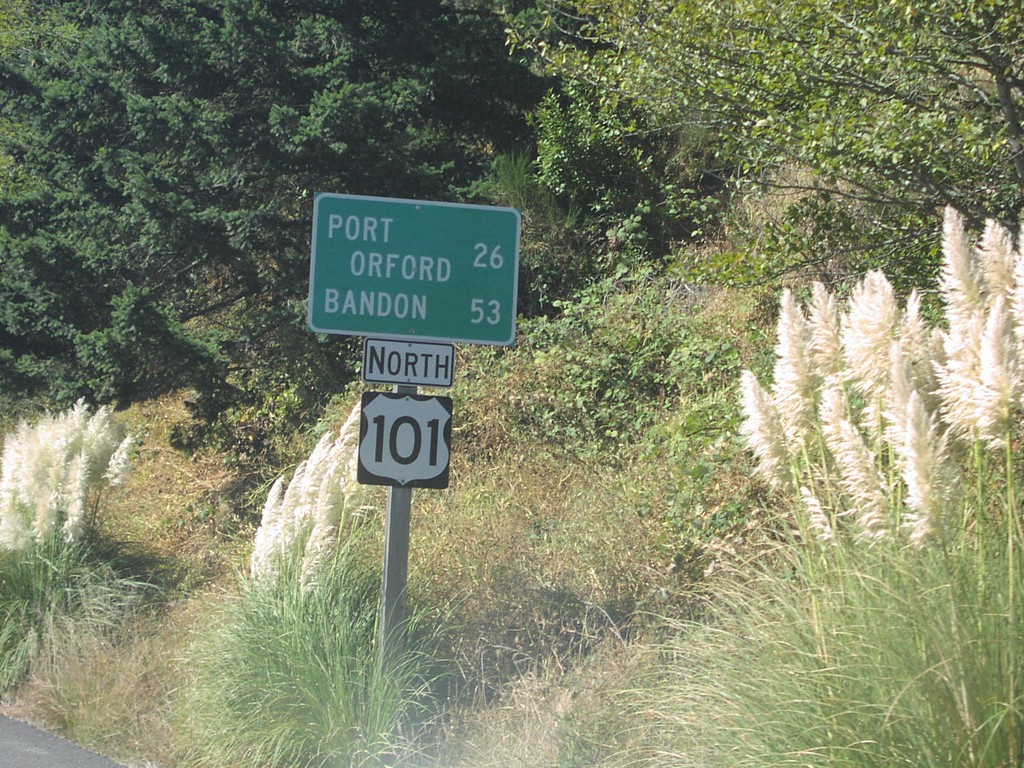
US-101 North - Distance Marker
Distance marker on US-101 north to Port Orford and Bandon.
Taken 10-01-2006
Gold Beach
Curry County
Oregon
United States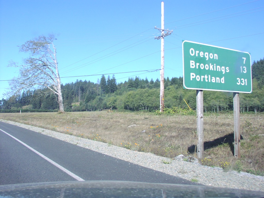
US-101 North - Distance Marker
Distance marker on US-101 north to Oregon, Brookings, and Portland.
Taken 10-01-2006
Smith River
Del Norte County
California
United States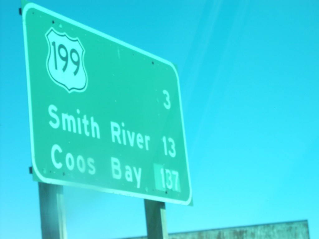
US-101 North - Distance Marker
Distance marker on US-101 north to US-199, Smith River, and Coos Bay.
Taken 10-01-2006
Crescent City
Del Norte County
California
United States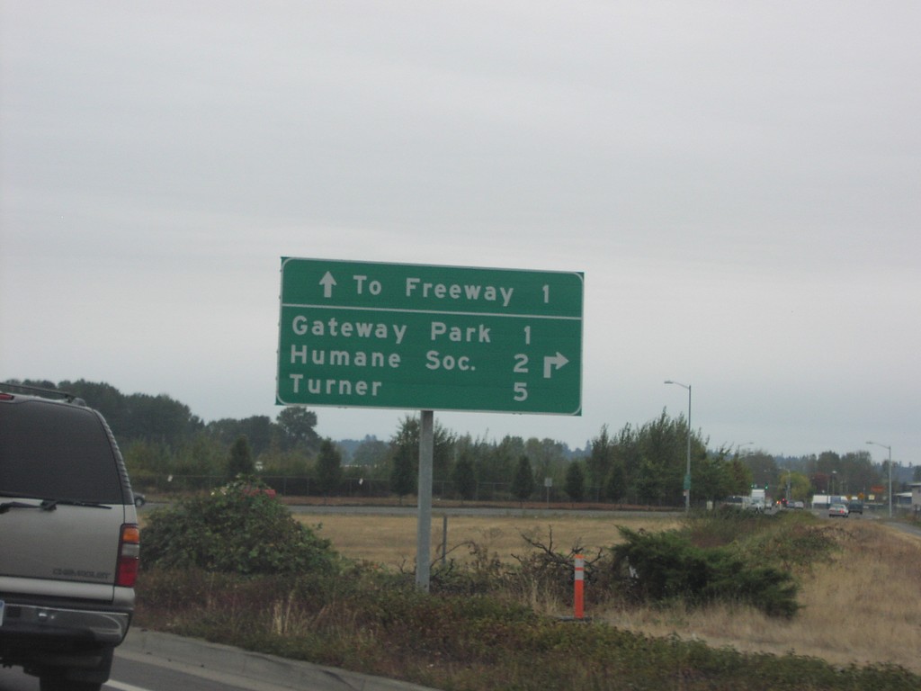
OR-22 East at Turner Road
OR-22 east/Bus. OR-99E at Turner Road to Humane Society and Turner.
Taken 10-01-2006

 Salem
Marion County
Oregon
United States
Salem
Marion County
Oregon
United States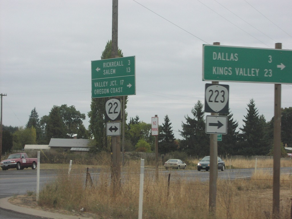
OR-22 East at OR-223
OR-22 east to Rickreall and Salem at OR-223 south to Dallas and Kings Valley.
Taken 10-01-2006
 Dallas
Polk County
Oregon
United States
Dallas
Polk County
Oregon
United States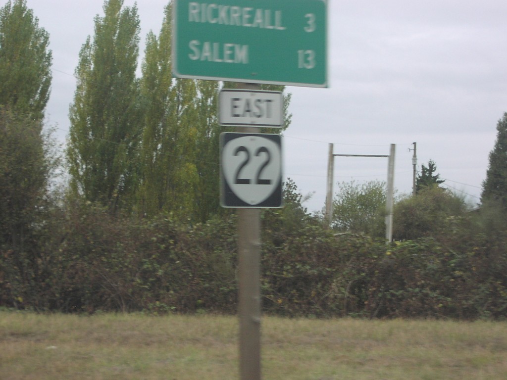
OR-22 East - Distance Marker
Distance marker on OR-22 east to Rickreall and Salem.
Taken 10-01-2006
Dallas
Polk County
Oregon
United States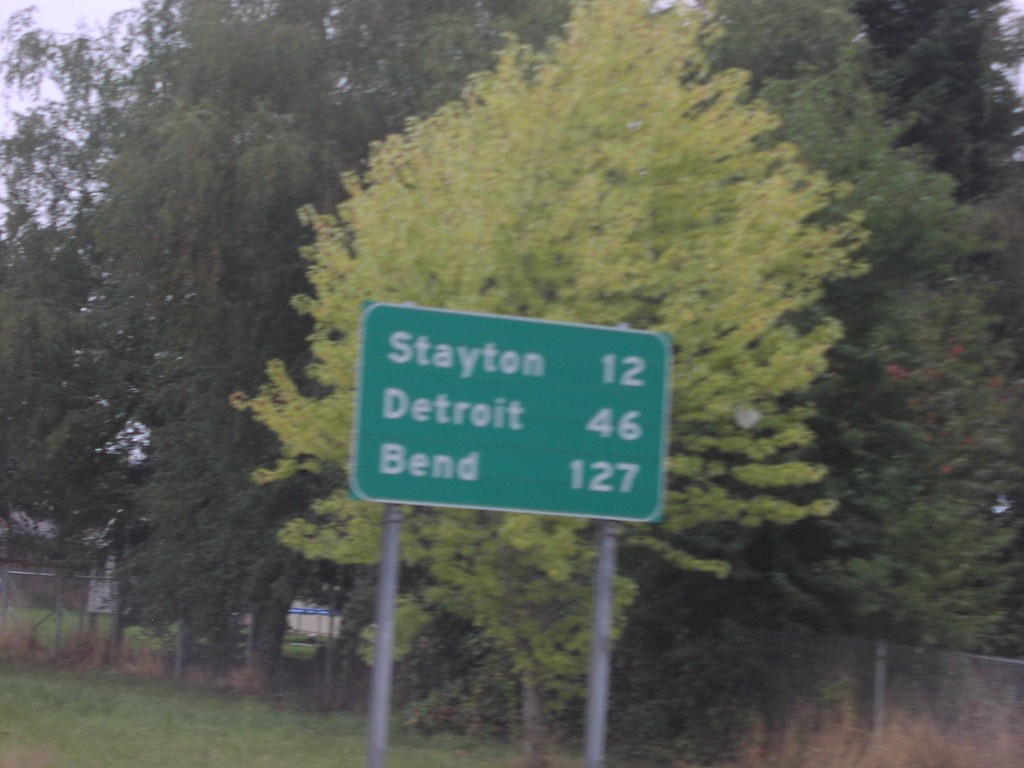
OR-22 East - Distance Marker
Distance marker on OR-22 east to Stayton, Detroit, and Bend.
Taken 10-01-2006
Salem
Marion County
Oregon
United States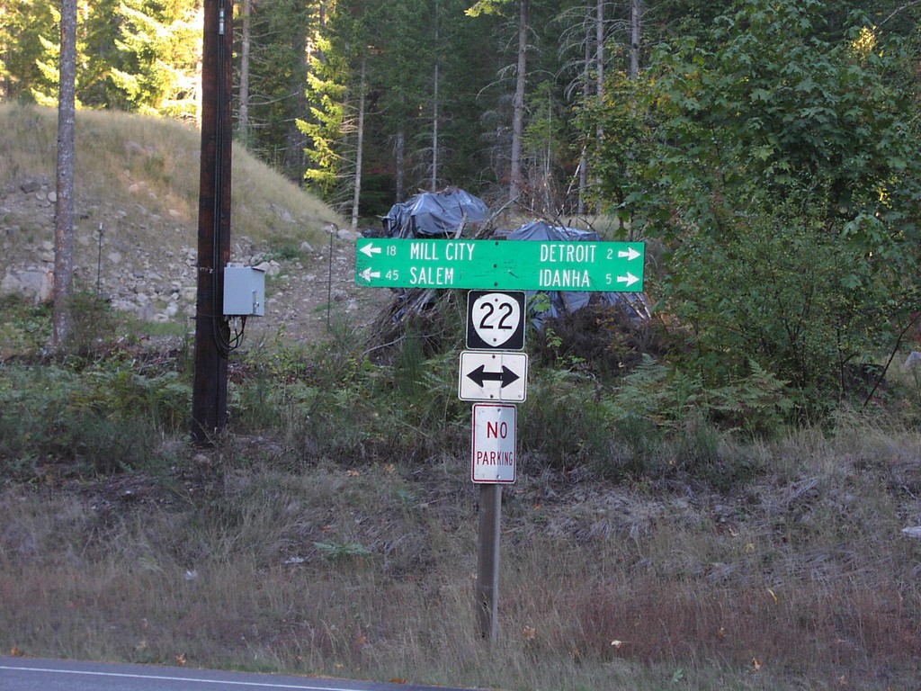
OR-22 - Detroit Lake StatePark
OR-22 west to Salem and Mill City; east to Detroit and Idanha at Detroit Lake State Park.
Taken 10-01-2006
Detroit
Marion County
Oregon
United States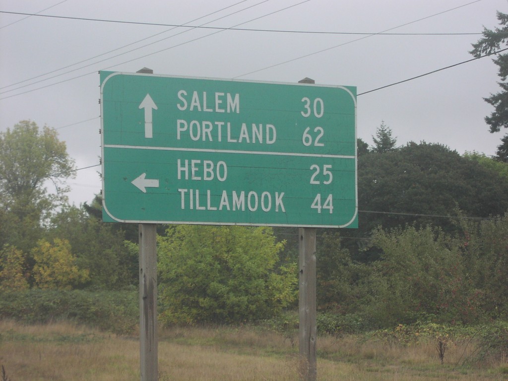
OR-18 East at OR-22
OR-18 east at OR-22 west to Hebo and Tillamook. OR-18/OR-22 east continue on to Portland and Salem.
Taken 10-01-2006
 Grand Ronde
Polk County
Oregon
United States
Grand Ronde
Polk County
Oregon
United States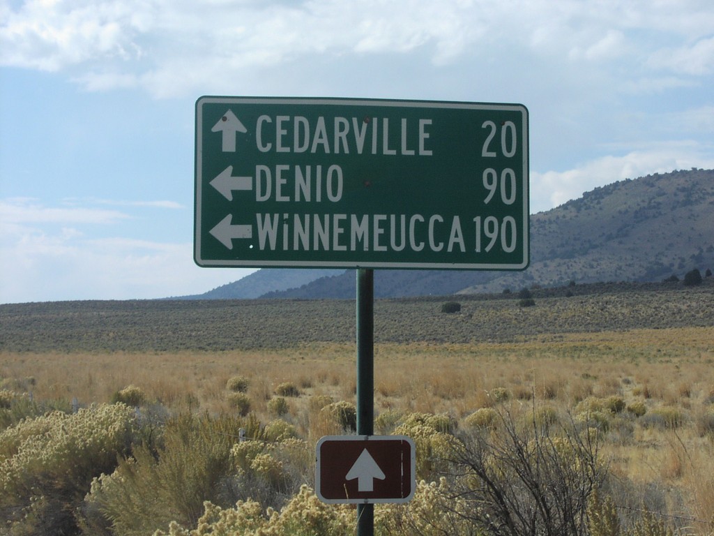
NV-8A/NV-34 Jct.
NV-34 south at NV-8A. NV-8A/NV-34 west to Cedarville, NV-8A east to Denio and Winnemucca.
Taken 10-01-2006

 Vya
Washoe County
Nevada
United States
Vya
Washoe County
Nevada
United States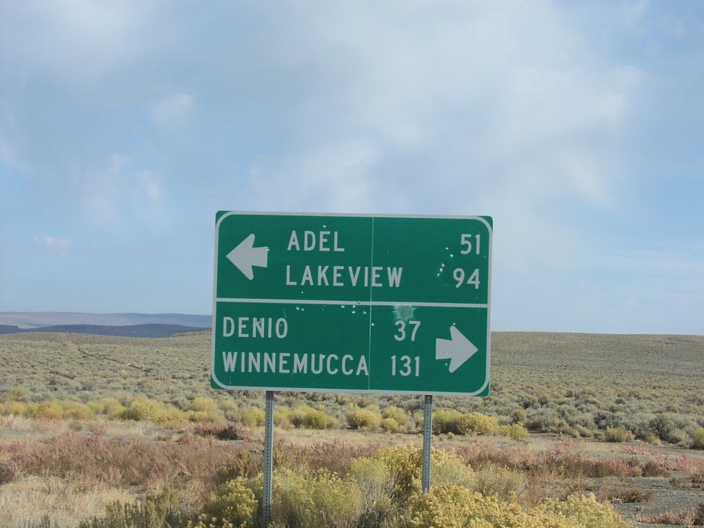
End NV-8A at NV-140
End NV-8A at NV-140. NV-140 west to Adel and Lakeview; east to Denio and Winnemucca.
Taken 10-01-2006
 Humboldt County
Nevada
United States
Humboldt County
Nevada
United States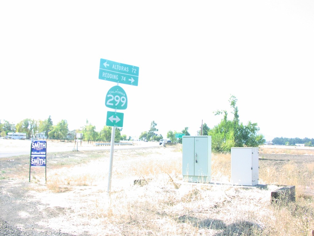
End CR-A19 at CA-299 Jct
End CR-A19 at CA-299 to Alturas and Redding.
Taken 10-01-2006
