Signs Tagged With Distance Marker
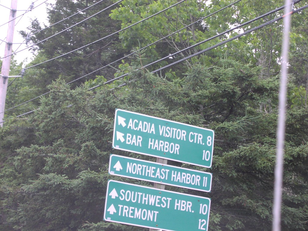
ME-3South at ME-198
ME-3 at ME-102/ME-198 Junction on Mt. Desert Island
Taken 07-01-2004

 Bar Harbor
Hancock County
Maine
United States
Bar Harbor
Hancock County
Maine
United States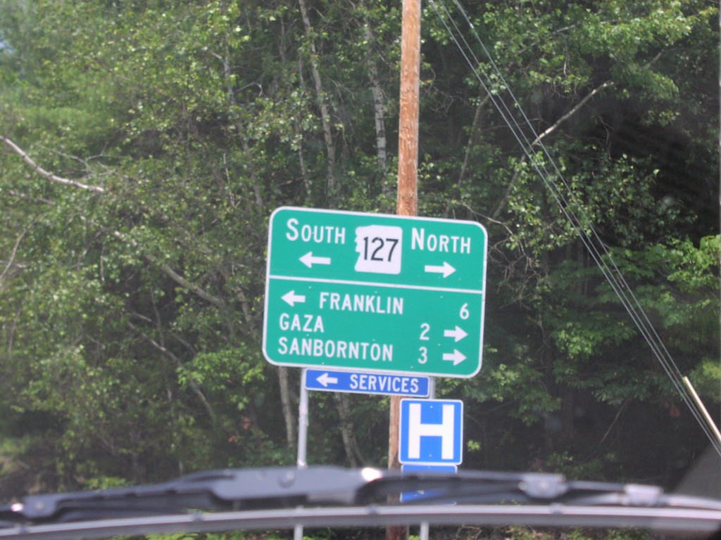
I-93 South at Exit 22 Offramp
NH-127 at I-93 Junction
Taken 07-01-2004

 Sanbornton
Belknap County
New Hampshire
United States
Sanbornton
Belknap County
New Hampshire
United States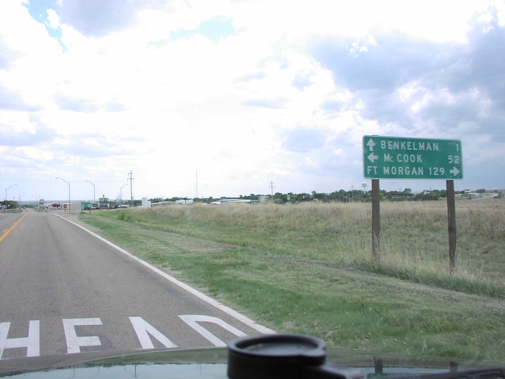
NE-61 South at US-34
NE-61 South at US-34 Junction
Taken 05-01-2004

 Benkelman
Dundy County
Nebraska
United States
Benkelman
Dundy County
Nebraska
United States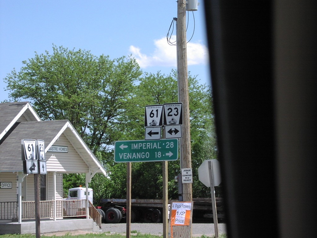
NE-61 South at NE-23
NE-61/NE-23 Junction to Imperial and Venango
Taken 05-01-2004
 Grant
Perkins County
Nebraska
United States
Grant
Perkins County
Nebraska
United States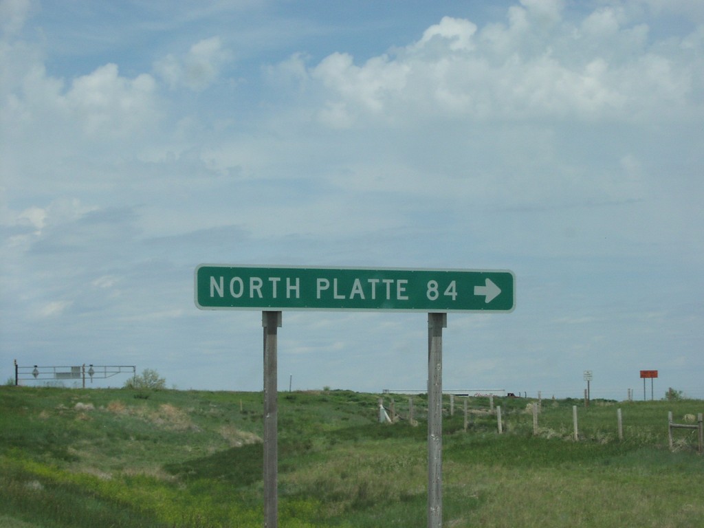
NE-27 North at I-80 Onramp Exit 95
NE-27 at I-80 to North Platte
Taken 05-01-2004

 Chappell
Deuel County
Nebraska
United States
Chappell
Deuel County
Nebraska
United States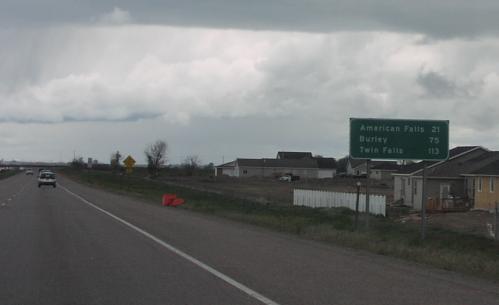
I-86 West - Distance Marker
Distance marker on I-86 west. Distance to American Falls, Burley, and Twin Falls.
Taken 05-01-2004
 Chubbuck
Bannock County
Idaho
United States
Chubbuck
Bannock County
Idaho
United States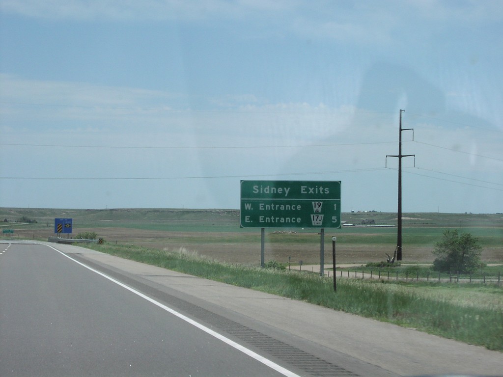
I-80 East - Sidney Exits
Sidney Exits Distance Marker on I-80 East
Taken 05-01-2004
Sidney
Cheyenne County
Nebraska
United States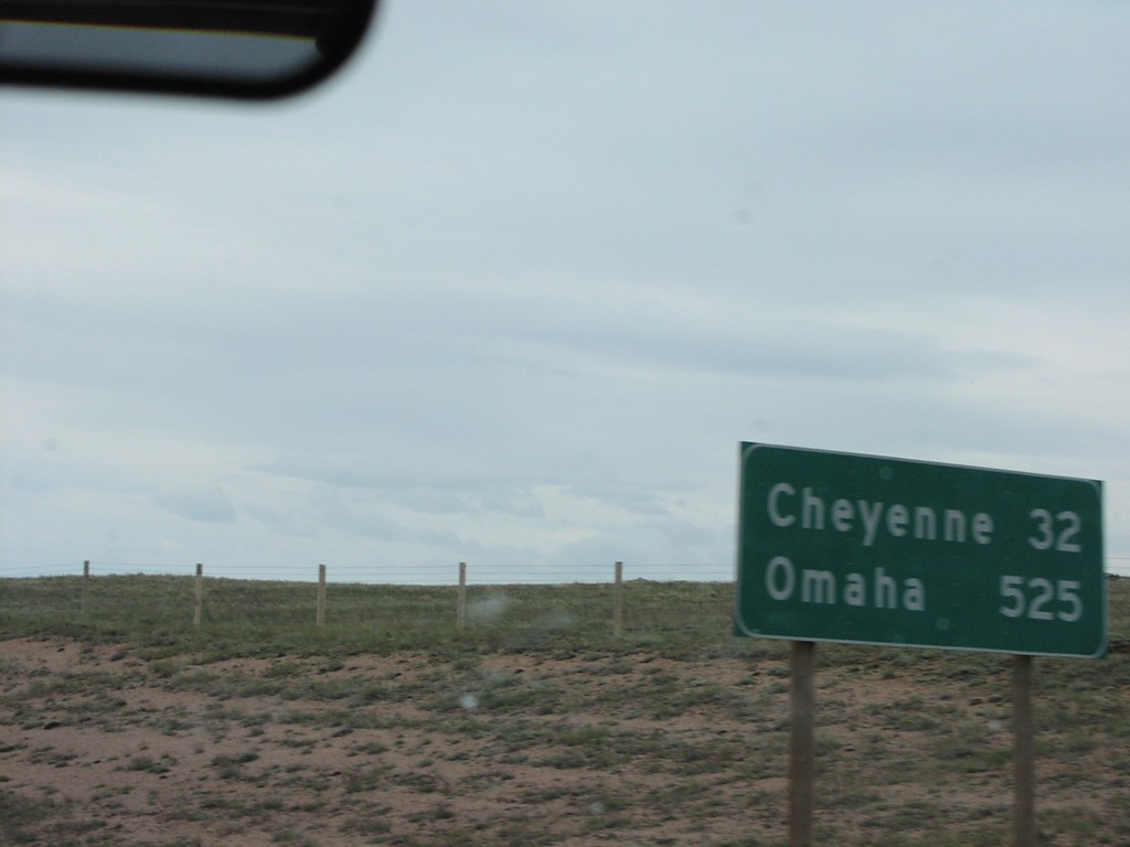
I-80 East - Distance Marker
Distance Marker To Cheyenne and Omaha on I-80 East
Taken 05-01-2004
Buford
Albany County
Wyoming
United States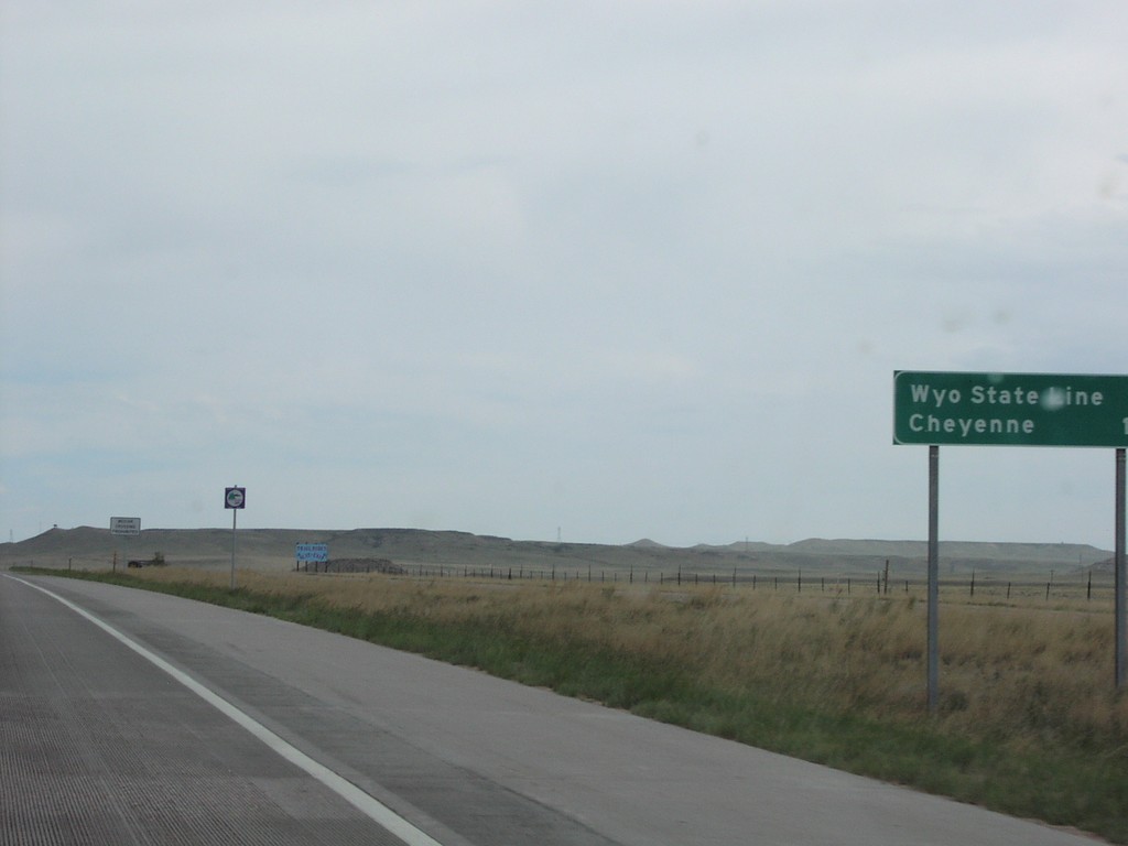
I-25 North - Distance Marker
Distance marker to Wyoming State Line on I-25 North
Taken 05-01-2004

 Norfolk
Larimer County
Colorado
United States
Norfolk
Larimer County
Colorado
United States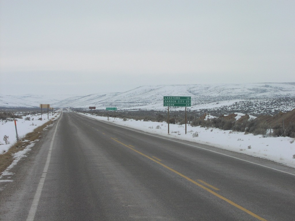
UT-30 West - Distance Marker
UT-30 West Distance Marker to Logan
Taken 02-01-2004
 Sage Creek Junction
Rich County
Utah
United States
Sage Creek Junction
Rich County
Utah
United States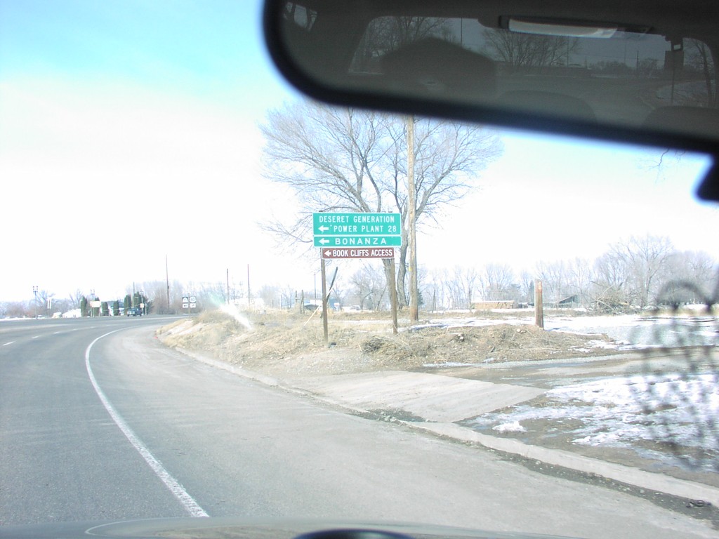
US-40 at UT-45 Jct.
Jct. UT-45 To Bonanza and Deseret Power Plant on US-40 West
Taken 02-01-2004

 Naples
Uintah County
Utah
United States
Naples
Uintah County
Utah
United States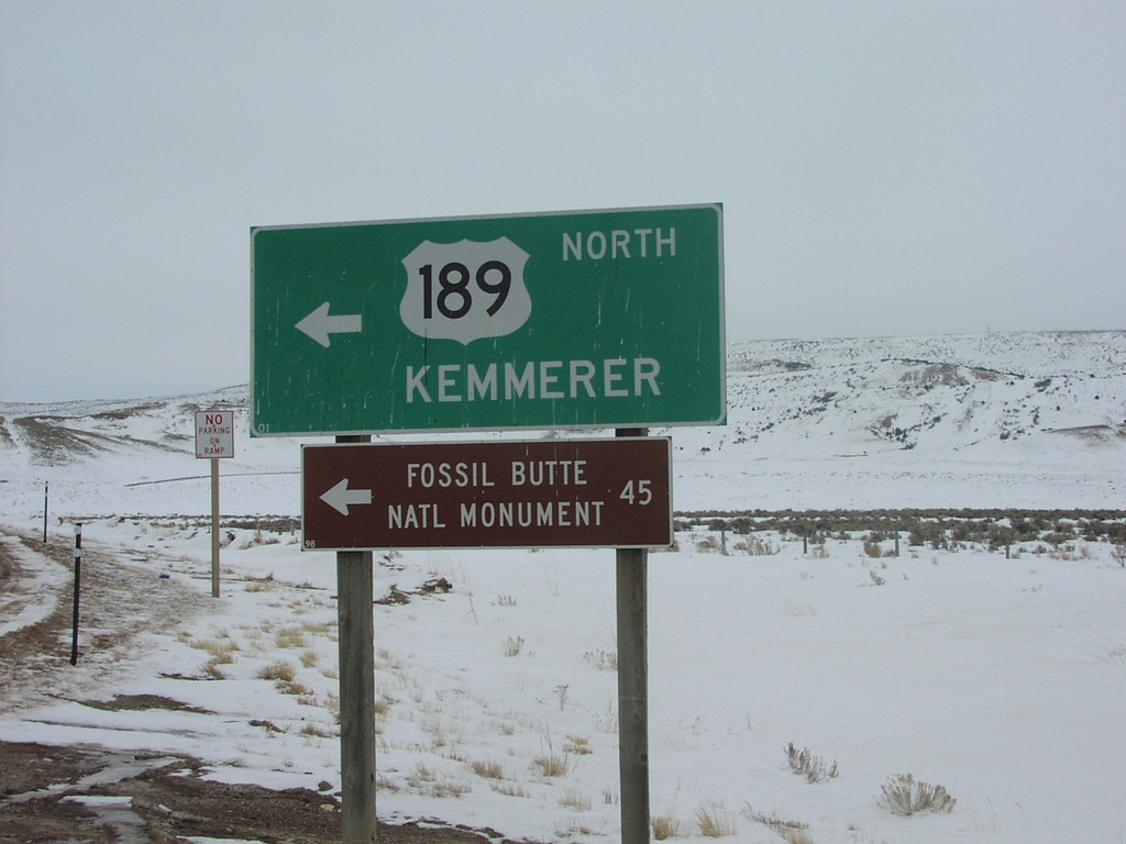
US-189 North to Kemmerer at I-80 Exit 18
US-189 North/Kemmerer at I-80 Freeway Entrance
Taken 02-01-2004
 Aspen
Uinta County
Wyoming
United States
Aspen
Uinta County
Wyoming
United States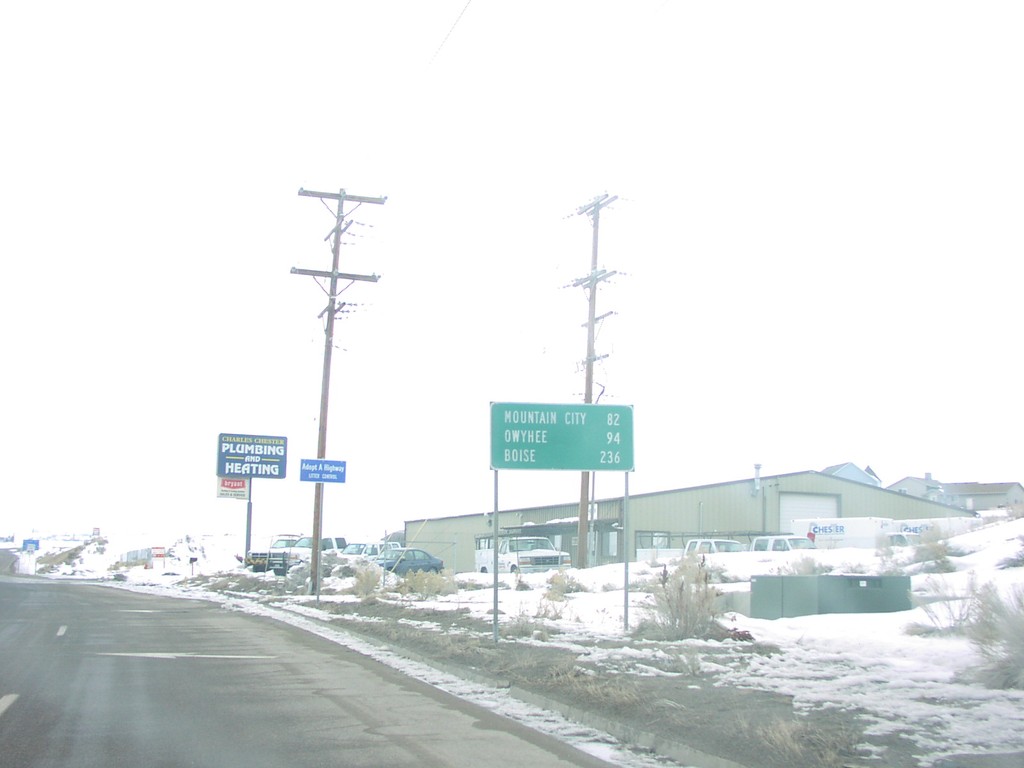
NV-225 North - Distance Marker
Distance Marker on NV-225 North to Mountain City, Owyhee, and Boise, in Elko
Taken 02-01-2004
 Elko
Elko County
Nevada
United States
Elko
Elko County
Nevada
United States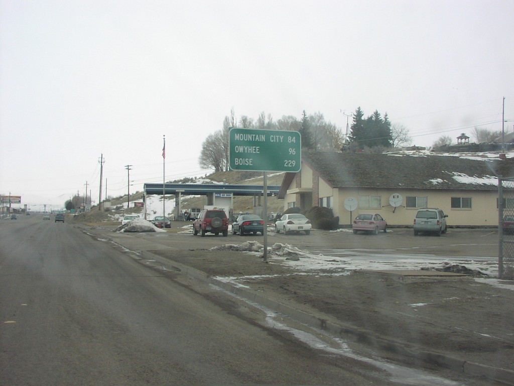
NV-225 North - Distance Marker
Distance Marker on NV-225 North to Mountain City, Owyhee and Boise, in Elko
Taken 02-01-2004
Elko
Elko County
Nevada
United States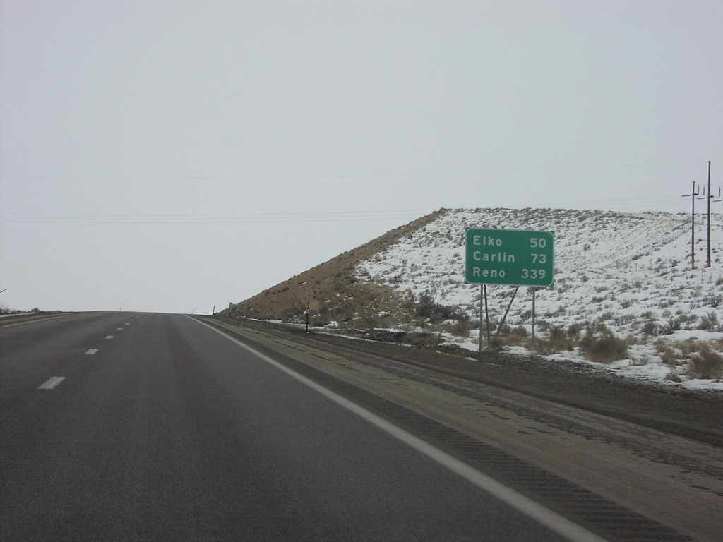
I-80 West - Distance Marker
I-80 West Distance Marker
Taken 02-01-2004
Wells
Elko County
Nevada
United States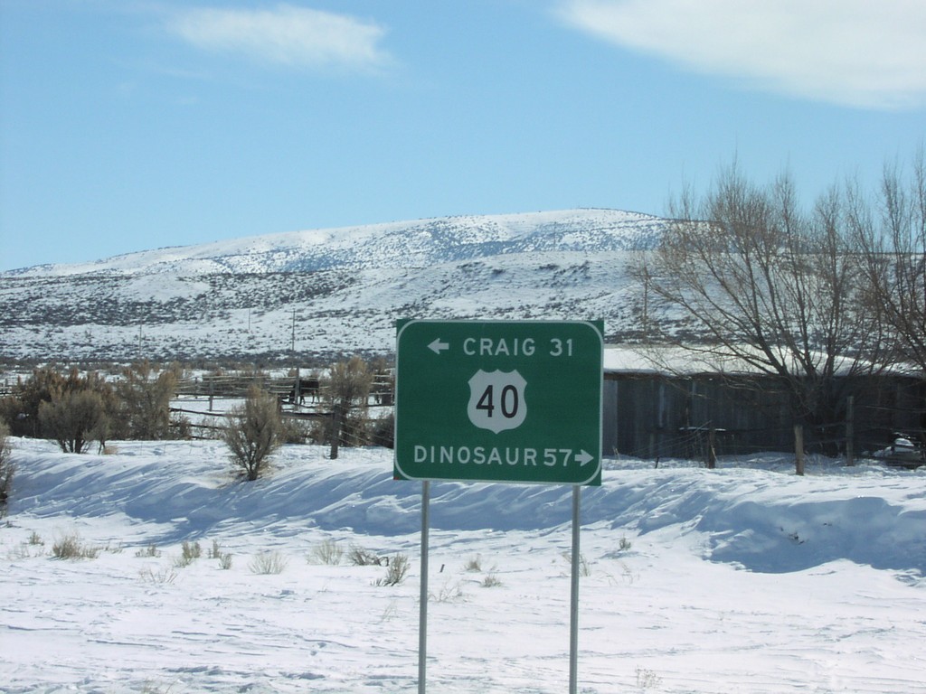
End CO-318 at US-40.
US-40 to Craig and Dinosaur at end of CO-318, near Maybell.
Taken 02-01-2004
 Moffat County
Colorado
United States
Moffat County
Colorado
United States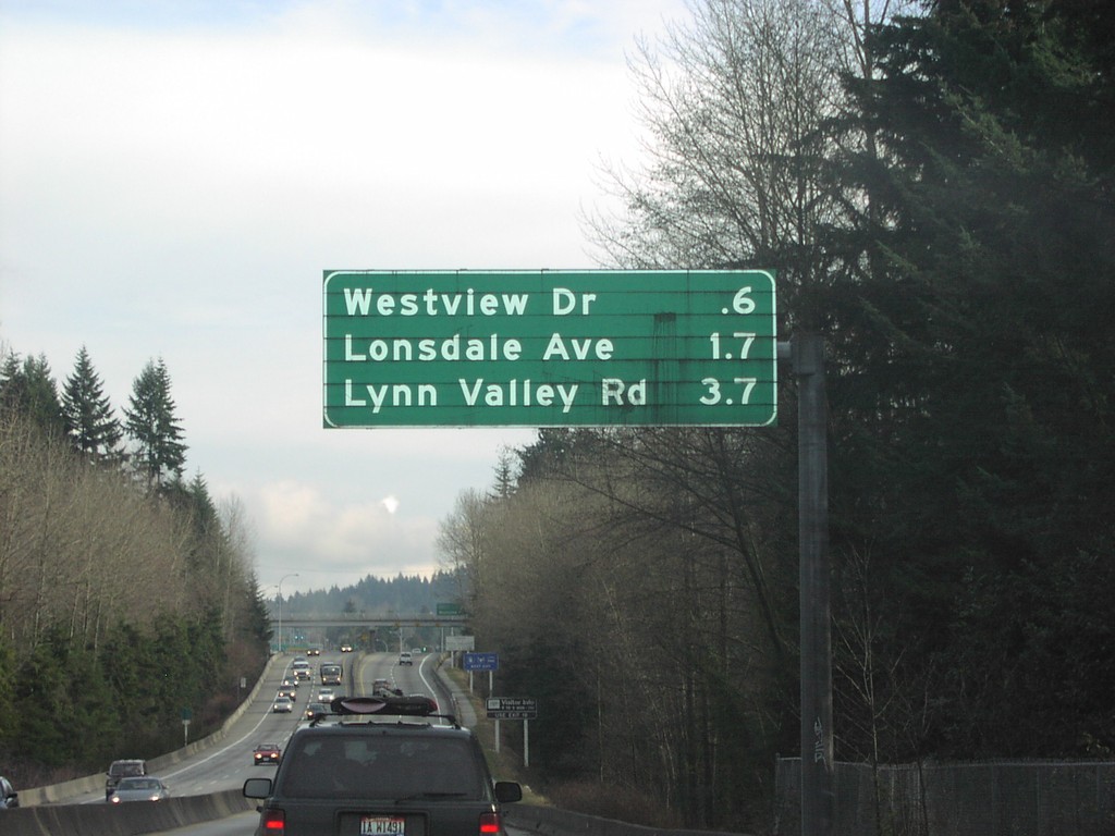
TC-1 East - North Vancouver Exits
North Vancouver Exits on TC-1 East.
Taken 01-01-2004
 North Vancouver
Metro Vancouver
British Columbia
Canada
North Vancouver
Metro Vancouver
British Columbia
Canada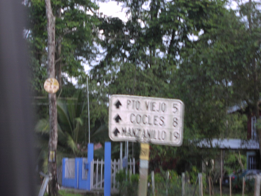
Puerto Viejo Road South - Distance Marker
Old style distance marker on coast road to Puerto Viejo, Cocles, and Manzanillo
Taken 09-23-2003

 Puerto Viejo de Talamanca
Limón Province
Costa Rica
Puerto Viejo de Talamanca
Limón Province
Costa Rica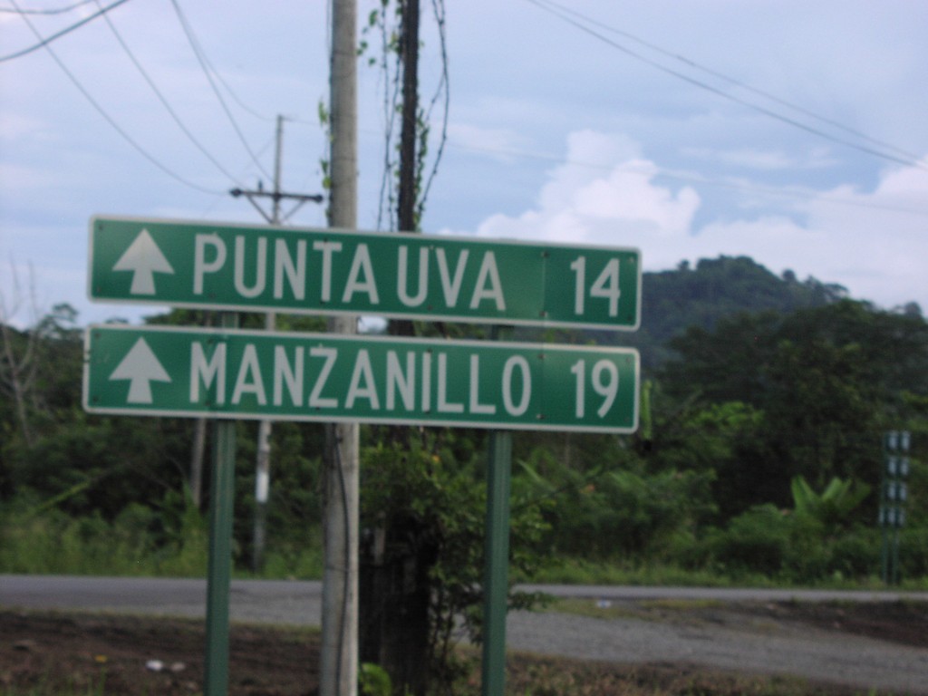
Puerto Viejo Road - Distance Marker
CR-36 at the junction with the coast road to Puerto Viejo, Manzanillo, and Punta Uva
Taken 09-23-2003
Puerto Viejo de Talamanca
Limón Province
Costa Rica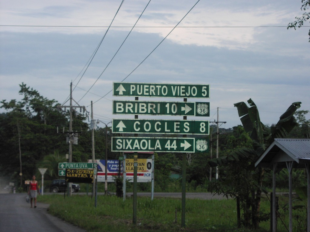
CR-36 South - Puerto Viejo Jct.
CR-36 south at Puerto Viejo/Cocles junction
Taken 09-23-2003
Limón Province
Costa Rica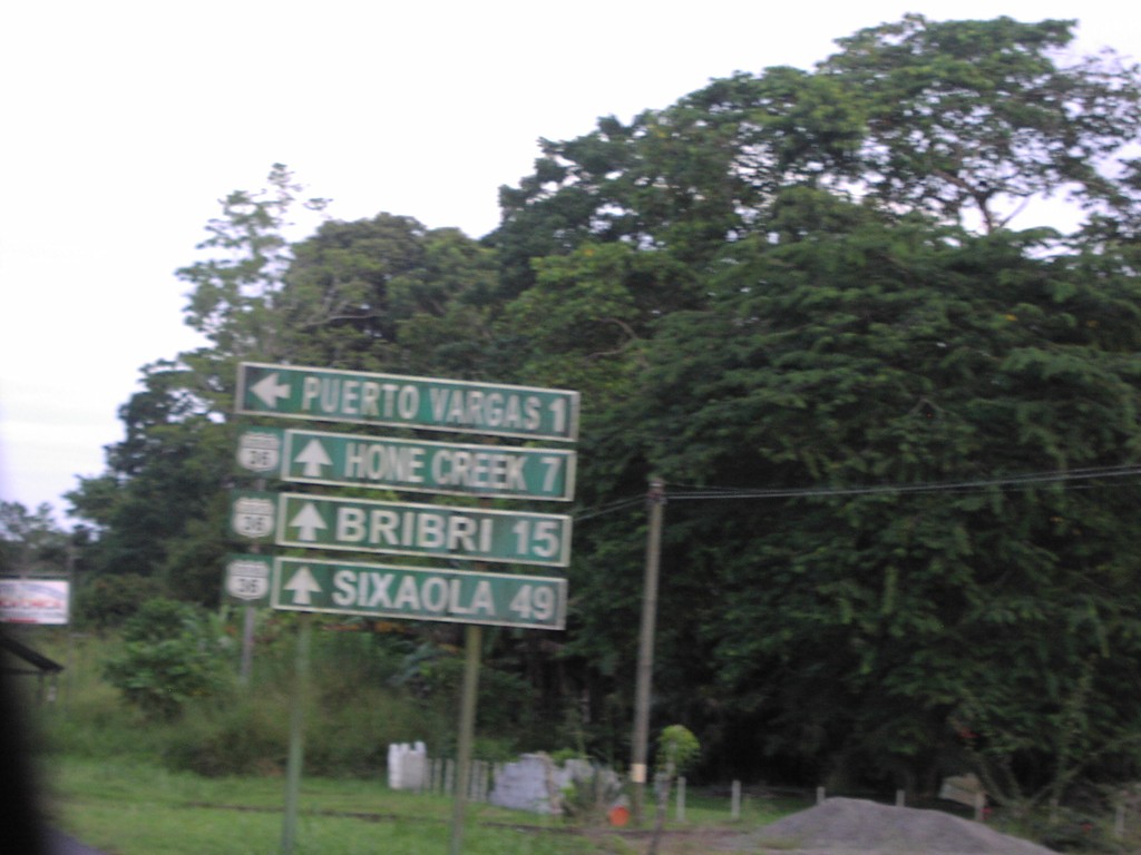
CR-36 South - Puerto Vargas Jct.
CR-36 south at Puerto Vargas junction
Taken 09-23-2003
Limón Province
Costa Rica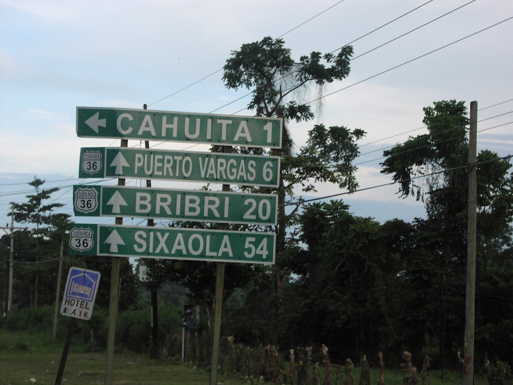
CR-36 South - Chauita Jct.
CR-36 south to Puerto Vargas, Bribri, and Sixaola at Chauita jct.
Taken 09-23-2003
Cahuita
Limón Province
Costa Rica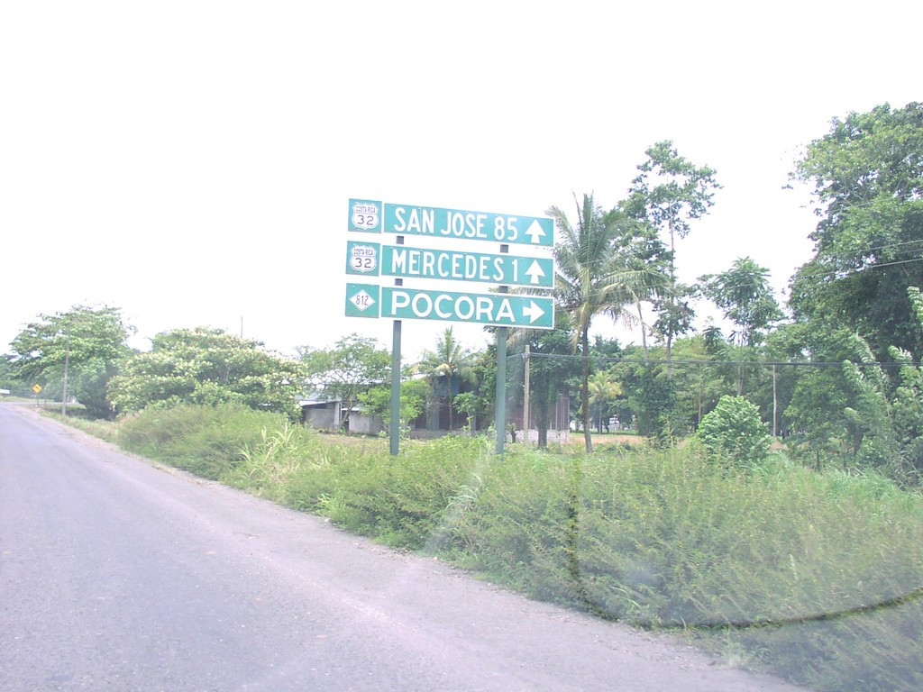
CR-32 West at CR-812
CR-32 west to San Jose at CR-812 north to Pocora
Taken 09-23-2003

 Pocora
Limón Province
Costa Rica
Pocora
Limón Province
Costa Rica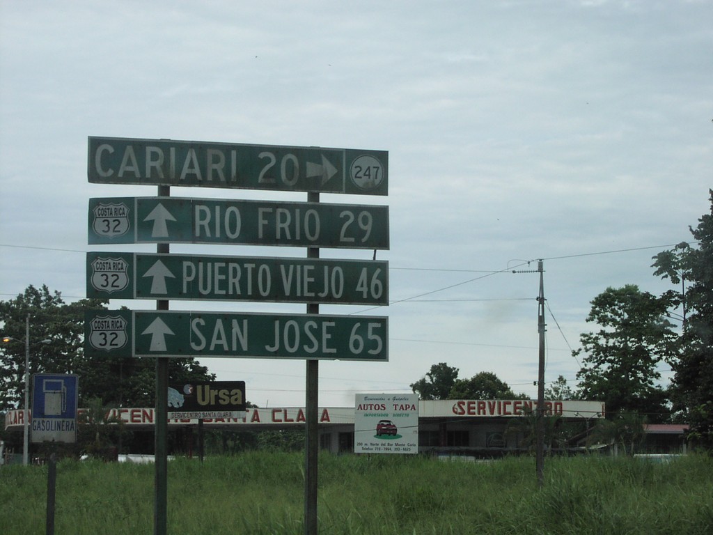
CR-32 West at CR-247
CR-32 west to San Jose, Rio Frio, and Puerto Viejo at CR-247 to Cariari
Taken 09-23-2003
 Guapiles
Pococí
Limón Province
Costa Rica
Guapiles
Pococí
Limón Province
Costa Rica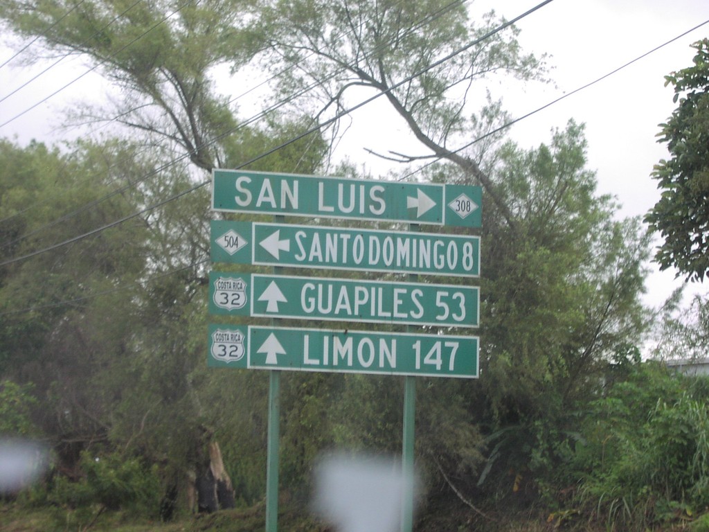
CR-32 North at CR-308/CR-504
CR-32 east to Limon and Guaplies at CR-308/CR-504 junction
Taken 09-23-2003

 Cantón de Santo Domingo
Heredia Province
Costa Rica
Cantón de Santo Domingo
Heredia Province
Costa Rica