Signs Tagged With Distance Marker
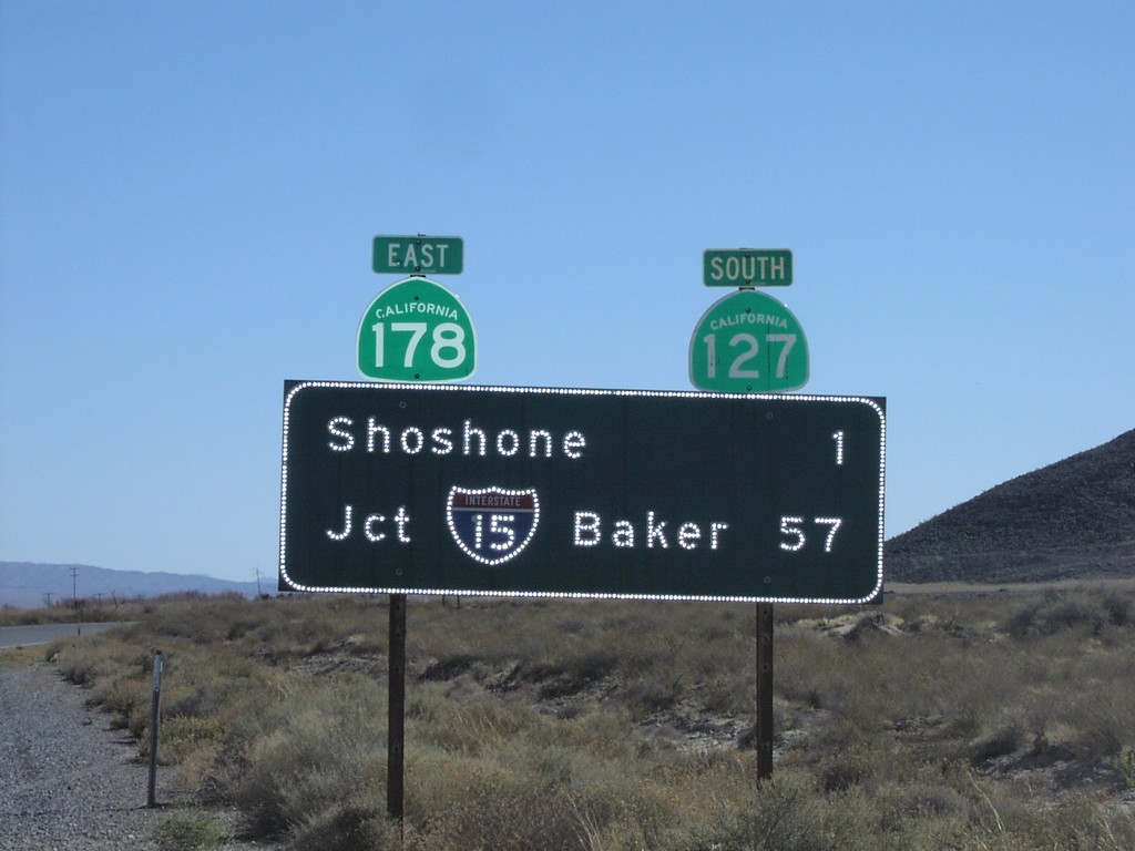
CA-127 South - Distance Marker
CA-127 South/CA-178 east to I-15 (Baker) and Shoshone.
Taken 02-01-2006

 Shoshone
Inyo County
California
United States
Shoshone
Inyo County
California
United States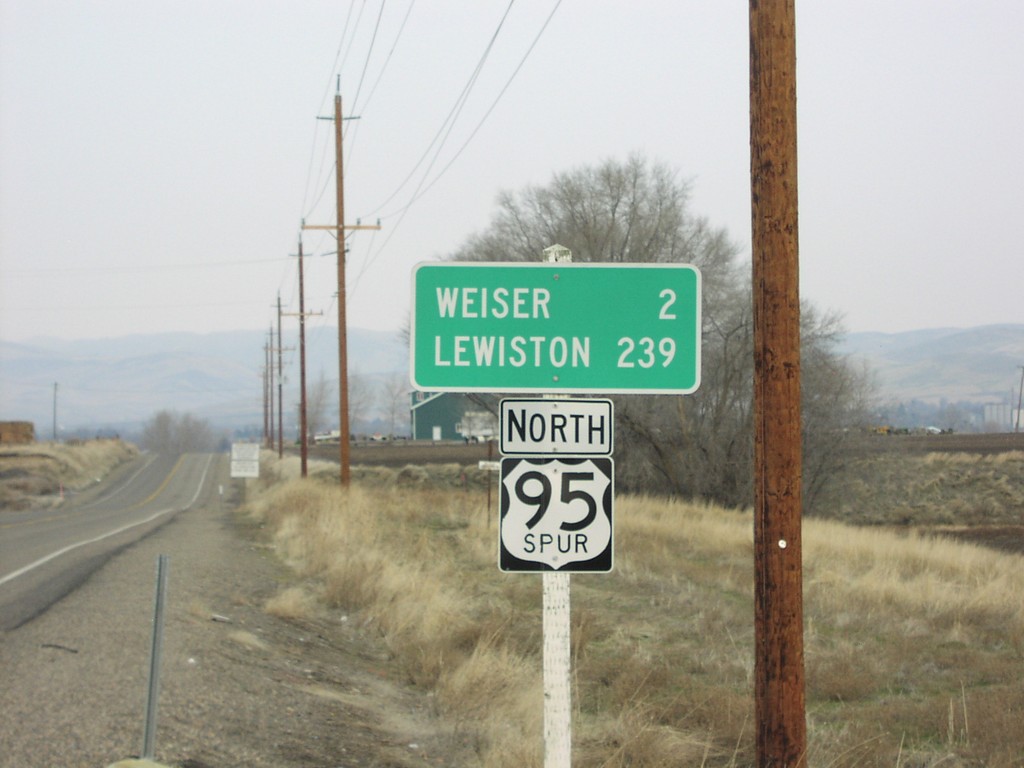
US-95 Spur North - Distance Marker
US-95 Spur North to Lewiston and Weiser. US-95 Spur connects the Oregon side of the Snake River, with the Idaho side at Weiser.
Taken 01-01-2006
 Ontario
Malheur County
Oregon
United States
Ontario
Malheur County
Oregon
United States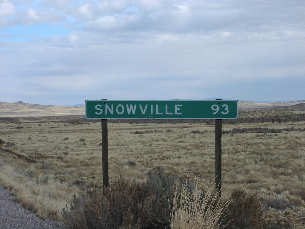
UT-30 East - Distance Marker
Distance marker to Snowville on UT-30 east at the Nevada line
Taken 11-12-2005
 Lucin
Box Elder County
Utah
United States
Lucin
Box Elder County
Utah
United States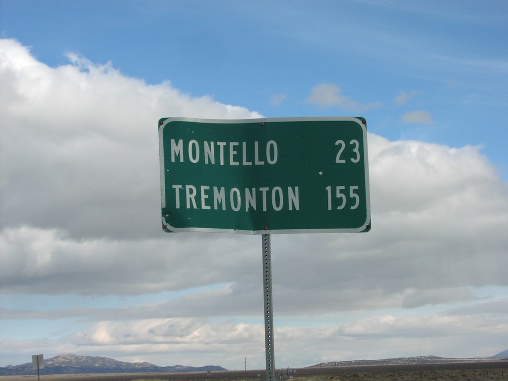
NV-233 North - Distance Marker
NV-233 north distance marker to Montello and Tremonton
Taken 11-12-2005
 Oasis
Elko County
Nevada
United States
Oasis
Elko County
Nevada
United States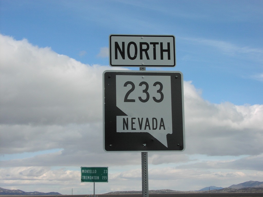
NV-233 North
NV-233 north at beginning of NV-233
Taken 11-12-2005
Oasis
Elko County
Nevada
United States
OR-78 East at OR-205 South
OR-78 east at OR-205 south to Frenchglen and Denio
Taken 11-11-2005

 Burns
Harney County
Oregon
United States
Burns
Harney County
Oregon
United States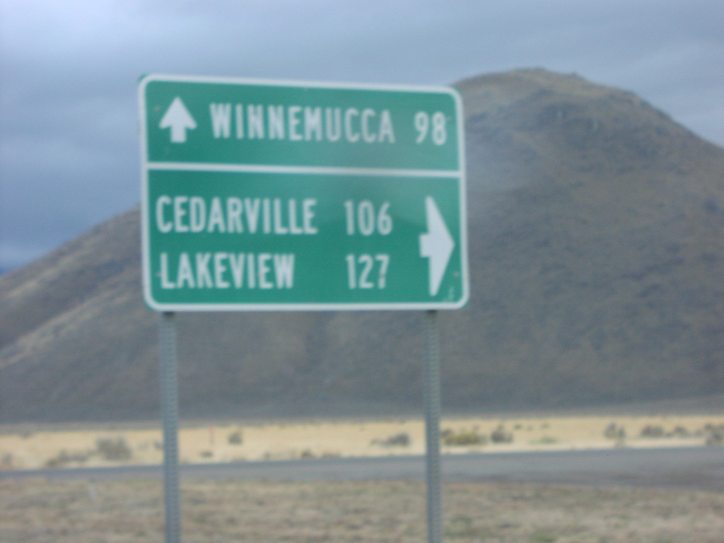
NV-292 South at NV-140
End NV-292 at NV-140 to Cedarville, Lakeview, and Winnemucca
Taken 11-11-2005

 Denio
Humboldt County
Nevada
United States
Denio
Humboldt County
Nevada
United States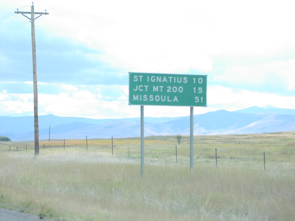
US-93 South - Distance Marker
Distance marker on US-93 south in Lake County. Distance to St. Ignatius, Jct. MT-200, and Missoula.
Taken 09-11-2005
 Saint Ignatius
Lake County
Montana
United States
Saint Ignatius
Lake County
Montana
United States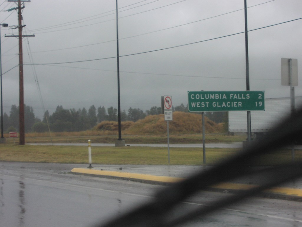
US-2 East - Distance Marker
Distance marker on US-2 east to Columbia Falls and West Glacier
Taken 09-11-2005
 Columbia Falls
Flathead County
Montana
United States
Columbia Falls
Flathead County
Montana
United States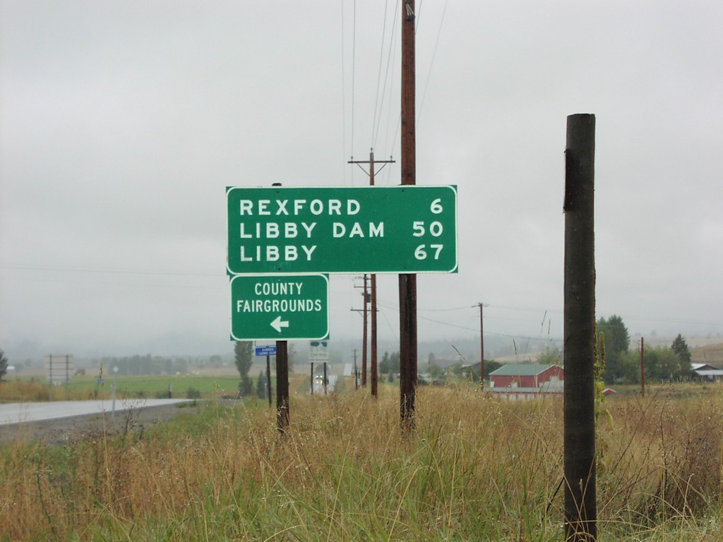
MT-37 South Distance Marker
Distance marker to Rexford, Libby, and Libby Dam at northern beginning of MT-37
Taken 09-11-2005
 Eureka
Lincoln County
Montana
United States
Eureka
Lincoln County
Montana
United States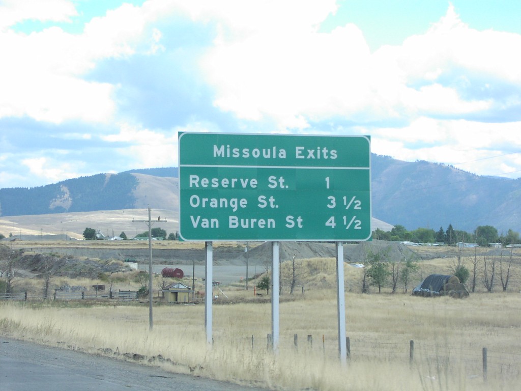
I-90 East - Missoula Exits
I-90 East - Missoula Exits: Reserve St., Orange St., Van Buren St.
Taken 09-11-2005

 Missoula
 County
Montana
United States
Missoula
Missoula County
Montana
United States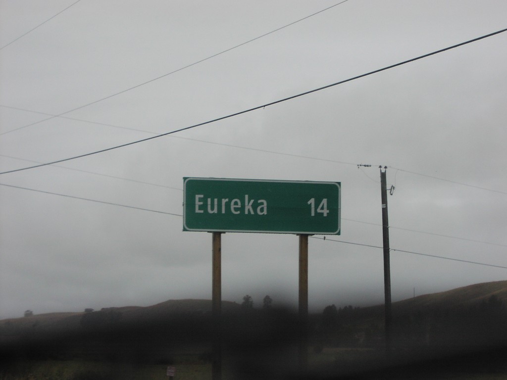
Distance Marker on BC-93 South
Distance marker to Eureka, Montana on BC-93 south
Taken 09-11-2005
 Roosville
East Kootenay
British Columbia
Canada
Roosville
East Kootenay
British Columbia
Canada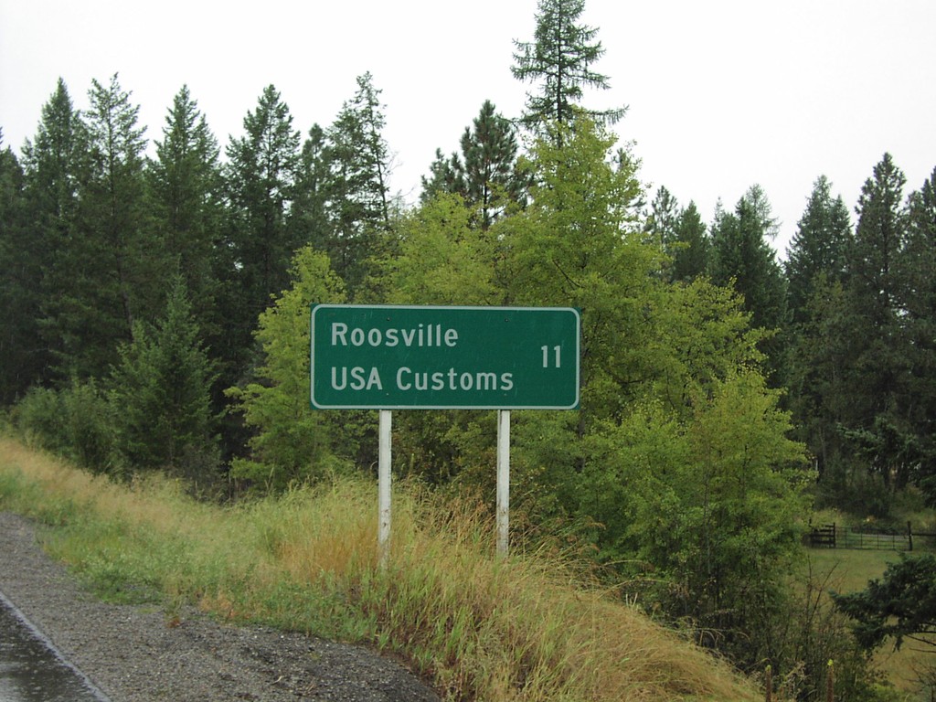
Distance Marker on BC-93 South
Distance marker to Roosville and US Border on BC-93 south
Taken 09-11-2005
Grasmere
East Kootenay
British Columbia
Canada
Distance Marker on BC-3 West
Distance marker to Cranbrook and Trail on BC-3 east. 100 km/h sign in background.
Taken 09-11-2005
 Elko
East Kootenay
British Columbia
Canada
Elko
East Kootenay
British Columbia
Canada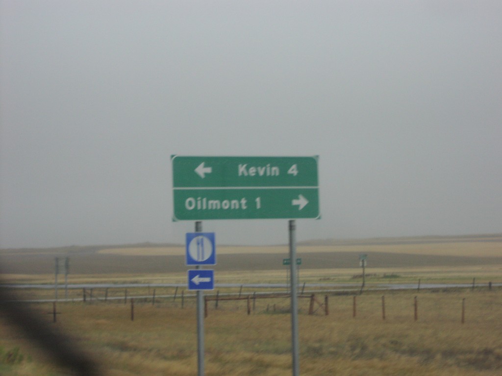
I-15 Exit 379 - MTS-215 and MTS-343
I-15 Exit 379 offramp. Turn right for MTS-215 to Kevin; turn right for MTS-343 to Oilmont.
Taken 09-10-2005


 Oilmont
Toole County
Montana
United States
Oilmont
Toole County
Montana
United States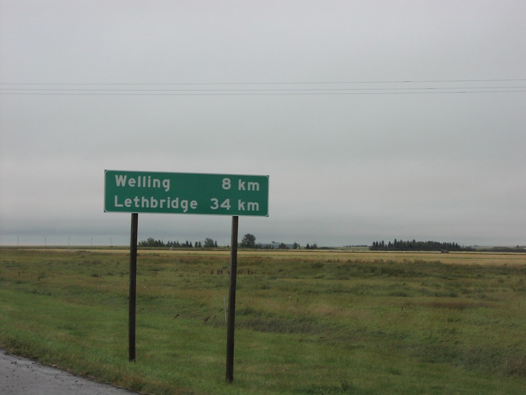
Distance Marker on AB-5 North
Distance to Welling and Lethbridge on AB-5 north
Taken 09-10-2005
 Magrath
Cardston County
Alberta
Canada
Magrath
Cardston County
Alberta
Canada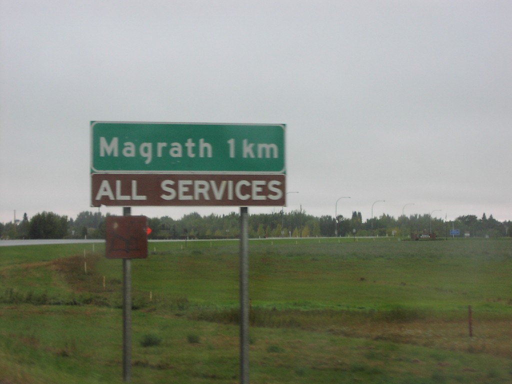
AB-62 North - Magrath
Magrath 1Km - All Traveller Services on AB-62 north
Taken 09-10-2005
 Magrath
Cardston County
Alberta
Canada
Magrath
Cardston County
Alberta
Canada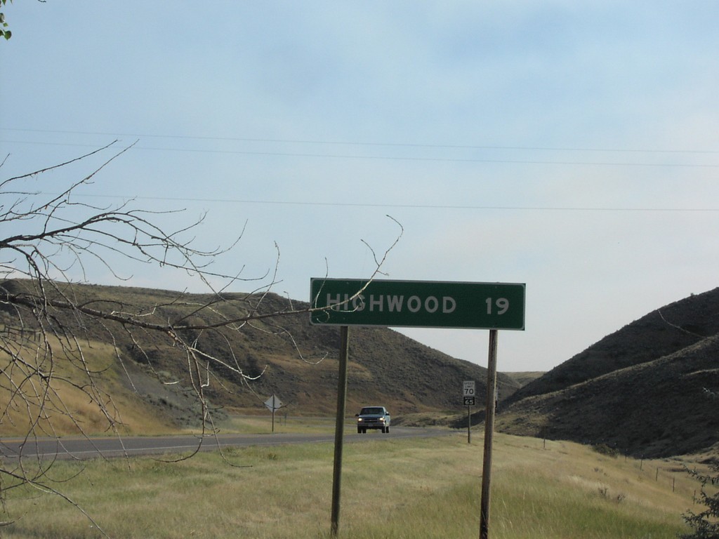
MTS-228 South - Distance Marker
Distance marker to Highwood on MTS-228 south
Taken 09-09-2005
 Fort Benton
Chouteau County
Montana
United States
Fort Benton
Chouteau County
Montana
United States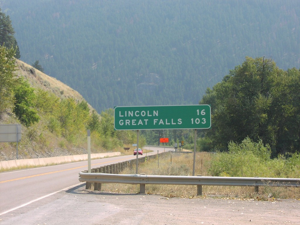
MT-200 East - Distance Marker
Distance marker on MT-200 east. Distance to Lincoln and Great Falls.
Taken 09-09-2005
Coughlin
Powell County
Montana
United States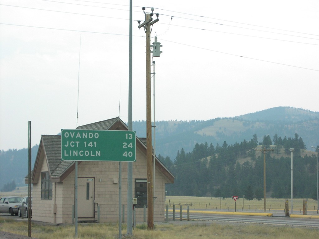
MT-200 East - Distance Marker
Distance marker on MT-200 east. Distance to Ovando, MT-141, and Lincoln.
Taken 09-09-2005
Potomac
Missoula County
Montana
United States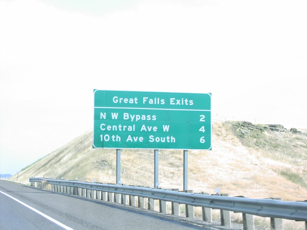
I-15 South - Great Falls Exits
I-15 South - Great Falls exits, approaching Great Falls. Next three Great Falls exits are: NW Bypass, Central Ave. W, and 10th Ave. South.
Taken 09-09-2005
 Sun Prairie
Cascade County
Montana
United States
Sun Prairie
Cascade County
Montana
United States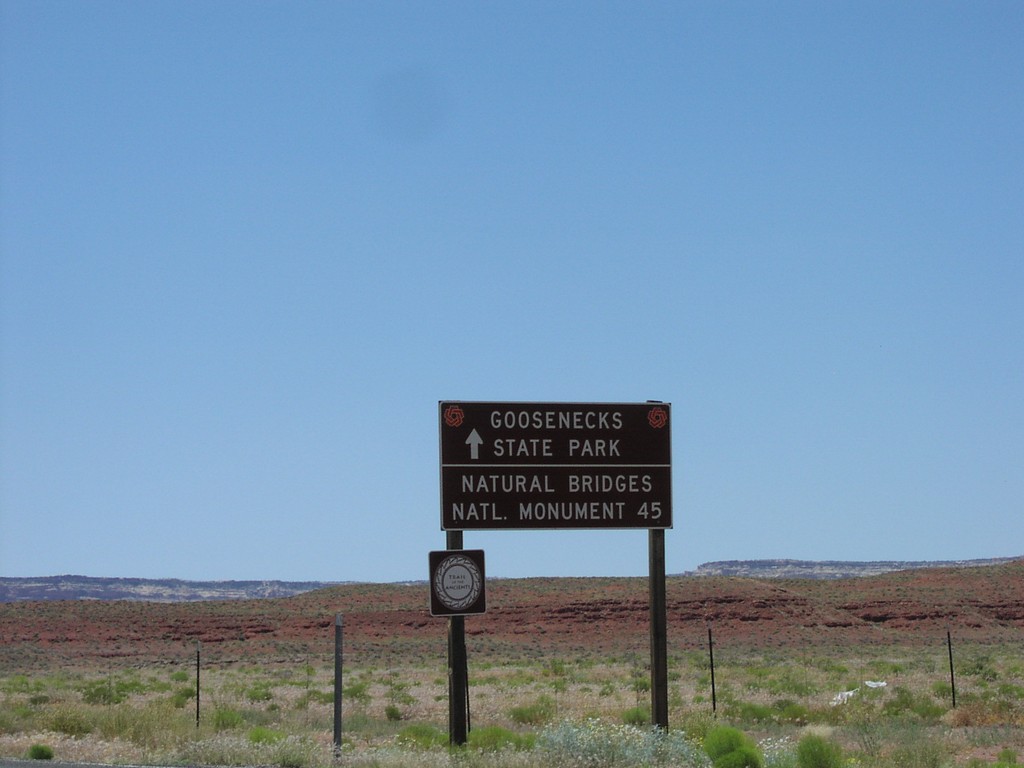
UT-261 North - Distance Marker
Distance marker to Goosenecks SP and Natural Bridges SP on UT-261 north near Mexican Hat.
Taken 05-01-2005
 Mexican Hat
San Juan County
Utah
United States
Mexican Hat
San Juan County
Utah
United States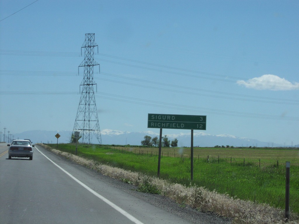
UT-24 East - Distance Marker
Distance to Sigurd and Richfield on UT-24 east, near Sigurd.
Taken 05-01-2005
 Sigurd
Sevier County
Utah
United States
Sigurd
Sevier County
Utah
United States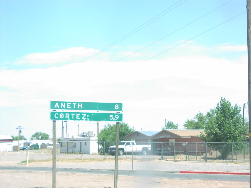
UT-162 - Distance Marker
Distance sign on UT-262 to Aneth and Cortez, CO in Montezuma Creek.
Taken 05-01-2005
 Montezuma Creek
San Juan County
Utah
United States
Montezuma Creek
San Juan County
Utah
United States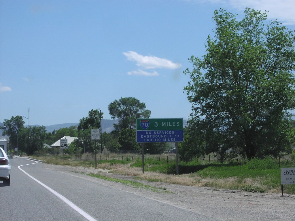
US-89 South To I-70
US-89 south at the northern entrance to Salina. Sign warning motorists that next services on I-70 east is 110 miles.
Taken 05-01-2005
 Salina
Sevier County
Utah
United States
Salina
Sevier County
Utah
United States