Signs Tagged With Distance Marker
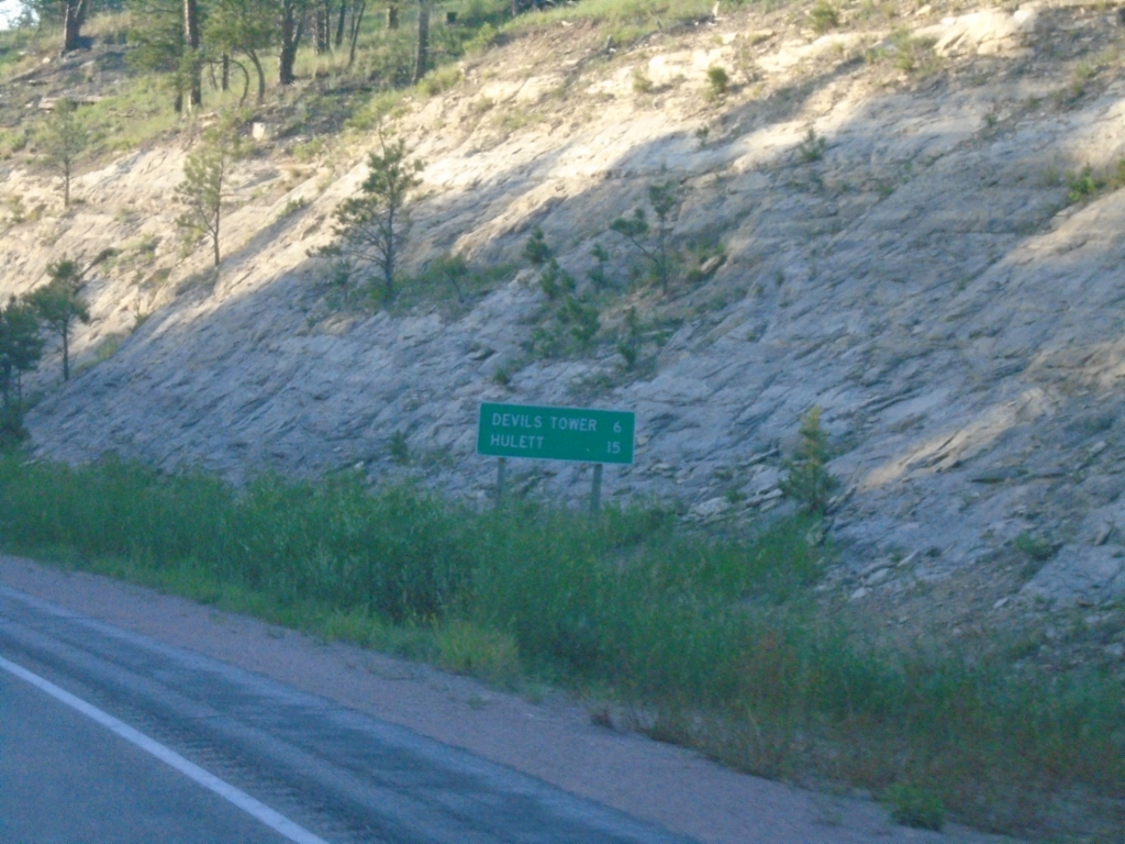
WY-24 East - Distance Marker
Distance marker on WY-24 east. Distance to Devils Tower and Hulett.
Taken 07-01-2025
 Sundance
Crook County
Wyoming
United States
Sundance
Crook County
Wyoming
United States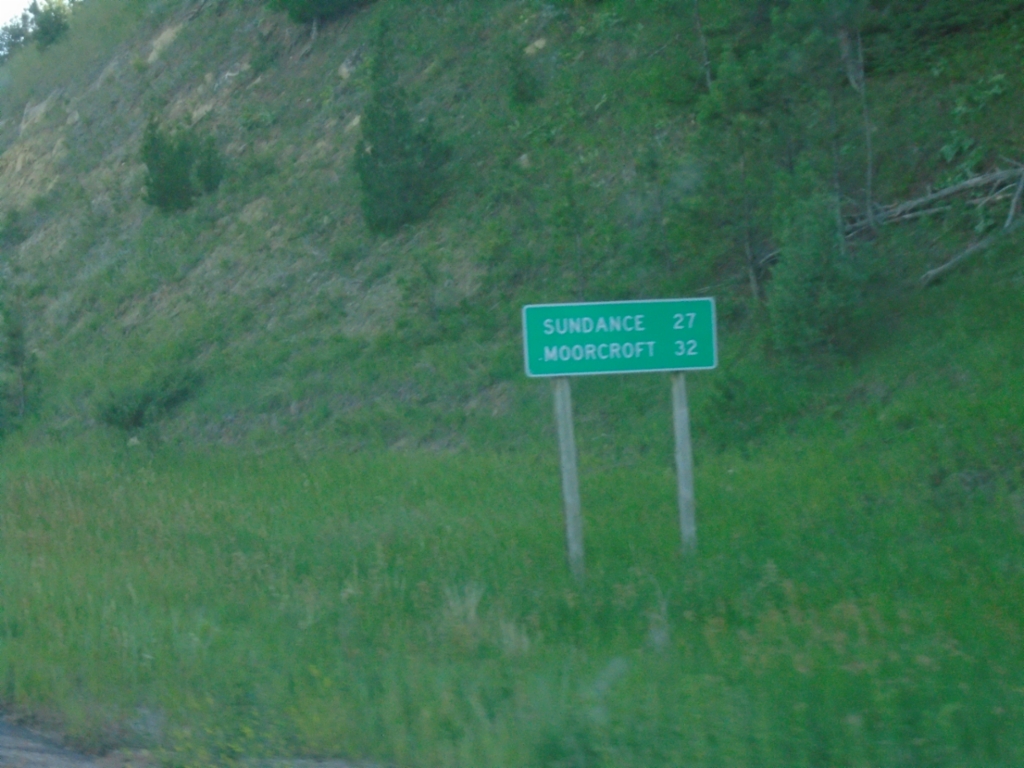
WY-24 West - Distance Marker
Distance marker on WY-24 west. Distance to Sundance and Moorcroft.
Taken 07-01-2025
Devils Tower
Crook County
Wyoming
United States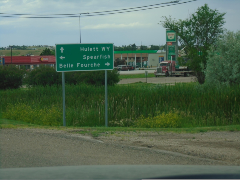
SD-34 West at US-85
SD-34 West at US-85. Use US-85 south to Spearfish; US-85 north to Belle Fourche. Continue west on SD-34 for Hulett, Wyoming.
Taken 06-29-2025

 Belle Fourche
Butte County
South Dakota
United States
Belle Fourche
Butte County
South Dakota
United States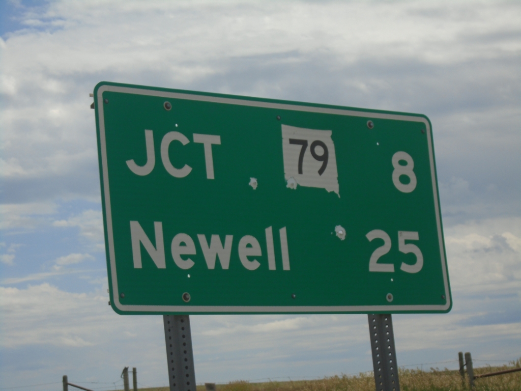
SD-168 East - Distance Marker
Distance marker on SD-168 east. Distance to SD-79 and Newell.
Taken 06-29-2025

 Castle Rock
Butte County
South Dakota
United States
Castle Rock
Butte County
South Dakota
United States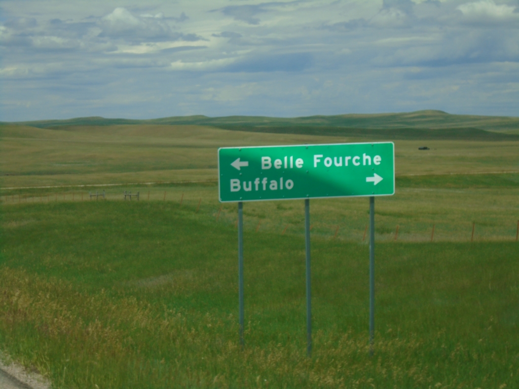
End SD-168 West at US-85
End SD-168 West at US-85. Use US-85 North to Buffalo; US-85 South to Belle Fourche.
Taken 06-29-2025
Castle Rock
Butte County
South Dakota
United States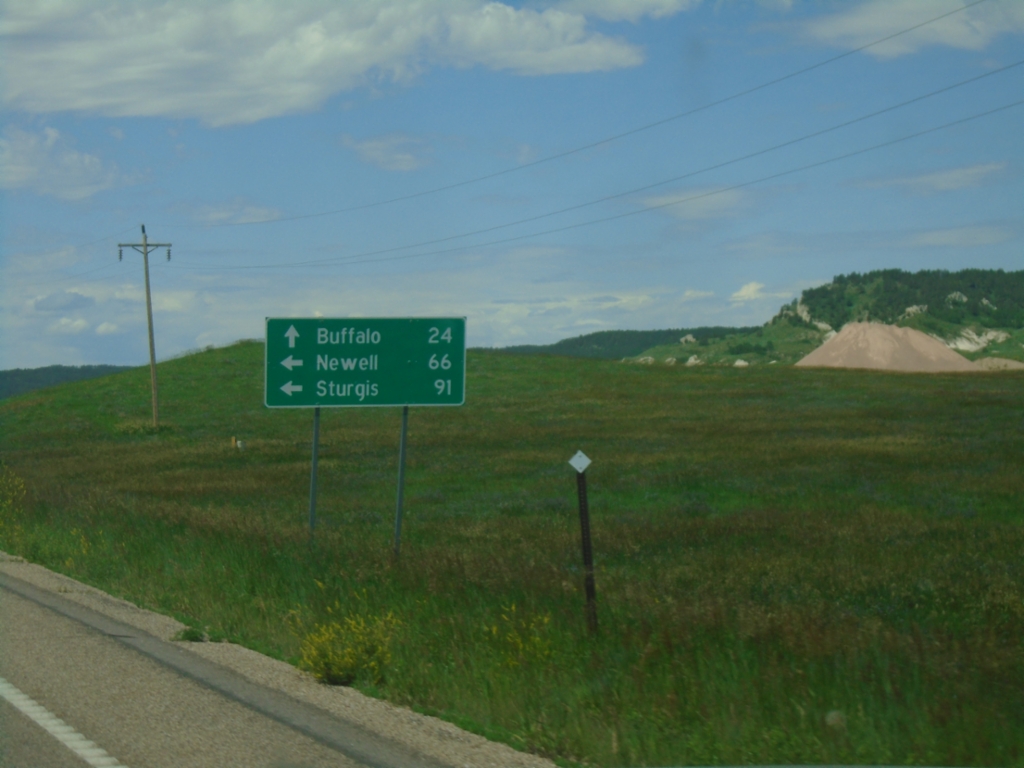
SD-20 West/SD-79 South at SD-20/SD-79 Split
SD-20 West/SD-79 South at SD-20/SD-79 split. Use SD-79 South to Newell and Sturgis; use SD-20 West for Buffalo.
Taken 06-29-2025
 Reva
Harding County
South Dakota
United States
Reva
Harding County
South Dakota
United States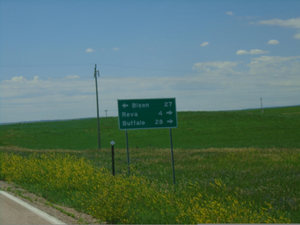
SD-79 South at SD-20
SD-79 South at SD-20 in Harding County. Use SD-20 East for Bison; SD-20 West/SD-79 South to Reva and Buffalo.
Taken 06-29-2025
Reva
Harding County
South Dakota
United States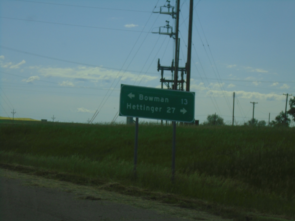
End ND-67 at US-12
End ND-67 at US-12 in Scranton. Use US-12 west to Bowman; east to Hettinger.
Taken 06-29-2025

 Scranton
Bowman County
North Dakota
United States
Scranton
Bowman County
North Dakota
United States
End ND-67 North at ND-21
End ND-67 North at ND-21. Use ND-21 west to Jct. US-85; ND-21 east to New England.
Taken 06-29-2025
 Amidon
Slope County
North Dakota
United States
Amidon
Slope County
North Dakota
United States
US-85 North Approaching ND-21
US-85 North approaching ND-21 in Slope County. Continue north on US-85 for Belfield; use ND-21 east for New England.
Taken 06-29-2025
Amidon
Slope County
North Dakota
United States
US-85 North - Distance Marker
Distance marker on US-85 north. Distance to Amidon and Belfield.
Taken 06-29-2025
Bowman
Slope County
North Dakota
United States
US-85 North - Distance Marker
Distance marker on US-85 north. Distance to Amidon and Belfield.
Taken 06-29-2025
Bowman
Bowman County
North Dakota
United States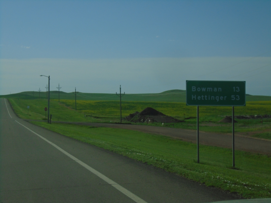
US-12 East - Distance Marker
Distance marker on US-12 east. Distance to Bowman and Hettinger.
Taken 06-29-2025
Rhame
Bowman County
North Dakota
United States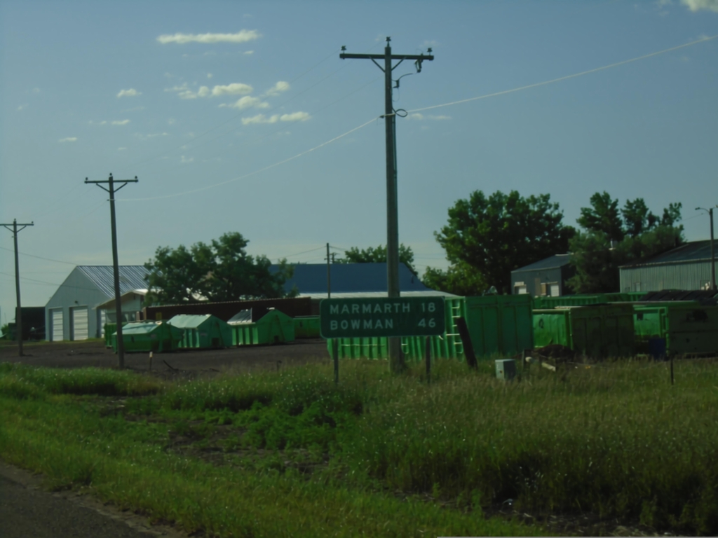
US-12 East - Distance Marker
Distance marker on US-12 east. Distance to Marmarth (ND) and Bowman (ND).
Taken 06-29-2025
Baker
Fallon County
Montana
United States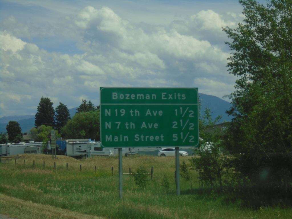
I-90 East - Bozeman Exits
Bozeman exits on I-90 east: N 19th Ave., N 7th Ave. and Main St.
Taken 06-28-2025
 Bozeman
Gallatin County
Montana
United States
Bozeman
Gallatin County
Montana
United States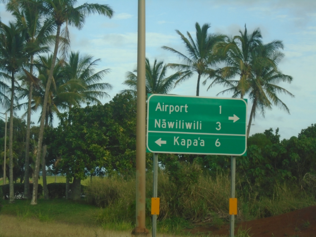
HI-56 North Approaching HI-51
HI-56 North (Kūhiō Highway) approaching HI-51 (Kapule Highway). Use HI-51 south to (Līhuʻe) Airport and Nāwiliwili. Turn left to continue north on HI-56 to Kapa’a.
Taken 02-18-2025

 Lihue
Kauai County
Hawaii
United States
Lihue
Kauai County
Hawaii
United States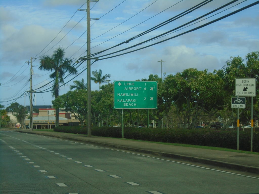
HI-50 East at HI-58 (Nāwiliwili Road)
HI-50 East (Kaumualiʻi Highway) at HI-58 (Nāwiliwili Road). Use HI-58 for Nāwiliwili and Kalapiki Beach. Continue east on HI-50 for Airport and Līhuʻe.
Taken 02-18-2025

 Lihue
Kauai County
Hawaii
United States
Lihue
Kauai County
Hawaii
United States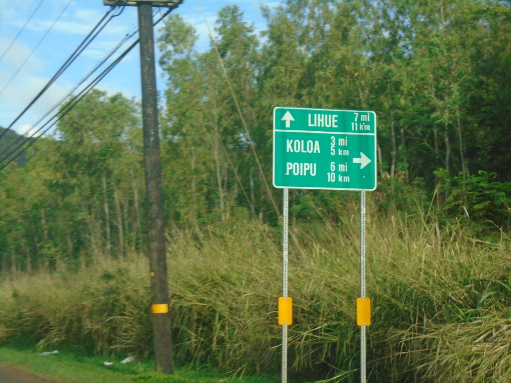
HI-50 East Approaching HI-520 (Maluhia Road)
HI-50 East (Kaumualiʻi Highway) approaching HI-520 (Maluhia Road) to Kōloa and Poʻipū. Continue east on HI-50 to Līhuʻe. This sign is in both miles and kilometers.
Taken 02-18-2025
 Kalaheo
Kauai County
Hawaii
United States
Kalaheo
Kauai County
Hawaii
United States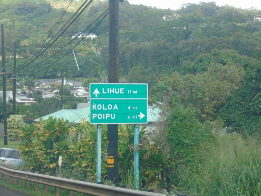
HI-50 East Approaching HI-530 (Kōloa Road)
HI-50 East (Kaumualiʻi Highway) approaching HI-530 (Kōloa Road) to Kōloa and Poʻipū. Continue east on HI-50 to Līhuʻe.
Taken 02-18-2025
 Kalaheo
Kauai County
Hawaii
United States
Kalaheo
Kauai County
Hawaii
United States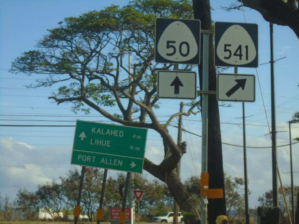
HI-50 East at HI-541 (Waialo Road)
HI-50 East (Kaumualiʻi Highway) at HI-541 (Waialo Road) to Port Allen. Continue east on HI-50 to Kalaheo and Līhuʻe.
Taken 02-18-2025
 Eleele
Kauai County
Hawaii
United States
Eleele
Kauai County
Hawaii
United States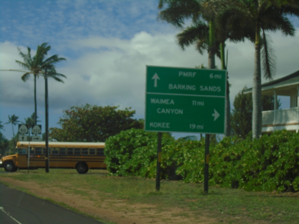
HI-50 West at HI-552 (Alae Road)
HI-50 West (Kaumualiʻi Highway) at HI-552 (Alae Road) to Waimea Canyon and Kōkeʻe. Continue west on HI-50 for Pacific Missile Range Facility (PMRF) Barking Sands.
Taken 02-18-2025
 Kekaha
Kauai County
Hawaii
United States
Kekaha
Kauai County
Hawaii
United States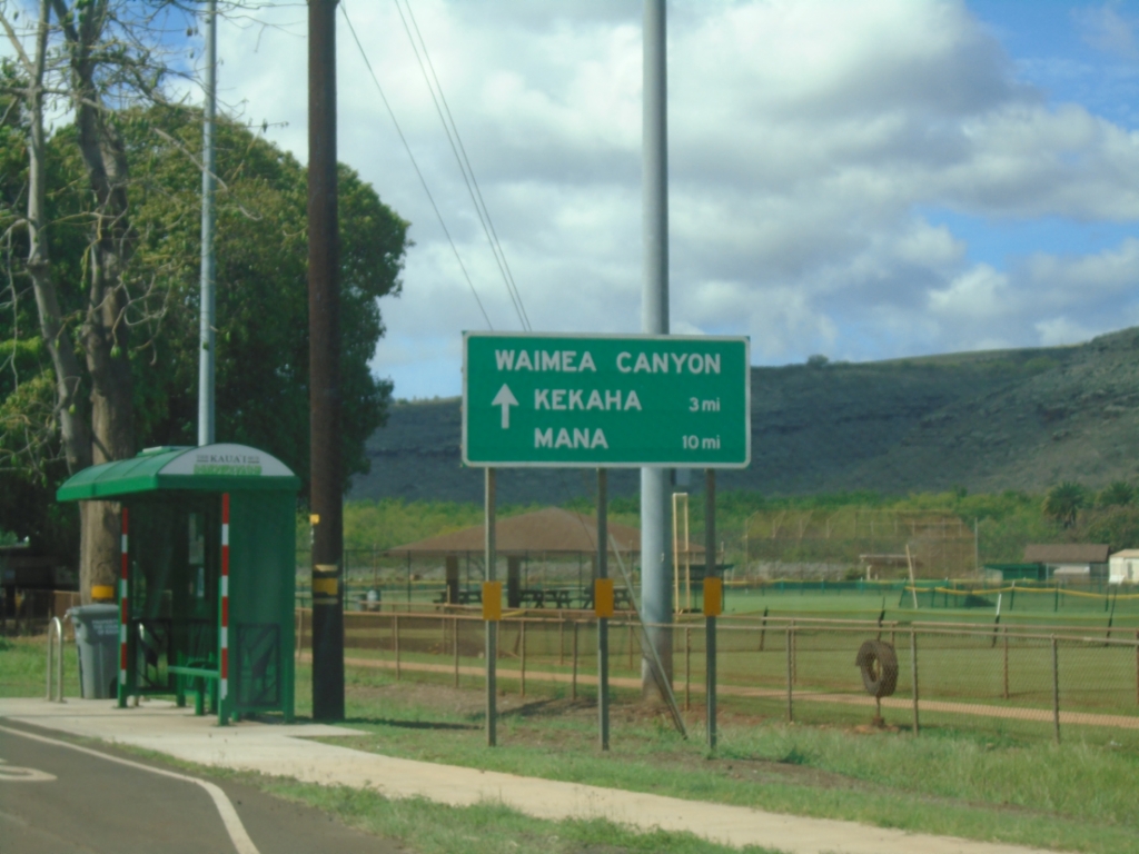
HI-50 West - Distance Marker
Distance marker on HI-50 (Kaumualiʻi Highway) west . Distance to Waimea Canyon, Kekaha, and Mana.
Taken 02-18-2025
Waimea
Kauai County
Hawaii
United States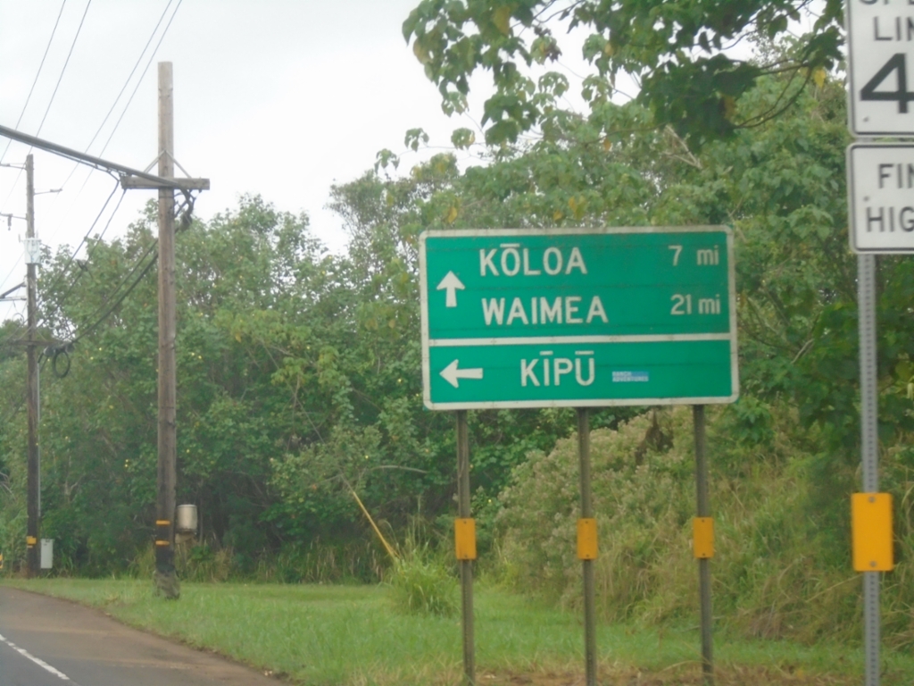
HI-50 West at Kīpū Road
HI-50 West (Kaumualiʻi) at Kīpū Road to Kīpū. Continue west on HI-50 to Kōloa and Waimea.
Taken 02-18-2025
Lihue
Kauai County
Hawaii
United States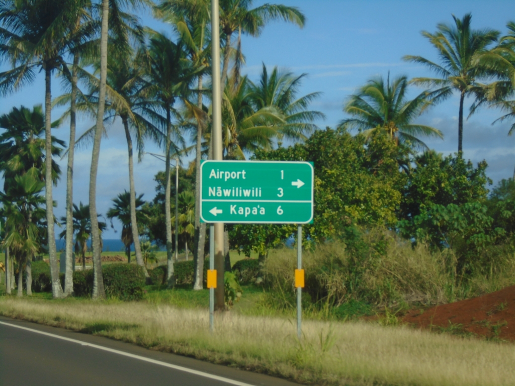
HI-56 North Approaching HI-51
HI-56 North (Kūhiō Highway) approaching HI-51 (Kapule Highway). Use HI-51 south to (Līhuʻe) Airport and Nāwiliwili. Turn left to continue north on HI-56 to Kapa’a.
Taken 02-17-2025
Lihue
Kauai County
Hawaii
United States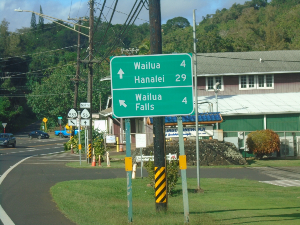
HI-56 North Approaching HI-583 (Maʻalo Road)
HI-56 North (Kūhiō Highway) approaching HI-583 (Maʻalo Road) to Wailua Falls. Continue north on HI-56 to Wailua and Hanalei.
Taken 02-17-2025
 Lihue
Kauai County
Hawaii
United States
Lihue
Kauai County
Hawaii
United States