Signs Tagged With Distance Marker
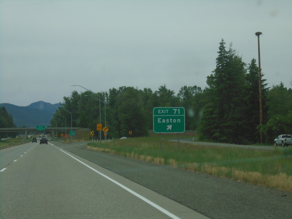
I-90 West - Exit 71
I-90 west at Exit 71 - Easton.
Taken 06-13-2024
 Easton
Kittitas County
Washington
United States
Easton
Kittitas County
Washington
United States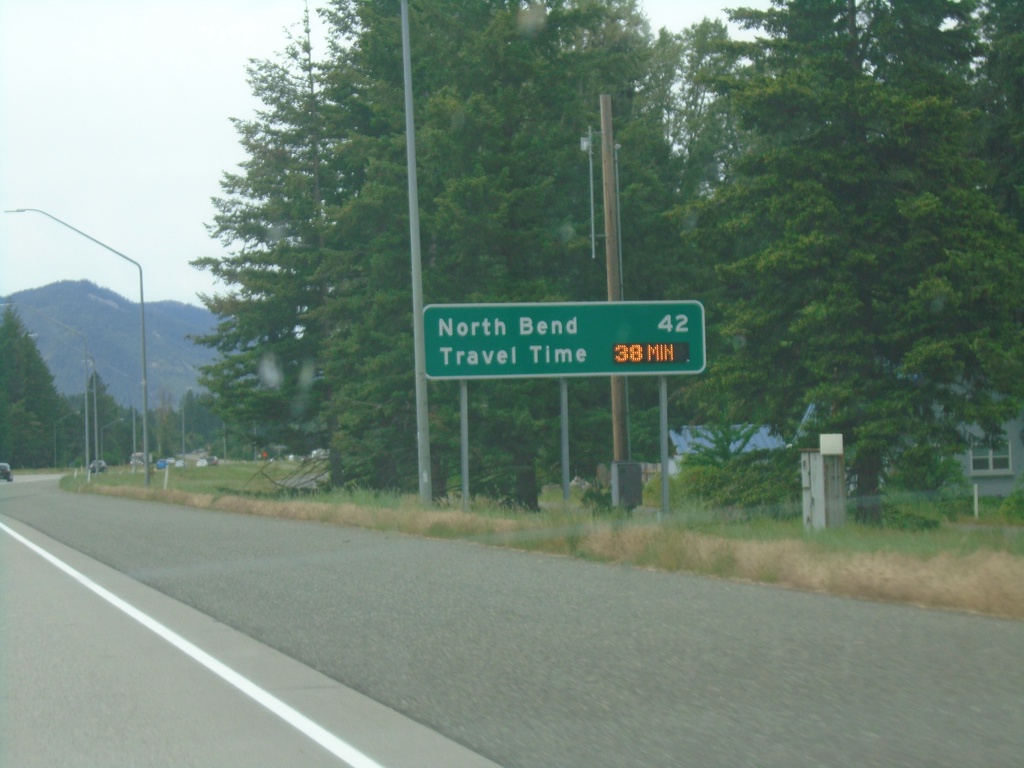
I-90 West - Distance Marker/Travel Time
Distance marker and dynamic travel time sign on I-90 west. Distance and travel time to North Bend, which is a Seattle suburb.
Taken 06-13-2024
Cle Elum
Kittitas County
Washington
United States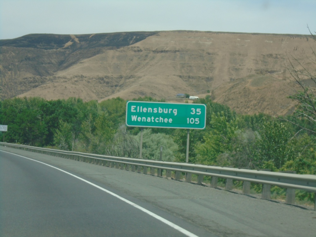
I-82 West - Distance Marker
Distance marker on I-82 west. Distance to Ellensburg and Wenatchee (via US-97 North).
Taken 06-13-2024


 Yakima
 County
Washington
United States
Yakima
Yakima County
Washington
United States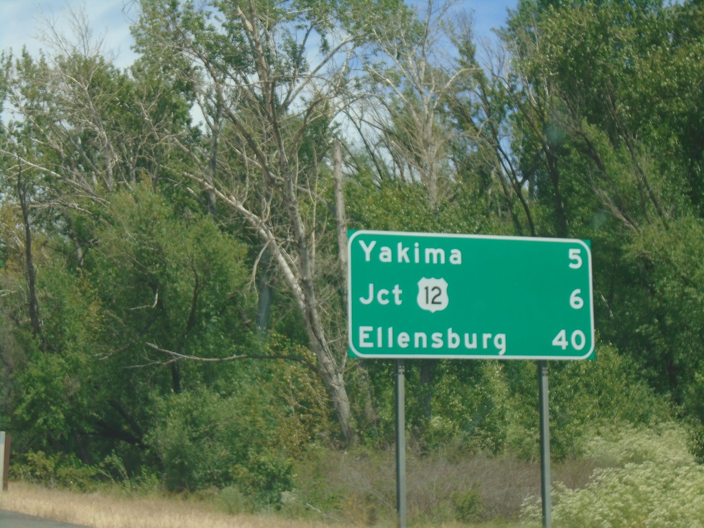
I-82 West - Distance Marker
Distance marker on I-82 west. Distance to Yakima, US-12 Junction, and Ellensburg.
Taken 06-13-2024
Union Gap
Yakima County
Washington
United States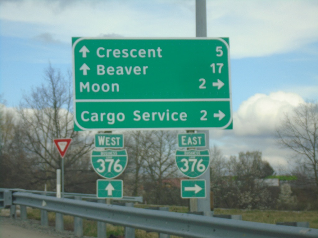
Flaugherty Run Road at BL-376
Flaugherty Run Road at BL-376. Use BL-376 East to Moon and Cargo Service. Continue over freeway for Beaver and Crescent.
Taken 04-01-2024
 Carnot-Moon
Allegheny County
Pennsylvania
United States
Carnot-Moon
Allegheny County
Pennsylvania
United States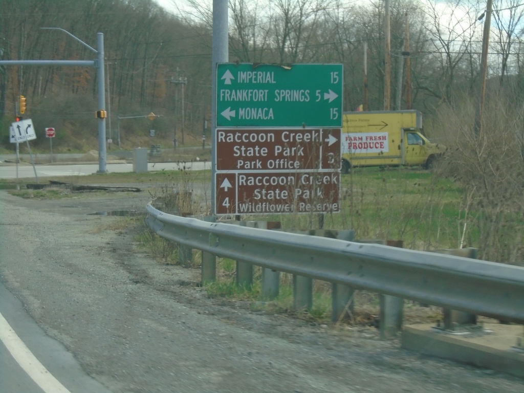
US-30 East at PA-18
US-30 East at PA-18. Use PA-18 north to Monaca; use PA-18 south to Frankfort Springs and Raccoon Creek State Park - Park Office. Continue east on US-30 for Imperial and Raccoon Creek State Park - Wildflower Reserve.
Taken 04-01-2024

 Clinton
Beaver County
Pennsylvania
United States
Clinton
Beaver County
Pennsylvania
United States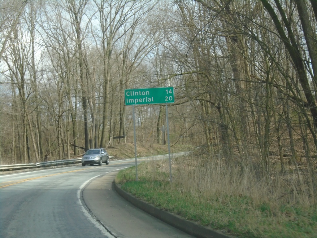
US-30 East - Distance Marker
Distance marker on US-30 east. Distance to Clinton and Imperial.
Taken 04-01-2024
Hookstown
Beaver County
Pennsylvania
United States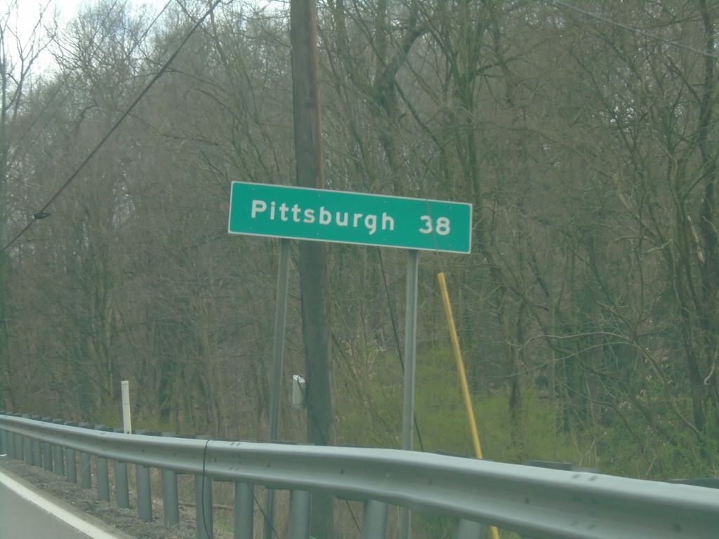
US-30 East - Distance Marker
Distance marker on US-30 East. Distance to Pittsburgh (PA).
Taken 04-01-2024
Chester
Hancock County
West Virginia
United States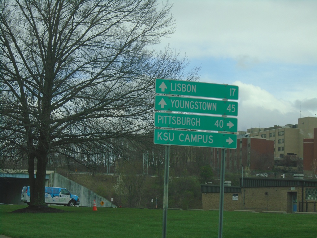
OH-7 North/OH-39 East at US-30/OH-267
OH-7 North/OH-39 East at US-30/OH-267 in East Liverpool. Use US-30/OH-39 East to Pittsburgh (PA) and KSU Campus. Use US-30 West/OH-267/OH-7 North to Youngstown and Lisbon.
Taken 04-01-2024


 East Liverpool
Columbiana County
Ohio
United States
East Liverpool
Columbiana County
Ohio
United States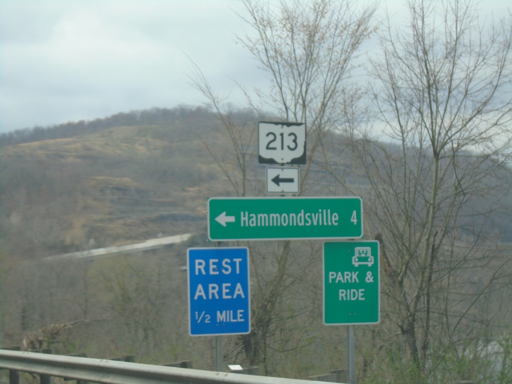
OH-7 North at OH-213 West
OH-7 North at OH-213 West to Hammondsville and Rest Area.
Taken 04-01-2024
 Toronto
Jefferson County
Ohio
United States
Toronto
Jefferson County
Ohio
United States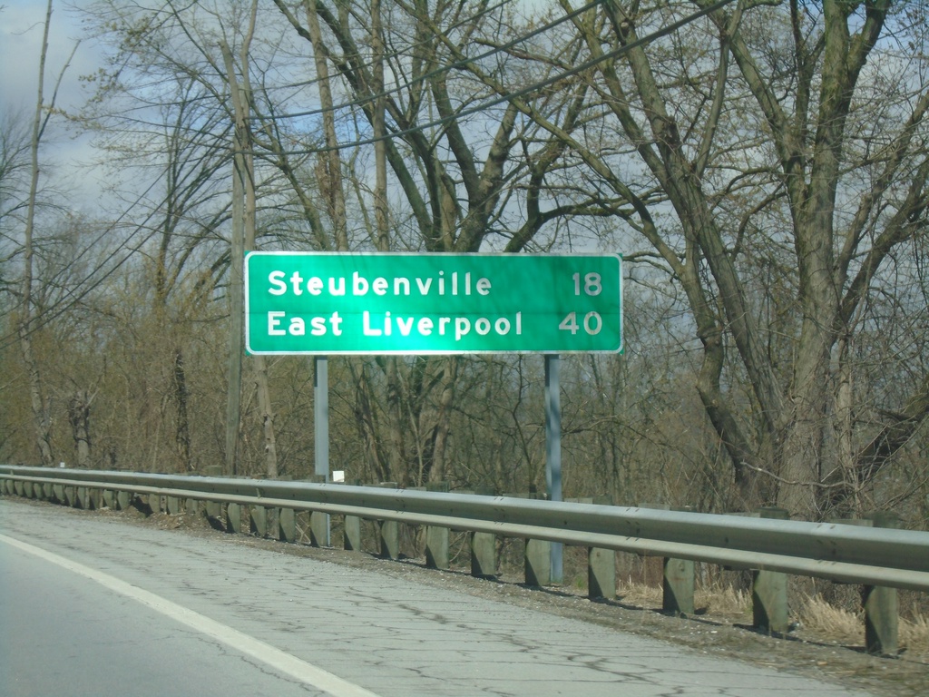
OH-7 North - Distance Marker
Distance marker on OH-7 north. Distance to Steubenville and East Liverpool.
Taken 04-01-2024
Martins Ferry
Belmont County
Ohio
United States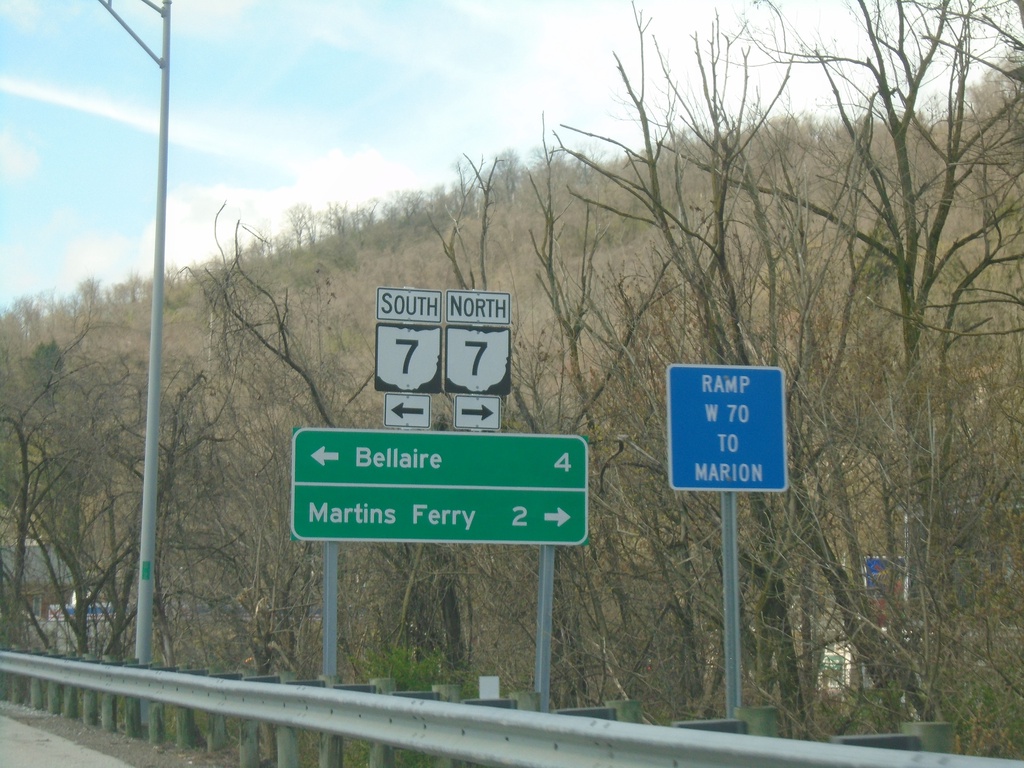
I-70 West - Exit 225 Offramp
I-70 West - Exit 225 offramp at access road to OH-7. Turn right for OH-7 North to Martins Ferry; left for OH-7 South to Bellaire.
Taken 04-01-2024
 Bridgeport
Belmont County
Ohio
United States
Bridgeport
Belmont County
Ohio
United States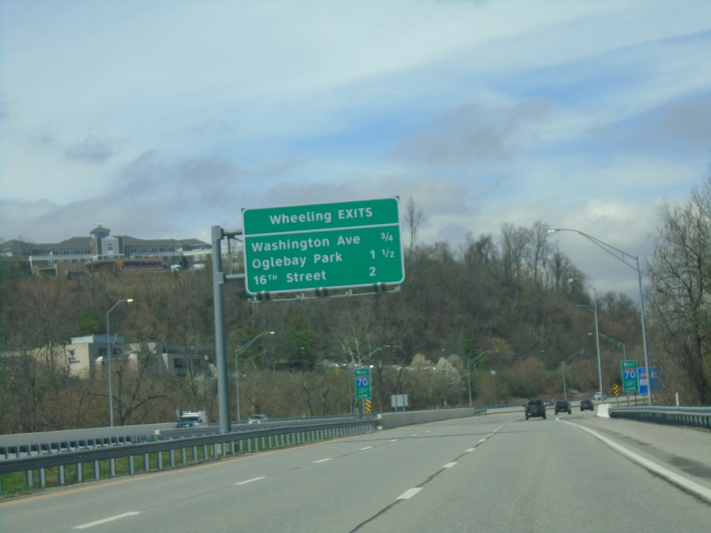
I-70 West - Wheeling Exits
Wheeling Exits on I-70: Washington Ave., Oglebay Park, and 16th ST.
Taken 04-01-2024
Wheeling
Ohio County
West Virginia
United States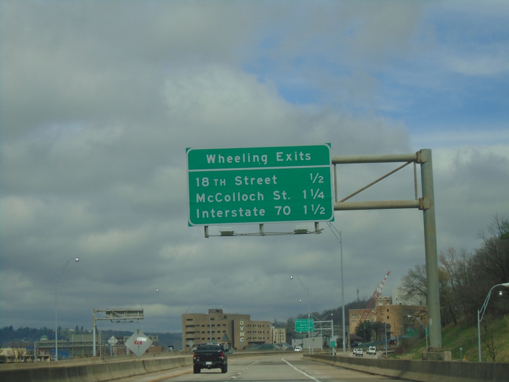
US-250 West/WV-2 North - Wheeling Exits
Wheeling Exits on US-250 West/WV-2 North: 18th St., McColloch St., and I-70.
Taken 04-01-2024

 Wheeling
Ohio County
West Virginia
United States
Wheeling
Ohio County
West Virginia
United States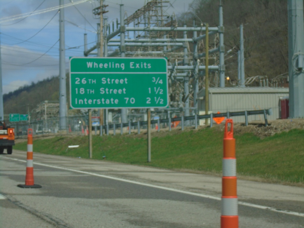
WV-2 North/US-250 West - Wheeling Exits
Wheeling Exits on WV-2 North/US-250 West. 26th St., 18th St., and I-70.
Taken 04-01-2024
Wheeling
Ohio County
West Virginia
United States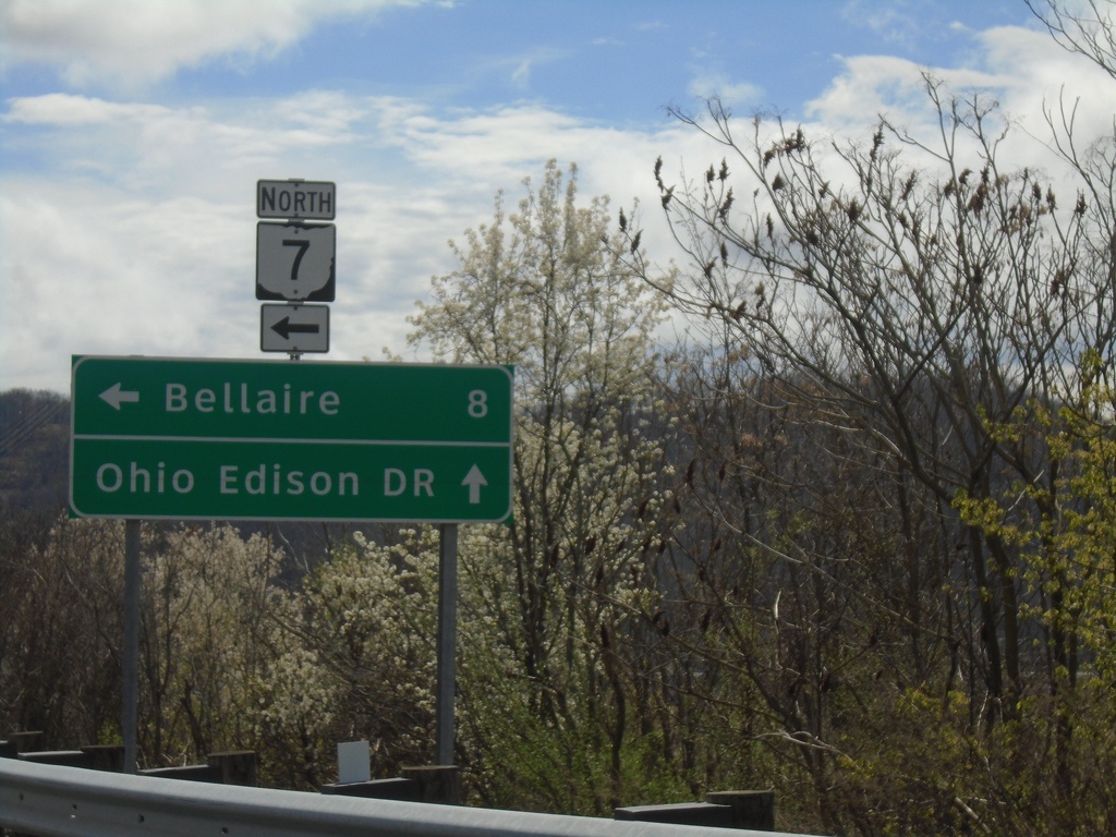
OH-872 East at OH-7 North Onramp
OH-872 East at OH-7 North onramp to Bellaire. Continue straight for (OH-872)/Ohio Edison Drive.
Taken 04-01-2024
 Shadyside
Belmont County
Ohio
United States
Shadyside
Belmont County
Ohio
United States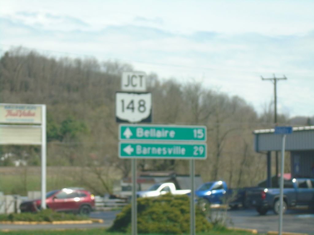
OH-7 North Approaching OH-148
OH-7 North approaching OH-148 in Powhatan Point. Use OH-148 West to Barnesville; OH-7 North to Bellaire.
Taken 04-01-2024
 Powhatan Point
Belmont County
Ohio
United States
Powhatan Point
Belmont County
Ohio
United States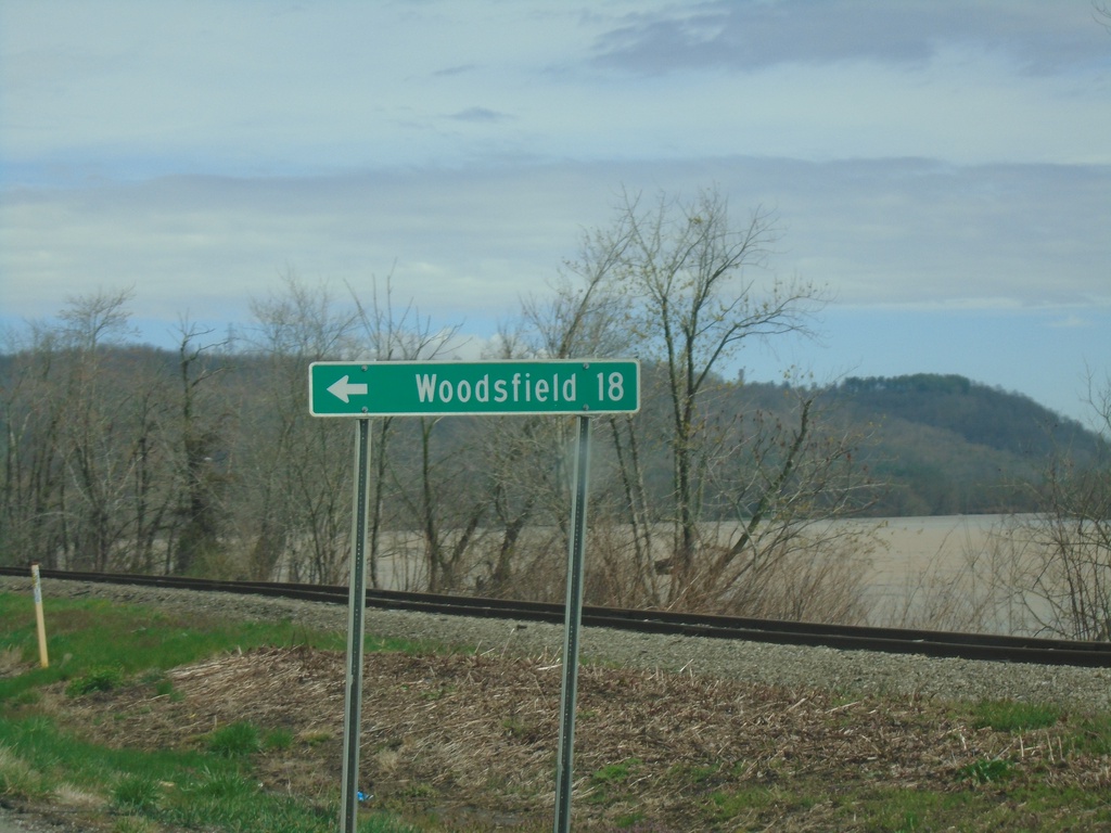
OH-7 North at OH-78 West
OH-7 North at OH-78 West to Woodsfield.
Taken 04-01-2024
 Clarington
Monroe County
Ohio
United States
Clarington
Monroe County
Ohio
United States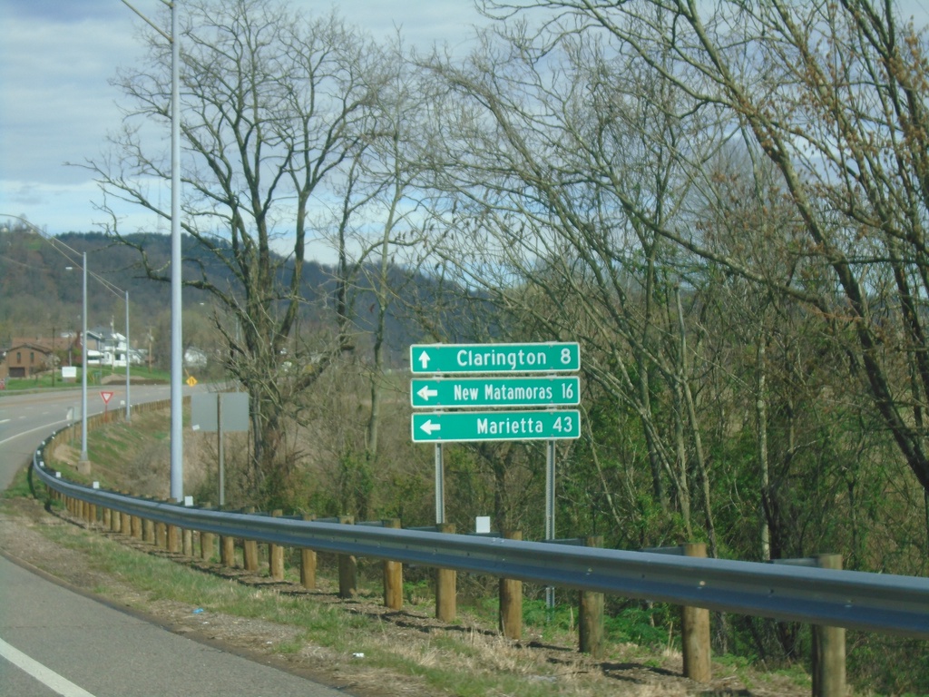
New Martinsville Bridge at OH-7
New Martinsville Bridge at OH-7. Use OH-7 north to Clarington; OH-7 South to New Matamoras and Marietta.
Taken 04-01-2024
Hannibal
Monroe County
Ohio
United States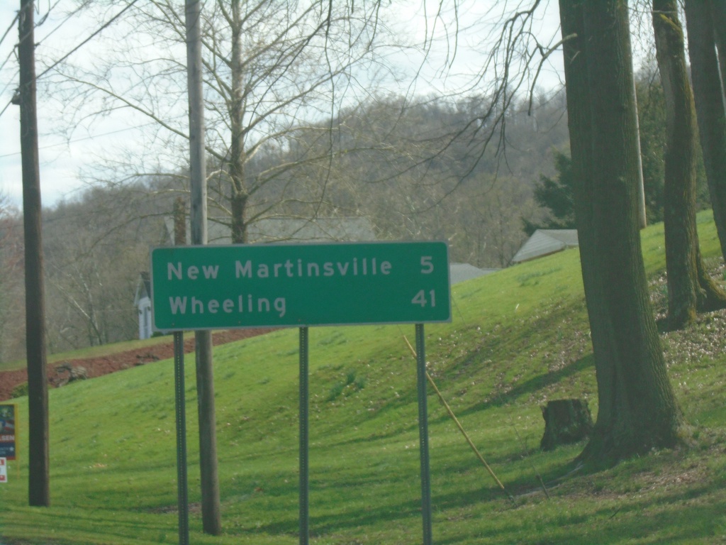
WV-2 North - Distance Marker
Distance maker on WV-2 North. Distance to New Martinsville and Wheeling.
Taken 04-01-2024
Paden City
Wetzel County
West Virginia
United States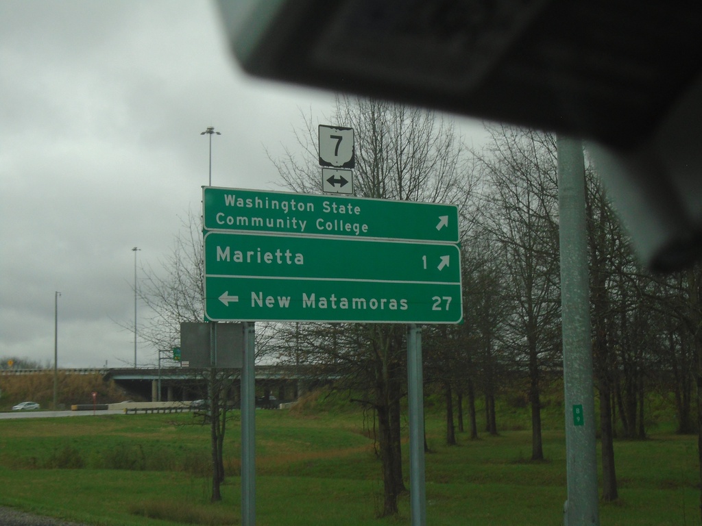
I-77 North - Exit 1 Offramp at OH-7
I-77 North - Exit 1 Offramp at OH-7. Use OH-7 South to Washington State Community College and Marietta. Use OH-7 North to New Matamoras.
Taken 04-01-2024
 Marietta
Washington County
Ohio
United States
Marietta
Washington County
Ohio
United States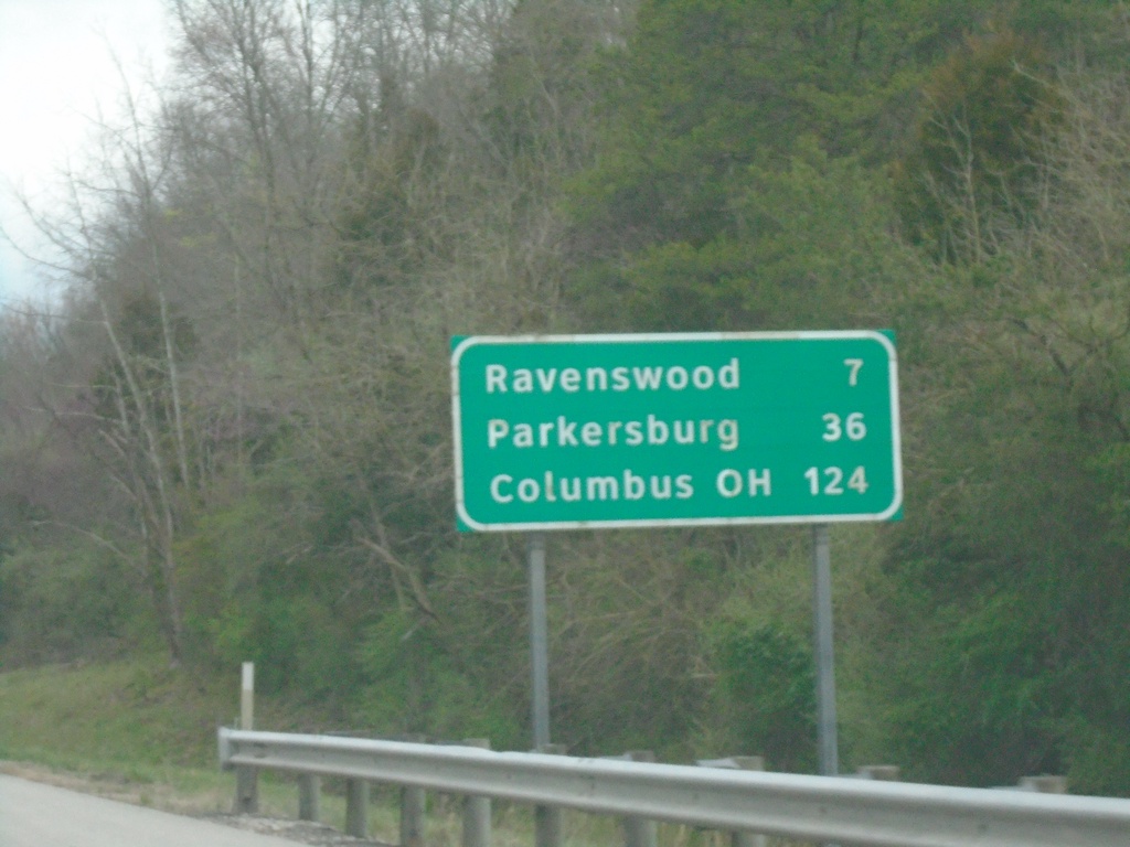
I-77 North - Distance Marker
Distance marker on I-77 north. Distance to Ravenswood, Parkersburg, Columbus (OH).
Taken 04-01-2024
 Ripley
Jackson County
West Virginia
United States
Ripley
Jackson County
West Virginia
United States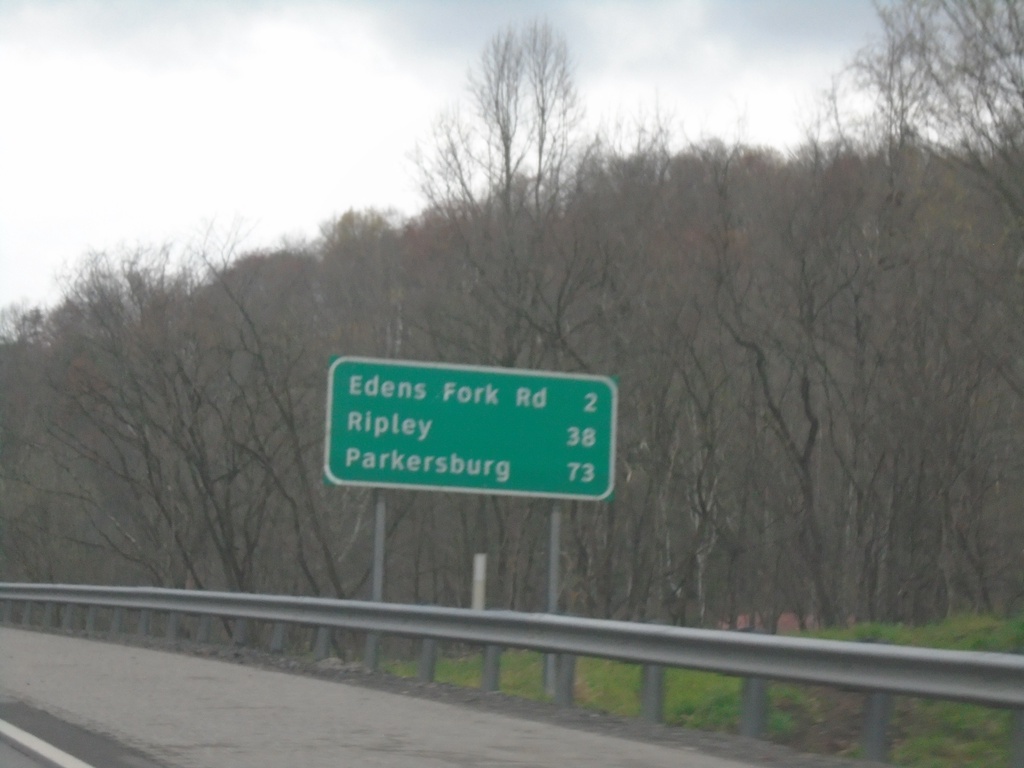
I-77 North - Distance Marker
Distance marker on I-77 North. Distance to Edens Fork Road, Ripley, and Parkersburg.
Taken 04-01-2024
Charleston
Kanawha County
West Virginia
United States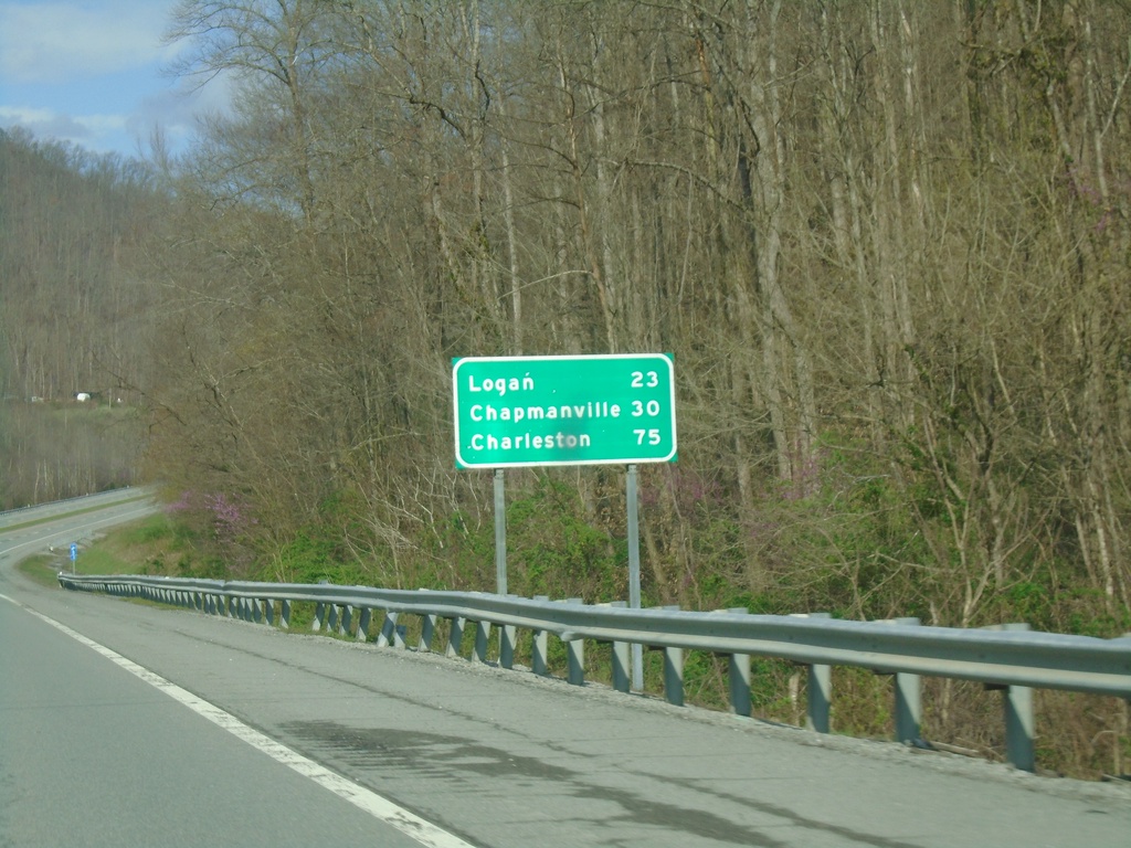
US-119 North - Distance Marker
Distance marker on US-119 North. Distance to Logan, Chapmanville, and Charleston.
Taken 03-31-2024
 Williamson
Mingo County
West Virginia
United States
Williamson
Mingo County
West Virginia
United States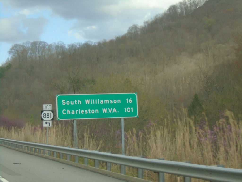
US-119 North at KY-881
US-119 North at KY-881 junction. Distance marker on US-119 North to South Williamson, and Charleston (WV).
Taken 03-31-2024
 Pikeville
Pike County
Kentucky
United States
Pikeville
Pike County
Kentucky
United States