Signs Tagged With Distance Marker
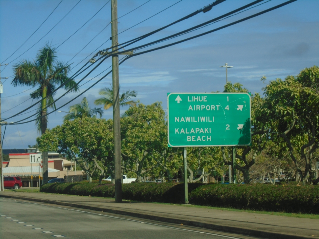
HI-50 East at HI-58 (Nāwiliwili Road)
HI-50 East (Kaumualiʻi Highway) at HI-58 (Nāwiliwili Road). Use HI-58 for Nāwiliwili and Kalapiki Beach. Continue east on HI-50 for Airport and Līhuʻe.
Taken 02-17-2025

 Lihue
Kauai County
Hawaii
United States
Lihue
Kauai County
Hawaii
United States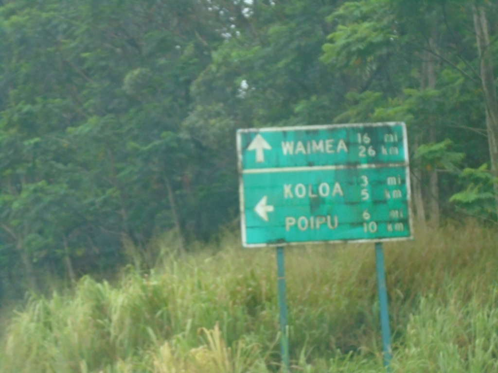
HI-50 West at HI-520
HI-50 West (Kaumualiʻi Highway) at HI-520 south (Maluhia Road) to Poʻipū and Kōloa.
Taken 02-17-2025
 Kalaheo
Kauai County
Hawaii
United States
Kalaheo
Kauai County
Hawaii
United States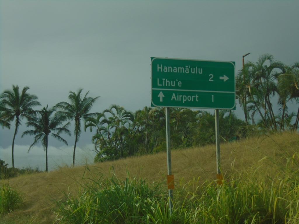
HI-56 South at HI-51
HI-56 South (Kūhiō Highway) at HI-51 (Kapule Highway). Turn right to continue south on HI-56 to Hanamāʻulu and Līhuʻe. Continue straight for HI-51 to (Līhuʻe) Airport.
Taken 02-17-2025

 Lihue
Kauai County
Hawaii
United States
Lihue
Kauai County
Hawaii
United States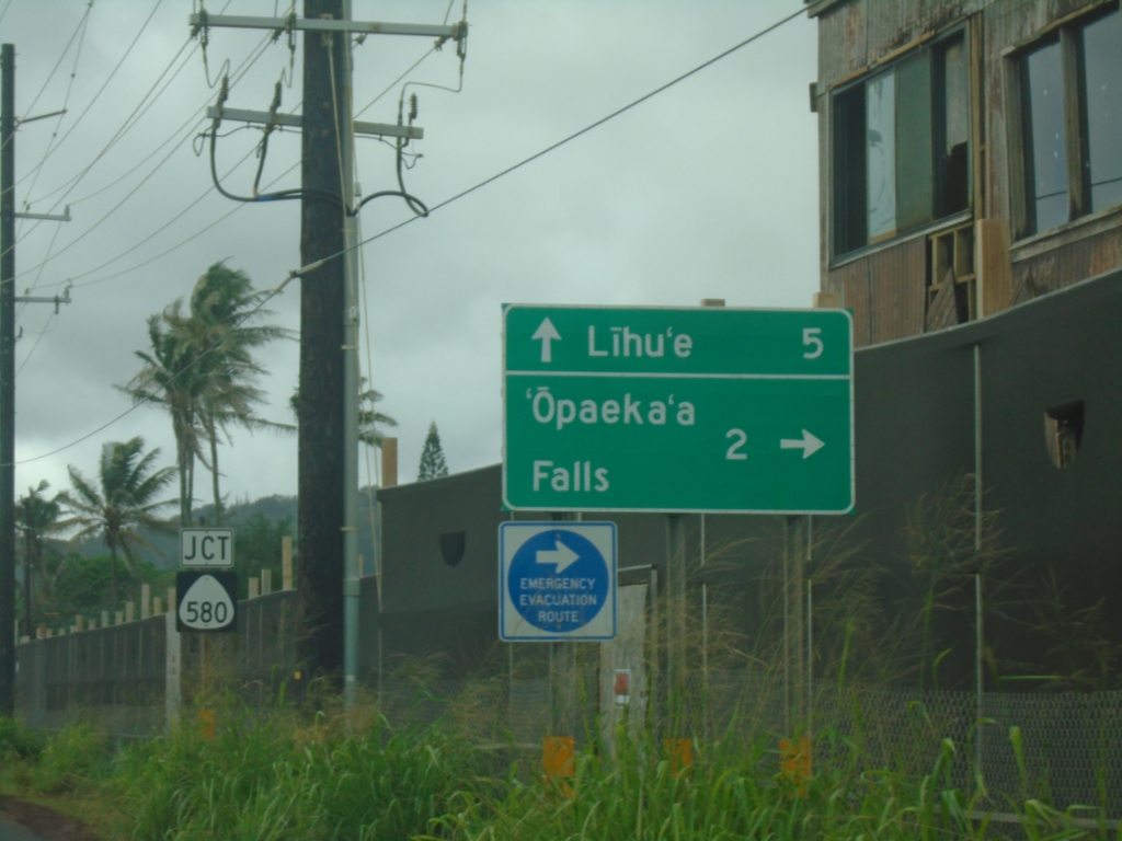
HI-56 South Approaching HI-580
HI-56 South (Kūhiō Highway) approaching HI-580 (Kuamoʻo Road) to ‘Opaeka’a Falls. Continue south on HI-56 to Līhuʻe.
Taken 02-16-2025
 Kapaʻa
Kauai County
Hawaii
United States
Kapaʻa
Kauai County
Hawaii
United States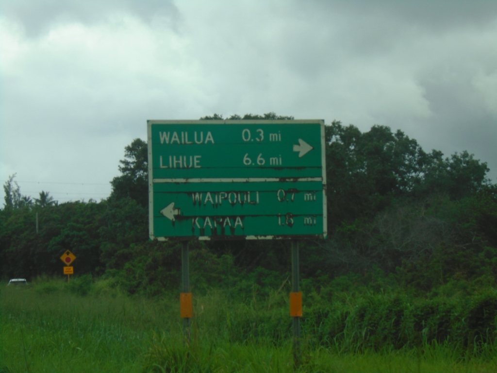
End HI-5600 (Kapa'a Bypass) at HI-56
End HI-5600 (Kapa’a Bypass) at HI-56 (Kūhiō Highway). Use HI-56 south to Wailua and Līhuʻe. Use HI-56 north to Waipouli and Kapa’a.
Taken 02-16-2025
 Kapaʻa
Kauai County
Hawaii
United States
Kapaʻa
Kauai County
Hawaii
United States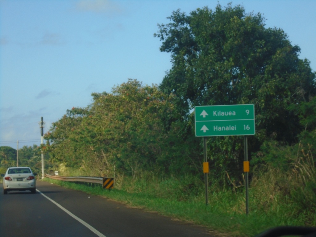
HI-56 North - Distance Marker
Distance marker on HI-56 north in Anahola. Distance to Kilauea and Hanalei.
Taken 02-15-2025
Kilauea
Kauai County
Hawaii
United States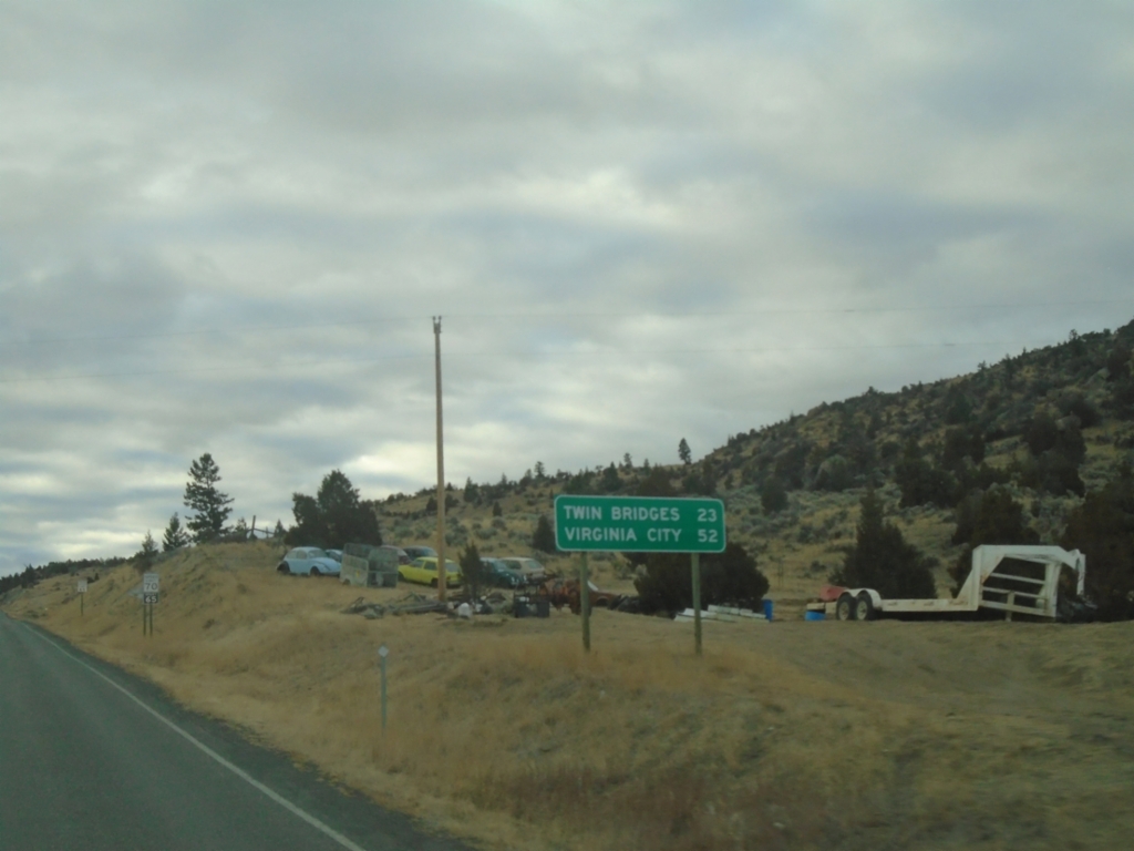
MT-41 South - Distance Marker
Distance marker on MT-41 south. Distance to Twin Bridges and Virginia City.
Taken 12-01-2024
 Whitehall
Jefferson County
Montana
United States
Whitehall
Jefferson County
Montana
United States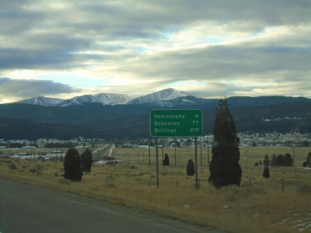
I-90 East - Distance Marker
Distance marker on I-90 east. Distance to Homestake, Bozeman, and Billings.
Taken 12-01-2024
 Butte
Silver Bow County
Montana
United States
Butte
Silver Bow County
Montana
United States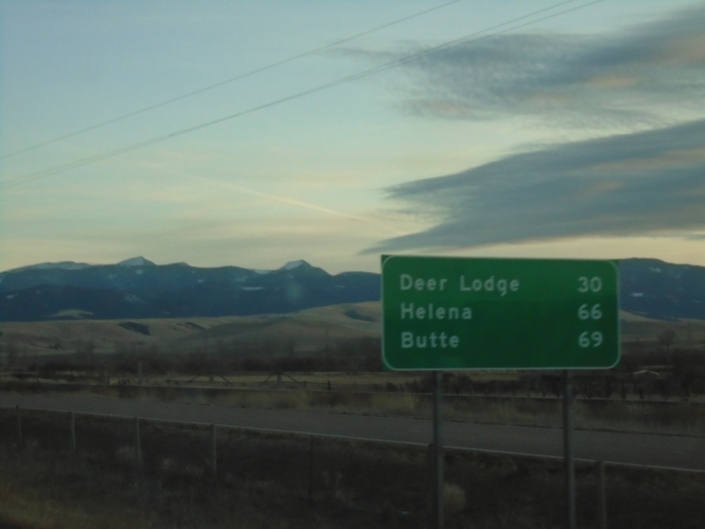
I-90 East - Distance Marker
Distance marker on I-90 east. Distance to Deer Lodge, Helena (via US-12) and Butte (via I-90).
Taken 11-30-2024
 Drummond
Granite County
Montana
United States
Drummond
Granite County
Montana
United States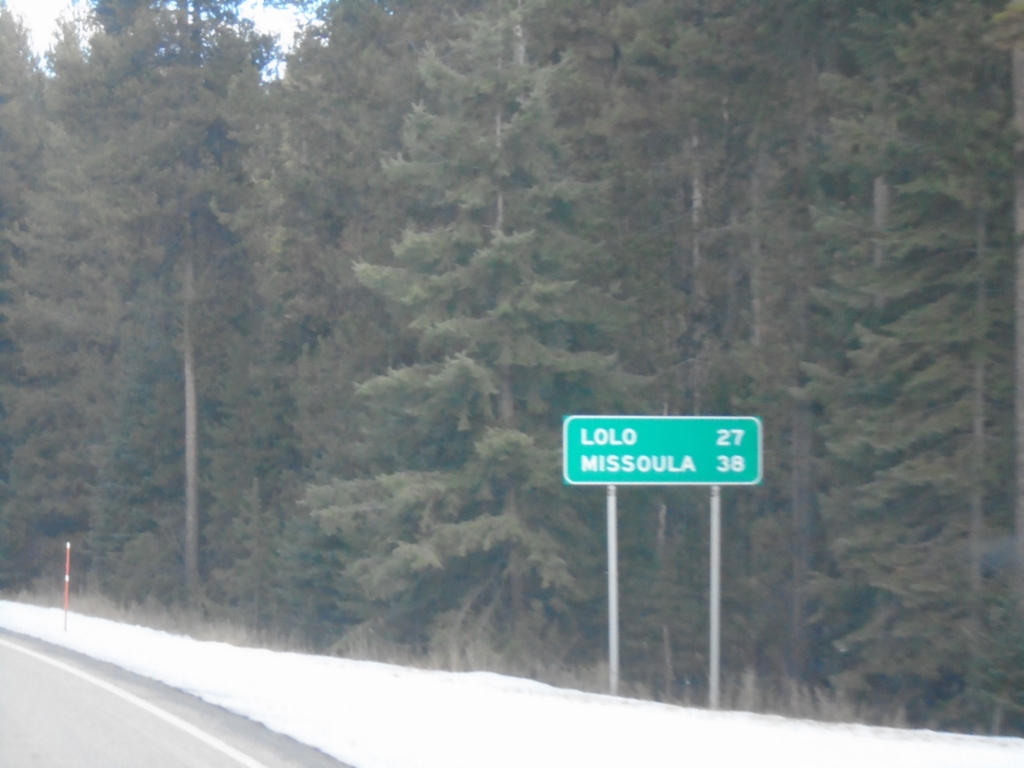
US-12 East - Distance Marker
Distance marker on US-12 east. Distance to Lolo and Missoula.
Taken 11-30-2024
Lolo
Missoula County
Montana
United States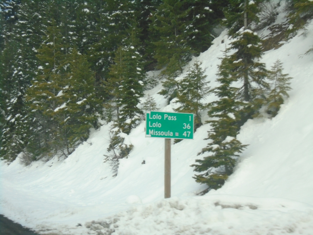
US-12 East - Distance Marker
Last distance marker in Idaho on US-12 east. Distance to Lolo Pass, Lolo (Montana), and Missoula (Montana).
Taken 11-30-2024
Powell Junction
Idaho County
Idaho
United States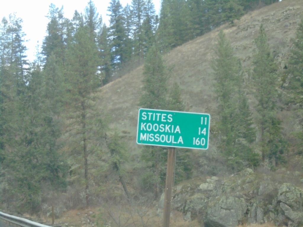
ID-13 North - Distance Marker
Distance marker on ID-13 north. Distance to Stites, Kooskia, and Missoula (Montana).
Taken 11-30-2024
 Grangeville
Idaho County
Idaho
United States
Grangeville
Idaho County
Idaho
United States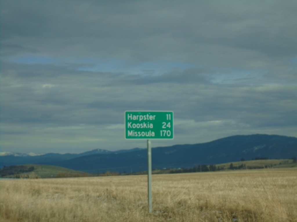
ID-13 North - Distance Marker
Distance marker on ID-13 north. Distance to Harpster, Kooskia, and Missoula (Montana).
Taken 11-30-2024
Grangeville
Idaho County
Idaho
United States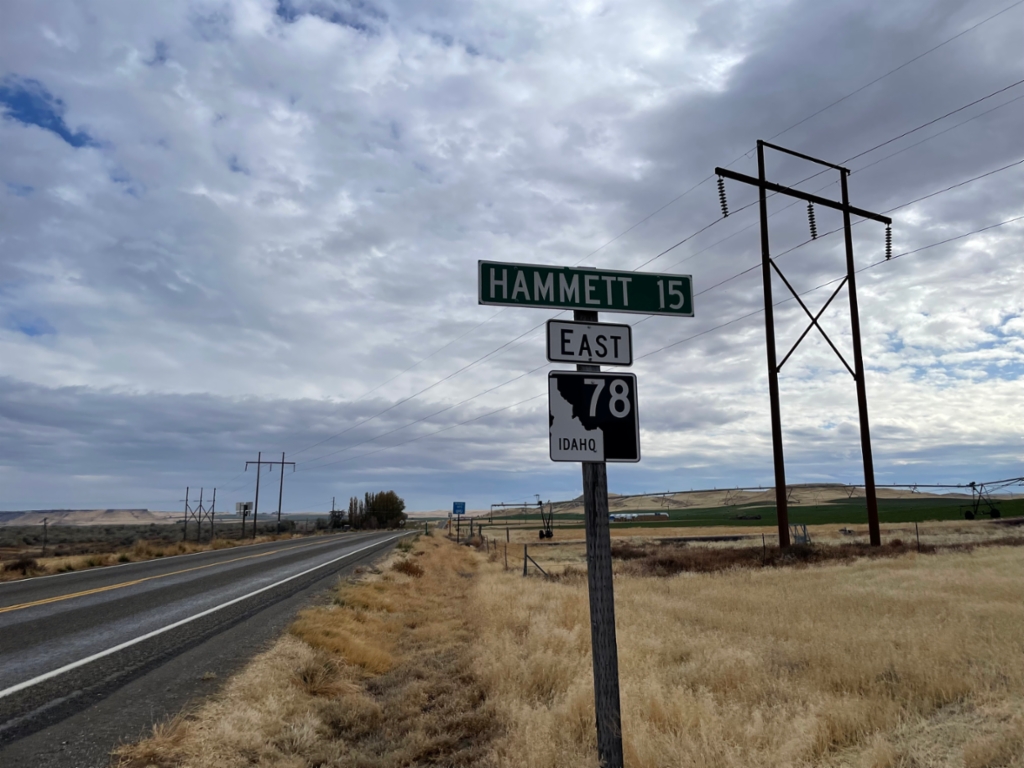
ID-78 East - Distance Marker
Distance marker on ID-78 East. Distance to Hammett.
Taken 11-02-2024
 Mountain Home
Owyhee County
Idaho
United States
Mountain Home
Owyhee County
Idaho
United States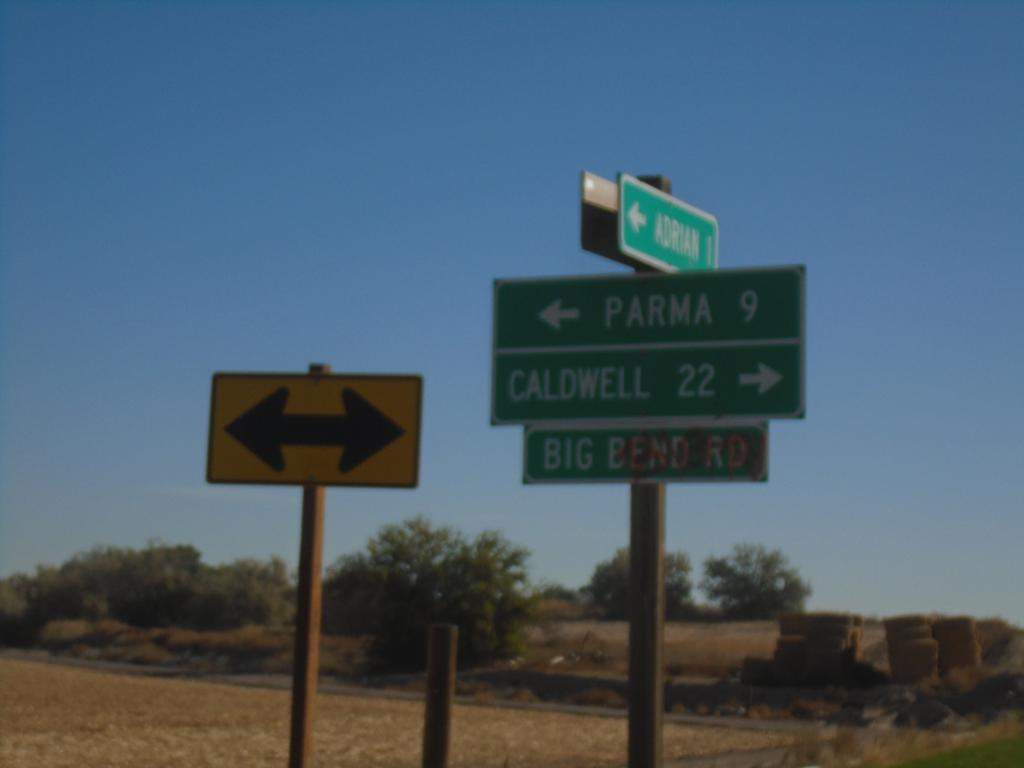
OR-452 East at OR-454
OR-452 East at OR-454 (Big Bend Road) in Malheur County. Turn right for OR-454 East to Caldwell (Idaho); turn left for OR-452 East to Parma (Idaho). OR-452 and OR-454 are both unsigned for their entire length.
Taken 10-19-2024

 Adrian
Malheur County
Oregon
United States
Adrian
Malheur County
Oregon
United States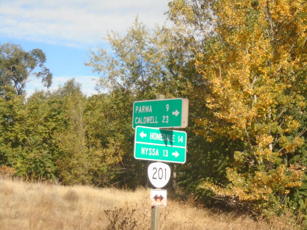
OR-201 North at OR-452
OR-201 North at OR-452 (unsigned) in Adrian. Turn right for OR-452 east to Parma (Idaho) and Caldwell (Idaho). Use OR-201 North to Nyssa; OR-201 South to Homedale (Idaho).
Taken 10-19-2024
 Adrian
Malheur County
Oregon
United States
Adrian
Malheur County
Oregon
United States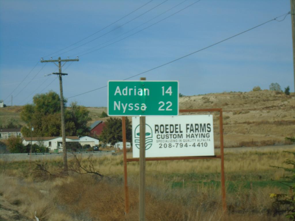
ID-19 West - Distance Marker
Distance marker on ID-19 west. Distance to Adrian (Oregon) and Nyssa (Oregon).
Taken 10-19-2024
 Homedale
Owyhee County
Idaho
United States
Homedale
Owyhee County
Idaho
United States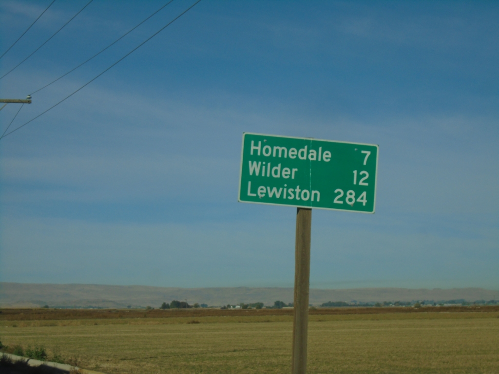
US-95 North - Distance Marker
Distance marker on US-95 north. Distance to Homedale, Wilder, and Lewiston.
Taken 10-19-2024
 Marsing
Owyhee County
Idaho
United States
Marsing
Owyhee County
Idaho
United States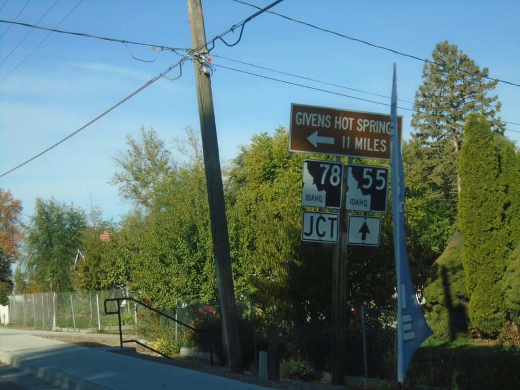
ID-55 South Approaching ID-78
ID-55 South approaching ID-78 east to Givens Hot Springs.
Taken 10-19-2024
 Marsing
Owyhee County
Idaho
United States
Marsing
Owyhee County
Idaho
United States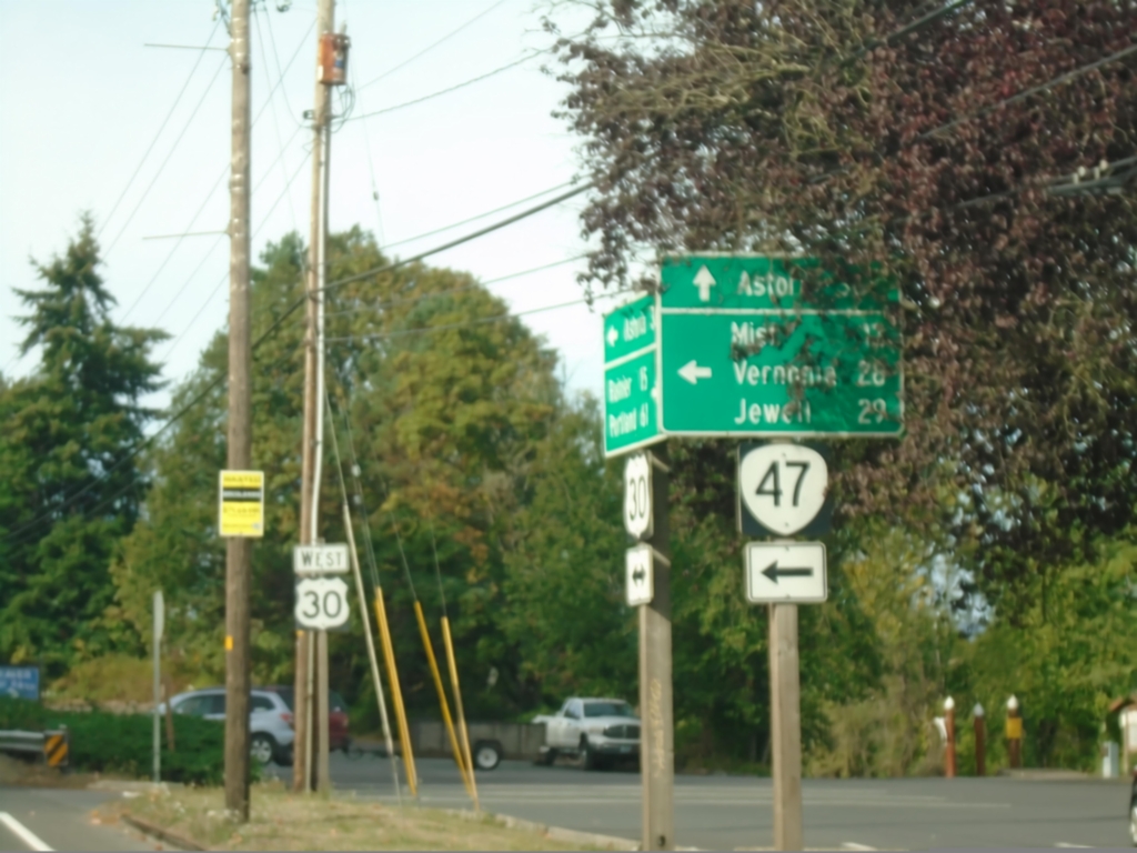
US-30 West at OR-47
US-30 West at OR-47 in Clatskanie. Use OR-47 south to Mist, Vernonia, and Jewell. Continue west on US-30 to Astoria.
Taken 09-22-2024

 Clatskanie
Columbia County
Oregon
United States
Clatskanie
Columbia County
Oregon
United States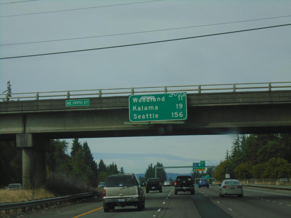
I-5 North - Distance Marker
Distance marker on I-5 north. Distance to Woodland, Kalama, and Seattle.
Taken 09-22-2024
 Ridgefield
Clark County
Washington
United States
Ridgefield
Clark County
Washington
United States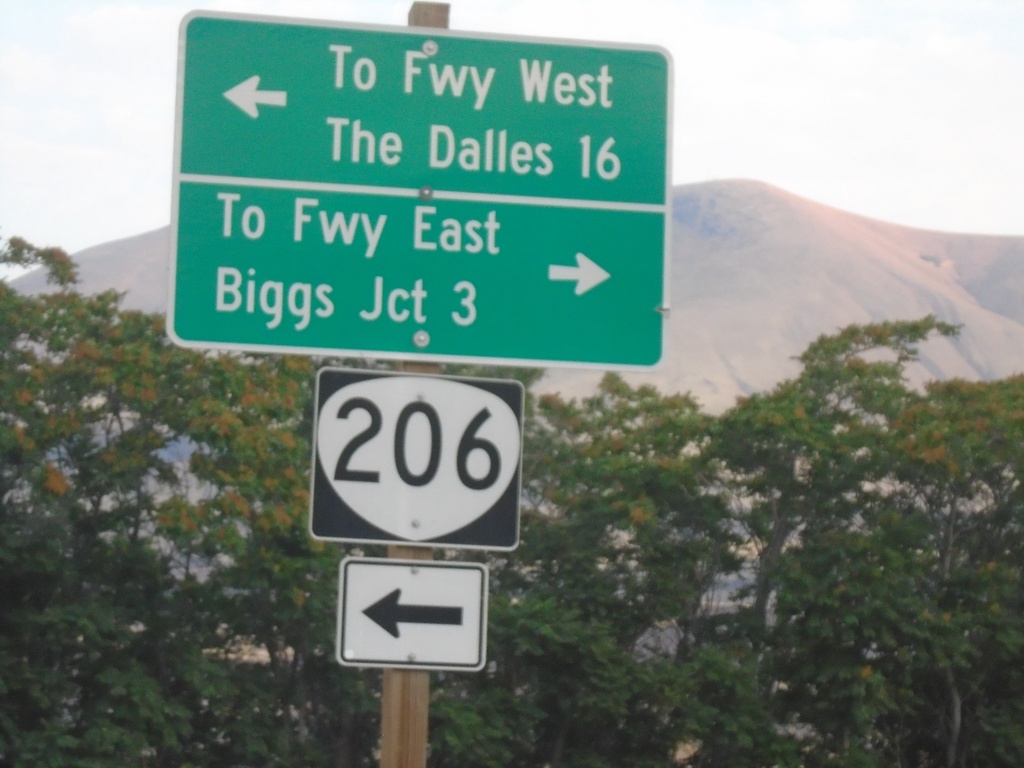
OR-206 West at Biggs-Rufus Highway
OR-206 West at Biggs-Rufus Highway. Turn left to continue on OR-206 west to Freeway West (I-84) and The Dalles. Turn right for Biggs-Rufus Highway to Freeway East (I-84) and Biggs Junction.
Taken 08-10-2024
 Wasco
Sherman County
Oregon
United States
Wasco
Sherman County
Oregon
United States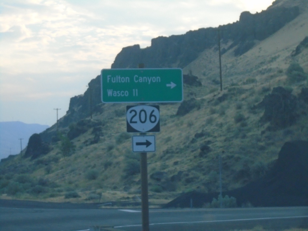
OR-206 East Approaching Biggs-Rufus Highway Junction
OR-206 East Approaching Biggs-Rufus Highway Junction. Turn right to continue east on OR-206 to Fulton Canyon and Wasco.
Taken 08-10-2024
Wasco
Sherman County
Oregon
United States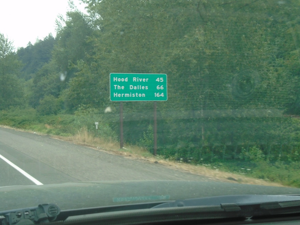
I-84 East - Distance Marker
First distance marker eastbound on I-84 after the Portland metro area. Distance to Hood River, The Dalles, and Hermiston.
Taken 08-09-2024
 Troutdale
Multnomah County
Oregon
United States
Troutdale
Multnomah County
Oregon
United States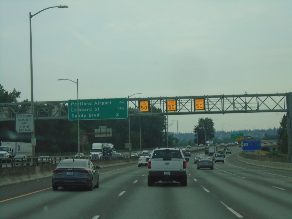
I-205 South - Distance Marker
Distance marker on I-205 south in Portland. Distance to Portland Airport, Lombard St., and Sandy Blvd. Electronic variable speed limit advisory signs showing an advised speed of 50 MPH.
Taken 08-09-2024
 Portland
Multnomah County
Oregon
United States
Portland
Multnomah County
Oregon
United States