Signs Tagged With Distance Marker
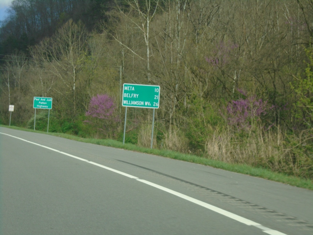
US-119 North - Distance Marker
Distance marker on US-119 north. Distance to Meta, Belfry, and Williamson, WV.
Taken 03-31-2024
 Pikeville
Pike County
Kentucky
United States
Pikeville
Pike County
Kentucky
United States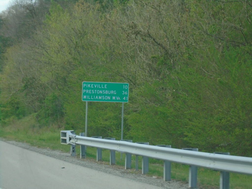
US-460/KY-80 West - Distance Marker
Distance Marker on US-460/KY-80 West. Distance to Pikeville, Prestonsburg, and Williamson, WV.
Taken 03-31-2024

 Shelbiana
Pike County
Kentucky
United States
Shelbiana
Pike County
Kentucky
United States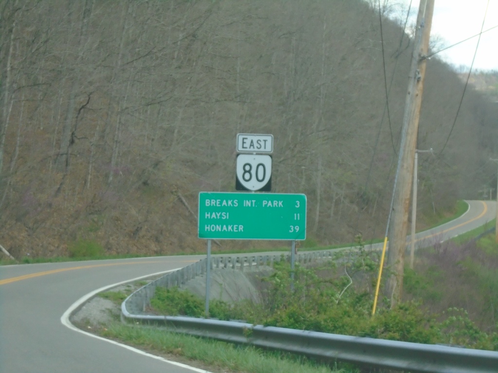
VA-80 East - Distance Marker
Distance marker on VA-80 east. Distance to Breaks Interstate Park, Haysi, and Honaker.
Taken 03-31-2024
 Haysi
Buchanan County
Virginia
United States
Haysi
Buchanan County
Virginia
United States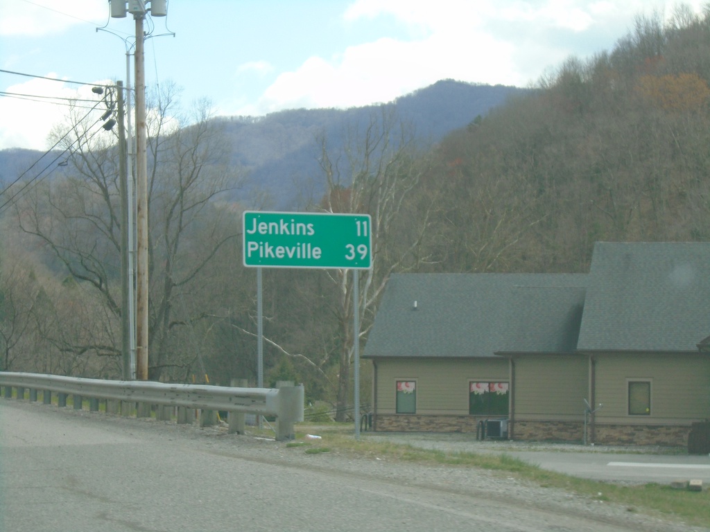
US-119 North - Distance Marker
Distance marker on US-119 north. Distance to Jenkins and Pikeville.
Taken 03-31-2024
Whitesburg
Letcher County
Kentucky
United States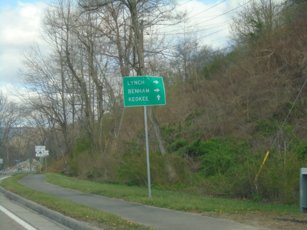
VA-68 West at VA-160
VA-68 West at VA-160. Continue west on VA-68 to Keokee; use VA-160 West to Lynch (KY) and Benham (KY).
Taken 03-31-2024

 Appalachia
Wise County
Virginia
United States
Appalachia
Wise County
Virginia
United States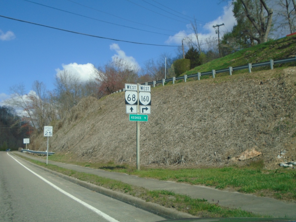
VA-68 West Approaching VA-160 West
VA-68 West approaching VA-160 West. Distance marker to Keokee.
Taken 03-31-2024
Appalachia
Wise County
Virginia
United States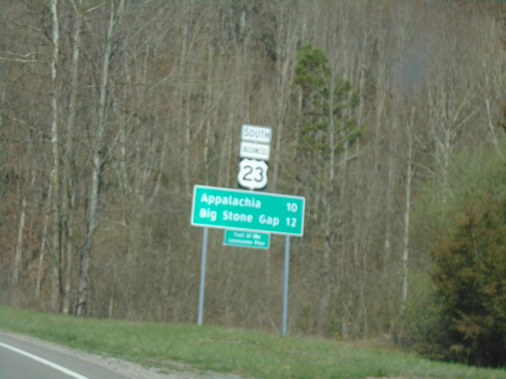
Bus. US-23 South - Distance Marker
Distance Marker on Bus. US-23 South. Distance to Appalachia and Big Stone Gap.
Taken 03-31-2024
 Norton
Wise County
Virginia
United States
Norton
Wise County
Virginia
United States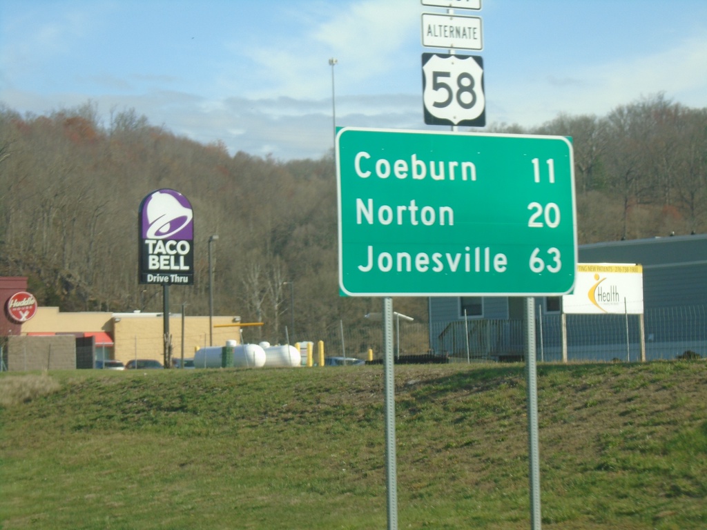
US-58 Alt. West - Distance Marker
Distance marker on US-58 Alt. West. Distance to Coeburn, Norton, and Jonesville.
Taken 03-31-2024
 Saint Paul
Russell County
Virginia
United States
Saint Paul
Russell County
Virginia
United States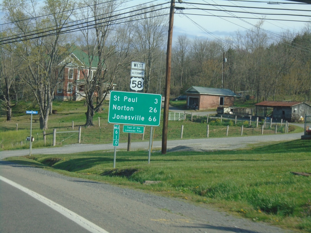
Alt. US-58 West - Distance Marker
Distance marker on Alt. US-58 West. Distance to St Paul, Norton, and Jonesville.
Taken 03-31-2024
Castlewood
Russell County
Virginia
United States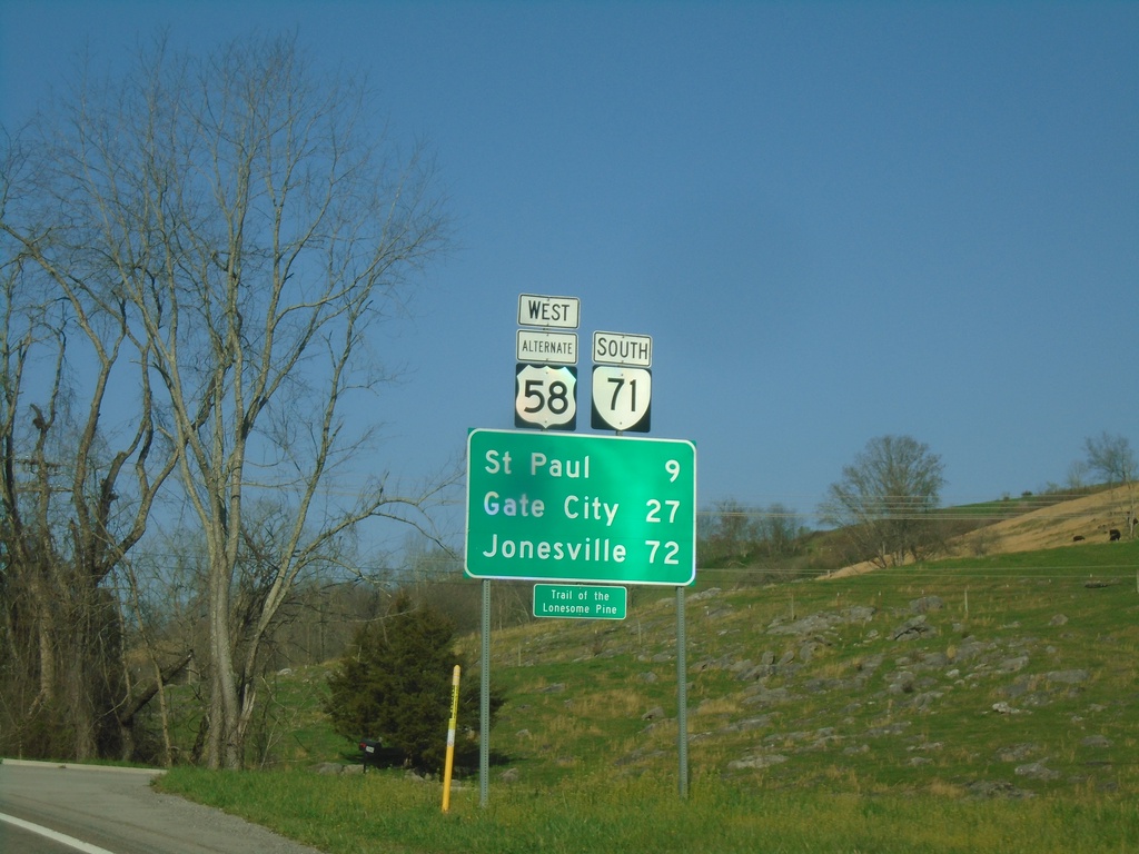
Alt. US-58 West/VA-71 South - Distance Marker
Distance Marker on Alt. US-58 West/VA-71 South. Distance to St. Paul, Gate City, and Jonesville.
Taken 03-31-2024
 Castlewood
Russell County
Virginia
United States
Castlewood
Russell County
Virginia
United States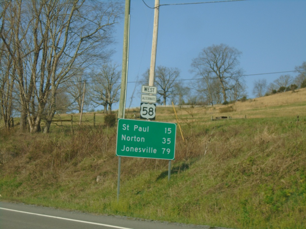
Alt. US-58 West - Distance Marker
Distance marker on Alt. US-58 West. Distance to St. Paul, Norton, and Jonesville.
Taken 03-31-2024
Lebanon
Russell County
Virginia
United States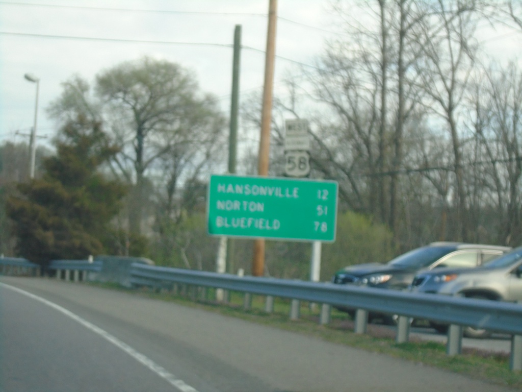
US-19 North/Alt. US-58 West - Distance Marker
Distance Marker on US-19 North/Alt. US-58 West. Distance to Hansonville, Norton, and Bluefield.
Taken 03-31-2024
 Abingdon
Washington County
Virginia
United States
Abingdon
Washington County
Virginia
United States
NC-194 South - Distance Marker
Distance marker on NC-194 south. Distance to Jefferson.
Taken 03-31-2024
 Grassy Creek
Ashe County
North Carolina
United States
Grassy Creek
Ashe County
North Carolina
United States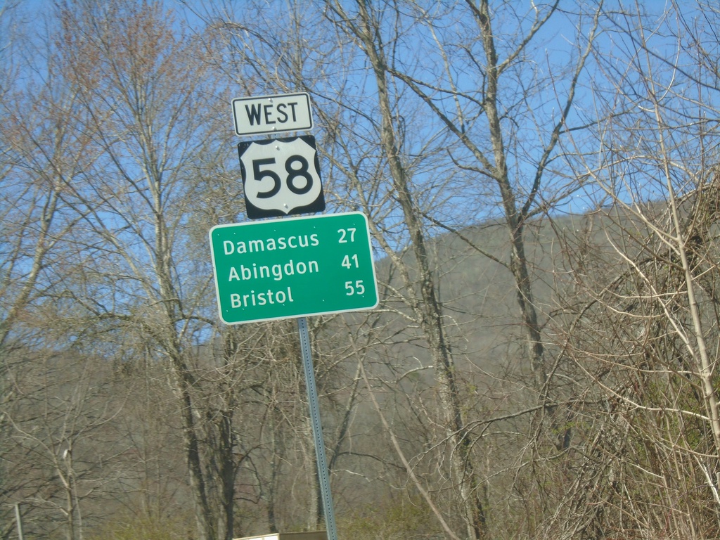
US-58 West - Distance Marker
Distance marker on US-58 west. Distance to Damascus, Abingdon, and Bristol.
Taken 03-30-2024
Mouth of Wilson
Grayson County
Virginia
United States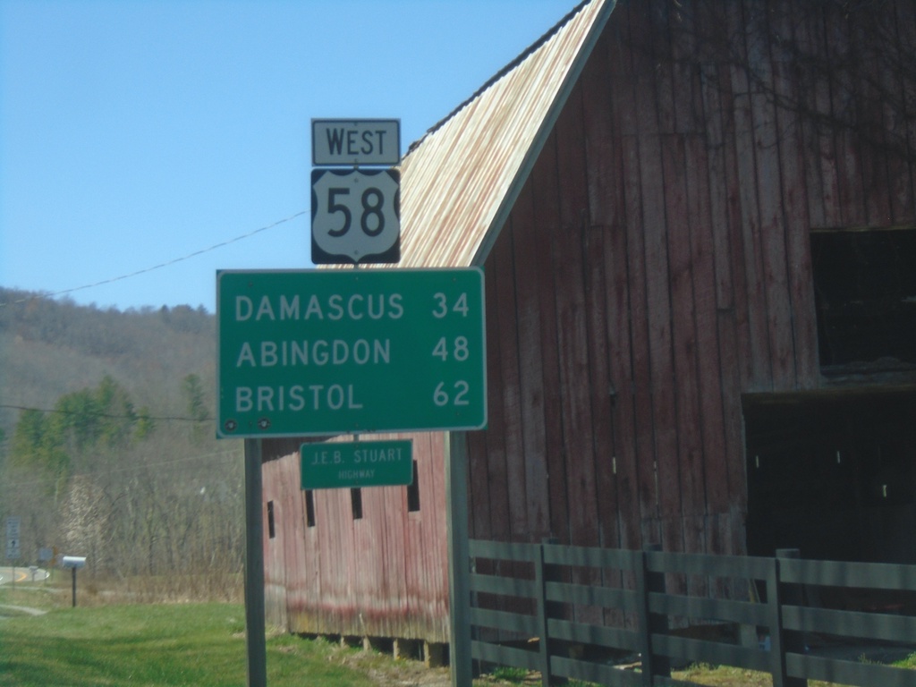
US-58 West - Distance Marker
Distance marker on US-58 west. Distance to Damascus, Abingdon, and Bristol.
Taken 03-30-2024
Mouth of Wilson
Grayson County
Virginia
United States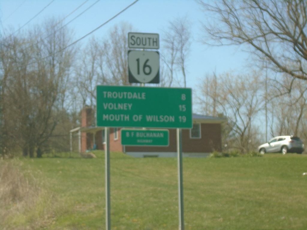
VA-16 South - Distance Marker
Distance marker on VA-16 south. Distance to Troutdale, Volney, and Mouth of Wilson.
Taken 03-30-2024
 Sugar Grove
Smyth County
Virginia
United States
Sugar Grove
Smyth County
Virginia
United States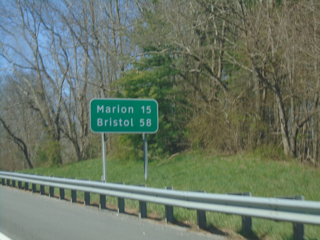
I-81 South - Distance Marker
Distance marker on I-81 south. Distance to Marion, and Bristol.
Taken 03-30-2024
 Rural Retreat
Wythe County
Virginia
United States
Rural Retreat
Wythe County
Virginia
United States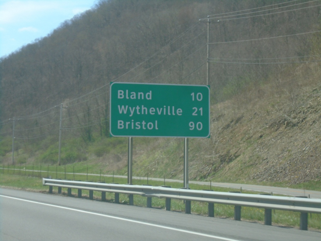
I-77 South - Distance Marker
Distance marker on I-77 south. Distance to Bland, Wytheville, and Bristol (via I-81 south).
Taken 03-30-2024
 Rocky Gap
Bland County
Virginia
United States
Rocky Gap
Bland County
Virginia
United States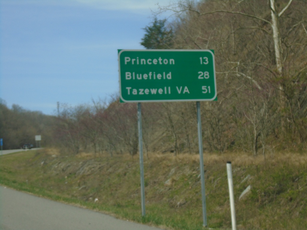
US-460 West - Distance Marker
Distance marker on US-460 west. Distance to Princeton, Bluefield, and Tazewell, VA.
Taken 03-30-2024
Princeton
Mercer County
West Virginia
United States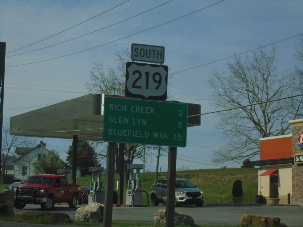
US-219 South - Distance Marker
Distance marker on US-219 south. Distance to Rich Creek, Glen Lyn, and Bluefield, WV.
Taken 03-30-2024
 Rich Creek
Giles County
Virginia
United States
Rich Creek
Giles County
Virginia
United States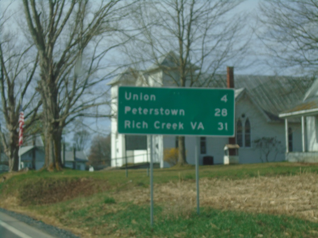
US-219 South/WV-3 East - Distance Marker
Distance Marker on US-219 South/WV-3 East. Distance to Union, Peterstown, and Rich Creek, VA.
Taken 03-30-2024
 Sinks Grove
Monroe County
West Virginia
United States
Sinks Grove
Monroe County
West Virginia
United States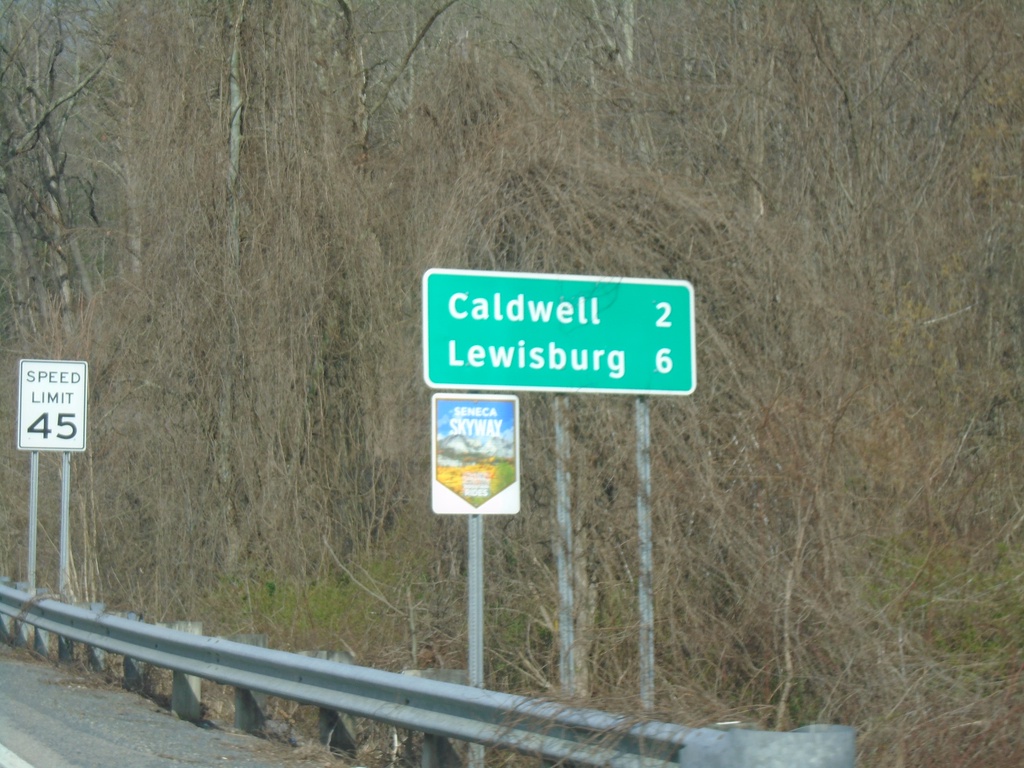
US-60 West - Distance Marker
Distance marker on US-60 west. Distance to Caldwell and Lewisburg. US-60 is part of the Seneca Skyway Mountain Ride.
Taken 03-30-2024
 Caldwell
Greenbrier County
West Virginia
United States
Caldwell
Greenbrier County
West Virginia
United States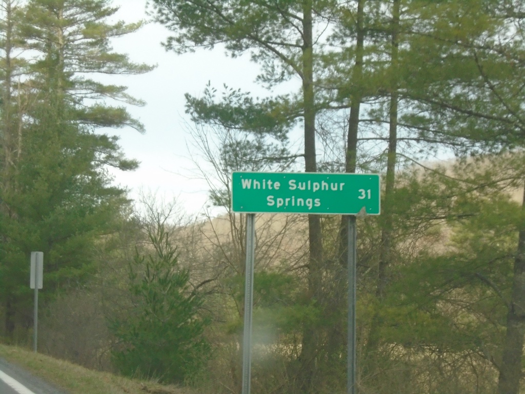
WV-92 South - Distance Marker
Distance marker on WV-92 south. Distance to White Sulphur Springs.
Taken 03-30-2024
 Marlinton
Pocahontas County
West Virginia
United States
Marlinton
Pocahontas County
West Virginia
United States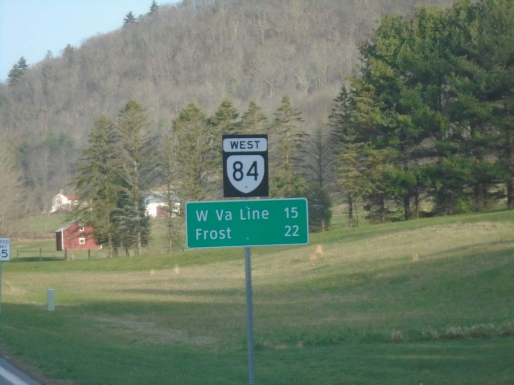
VA-84 West - Distance Marker
Distance marker on VA-84 west. Distance to West Virginia Line and Frost, WV.
Taken 03-30-2024
 Monterey
Highland County
Virginia
United States
Monterey
Highland County
Virginia
United States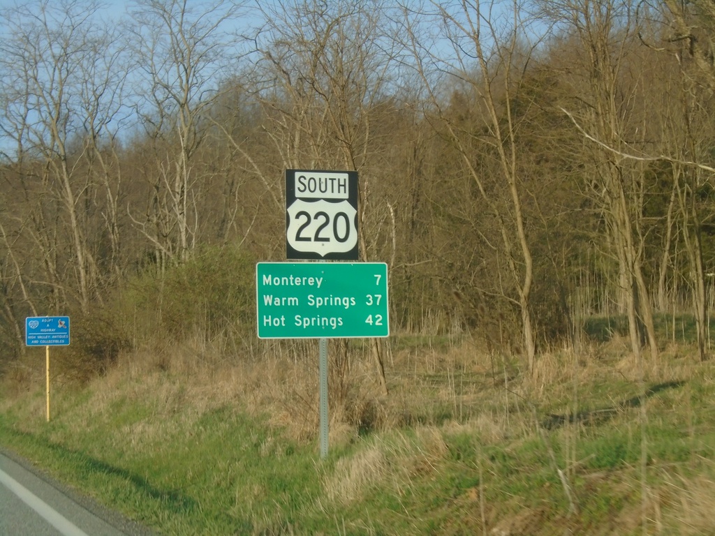
US-220 South - Distance Marker
Distance marker on US-220 south. Distance to Monterey, Warm Springs, and Hot Springs. This is the first distance marker southbound in Virginia. Most of the highway shields in Highland County seem to have a combined shield and banner into one assembly.
Taken 03-30-2024
 Monterey
Highland County
Virginia
United States
Monterey
Highland County
Virginia
United States