Signs Tagged With Freeway Junction
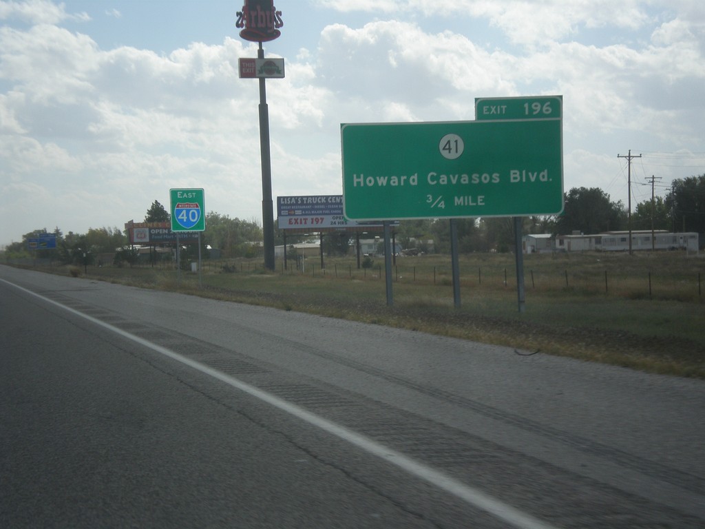
I-40 East - Exit 196
I-40 East approaching Exit 196 - NM-41/Howards Cavasos Blvd. The I-40 sign in the background is pretty common on I-40 east out of Albuquerque.
Taken 10-10-2013

 Moriarty
Torrance County
New Mexico
United States
Moriarty
Torrance County
New Mexico
United States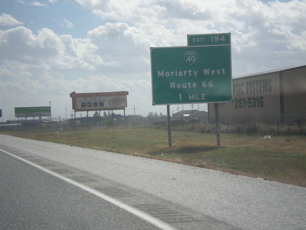
I-40 East Approaching Exit 194
I-40 east approaching Exit 194 - BL-40/Moriarty West/Route 66.
Taken 10-10-2013
 Moriarty
Torrance County
New Mexico
United States
Moriarty
Torrance County
New Mexico
United States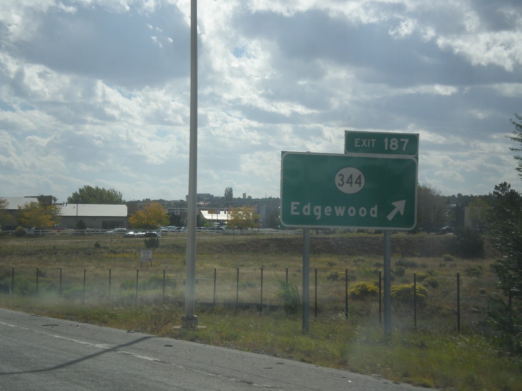
I-40 East - Exit 187
I-40 east at Exit 187 - NM-344/Edgewood.
Taken 10-10-2013
 Edgewood
Santa Fe County
New Mexico
United States
Edgewood
Santa Fe County
New Mexico
United States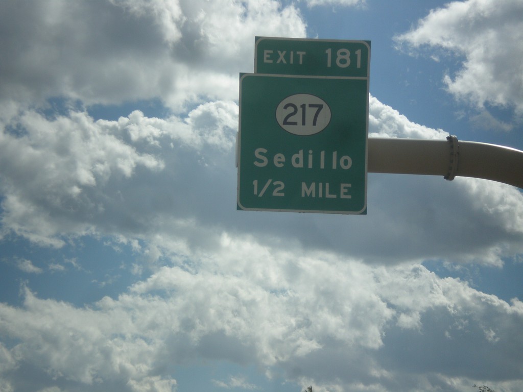
I-40 East - Exit 181
I-40 east approaching Exit 181 - NM-217/Sedillo.
Taken 10-10-2013
 Tijeras
Bernalillo County
New Mexico
United States
Tijeras
Bernalillo County
New Mexico
United States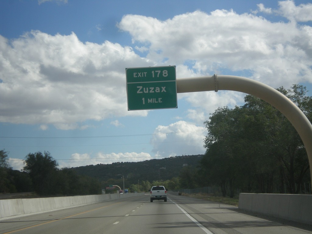
I-40 East - Exit 178
I-40 east at Exit 178 - Zuzax.
Taken 10-10-2013
Tijeras
Bernalillo County
New Mexico
United States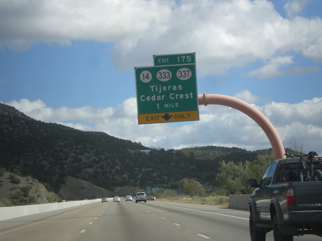
I-40 East - Exit 175
I-40 east at Exit 175 - NM-14/NM-333/NM-337/Tijeras/Cedar Crest. Use NM-14 for the Turquoise Trail National Scenic Byway and the Sandia Crest Ski Area.
Taken 10-10-2013


 Cedar Crest
Bernalillo County
New Mexico
United States
Cedar Crest
Bernalillo County
New Mexico
United States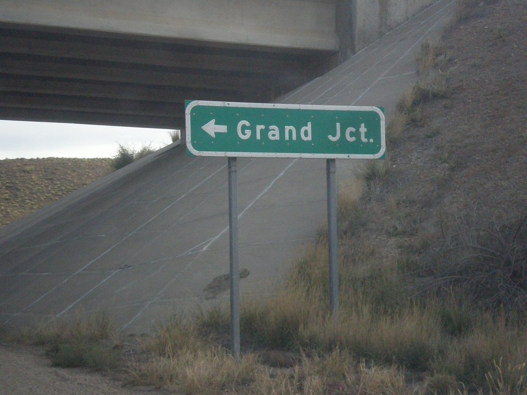
I-70 East Onramp to Grand Junction
I-70 East Onramp to Grand Junction (Colorado) at Exit 187.
Taken 10-07-2013


 Thompson Springs
Grand County
Utah
United States
Thompson Springs
Grand County
Utah
United States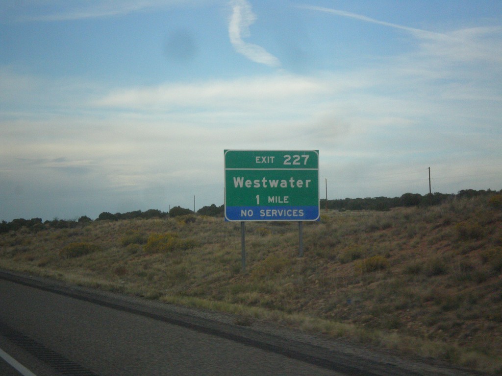
I-70 East - Exit 227
I-70 east at Exit 227 - Westwater. This is the last exit along I-70 in Utah. This is also the exit to access the Westwater whitewater run on the Colorado River.
Taken 10-07-2013
Thompson Springs
Grand County
Utah
United States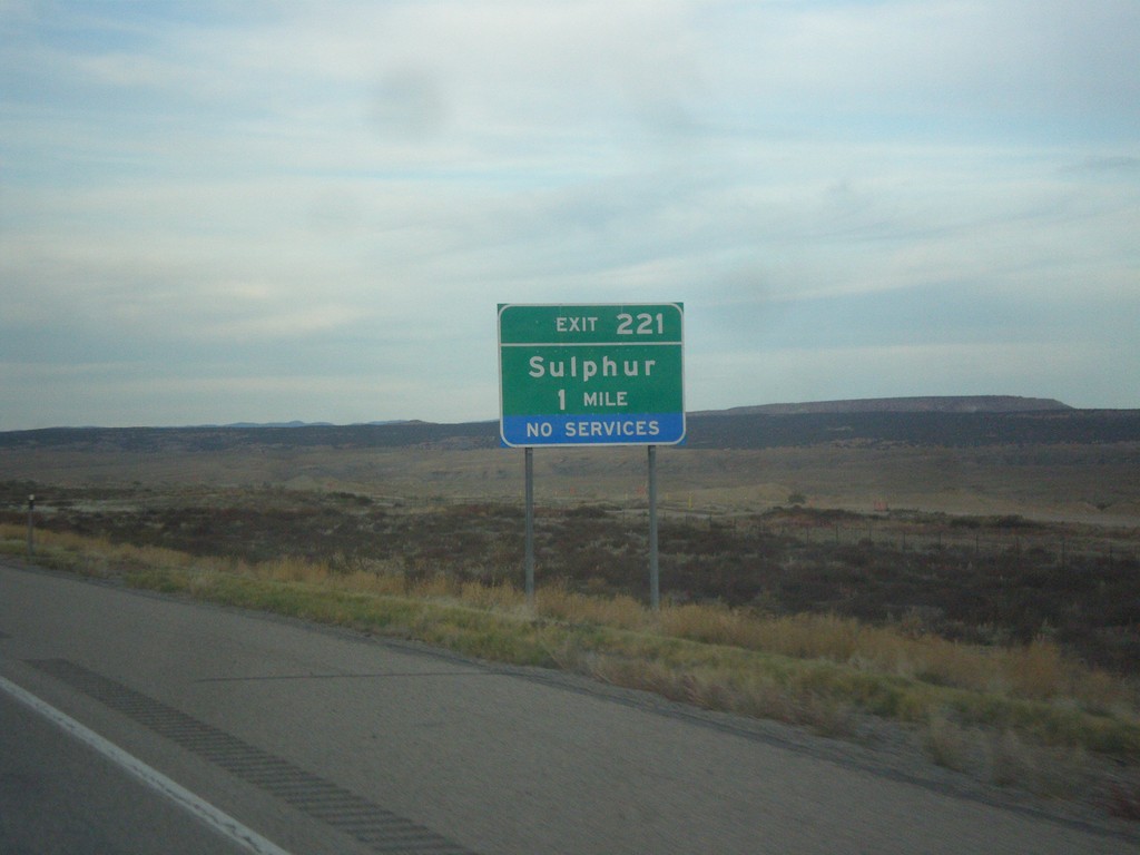
I-70 East - Exit 221
I-70 east approaching Exit 221 - Sulphur.
Taken 10-07-2013
Thompson Springs
Grand County
Utah
United States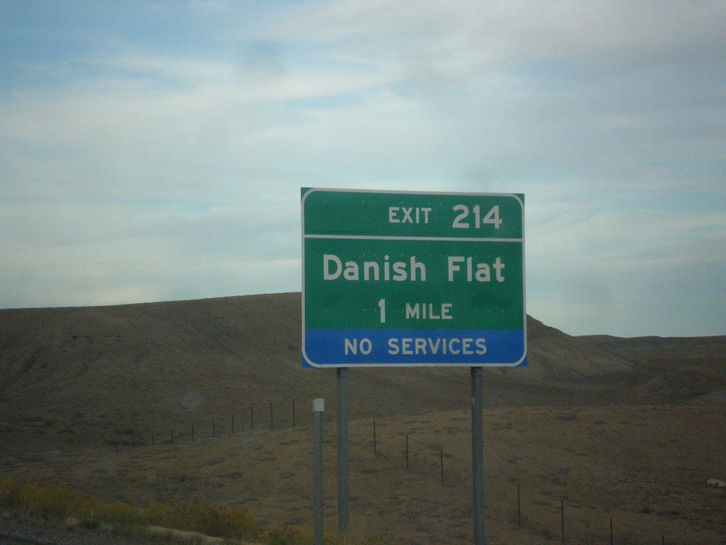
I-70 East - Exit 217
I-70 east approaching Exit 214 - Danish Flat.
Taken 10-07-2013
Thompson Springs
Grand County
Utah
United States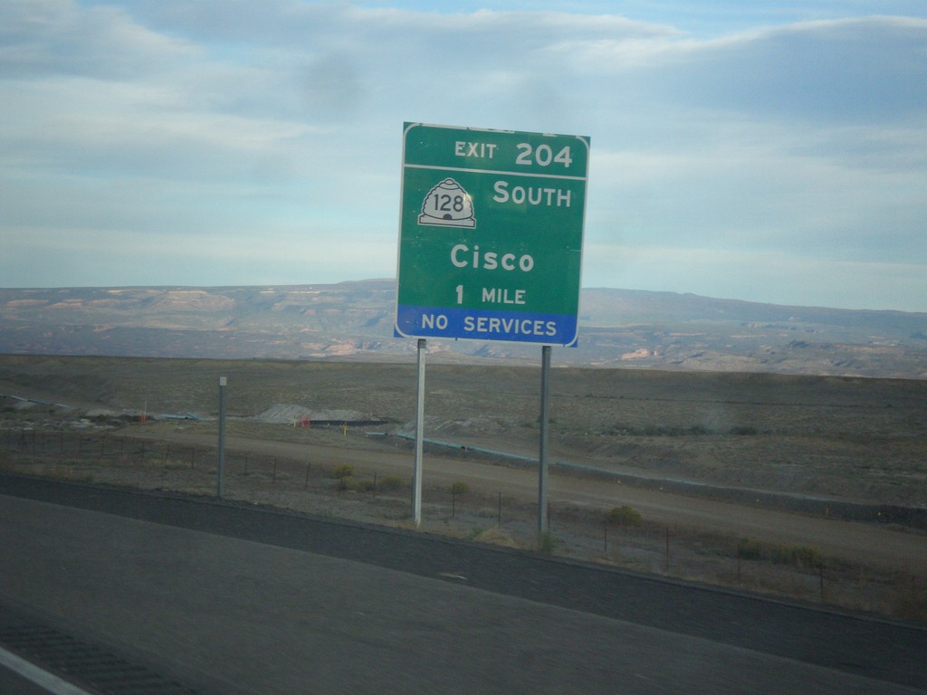
I-70 East - Exit 204
I-70 east approaching Exit 204 - UT-128 South/Cisco.
Taken 10-07-2013
 Thompson Springs
Grand County
Utah
United States
Thompson Springs
Grand County
Utah
United States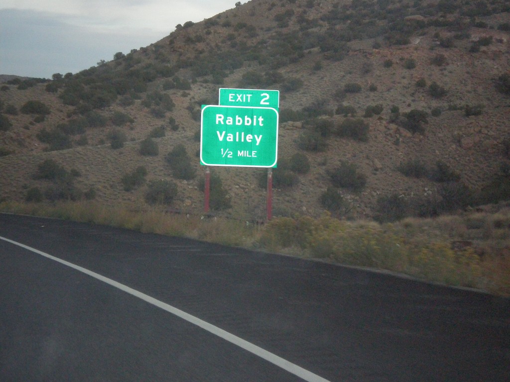
I-70 East - Exit 2
I-70 east at Exit 2 - Rabbit Valley. This is the first exit on I-70 east in Colorado.
Taken 10-07-2013
Mack
Mesa County
Colorado
United States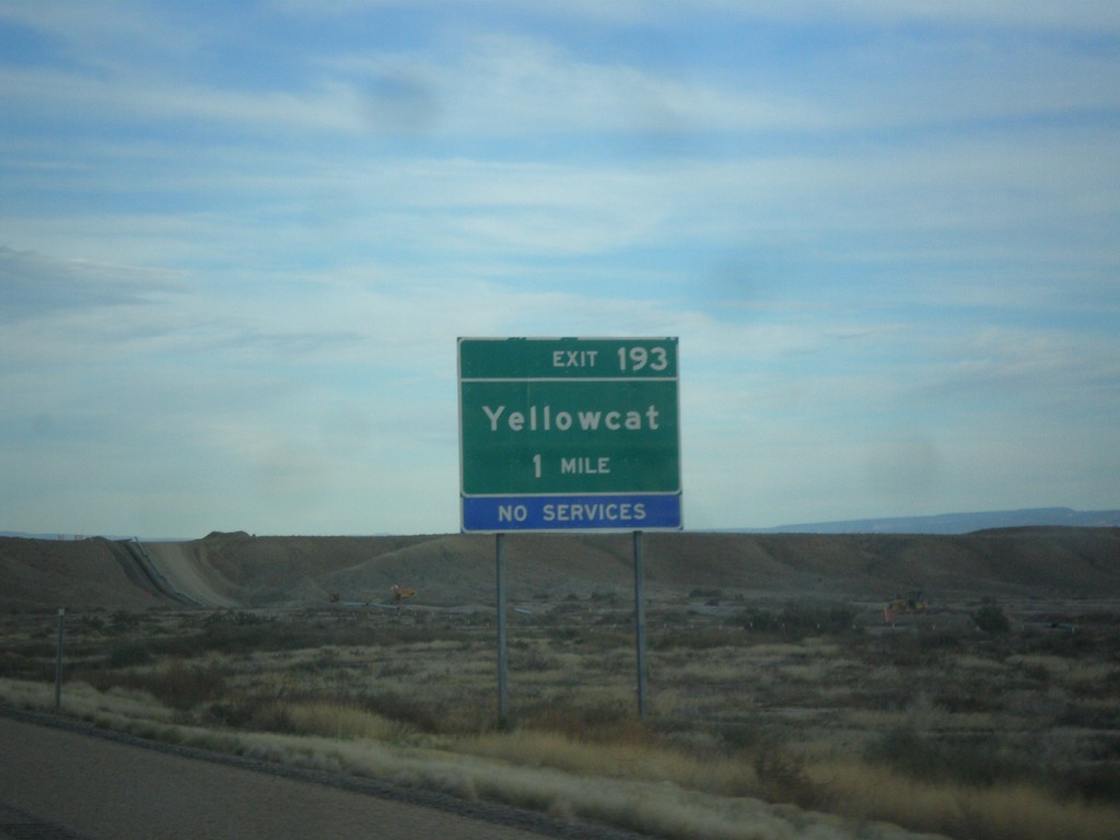
I-70 East - Exit 193
I-70 east approaching Exit 193 - Yellowcat.
Taken 10-07-2013
Thompson Springs
Grand County
Utah
United States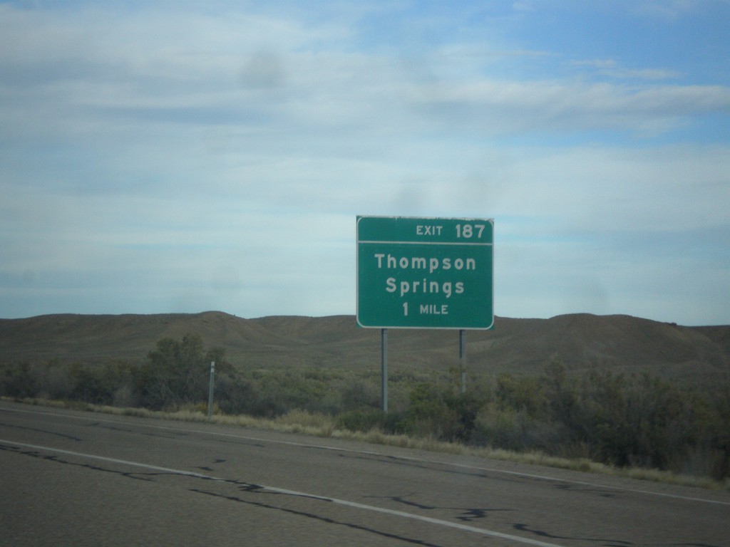
I-70 East - Exit 187
I-70 east approaching Exit 187 - Thompson Springs.
Taken 10-07-2013
Thompson Springs
Grand County
Utah
United States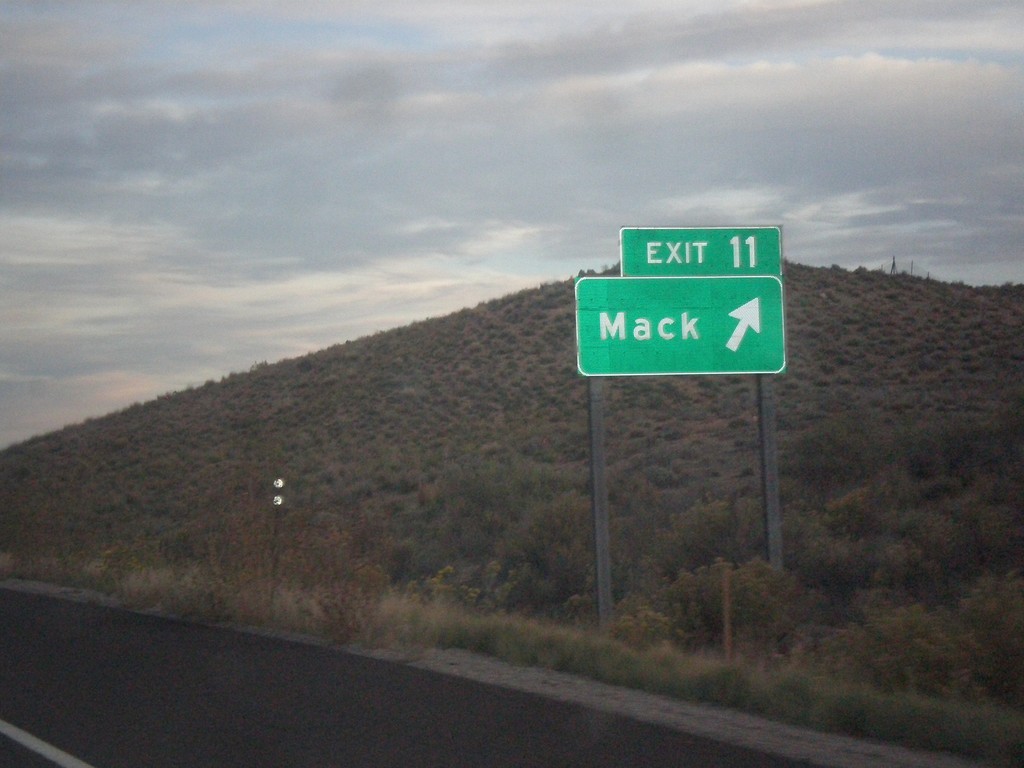
I-70 East - Exit 11
I-70 east at Exit 11 - Mack. US-6 leaves I-70 here, although it is not signed as such on the signage.
Taken 10-07-2013
Mesa County
Colorado
United States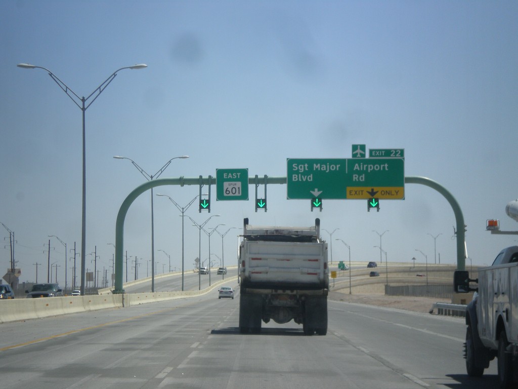
TX-601 Spur East - Exit 22
TX-601 Spur east at Exit 22 - Sargent Major Blvd./Airport Road.
Taken 04-15-2013
 Fort Bliss
El Paso County
Texas
United States
Fort Bliss
El Paso County
Texas
United States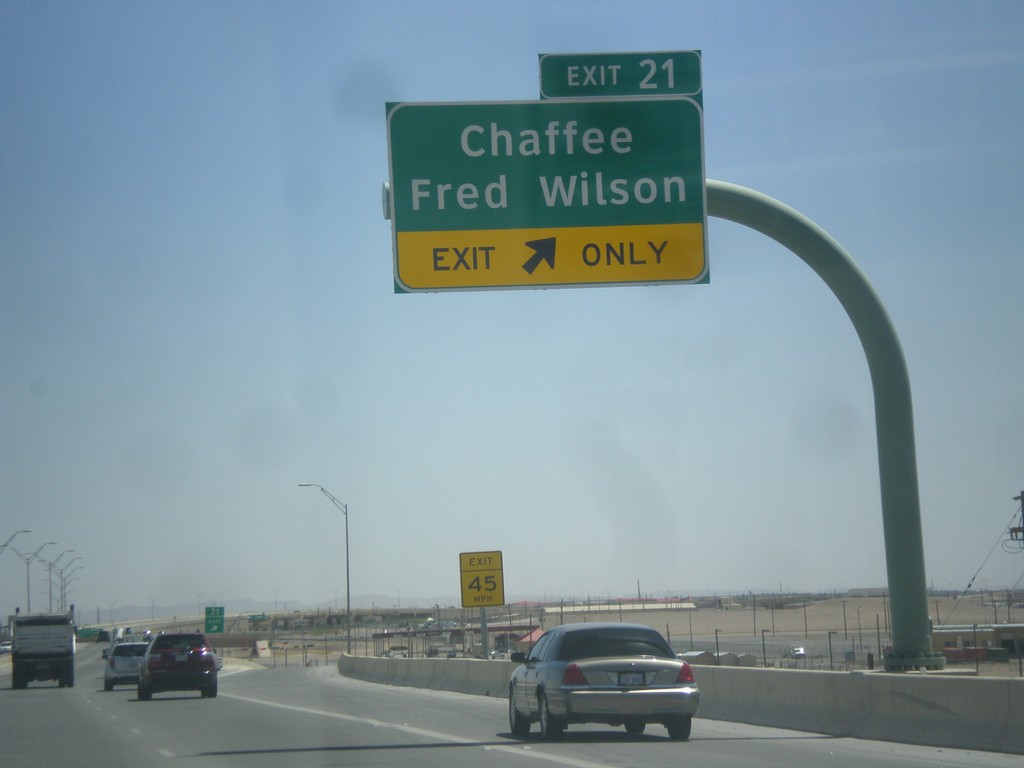
TX-601 Spur East - Exit 21
TX-601 Spur east at Exit 21 - Chaffee/Fred Wilson.
Taken 04-15-2013
El Paso
El Paso County
Texas
United States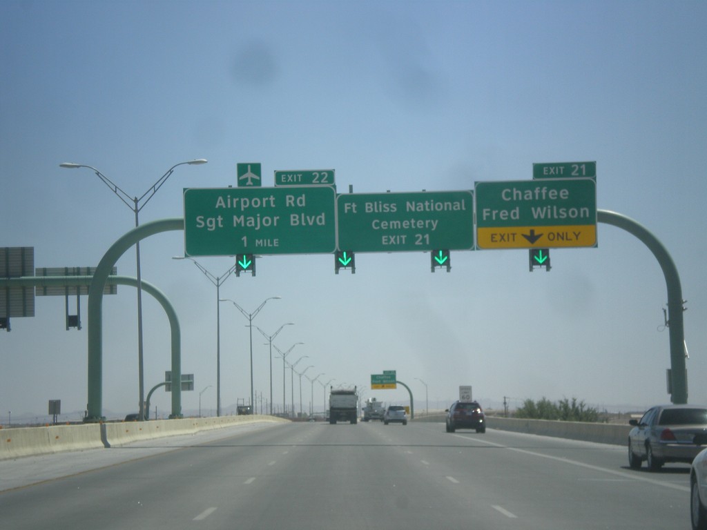
TX-601 Spur East Approaching Exits 21 and 22
TX-601 Spur east approaching Exit 21 - Chaffee/Fred Wilson and Exit 22 - Airport Road/Sargent Major Blvd. Use Exit 21 for Fort Bliss National Cemetery.
Taken 04-15-2013
El Paso
El Paso County
Texas
United States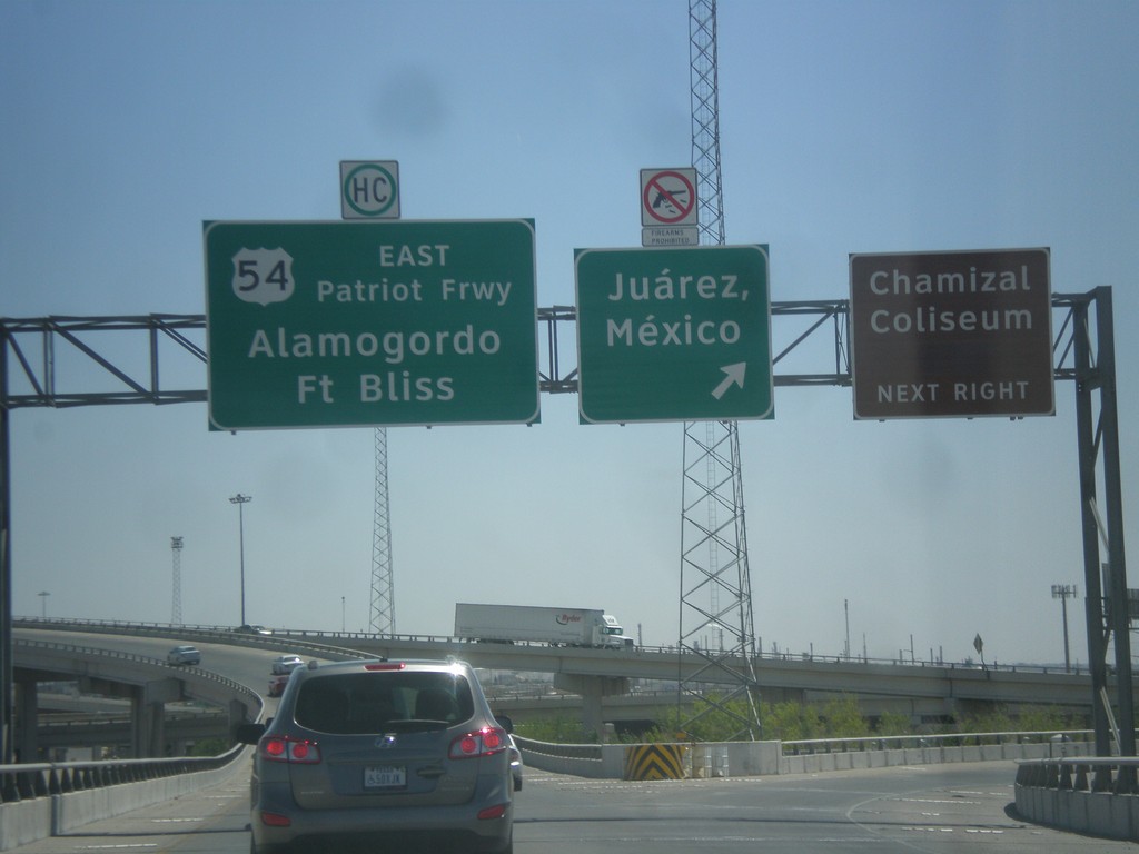
I-10 East - I-110/US-54 Jct.
I-10 east at I-110/US-54 ramps. Use left lane for US-54 East/Alamogordo/Ft. Bliss; use right lane for (I-110 South/US-54 West)Juarez Mexico. Notice that firearms are prohibited in Mexico.
Taken 04-15-2013


 El Paso
 County
Texas
United States
El Paso
El Paso County
Texas
United States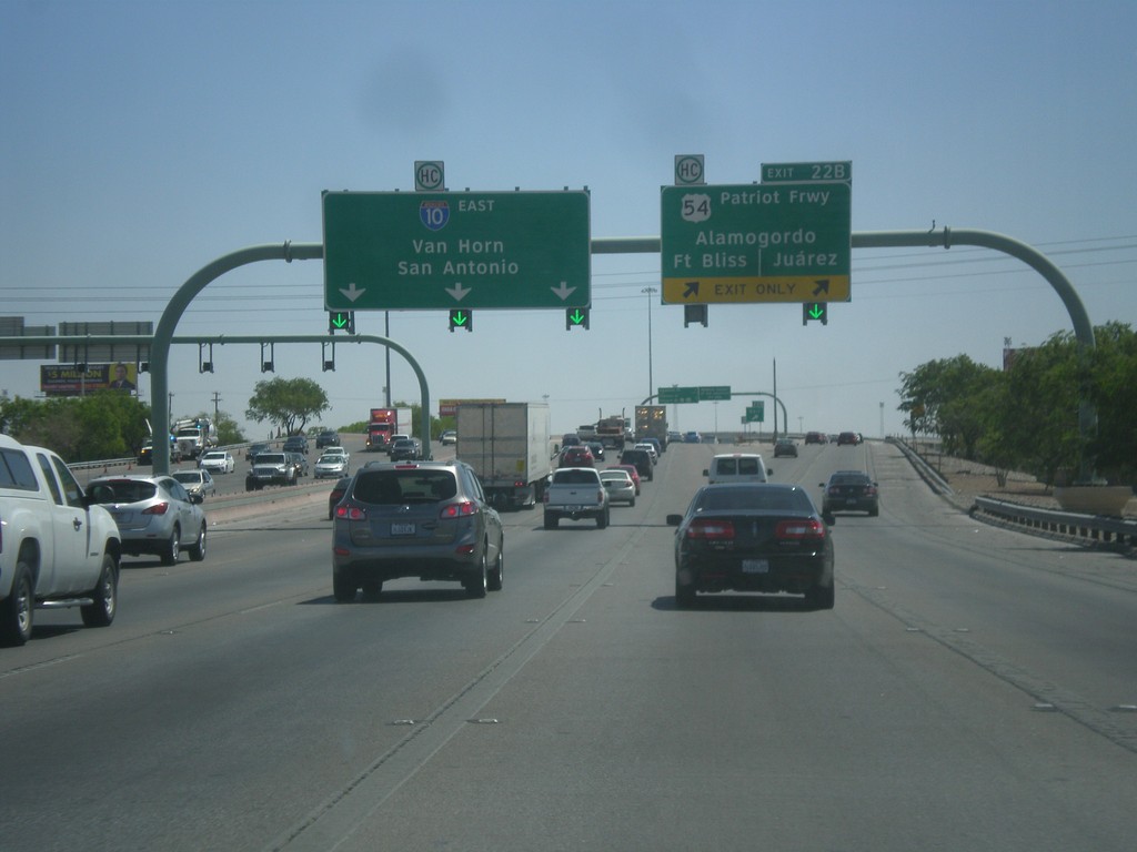
I-10 East - Exit 22B
I-10 east at Exit 22B - US-54/Patriot Freeway/Alamogordo (NM)/Fort Bliss/Juarez (Mexico). Continue east on I-10 for San Antonio and Van Horn.
Taken 04-15-2013
El Paso
El Paso County
Texas
United States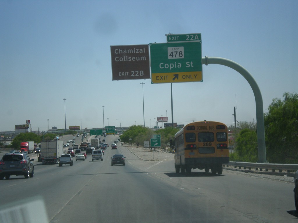
I-10 East - Exit 22A
I-10 East at Exit 22A - TX-478 Loop/Copia St. For the Chamizal Coliseum use Exit 22B (I-110).
Taken 04-15-2013
 El Paso
 County
Texas
United States
El Paso
El Paso County
Texas
United States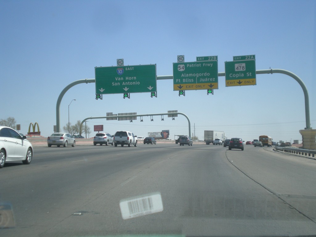
I-10 East - Exits 22A and 22B
I-10 east at Exit 22A - TX-478 Loop/Copia St. Approaching Exit 22B - US-54/Alamogordo (NM)/Fort Bliss/Juarez (Mexico). Continue east on I-10 for San Antonio and Van Horn.
Taken 04-15-2013
El Paso
El Paso County
Texas
United States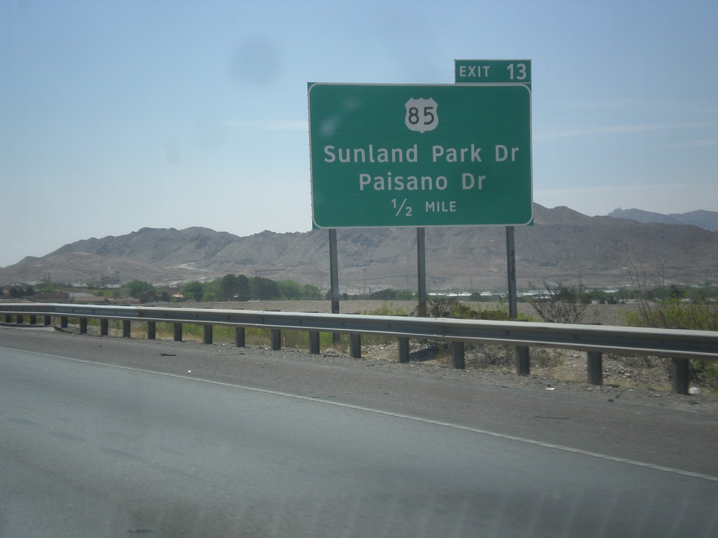
I-10 East Approaching Exit 12
I-10 east approaching Exit 12 - US-85/Sunland Park Drive/Paisano Drive.
Taken 04-15-2013
 El Paso
 County
Texas
United States
El Paso
El Paso County
Texas
United States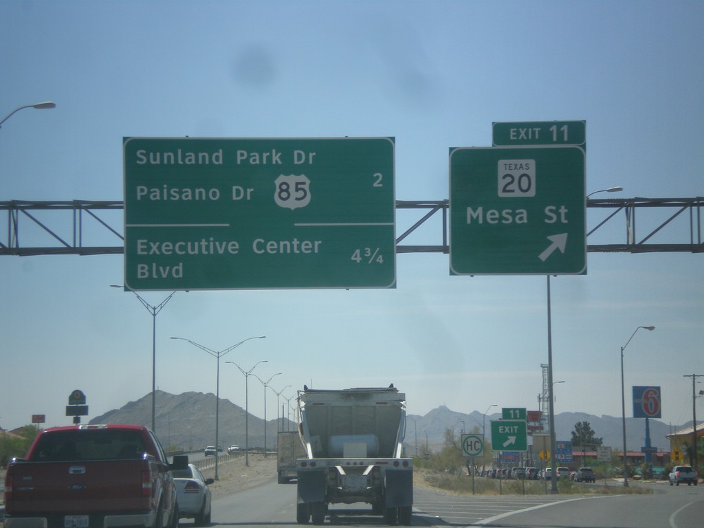
I-10 East - Exit 11
I-10 east at Exit 11 - TX-20/Mesa St. Next exits are - US-85/Sunland Park Drive/Paisano Drive and Executive Center Blvd.
Taken 04-15-2013
 El Paso
 County
Texas
United States
El Paso
El Paso County
Texas
United States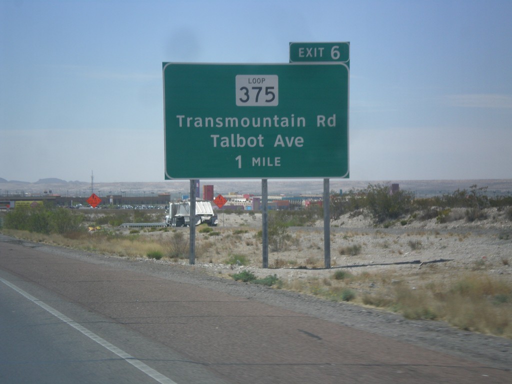
I-10 East Approaching Exit 6
I-10 east approaching Exit 6 - TX-375 Loop/Talbot Ave/Transmountain Road. This is the the northwestern end of the TX-375 Loop, which crosses the Franklin Mountains, and loops around Fort Bliss, before turning into the Border Freeway.
Taken 04-15-2013
 Canutillo
El Paso County
Texas
United States
Canutillo
El Paso County
Texas
United States