Signs Tagged With Freeway Junction
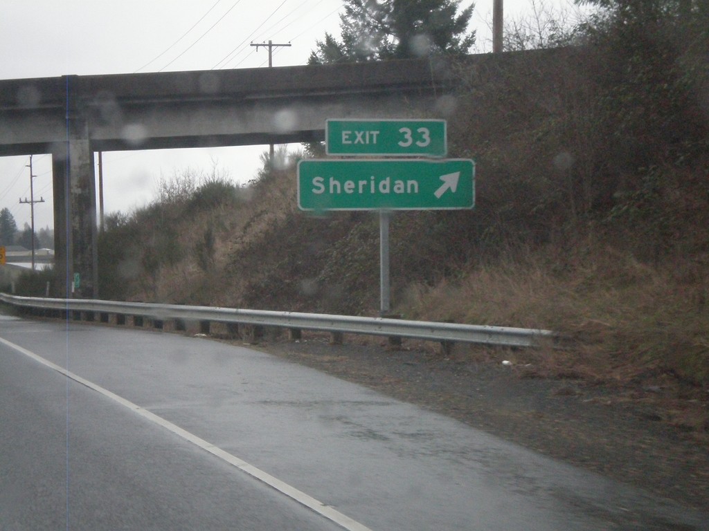
OR-18 East - Exit 33
OR-18 east at Exit 33 - Sheridan. OR-18 becomes a freeway briefly through the town of Sheridan.
Taken 02-21-2012
 Sheridan
Yamhill County
Oregon
United States
Sheridan
Yamhill County
Oregon
United States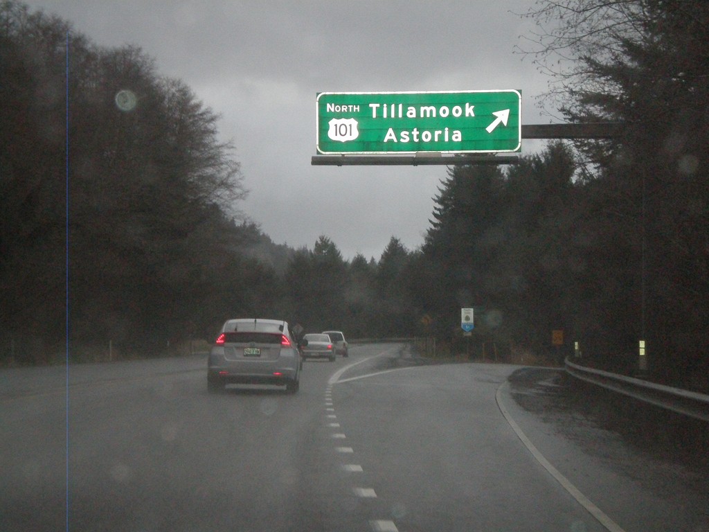
End OR-18 West at US-101
End OR-18 west at US-101. Merge right for US-101 to Tillamook and Astoria.
Taken 02-18-2012
 Lincoln City
Lincoln County
Oregon
United States
Lincoln City
Lincoln County
Oregon
United States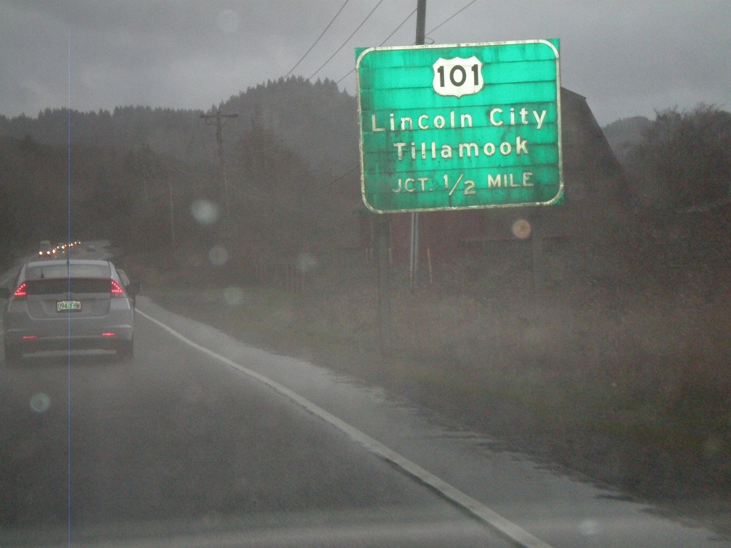
OR-18 West Approaching US-101
OR-18 west approaching US-101. Use US-101 for Lincoln City and Tillamook. This is the western end of OR-18.
Taken 02-18-2012
Otis
Lincoln County
Oregon
United States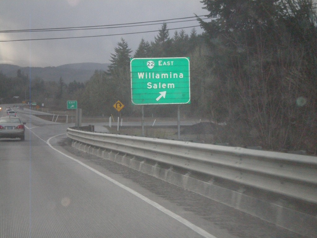
OR-18 West at OR-22
OR-18 west at OR-22 east to Willamina and Salem. OR-22 west joins OR-18 west to Valley Junction.
Taken 02-18-2012
 Sheridan
Polk County
Oregon
United States
Sheridan
Polk County
Oregon
United States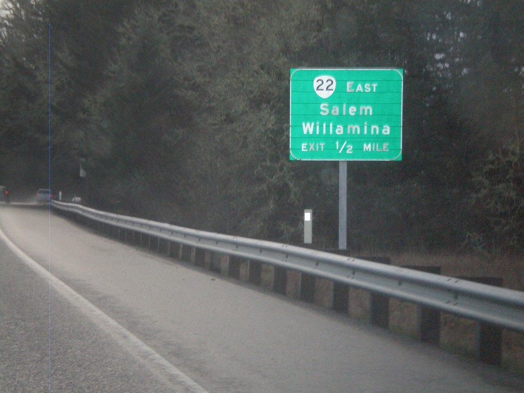
OR-18 West Approaching OR-22
OR-18 west approaching OR-22. Use OR-22 east for Willamina and Salem. OR-22 west joins OR-18 west to Valley Junction.
Taken 02-18-2012
Sheridan
Polk County
Oregon
United States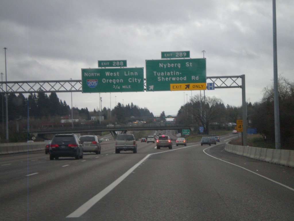
I-5 South - Exits 289 and 286
I-5 south at Exit 289 - Nyberg St./Tualatin-Sherwood Road. Approaching Exit 286 - I-205 North/West Linn/Oregon City.
Taken 02-18-2012

 Tualatin
Washington County
Oregon
United States
Tualatin
Washington County
Oregon
United States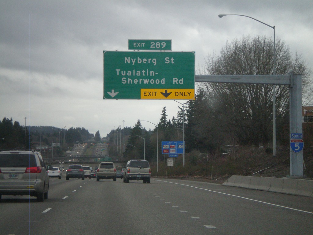
I-5 South Approaching Exit 289
I-5 south approaching Exit 289 - Nyberg St./Tualatin-Sherwood Road. An I-5 south shield is attached to the sign structure.
Taken 02-18-2012
Lake Oswego
Washington County
Oregon
United States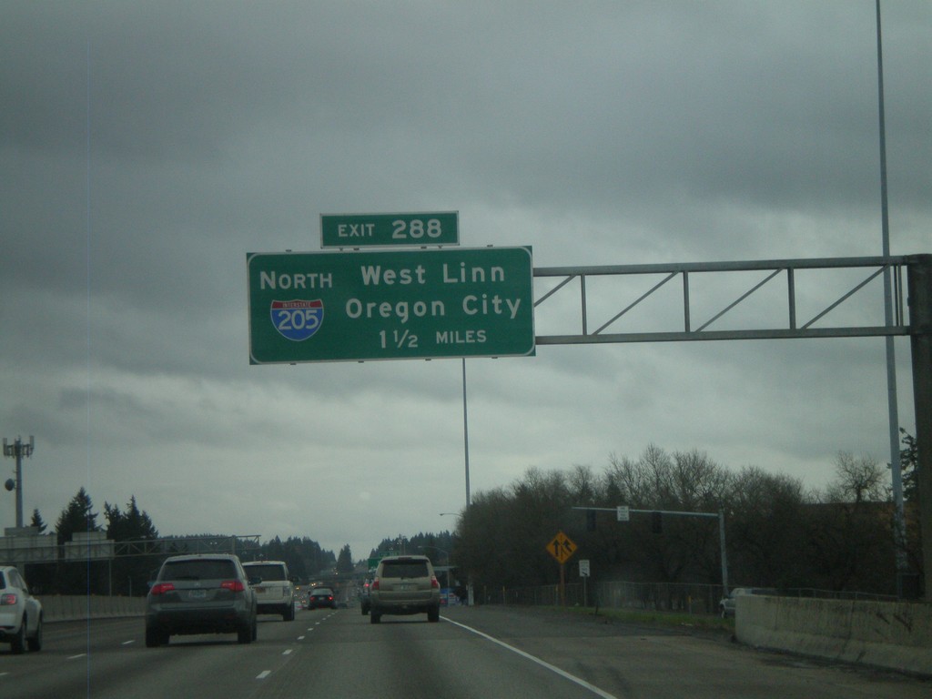
I-5 South Approaching Exit 288
I-5 south approaching Exit 288 - I-205 North/West Linn/Oregon City. I-205 is the beltway around the east side of the Portland metropolitan area. I-205 rejoins I-5 again north of Vancouver, Washington.
Taken 02-18-2012
Portland
Washington County
Oregon
United States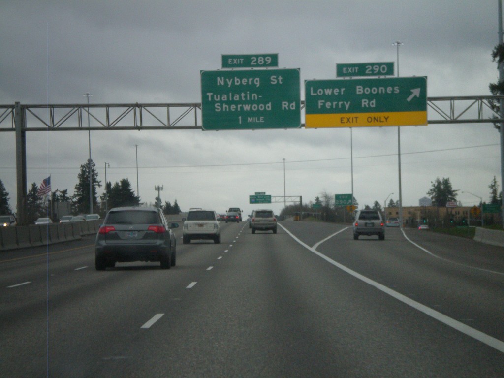
I-5 South - Exits 290 and 289
I-5 south at Exit 290 - Lower Boones Ferry Road. Approaching Exit 289 - Nyberg St./Tualatin-Sherwood Road.
Taken 02-18-2012
Tigard
Washington County
Oregon
United States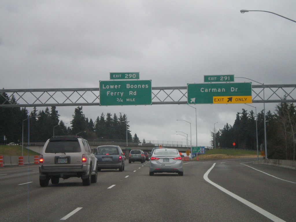
I-5 South - Exits 291 and 290
I-5 south at Exit 291 - Carman Drive. Approaching Exit 290 - Lower Boones Ferry Road.
Taken 02-18-2012
Lake Oswego
Clackamas County
Oregon
United States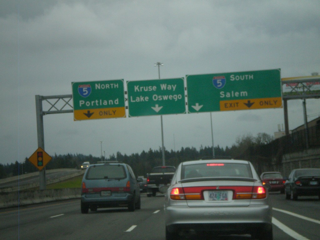
End OR-217 South at I-5
End OR-217 south at I-5. Use right lane for I-5 south to Salem. Use left lane for I-5 north to Portland. Continue ahead for Kruse Way into Lake Oswego. The OR-217 freeway ends here.
Taken 02-18-2012
 Tigard
Washington County
Oregon
United States
Tigard
Washington County
Oregon
United States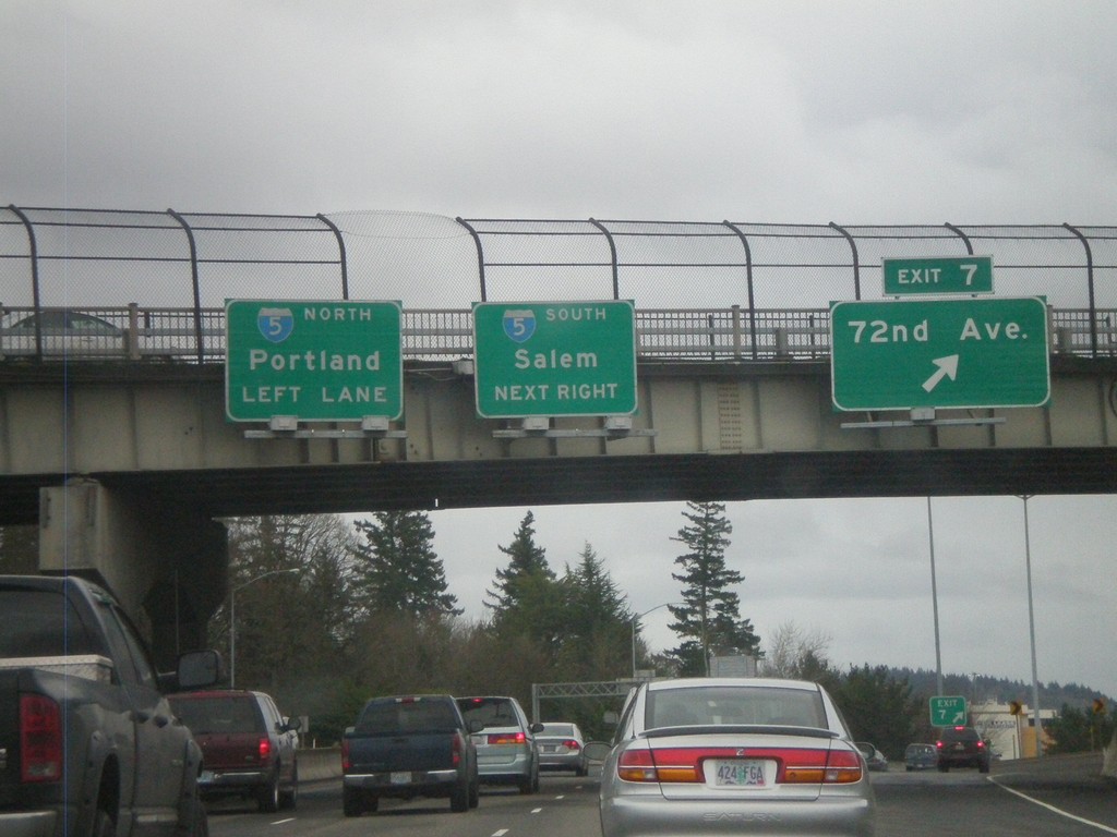
OR-217 South at Exit 7
OR-217 south at Exit 7 - 72nd Ave. Approaching I-5 to Salem and Portland. The OR-217 south freeway ends at I-5.
Taken 02-18-2012
Tigard
Washington County
Oregon
United States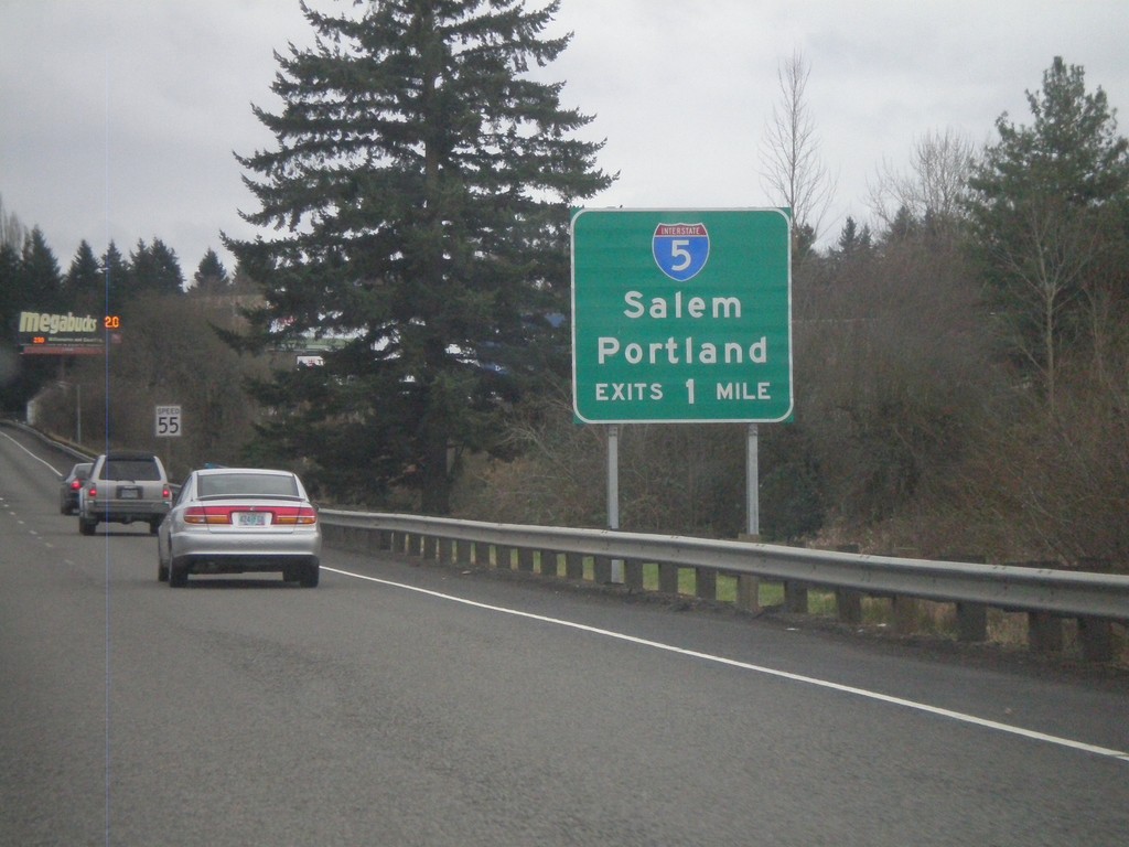
OR-217 South Approaching I-5
OR-217 South approaching I-5 to Salem and Portland.
Taken 02-18-2012
Tigard
Washington County
Oregon
United States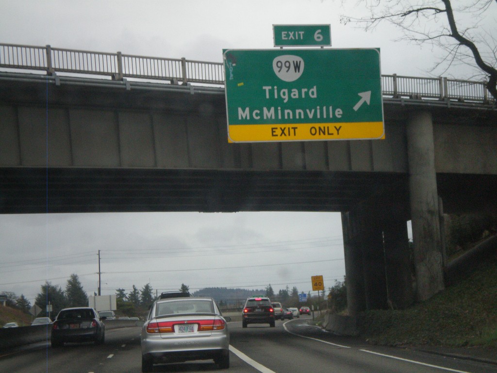
OR-217 South - Exit 6
OR-217 south at Exit 6 - OR-99W/Tigard/McMinnville.
Taken 02-18-2012
 Tigard
Washington County
Oregon
United States
Tigard
Washington County
Oregon
United States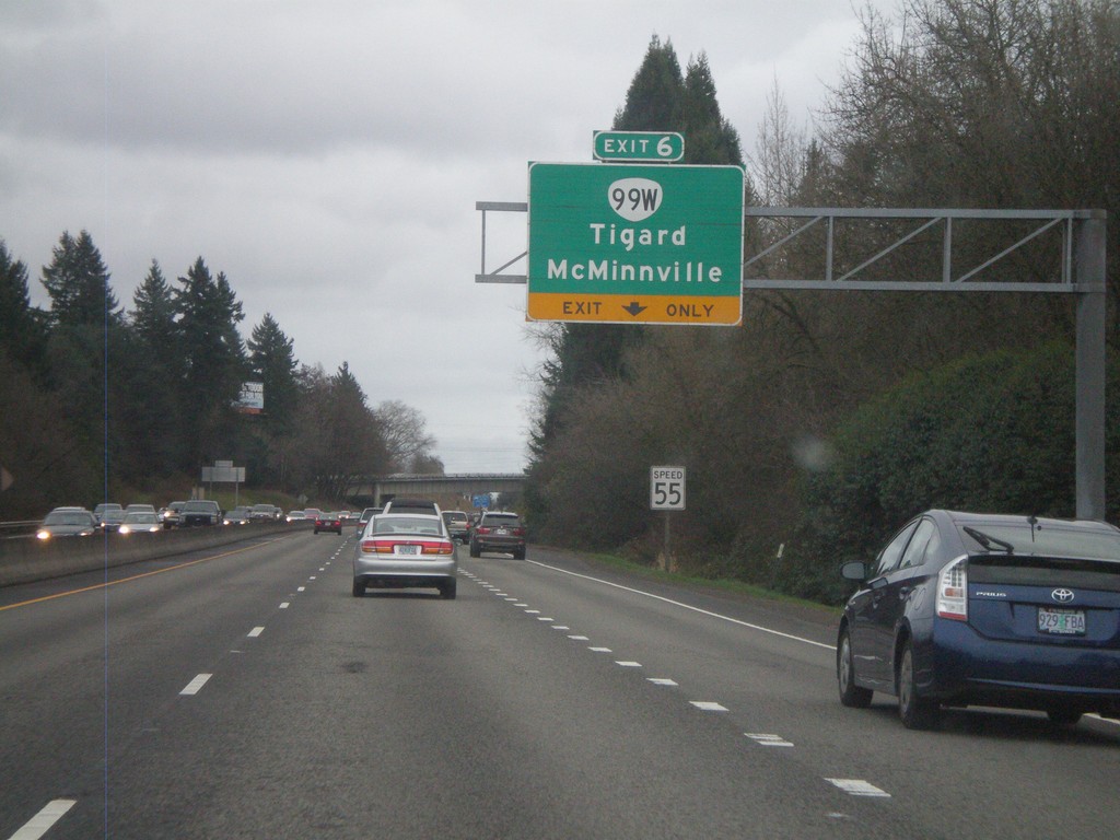
OR-217 South Approaching Exit 6
OR-217 south approaching Exit 6 - OR-99W/McMinnville/Tigard.
Taken 02-18-2012
Portland
Washington County
Oregon
United States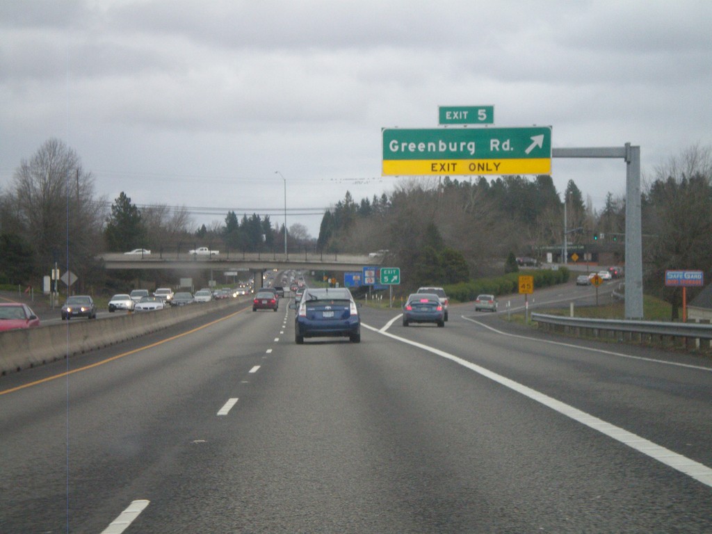
OR-217 South - Exit 5
OR-217 south at Exit 5 - Greenburg Road.
Taken 02-18-2012
Tigard
Washington County
Oregon
United States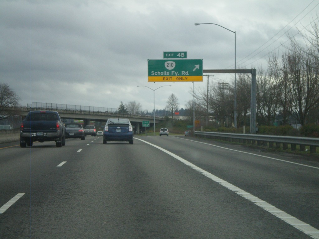
OR-217 South - Exit 4B
OR-217 south at Exit 4B - OR-210/Scholls Ferry Road.
Taken 02-18-2012
 Beaverton
Washington County
Oregon
United States
Beaverton
Washington County
Oregon
United States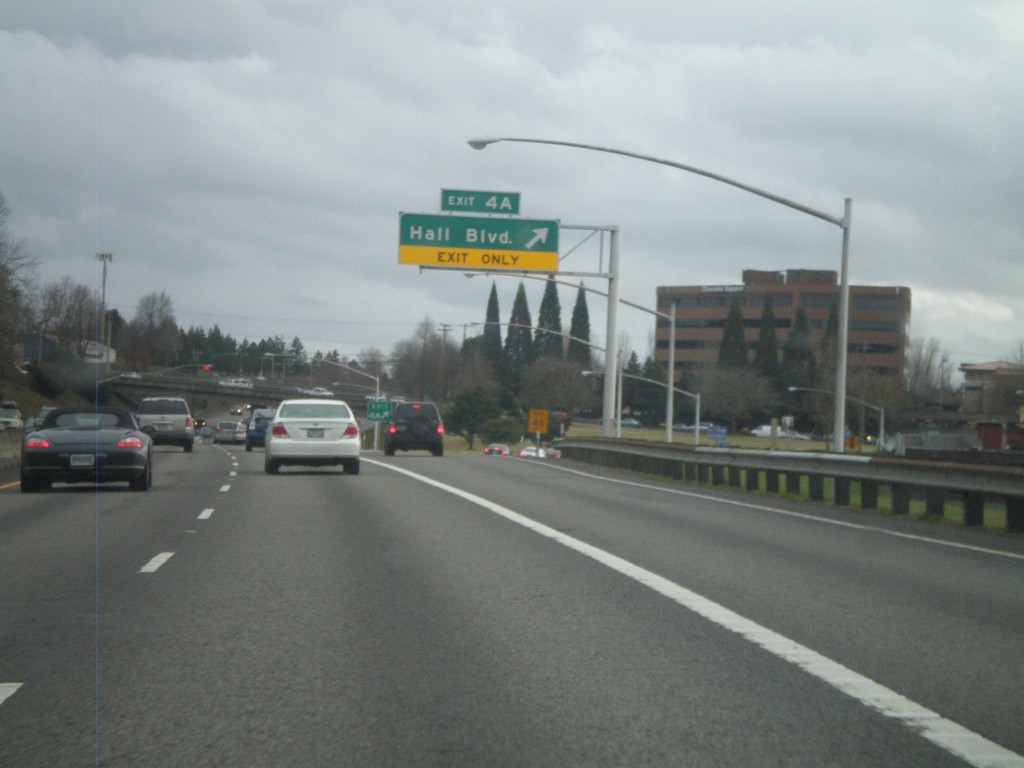
OR-217 South - Exit 4A
OR-217 south at Exit 4A - Hall Blvd.
Taken 02-18-2012
Beaverton
Washington County
Oregon
United States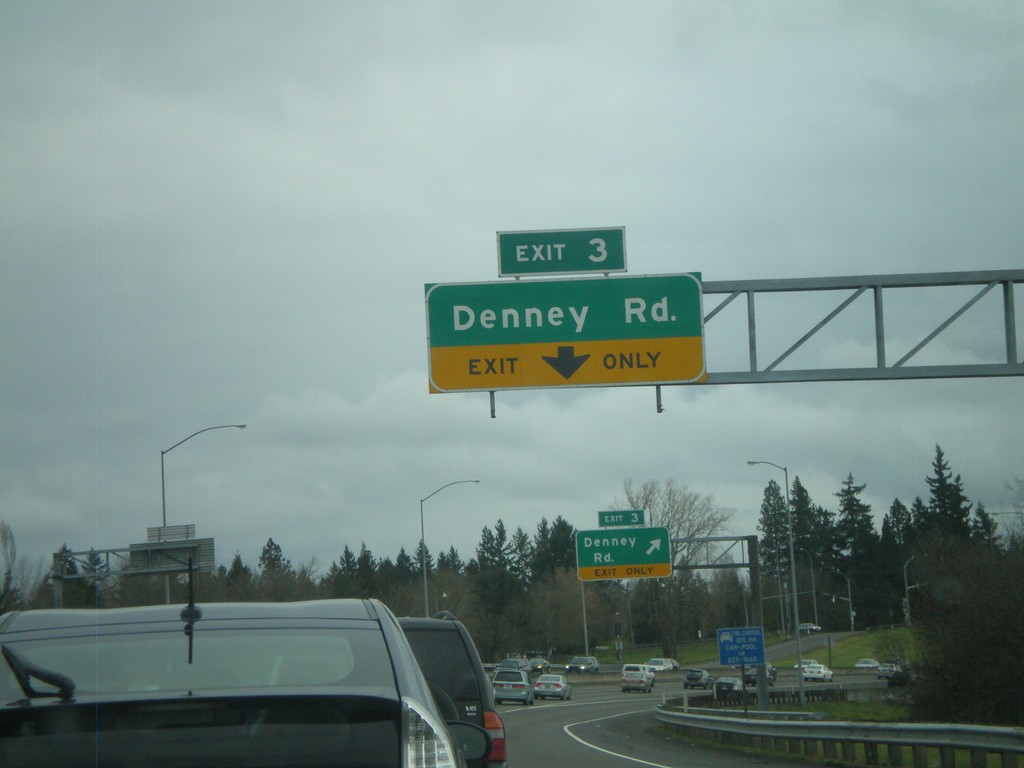
OR-217 South - Exit 3
OR-217 south at Exit 3 - Denney Road.
Taken 02-18-2012
Beaverton
Washington County
Oregon
United States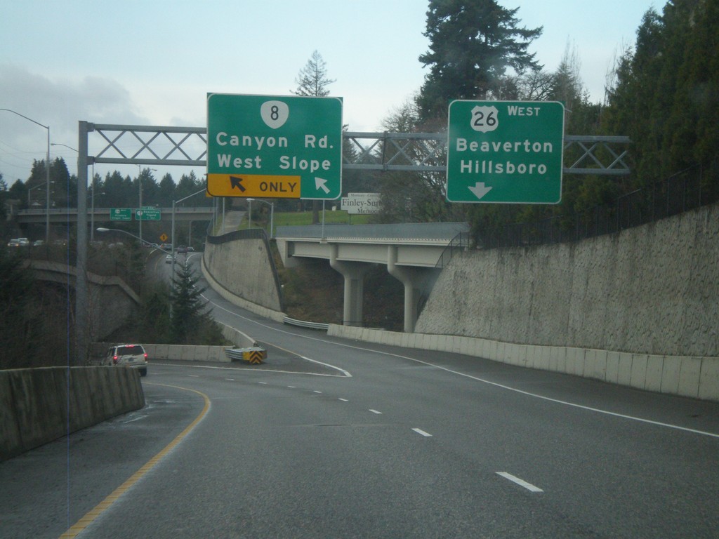
US-26 East Offramp at OR-8
US-26 east offramp at OR-8 split. Use left lane for OR-8 for Canyon Road and West Slope. Use right lane for US-26 West/Beaverton/Hillsboro.
Taken 02-18-2012

 Portland
Washington County
Oregon
United States
Portland
Washington County
Oregon
United States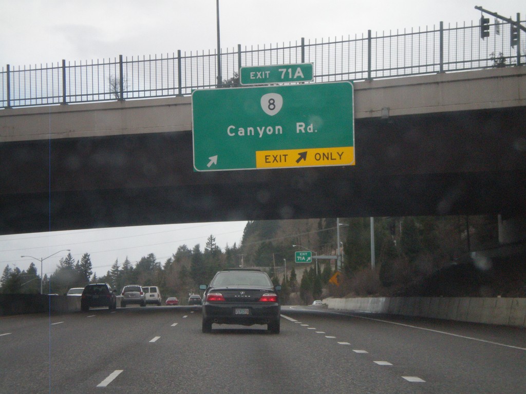
US-26 West - Exit 71A
US-26 west at Exit 71A - OR-8/Canyon Road.
Taken 02-18-2012
Portland
Multnomah County
Oregon
United States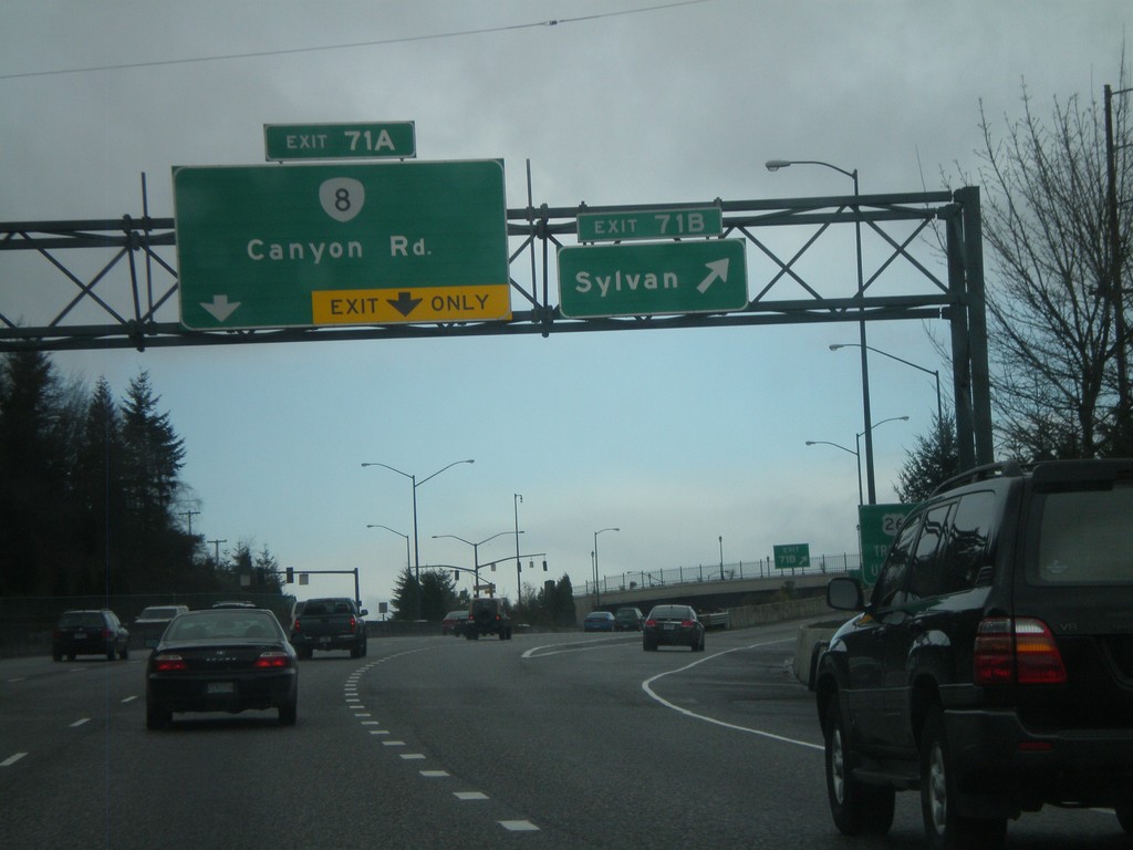
US-26 West - Exits 71B and 71A
US-26 west at Exit 71B - Sylvan. Approaching Exit 71A - OR-8/Canyon Road.
Taken 02-18-2012
Portland
Multnomah County
Oregon
United States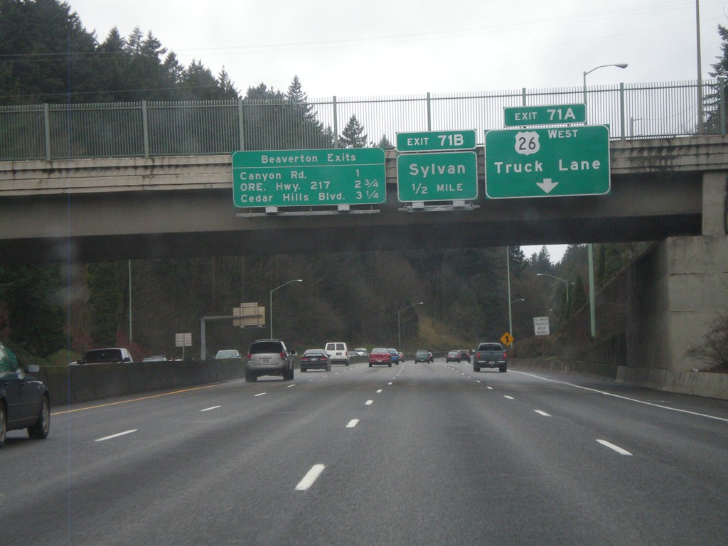
US-26 West - Beaverton Exits and Exits 71AB
US-26 West approaching Exit 71B - Sylvan. Truck traffic, including Exit 71A bound truck traffic, need to use the right truck lane. Also a sign on the bridge lists the Beaverton Exits - Canyon Road, ORE Hwy. 217, and Cedar Hills Road.
Taken 02-18-2012
Portland
Multnomah County
Oregon
United States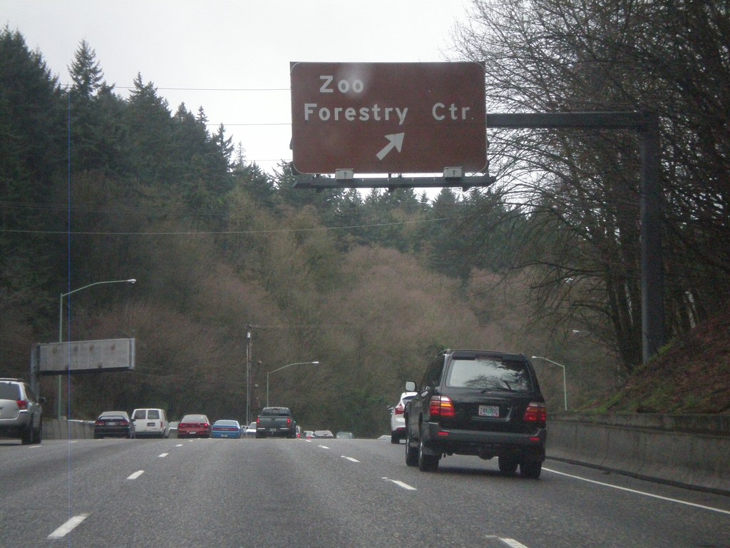
US-26 West - Exit 72
US-26 west at Exit 72 - Zoo/Forestry Center. Access to the Portland Zoo and Washington Park.
Taken 02-18-2012
Portland
Multnomah County
Oregon
United States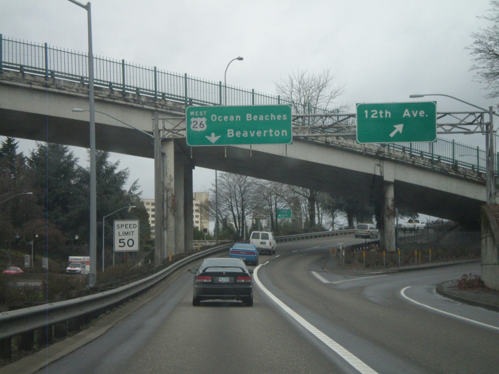
Offramp for I-405 North to US-26 at 12th Ave.
Offramp from I-405 to US-26 west at 12th Ave. interchange. Stay in left lanes for US-26 West/Ocean Beaches/Beaverton. Speed limit is 50 MPH. This speed limit sign is one of the newer style speed limit signs seen on Oregon freeways, with the word LIMIT included.
Taken 02-18-2012
 Portland
Multnomah County
Oregon
United States
Portland
Multnomah County
Oregon
United States