Signs Tagged With Freeway Junction
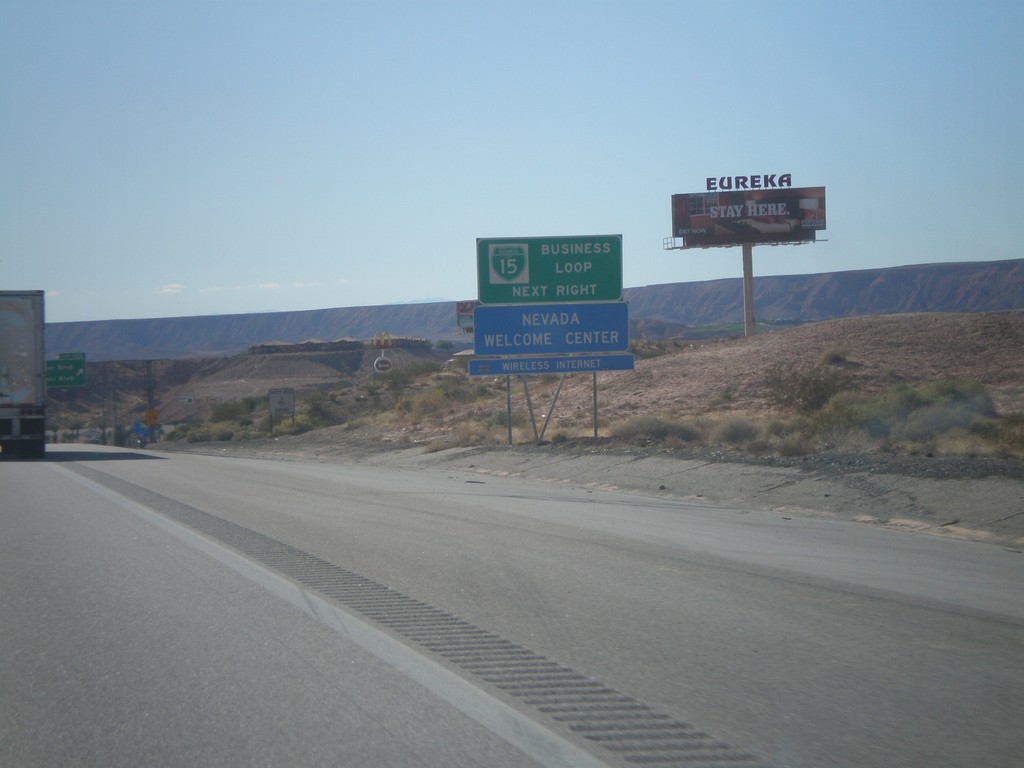
I-15 South - BL-15 Next Right
I-15 south approaching Exit 122. Use Exit 122 for BL-15 and Nevada Welcome Center. This is the north end of the Mesquite Business Loop.
Taken 10-09-2011

 Mesquite
Clark County
Nevada
United States
Mesquite
Clark County
Nevada
United States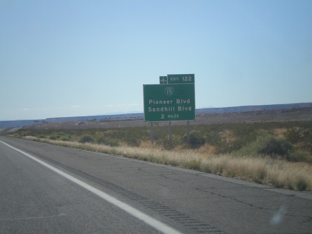
I-15 South Approaching Exit 122
I-15 south approaching Exit 122 (Nevada) - BL-15/Pioneer Blvd/Sandhill Blvd. BL-15 is not signed on the actual interchange within Nevada.
Taken 10-09-2011
Littlefield
Mohave County
Arizona
United States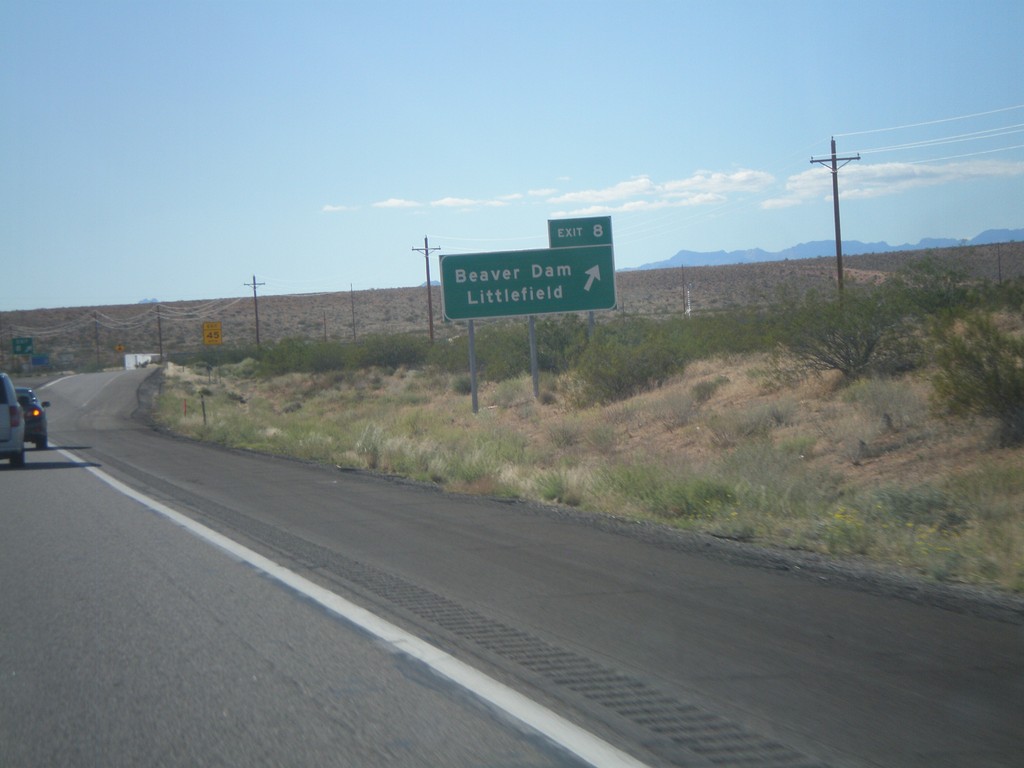
I-15 South - Exit 8
I-15 south at Exit 8 - Littlefield/Beaver Dam.
Taken 10-09-2011
Littlefield
Mohave County
Arizona
United States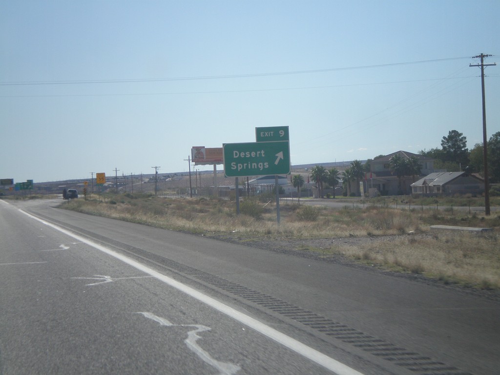
I-15 South - Exit 9
I-15 south at Exit 9 - Desert Springs. This interchange used to be labeled Farm Road.
Taken 10-09-2011
Littlefield
Mohave County
Arizona
United States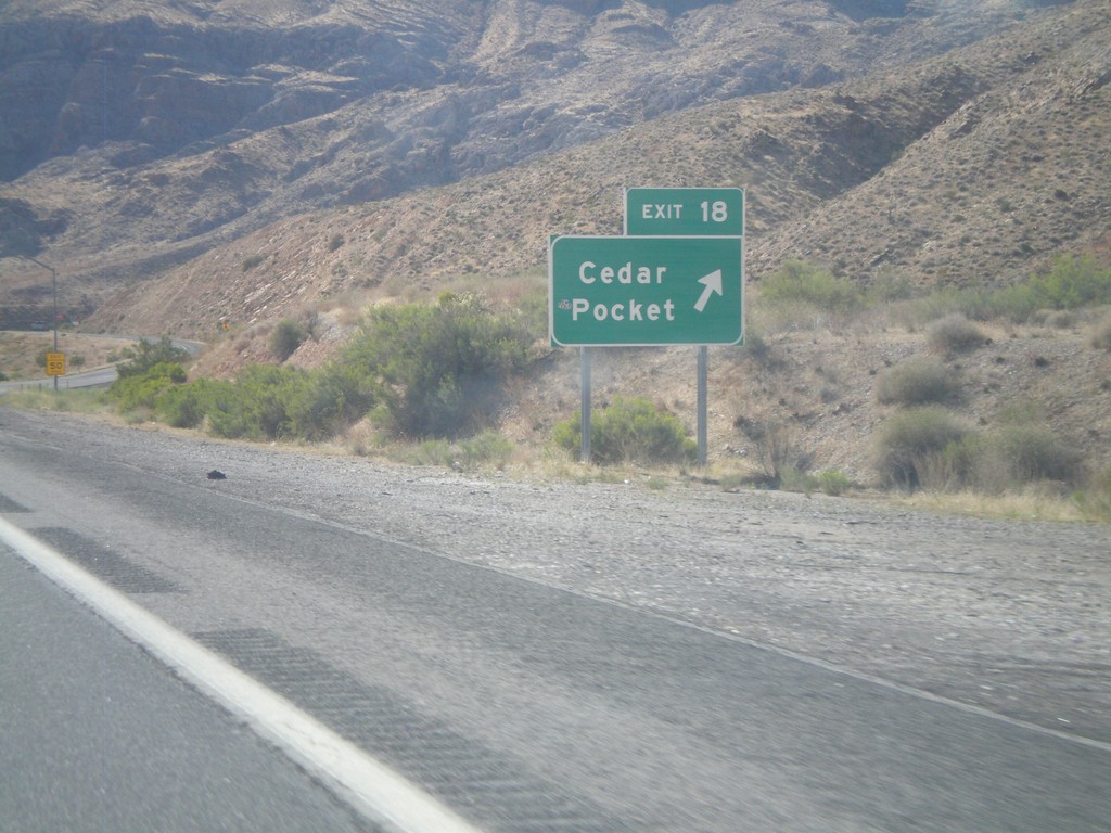
I-15 South - Exit 18
I-15 south at Exit 18 - Cedar Pocket.
Taken 10-09-2011
Littlefield
Mohave County
Arizona
United States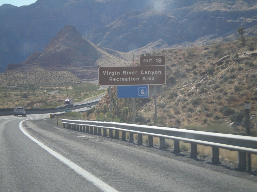
I-15 South Approaching Exit 18
I-15 South approaching Exit 18. Use Exit 18 for the Virgin Canyon Recreation Area.
Taken 10-09-2011
Littlefield
Mohave County
Arizona
United States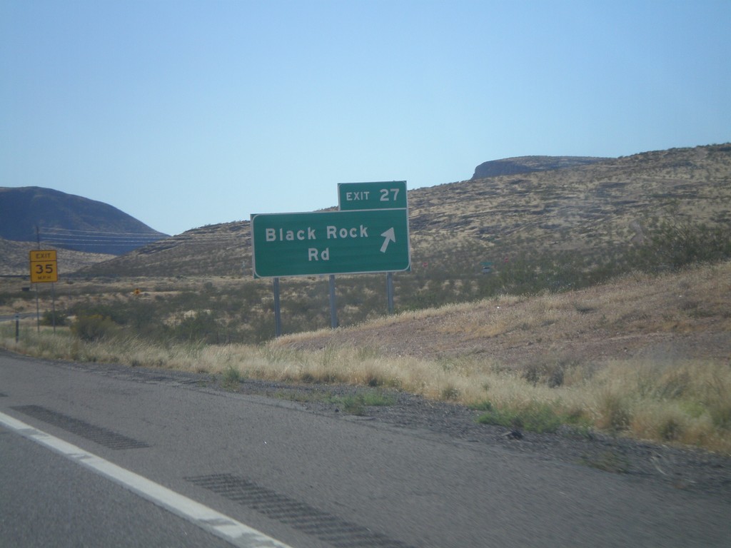
I-15 South - Exit 27
I-15 south at Exit 27 - Black Rock Road. This is the first exit on I-15 south in Arizona.
Taken 10-09-2011
Littlefield
Mohave County
Arizona
United States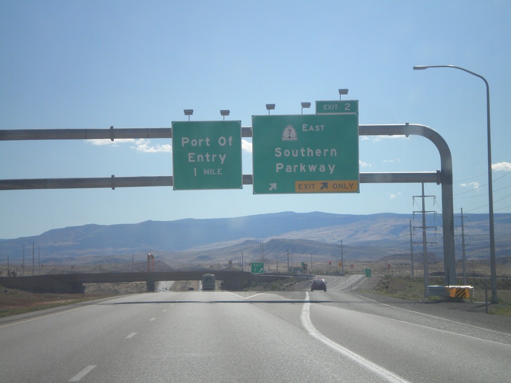
I-15 South - Exit 2
I-15 south at Exit 2 - UT-7 East/Southern Parkway. This is the south eastern end of the new St. George beltway.
Taken 10-09-2011
 St. George
Washington County
Utah
United States
St. George
Washington County
Utah
United States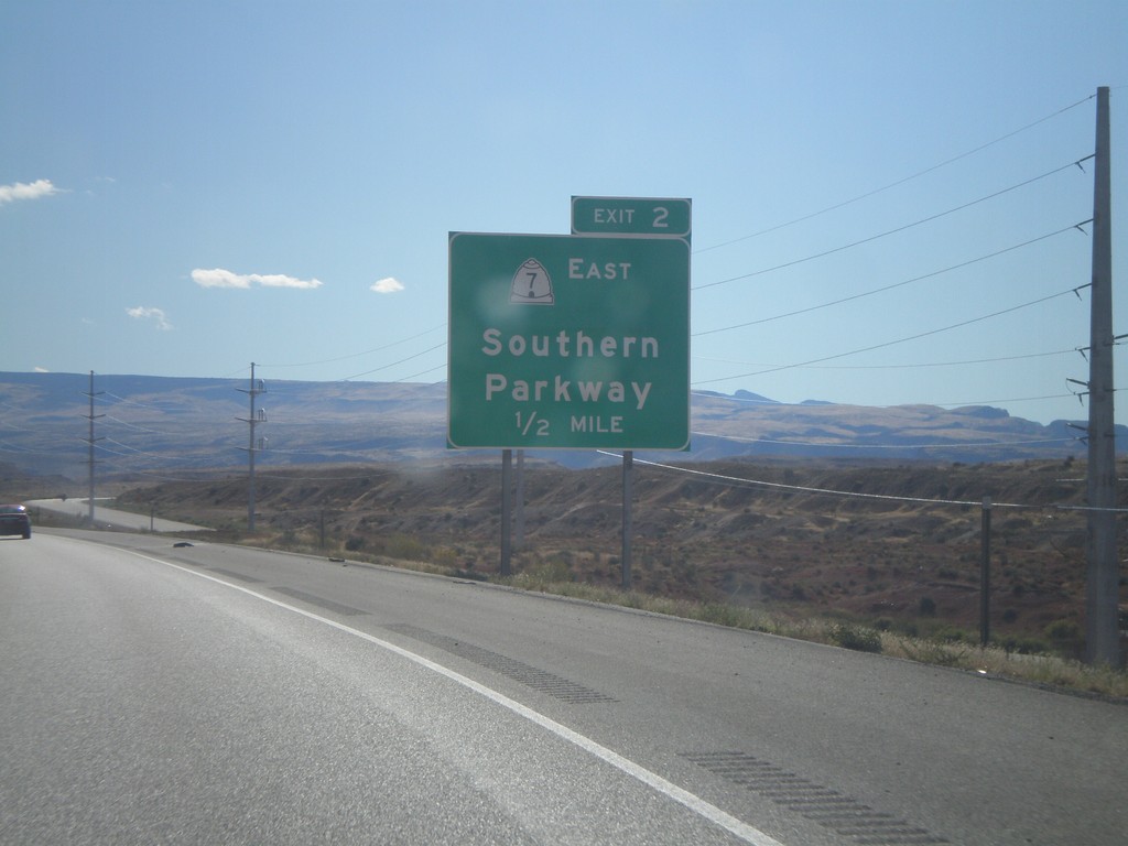
I-15 South Approaching Exit 2
I-15 south approaching Exit 2 - UT-7 East/Southern Parkway. This is the last exit in Utah on I-15 south.
Taken 10-09-2011
St. George
Washington County
Utah
United States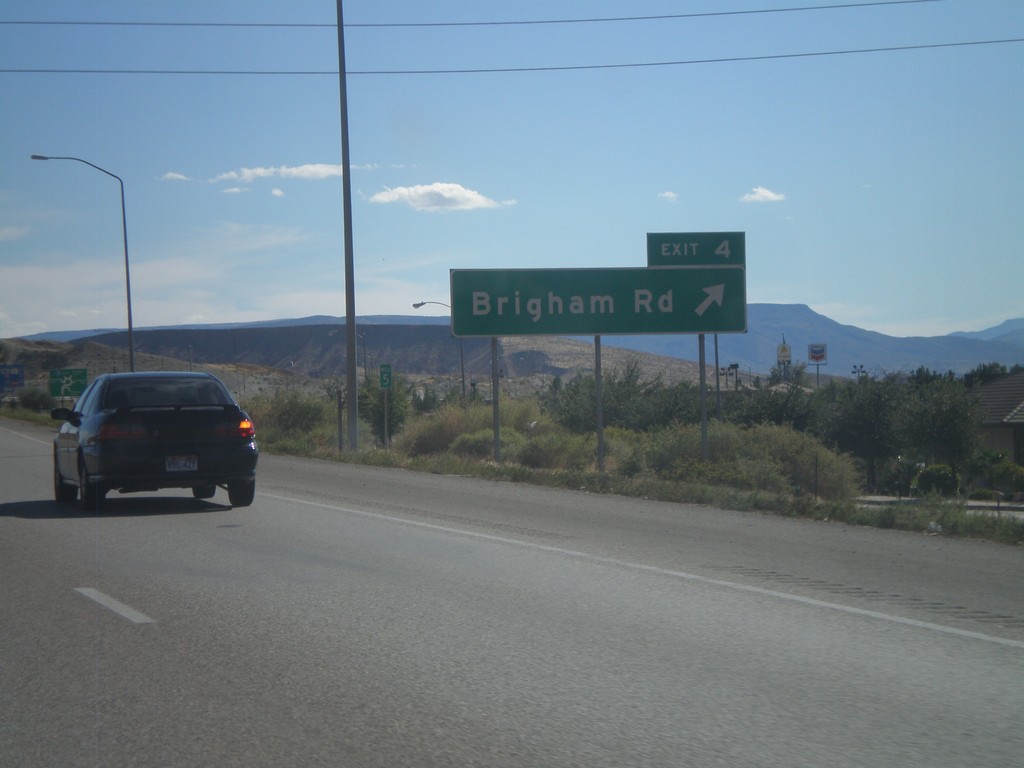
I-15 South - Exit 4
I-15 south at Exit 4 - Brigham Road. This interchange formerly was signed as Bloomington.
Taken 10-09-2011
St. George
Washington County
Utah
United States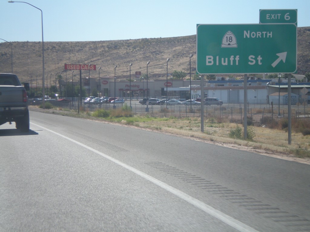
I-15 South - Exit 6
I-15 south at Exit 6 - UT-18/Bluff St. This is the southern end of the St. George business loop.
Taken 10-09-2011
 St. George
Washington County
Utah
United States
St. George
Washington County
Utah
United States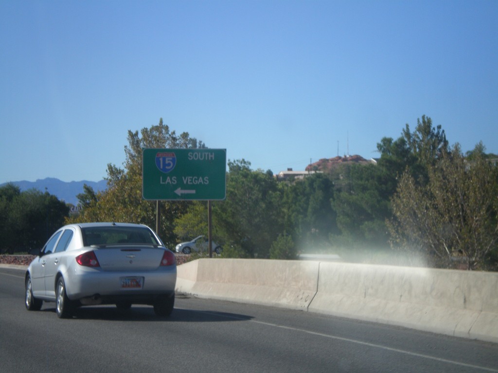
Begin UT-34/BL-15 at I-15 South
Begin UT-34/BL-15 at I-15 South to Las Vegas (Nevada). This is the northern end of the St. George Business Loop.
Taken 10-09-2011
 St. George
Washington County
Utah
United States
St. George
Washington County
Utah
United States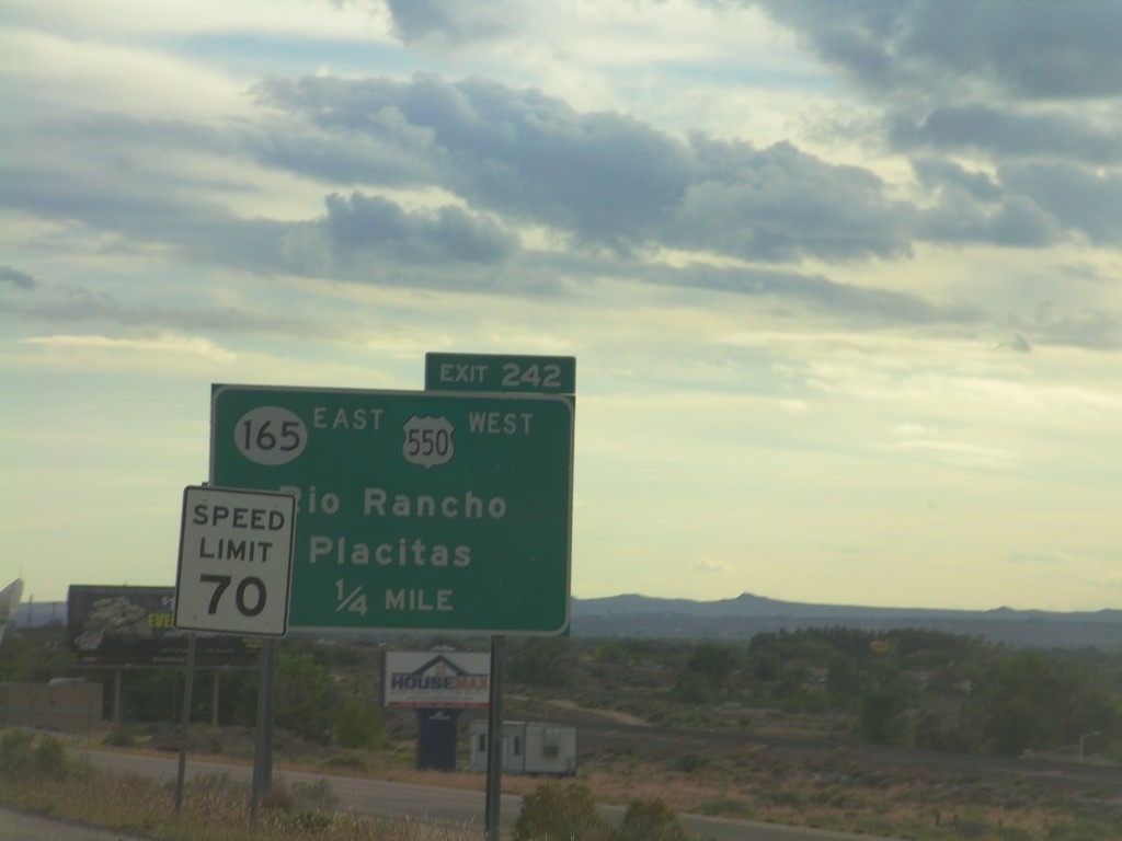
I-25 South - Exit 242
I-25 south approaching Exit 242 - US-550 West/NM-165 East/Rio Rancho/Placitas. This is the southern end of US-550. The speed limit drops from 75 miles per hour to 70 miles per hour as the highway enters the edge of the Albuquerque metropolitan area.
Taken 10-05-2011


 Bernalillo
Sandoval County
New Mexico
United States
Bernalillo
Sandoval County
New Mexico
United States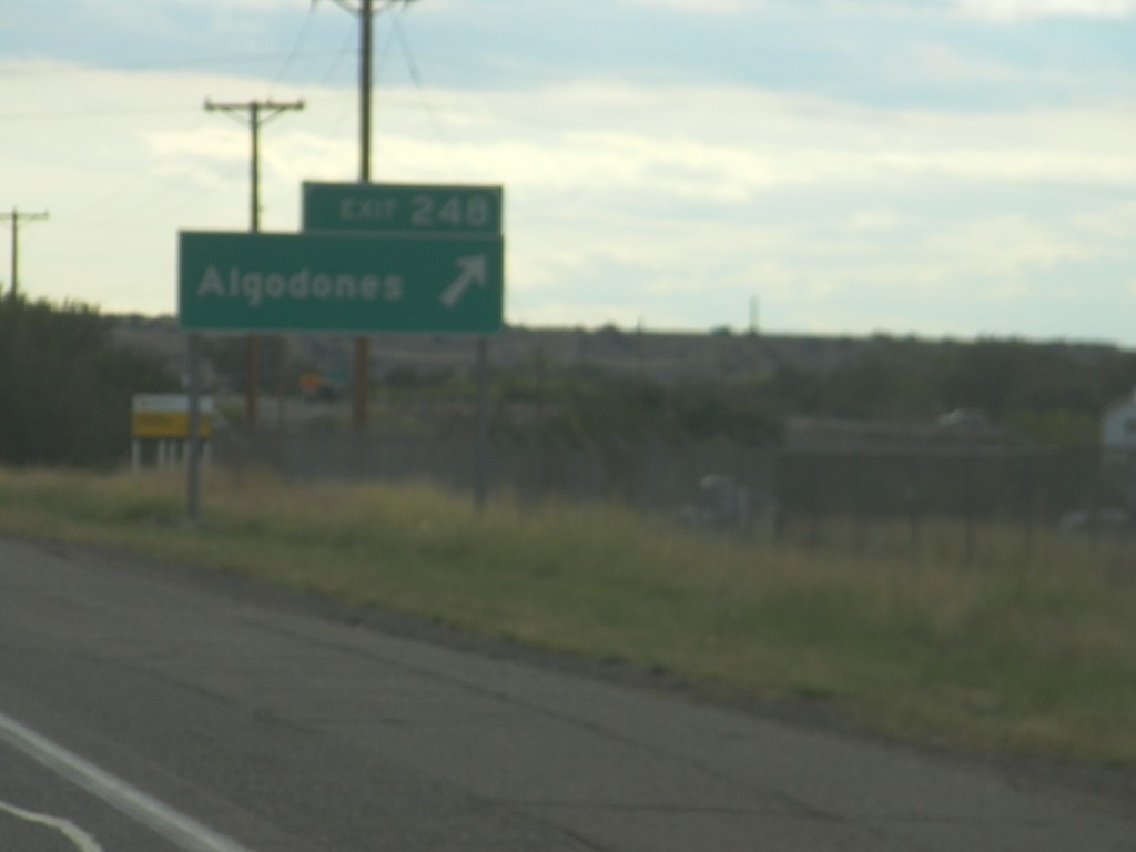
I-25 South - Exit 248
I-25 south at Exit 248 - Algodones.
Taken 10-05-2011
Algodones
Sandoval County
New Mexico
United States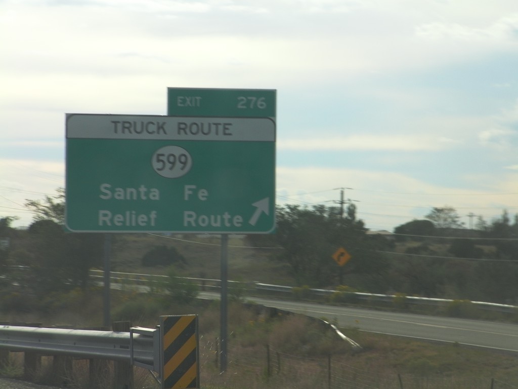
I-25 South - Exit 276
I-25 south at Exit 276 - NM-599/Santa Fe Relief Route. NM-599 is the truck route around the north side of Santa Fe.
Taken 10-05-2011
 La Cienega
Santa Fe County
New Mexico
United States
La Cienega
Santa Fe County
New Mexico
United States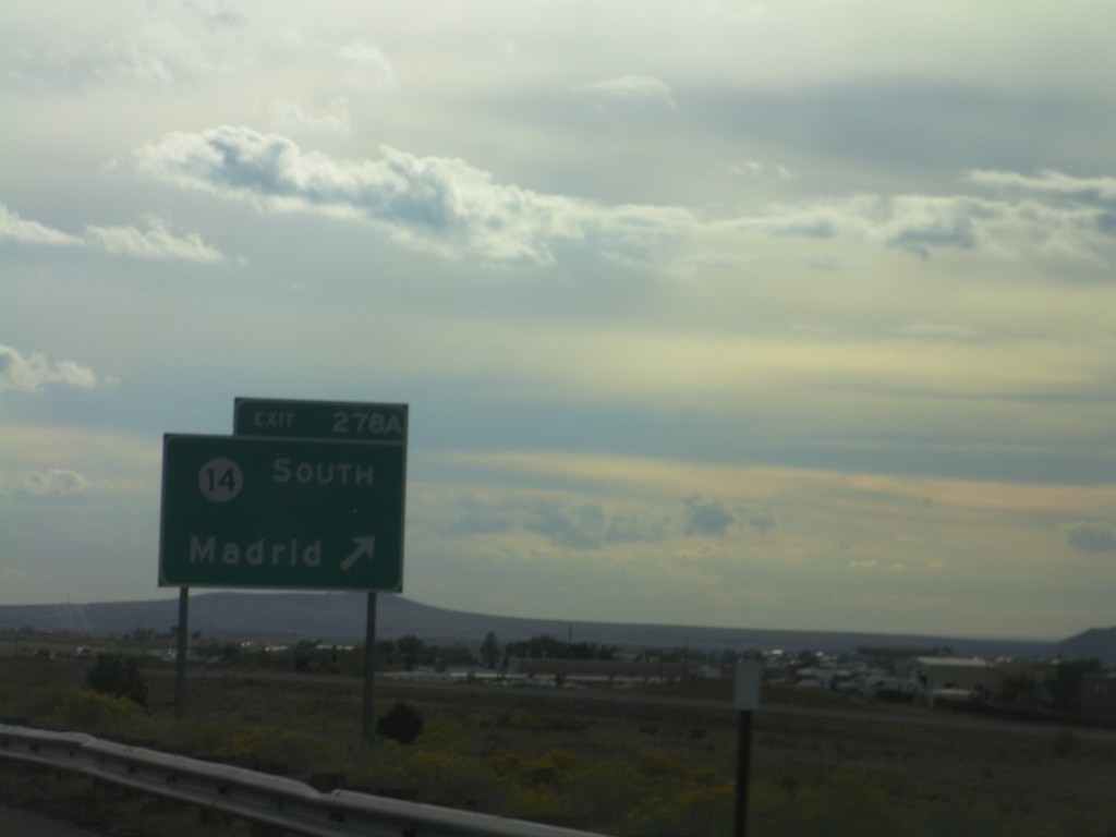
I-25 South - Exit 278A
I-25 south at Exit 278A - NM-14 South/Madrid.
Taken 10-05-2011
 Santa Fe
 County
New Mexico
United States
Santa Fe
Santa Fe County
New Mexico
United States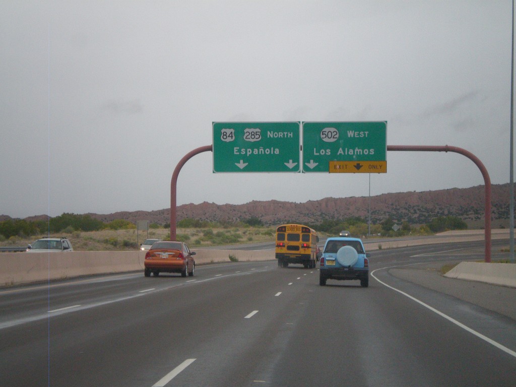
US-84/US-285 North - NM-502 Jct.
US-84/US-285 North - NM-502 West/Los Alamos exit. Continue north on US-84/US-285 North to Española.
Taken 10-04-2011


 Santa Fe
 County
New Mexico
United States
Santa Fe
Santa Fe County
New Mexico
United States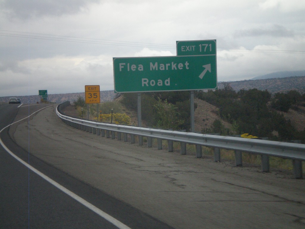
US-84/US-285 North - Exit 171
US-84/US-285 North at Exit 171 - Flea Market Road.
Taken 10-04-2011
Tesuque
Santa Fe County
New Mexico
United States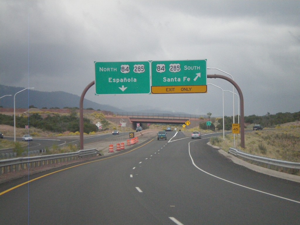
End NM-599 East at US-84/US-285
End NM-599 (Santa Fe Relief Route) east at US-84/US-285. Use US-84/US-285 north for Española. Use US-84/US-285 south for Santa Fe.
Taken 10-04-2011
Santa Fe
Santa Fe County
New Mexico
United States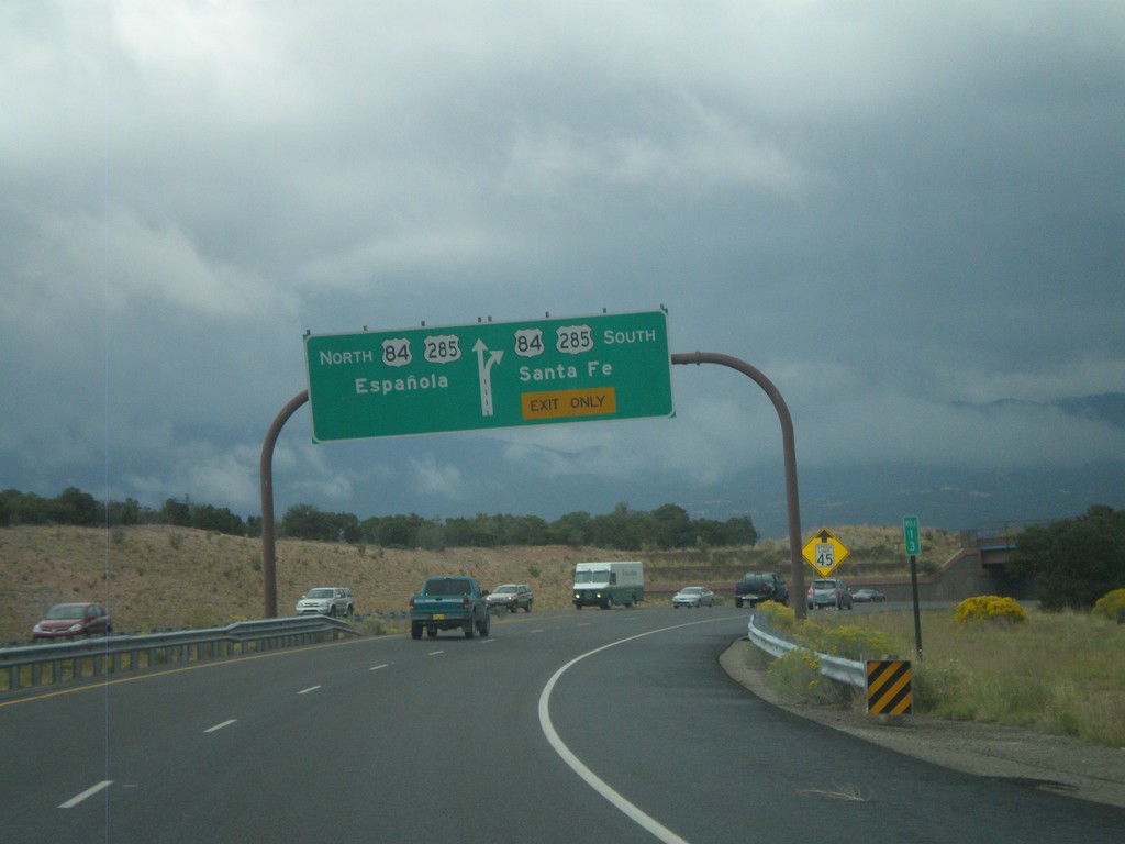
End NM-599 East at US-84/US-285
End NM-599 (Santa Fe Relief Route) east at US-84/US-285. Use US-84/US-285 north for Española; use US-84/US-285 south for Santa Fe.
Taken 10-04-2011
Santa Fe
Santa Fe County
New Mexico
United States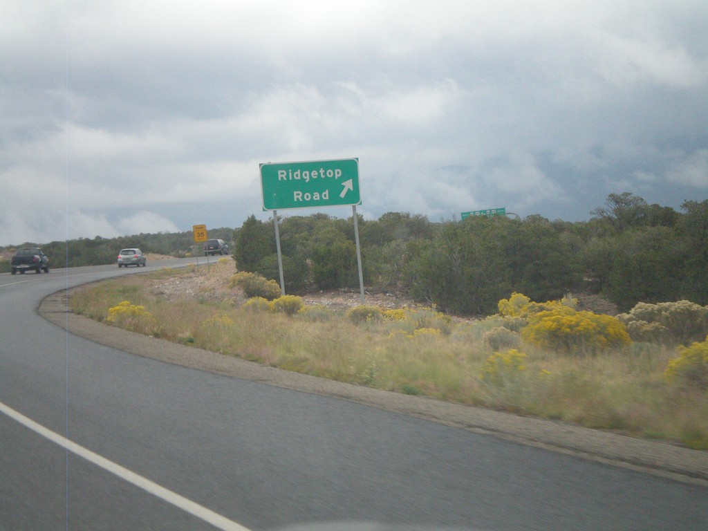
NM-599 East at Ridgetop Road
NM-599 East (Santa Fe Relief Route) at Ridgetop Road interchange.
Taken 10-04-2011
Santa Fe
Santa Fe County
New Mexico
United States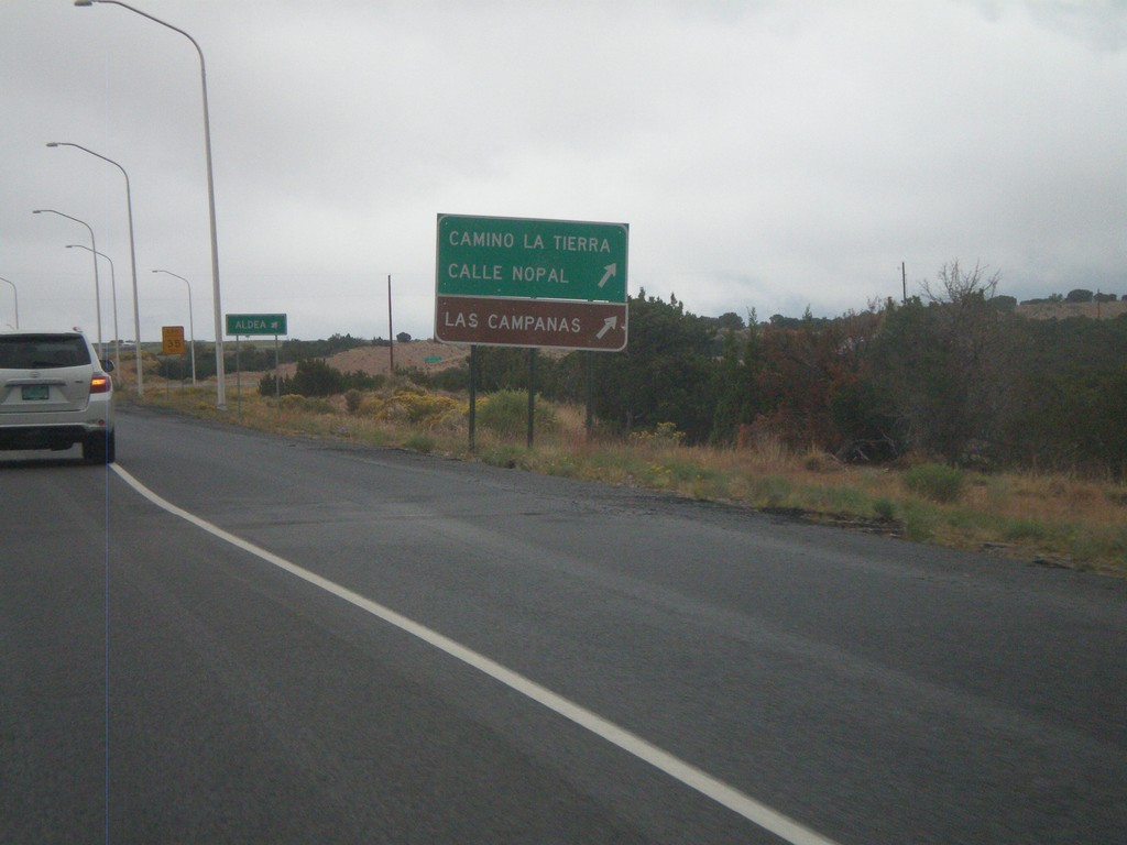
NM-599 East at Camino La Tierra
NM-599 east at Camino La Tierra/Calle Nopal interchange. Also use this exit for Las Campanas.
Taken 10-04-2011
Santa Fe
Santa Fe County
New Mexico
United States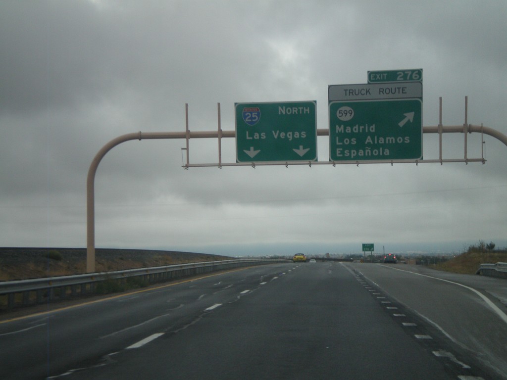
I-25 North - Exit 276
I-25 north at Exit 276 - NM-599/Madrid/Los Alamos/Española. NM-599 is the truck route around Santa Fe. I-25 continues north to Las Vegas.
Taken 10-04-2011
Santa Fe
Santa Fe County
New Mexico
United States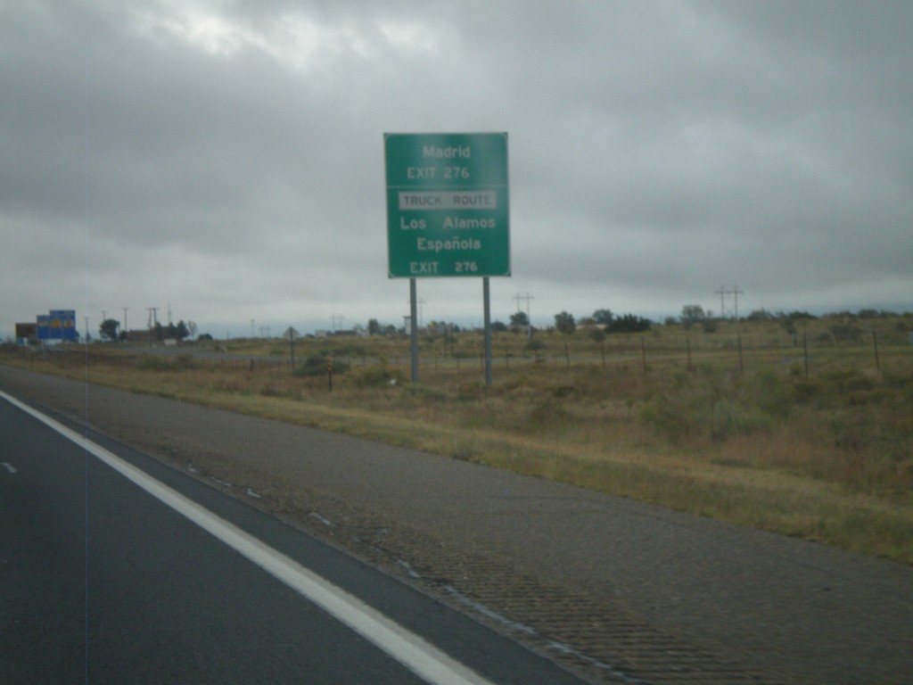
I-25 North Approaching Exit 276
I-25 north approaching Exit 276 (NM-599). Use Exit 276 for Los Alamos, Española, Madrid. NM-599 is the truck route around Santa Fe.
Taken 10-04-2011
Santa Fe
Santa Fe County
New Mexico
United States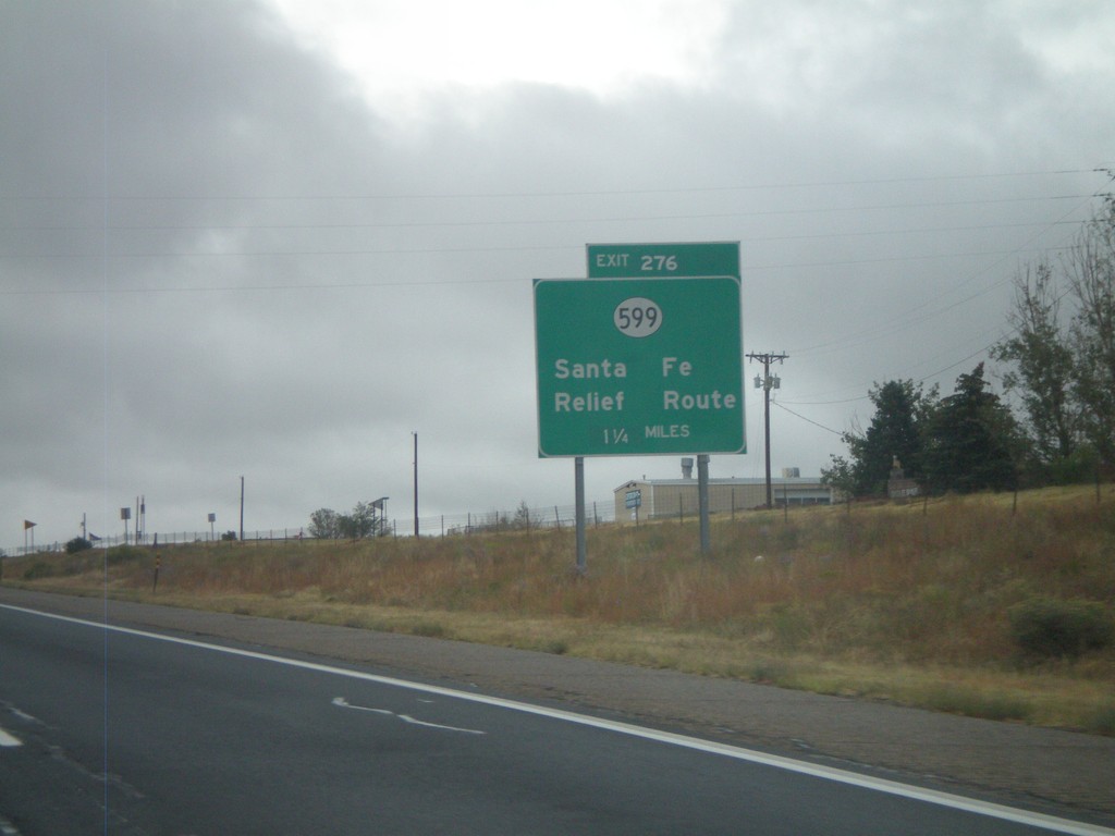
I-25 North - Exit 276
I-25 North at Exit 276 - NM-599/Santa Fe Relief Route. NM-599 is the truck route around Santa Fe.
Taken 10-04-2011
Santa Fe
Santa Fe County
New Mexico
United States