Signs Tagged With Freeway Junction
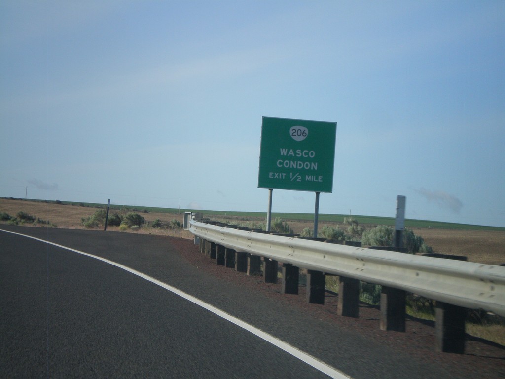
US-97 South Approaching OR-206 IC
US-97 south approaching OR-206 interchange to Wasco and Condon.
Taken 05-27-2012

 Wasco
Sherman County
Oregon
United States
Wasco
Sherman County
Oregon
United States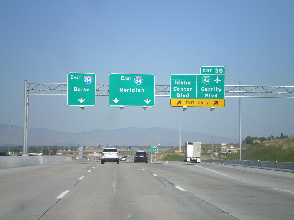
I-84 East - Exit 38
I-84 east at Exit 38 - BL-84/Garrity Blvd/Idaho Center Blvd. Use I-84 east for Meridian and Boies. This is the eastern end of the Nampa/Caldwell business loop. This interchange was recently rebuilt as part of the widening of I-84 between Nampa and Boise.
Taken 05-07-2012


 Nampa
Canyon County
Idaho
United States
Nampa
Canyon County
Idaho
United States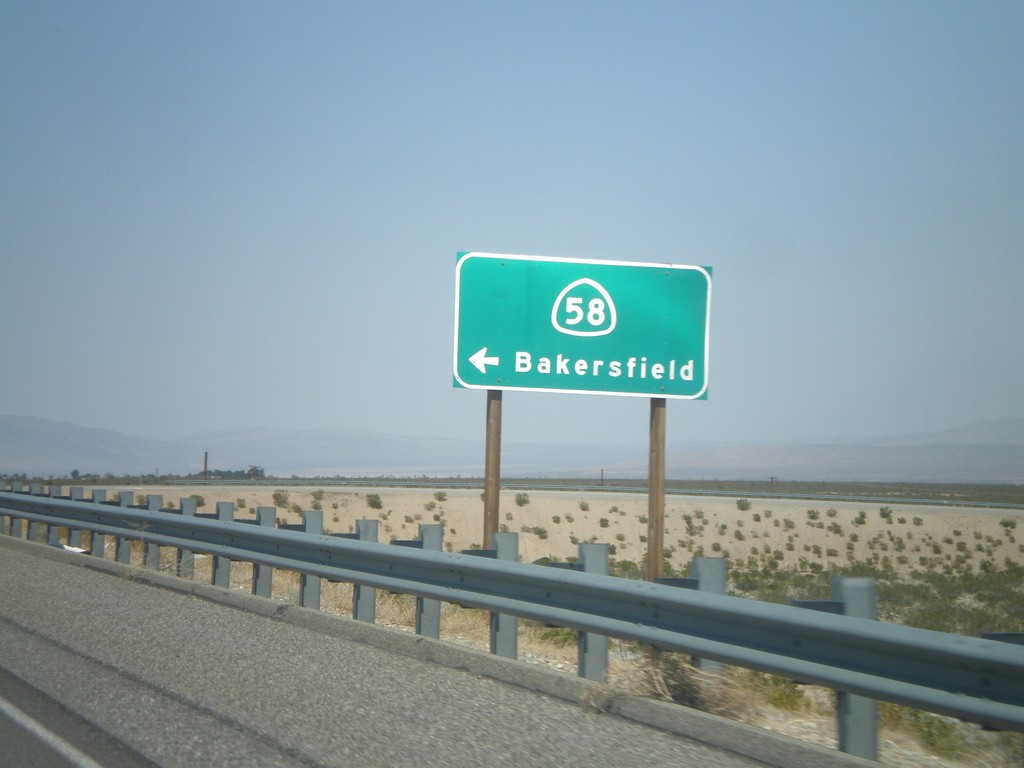
CA-14 North at CA-58 West Onramp
CA-14 North at CA-58 West onramp to Bakersfield.
Taken 05-06-2012

 California City
Kern County
California
United States
California City
Kern County
California
United States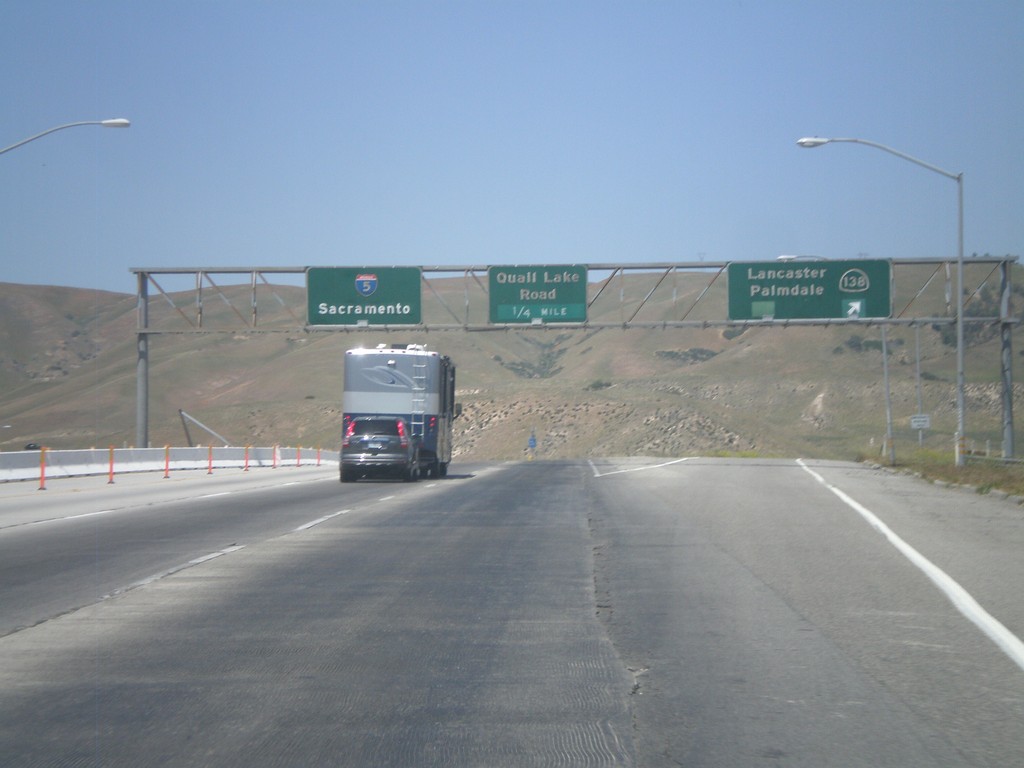
I-5 North - Exits 198A and 198B
I-5 north at Exit 198A - CA-138/Lancaster/Palmdale. Approaching Exit 198B - Quail Lake Road. I-5 continues north to Sacramento.
Taken 05-06-2012

 Lebec
Kern County
California
United States
Lebec
Kern County
California
United States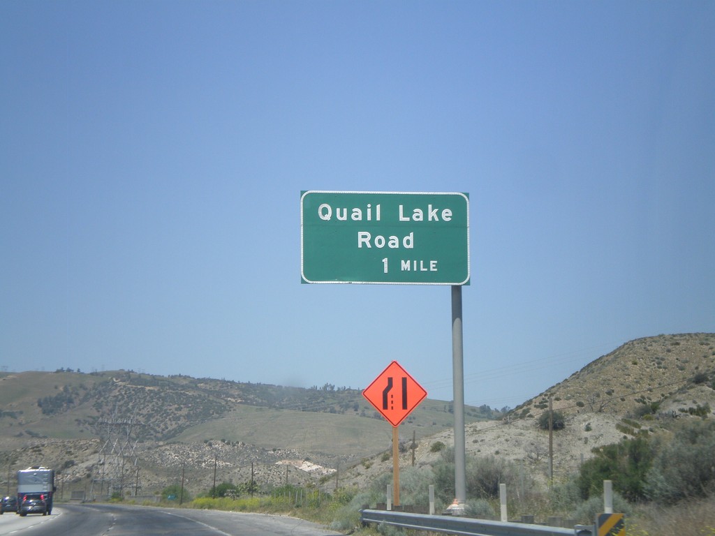
I-5 North - Exit 198B
I-5 north approaching Exit 198B - Quail Lake Road.
Taken 05-06-2012
Lebec
Los Angeles County
California
United States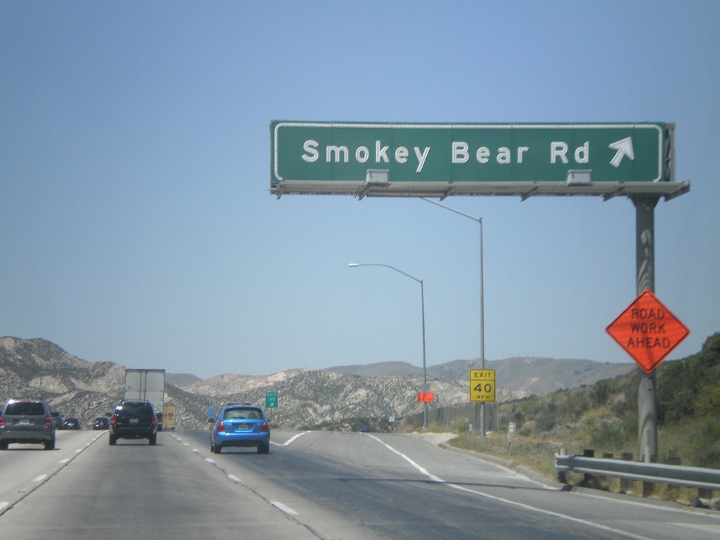
I-5 North - Exit 195
I-5 north at Exit 195 - Smokey Bear Road.
Taken 05-06-2012
Lebec
Los Angeles County
California
United States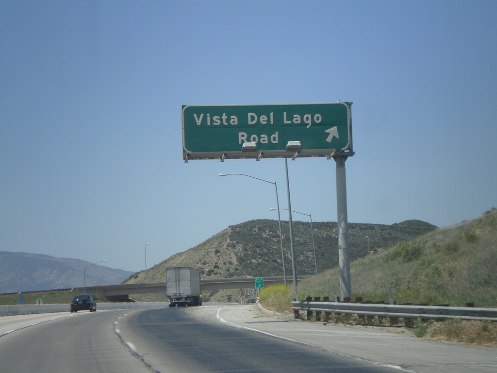
I-5 North - Exit 191
I-5 north at Exit 191 - Vista Del Lago Road.
Taken 05-06-2012
Sandberg
Los Angeles County
California
United States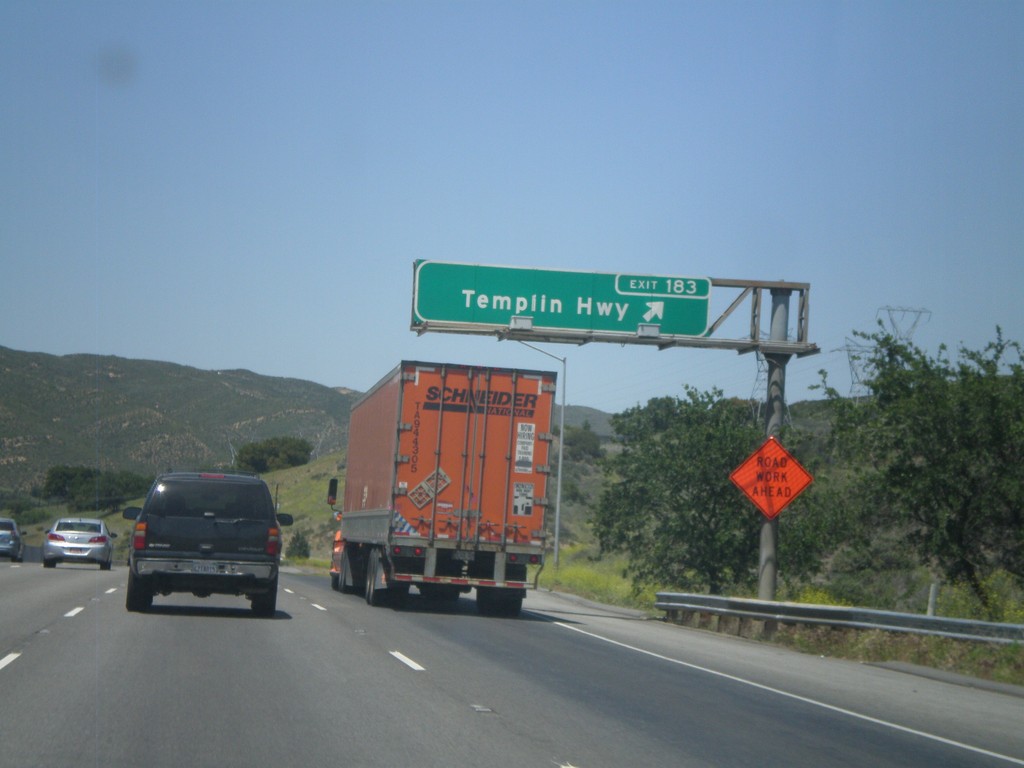
I-5 North - Exit 183
I-5 north at Exit 183 - Templin Highway.
Taken 05-06-2012
Martins
Los Angeles County
California
United States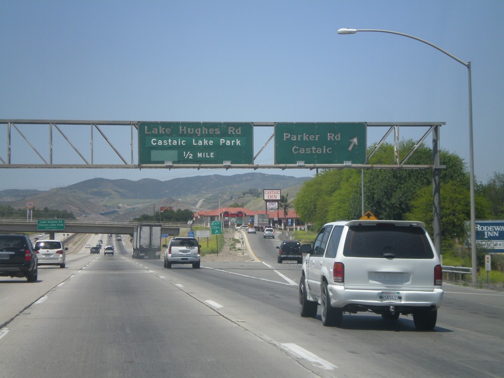
I-5 North - Exits 176A and 176B
I-5 north at Exit 176A - Parker Road/Castaic. Approaching Exit 176B - Lake Hughes Road/Castaic Lake Park.
Taken 05-06-2012
Castaic
Los Angeles County
California
United States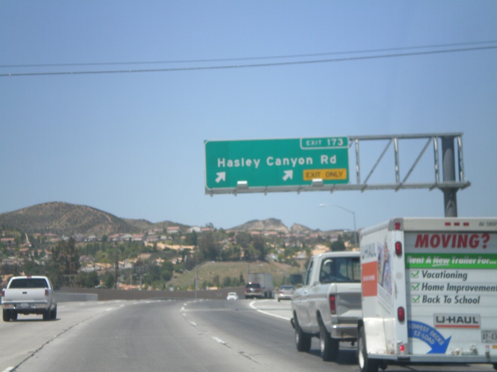
I-5 North - Exit 173
I-5 north at Exit 173 - Hasley Canyon Road.
Taken 05-06-2012
Castaic
Los Angeles County
California
United States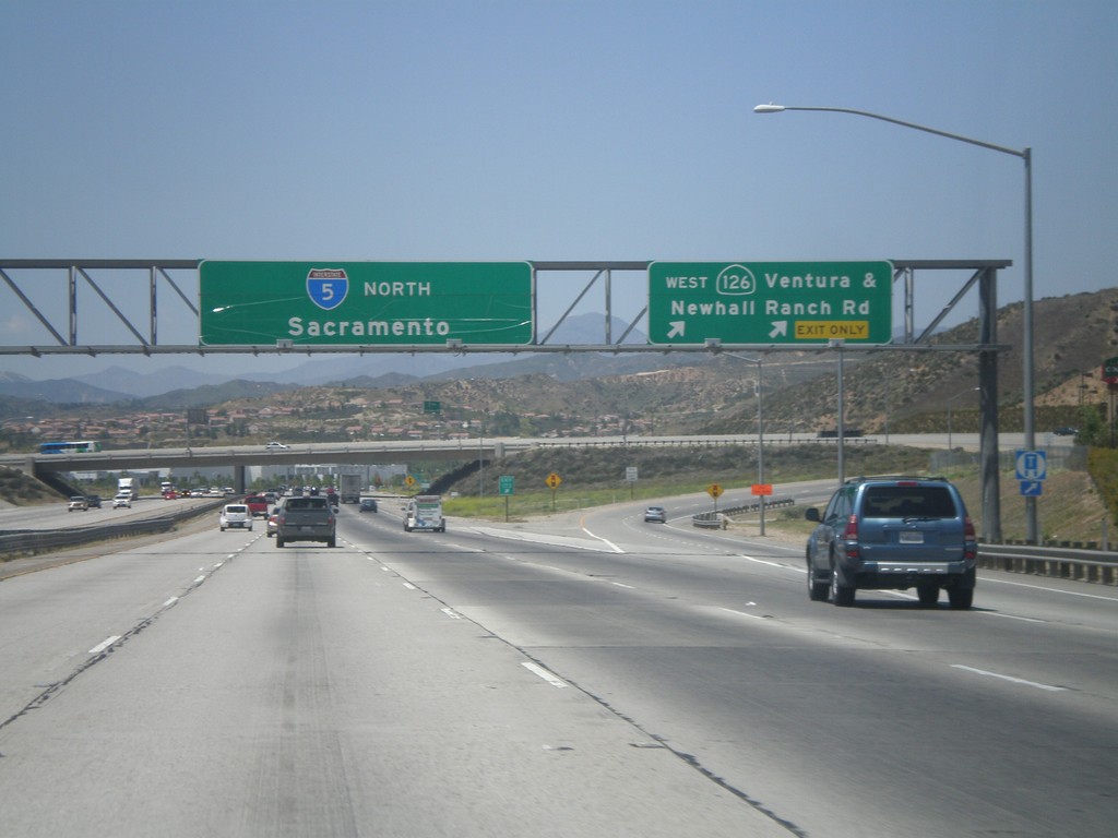
I-5 North - Exit 170
I-5 north at Exit 170 - CA-126 West/Ventura/Newhall Ranch Road. I-5 continues north to Sacramento. This sign is strange because the words Ventura and Newhall Ranch Road are separated by an "&" instead of a new line.
Taken 05-06-2012
 Santa Clarita
Los Angeles County
California
United States
Santa Clarita
Los Angeles County
California
United States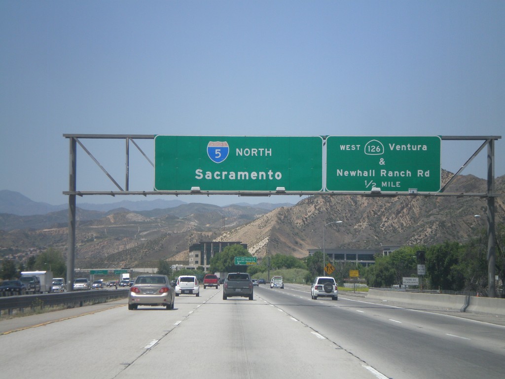
I-5 North - Exit 172
I-5 north approaching Exit 172 - CA-126 West/Ventura/Newhall Ranch Road. I-5 continues north to Sacramento.
Taken 05-06-2012
Santa Clarita
Los Angeles County
California
United States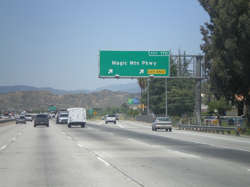
I-5 North - Exit 170
I-5 north at Exit 170 - Magic Mountain Parkway.
Taken 05-06-2012
Santa Clarita
Los Angeles County
California
United States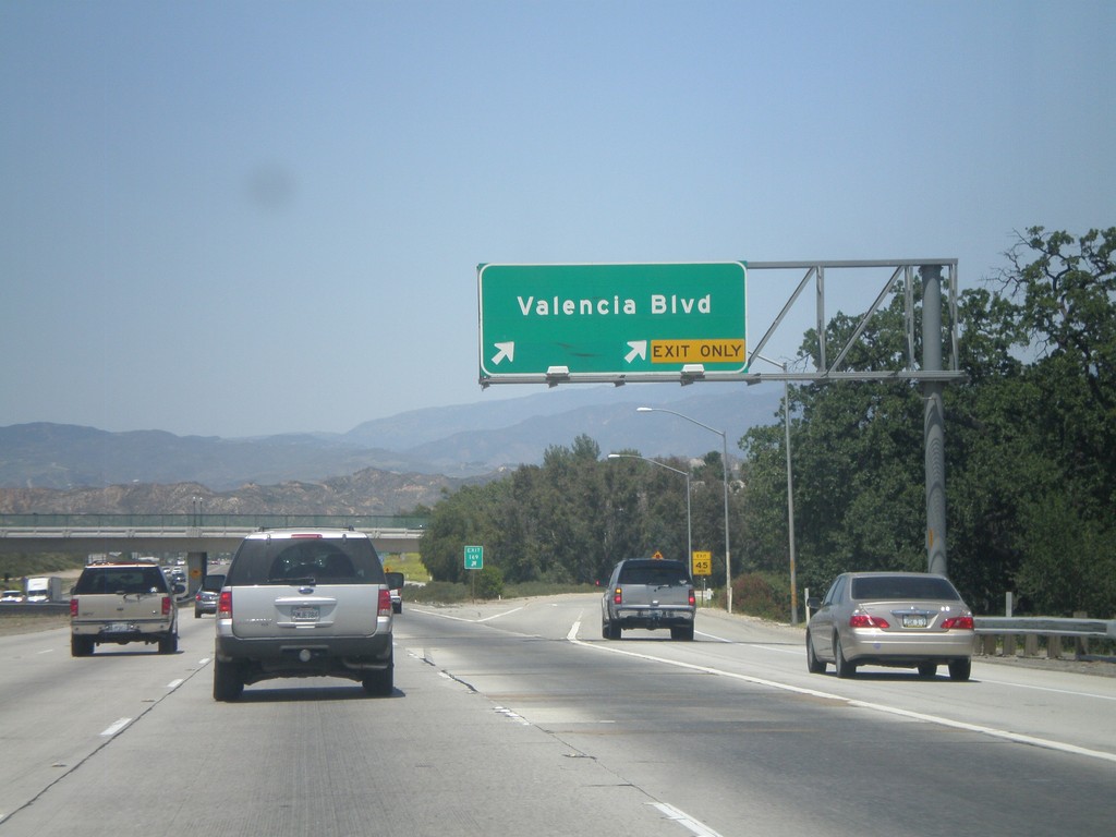
I-5 North - Exit 169
I-5 north at Exit 169 - Valencia Blvd.
Taken 05-06-2012
Santa Clarita
Los Angeles County
California
United States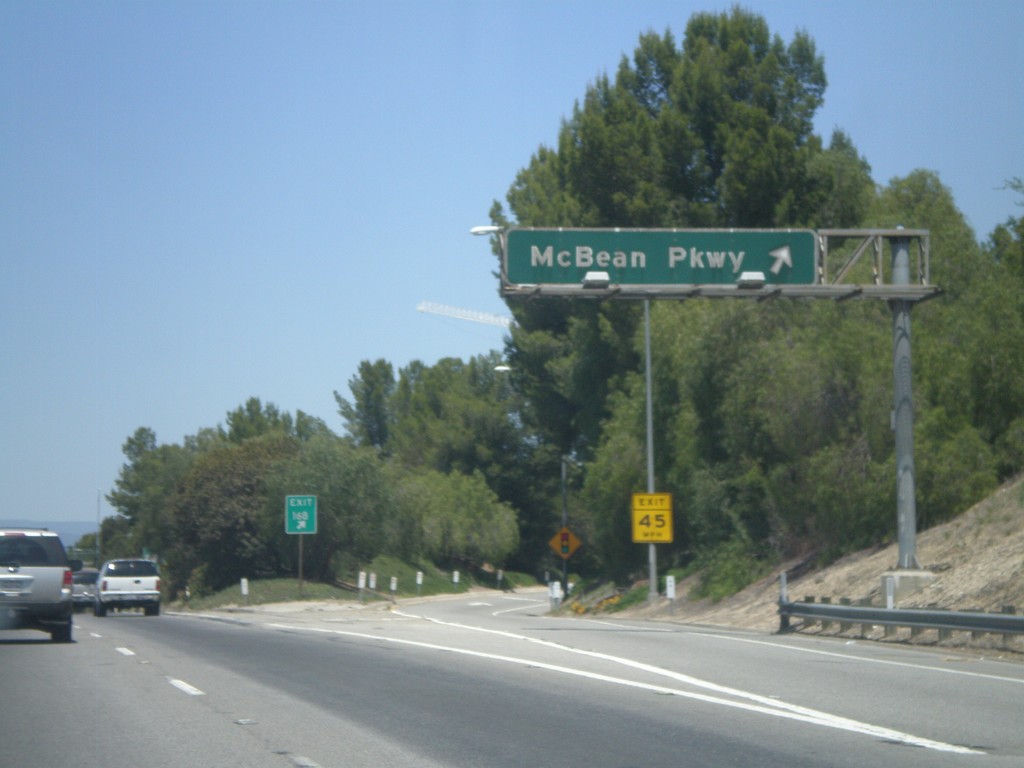
I-5 North - Exit 168
I-5 north at Exit 168 - McBean Parkway.
Taken 05-06-2012
Valencia
Los Angeles County
California
United States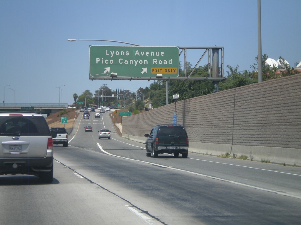
I-5 North - Exit 167
I-5 north at Exit 167 - Lyons Ave./Pico Canyon Road.
Taken 05-06-2012
Santa Clarita
Los Angeles County
California
United States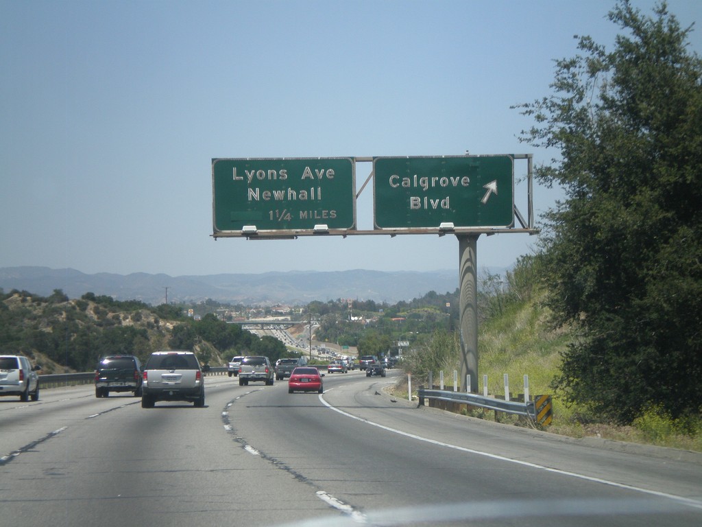
I-5 North - Exits 166 and 167
I-5 north at Exit 166 - Calgrove Blvd. Approaching Exit 167 - Lyons Ave./Newhall.
Taken 05-06-2012
Santa Clarita
Los Angeles County
California
United States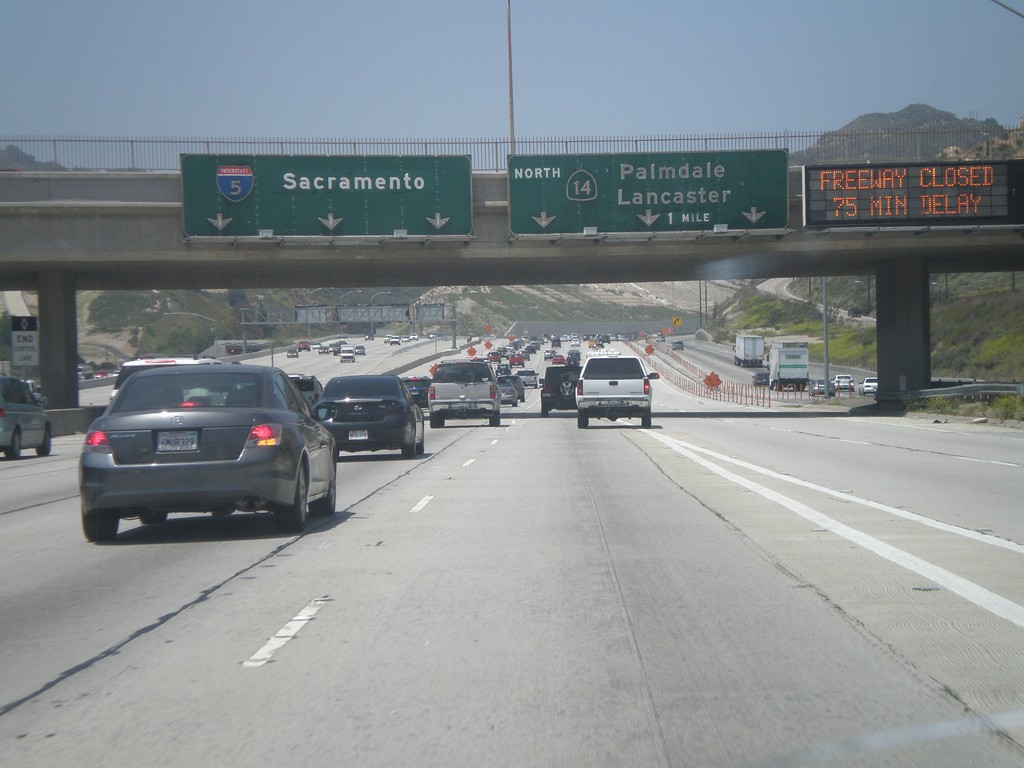
I-5 North - Exit 162
I-5 north approaching Exit 162 - CA-14 North/Palmdale/Lancaster. I-5 continues north towards Sacramento. When this picture was taken CA-14 was closed by an accident at the Red Rover interchange. I had to change my travel plans and follow I-5 up the Grapevine and cut over to CA-14 on CA-138.
Taken 05-06-2012
Los Angeles
Los Angeles County
California
United States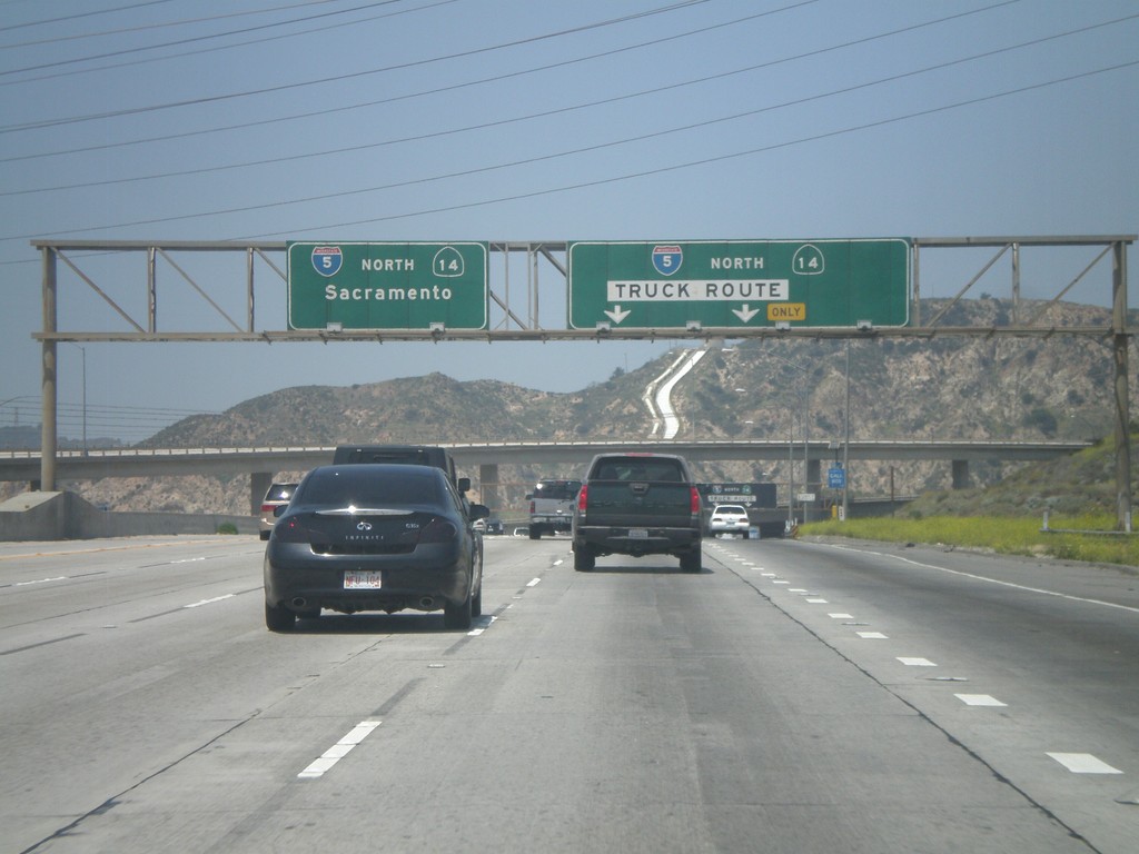
I-5 North - Exit 161A
I-5 north at Exit1 61A - I-5/CA-14/Truck Route. All I-5 northbound and CA-14 northbound trucks must exit here. This provides a separate lane for trucks through the I-210 on ramps, and CA-14 interchange. All I-5 and CA-14 auto traffic continue north along main freeway.
Taken 05-06-2012
Los Angeles
Los Angeles County
California
United States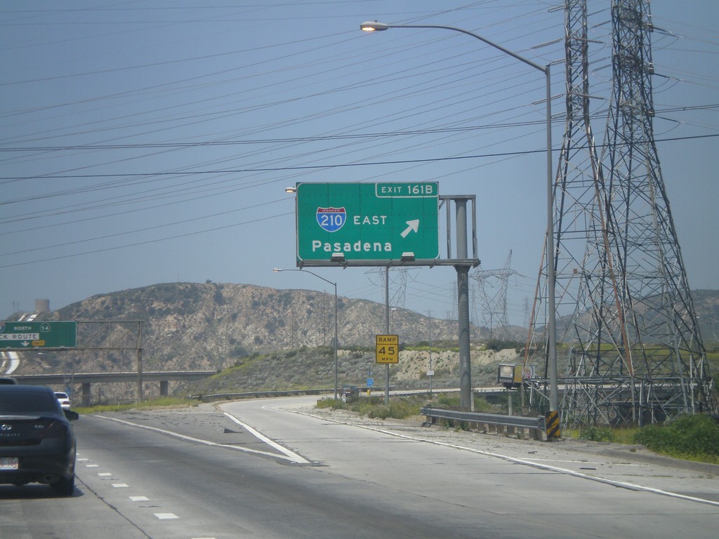
I-5 North - Exit 161B
I-5 north at Exit 161B - I-210 East/Pasadena.
Taken 05-06-2012
 Los Angeles
 County
California
United States
Los Angeles
Los Angeles County
California
United States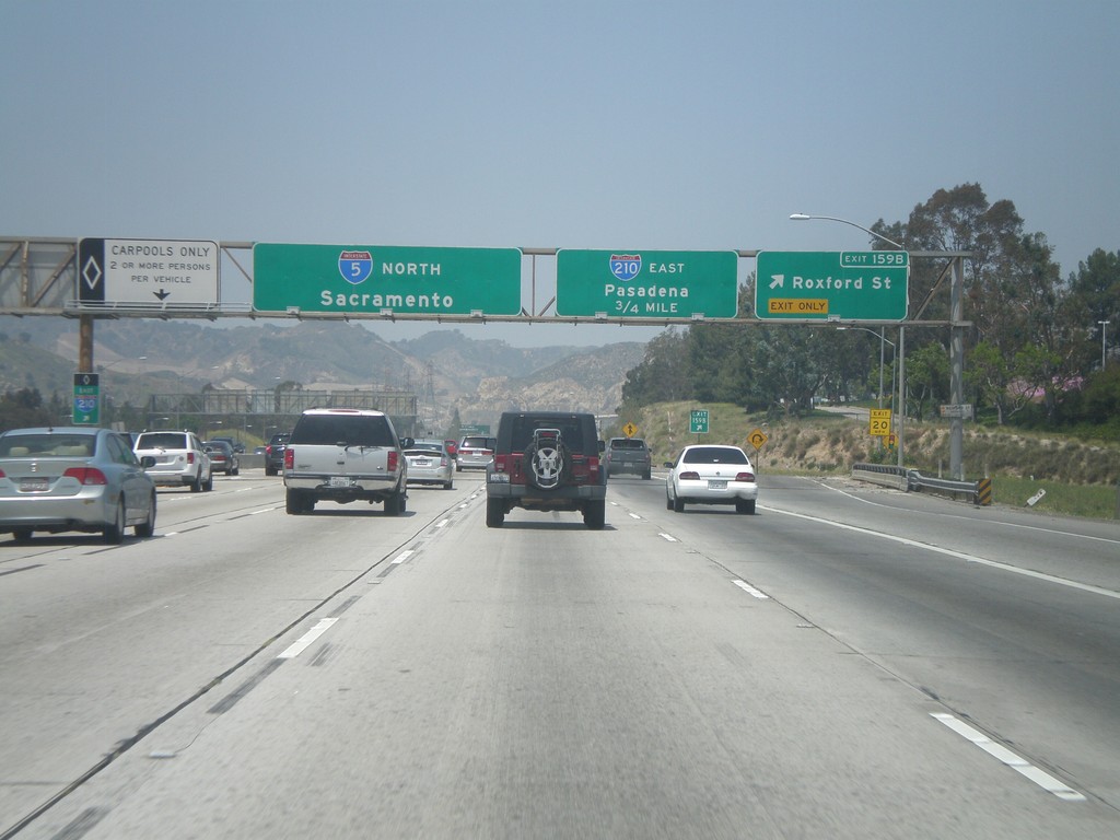
I-5 North - Exits 159B and 161B
I-5 north at Exit 159B - Roxford St. Approaching Exit 161B - I-210 East/Pasadena. I-5 continues north towards Sacramento.
Taken 05-06-2012
Los Angeles
Los Angeles County
California
United States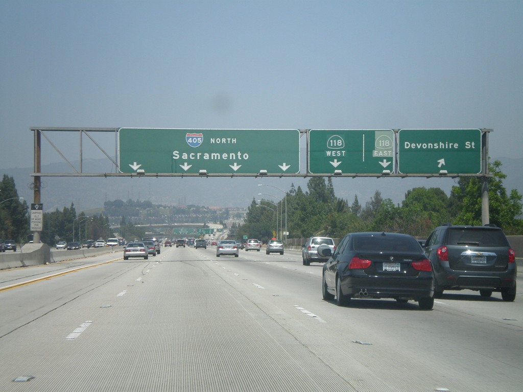
I-405 North - Exits 70 and 71A
I-405 north at Exit 70 - Devonshire St. Approaching Exit 71A - CA-118. I-405 continues north towards Sacramento.
Taken 05-06-2012

 Los Angeles
 County
California
United States
Los Angeles
Los Angeles County
California
United States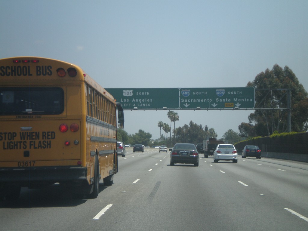
US-101 South - Exit 19A
US-101 south at Exit 19A - I-405/Sacramento/Santa Monica. Continue south on US-101 for (Downtown) Los Angeles.
Taken 05-06-2012
 Los Angeles
 County
California
United States
Los Angeles
Los Angeles County
California
United States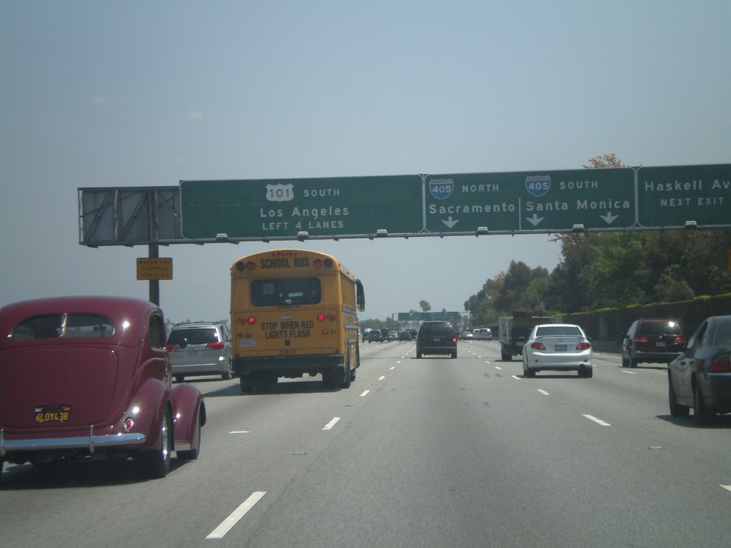
US-101 South - Exits 19B and 19A
US-101 south approaching Exit 19B - Haskell Ave and Exit 19A - I-405/Sacramento/Santa Monica. Continue south on US-101 for (Downtown) Los Angeles.
Taken 05-06-2012
Los Angeles
Los Angeles County
California
United States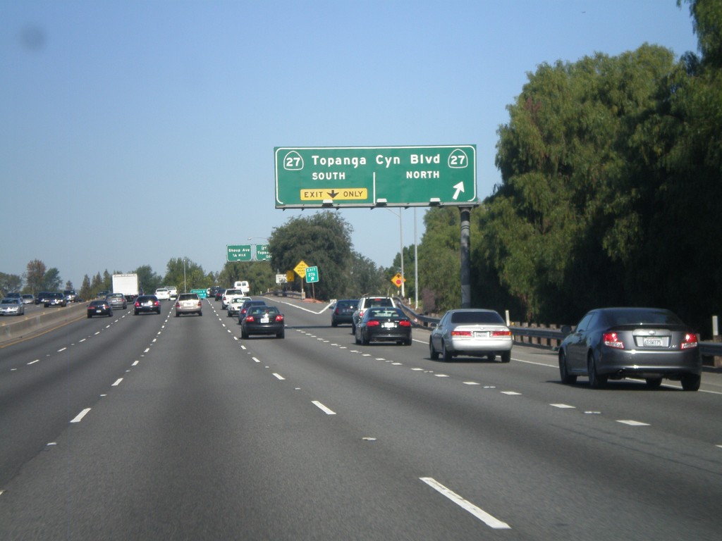
US-101 North - Exits 27A and 27B
US-101 north at Exit 27A - CA-27 North/Topanga Canyon Blvd and Exit 27B - CA-27 South/Topanga Canyon Blvd.
Taken 05-05-2012
 Los Angeles
 County
California
United States
Los Angeles
Los Angeles County
California
United States