Signs Tagged With Freeway Junction
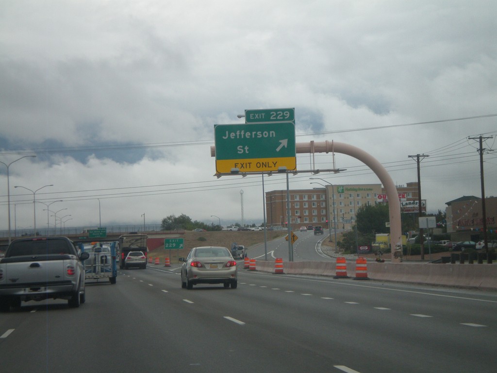
I-25 North - Exit 229
I-25 north at Exit 229 - Jefferson Street.
Taken 10-04-2011
 Albuquerque
Bernalillo County
New Mexico
United States
Albuquerque
Bernalillo County
New Mexico
United States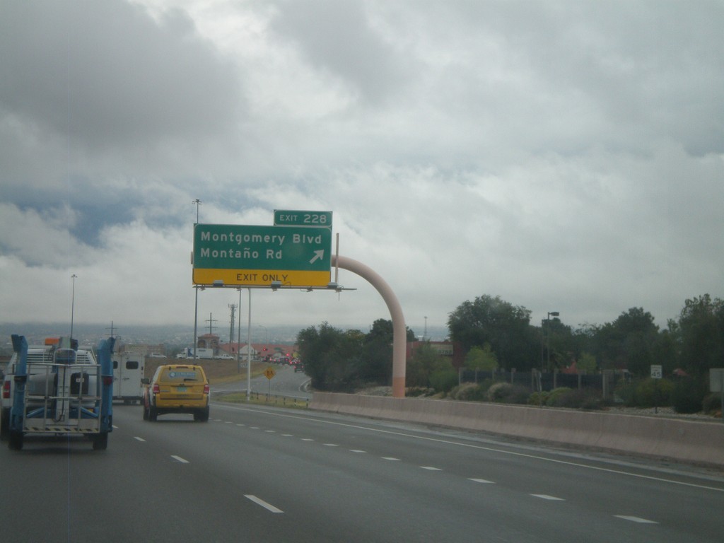
I-25 North - Exit 228
I-25 north at Exit 228 - Montgomery Blvd./Montaño Road.
Taken 10-04-2011
Albuquerque
Bernalillo County
New Mexico
United States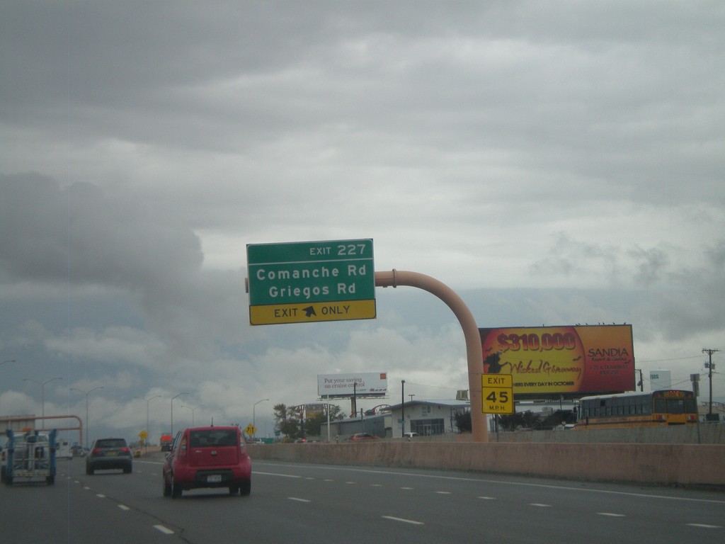
I-25 North - Exit 227
I-25 north at Exit 227 - Comanche Road/Griegos Road.
Taken 10-04-2011
Albuquerque
Bernalillo County
New Mexico
United States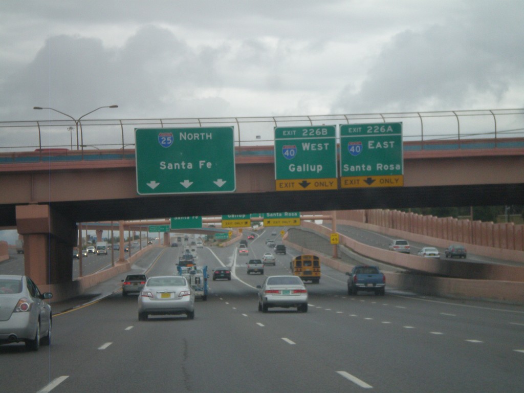
I-25 North - Exits 226A and B
I-25 north at Exit 226A - I-40 East/Santa Rosa. Exit 226B - I-40 West/Gallup. Continue north on I-25 for Santa Fe.
Taken 10-04-2011
 Albuquerque
Bernalillo County
New Mexico
United States
Albuquerque
Bernalillo County
New Mexico
United States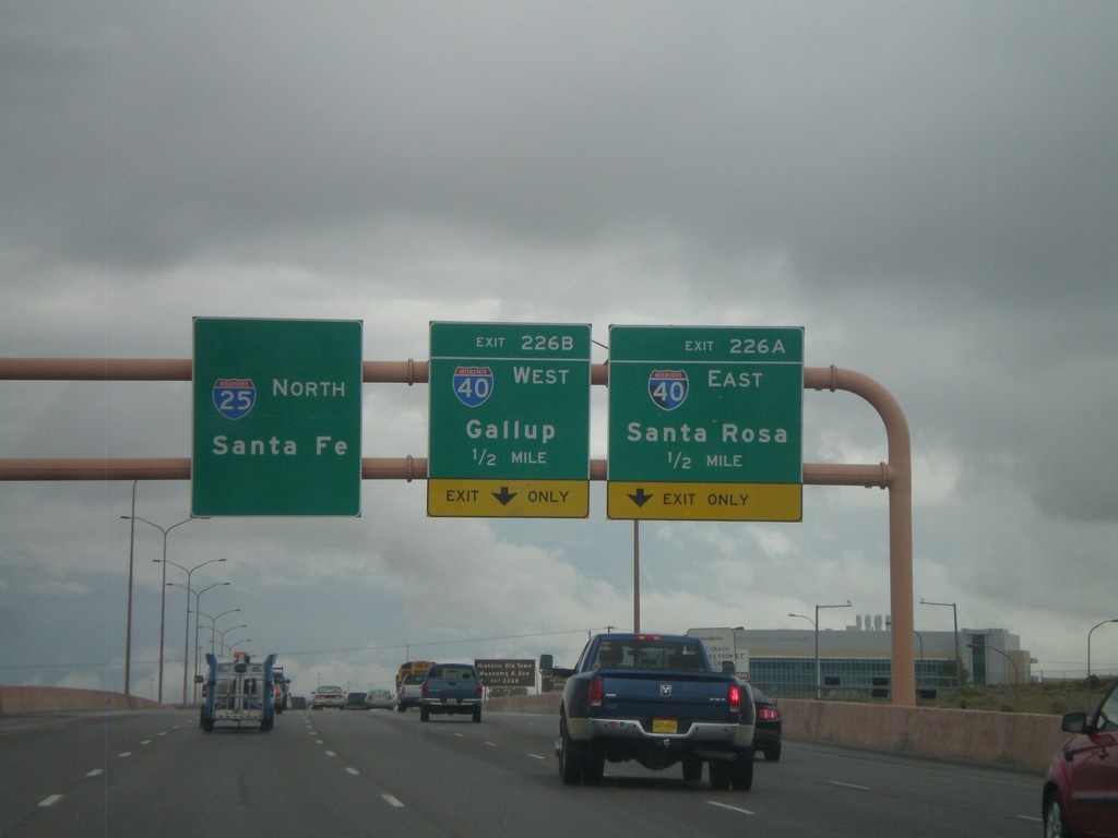
I-25 North - Exits 226A and B
I-25 North approaching Exit 226A - I-40 East/Santa Rosa. Also approaching Exit 226B - I-40 West/Gallup. I-25 continues north towards Santa Fe.
Taken 10-04-2011
Albuquerque
Bernalillo County
New Mexico
United States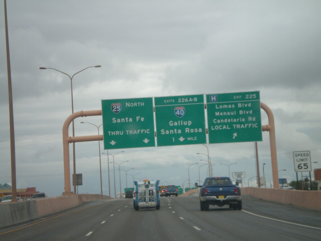
I-25 North - Exits 225 and 226AB
I-25 north at Exit 225 - Lomas Blvd./Menaul Blvd./Candelaria Road./LOCAL TRAFFIC. Approaching Exits 226AB - I-40/Gallup/Santa Rosa. Continue north on I-25 for Santa Fe.
Taken 10-04-2011
Albuquerque
Bernalillo County
New Mexico
United States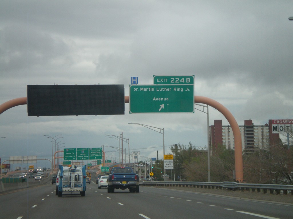
I-25 North - Exit 224B
I-25 north at Exit 224B - Dr. Martin Luther King Jr. Ave.
Taken 10-04-2011
Albuquerque
Bernalillo County
New Mexico
United States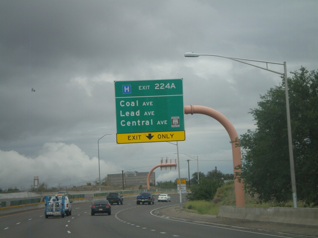
I-25 North - Exit 224A
I-25 north at Exit 224A - Coal Ave./Lead Ave./Central Ave./Historic US-66.
Taken 10-04-2011
Albuquerque
Bernalillo County
New Mexico
United States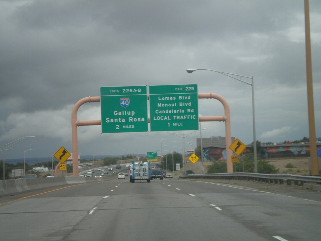
I-25 North - Exits 225 and 226AB
I-25 north approaching Exit 225 - Lomas Blvd./Menaul Blvd./Candelaria Road/LOCAL TRAFFIC. Also approaching Exits 226AB - I-40/Gallup/Santa Rosa.
Taken 10-04-2011
Albuquerque
Bernalillo County
New Mexico
United States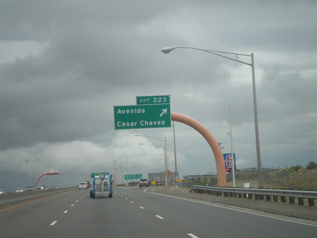
I-25 North - Exit 223
I-25 north at Exit 223 - Avenida Cesar Chavez.
Taken 10-04-2011
Albuquerque
Bernalillo County
New Mexico
United States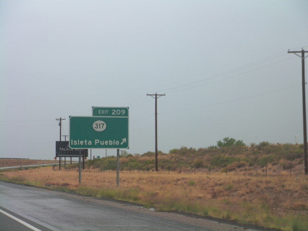
I-25 North - Exit 209
I-25 north at Exit 209 - NM-317/Isleta Pueblo.
Taken 10-04-2011
 Albuquerque
Bernalillo County
New Mexico
United States
Albuquerque
Bernalillo County
New Mexico
United States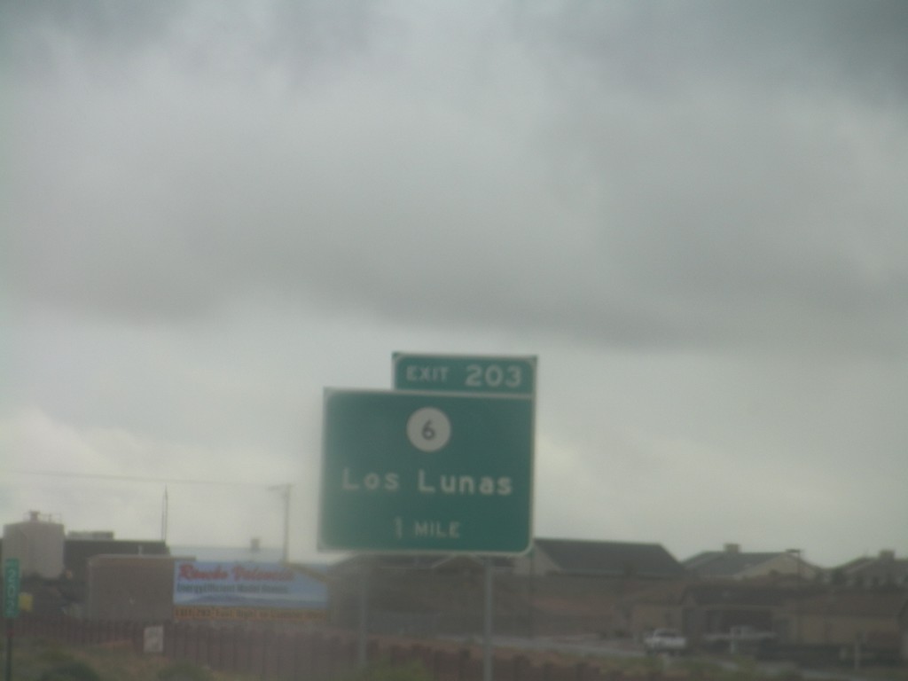
I-25 North - Exit 203
I-25 north approaching Exit 203 - NM-6/Las Lunas.
Taken 10-04-2011
 Belen
Valencia County
New Mexico
United States
Belen
Valencia County
New Mexico
United States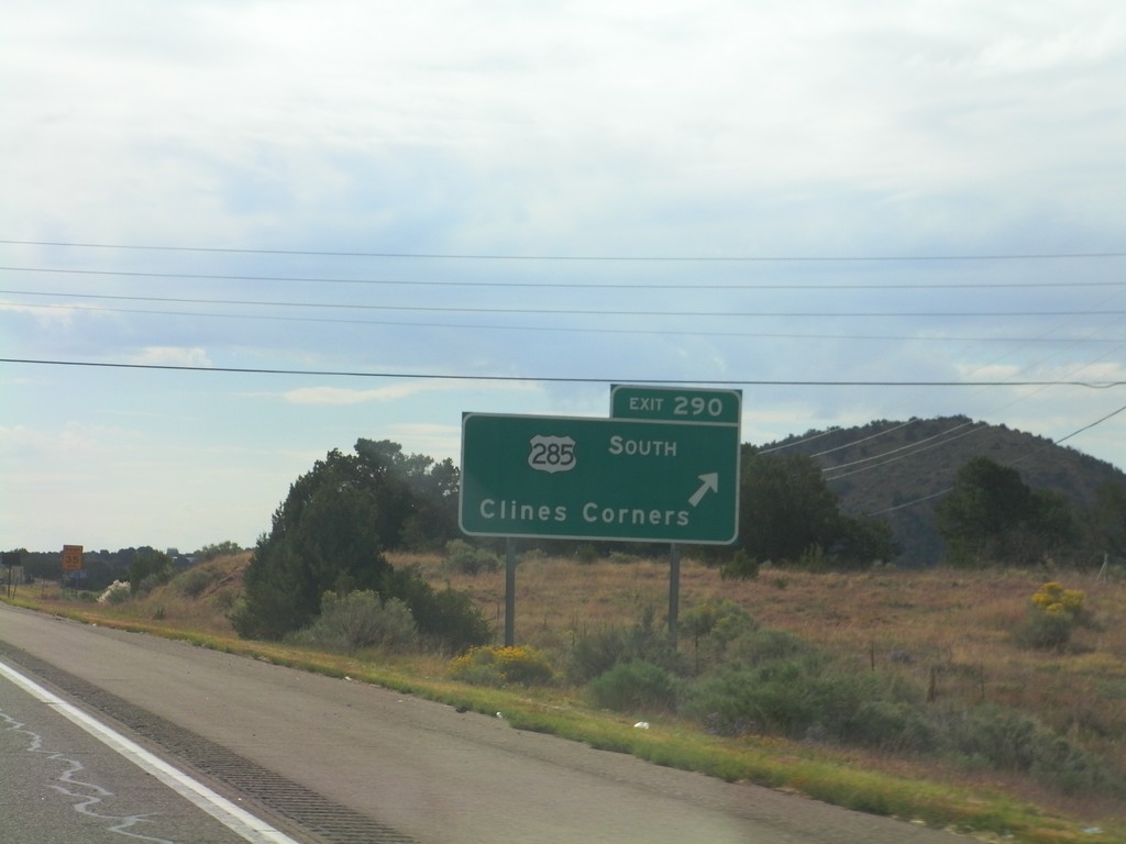
I-25 North - Exit 290
I-25 north at Exit 290 - US-285 South/Clines Corner. US-285 leaves I-25 south here.
Taken 10-04-2011

 Santa Fe
 County
New Mexico
United States
Santa Fe
Santa Fe County
New Mexico
United States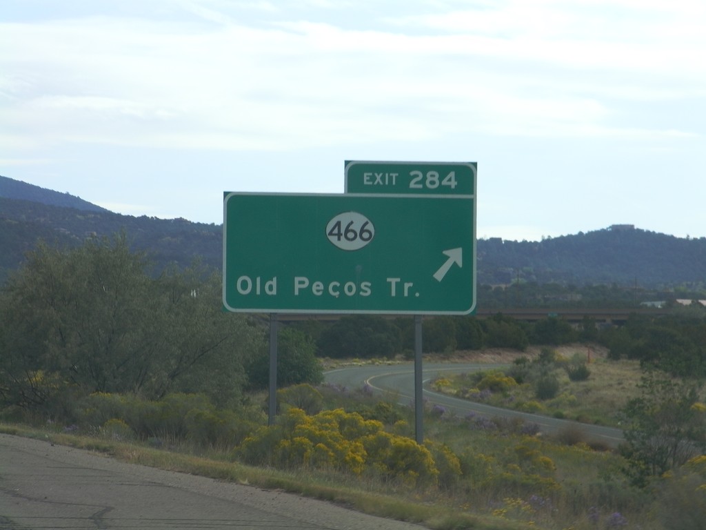
I-25 North - Exit 284
I-25 north at Exit 284 - NM-466/Old Pecos Trail.
Taken 10-04-2011
 Santa Fe
 County
New Mexico
United States
Santa Fe
Santa Fe County
New Mexico
United States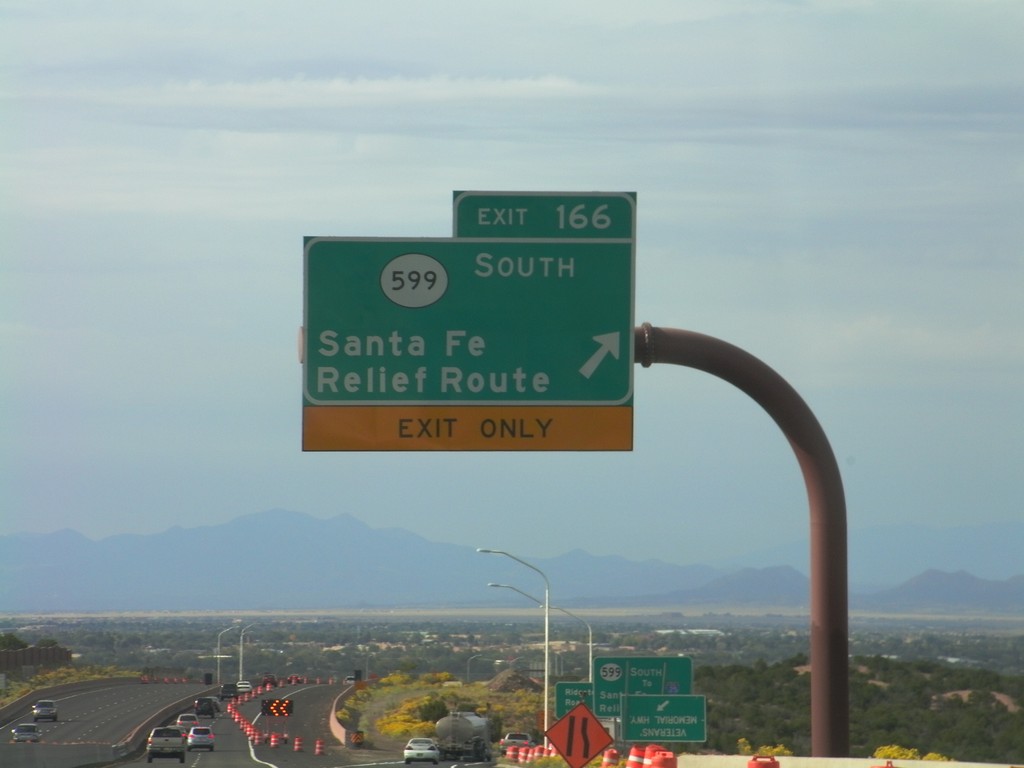
US-84/US-285 South - Exit 166
US-285 South/US-84 East at Exit 166 - NM-599 South/Santa Fe Relief Route. After this interchange, the US-84/US-285 South freeway ends and becomes St. Francis Drive, in Santa Fe.
Taken 10-04-2011
 Santa Fe
 County
New Mexico
United States
Santa Fe
Santa Fe County
New Mexico
United States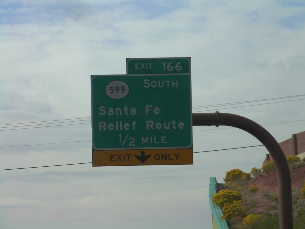
US-84/US-285 South Approaching Exit 166
US-84/US-285 South approaching Exit 166 - NM-599/Santa Fe Relief Route.
Taken 10-04-2011
Santa Fe
Santa Fe County
New Mexico
United States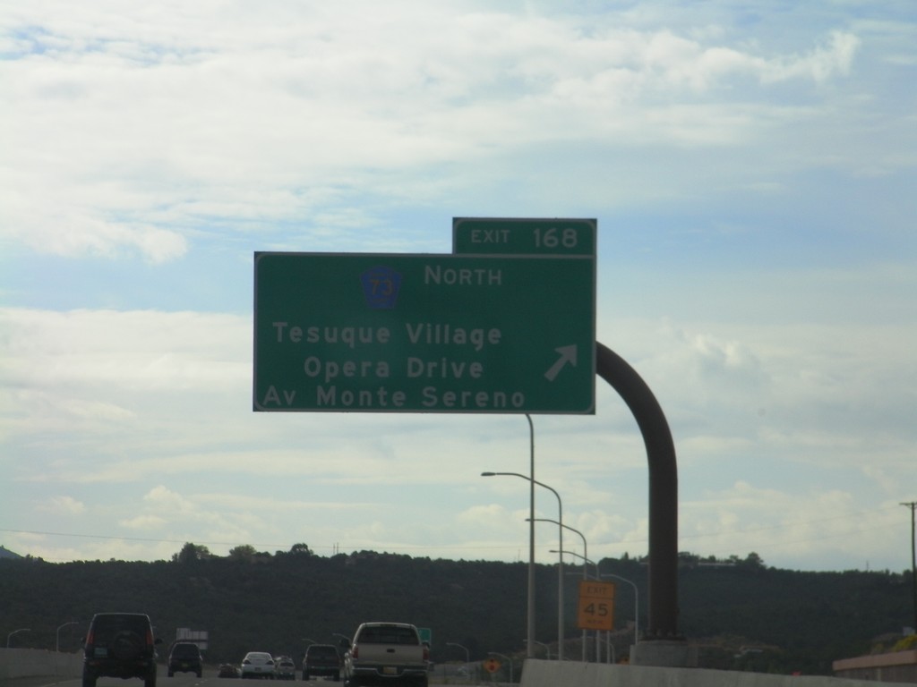
US-84/US-285 South - Exit 168
US-84/US-285 South at Exit 168 - CH-73 North/Tesuque Village/Opera Drive/Av Monte Sereno.
Taken 10-04-2011
 Santa Fe
 County
New Mexico
United States
Santa Fe
Santa Fe County
New Mexico
United States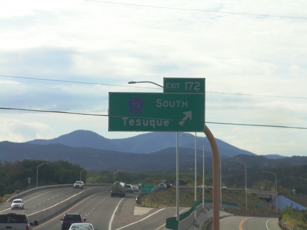
US-84/US-285 South - Exit 172
US-84/US-285 South at Exit 172 - CH-73 South/Tesuque.
Taken 10-04-2011
Santa Fe
Santa Fe County
New Mexico
United States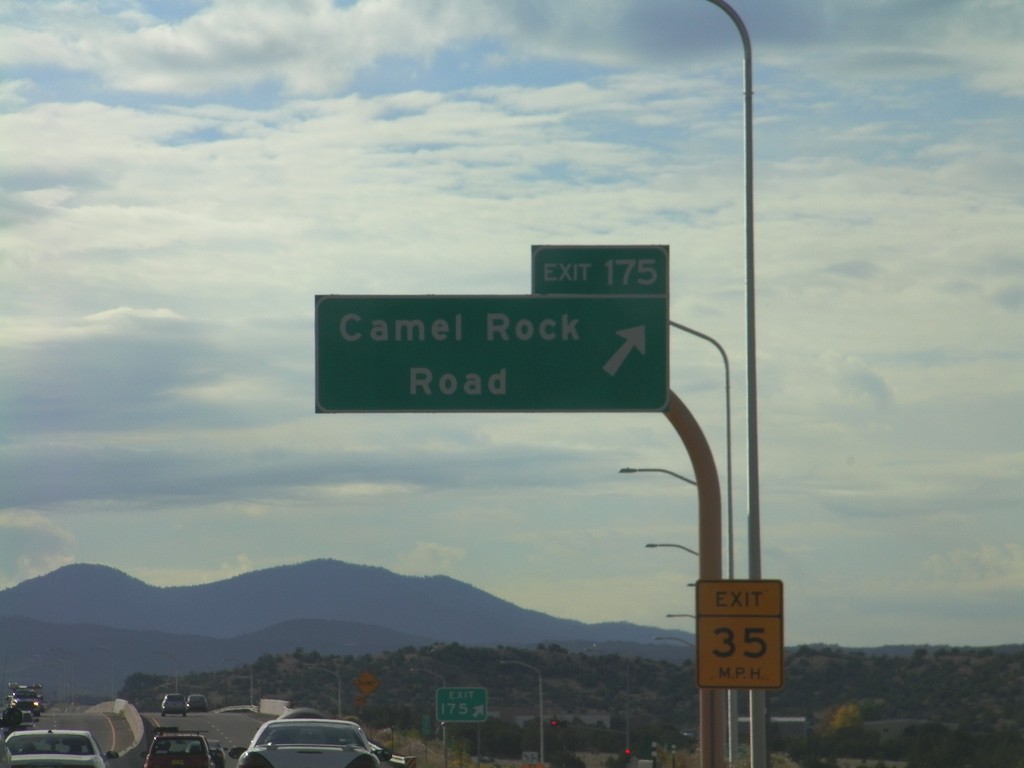
US-84/US-285 South - Exit 175
US-84/US-285 South at Exit 175 - Camel Rock Road.
Taken 10-04-2011
Santa Fe
Santa Fe County
New Mexico
United States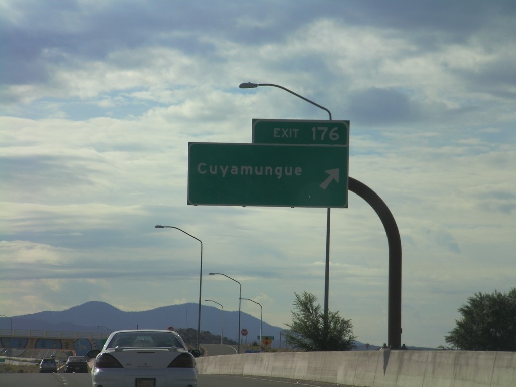
US-84/US-285 South - Exit 176
US-84/US-285 South at Exit 176 - Cuyamungue.
Taken 10-04-2011
Santa Fe
Santa Fe County
New Mexico
United States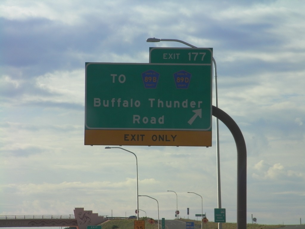
US-84/US-285 South - Exit 177
US-84/US-285 South at Exit 177 - To CH-89B/CH-89D/Buffalo Thunder Road.
Taken 10-04-2011

 Santa Fe
 County
New Mexico
United States
Santa Fe
Santa Fe County
New Mexico
United States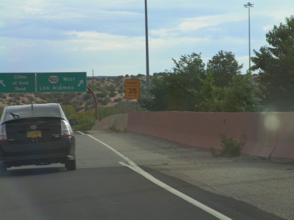
US-84/US-285 South - NM-502
US-84/US-285 South on NM-502 offramp. Merge left for Cities of Gold Road. Merge right for NM-502 West for Los Alamos.
Taken 10-03-2011
 Jaconita
Santa Fe County
New Mexico
United States
Jaconita
Santa Fe County
New Mexico
United States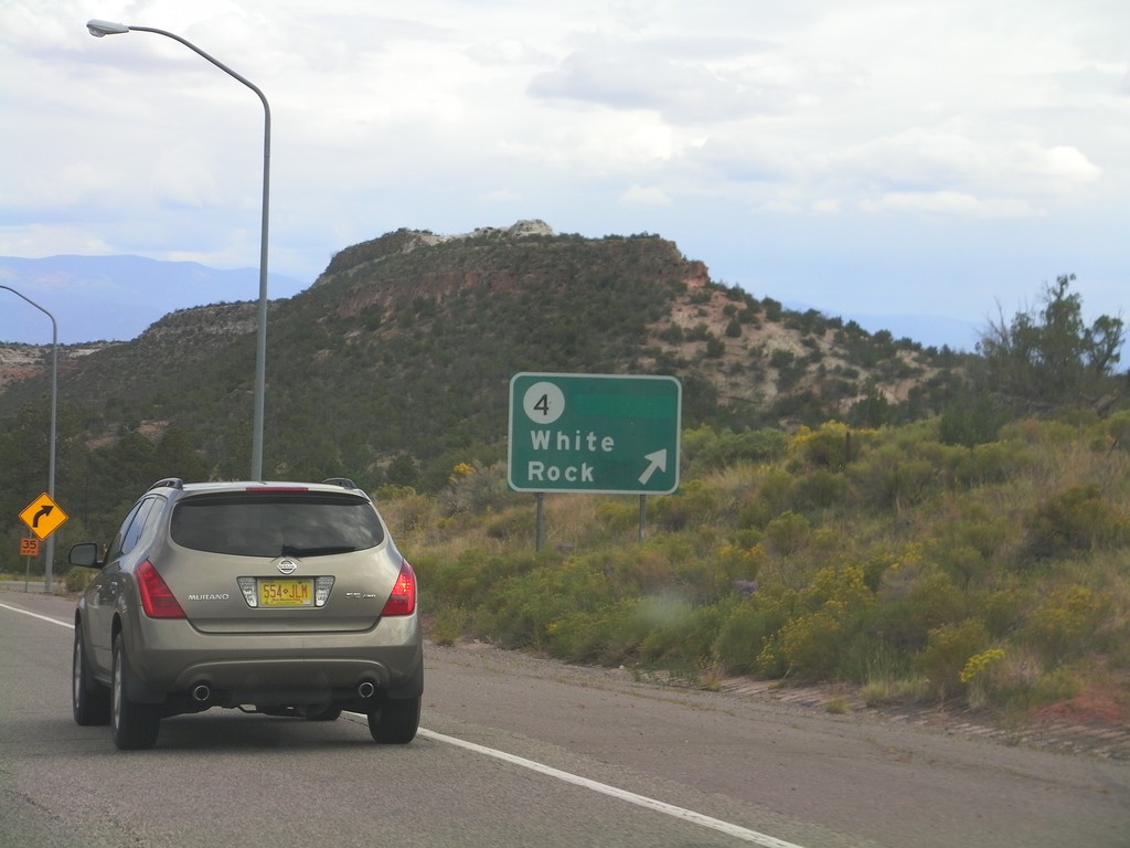
NM-502 East at NM-4
NM-502 east at NM-4 west to White Rock.
Taken 10-03-2011
 Los Alamos
Santa Fe County
New Mexico
United States
Los Alamos
Santa Fe County
New Mexico
United States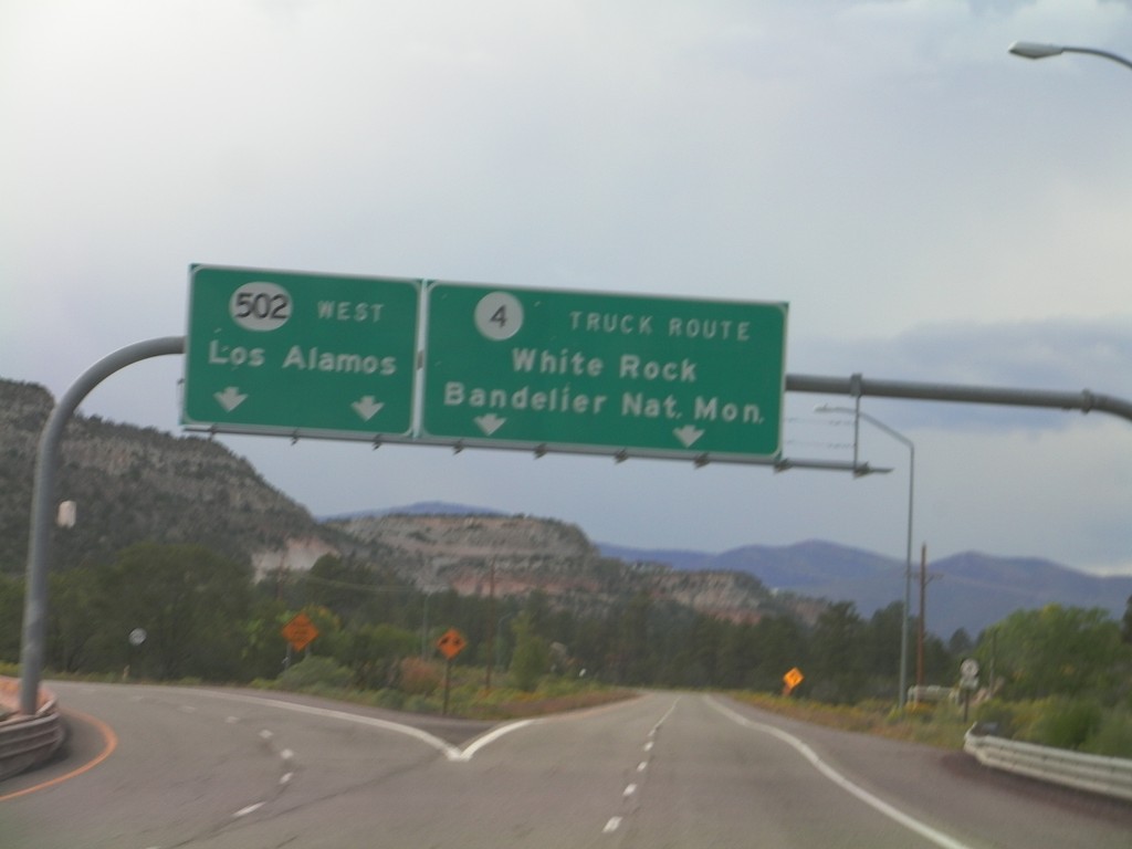
NM-502 West at NM-4
NM-502 West at NM-4. Merge right for NM-4/White Rock/Bandelier National Monument. This is the truck route into Los Alamos. Continue ahead for NM-502 west to Los Alamos.
Taken 10-02-2011
Los Alamos
Santa Fe County
New Mexico
United States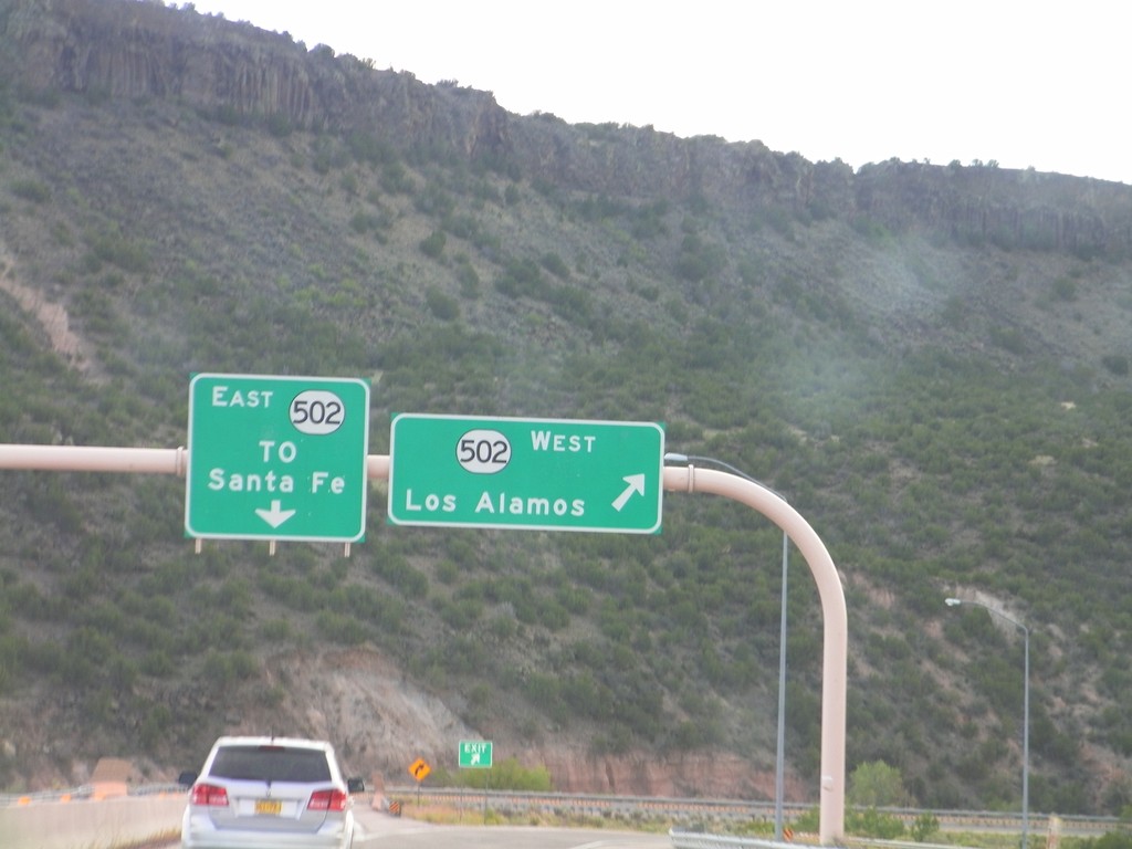
End NM-30 South at NM-520
End NM-30 South at NM-520. Use NM-520 west for Los Alamos; use NM-520 east for Santa Fe.
Taken 10-02-2011
 Santa Fe
 County
New Mexico
United States
Santa Fe
Santa Fe County
New Mexico
United States