Signs Tagged With Freeway Junction
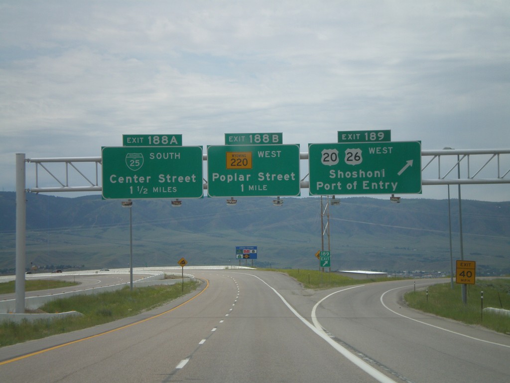
I-25 South - Exits 189, 188B, 188A
I-25/US-87 South at Exit 187 - US-20/US-26 West/Shoshoni/Port of Entry. Approaching Exit 188B - WY-220 West/Poplar St. Also approaching Exit 188A - BL-25 South/Center St. US-20/US-26 join I-25/US-87 south through Casper at this interchange.
Taken 07-04-2011


 Casper
Natrona County
Wyoming
United States
Casper
Natrona County
Wyoming
United States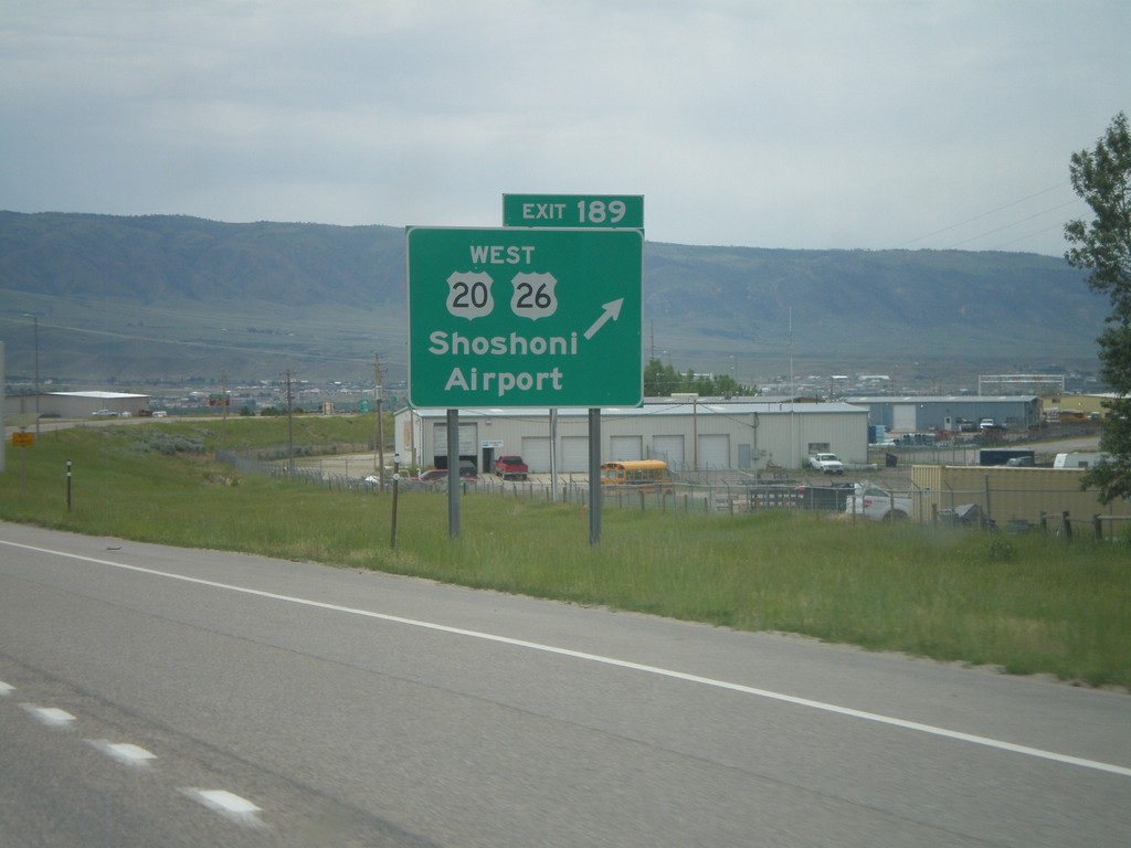
I-25 South - Exit 189
I-25/US-87 South - Exit 189 - US-20/US-26 West/Shoshoni/Airport. US-20/US-26 joins I-25 south through Casper.
Taken 07-04-2011
Casper
Natrona County
Wyoming
United States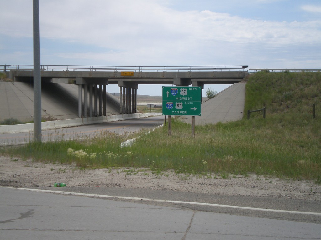
Begin WY-387 North at I-25
Begin WY-387 north at I-25/US-87. Use I-25 South/US-87 South for Casper. I-25 North/US-87 North is signed for Midwest, where actually WY-387 north heads towards Midwest. The actual destination for I-25/US-87 North would be for Kaycee or Buffalo.
Taken 07-04-2011
 Midwest
Natrona County
Wyoming
United States
Midwest
Natrona County
Wyoming
United States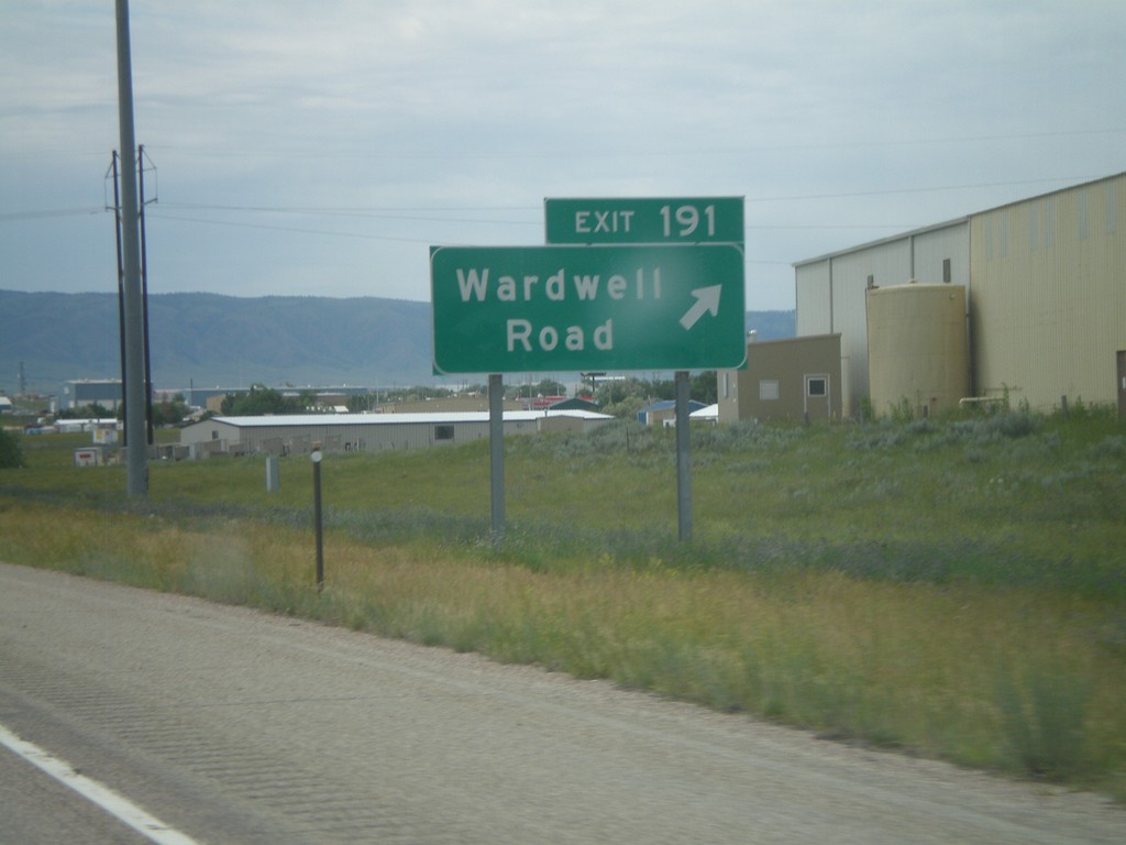
I-25 South - Exit 191
I-25 south at Exit 191 - Wardwell Road. This is the first exit along I-25 in the Casper area.
Taken 07-04-2011
 Casper
Natrona County
Wyoming
United States
Casper
Natrona County
Wyoming
United States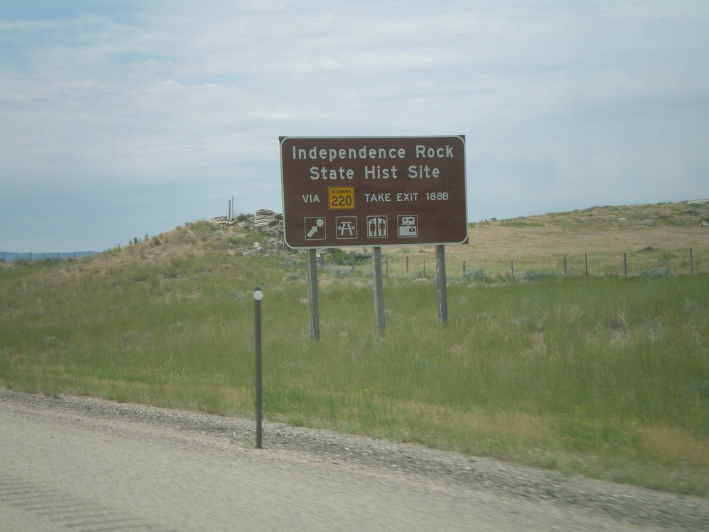
I-25 South - Independence Rock State Historic Site
Directions for Independence Rock State Historic Site on I-25/US-87 South. Use WY-220 via Exit 188B for Independence Rock State Historic Site.
Taken 07-04-2011
Casper
Natrona County
Wyoming
United States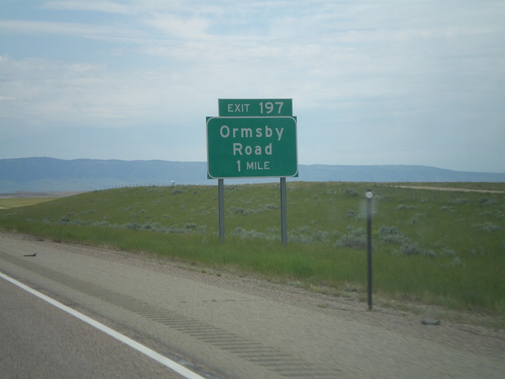
I-25 South - Exit 197
I-25/US-87 South approaching Exit 197 - Ormsby Road.
Taken 07-04-2011
Casper
Natrona County
Wyoming
United States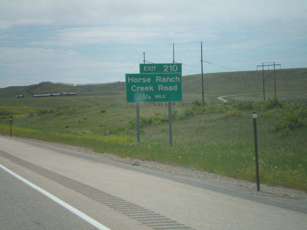
I-25 South - Exit 210
I-25 South at Exit 210 - Horse Ranch Creek Road. This is also the intersection with WY-259, although it is not signed in this direction.
Taken 07-04-2011
 Casper
Natrona County
Wyoming
United States
Casper
Natrona County
Wyoming
United States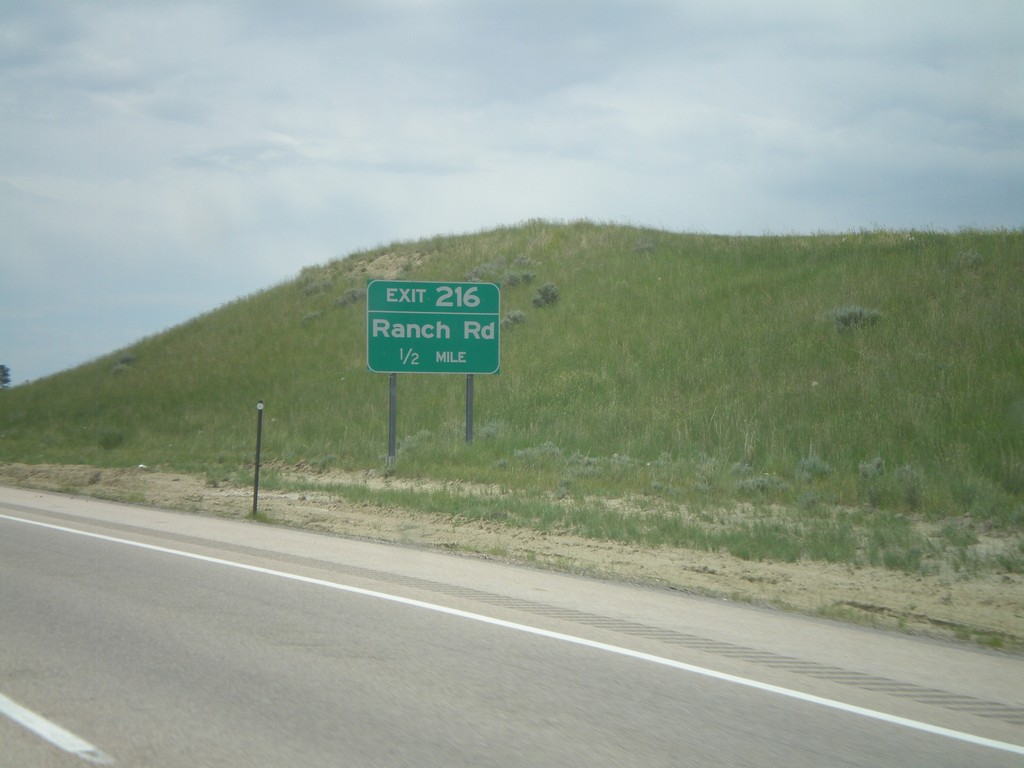
I-25 South - Exit 216
I-25/US-87 south approaching Exit 216 - Ranch Road.
Taken 07-04-2011
Casper
Natrona County
Wyoming
United States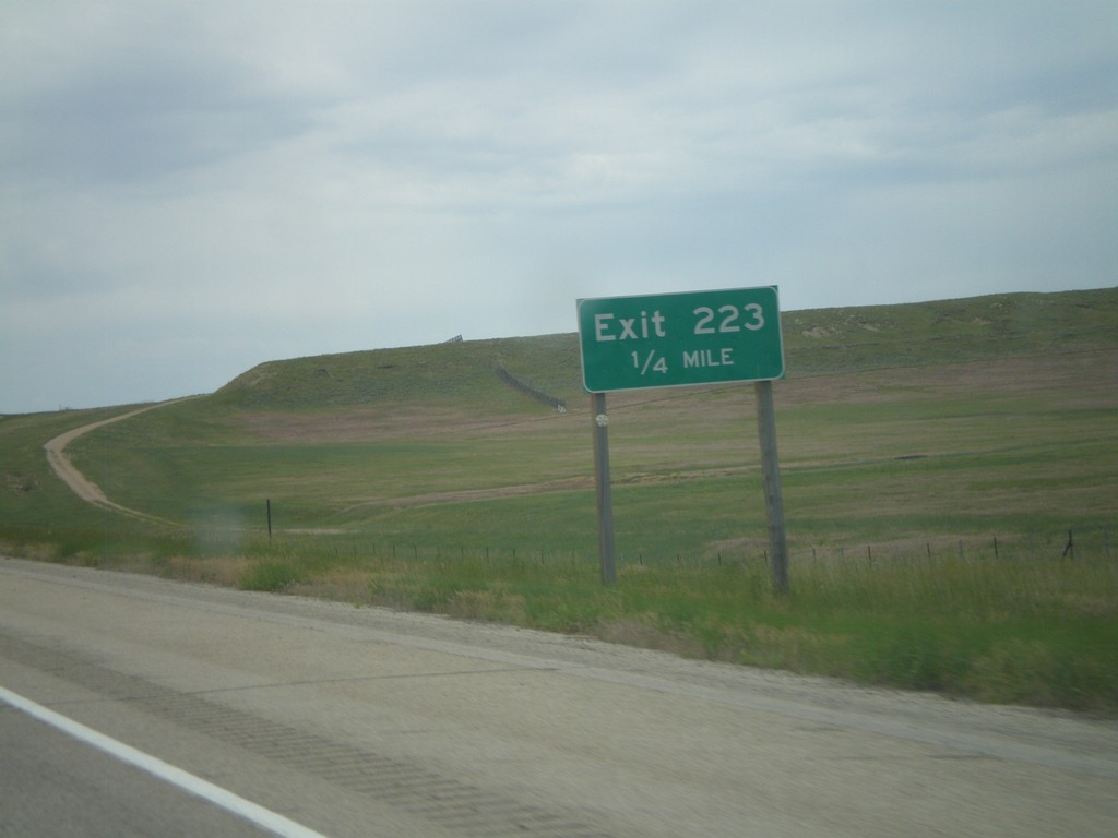
I-25 South - Exit 223
I-25 South at Exit 223 (No Name). This is one of the few unnamed interchanges in Wyoming. The Wyoming DOT Milepost Reference publication calls this the Midwest Interchange.
Taken 07-04-2011
Casper
Natrona County
Wyoming
United States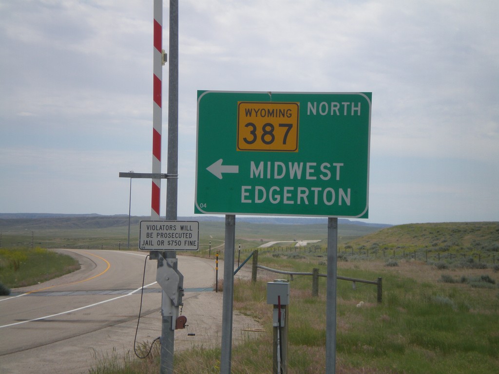
I-25 South at WY-387
I-25 south at WY-387. Use WY-387 North for Midwest and Edgerton. Continue ahead to return to I-25 south. Notice the closed highway gate for severe weather.
Taken 07-04-2011
Midwest
Natrona County
Wyoming
United States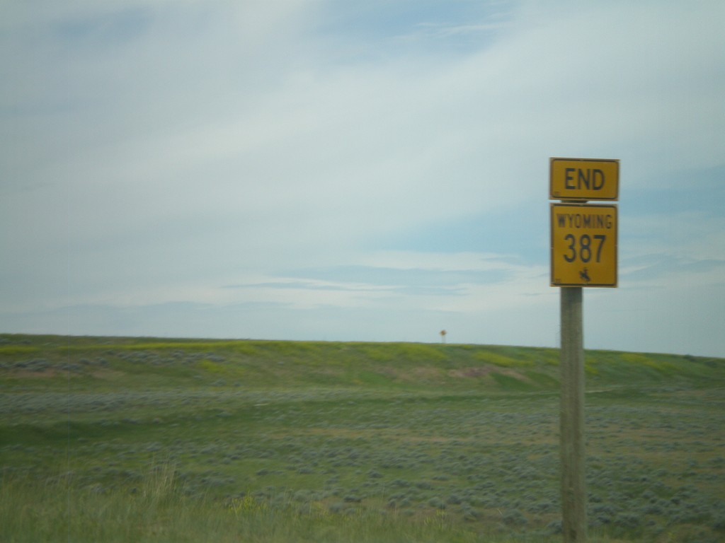
End WY-387 West at I-25/US-87
End WY-387 west at I-25/US-87 (Exit 227) near Midwest.
Taken 07-04-2011
Midwest
Natrona County
Wyoming
United States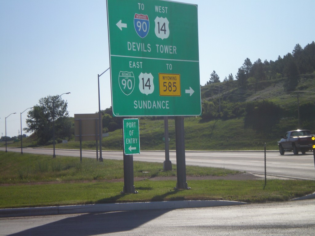
WY-116 North at BL-90/US-14
WY-116 north at BL-90/US-14. Turn right on BL-90/US-14 East for WY-585 and Sundance (City Center). Turn left for US-14 West to I-90 and Devils Tower.
Taken 07-04-2011


 Sundance
Crook County
Wyoming
United States
Sundance
Crook County
Wyoming
United States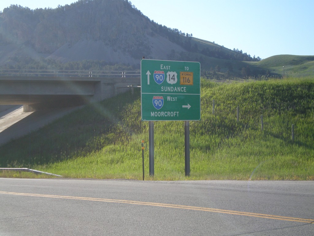
US-14 East at I-90 West (Exit 185)
US-14 east at I-90 West (Exit 185). Use I-90 west for Moorcroft. Continue east on US-14 for I-90 East, WY-116 and Sundance (City Center). The is the beginning of the I-90 Business Loop in Sundance.
Taken 07-04-2011
Sundance
Crook County
Wyoming
United States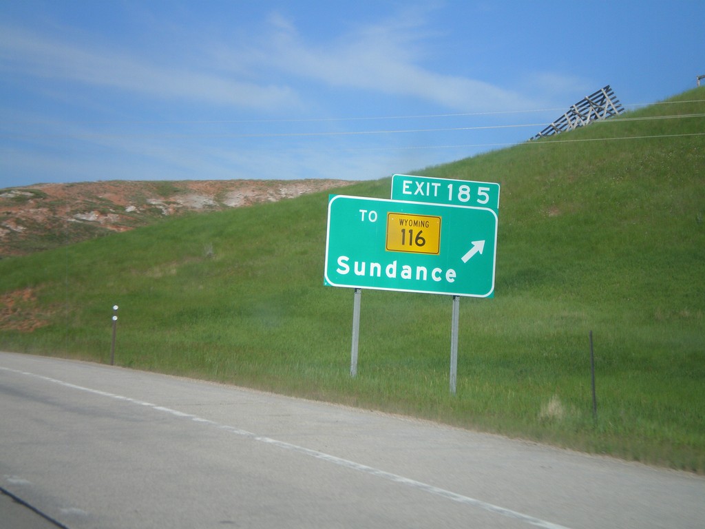
I-90 West - Exit 185
I-90 west at Exit 185 - To WY-116/Sundance.
Taken 07-04-2011
Sundance
Crook County
Wyoming
United States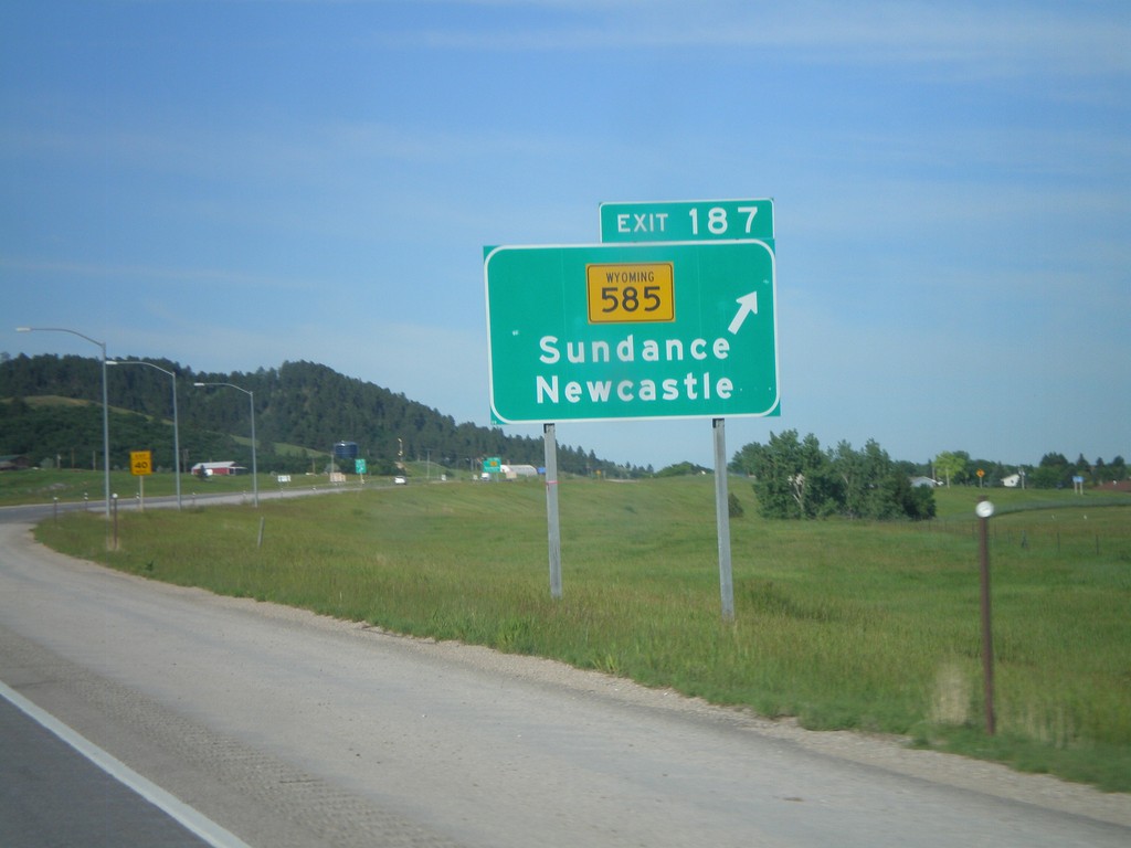
I-90 West - Exit 187
I-90 west at Exit 187 - WY-585/Sundance/Newcastle.
Taken 07-04-2011
Sundance
Crook County
Wyoming
United States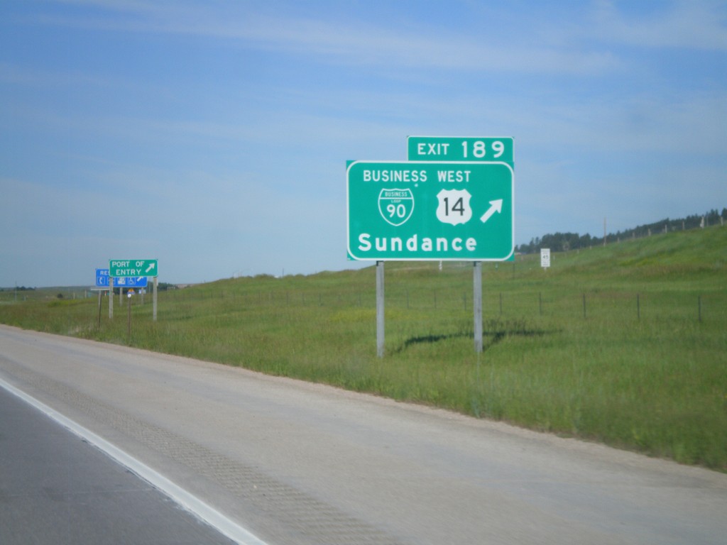
I-90 West - Exit 189
I-90/US-14 West at Exit 189 - BL-90/US-14 West/Sundance. US-14 leaves I-90 here and heads northwest to the Devils Tower National Monument. This is the eastern end of the Sundance business loop.
Taken 07-04-2011
Sundance
Crook County
Wyoming
United States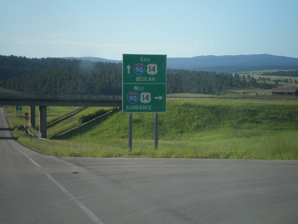
End WY-111 South at I-90 (Exit 199)
WY-111 south at I-90/US-14 (Exit 199). Use I-90/US-14 East for Beulah; west for Sundance.
Taken 07-04-2011
 Farrall
Crook County
Wyoming
United States
Farrall
Crook County
Wyoming
United States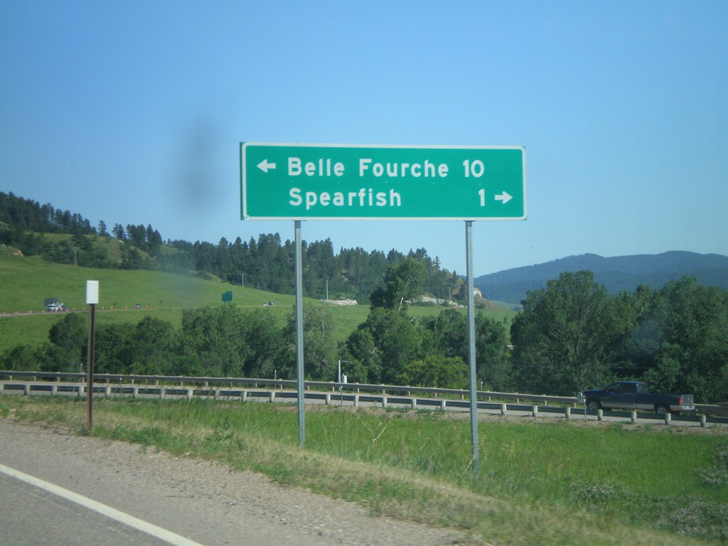
I-90/US-14 East at US-85
I-90/US-14 East (Exit 10) at US-85. Turn left for US-85 North to Belle Fourche. Turn right for BL-90 to Spearfish.
Taken 07-03-2011
 Spearfish
Lawrence County
South Dakota
United States
Spearfish
Lawrence County
South Dakota
United States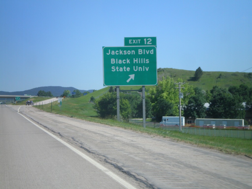
I-90 East - Exit 12
I-90 East at Exit 12 - Jackson Blvd/Black Hills State University.
Taken 07-03-2011
Spearfish
Lawrence County
South Dakota
United States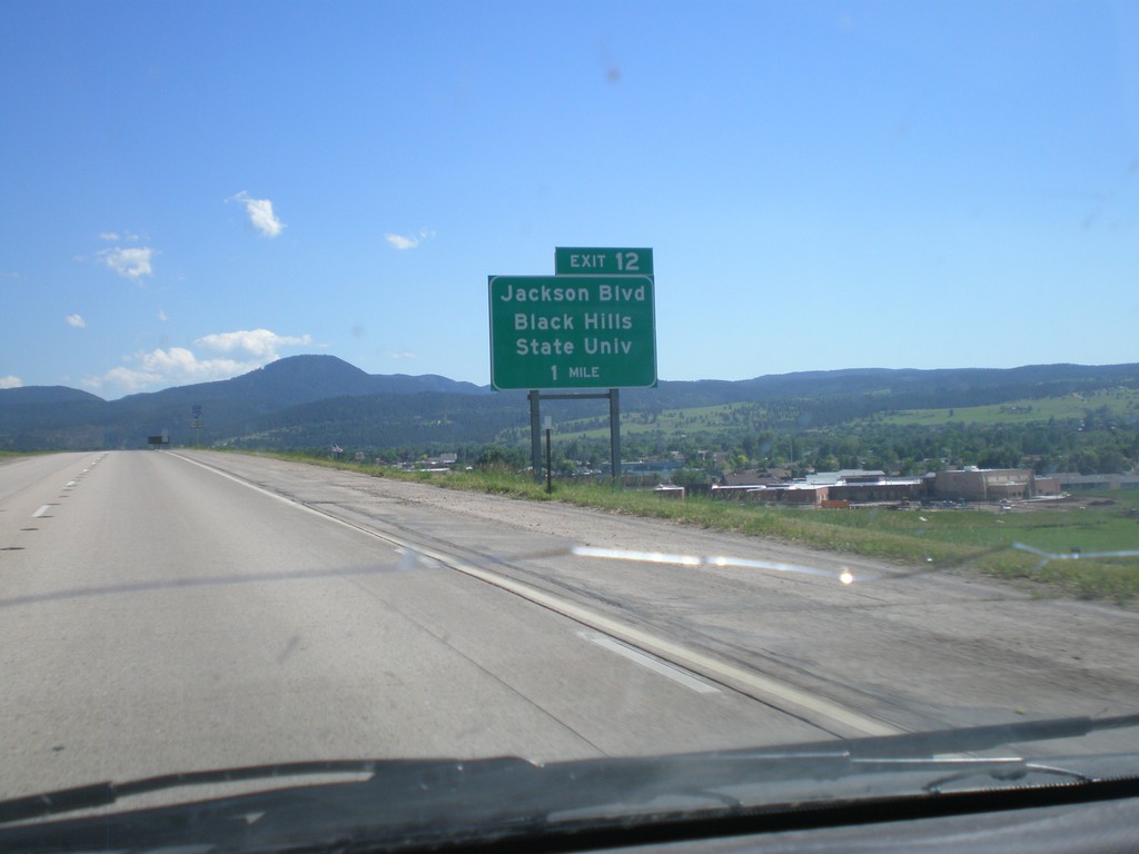
I-90 East Approaching Exit 12
I-90 East approaching Exit 12 - Jackson Blvd/Black Hills State University.
Taken 07-03-2011
Spearfish
Lawrence County
South Dakota
United States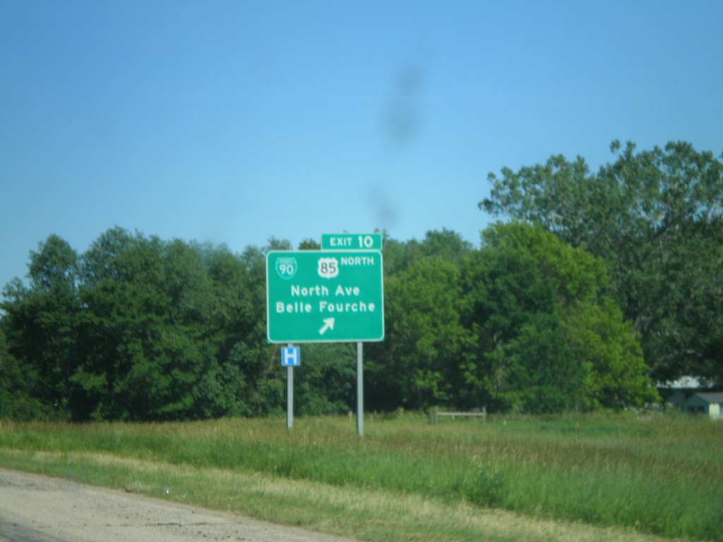
I-90 East - Exit 10
I-90 East at Exit 10 - BL-90/US-85 North/North Ave./Belle Fourche. US-85 joins I-90 east through Spearfish.
Taken 07-03-2011
Spearfish
Lawrence County
South Dakota
United States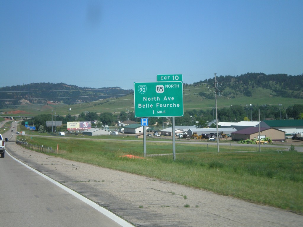
I-90 East Approaching Exit 10
I-90 East approaching Exit 10 - BL-90/US-85 North/Belle Fourche/North Ave. This is the western end of the Spearfish business loop. US-85 joins I-90 eastbound through Spearfish.
Taken 07-03-2011
Spearfish
Lawrence County
South Dakota
United States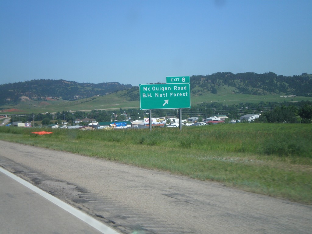
I-90 East - Exit 8
I-90 East at Exit 8 - Mc Guigan Road/Black Hills National Forest.
Taken 07-03-2011
Spearfish
Lawrence County
South Dakota
United States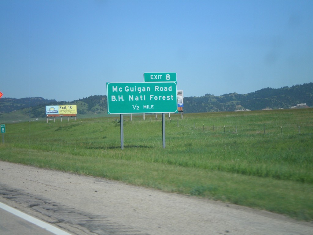
I-90 East - Exit 8
I-90 east approaching Exit 8 - Mc Guigan Road/Black Hills National Forest. The Black Hills are in the background of the picture.
Taken 07-03-2011
Spearfish
Lawrence County
South Dakota
United States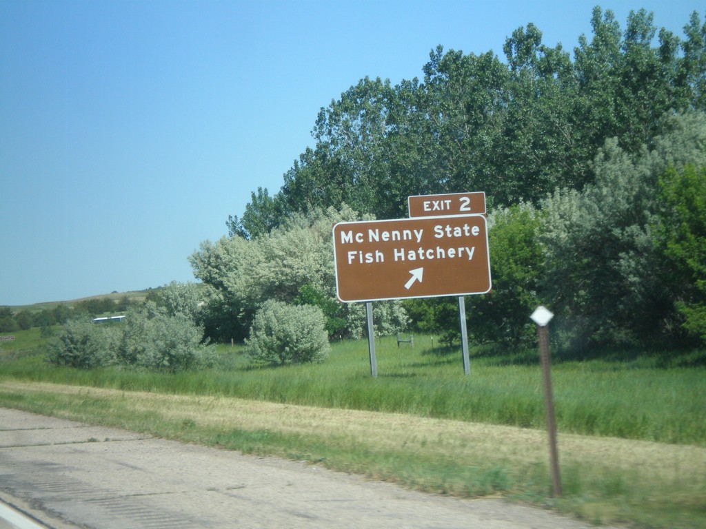
I-90 East - Exit 2
I-90 East at Exit 2 Mc Nenny State Fish Hatchery. This is the first exit eastbound on I-90 in South Dakota.
Taken 07-03-2011
North Spearfish
Lawrence County
South Dakota
United States