Signs Tagged With Freeway Junction
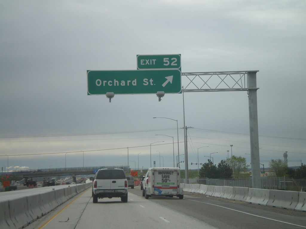
I-84 East - Exit 52
I-84 east at Exit 52 - Orchard St. Orchard St. provides access to Gowen Field - the National Guard Base. This interchange is currently being rebuilt.
Taken 05-01-2010

 Boise
Ada County
Idaho
United States
Boise
Ada County
Idaho
United States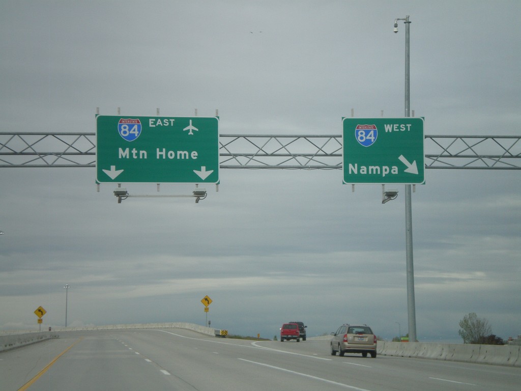
End I-184 at I-84
End I-184 on the ramp to I-84 East to Mountain Home, and I-84 west to Nampa. The control cities on this interchange was recently changed from Twin Falls and Ontario.
Taken 05-01-2010
 Boise
Ada County
Idaho
United States
Boise
Ada County
Idaho
United States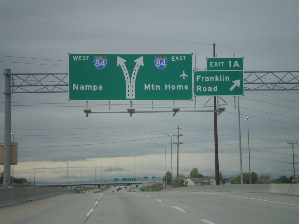
I-184 West - Exit 1A
I-184 west at Exit 1A - Franklin Road. Approaching I-84 to Mountain Home and Nampa.
Taken 05-01-2010
Boise
Ada County
Idaho
United States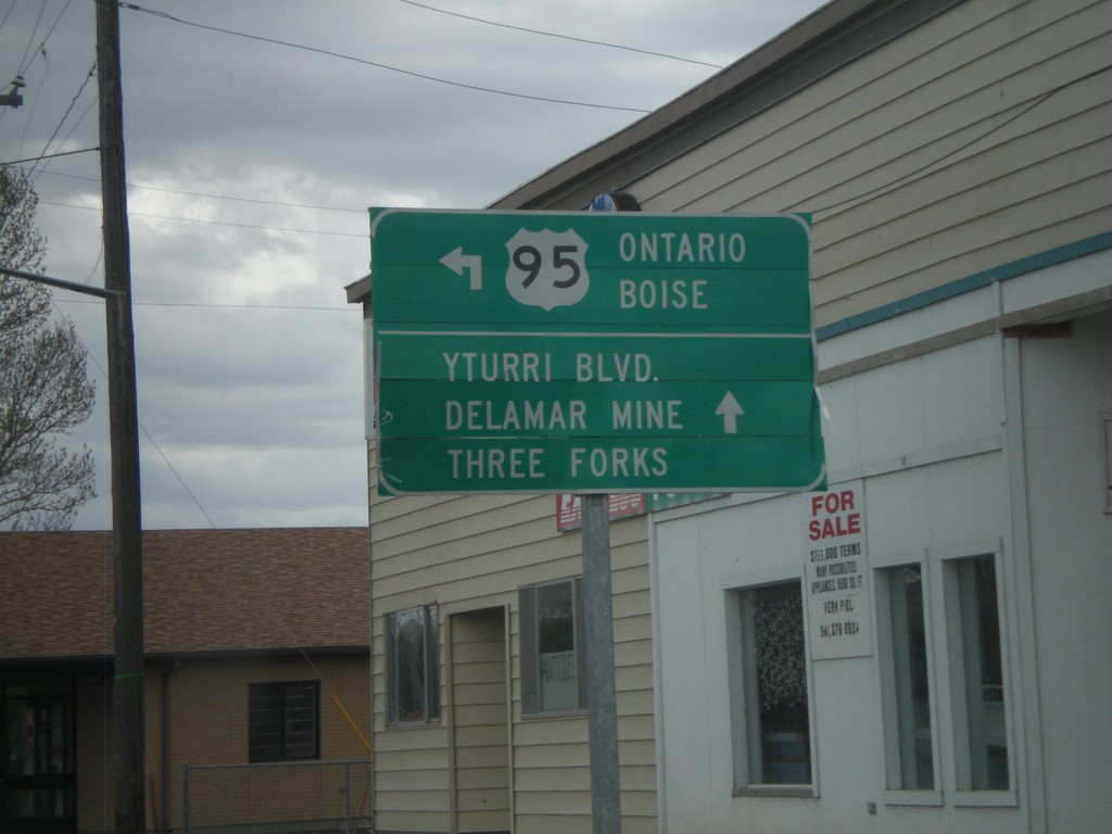
US-95 North - Jordan Valley
US-95 north (Main St.) at Bassett St. Turn north to continue on US-95 north to Ontario and Boise.
Taken 04-20-2010
 Jordan Valley
Malheur County
Oregon
United States
Jordan Valley
Malheur County
Oregon
United States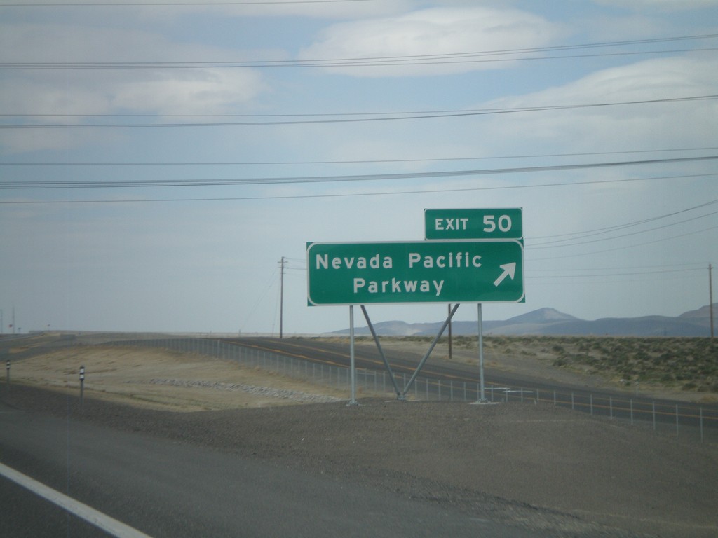
I-80 East - Exit 50
I-80 east at Exit 50 - Nevada Pacific Parkway. This exit was completed in 2010.
Taken 04-19-2010

 Fernley
Lyon County
Nevada
United States
Fernley
Lyon County
Nevada
United States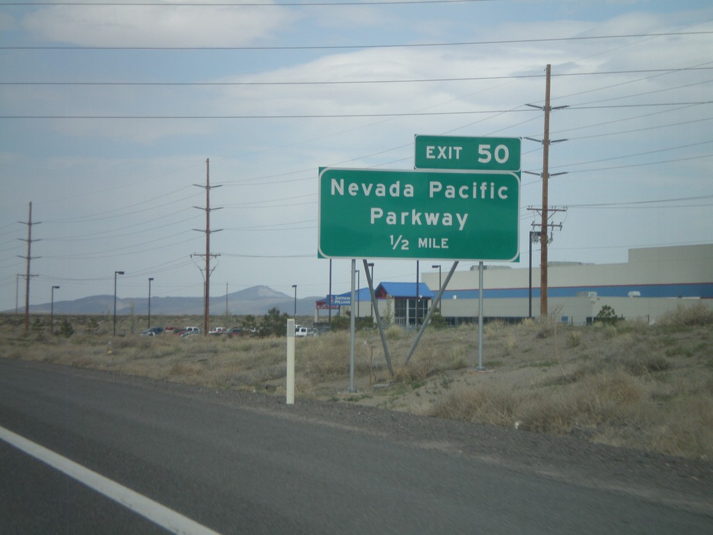
I-80 East Approaching Exit 50
I-80 east approaching Exit 50 - Nevada Pacific Parkway.
Taken 04-19-2010
Fernley
Lyon County
Nevada
United States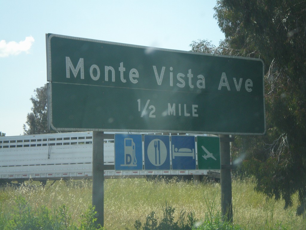
I-80 West - Exit 55
I-80 west approaching Exit 55 - Monte Vista Ave.
Taken 04-16-2010
Vacaville
Solano County
California
United States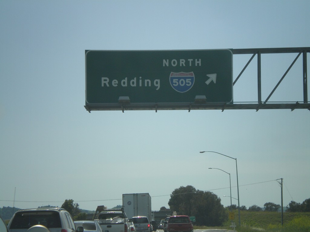
I-80 West - Exit 56
I-80 west at Exit 56 - I-505 North/Redding.
Taken 04-16-2010
 Vacaville
Solano County
California
United States
Vacaville
Solano County
California
United States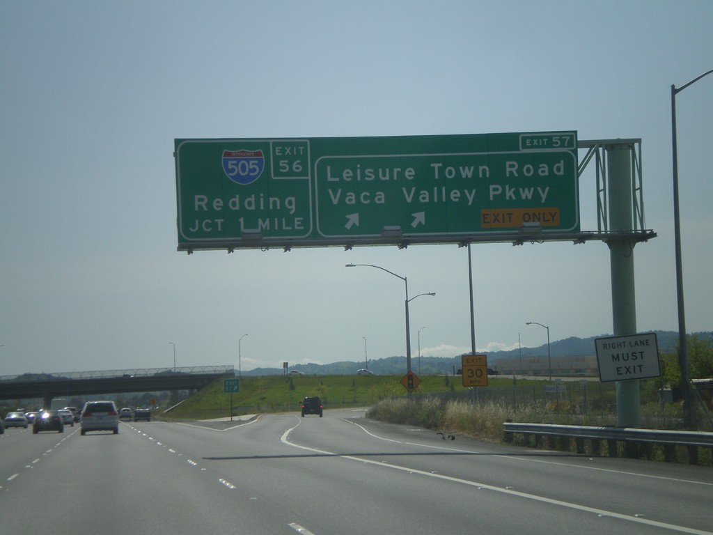
I-80 West - Exit 57 Approaching Exit 56
I-80 west at Exit 57 - Leisure Town Road/Vaca Valley Parkway. Approaching Exit 56 - I-505 North/Redding.
Taken 04-16-2010
Vacaville
Solano County
California
United States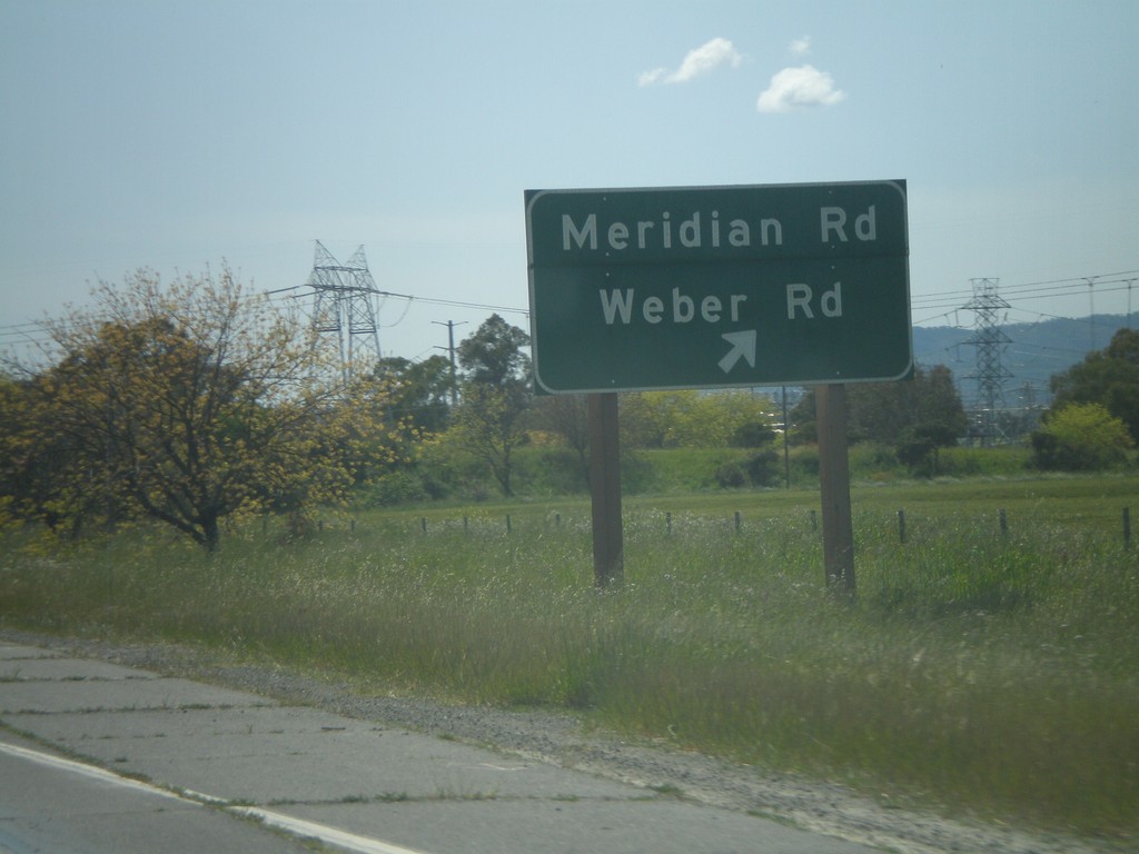
I-80 West - Exit 59
I-80 west at Exit 59 - Meridian Road/Weber Road.
Taken 04-16-2010
Vacaville
Solano County
California
United States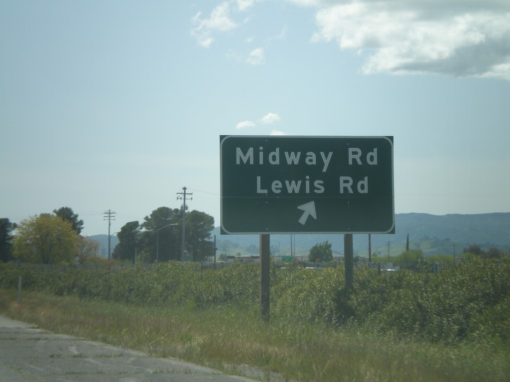
I-80 West - Exit 60
I-80 west at Exit 60 - Midway Road/Lewis Road.
Taken 04-16-2010
Vacaville
Solano County
California
United States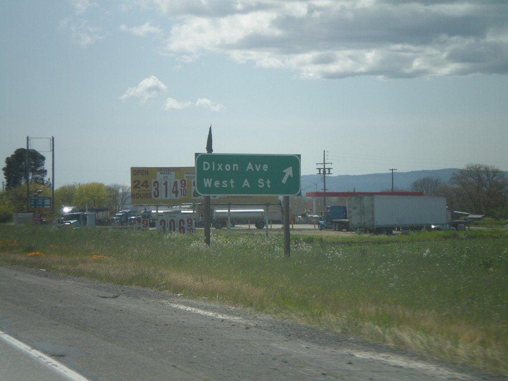
I-80 West - Exit 63
I-80 west at Exit 63 - Dixon Ave./West A St.
Taken 04-16-2010
Dixon
Solano County
California
United States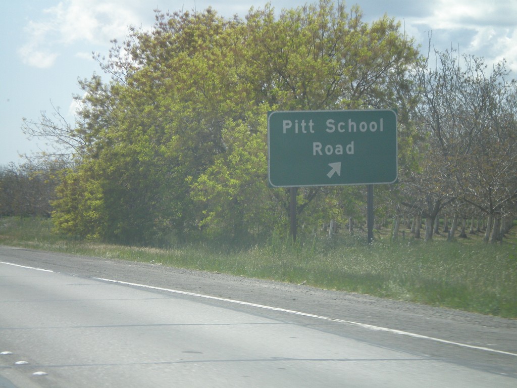
I-80 West - Exit 64
I-80 west at Exit 64 - Pitt School Road.
Taken 04-16-2010
Dixon
Solano County
California
United States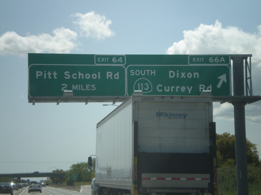
I-80 West/CA-113 South - Exit 66A
I-80 west/CA-113 south at Exit 66A - CA-113 South/Dixon/Currey Road. I-80 and CA-113 split separate here. I-80 west approaches Exit 64 - Pitt School Road.
Taken 04-16-2010
 Dixon
Solano County
California
United States
Dixon
Solano County
California
United States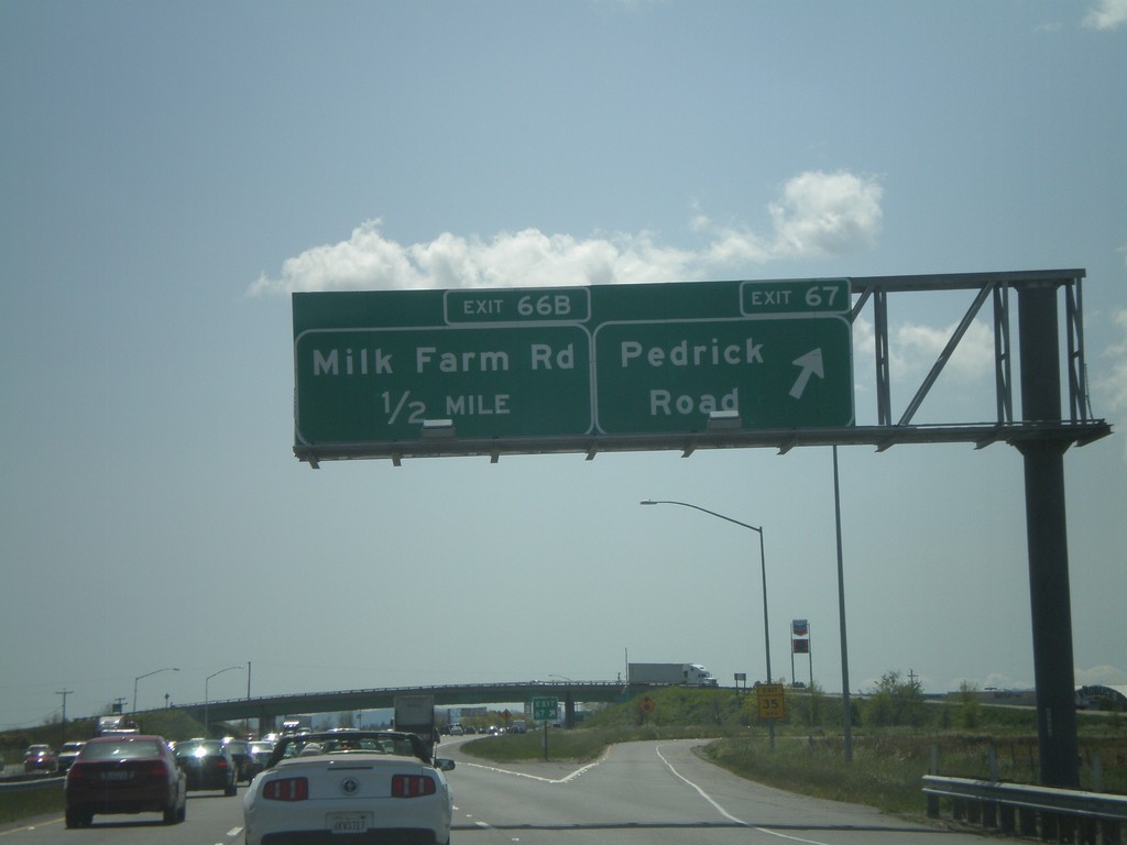
I-80 West/CA-113 South - Exit 67 Approaching Exit 66B
I-80 west/CA-113 south at Exit 67 - Pedrick Road. Approaching Exit 66B - Milk Farm Road.
Taken 04-16-2010
Dixon
Solano County
California
United States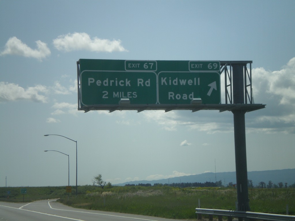
I-80 West/CA-113 South - Exit 69 Approaching Exit 67
I-80 West/CA-113 South at Exit 69 - Kidwell Road. Approaching Exit 67 - Pedrick Road.
Taken 04-16-2010
Dixon
Solano County
California
United States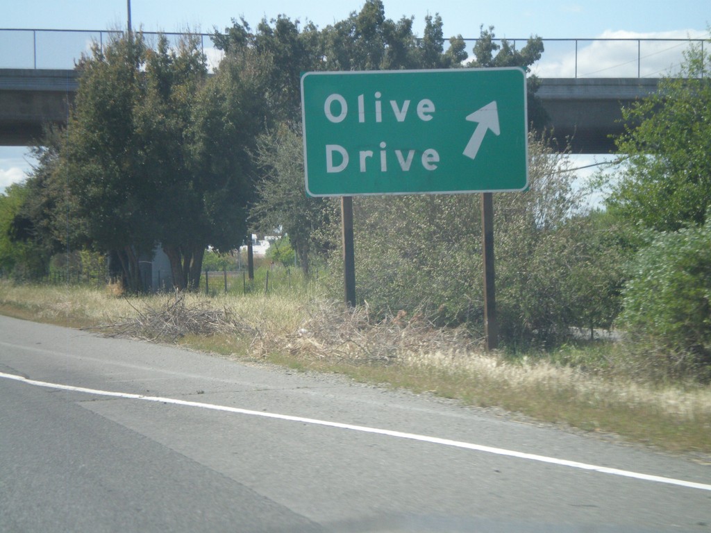
I-80 West - Exit 73
I-80 west at Exit 73 - Olive Drive.
Taken 04-16-2010
Davis
Yolo County
California
United States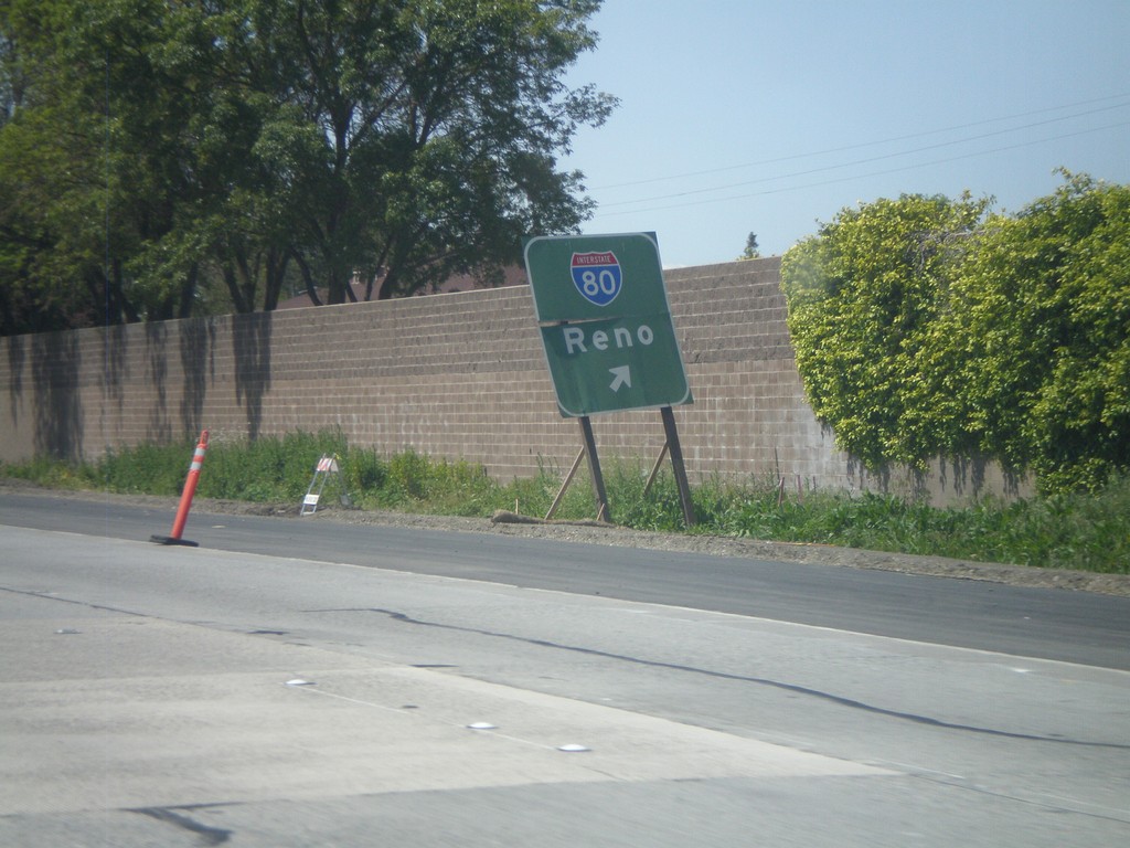
End US-50/BL-80 West at I-80
End US-50/BL-80 west at I-80 to Reno. Roadway turns into I-80 westbound.
Taken 04-16-2010

 West Sacramento
Yolo County
California
United States
West Sacramento
Yolo County
California
United States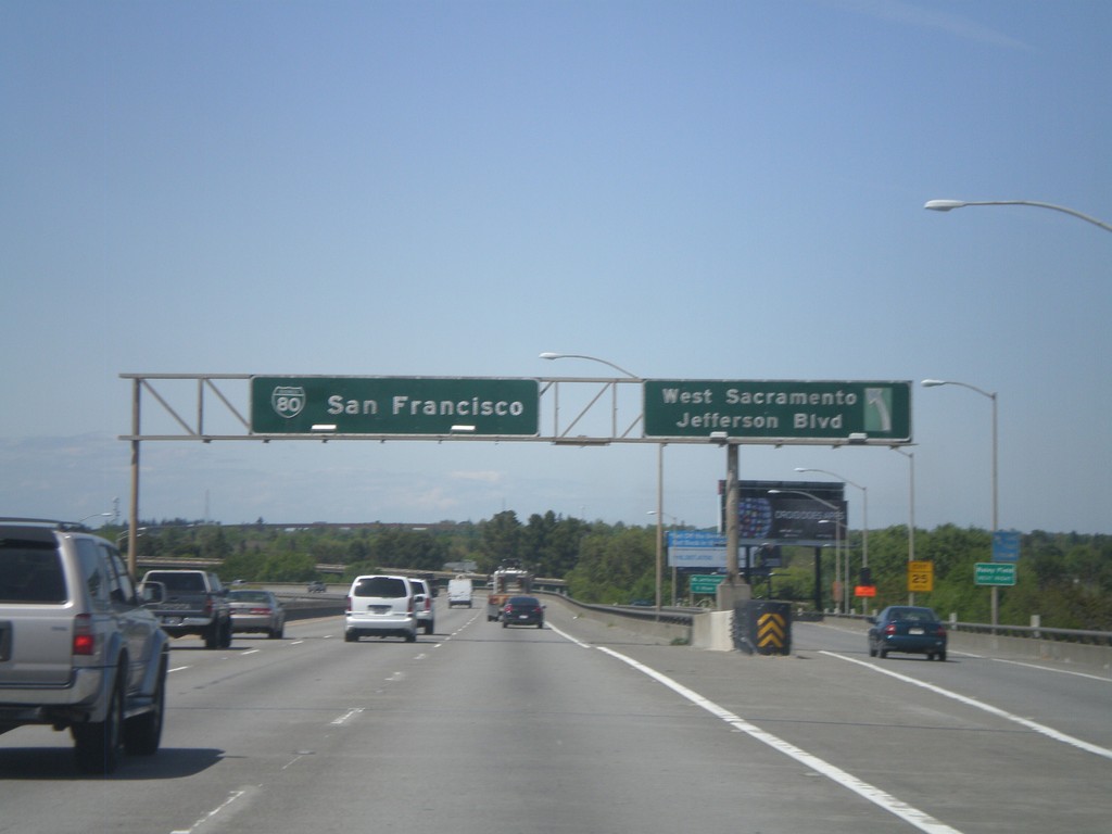
US-50/BL-80 West - Exit 3
US-50/BL-80 west at Exit 3 - West Sacramento/Jefferson Blvd
Taken 04-16-2010
West Sacramento
Yolo County
California
United States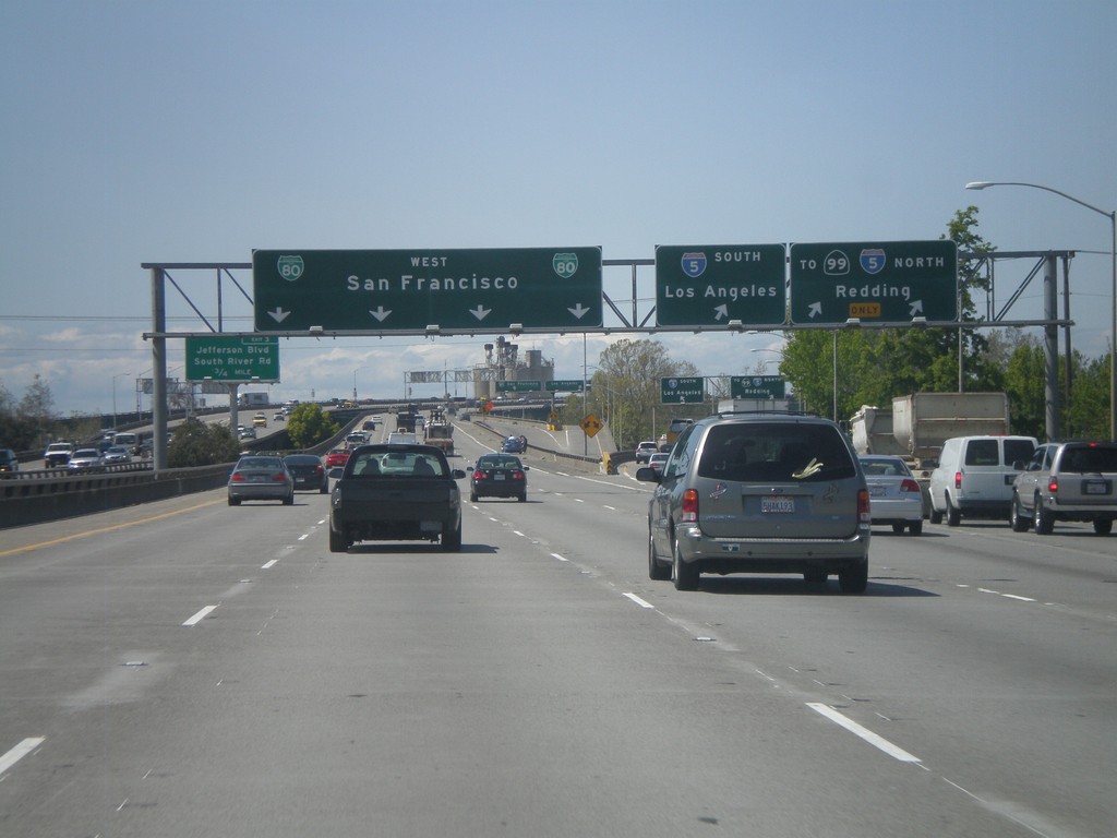
US-50/BL-80 West/CA-99 North - Exit 4A
US-50 West/BL-80 West/CA-99 north at Exit 4A - I-5 South/Los Angeles. I-5 North/To CA-99/Redding. CA-99 is marked as To CA-99 while is joins I-5 through Sacramento. Continue west on BL-80 (and US-50) to San Francisco.
Taken 04-16-2010

 Sacramento
 County
California
United States
Sacramento
Sacramento County
California
United States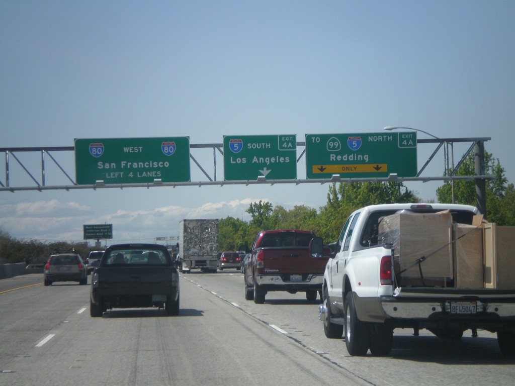
BL-80/US-50 West/CA-99 North Approaching Exit 4A
US-50/BL-80 West/CA-99 north approaching Exit 4A - I-5 South/Los Angeles and I-5 North/To CA-99/Redding. Continue west on BL-80/US-50 for I-80 to San Francisco.
Taken 04-16-2010
Sacramento
Sacramento County
California
United States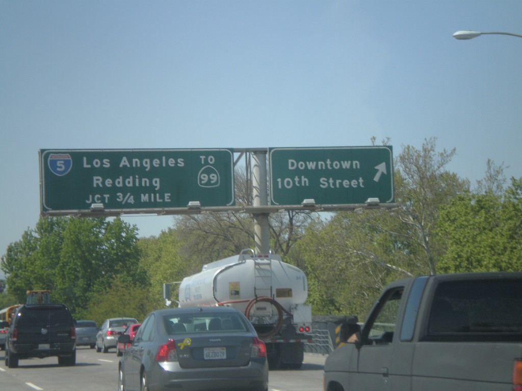
US-50/BL-80 West/CA-99 North at Exit 4B
US-50/BL-80 West/CA-99 North at Exit 4B - Downtown/10th St. Approaching Exit 4A - I-5/CA-99 North/Los Angeles/Redding.
Taken 04-16-2010
Sacramento
Sacramento County
California
United States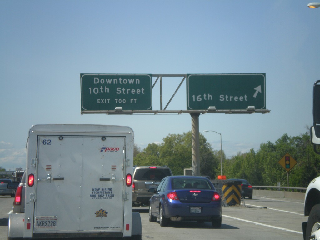
US-50/BL-80 West - Exit 5
US-50/BL-80 West at Exit 5 - 16th St. Approaching Exit 4B - Downtown/10th St.
Taken 04-16-2010
Sacramento
Sacramento County
California
United States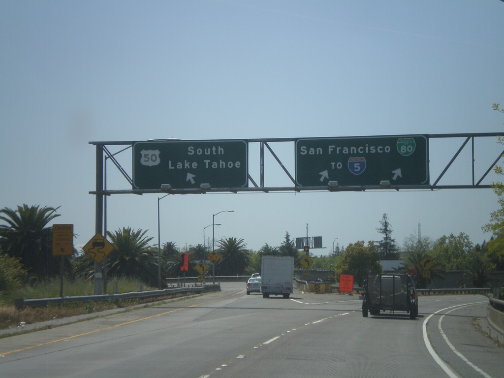
BL-80 West at US-50 on Exit 6A Ramp
BL-80 west at US-50 on Exit 6A ramp. Merge left for US-50 east towards South Lake Tahoe. Merge right for BL-80 towards I-5 and San Francisco.
Taken 04-16-2010
Sacramento
Sacramento County
California
United States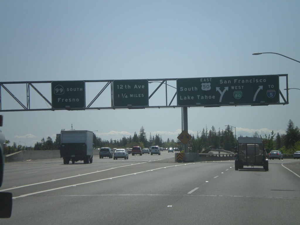
BL-80 West at US-50 and CA-99
BL-80 west at Exits 6A and 6B. Exit 6A is BL-80 West/US-50/To I-5/South Lake Tahoe/San Francisco. Exit 6B is CA-99 South/Fresno.
Taken 04-16-2010
Sacramento
Sacramento County
California
United States