Signs Tagged With Freeway Junction
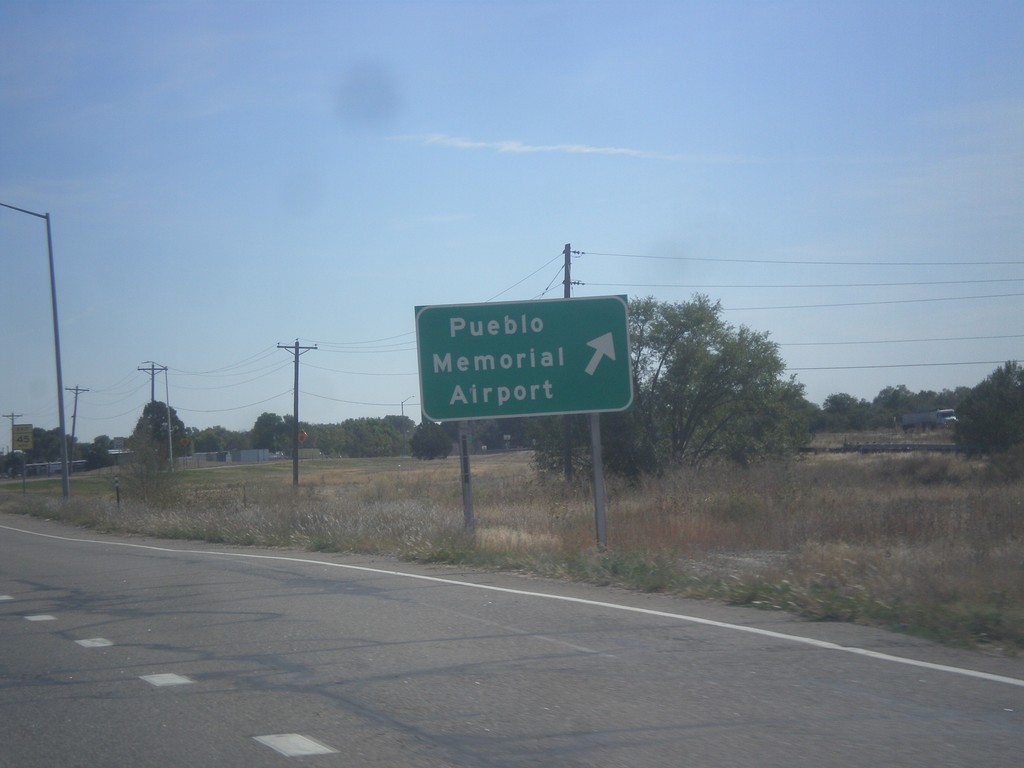
US-50 East - Pueblo Memorial Airport
US-50 East at Pueblo Memorial Airport interchange.
Taken 10-08-2016

 Pueblo
 County
Colorado
United States
Pueblo
Pueblo County
Colorado
United States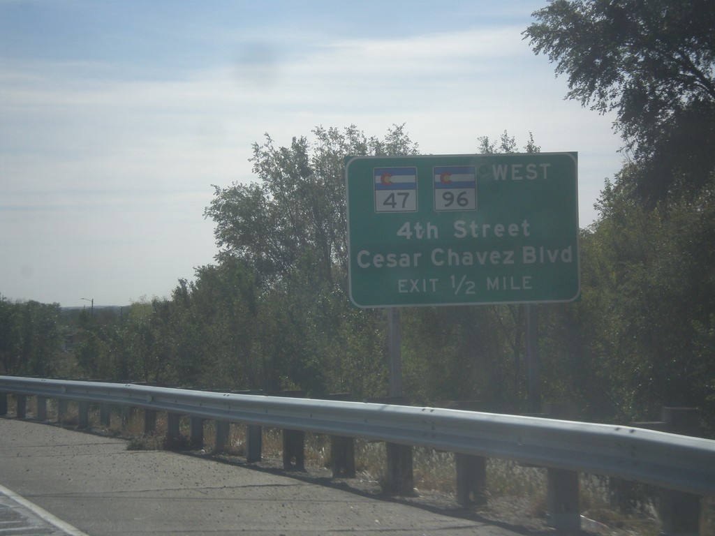
US-50 East Approaching CO-47/CO-96
US-50 East approaching CO-47/CO-96 West/4th St./Cesar Chavez Blvd. CO-96 joins US-50 eastbound to Avondale.
Taken 10-08-2016
 Pueblo
 County
Colorado
United States
Pueblo
Pueblo County
Colorado
United States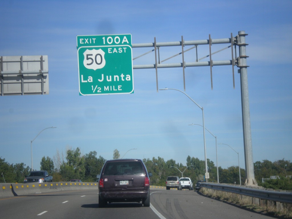
I-25 North - Exit 100A
I-25 north approaching Exit 100A - US-50 East/La Junta. US-50 joins I-25 northbound through Pueblo.
Taken 10-08-2016

 Pueblo
 County
Colorado
United States
Pueblo
Pueblo County
Colorado
United States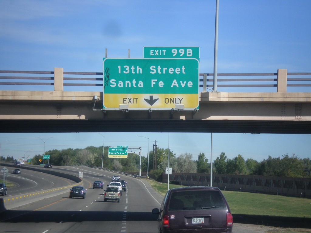
I-25 North - Exit 99B
I-25 north approaching Exit 99B - 13th St./Santa Fe Ave.
Taken 10-08-2016
Pueblo
Pueblo County
Colorado
United States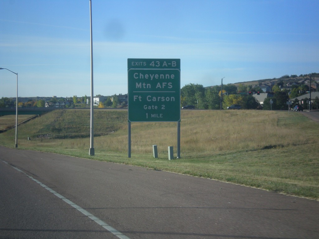
CO-115 South - Exits 43A-B
CO-115 south approaching Exits 43A-B - Cheyenne Mountain AFS/Fort Carson Gate 2.
Taken 10-08-2016
 Colorado Springs
El Paso County
Colorado
United States
Colorado Springs
El Paso County
Colorado
United States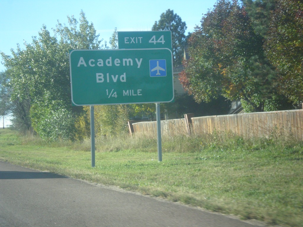
CO-115 South - Exit 44
CO-115 south approaching Exit 44 - Academy Blvd.
Taken 10-08-2016
Colorado Springs
El Paso County
Colorado
United States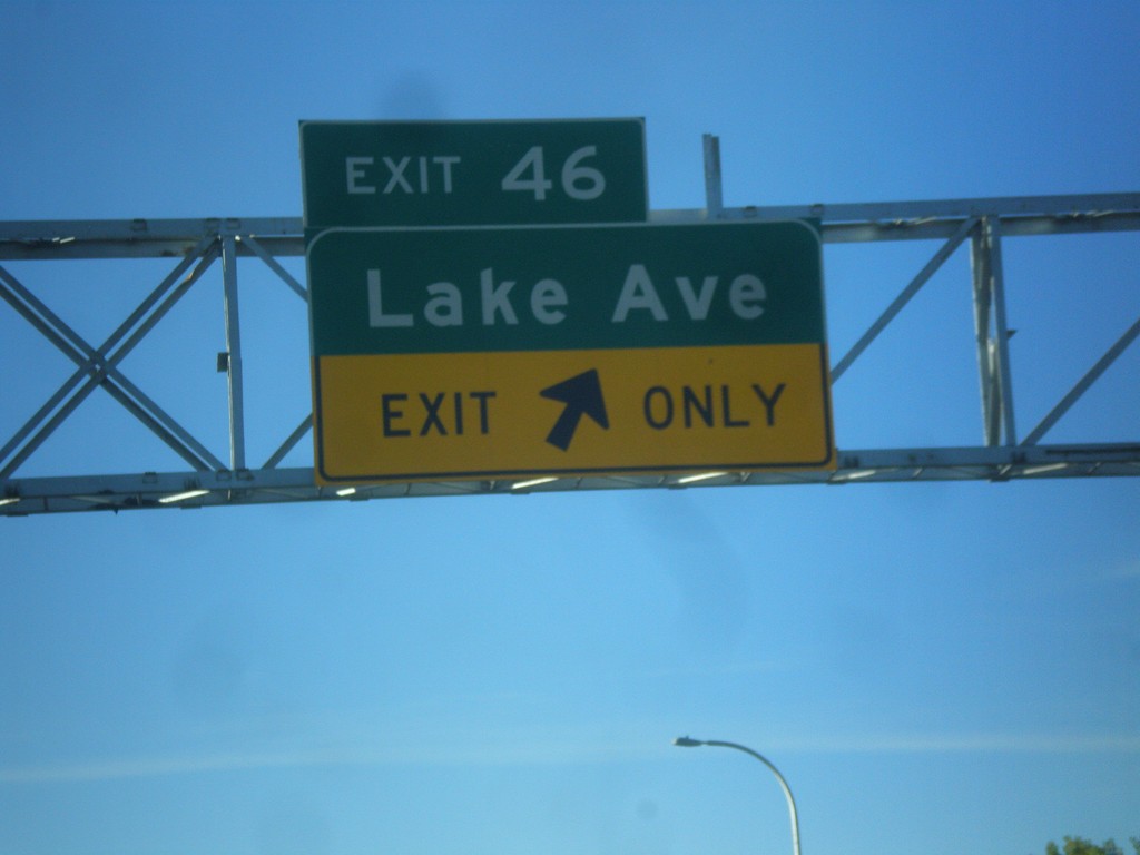
CO-115 South - Exit 46
CO-115 south at Exit 46 - Lake Ave.
Taken 10-08-2016
Colorado Springs
El Paso County
Colorado
United States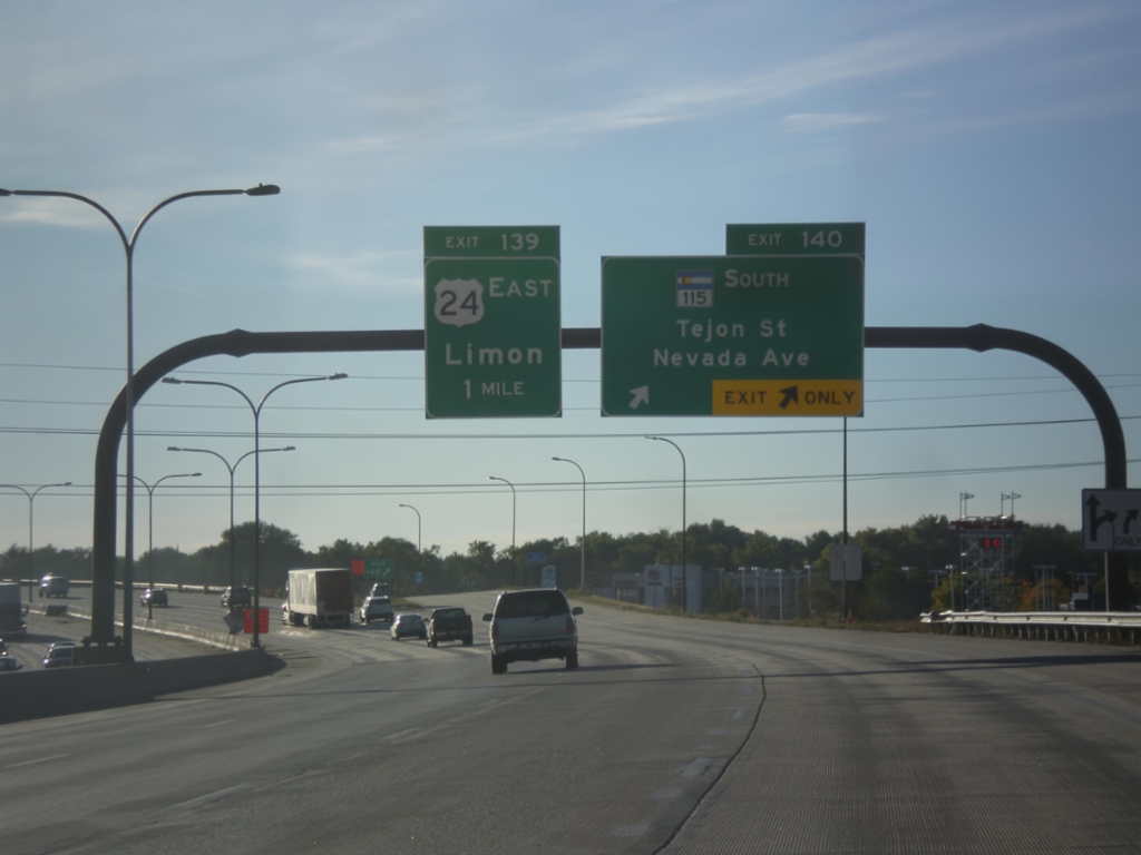
I-25 South/US-24 East - Exits 140 and 139
I-25 South/US-24 East at Exit 140 - CO-115 South/Tejon St./Nevada Ave. Approaching Exit 139 - US-24 East/Limon.
Taken 10-08-2016
 Colorado Springs
El Paso County
Colorado
United States
Colorado Springs
El Paso County
Colorado
United States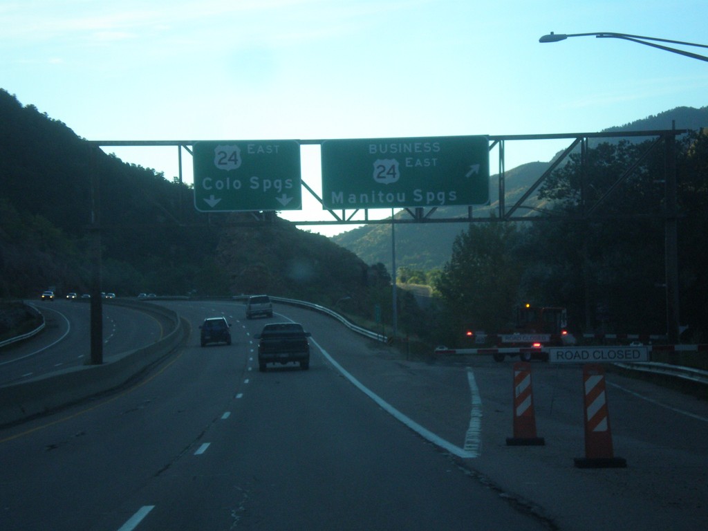
US-24 East - Manitou Springs Business Loop
US-24 East at Bus. US-24 East - Manitou Springs. US-24 continues eastbound to Colorado Springs.
Taken 10-08-2016
 El Paso County
Colorado
United States
El Paso County
Colorado
United States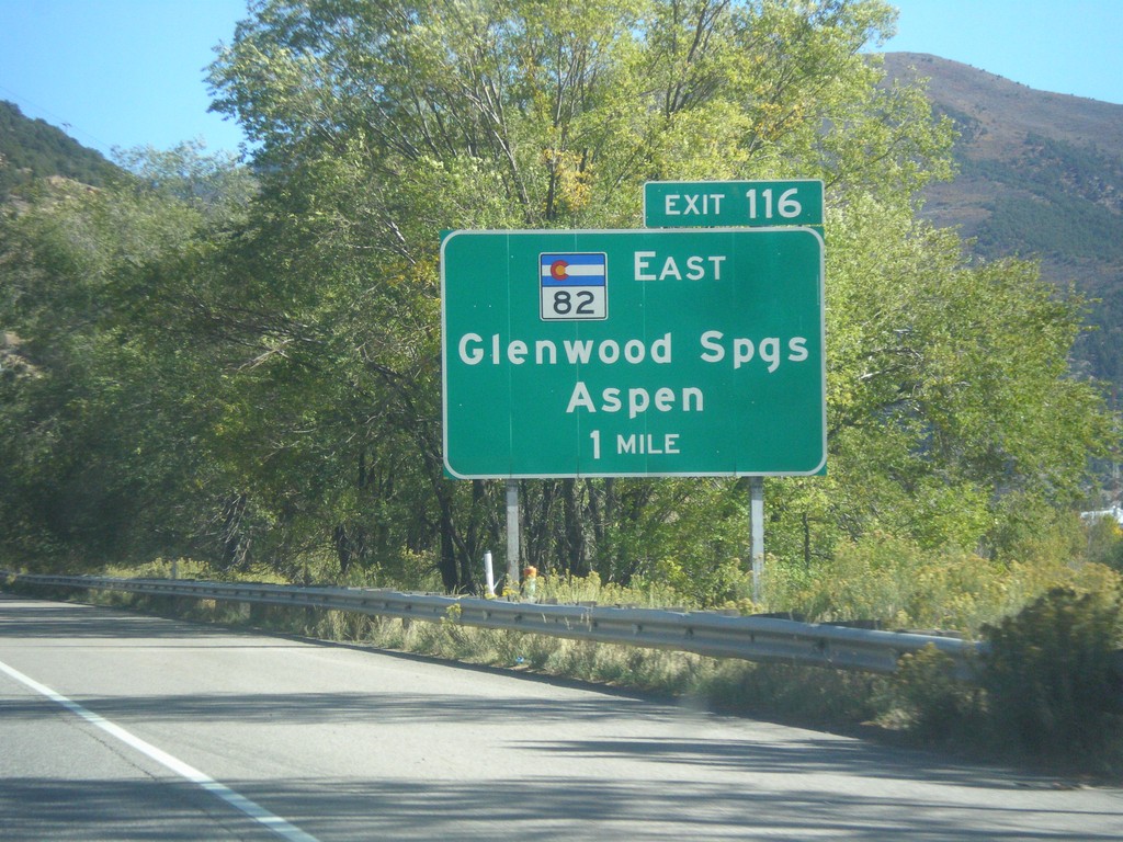
I-70 East - Exit 116
I-70 east approaching Exit 116 - CO-82 East/Glenwood Springs/Aspen.
Taken 10-07-2016


 Glenwood Springs
Garfield County
Colorado
United States
Glenwood Springs
Garfield County
Colorado
United States
I-70 East - Exit 111
I-70 east approaching Exit 111 - South Canyon.
Taken 10-07-2016
Glenwood Springs
Garfield County
Colorado
United States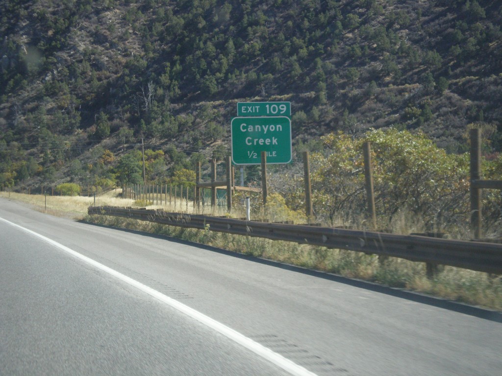
I-70 East - Exit 109
I-70 east approaching Exit 109 - Canyon Creek.
Taken 10-07-2016
Glenwood Springs
Garfield County
Colorado
United States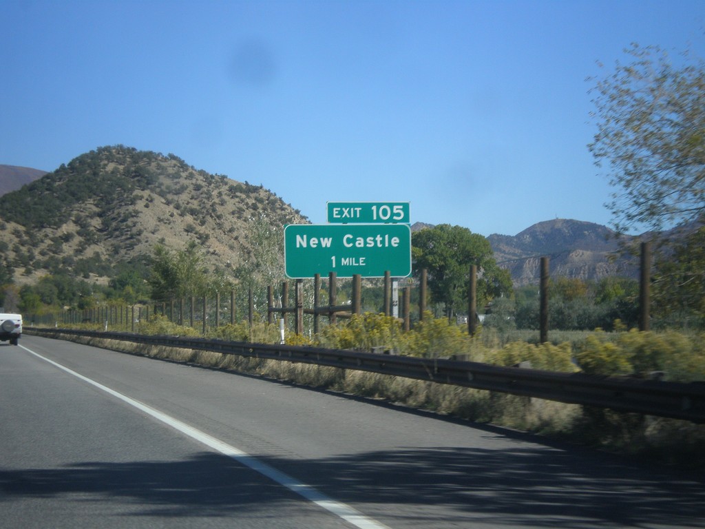
I-70 East - Exit 105
I-70 east approaching Exit 105 - New Castle.
Taken 10-07-2016
New Castle
Garfield County
Colorado
United States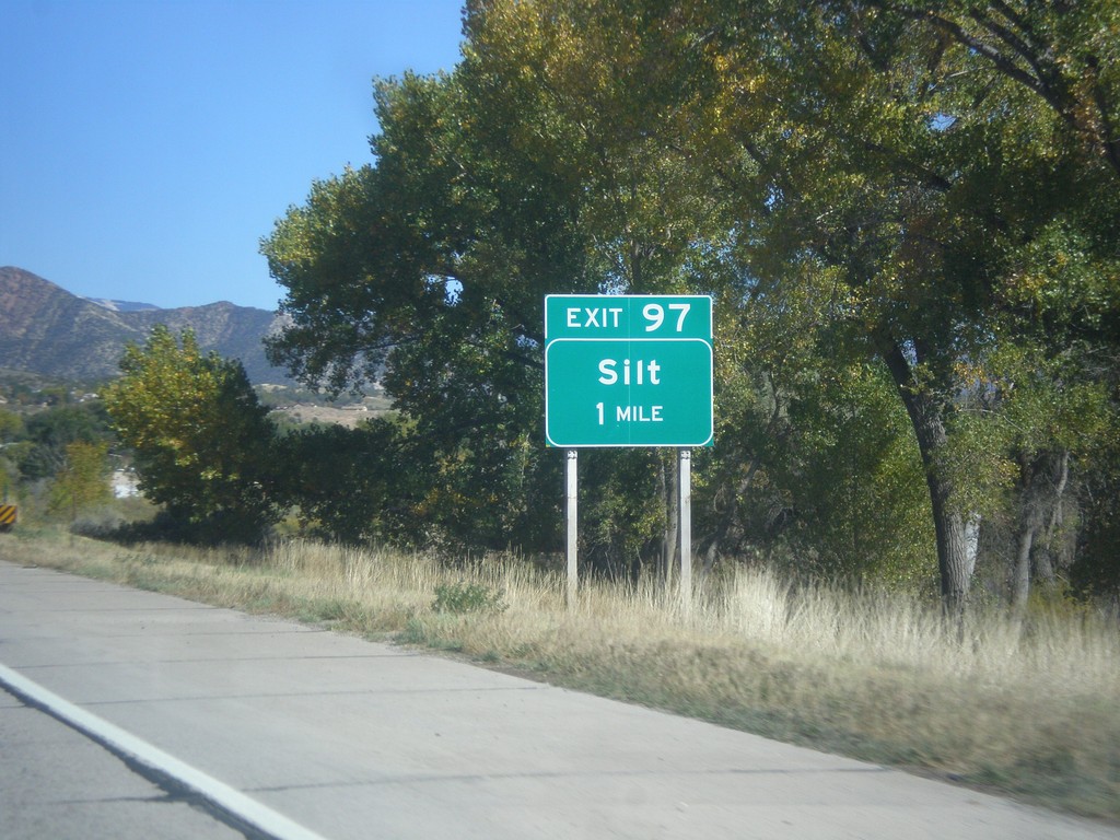
I-70 East - Exit 97
I-70 east approaching Exit 97 - Silt.
Taken 10-07-2016
Silt
Garfield County
Colorado
United States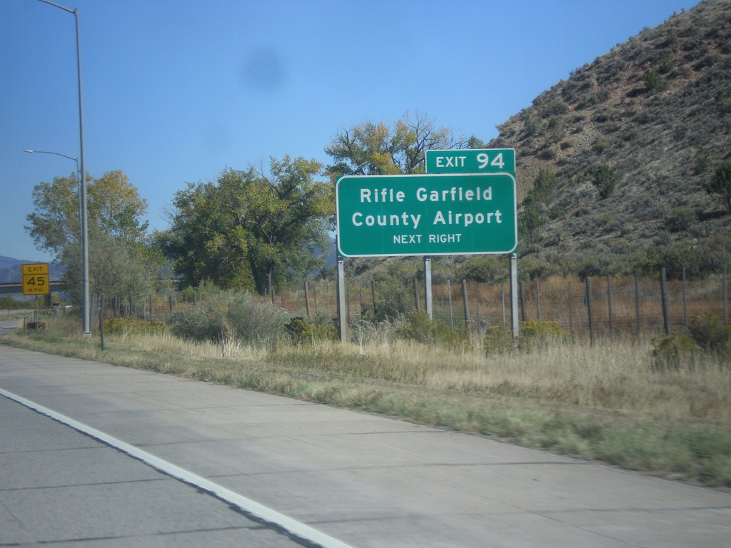
I-70 East - Exit 94
I-70 east approaching Exit 94 - Rifle Garfield County Airport.
Taken 10-07-2016
Silt
Garfield County
Colorado
United States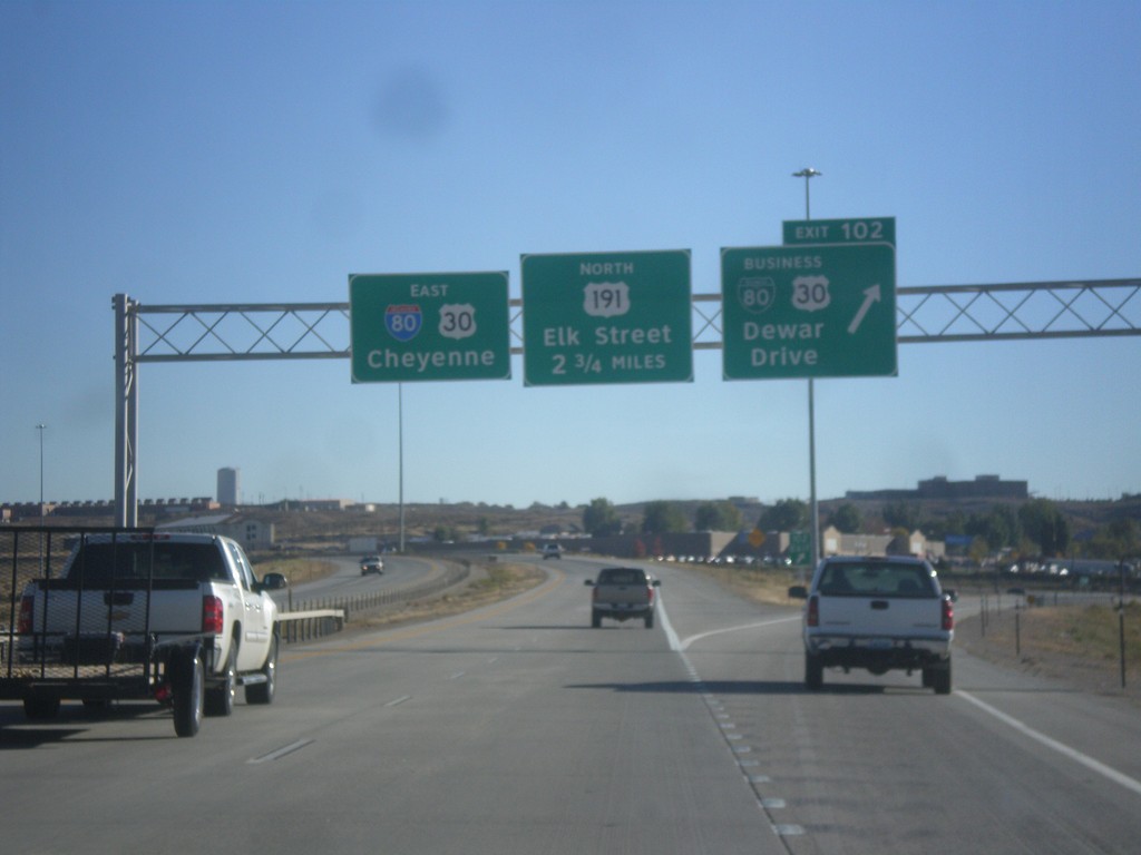
I-80 East - Exits 102 and 104
I-80 East at Exit 102 - BL-80/Bus. US-30/Dewar Drive. Next exit is College Drive which is unsigned on this assembly. The exit after that is Exit 104 - US-191 North/Elk St. I-80/US-30 continues east towards Cheyenne.
Taken 10-07-2016


 Rock Springs
Sweetwater County
Wyoming
United States
Rock Springs
Sweetwater County
Wyoming
United States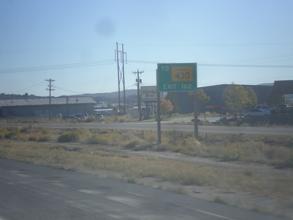
I-80 East Approaching Exit 102
I-80 east approaching Exit 102. Use Exit 102 for WY-430 south.
Taken 10-07-2016
 Rock Springs
Sweetwater County
Wyoming
United States
Rock Springs
Sweetwater County
Wyoming
United States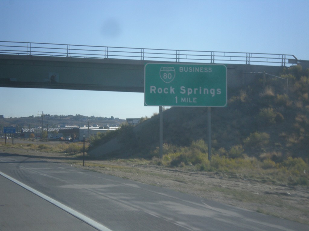
I-80 East - Exit 102
I-80 east approaching Exit 102 - BL-80/Rock Springs.
Taken 10-07-2016
Rock Springs
Sweetwater County
Wyoming
United States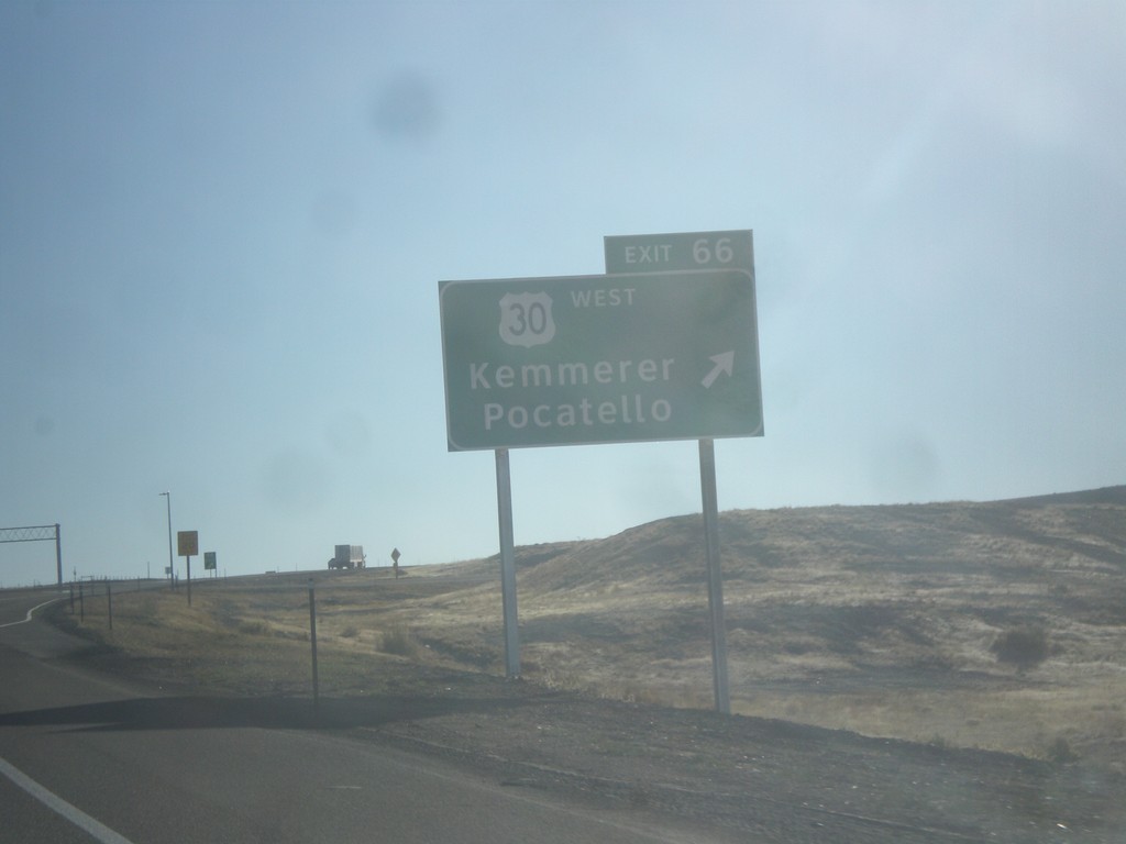
I-80 East - Exit 66
I-80 East at Exit 66 - US-30 West/Kemmerer/Pocatello. US-30 joins I-80 eastbound to just east of Rawlins.
Taken 10-07-2016
Little America
Sweetwater County
Wyoming
United States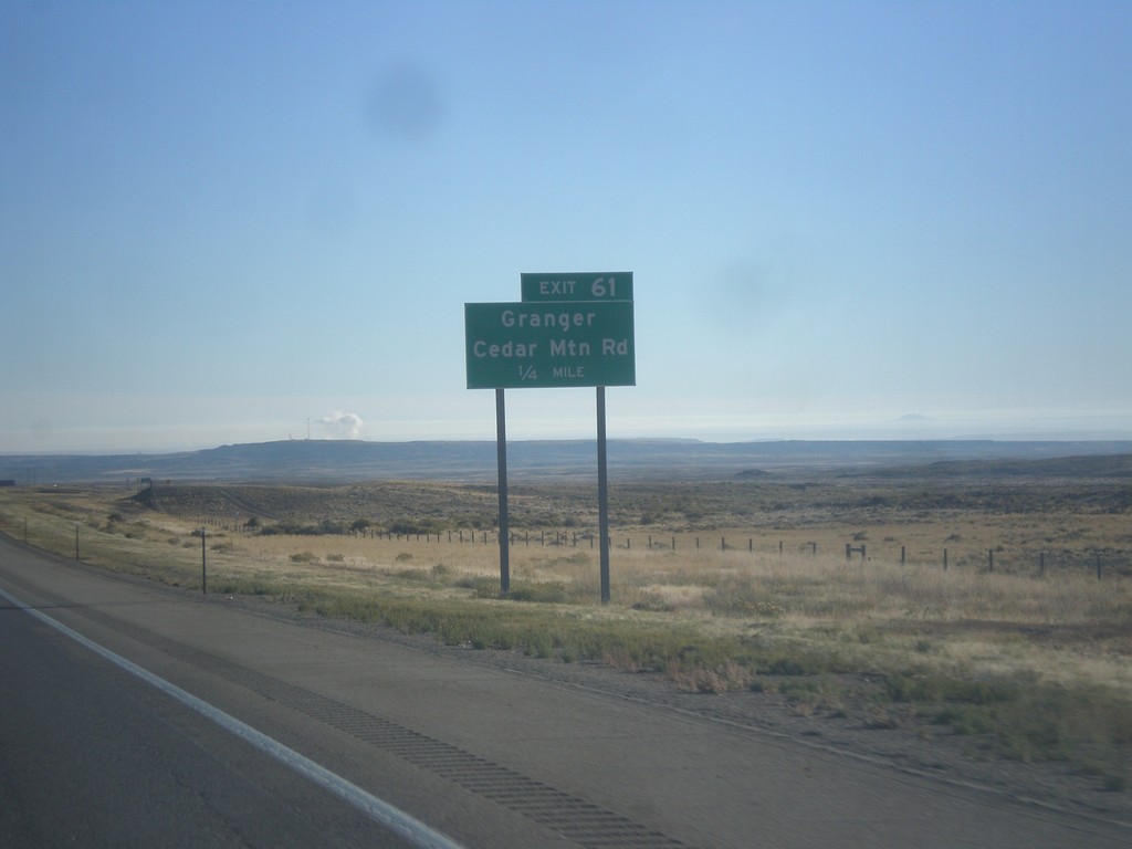
I-80 East - Exit 61
I-80 east approaching 61 - Granger/Cedar Mountain Road.
Taken 10-07-2016
Granger
Sweetwater County
Wyoming
United States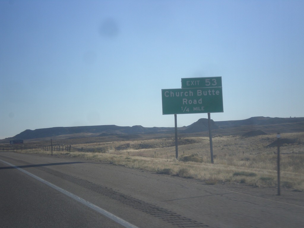
I-80 East - Exit 53
I-80 east approaching Exit 53 - Church Butte Road.
Taken 10-07-2016
Lyman
Uinta County
Wyoming
United States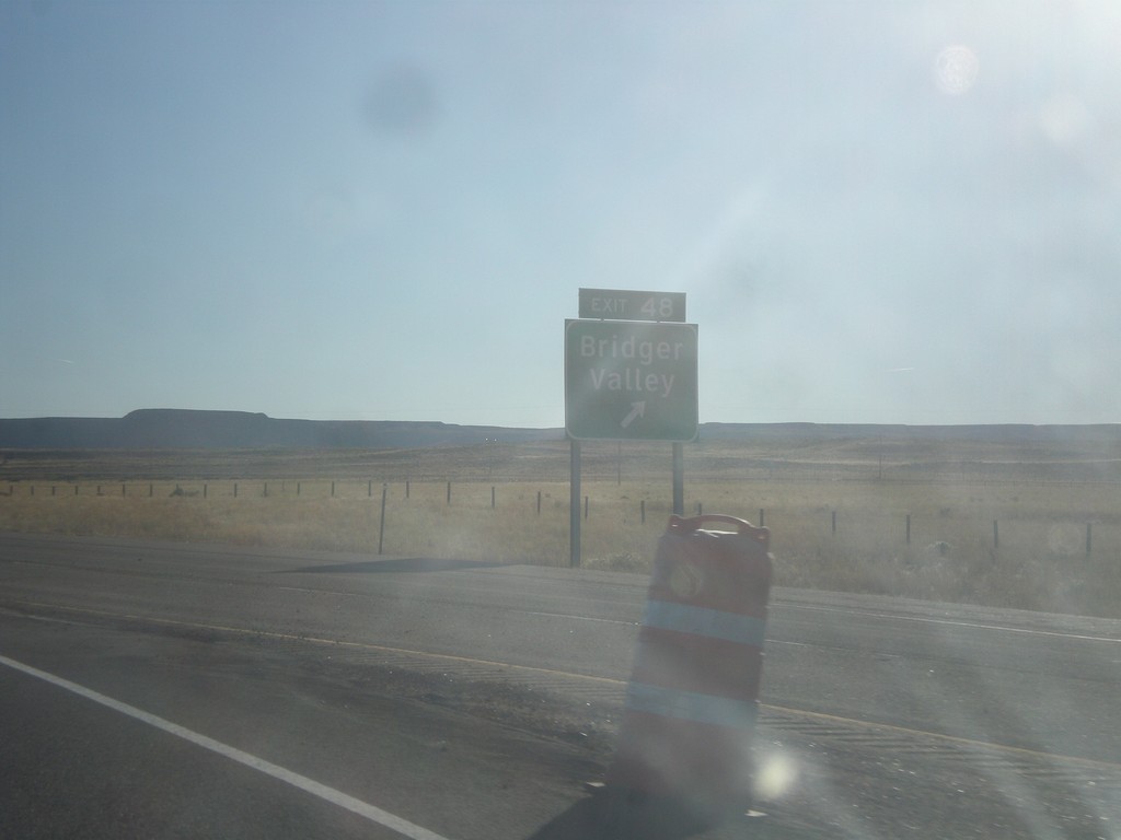
I-80 East - Exit 48
I-80 east at Exit 48 - Bridger Valley. This is the east end of the Bridger Valley business loop.
Taken 10-07-2016
Lyman
Uinta County
Wyoming
United States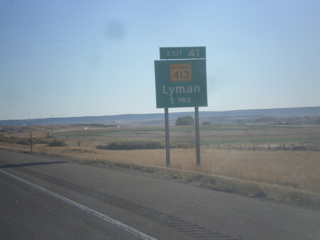
I-80 East - Exit 41
I-80 east approaching Exit 41 - WY-413/Lyman.
Taken 10-07-2016
 Lyman
Uinta County
Wyoming
United States
Lyman
Uinta County
Wyoming
United States
AK-1 West - Bragaw St.
AK-1 West at the Bragaw St. interchange. This is the last exit on the Glenn Highway freeway, before the freeway ends and becomes East 5th Ave.
Taken 07-23-2016
 Anchorage
 Municipality
Alaska
United States
Anchorage
Anchorage Municipality
Alaska
United States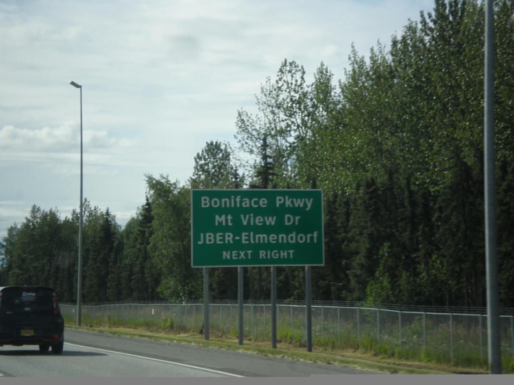
AK-1 West - Boniface Parkway
AK-1 west approaching Boniface Parkway/Mountain View Drive/JBER-Elmendorf. JBER stands for Joint Base Elmendorf-Richardson and is US Military facility.
Taken 07-23-2016
Anchorage
Anchorage Municipality
Alaska
United States