Signs Tagged With Information
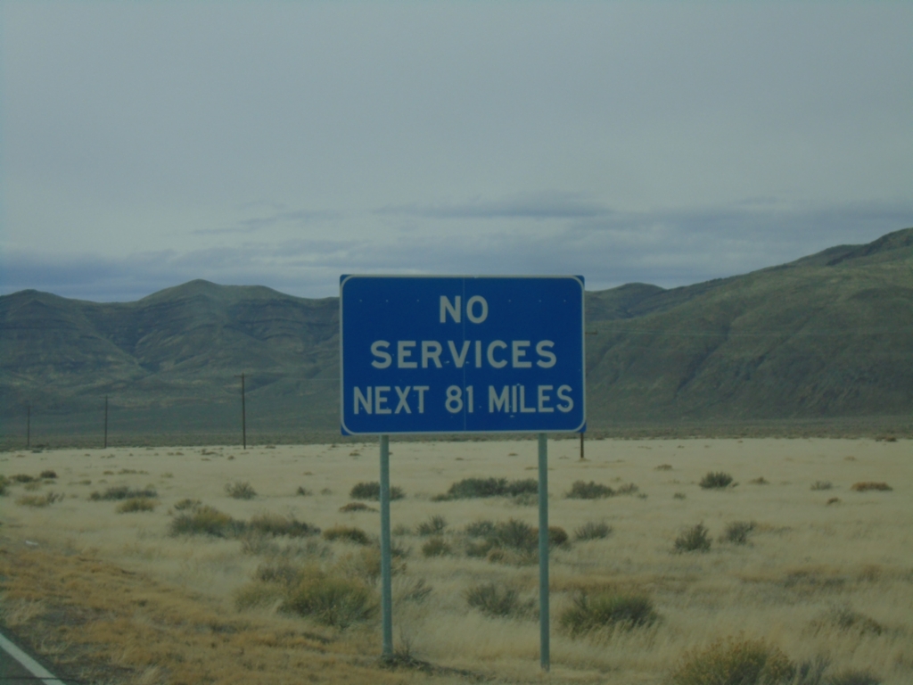
NV-140 North - No Services Next 81 Miles
No Services Next 81 Miles on NV-140 North. Next services are in Adel, Oregon.
Taken 02-14-2026
 Denio
Humboldt County
Nevada
United States
Denio
Humboldt County
Nevada
United States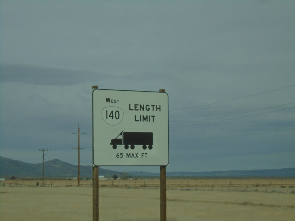
NV-140 North - Oregon Truck Restrictions
Truck restrictions on OR-140. NV-140 becomes OR-140 in Oregon. This sign is posted in Denio Junction, Nevada.
Taken 02-14-2026
Denio
Humboldt County
Nevada
United States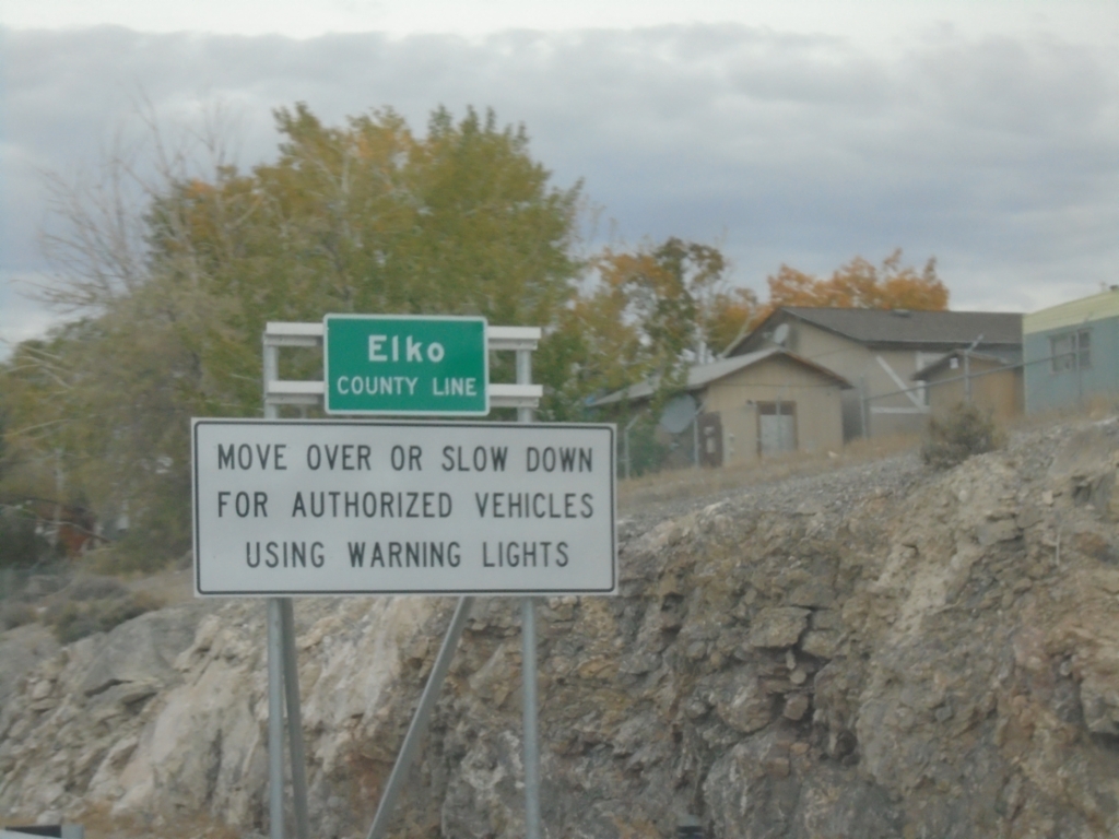
I-80 West - Elko County Line / Emergency Vehicle Law
Elko County Line on I-80 west at the Nevada-Utah state line. Move over or slow down for authorized vehicles using warning lights.
Taken 10-25-2025
 West Wendover
Elko County
Nevada
United States
West Wendover
Elko County
Nevada
United States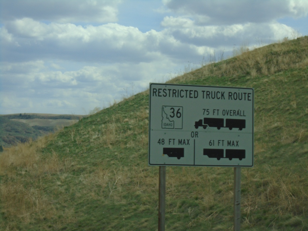
ID-34 South - ID-36 East Truck Information
ID-34 south approaching ID-36. Truck information for ID-36 east traffic.
Taken 04-23-2021

 Preston
Franklin County
Idaho
United States
Preston
Franklin County
Idaho
United States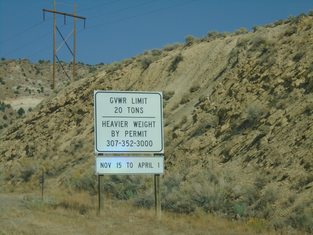
US-191 North - Weight Limits
Weight Limits on US-191 North in Wyoming. There is no Wyoming welcome sign on US-191 north (at least when this photo was taken). This was taken at the state line between Utah and Wyoming.
Taken 10-03-2020
 Rock Springs
Sweetwater County
Wyoming
United States
Rock Springs
Sweetwater County
Wyoming
United States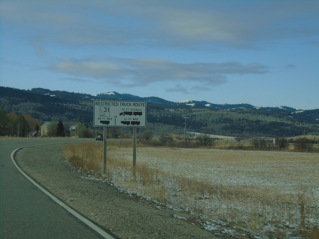
ID-33 West - Restricted Truck Route on ID-31
ID-33 West approaching ID-31. Restricted Truck Route on ID-31.
Taken 10-27-2019

 Victor
Teton County
Idaho
United States
Victor
Teton County
Idaho
United States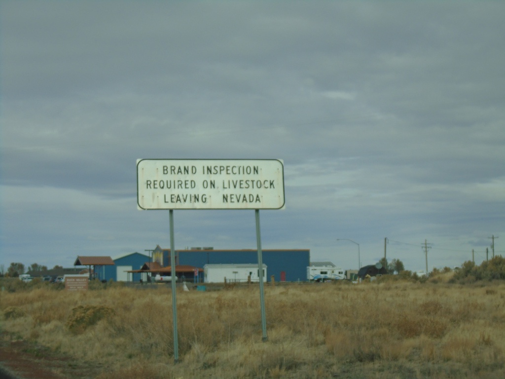
NV-225 North - Brand Inspection Required
Brand Inspection Required on Livestock Leaving Nevada on NV-225 north.
Taken 10-20-2019
 Owyhee
Elko County
Nevada
United States
Owyhee
Elko County
Nevada
United States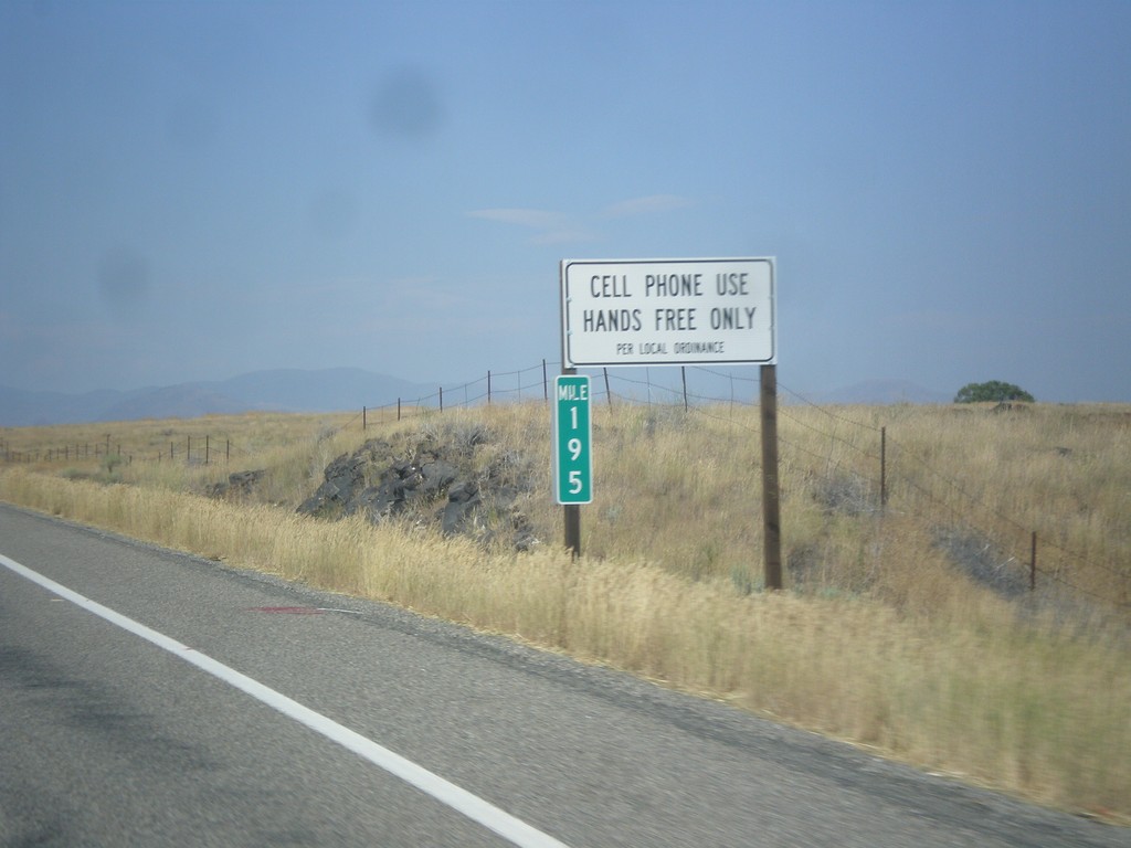
US-26 East/US-93 North - Cell Phone Use - Hands Free Only
Cell Phone Use - Hands Free Only Per Local (Blaine County) ordinance on US-26 East/US-93 North. The state of Idaho as a whole does allow hand held cell phone use.
Taken 07-21-2018

 Carey
Blaine County
Idaho
United States
Carey
Blaine County
Idaho
United States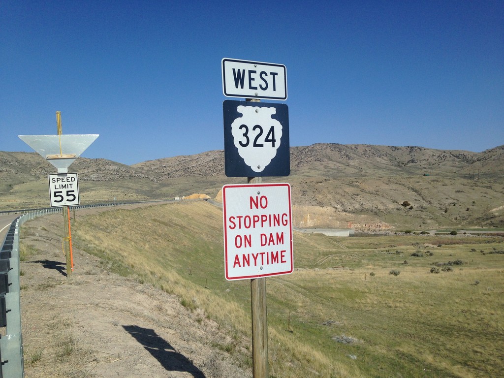
MTS-324 West - Beaverhead County
MTS-324 West - Beaverhead County
Taken 05-10-2015
 Dillon
Beaverhead County
Montana
United States
Dillon
Beaverhead County
Montana
United States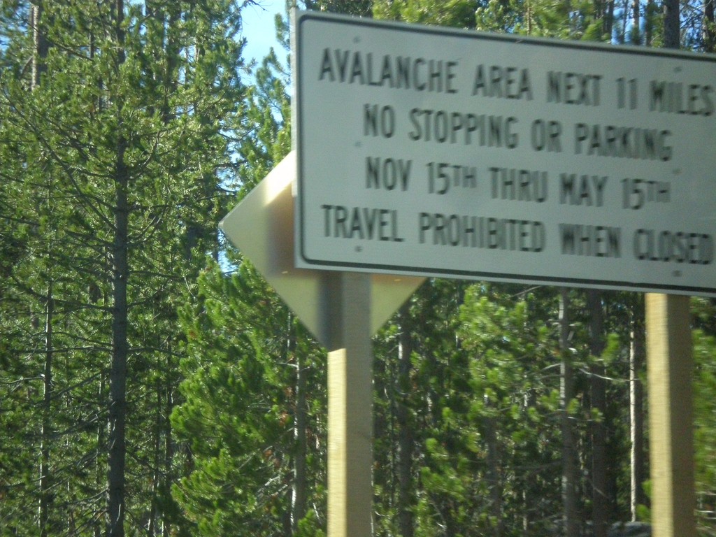
ID-21 South - Avalanche Area
Entering Avalanche Zone on ID-21 south. This area south of Banner Summit has frequent avalanches in the winter, which causes road closures.
Taken 10-05-2014
 Lowman
Boise County
Idaho
United States
Lowman
Boise County
Idaho
United States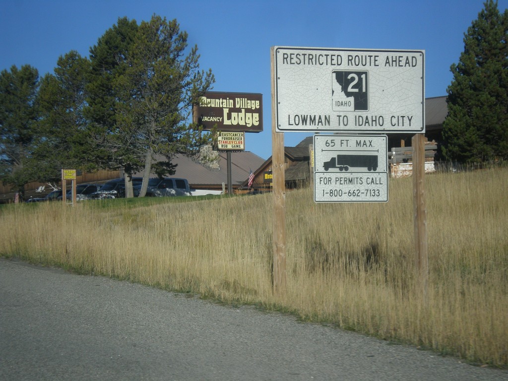
ID-21 - Truck Restrictions
Truck restrictions on ID-21 between Lowman and Idaho City.
Taken 10-05-2014
Stanley
Custer County
Idaho
United States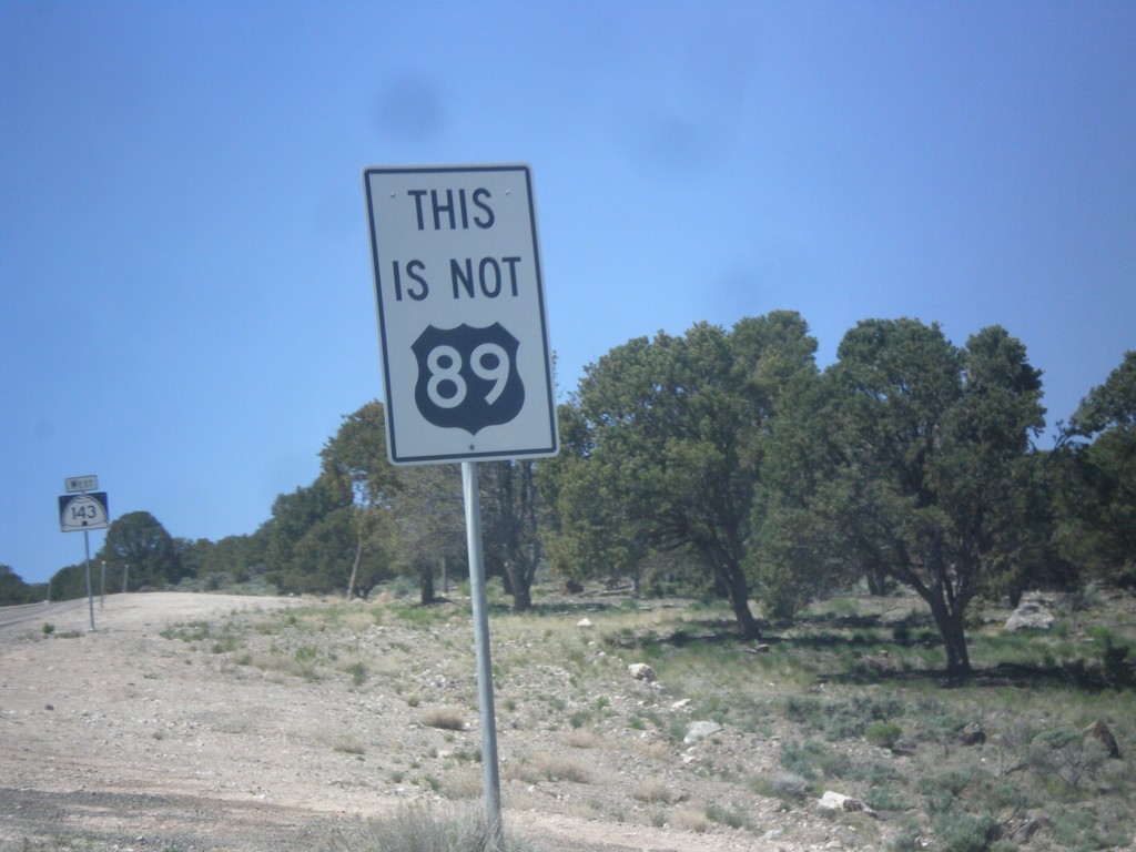
UT-143 South - This is not US-89
This is not US-89 sign on UT-143 south. US-89 southbound traffic in Panguitch who do not turn left at the stoplight in town will end up on UT-143. This sign notifies travelers that they are not on US-89. There are also many oversizes UT-143 signs on the first few miles out of Panguitch as a reminder as well.
Taken 05-21-2014
 Panguitch
Garfield County
Utah
United States
Panguitch
Garfield County
Utah
United States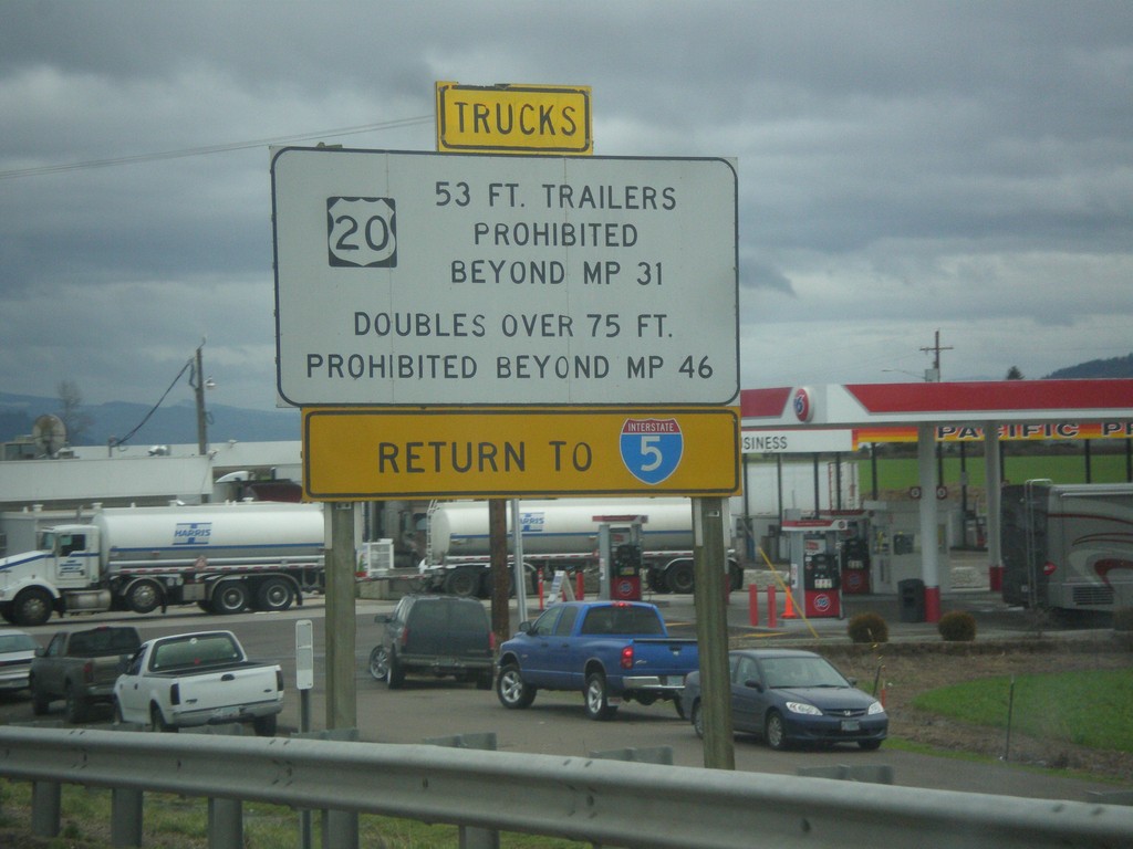
OR-34 East - Truck Restrictions On US-20
OR-34 East - Truck Restrictions On US-20 warning, just east of the I-5 interchange. Trucks exceeding these restrictions on the affected portion of US-20 need to return to I-5. OR-34 reaches US-20 in Lebanon a few miles east of here.
Taken 02-16-2014


 Albany
Linn County
Oregon
United States
Albany
Linn County
Oregon
United States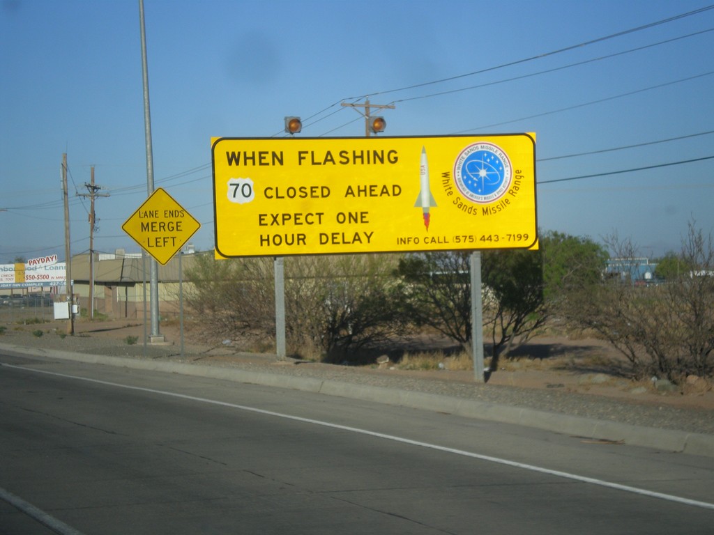
US-70 West - White Sands Missile Range Warning
Warning on US-70 west leaving Alamogordo: When flashing US-70 closed ahead. Expect one hour delay.
Taken 04-15-2013
 Alamogordo
Otero County
New Mexico
United States
Alamogordo
Otero County
New Mexico
United States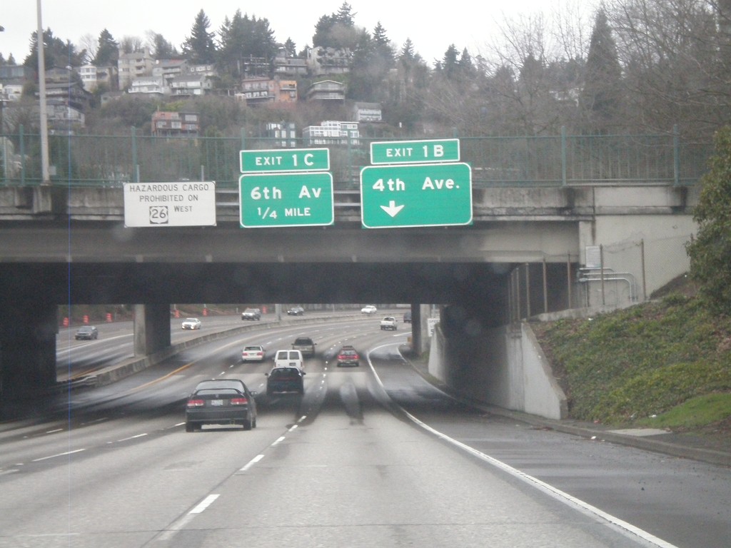
I-405 North - Exits 1B and 1C
I-405 north approaching Exit 1B - 4th Ave and Exit 1C - 6th Ave. Also, there is a warning against hazardous material traffic on US-26 west through the Sunset Tunnel.
Taken 02-18-2012
 Portland
Multnomah County
Oregon
United States
Portland
Multnomah County
Oregon
United States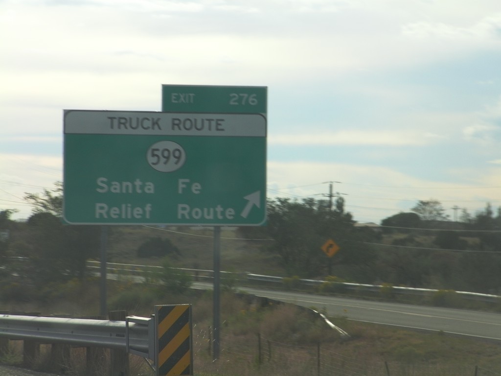
I-25 South - Exit 276
I-25 south at Exit 276 - NM-599/Santa Fe Relief Route. NM-599 is the truck route around the north side of Santa Fe.
Taken 10-05-2011

 La Cienega
Santa Fe County
New Mexico
United States
La Cienega
Santa Fe County
New Mexico
United States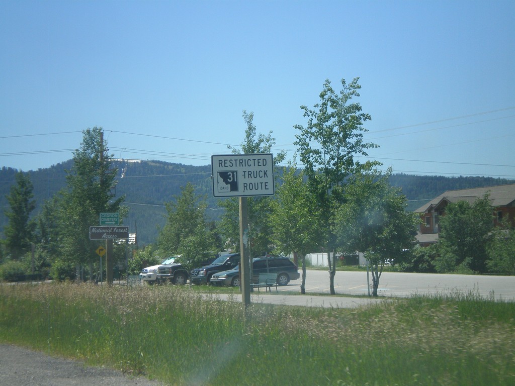
ID-33 East Approaching ID-31
ID-33 east approaching ID-31. ID-31 between Victor and Swan Valley is a restricted route for trucking.
Taken 07-02-2011
Victor
Teton County
Idaho
United States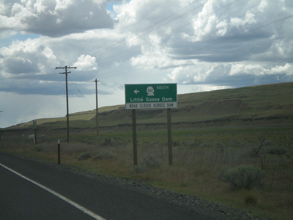
WA-260 West/WA-261 South at Split
WA-260 West/WA-261 South at Split. Turn right to continue south on WA-261 to Little Goose Dam. Currently, the roadway across Little Goose Dam is closed. Little Goose Dam is located on the Snake River in Central Washington.
Taken 04-28-2011

 Washtucna
Franklin County
Washington
United States
Washtucna
Franklin County
Washington
United States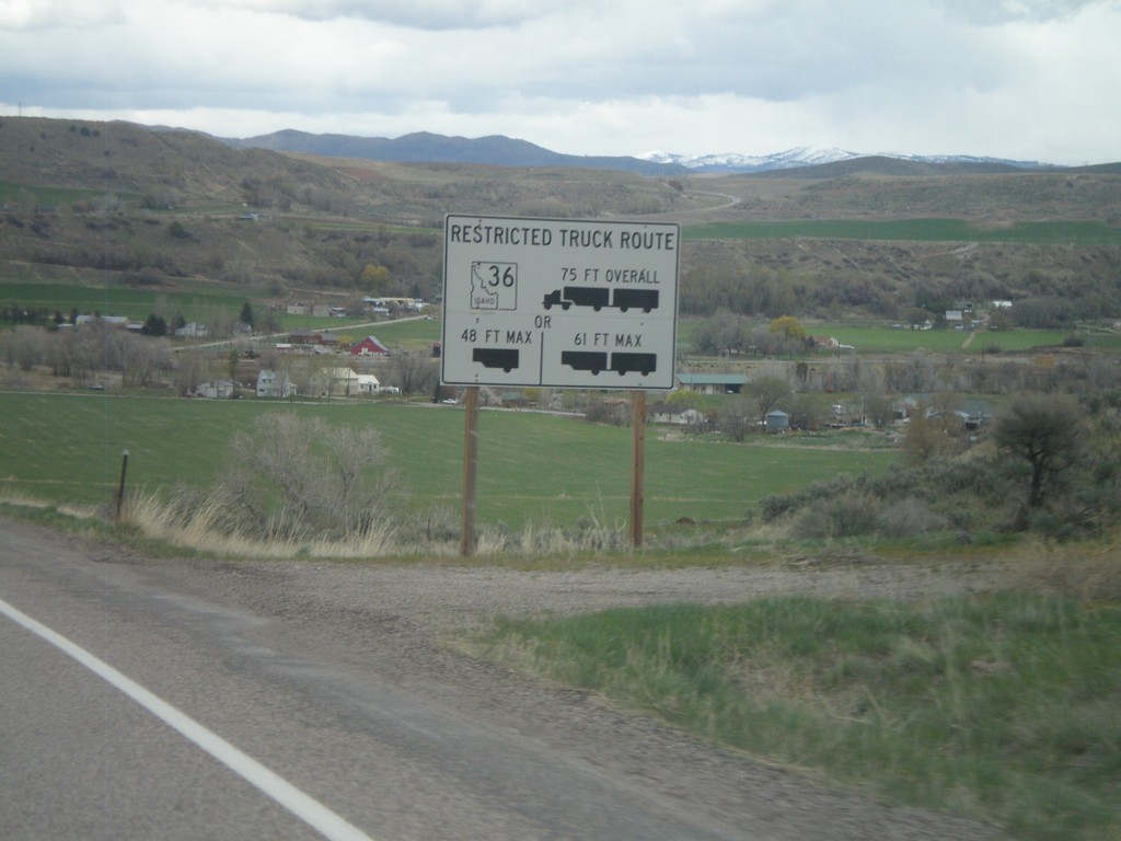
ID-34/ID-36 East - Restricted Truck Route on ID-36
Restricted Truck Route on ID-36 on ID-34/ID-36 east.
Taken 05-01-2010
Preston
Franklin County
Idaho
United States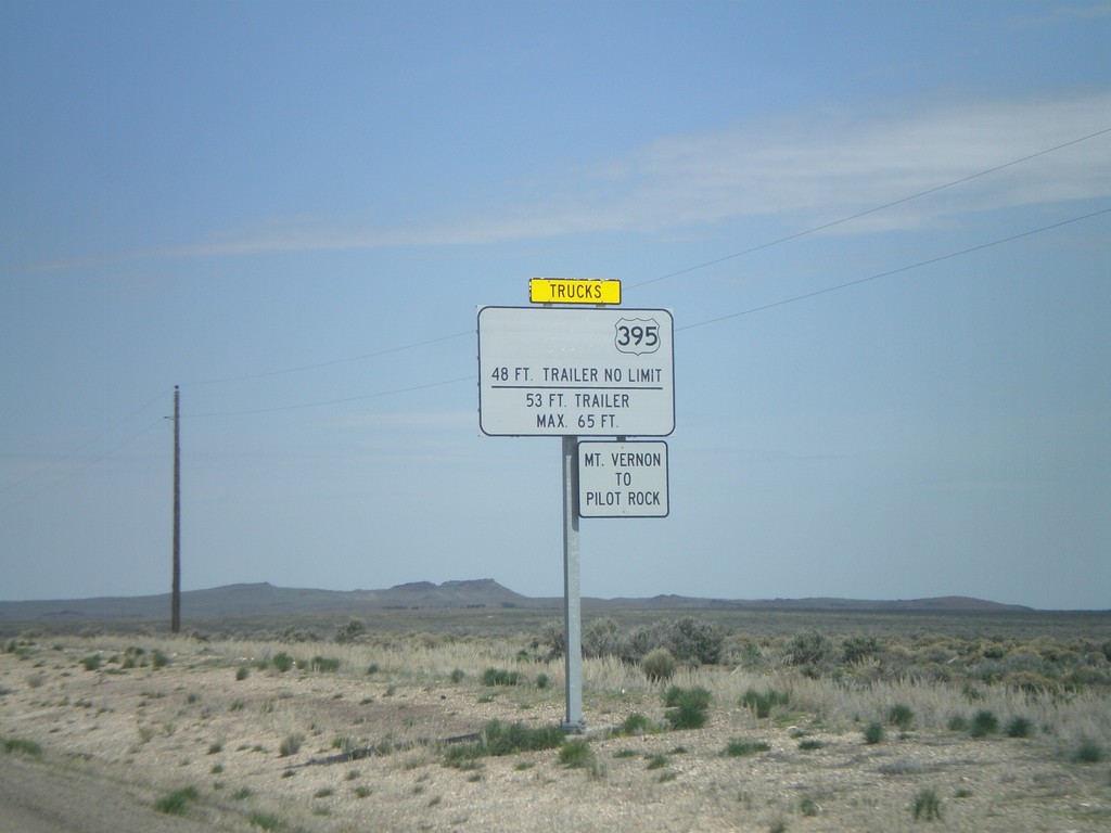
US-95 North Approaching OR-78
US-95 north approaching OR-78. Weight restrictions on US-395 northbound traffic between Mt Vernon and Pilot Rock. OR-78 is the only connecting highway into central Oregon from US-95, and connects to US-20 and US-395 in Burns.
Taken 04-20-2010


 Jordan Valley
Malheur County
Oregon
United States
Jordan Valley
Malheur County
Oregon
United States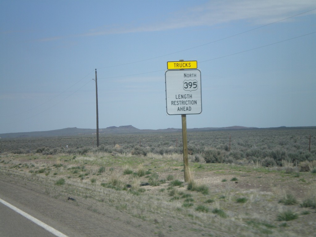
US-95 North Approaching OR-78 - Length Restrictions
US-95 north approaching OR-78. Length restrictions on US-395 north traffic ahead. OR-78 is the only road that connects US-95 with the rest of Oregon. OR-78 connects US-95 with US-20/US-395 in Burns.
Taken 04-20-2010
Jordan Valley
Malheur County
Oregon
United States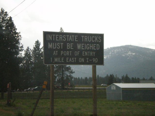
ID-41 South at I-90 - Interstate Trucks
ID-41 south approaching I-90. All Interstate trucks must be weighed at Port of Entry on I-90 East.
Taken 05-07-2008
 Post Falls
Kootenai County
Idaho
United States
Post Falls
Kootenai County
Idaho
United States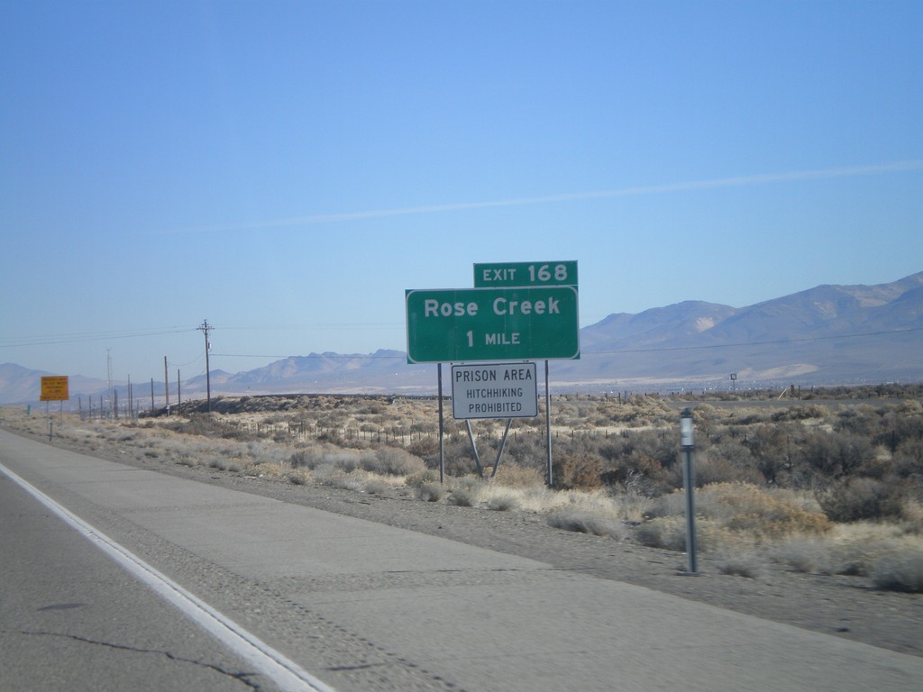
I-80 East Exit 168
I-80 east approaching Exit 168 - Rose Creek. Prison Area - Hitchhiking Prohibited.
Taken 11-24-2007
Winnemucca
Humboldt County
Nevada
United States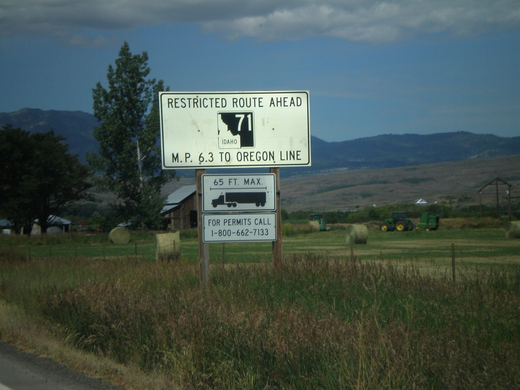
ID-71 North - Route Restrictions
ID-71 Restricted Route Ahead between Milepost 6.3 and Oregon Line for trucks 65 feet long and greater.
Taken 06-30-2007
 Cambridge
Washington County
Idaho
United States
Cambridge
Washington County
Idaho
United States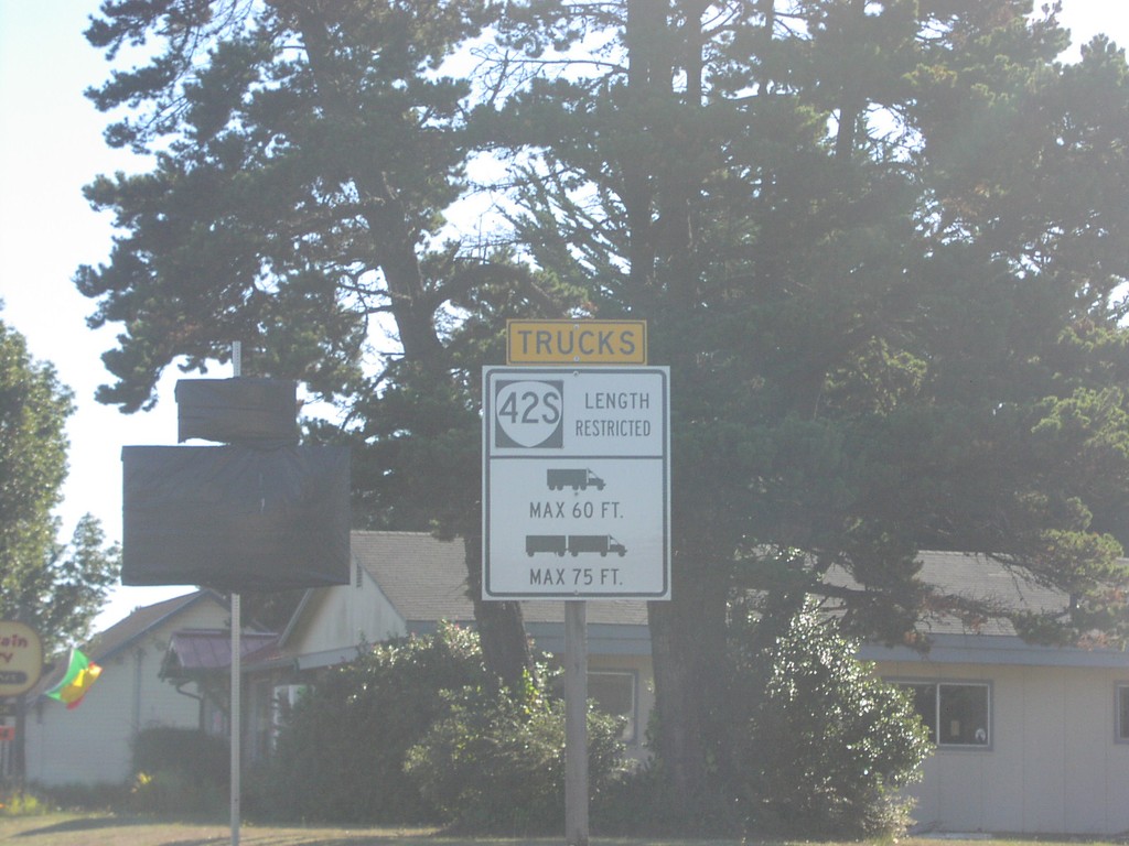
US-101 North - OR-42S Truck Information
Truck information for OR-42S on US-101.
Taken 10-01-2006

 Bandon
Coos County
Oregon
United States
Bandon
Coos County
Oregon
United States