Signs Tagged With Interchange
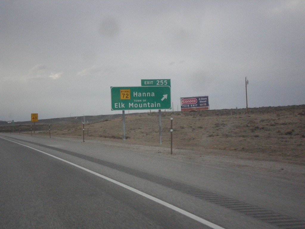
I-80 West Exit 255
I-80 west approaching Exit 255 - WY-72/Hanna/Town of Elk Mountain. The word TOWN OF was added to the sign when the font was converted to Clearview.
Taken 03-30-2014

 Elk Mountain
Carbon County
Wyoming
United States
Elk Mountain
Carbon County
Wyoming
United States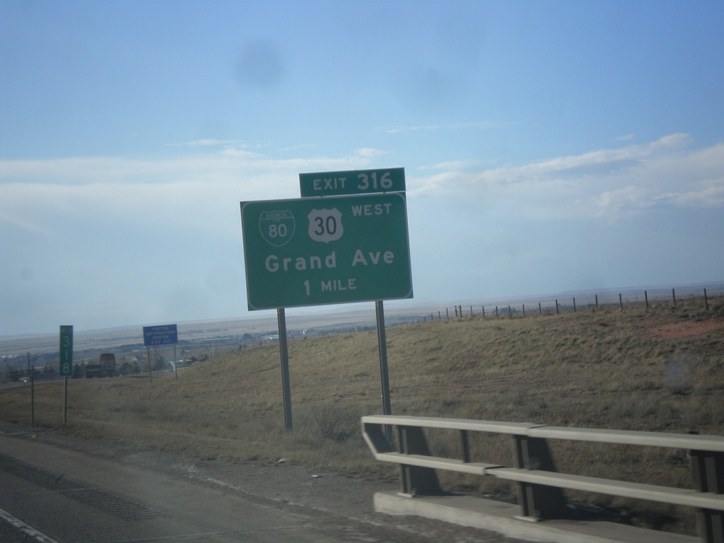
I-80 West - Exit 316
I-80 west approaching Exit 316 - BL-80/US-30 West/Grand Ave. This is the eastern end of the Laramie business loop. US-30 leaves I-80 westbound here and rejoins I-80 at Walcott Junction.
Taken 03-30-2014

 Laramie
Albany County
Wyoming
United States
Laramie
Albany County
Wyoming
United States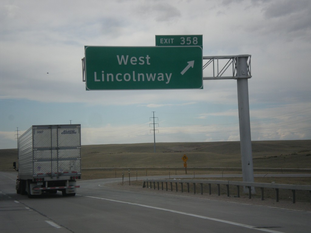
I-80 West - Exit 358
I-80 west at Exit 358 - West Lincolnway. This is the western end of the Cheyenne business loop. US-30 rejoins I-80 here westbound.
Taken 03-30-2014
Cheyenne
Laramie County
Wyoming
United States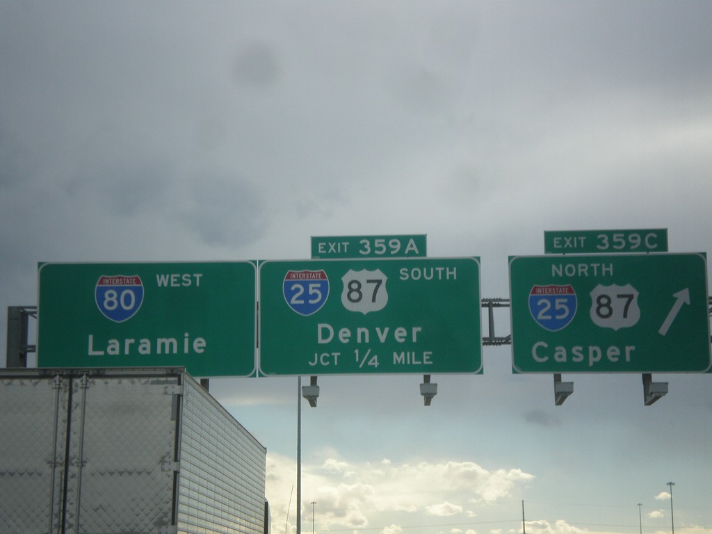
I-80 West - Exits 359C and 359A
I-80 west at Exit 359C - I-25/US-87 North/Casper. Approaching Exit 359A - I-25/US-87 South/Denver. Continue west on I-80 for Laramie.
Taken 03-30-2014

 Cheyenne
Laramie County
Wyoming
United States
Cheyenne
Laramie County
Wyoming
United States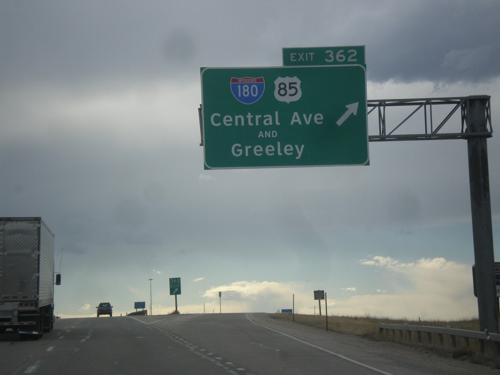
I-80 West - Exit 362
I-80 west at Exit 362 - I-180/US-85/Central Ave./Greeley. I-180 in Cheyenne is the rare interstate highway that is not a freeway, rather a city street with stoplights.
Taken 03-30-2014

 Cheyenne
Laramie County
Wyoming
United States
Cheyenne
Laramie County
Wyoming
United States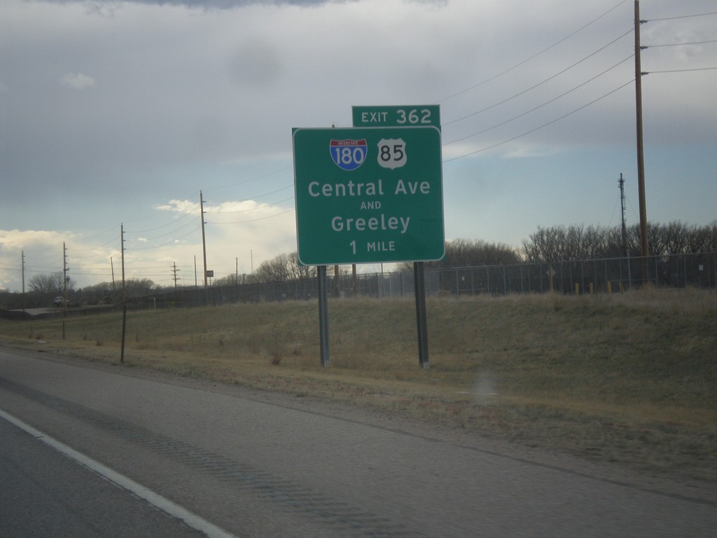
I-80 West - Exit 362
I-80 west approaching Exit 362 - I-180/US-85/Central Ave./Greeley (Colorado). Notice the word AND between Central Ave. and Greeley. This wording also occurs at the US-287 interchange with I-80 in Laramie.
Taken 03-30-2014
Cheyenne
Laramie County
Wyoming
United States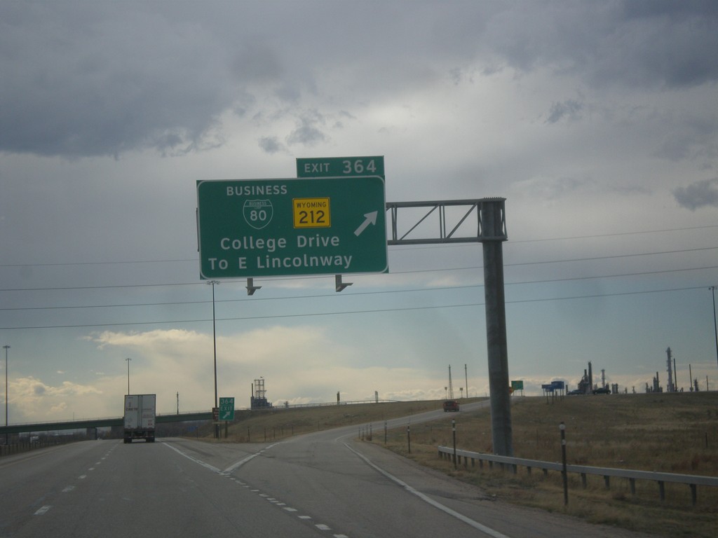
I-80 West - Exit 364
I-80 west at Exit 364 - BL-80/WY-212/College Drive/To E. Lincolnway. This is the eastern edge of the Cheyenne business loop. College Drive acts as a beltway around the northeast side of Cheyenne.
Taken 03-30-2014
 Cheyenne
Laramie County
Wyoming
United States
Cheyenne
Laramie County
Wyoming
United States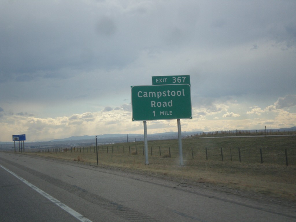
I-80 West - Exit 367
I-80 west approaching Exit 367 - Campstool Road.
Taken 03-30-2014
Cheyenne
Laramie County
Wyoming
United States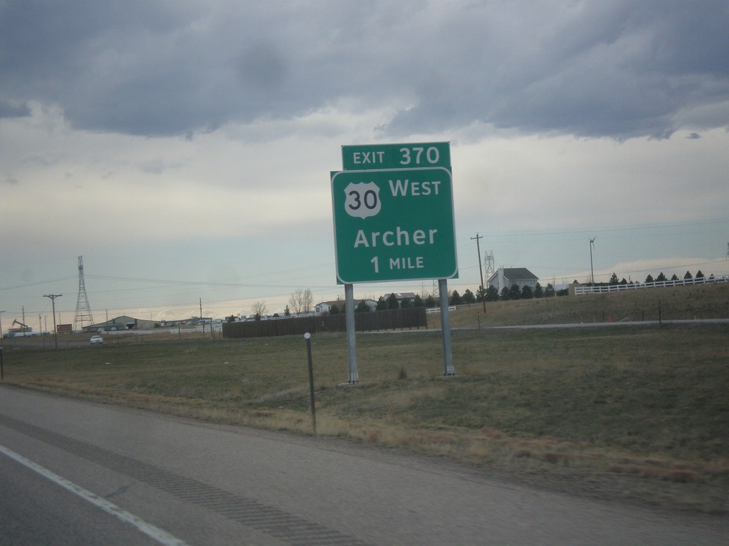
I-80 West - Exit 370
I-80 west approaching Exit 370 - US-30 West/Archer. US-30 leaves I-80 westbound here, and rejoins on the west side of Cheyenne.
Taken 03-30-2014
Cheyenne
Laramie County
Wyoming
United States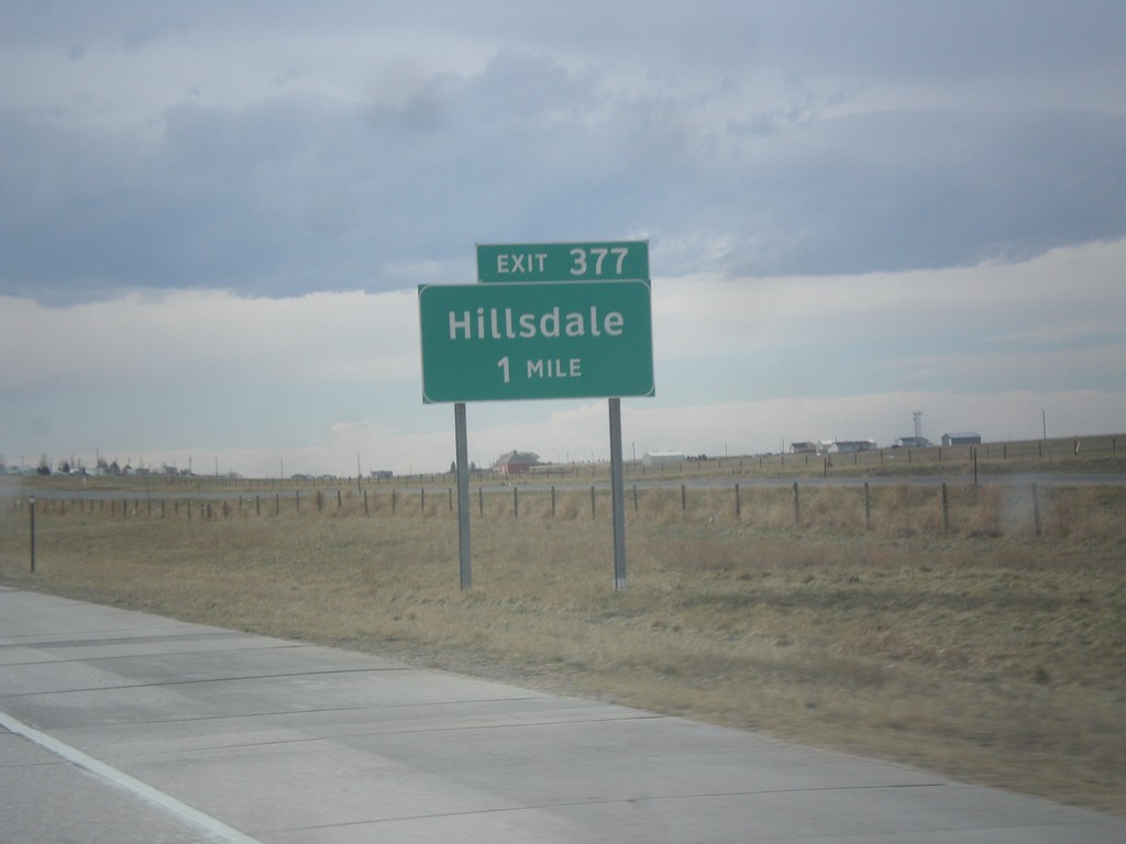
I-80 West - Exit 377
I-80 west approaching Exit 377 - Hillsdale.
Taken 03-30-2014
Burns
Laramie County
Wyoming
United States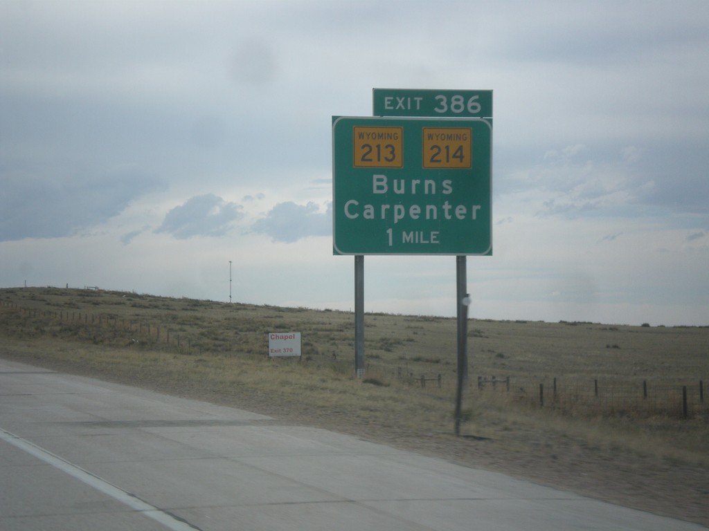
I-80 West - Exit 386
I-80 west approaching Exit 386 - WY-213/WY-214/Burns/Carpenter.
Taken 03-30-2014

 Burns
Laramie County
Wyoming
United States
Burns
Laramie County
Wyoming
United States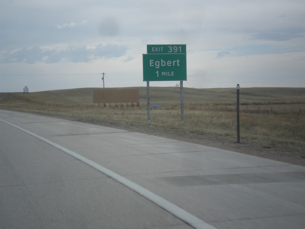
I-80 West - Exit 391
I-80 west approaching Exit 391 - Egbert.
Taken 03-30-2014
Pine Bluffs
Laramie County
Wyoming
United States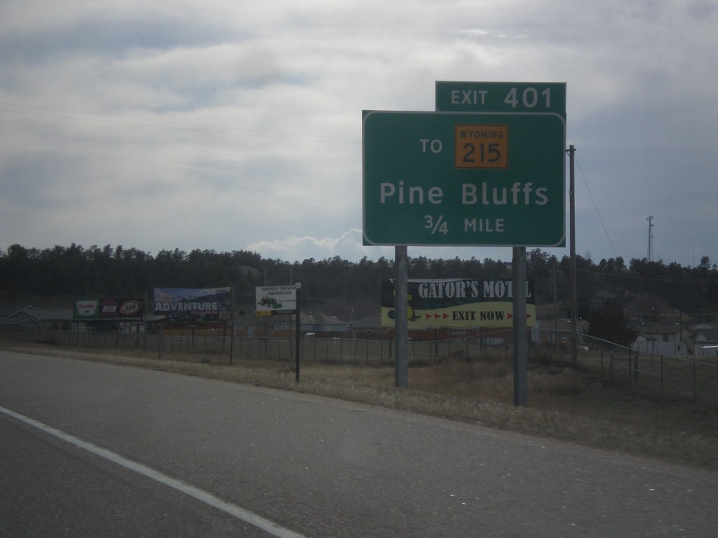
I-80 West - Exit 401
I-80 west approaching Exit 401 - To WY-215/Pine Bluffs. This is the first exit in Wyoming along I-80 west. US-30 joins I-80 westbound at Exit 401 into Cheyenne.
Taken 03-30-2014
 Pine Bluffs
Laramie County
Wyoming
United States
Pine Bluffs
Laramie County
Wyoming
United States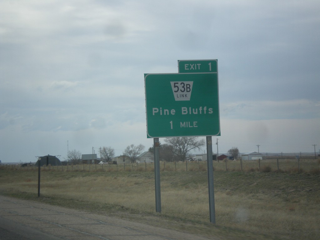
I-80 West - Exit 1
I-80 west approaching Exit 1 - NE-53B Link/Pine Bluffs. This is the last exit on I-80 west in Nebraska.
Taken 03-30-2014
 Bushnell
Kimball County
Nebraska
United States
Bushnell
Kimball County
Nebraska
United States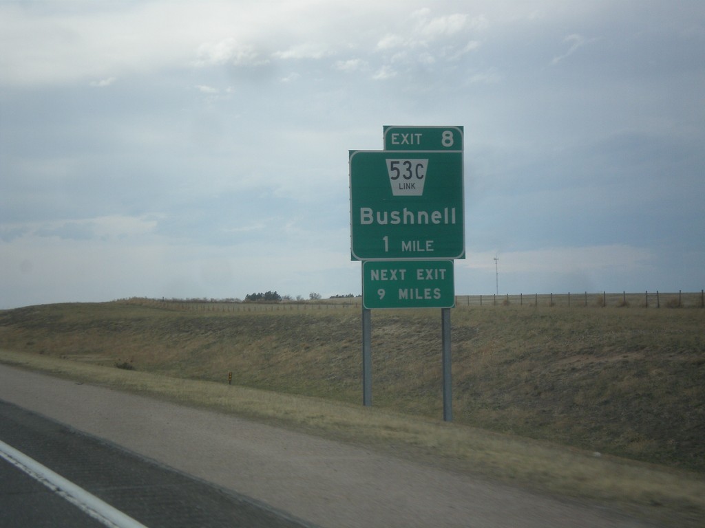
I-80 West - Exit 8
I-80 west approaching Exit 8 - NE-53C Link/Bushnell. Next exit along I-80 west is 9 miles, at Pine Bluffs.
Taken 03-30-2014
 Bushnell
Kimball County
Nebraska
United States
Bushnell
Kimball County
Nebraska
United States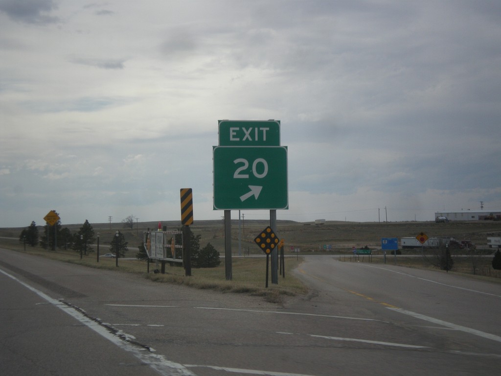
I-80 West - Exit 20 Gore
Exit 20 gore on I-80 west. This is a standard Nebraska exit gore sign.
Taken 03-30-2014
 Kimball
 County
Nebraska
United States
Kimball
Kimball County
Nebraska
United States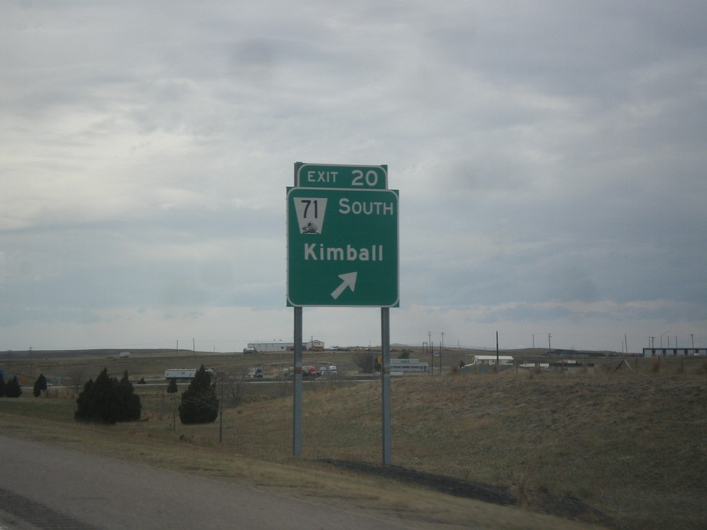
I-80 West - Exit 20
I-80 west at Exit 20 - NE-71 South/Kimball. NE-71 leaves I-80 westbound here.
Taken 03-30-2014
Kimball
Kimball County
Nebraska
United States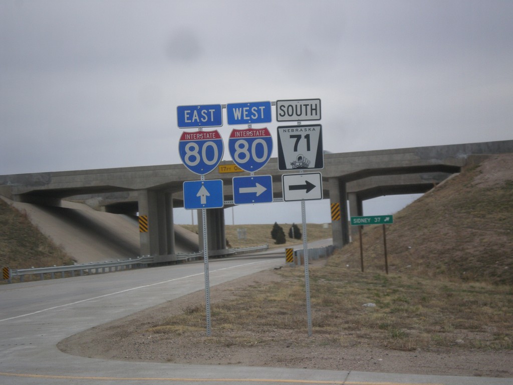
NE-71 South at I-80
NE-71 south at I-80. Turn right for I-80 West/NE-71 South; continue under overpass for I-80 East.
Taken 03-30-2014
Kimball
Kimball County
Nebraska
United States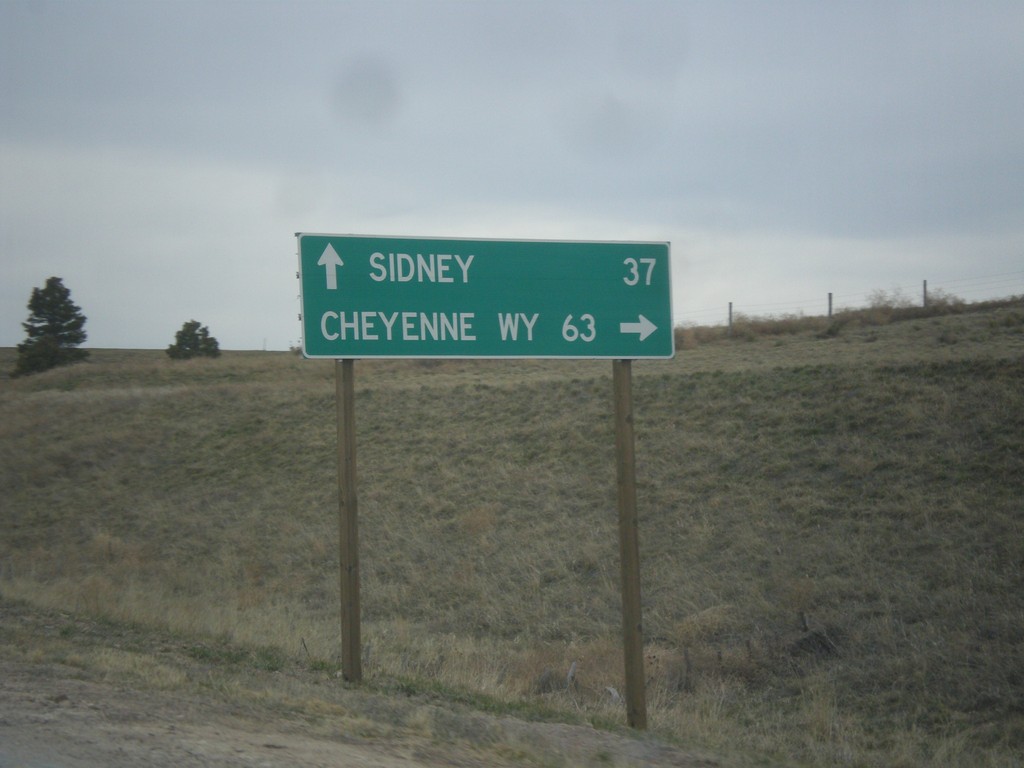
NE-71 South at I-80
NE-71 south at I-80. Use I-80 West/NE-71 South for Cheyenne, WY; I-80 East for Sidney.
Taken 03-30-2014
Kimball
Kimball County
Nebraska
United States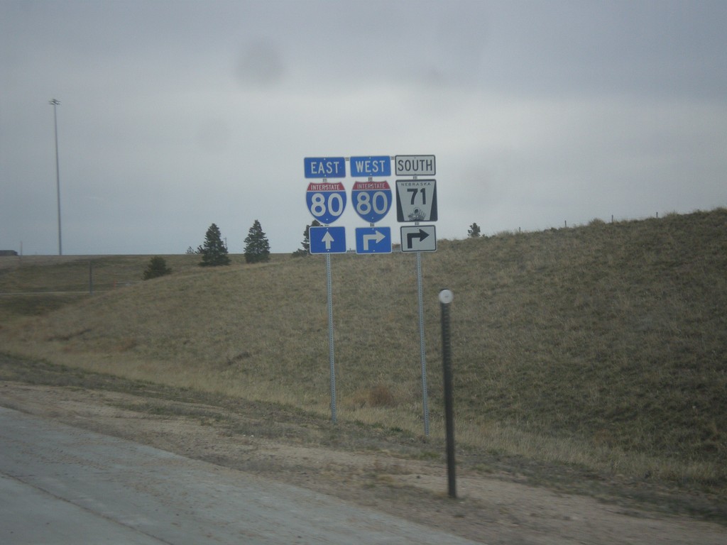
NE-71 South Approaching I-80
NE-71 south approaching I-80. NE-71 south joins I-80 west through Kimball.
Taken 03-30-2014
Kimball
Kimball County
Nebraska
United States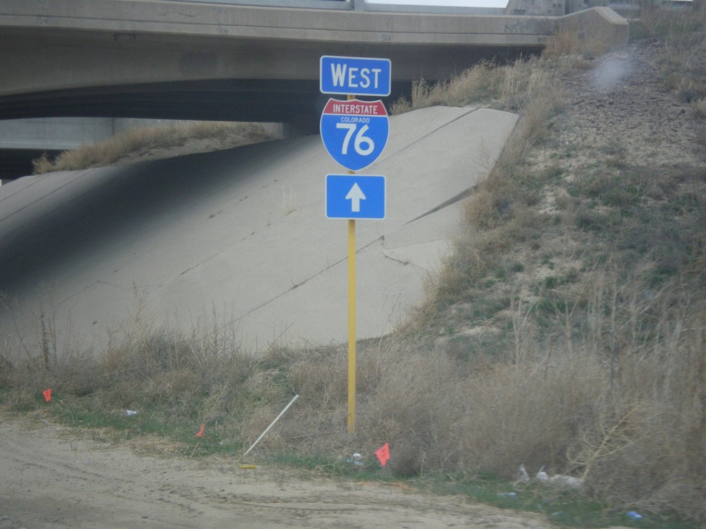
Hospital Road North at I-76 West
Hospital Road north approaching I-76 west.
Taken 03-30-2014
 Brush
Morgan County
Colorado
United States
Brush
Morgan County
Colorado
United States
I-70 East - Exit 361
I-70 east at Exit 361 - To CO-71/Limon.
Taken 03-30-2014

 Limon
Lincoln County
Colorado
United States
Limon
Lincoln County
Colorado
United States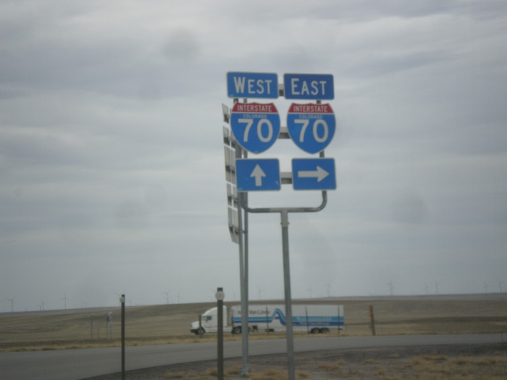
BL-70/US-40 West/US-287 North at I-70
BL-70/US-40 West/US-287 North at I-70. Turn right for I-70 East; continue over overpass for I-70/US-40 East/US-287 North. This is the western end of the Limon business loop.
Taken 03-30-2014


 Limon
Lincoln County
Colorado
United States
Limon
Lincoln County
Colorado
United States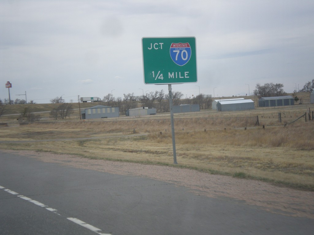
BL-70/US-24/US-40 West/US-287 North Approaching I-70
BL-70/US-24/US-40 West/US-287 North approaching I-70 (Exit 361).
Taken 03-30-2014
 Limon
Lincoln County
Colorado
United States
Limon
Lincoln County
Colorado
United States
US-40 West/US-287 North at I-70/US-24/BL-70
US-40 West/US-287 North at I-70/US-24/BL-70. Turn right for I-70/US-24 East. Continue under overpass for I-70 west. US-40/US-287 joins US-24/BL-70 through Limon. This is the eastern end of the Limon business loop.
Taken 03-30-2014
Limon
Lincoln County
Colorado
United States