Signs Tagged With Interchange
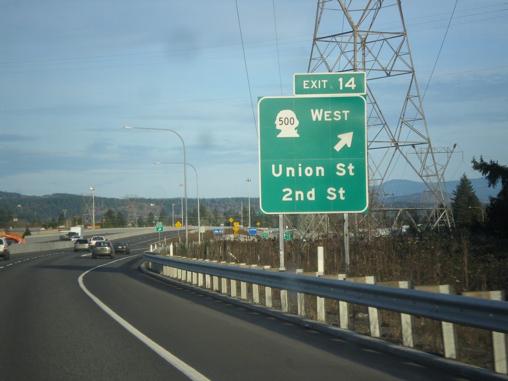
WA-14 East - Exit 14
WA-14 East at Exit 14 - WA-500 West/Union St./2nd St.
Taken 02-16-2015

 Camas
Clark County
Washington
United States
Camas
Clark County
Washington
United States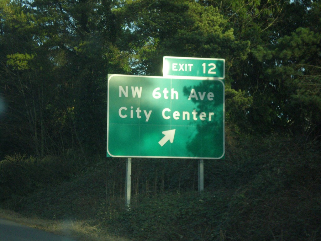
WA-14 East - Exit 12
WA-14 east at Exit 12 - NW 6th Ave./City Center.
Taken 02-16-2015
Camas
Clark County
Washington
United States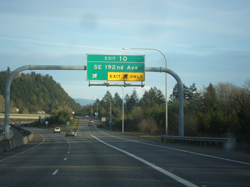
WA-14 East - Exit 10
WA-14 east at Exit 10 - SE 192nd Ave.
Taken 02-16-2015
Vancouver
Clark County
Washington
United States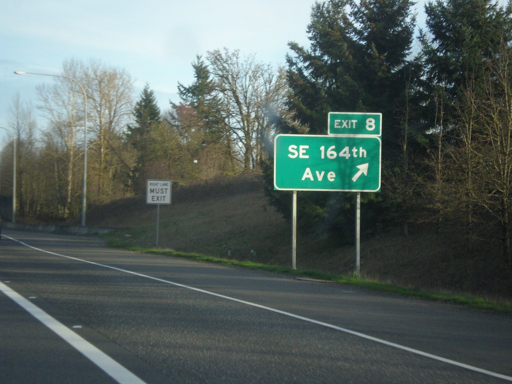
WA-14 East - Exit 8
WA-14 east at Exit 8 - SE 164th Ave.
Taken 02-16-2015
Vancouver
Clark County
Washington
United States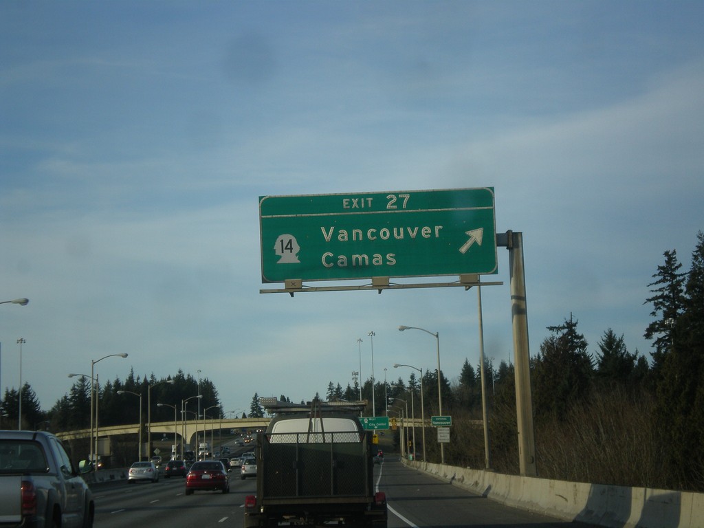
I-205 North - Exit 27
I-205 north at Exit 27 - WA-14/Vancouver/Camas. This is the first exit in Washington along I-205.
Taken 02-16-2015
 Vancouver
Clark County
Washington
United States
Vancouver
Clark County
Washington
United States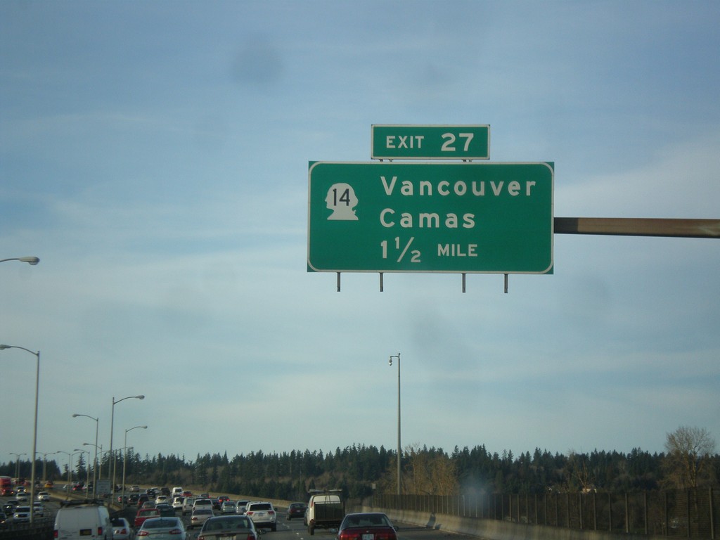
I-205 North - Exit 27
I-205 north approaching Exit 27 - WA-14/Vancouver/Camas. The milemarkers and exit numbers along I-205 do not reset back to zero when crossing into Washington. They continue on the Oregon numbering scheme. Although this is a Washington exit, this sign is still within Oregon.
Taken 02-16-2015
Portland
Multnomah County
Oregon
United States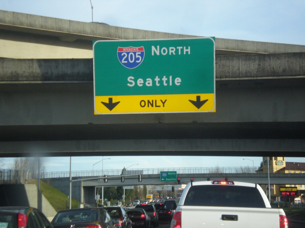
NE Airport Way at I-205 North
NE Airport Way at I-205 North to Seattle.
Taken 02-16-2015
Portland
Multnomah County
Oregon
United States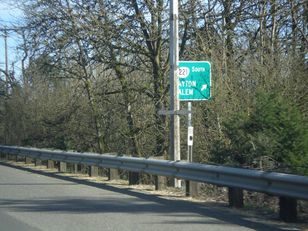
OR-18 East/OR-233 North at OR-221 South
OR-18 East/OR-233 North at OR-221 South to Dayton and Salem.
Taken 02-16-2015


 Dayton
Yamhill County
Oregon
United States
Dayton
Yamhill County
Oregon
United States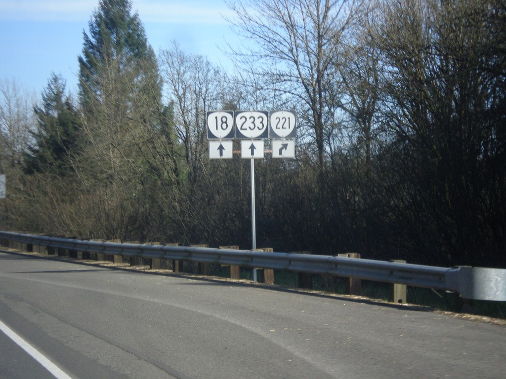
OR-18 East/OR-223 North Approaching OR-221
OR-18 East/OR-223 North approaching OR-221 in Dayton.
Taken 02-16-2015
Dayton
Yamhill County
Oregon
United States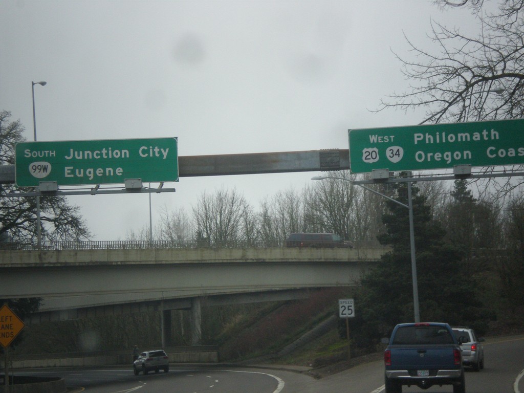
OR-99W South/US-20/OR-34 West at Split
OR-99W South/US-20/OR-34 West at split. Merge right for US-20/OR-34 West to Philomath and Oregon Coast. Continue straight for OR-99W South to Eugene and Junction City. The destination Oregon Coast is common along signs in Oregon, along with Ocean Beaches to denote costal locations.
Taken 02-13-2015


 Corvallis
Benton County
Oregon
United States
Corvallis
Benton County
Oregon
United States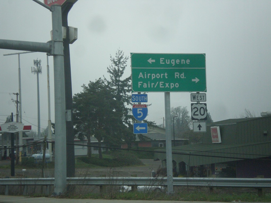
US-20 West at I-5 South
US-20 west at I-5 south. Use I-5 south for Eugene. Turn right for Airport Road and Fair/Expo. Continue straight for US-20 west.
Taken 02-13-2015
 Albany
Linn County
Oregon
United States
Albany
Linn County
Oregon
United States
US-20 West Approaching I-5 South
US-20 west approaching I-5 south to Eugene.
Taken 02-13-2015
Albany
Linn County
Oregon
United States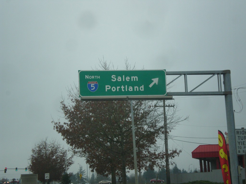
US-20 West at I-5 North
US-20 west at I-5 north to Salem and Portland.
Taken 02-13-2015
Albany
Linn County
Oregon
United States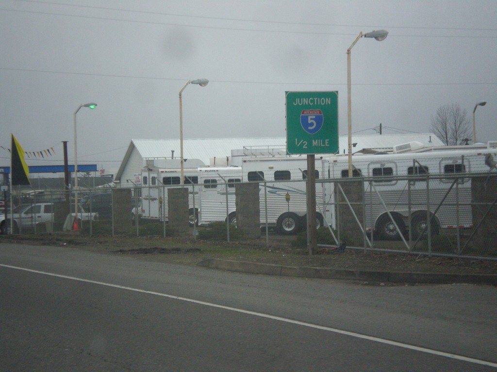
US-20 West Approaching I-5
US-20 west approaching I-5 in Albany.
Taken 02-13-2015
Albany
Linn County
Oregon
United States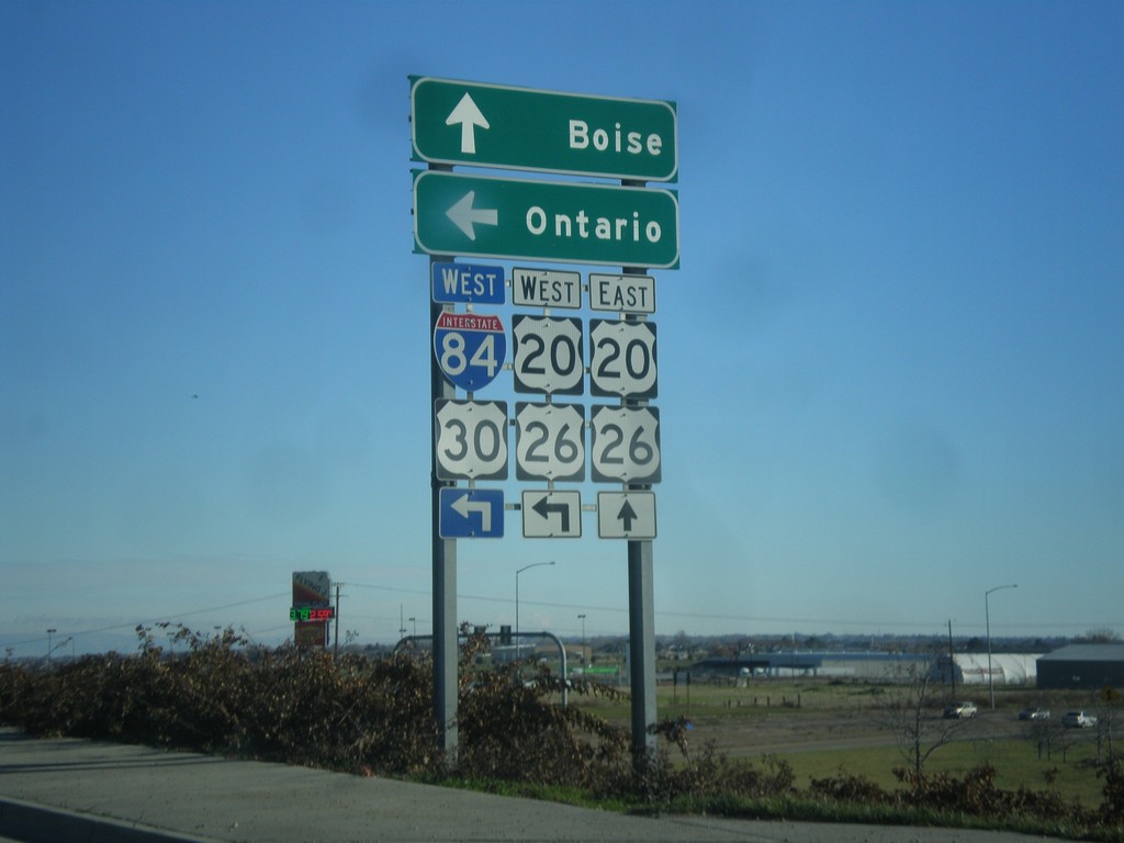
US-20/US-26 East at I-84 West
US-20/US-26 East at I-84 West in Caldwell. Use I-84/US-30/US-20/US-26 West for Ontario (Oregon). Continue east for US-20/US-26 to Boise.
Taken 12-14-2014


 Caldwell
Canyon County
Idaho
United States
Caldwell
Canyon County
Idaho
United States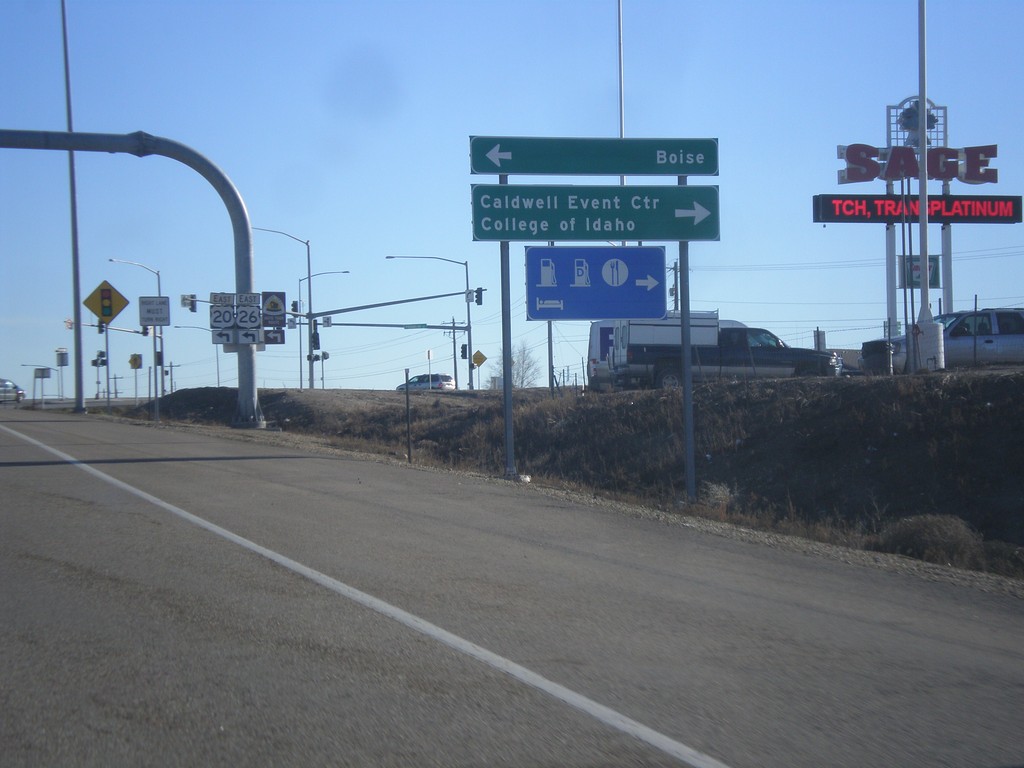
I-84 East at US-20/US-26 - Exit 29 Offramp
I-84 East (Exit 29) offramp at US-20/US-26 (Franklin Road). US-20/US-26 leaves I-84 here, and turns east into Boise. Turn left for US-20/US-26 to Boise. Turn right for Franklin Road to College of Idaho and Caldwell Event Center.
Taken 12-14-2014
Caldwell
Canyon County
Idaho
United States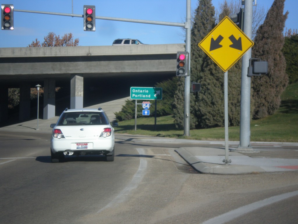
10th St. East at I-84 East
10th St. East at I-84 East to Ontario, and Portland. This is one of the few instances of Portland used as a control city on I-84.
Taken 12-14-2014
Caldwell
Canyon County
Idaho
United States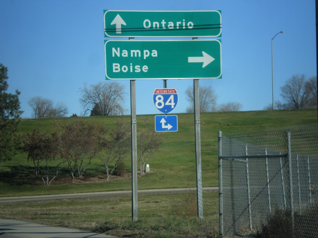
10th St. East at I-84 East
10th St. East at I-84 East (Exit 28). Turn right on I-84 for Nampa and Boise. Continue east on 10th St. for I-84 East to Ontario (Oregon).
Taken 12-14-2014
Caldwell
Canyon County
Idaho
United States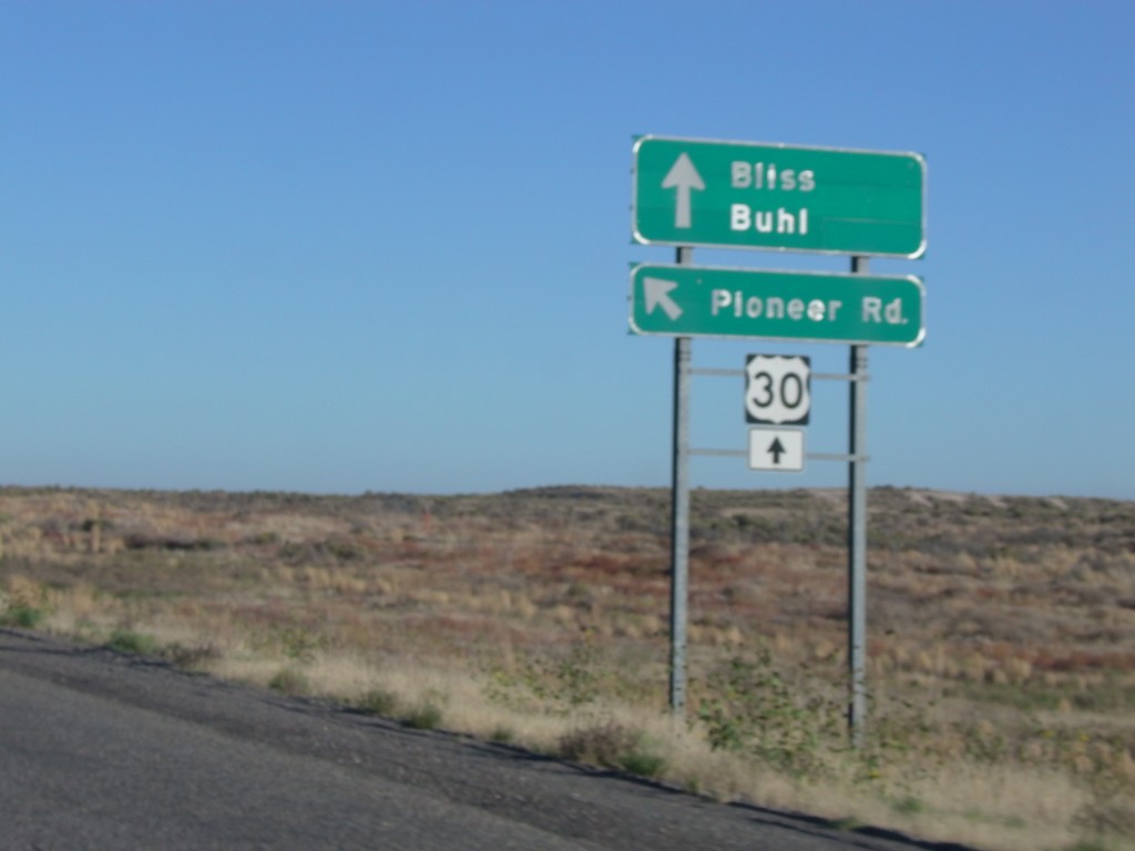
I-84 - Exit 137 Offramp at Pioneer Road
I-84 - Exit 137 Offramp at Pioneer Road. Merge left for Pioneer Road. Continue straight for US-30 to Bliss and Buhl.
Taken 10-03-2014
 Bliss
Gooding County
Idaho
United States
Bliss
Gooding County
Idaho
United States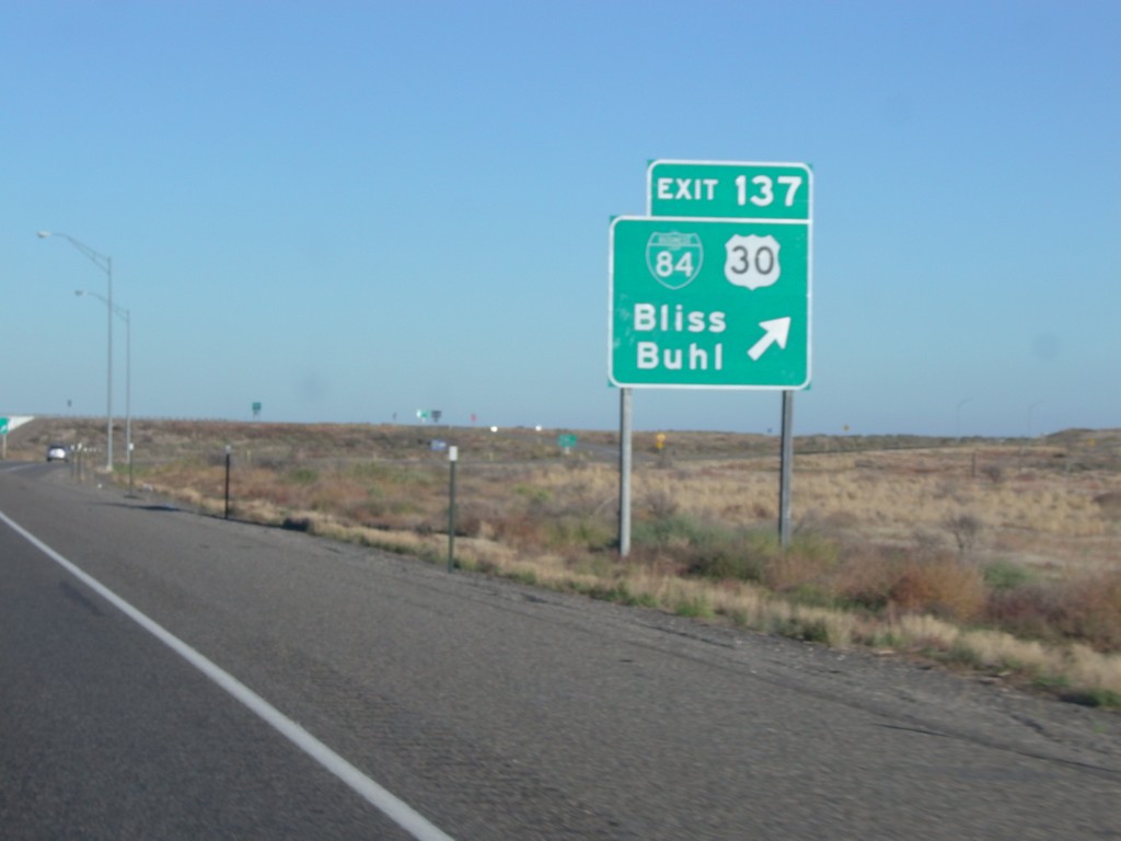
I-84 East - Exit 137
I-84 east at Exit 137 - BL-84/US-30/Bliss/Buhl. US-30 leaves I-84 here, and rejoins I-84 in Heyburn. This is the western end of the Thousands Springs Scenic Byway.
Taken 10-03-2014
Bliss
Gooding County
Idaho
United States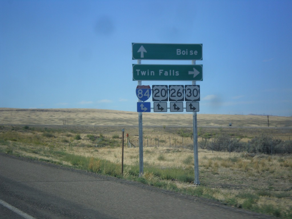
End BL-84 East at I-84 (Exit 90)
End BL-84 east at I-84, Exit 90 onramps. Use I-84/US-20/US-26/US-30 east for Twin Falls; use I-84/US-20/US-26/US-30 west for Boise. This is the western end of the Mountain Home business loop.
Taken 08-31-2014
Mountain Home
Elmore County
Idaho
United States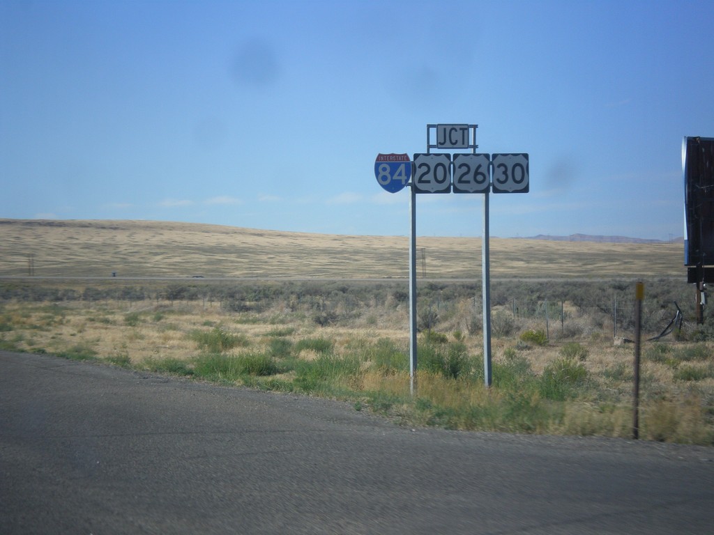
BL-84 West Approaching I-84
BL-84 west approaching I-84/US-20/US-26/US-30 in Mountain Home. This is the western end of the Mountain Home business loop.
Taken 08-31-2014
Mountain Home
Elmore County
Idaho
United States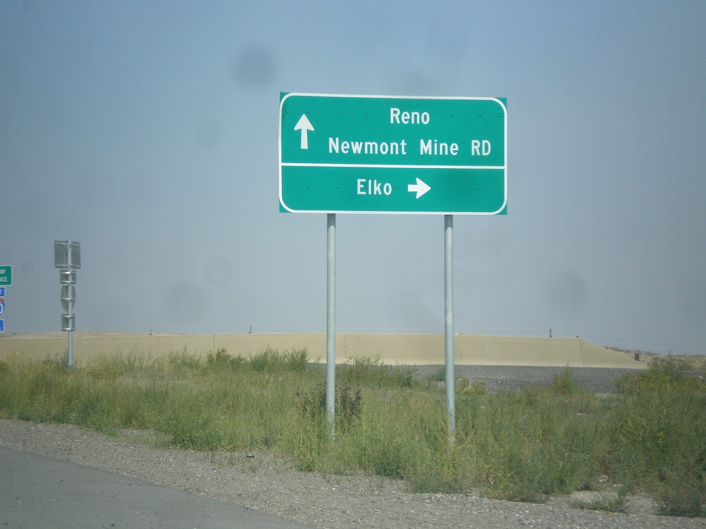
NV-766 North at I-80 (Exit 280)
NV-766 north at I-80 (Exit 280). Use I-80 east for Elko; I-80 west for Reno; NV-766 north for Newmont Mine Road.
Taken 08-31-2014

 Carlin
Elko County
Nevada
United States
Carlin
Elko County
Nevada
United States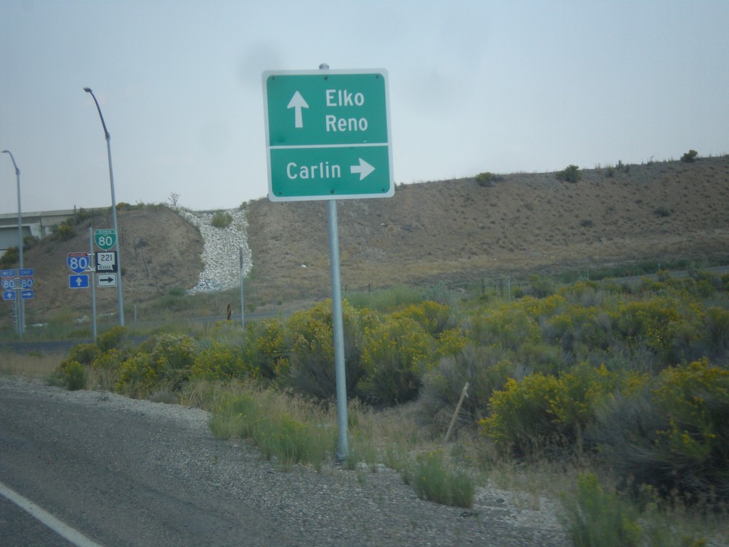
NV-278 North at BL-80/NV-221. Approaching I-80.
NV-278 at BL-80/NV-221 east to Carlin. Immediately after this intersection is the onramp for I-80 to Reno and Elko. This interchange was recently upgraded from a partial diamond to a full diamond that now has an eastbound ramp onto the freeway.
Taken 08-31-2014


 Carlin
Elko County
Nevada
United States
Carlin
Elko County
Nevada
United States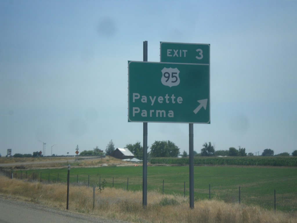
I-84 East - Exit 3
I-84 east at Exit 3 - US-95/Payette/Parma. First Idaho exit.
Taken 07-27-2014
 Fruitland
Payette County
Idaho
United States
Fruitland
Payette County
Idaho
United States