Signs Tagged With Interchange
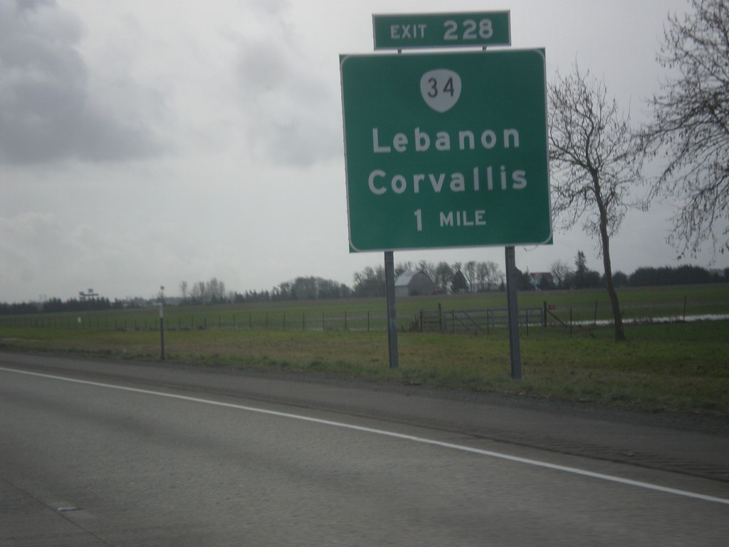
I-5 South Approaching Exit 228
I-5 south approaching Exit 228 - OR-34/Lebanon/Corvallis.
Taken 02-13-2014

 Albany
Linn County
Oregon
United States
Albany
Linn County
Oregon
United States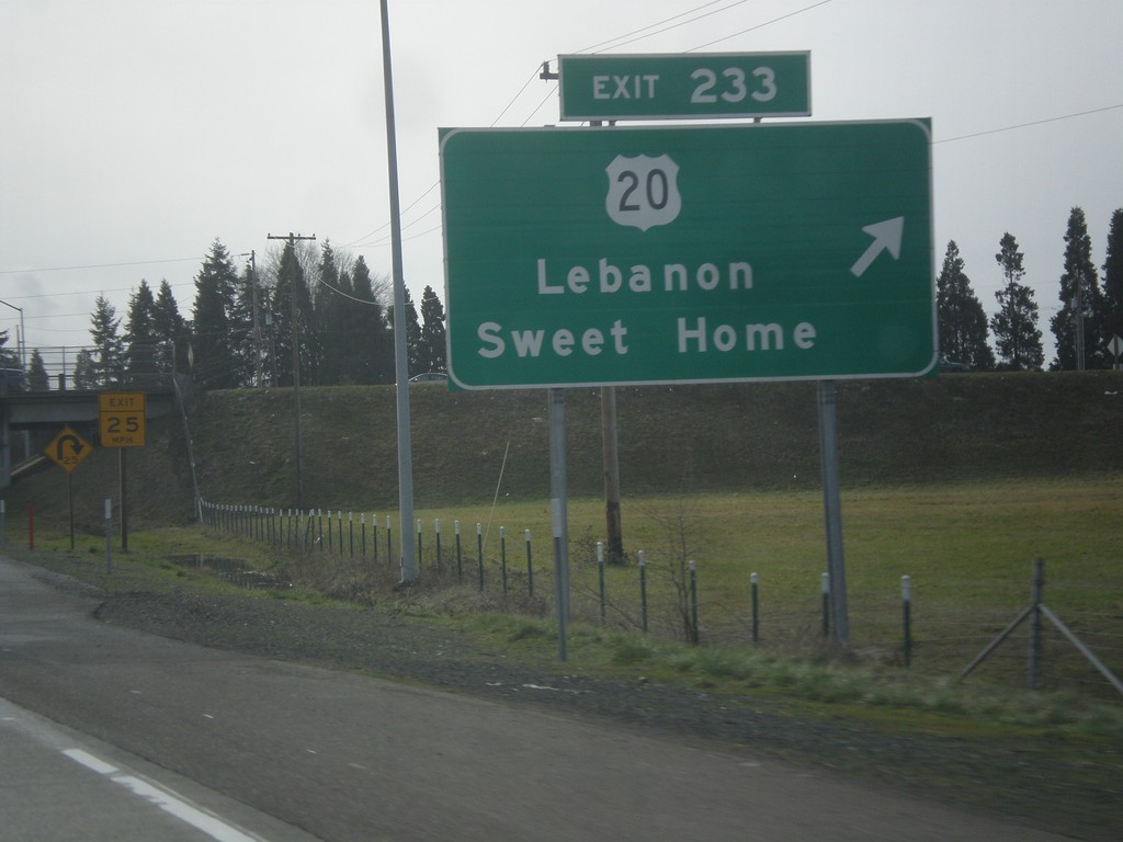
I-5 South - Exit 233
I-5 south at Exit 233 - US-20 East/Lebanon/Sweet Home.
Taken 02-13-2014
 Albany
Linn County
Oregon
United States
Albany
Linn County
Oregon
United States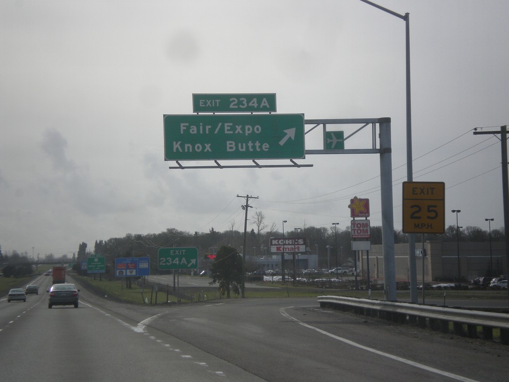
I-5 South - Exit 234A
I-5 south at Exit 234A - Knox Butte/Fair/Expo.
Taken 02-13-2014
Albany
Linn County
Oregon
United States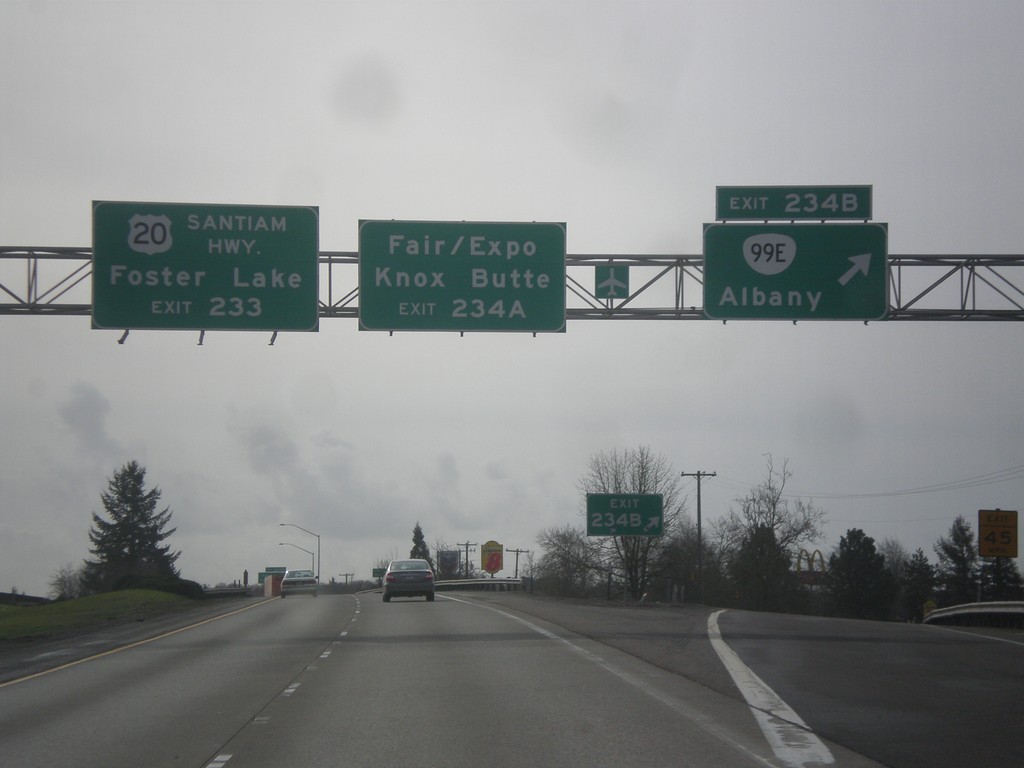
I-5 South - Exits 234BA
I-5 south at Exit 234B - OR-99E/Albany. Approaching Exit 234A - Knox Butte/Fair/Expo. For Foster Lake, use US-20/Santiam Highway, Exit 233.
Taken 02-13-2014
 Albany
Linn County
Oregon
United States
Albany
Linn County
Oregon
United States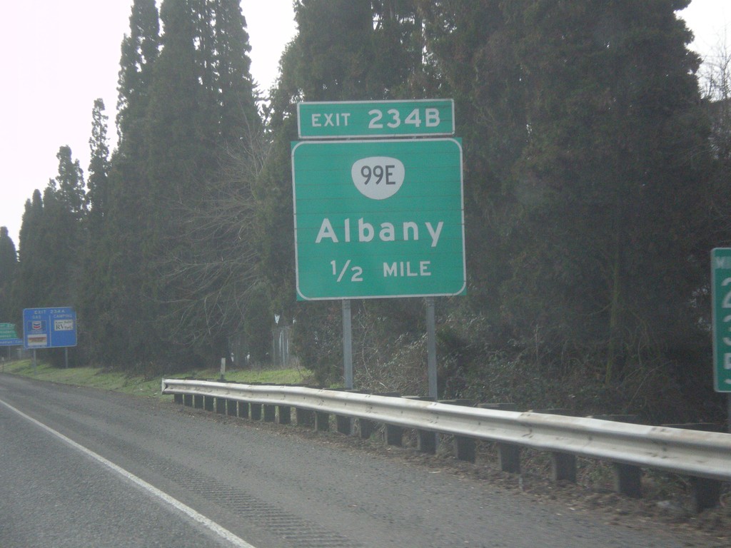
I-5 South Approaching Exit 234B
I-5 south approaching Exit 234B - OR-99E/Albany.
Taken 02-13-2014
Albany
Linn County
Oregon
United States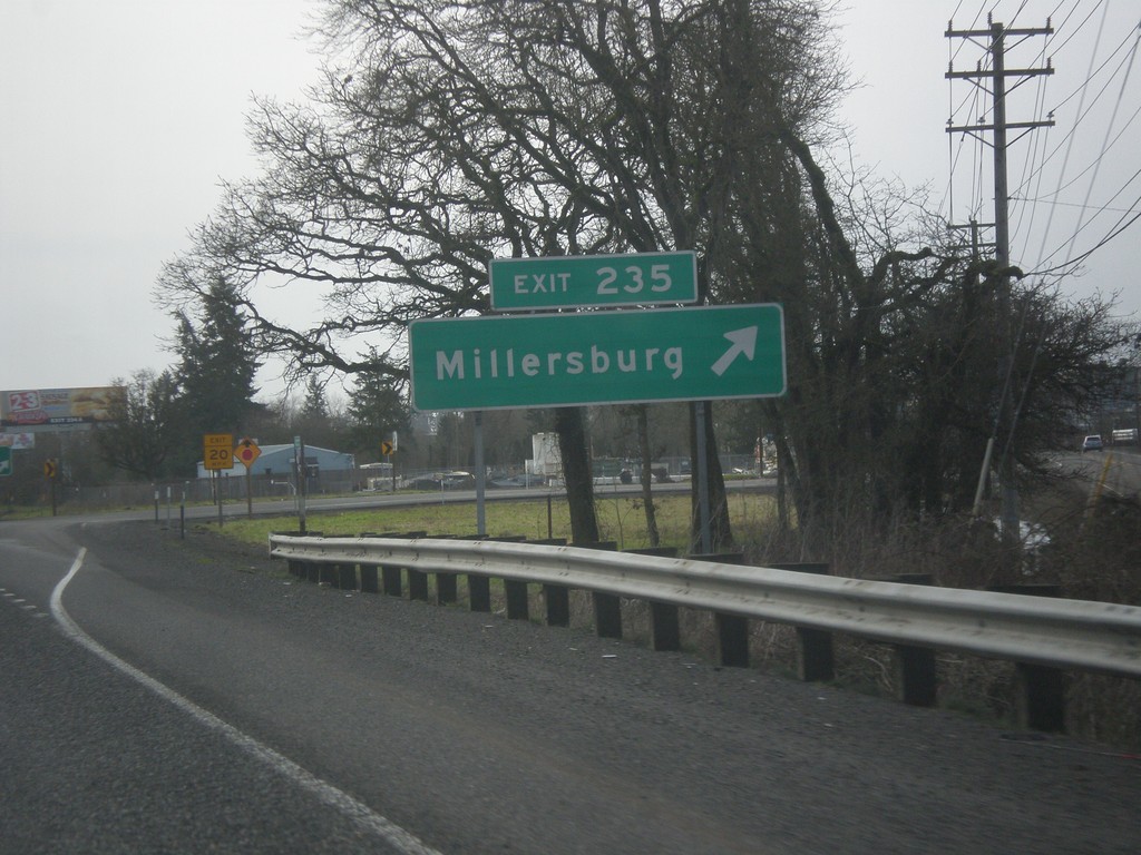
I-5 South - Exit 235
I-5 south at Exit 235 - Millersburg.
Taken 02-13-2014
Millersburg
Linn County
Oregon
United States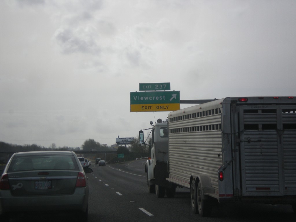
I-5 South - Exit 237
I-5 south at Exit 237 - Viewcrest.
Taken 02-13-2014
Albany
Linn County
Oregon
United States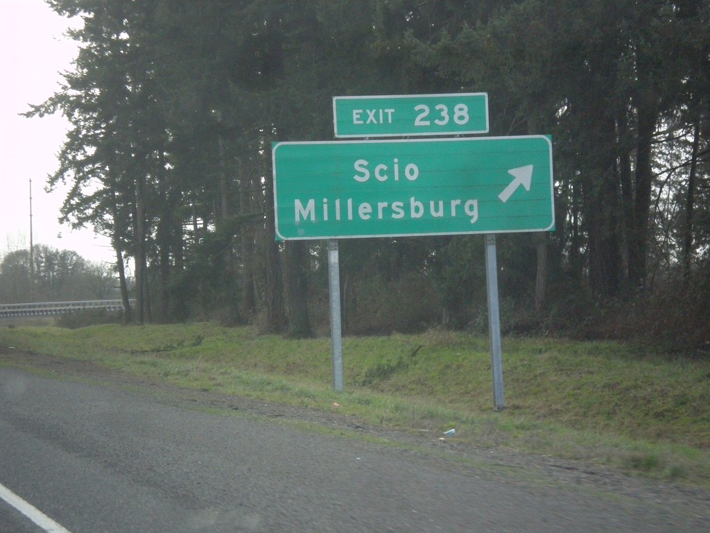
I-5 South - Exit 238
I-5 south at Exit 238 - Scio/Millersburg.
Taken 02-13-2014
Albany
Linn County
Oregon
United States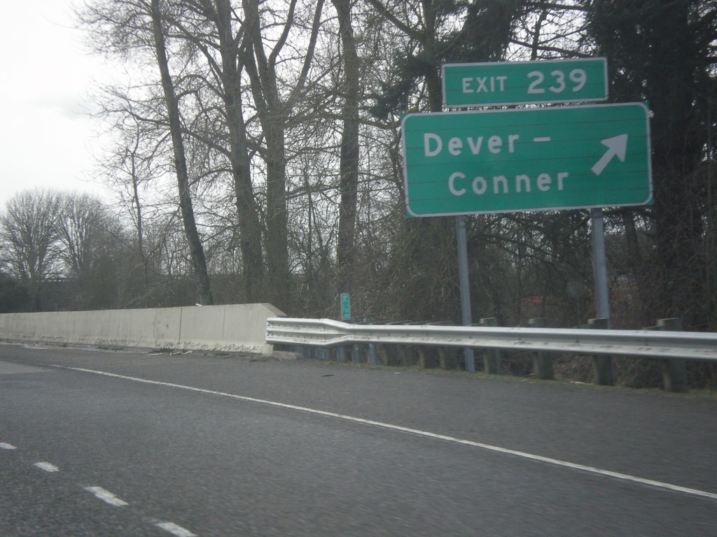
I-5 South - Exit 239
I-5 south at Exit 239 - Dever - Conner.
Taken 02-13-2014
Albany
Linn County
Oregon
United States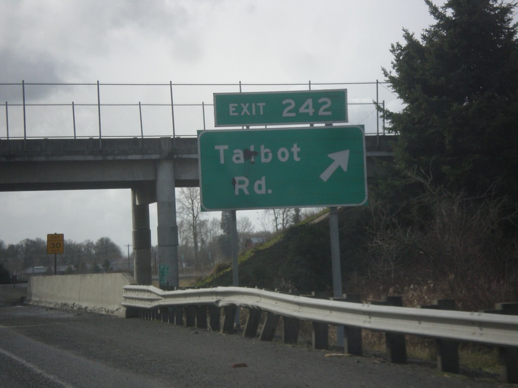
I-5 South - Exit 242
I-5 south at Exit 242 - Talbot Road.
Taken 02-13-2014
Talbot
Marion County
Oregon
United States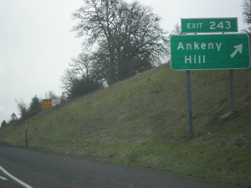
I-5 South - Exit 243
I-5 south at Exit 243 - Ankeny Hill.
Taken 02-13-2014
Salem
Marion County
Oregon
United States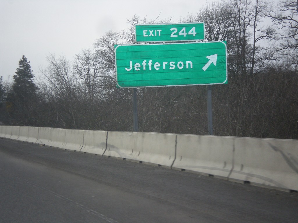
I-5 South - Exit 244
I-5 south at Exit 244 - Jefferson.
Taken 02-13-2014
Jefferson
Marion County
Oregon
United States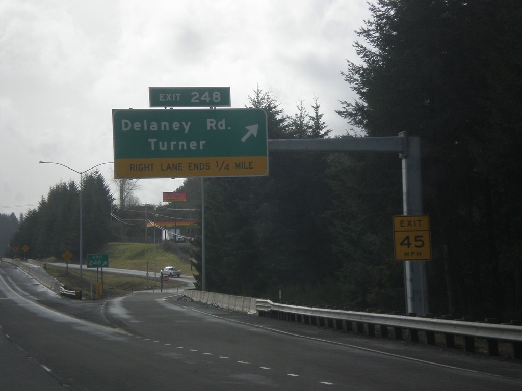
I-5 South - Exit 248
I-5 south at Exit 248 - Delaney Road/Turner.
Taken 02-13-2014
Salem
Marion County
Oregon
United States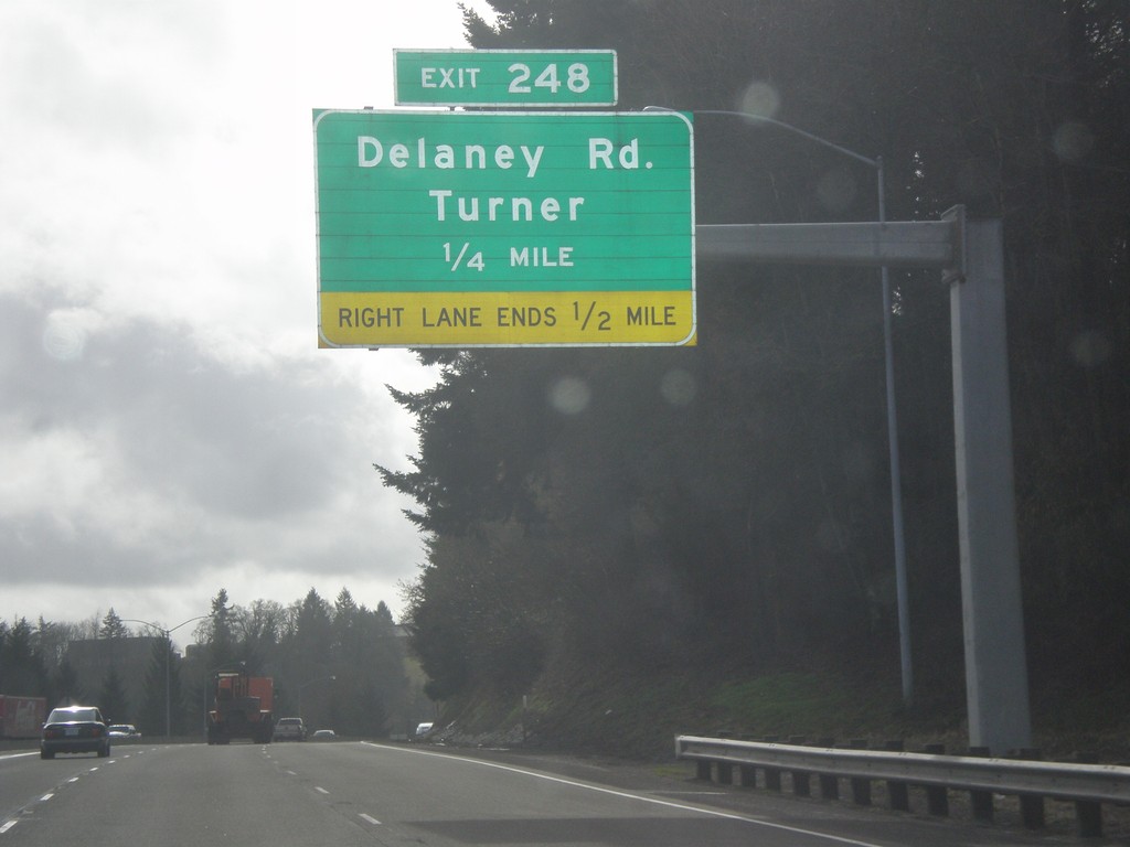
I-5 South Approaching Exit 248
I-5 south approaching Exit 248 - Delaney Road/Turner.
Taken 02-13-2014
Salem
Marion County
Oregon
United States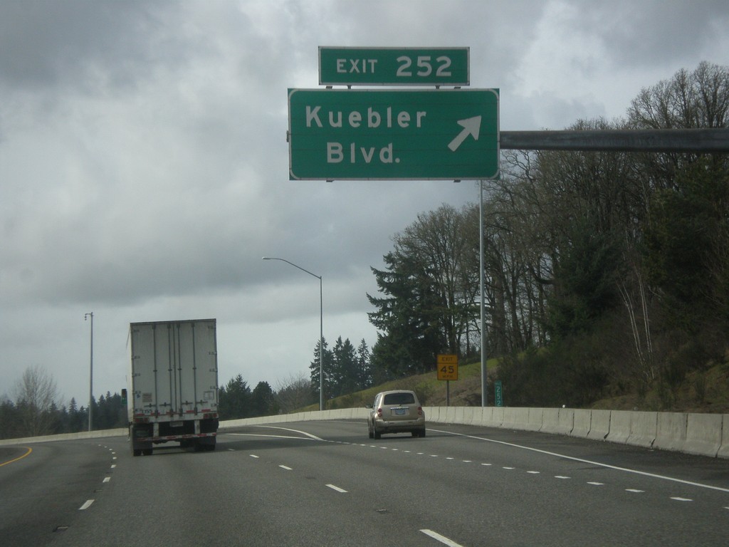
I-5 South - Exit 252
I-5 south at Exit 252 - Kuebler Blvd.
Taken 02-13-2014
Salem
Marion County
Oregon
United States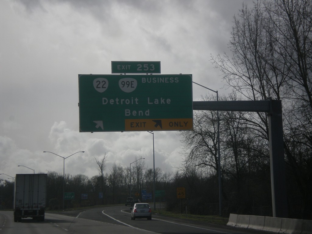
I-5 South - Exit 253
I-5 south at Exit 253 - OR-22/OR-99E Business/Detroit Lake/Bend.
Taken 02-13-2014

 Salem
Marion County
Oregon
United States
Salem
Marion County
Oregon
United States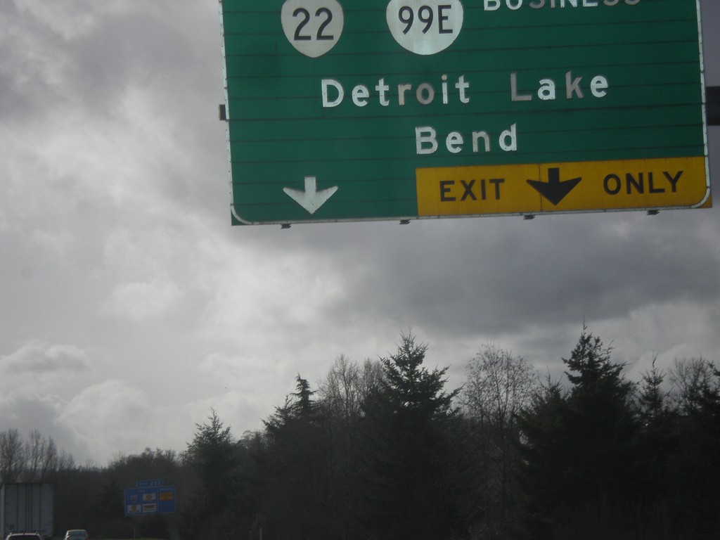
I-5 South Approaching Exit 253
I-5 south approaching Exit 253 - OR-22/Bus. OR-99E/Detroit Lake/Bend.
Taken 02-13-2014
Salem
Marion County
Oregon
United States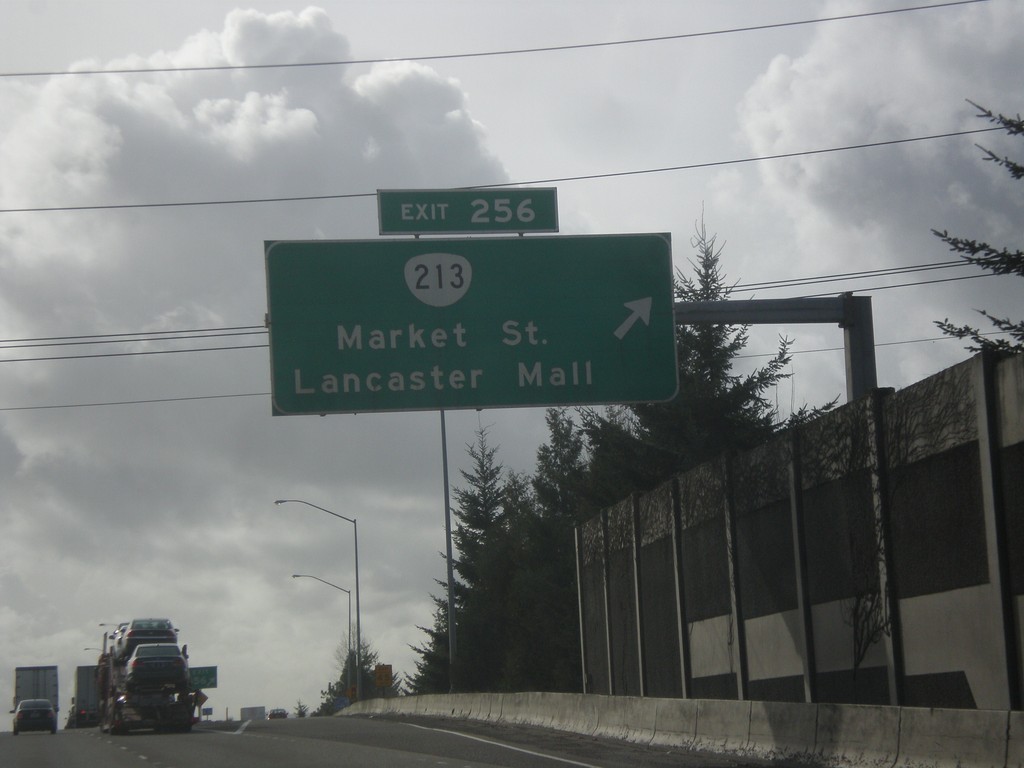
I-5 South - Exit 256
I-5 south at Exit 256 - OR-213/Market St./Lancaster Mall.
Taken 02-13-2014
 Salem
Marion County
Oregon
United States
Salem
Marion County
Oregon
United States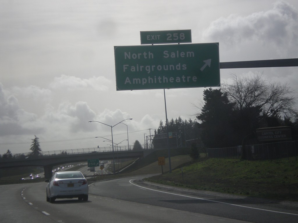
I-5 South - Exit 258
I-5 south at Exit 258 - North Salem/Fairgrounds/Amphitheater.
Taken 02-13-2014
Salem
Marion County
Oregon
United States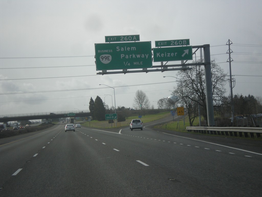
I-5 South - Exits 260B and 260A
I-5 south at Exit 260B - Keizer. Approaching Exit 260A - OR-99E/Salem Parkway.
Taken 02-13-2014
Keizer
Marion County
Oregon
United States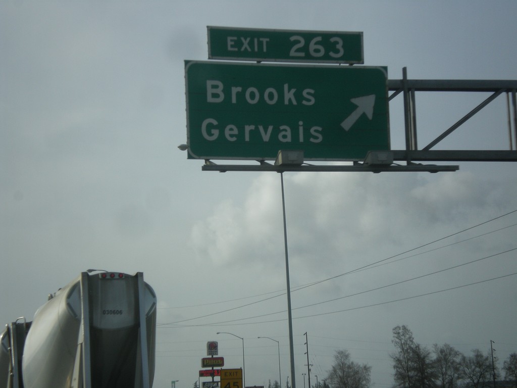
I-5 South - Exit 263
I-5 south at Exit 263 - Brooks/Gervais.
Taken 02-13-2014
Brooks
Marion County
Oregon
United States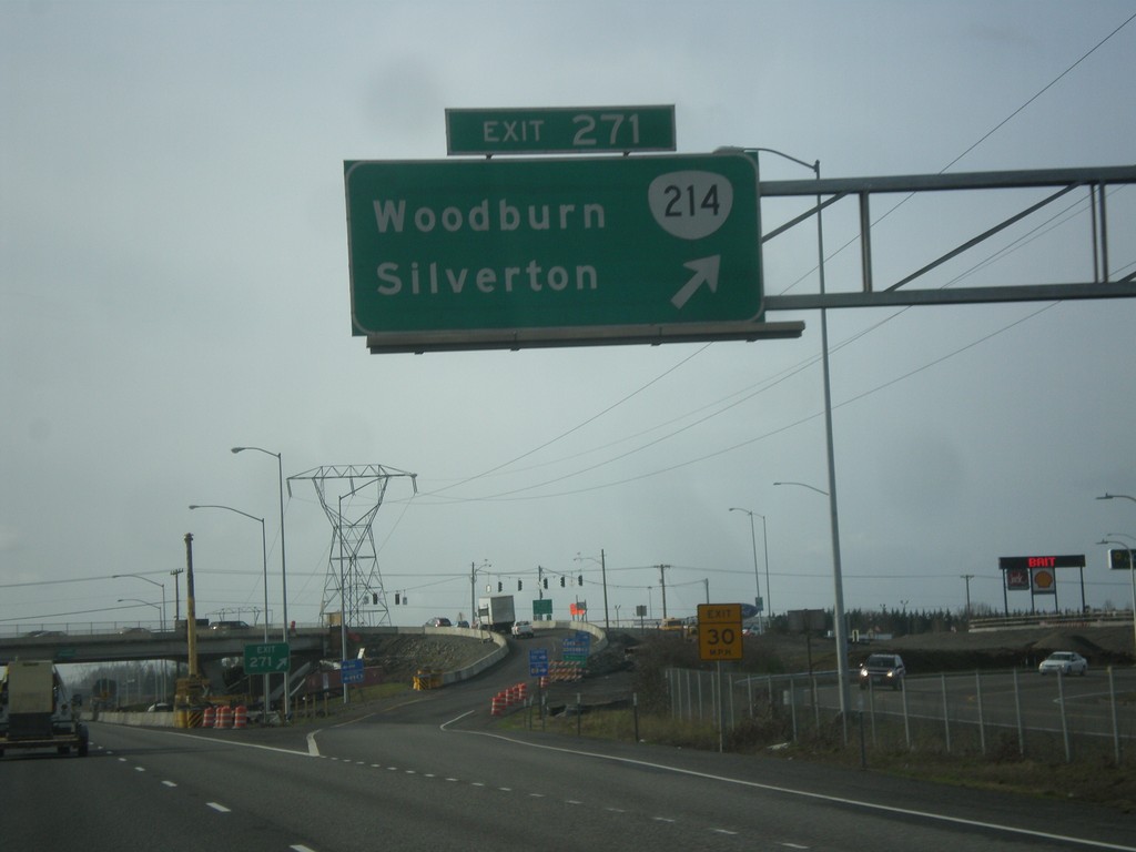
I-5 South - Exit 271
I-5 south at Exit 271 - OR-214/Woodburn/Silverton.
Taken 02-13-2014
 Woodburn
Marion County
Oregon
United States
Woodburn
Marion County
Oregon
United States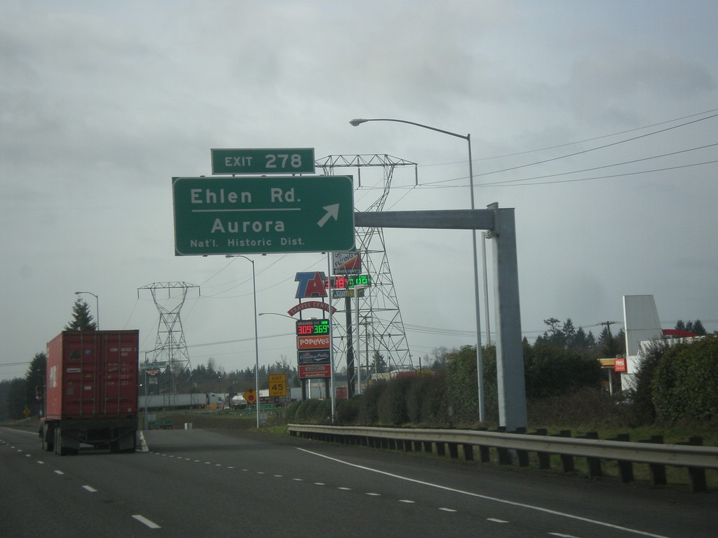
I-5 South - Exit 278
I-5 south at Exit 278 - Ehlen Road/Aurora/National Historic District.
Taken 02-13-2014
Aurora
Marion County
Oregon
United States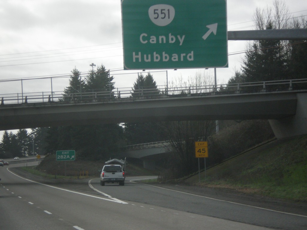
I-5 South - Exit 282A
I-5 south at Exit 282A - OR-551/Canby/Hubbard.
Taken 02-13-2014
 Aurora
Clackamas County
Oregon
United States
Aurora
Clackamas County
Oregon
United States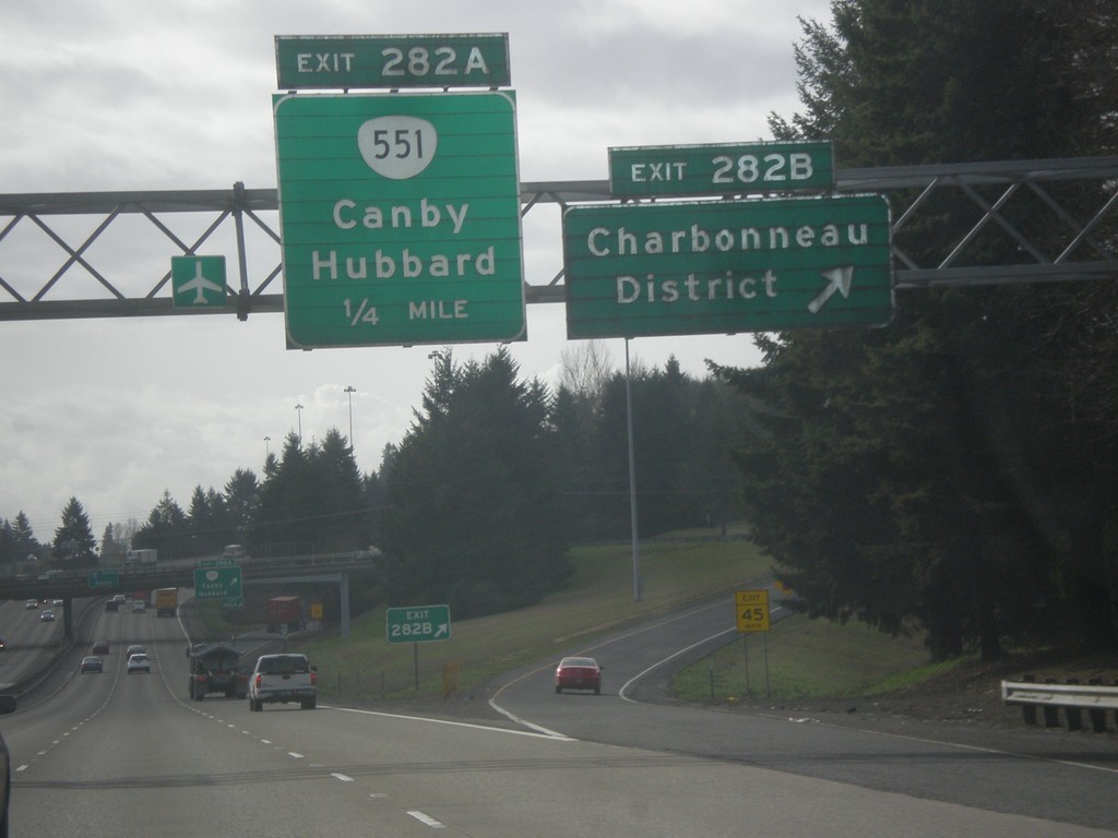
I-5 South - Exits 282B and 282A
I-5 south at Exit 282B - Charbonneau District. Approaching Exit 282A - OR-551/Canby/Hubbard.
Taken 02-13-2014
Wilsonville
Clackamas County
Oregon
United States