Signs Tagged With Interchange
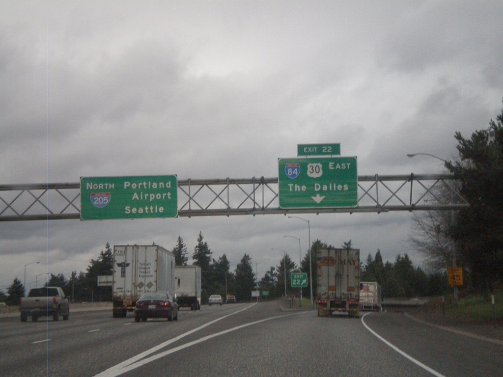
I-205 North - Exit 22
I-205 north at Exit 22 - I-84/US-30 East/The Dalles. I-205 continues north to Portland Airport and Seattle.
Taken 02-21-2012


 Portland
Multnomah County
Oregon
United States
Portland
Multnomah County
Oregon
United States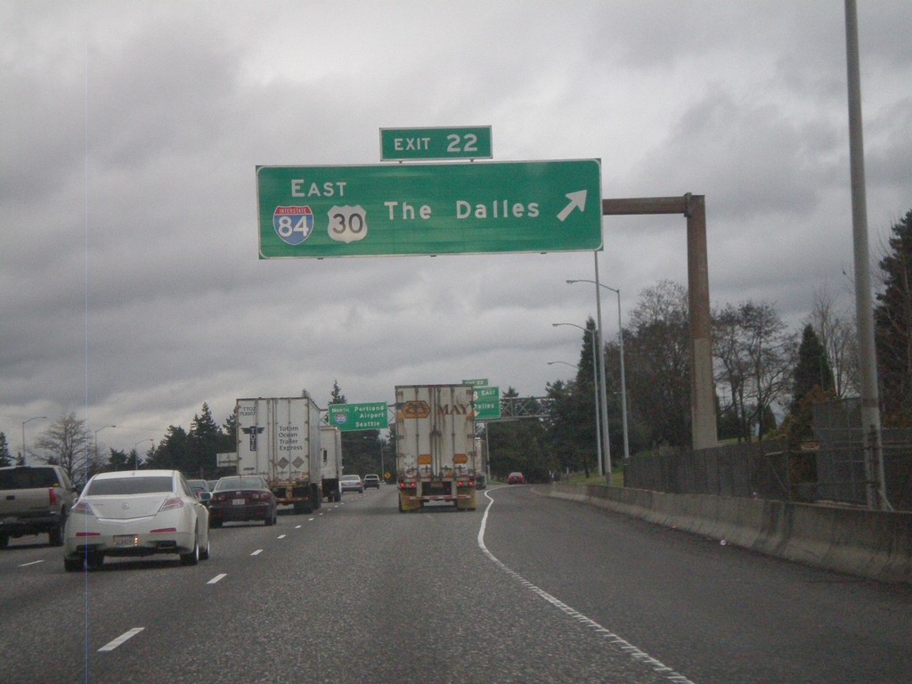
I-205 North - Exit 22
I-205 North at Exit 22 - I-84/US-30 East/The Dalles.
Taken 02-21-2012
Portland
Multnomah County
Oregon
United States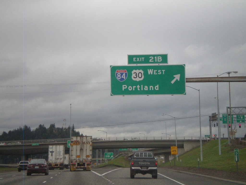
I-205 North - Exit 21B
I-205 north at Exit 21B - I-84/US-30 West/Portland.
Taken 02-21-2012
Portland
Multnomah County
Oregon
United States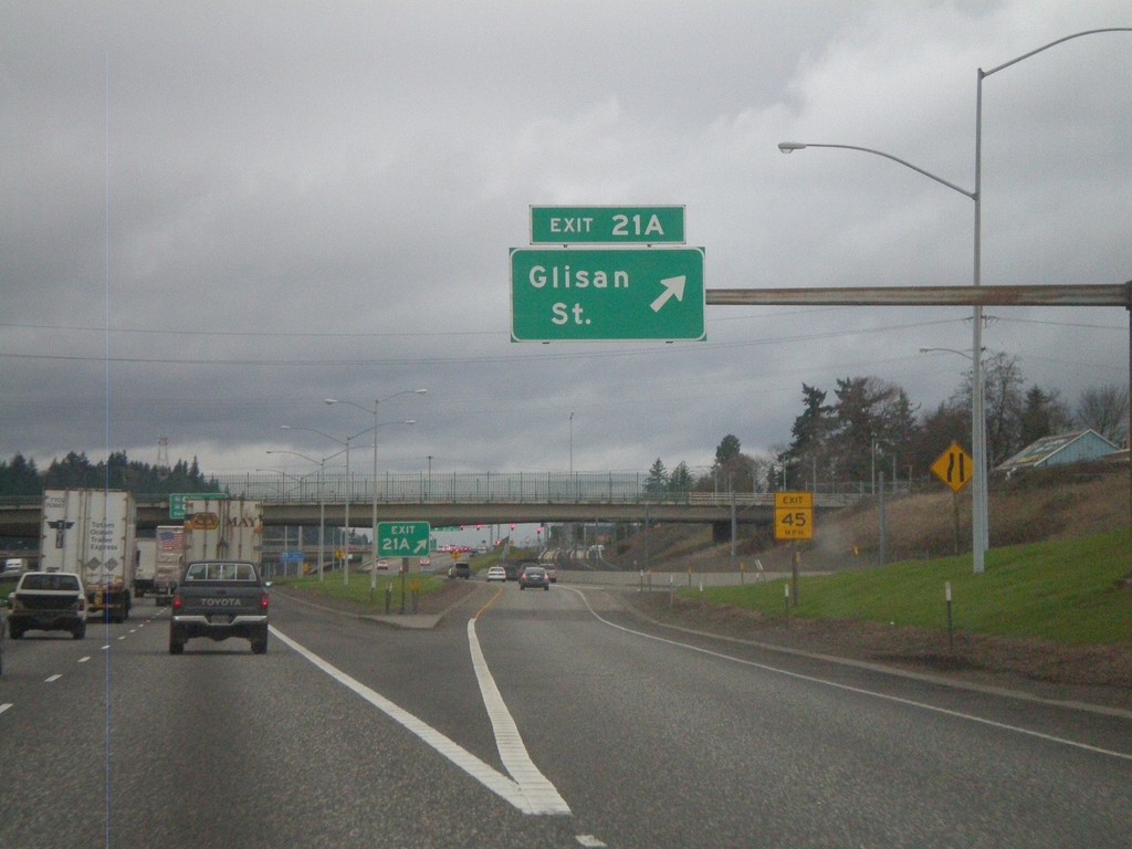
I-205 North - Exit 21B
I-205 north at Exit 21B - Glisan St.
Taken 02-21-2012
Portland
Multnomah County
Oregon
United States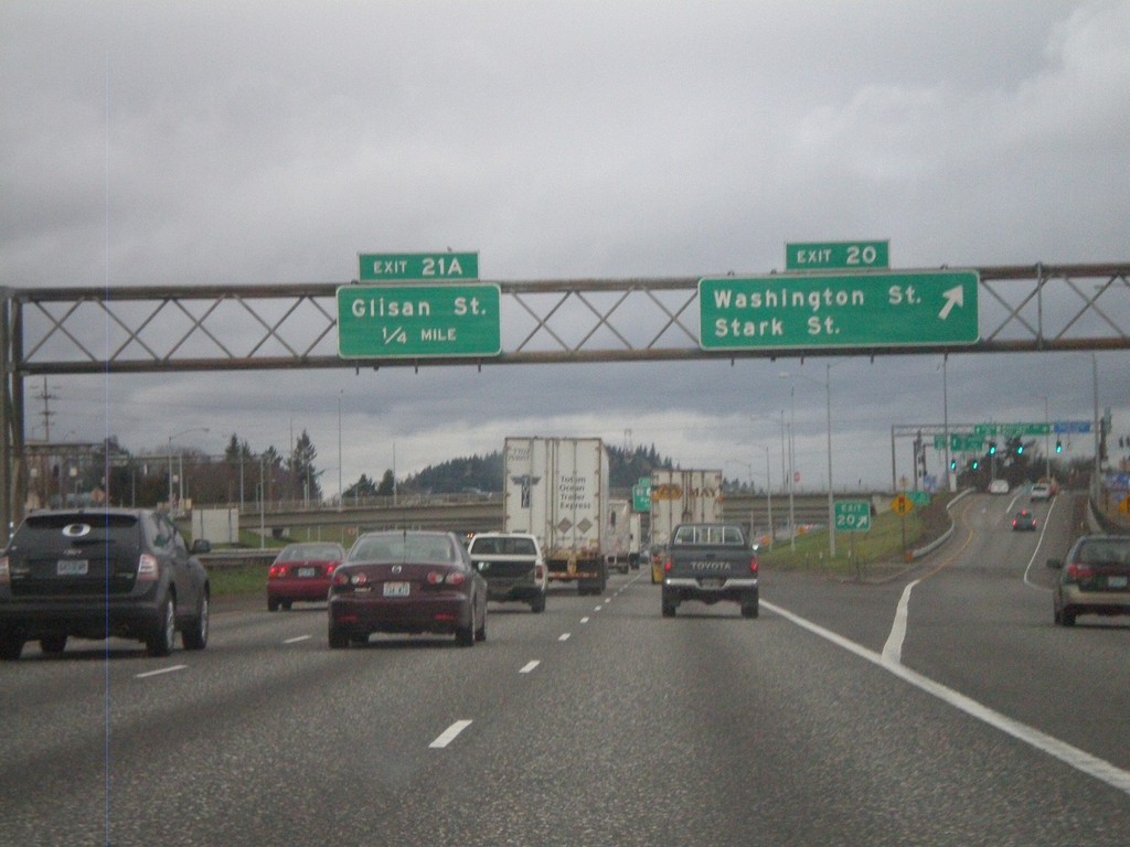
I-205 North - Exits 20 and 21A
I-205 north approaching Exit 20 - Washington St./Stark St. Approaching Exit 21A - Glisan St.
Taken 02-21-2012
Portland
Multnomah County
Oregon
United States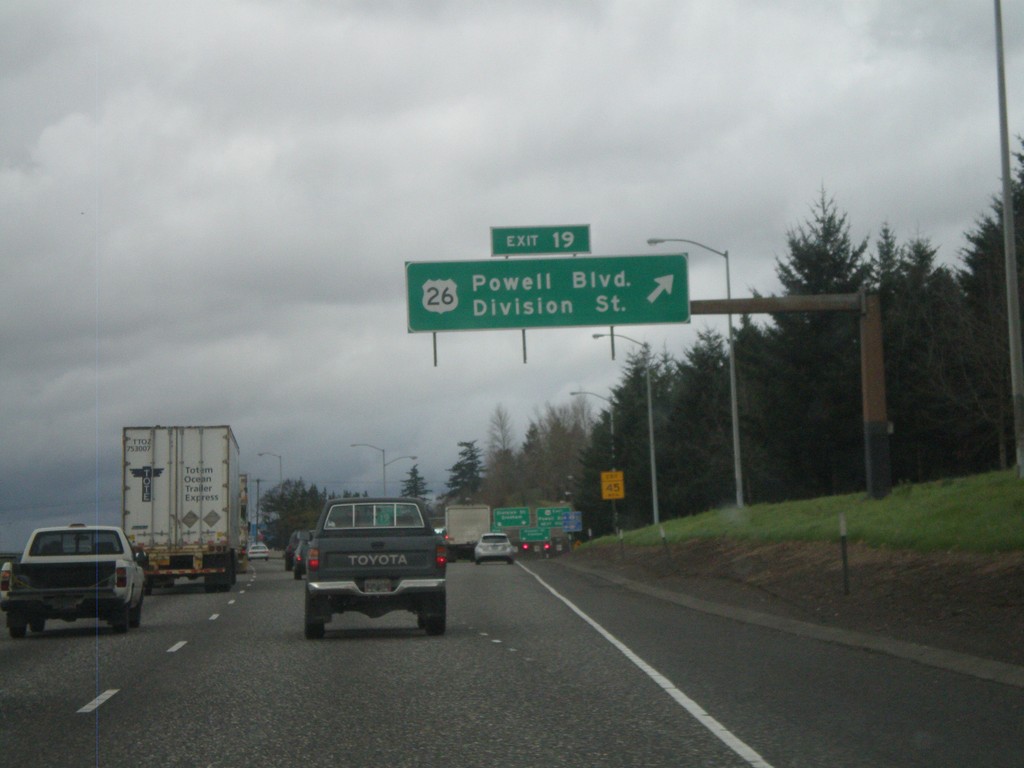
I-205 North - Exit 19
I-205 north at Exit 19 - US-26/Powell Blvd./Division St.
Taken 02-21-2012
 Portland
Multnomah County
Oregon
United States
Portland
Multnomah County
Oregon
United States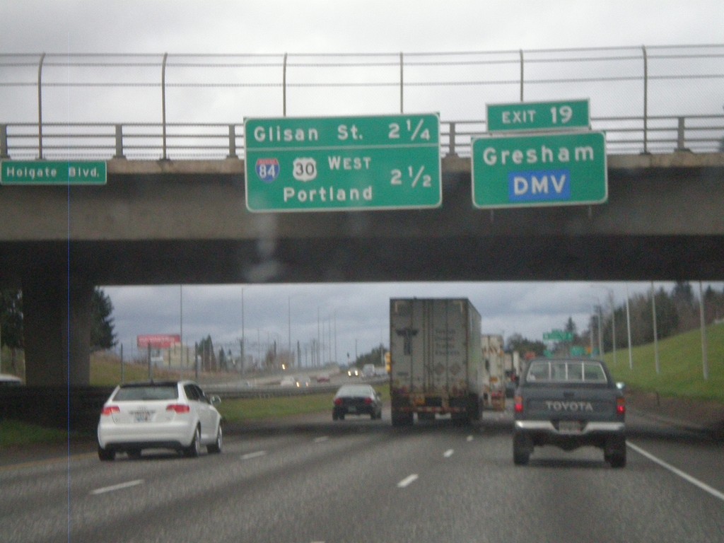
I-205 North - Exit 19 and Next Exits
I-205 north approaching Exit 9 - US-26/Powell St./Division St. Use Exit 19 for Gresham and the DMV. Distance marker for two approaching Exits - Glisan St. (Exit 21A) and I-84/US-30 West/Portland (Exit 21B).
Taken 02-21-2012
Portland
Multnomah County
Oregon
United States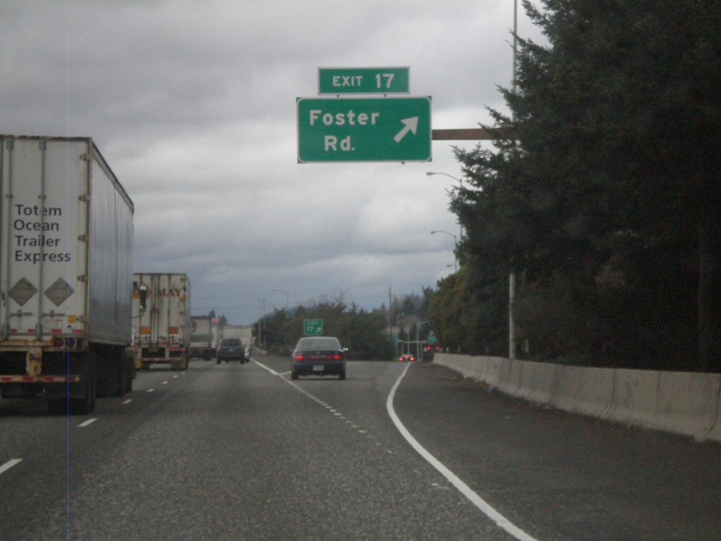
I-205 North - Exit 17
I-205 north at Exit 17 - Foster Road.
Taken 02-21-2012
Portland
Multnomah County
Oregon
United States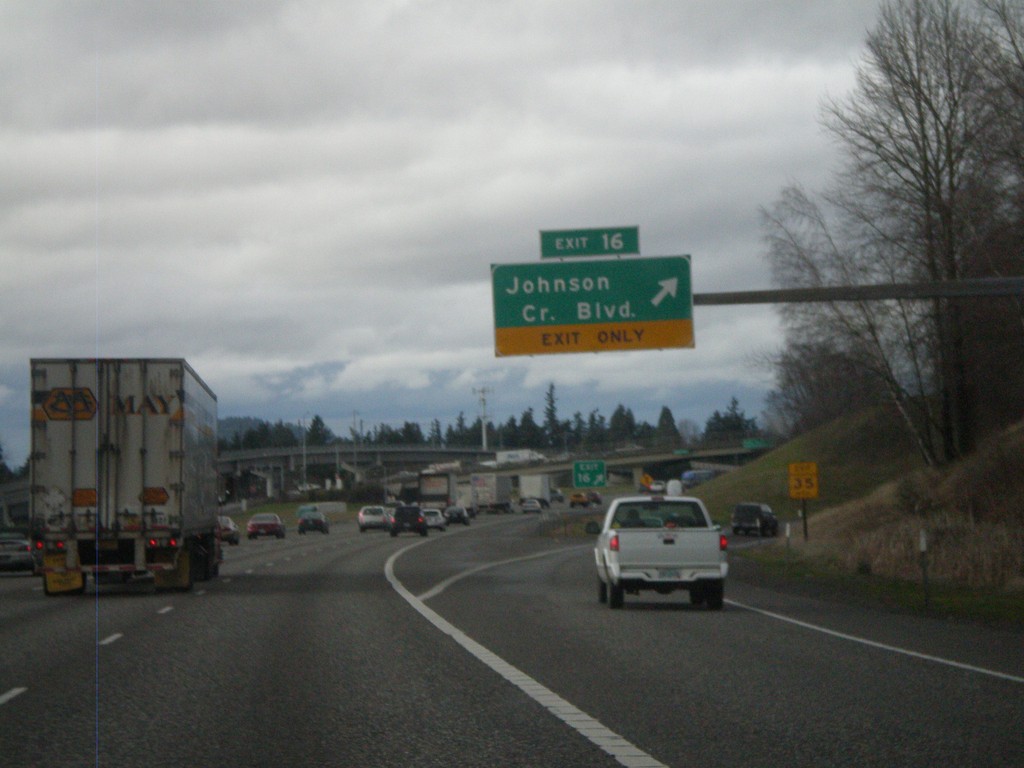
I-205 North - Exit 16
I-205 north at Exit 16 - Johnson Creek Blvd.
Taken 02-21-2012
Happy Valley
Clackamas County
Oregon
United States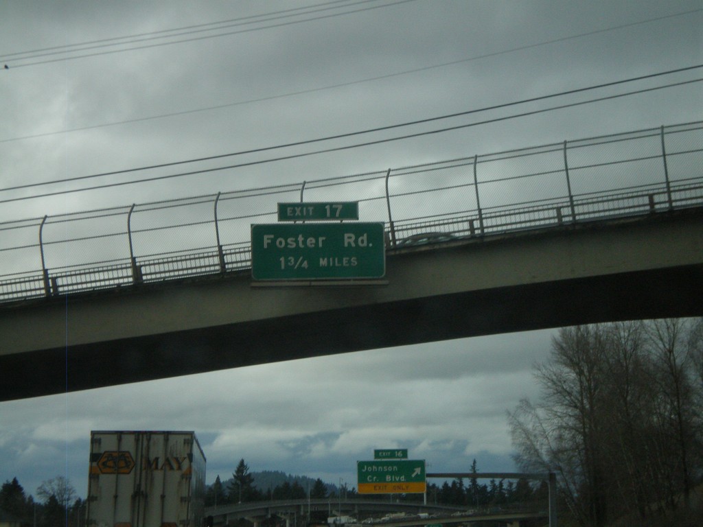
I-205 North Approaching Exit 17
I-205 North approaching Exit 17 - Foster Road.
Taken 02-21-2012
Happy Valley
Clackamas County
Oregon
United States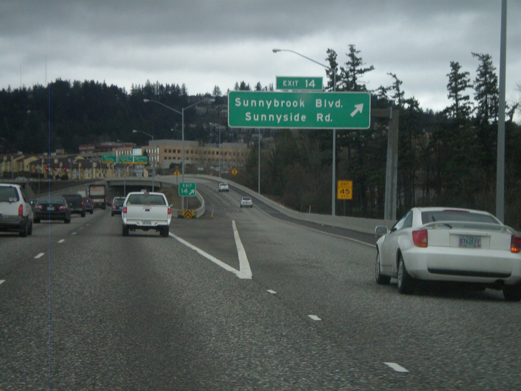
I-205 North - Exit 14
I-205 north at Exit 14 - Sunnybrook Blvd./Sunnyside Road.
Taken 02-21-2012
Clackamas
Clackamas County
Oregon
United States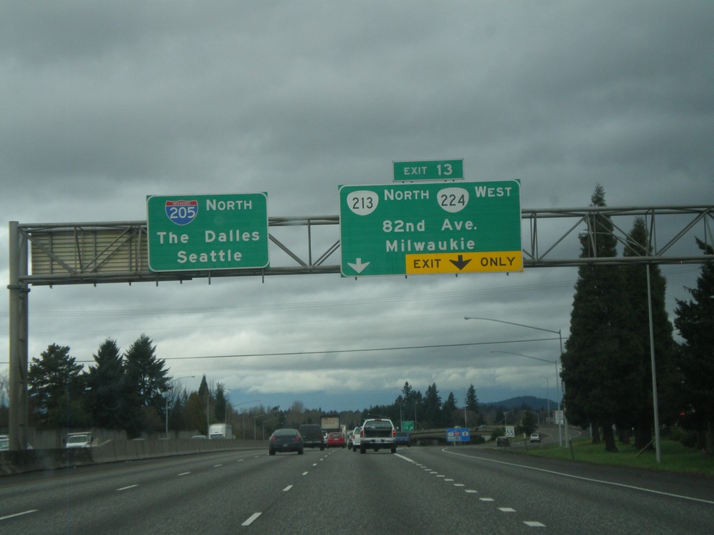
I-205 North - Exit 13
I-205 north at Exit 13 - OR-213/OR-224/82nd Ave/Milwaukee. Continue north on I-205 for The Dalles (via I-84) and Seattle.
Taken 02-21-2012

 Clackamas
 County
Oregon
United States
Clackamas
Clackamas County
Oregon
United States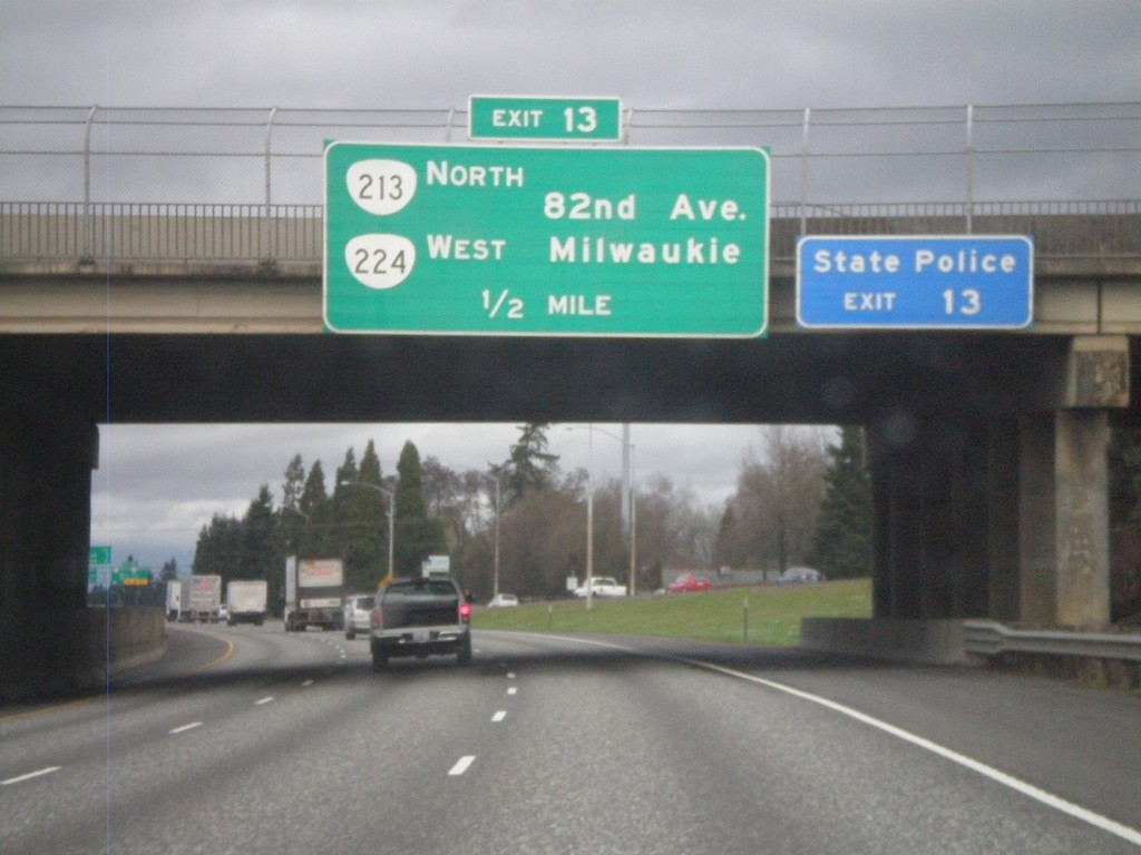
I-205 North Approaching Exit 13
I-205 North approaching Exit 13 - OR-213 North/OR-224 West/82nd Ave./Milwaukie.
Taken 02-21-2012
Clackamas
Clackamas County
Oregon
United States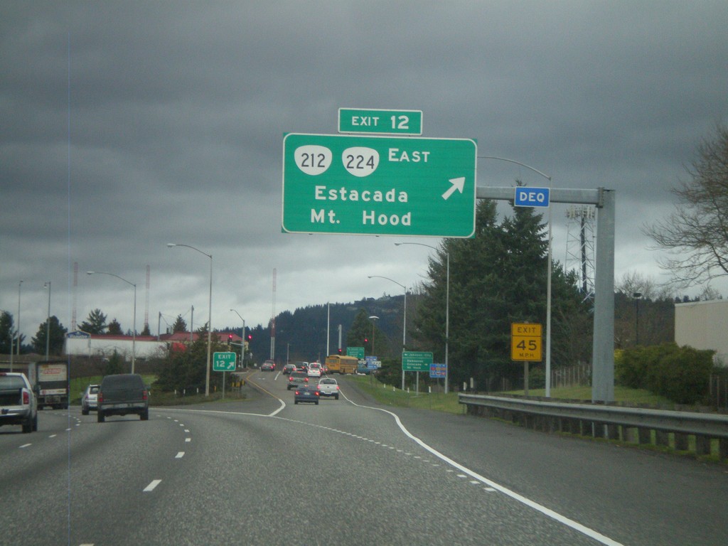
I-205 North - Exit 12
I-205 north at Exit 12 - OR-212/OR-224 East/Estacada/Mt. Hood.
Taken 02-21-2012
 Clackamas
 County
Oregon
United States
Clackamas
Clackamas County
Oregon
United States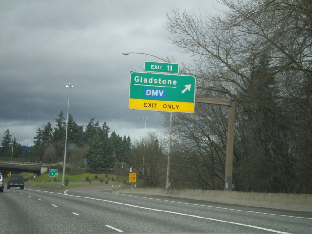
I-205 North - Exit 11
I-205 north at Exit 11 - Gladstone/DMV.
Taken 02-21-2012
Gladstone
Clackamas County
Oregon
United States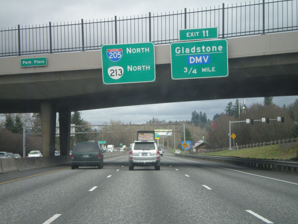
I-205 North Approaching Exit 11
I-205 north approaching Exit 11 - Gladstone/DMV. OR-213 joins I-215 north to Clackamas.
Taken 02-21-2012
Oregon City
Clackamas County
Oregon
United States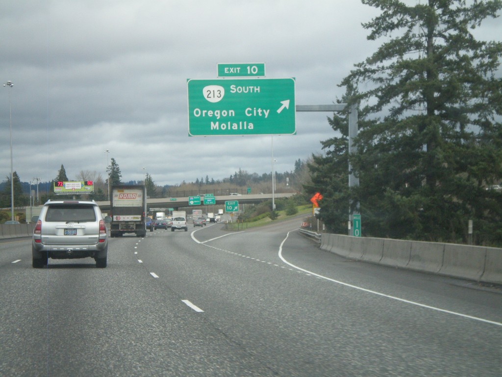
I-205 North - Exit 10
I-205 north at Exit 10 - OR-213 South/Oregon City/Molalla. OR-213 north joins I-205 north to Clackamas.
Taken 02-21-2012
Oregon City
Clackamas County
Oregon
United States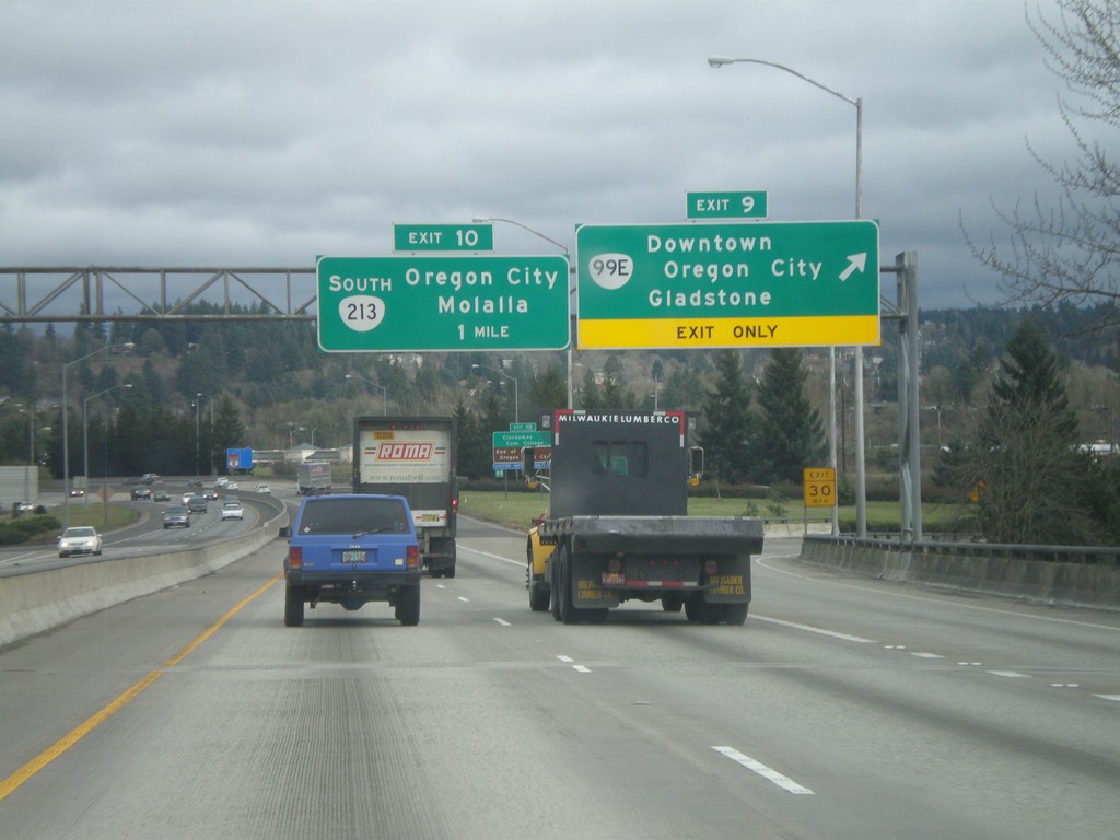
I-205 North - Exits 9 and 10
I-205 north at Exit 9 - OR-99E/Downtown Oregon City/Gladstone. Approaching Exit 10 - OR-213 South/Oregon City/Molalla.
Taken 02-21-2012
 Oregon City
Clackamas County
Oregon
United States
Oregon City
Clackamas County
Oregon
United States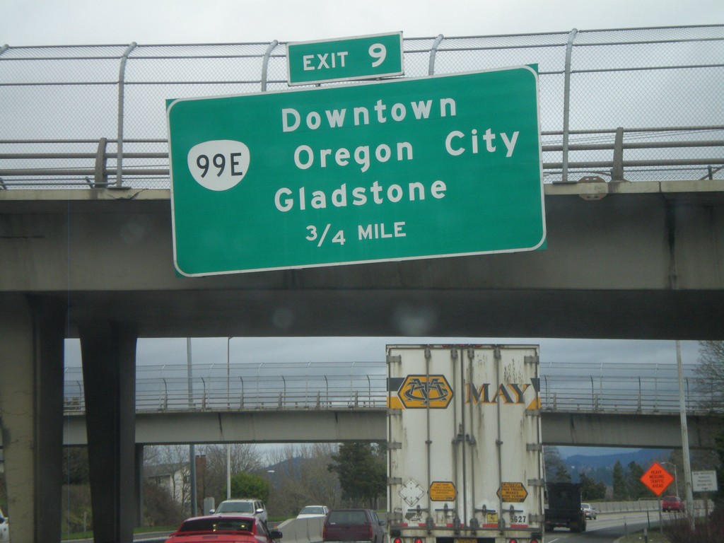
I-205 North - Exit 9
I-205 north approaching Exit 9 - OR-99E/Downtown Oregon City/Gladstone.
Taken 02-21-2012
West Linn
Clackamas County
Oregon
United States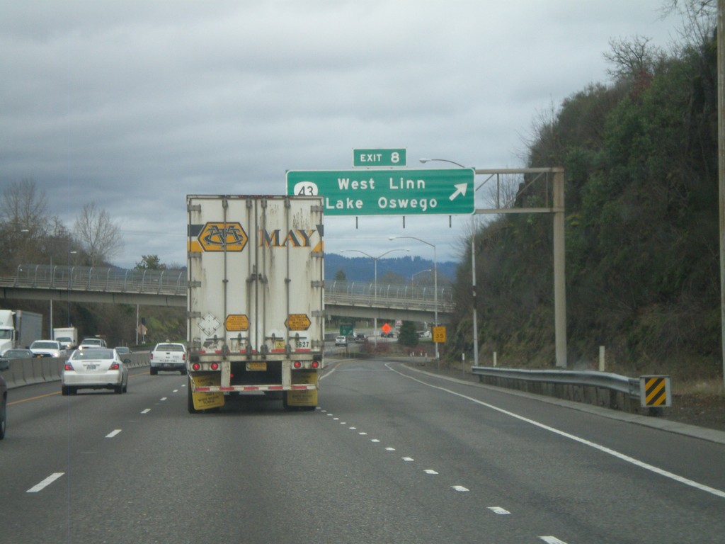
I-205 North - Exit 8
I-205 north at Exit 8 - OR-43/West Linn/Lake Oswego.
Taken 02-21-2012
 West Linn
Clackamas County
Oregon
United States
West Linn
Clackamas County
Oregon
United States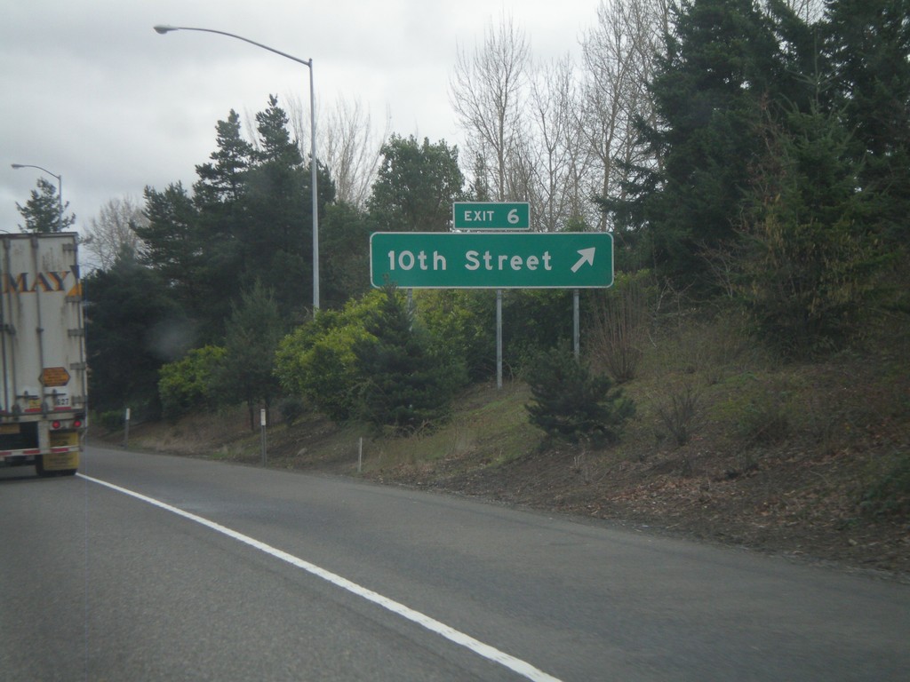
I-205 North - Exit 6
I-205 north at Exit 6 - 10th St.
Taken 02-21-2012
West Linn
Clackamas County
Oregon
United States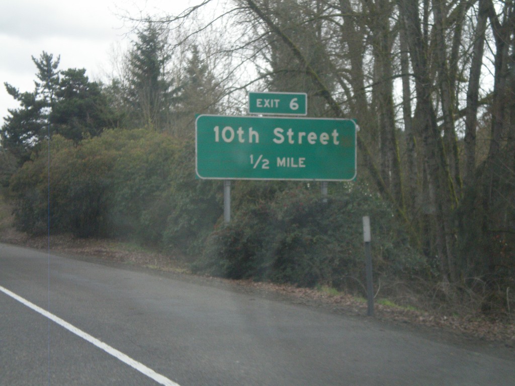
I-205 North Approaching Exit 6
I-205 north approaching Exit 6 - 10th St.
Taken 02-21-2012
West Linn
Clackamas County
Oregon
United States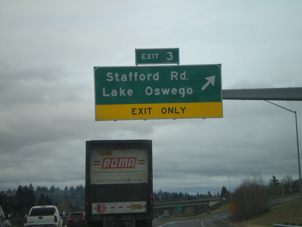
I-205 North - Exit 3
I-205 north at Exit 3 - Stafford Road/Lake Oswego.
Taken 02-21-2012
Tualatin
Clackamas County
Oregon
United States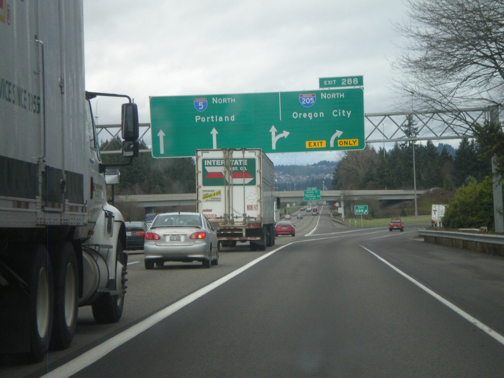
I-5 North - Exit 288
I-5 north at Exit 288 - I-205 North/Oregon City. I-5 continues north to Portland. I-205 is the eastern loop around Portland. Seattle bound traffic, or traffic bound for I-84 east might find I-205 faster than going through downtown Portland.
Taken 02-21-2012
 Tualatin
Washington County
Oregon
United States
Tualatin
Washington County
Oregon
United States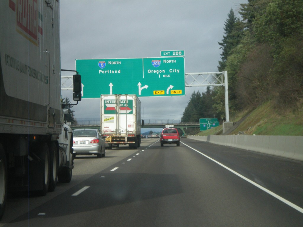
I-5 North Approaching Exit 288
I-5 north approaching Exit 288 - I-205 North/Oregon City. I-5 continues north to Portland. I-205 is the beltway around the east side of the Portland metropolitan area.
Taken 02-21-2012
Tualatin
Washington County
Oregon
United States