Signs Tagged With Interchange
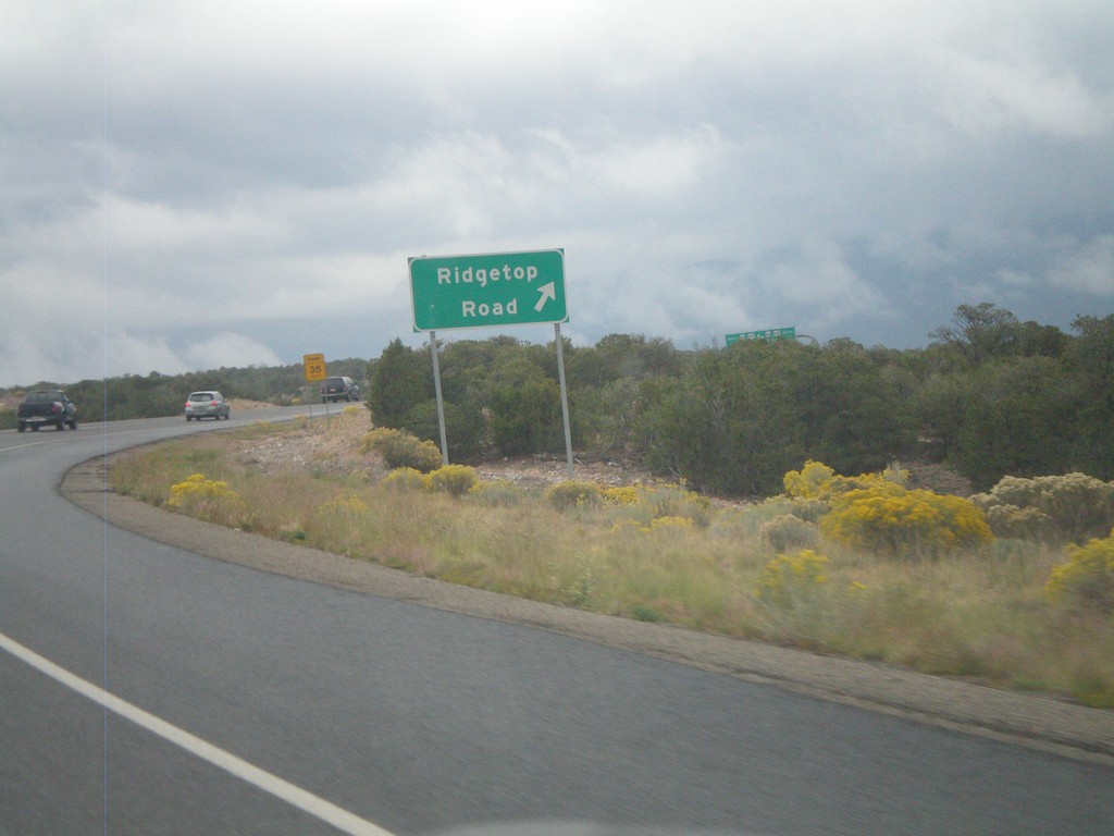
NM-599 East at Ridgetop Road
NM-599 East (Santa Fe Relief Route) at Ridgetop Road interchange.
Taken 10-04-2011
 Santa Fe
 County
New Mexico
United States
Santa Fe
Santa Fe County
New Mexico
United States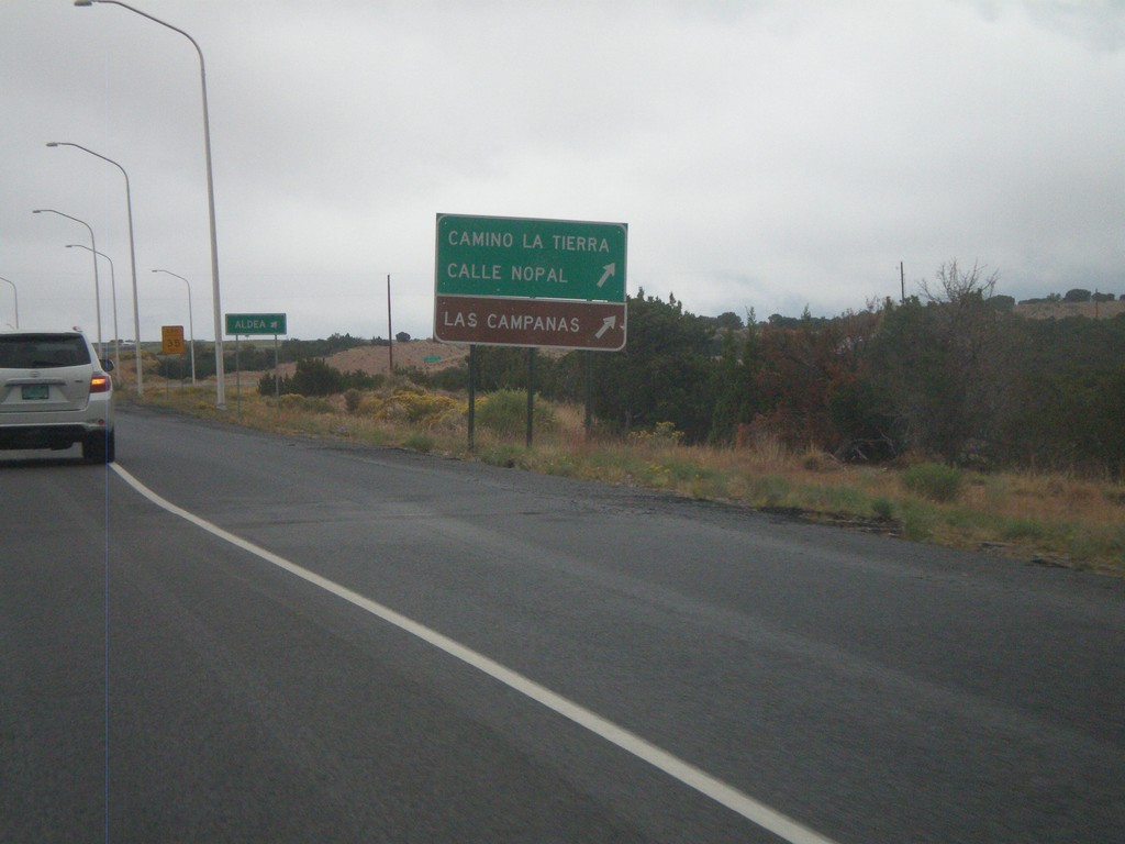
NM-599 East at Camino La Tierra
NM-599 east at Camino La Tierra/Calle Nopal interchange. Also use this exit for Las Campanas.
Taken 10-04-2011
Santa Fe
Santa Fe County
New Mexico
United States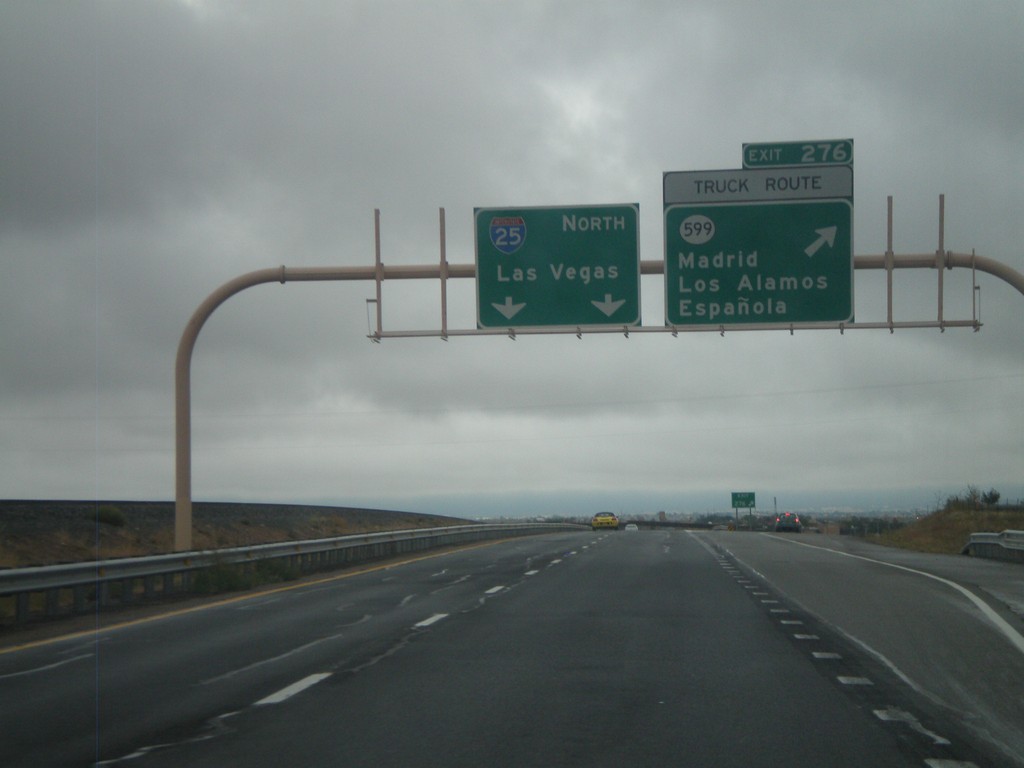
I-25 North - Exit 276
I-25 north at Exit 276 - NM-599/Madrid/Los Alamos/Española. NM-599 is the truck route around Santa Fe. I-25 continues north to Las Vegas.
Taken 10-04-2011
 Santa Fe
 County
New Mexico
United States
Santa Fe
Santa Fe County
New Mexico
United States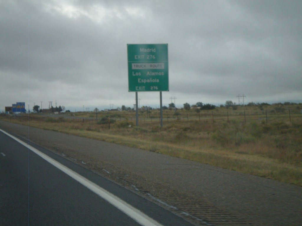
I-25 North Approaching Exit 276
I-25 north approaching Exit 276 (NM-599). Use Exit 276 for Los Alamos, Española, Madrid. NM-599 is the truck route around Santa Fe.
Taken 10-04-2011
Santa Fe
Santa Fe County
New Mexico
United States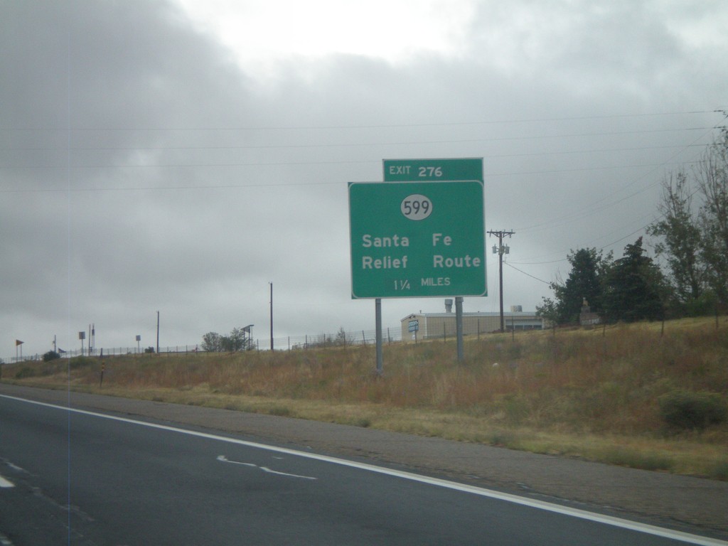
I-25 North - Exit 276
I-25 North at Exit 276 - NM-599/Santa Fe Relief Route. NM-599 is the truck route around Santa Fe.
Taken 10-04-2011
Santa Fe
Santa Fe County
New Mexico
United States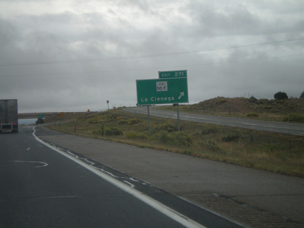
I-25 North - Exit 271
I-25 north at Exit 271 - CR-50F/La Cienega.
Taken 10-04-2011
Santa Fe
Santa Fe County
New Mexico
United States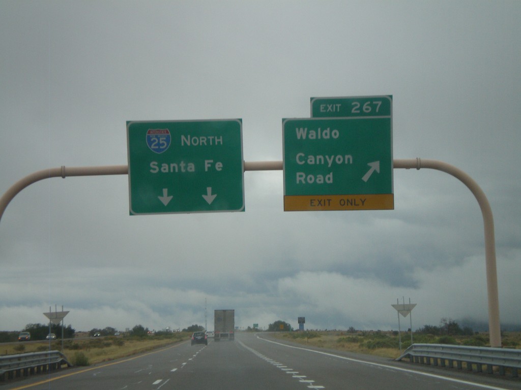
I-25 North - Exit 267
I-25 north at Exit 267 - Waldo Canyon Road. I-25 continues north towards Santa Fe.
Taken 10-04-2011
Los Cerrillos
Santa Fe County
New Mexico
United States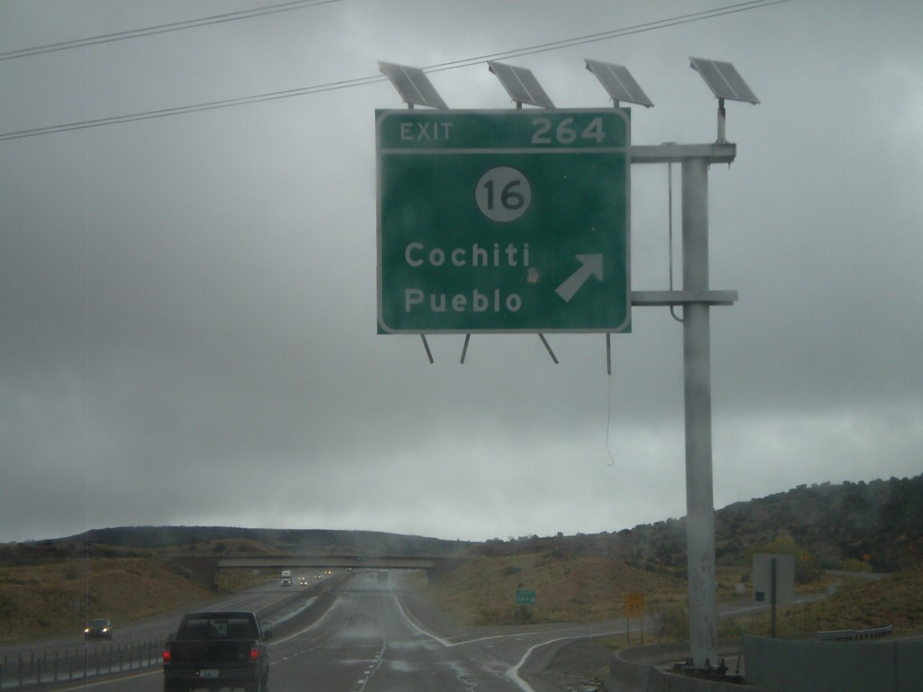
I-25 North - Exit 264
I-25 north at Exit 264 - NM-16/Cochiti Pueblo.
Taken 10-04-2011
 Kewa Pueblo
Santa Fe County
New Mexico
United States
Kewa Pueblo
Santa Fe County
New Mexico
United States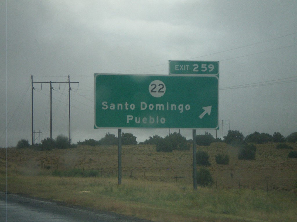
I-25 North - Exit 259
I-25 north at Exit 259 - NM-22/Santo Domingo Pueblo.
Taken 10-04-2011
 Algodones
Sandoval County
New Mexico
United States
Algodones
Sandoval County
New Mexico
United States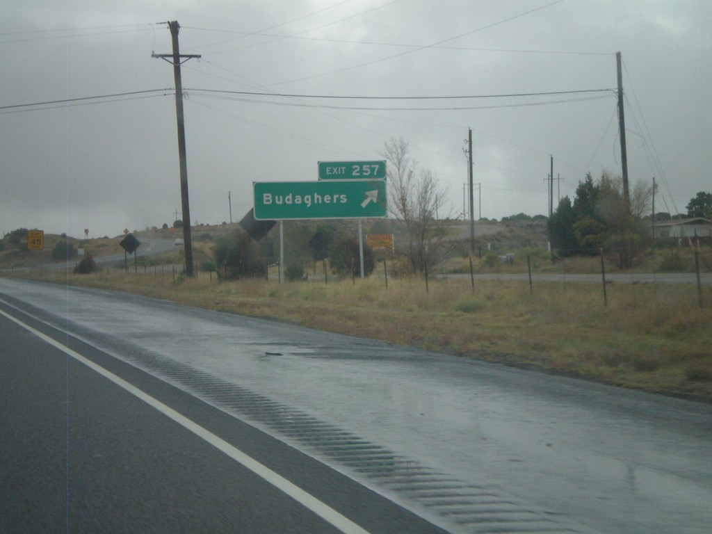
I-25 North - Exit 257
I-25 north at Exit 257 - Budaghers.
Taken 10-04-2011
Algodones
Sandoval County
New Mexico
United States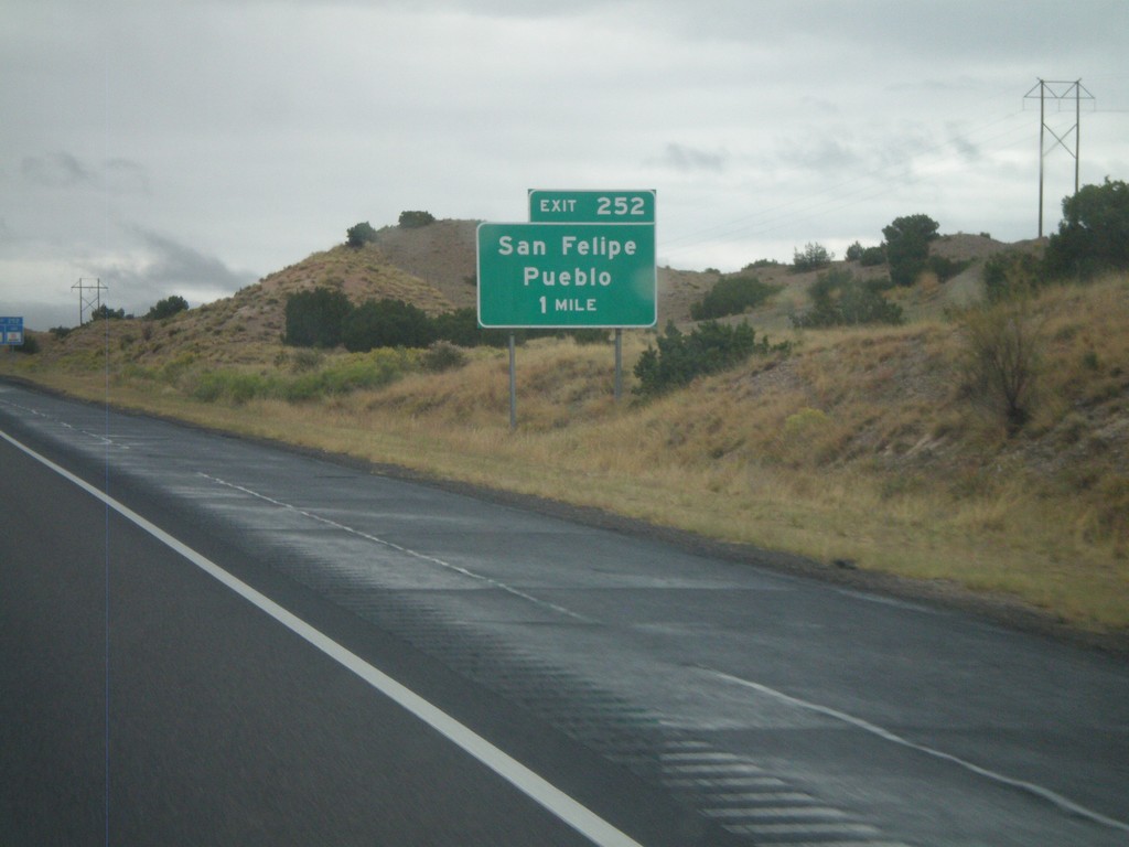
I-25 North - Exit 252
I-25 north approaching Exit 252 - San Felipe Pueblo.
Taken 10-04-2011
Algodones
Sandoval County
New Mexico
United States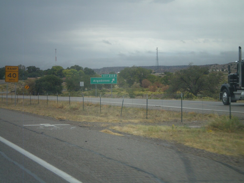
I-25 North - Exit 248
I-25 north at Exit 248 - Algodones.
Taken 10-04-2011
Algodones
Sandoval County
New Mexico
United States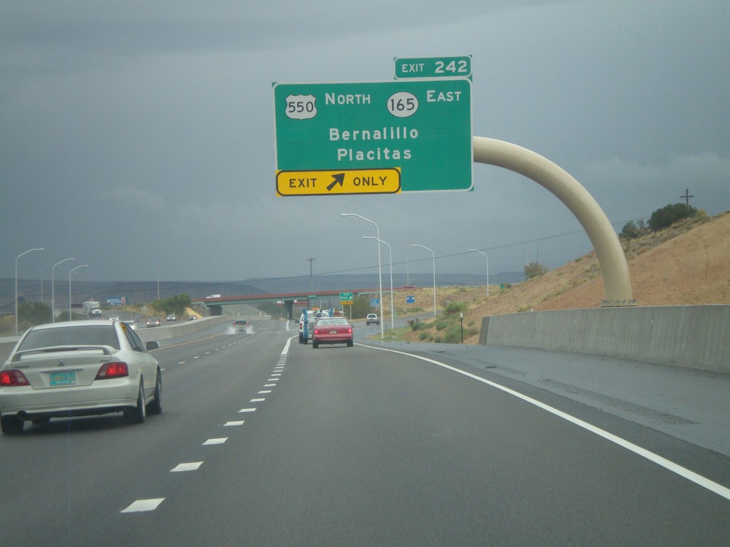
I-25 North - Exit 242
I-25 north at Exit 242 - US-550 North/NM-165 East/Bernalillo/Placitas. This is the southern end of US-550.
Taken 10-04-2011

 Bernalillo
Sandoval County
New Mexico
United States
Bernalillo
Sandoval County
New Mexico
United States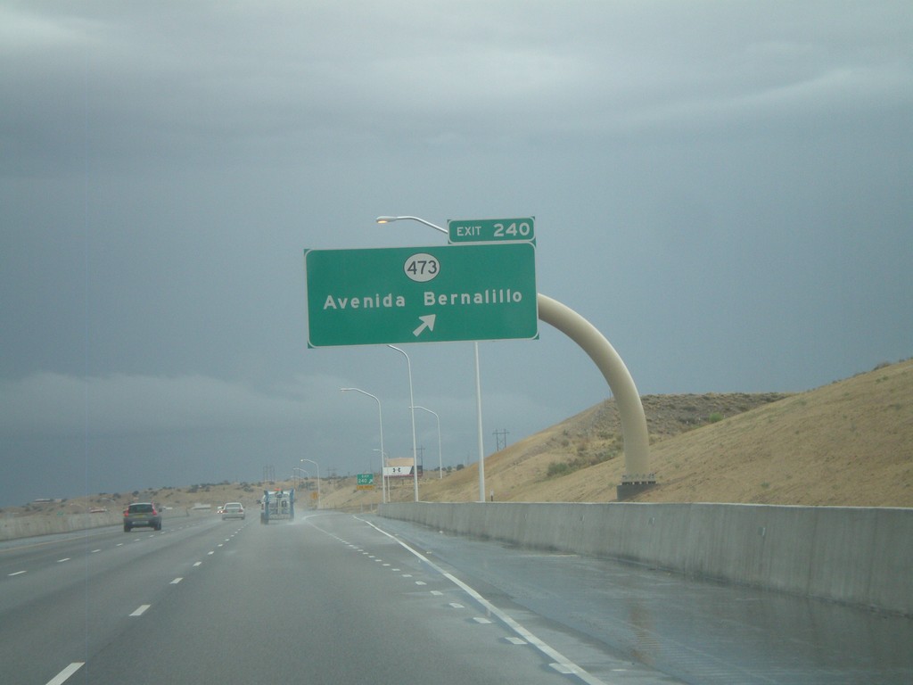
I-25 North - Exit 240
I-25 north at Exit 240 - NM-473/Avenida Bernalillo.
Taken 10-04-2011
 Bernalillo
Sandoval County
New Mexico
United States
Bernalillo
Sandoval County
New Mexico
United States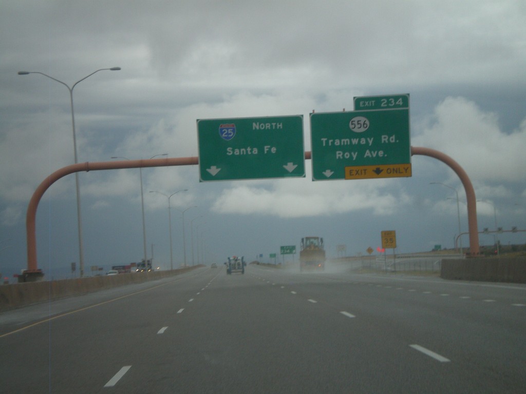
I-25 North - Exit 234
I-25 north at Exit 234 - NM-556/Tramway Road/Roy Ave. This is the last exit in Albuquerque on I-25 north. Use NM-556 east for the Sandia Peak Tramway. Continue north on I-25 for Santa Fe.
Taken 10-04-2011
 Albuquerque
Bernalillo County
New Mexico
United States
Albuquerque
Bernalillo County
New Mexico
United States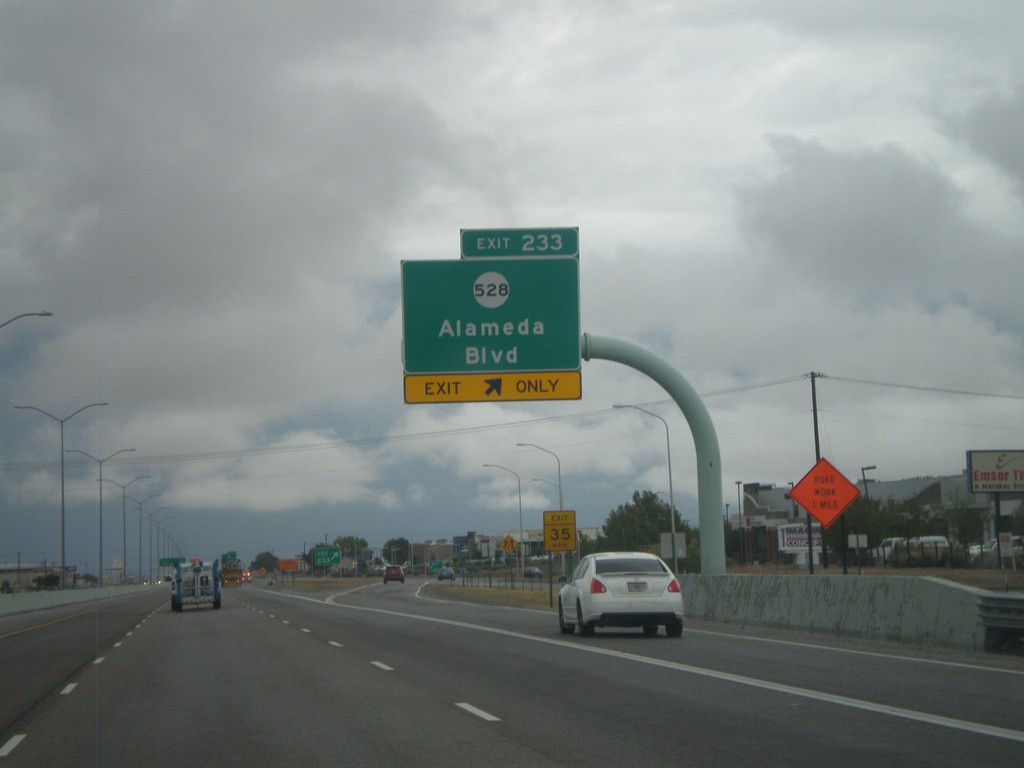
I-25 North - Exit 233
I-25 north at Exit 233 - NM-528/Alameda Blvd.
Taken 10-04-2011
 Albuquerque
Bernalillo County
New Mexico
United States
Albuquerque
Bernalillo County
New Mexico
United States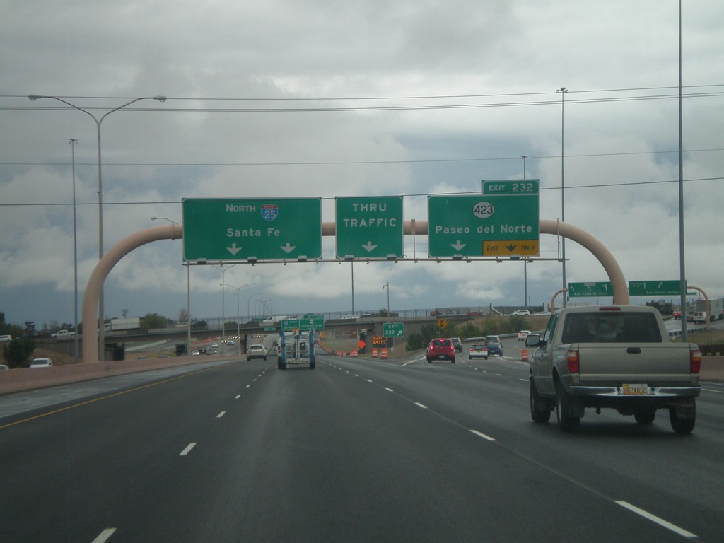
I-25 North - Exit 232
I-25 north at Exit 232 - NM-423/Paseo del Norte. Continue north on I-25 for Santa Fe.
Taken 10-04-2011
 Albuquerque
Bernalillo County
New Mexico
United States
Albuquerque
Bernalillo County
New Mexico
United States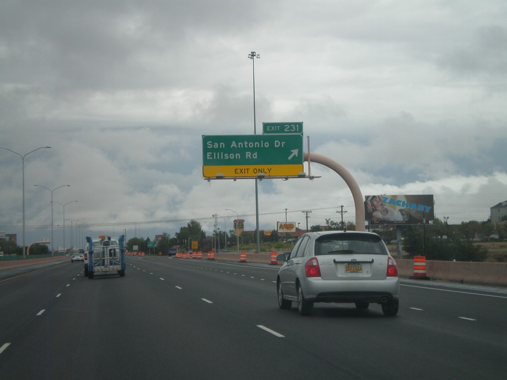
I-25 North - Exit 231
I-25 north at Exit 231 - San Antonio Drive/Ellison Road.
Taken 10-04-2011
Albuquerque
Bernalillo County
New Mexico
United States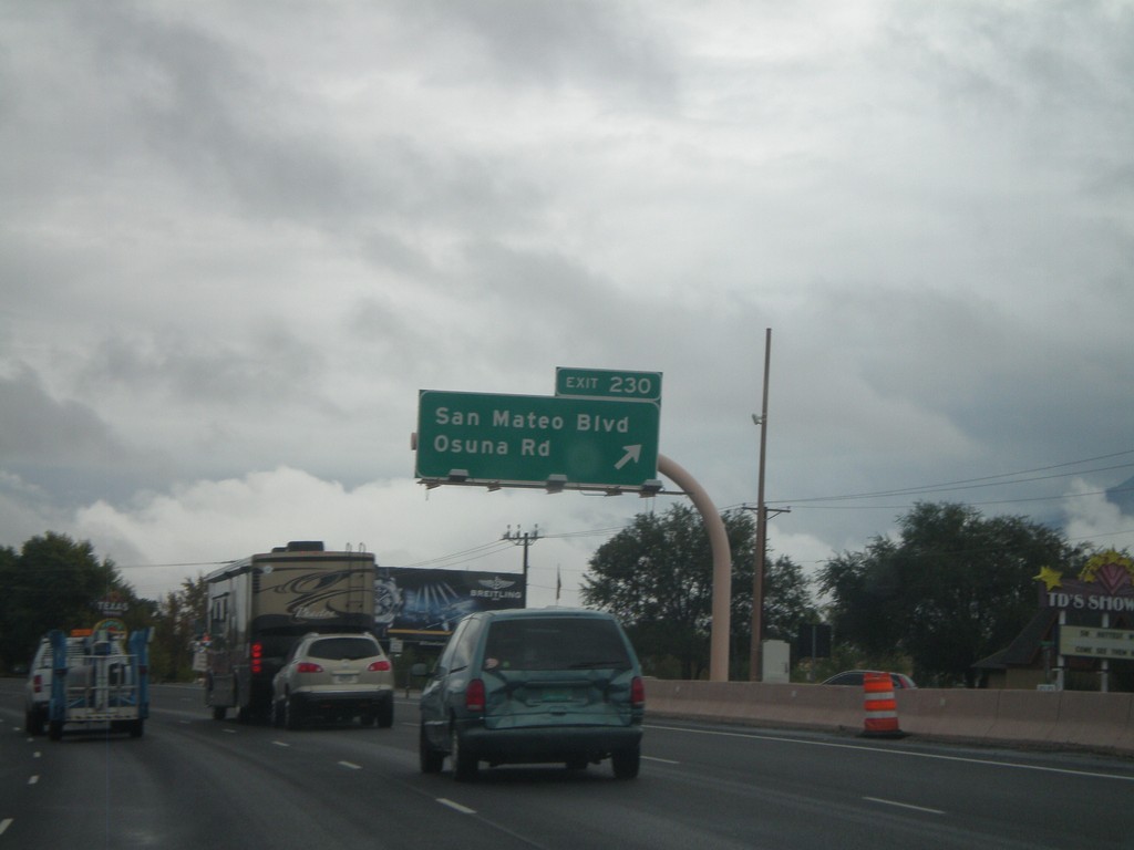
I-25 North - Exit 230
I-25 north at Exit 230 - San Mateo Blvd./Osuna Road.
Taken 10-04-2011
Albuquerque
Bernalillo County
New Mexico
United States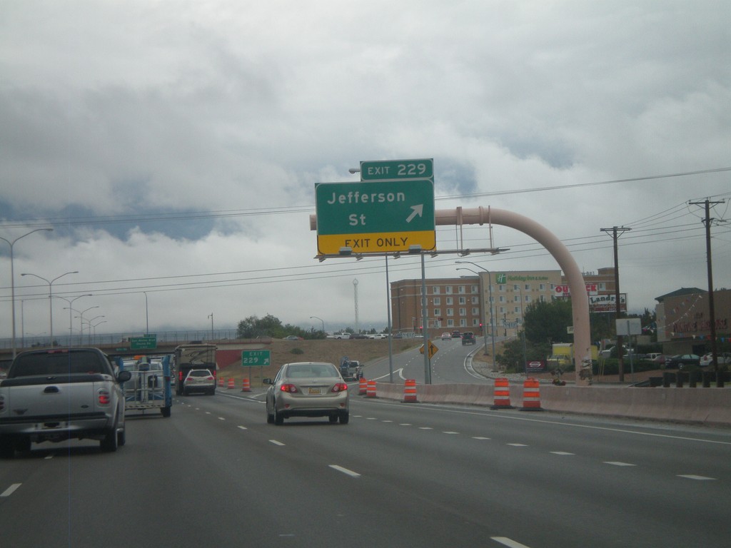
I-25 North - Exit 229
I-25 north at Exit 229 - Jefferson Street.
Taken 10-04-2011
Albuquerque
Bernalillo County
New Mexico
United States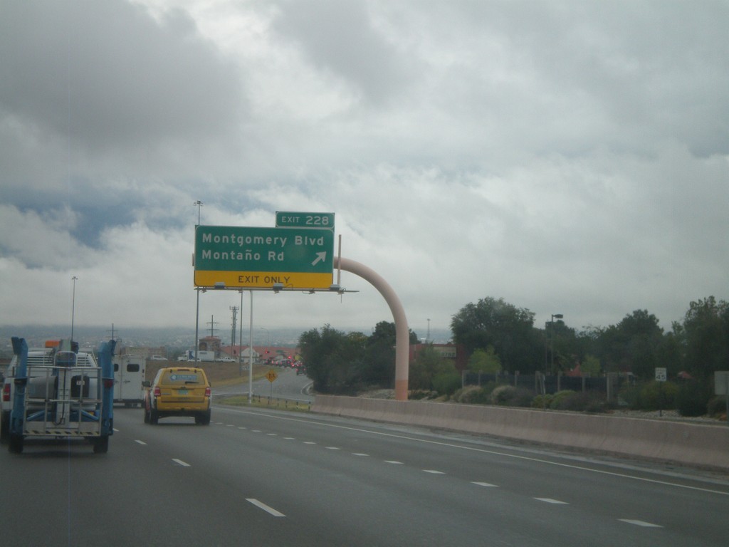
I-25 North - Exit 228
I-25 north at Exit 228 - Montgomery Blvd./Montaño Road.
Taken 10-04-2011
Albuquerque
Bernalillo County
New Mexico
United States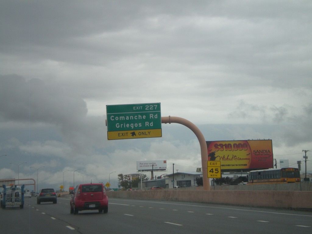
I-25 North - Exit 227
I-25 north at Exit 227 - Comanche Road/Griegos Road.
Taken 10-04-2011
Albuquerque
Bernalillo County
New Mexico
United States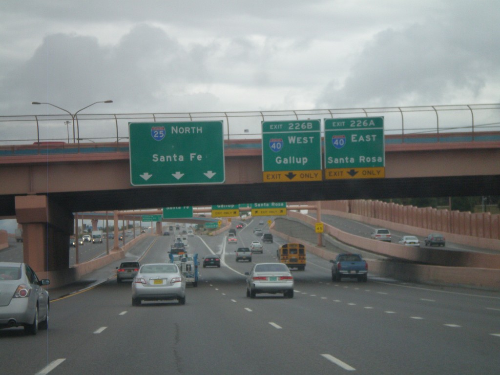
I-25 North - Exits 226A and B
I-25 north at Exit 226A - I-40 East/Santa Rosa. Exit 226B - I-40 West/Gallup. Continue north on I-25 for Santa Fe.
Taken 10-04-2011
 Albuquerque
Bernalillo County
New Mexico
United States
Albuquerque
Bernalillo County
New Mexico
United States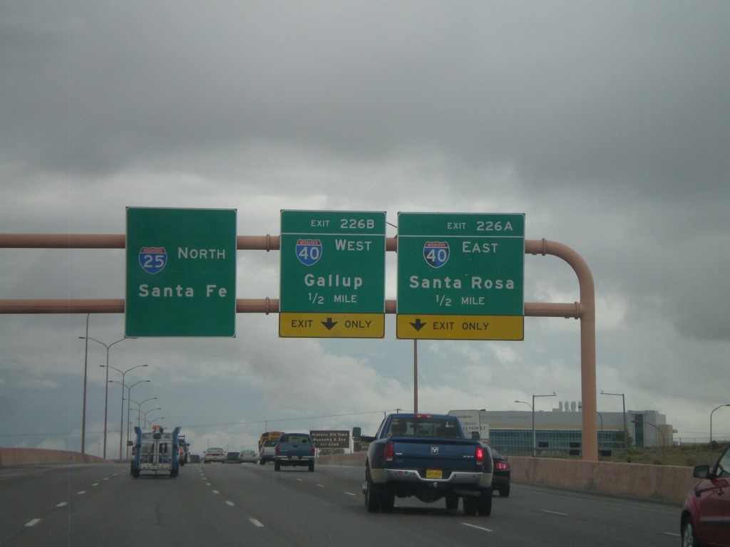
I-25 North - Exits 226A and B
I-25 North approaching Exit 226A - I-40 East/Santa Rosa. Also approaching Exit 226B - I-40 West/Gallup. I-25 continues north towards Santa Fe.
Taken 10-04-2011
Albuquerque
Bernalillo County
New Mexico
United States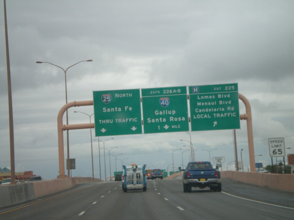
I-25 North - Exits 225 and 226AB
I-25 north at Exit 225 - Lomas Blvd./Menaul Blvd./Candelaria Road./LOCAL TRAFFIC. Approaching Exits 226AB - I-40/Gallup/Santa Rosa. Continue north on I-25 for Santa Fe.
Taken 10-04-2011
Albuquerque
Bernalillo County
New Mexico
United States