Signs Tagged With Interchange
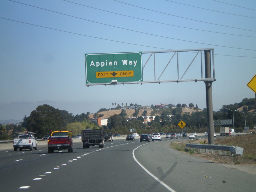
I-80 East - Exit 21
I-80 east approaching Exit 21 - Appian Way.
Taken 10-01-2010
 Pinole
Contra Costa County
California
United States
Pinole
Contra Costa County
California
United States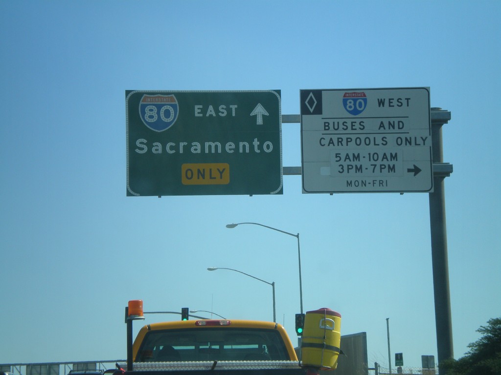
Richmond Parkway East at I-80
Richmond Parkway East at I-80. Turn right for the I-80 West HOV lanes. Continue ahead for I-80 east towards Sacramento.
Taken 10-01-2010
Richmond
Contra Costa County
California
United States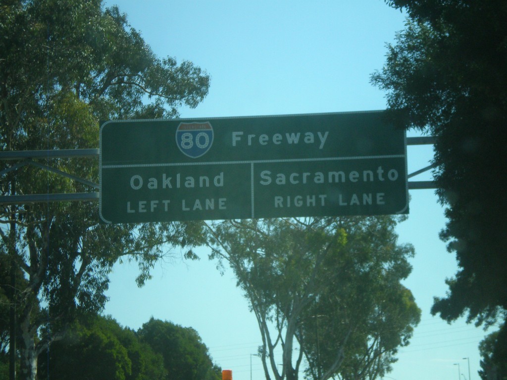
Richmond Parkway East Nearing I-80
Richmond Parkway East approaching I-80. Use right lane for Sacramento. Use left lane for Oakland.
Taken 10-01-2010
Richmond
Contra Costa County
California
United States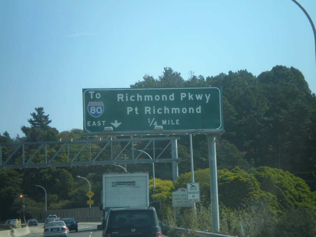
I-580 East - Exit 7
I-580 east approaching Exit 7 - To I-80 East/Richmond Parkway/Point Richmond.
Taken 10-01-2010
 Richmond
Contra Costa County
California
United States
Richmond
Contra Costa County
California
United States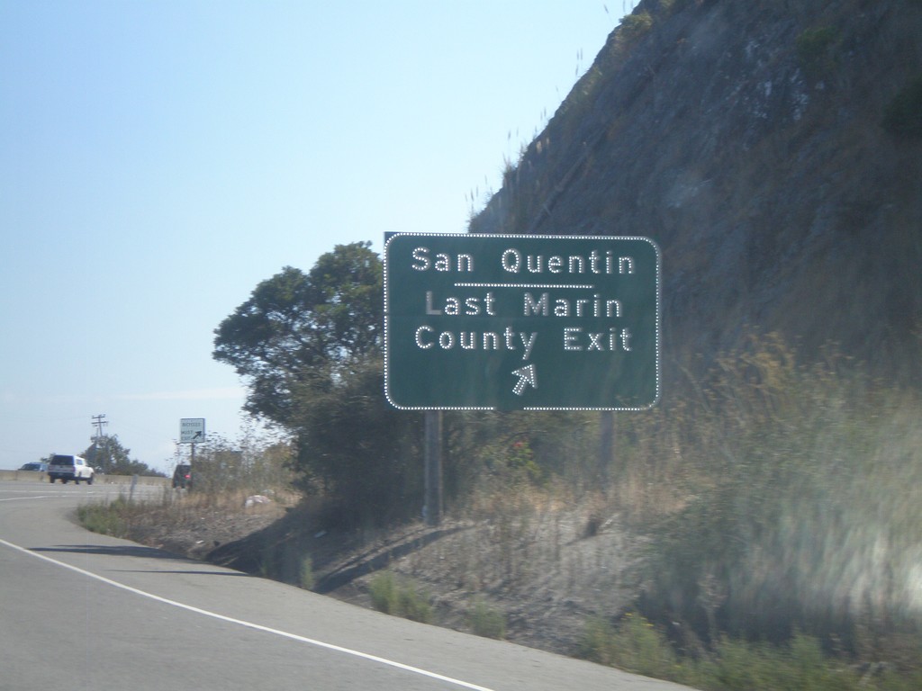
I-580 East - Exit 2
I-580 east at Exit 2 - San Quentin/Last Marin County Exit. Access to the San Quentin State Prison. This is the last exit before the Richmond Bridge over San Pablo Bay.
Taken 10-01-2010
San Rafael
Marin County
California
United States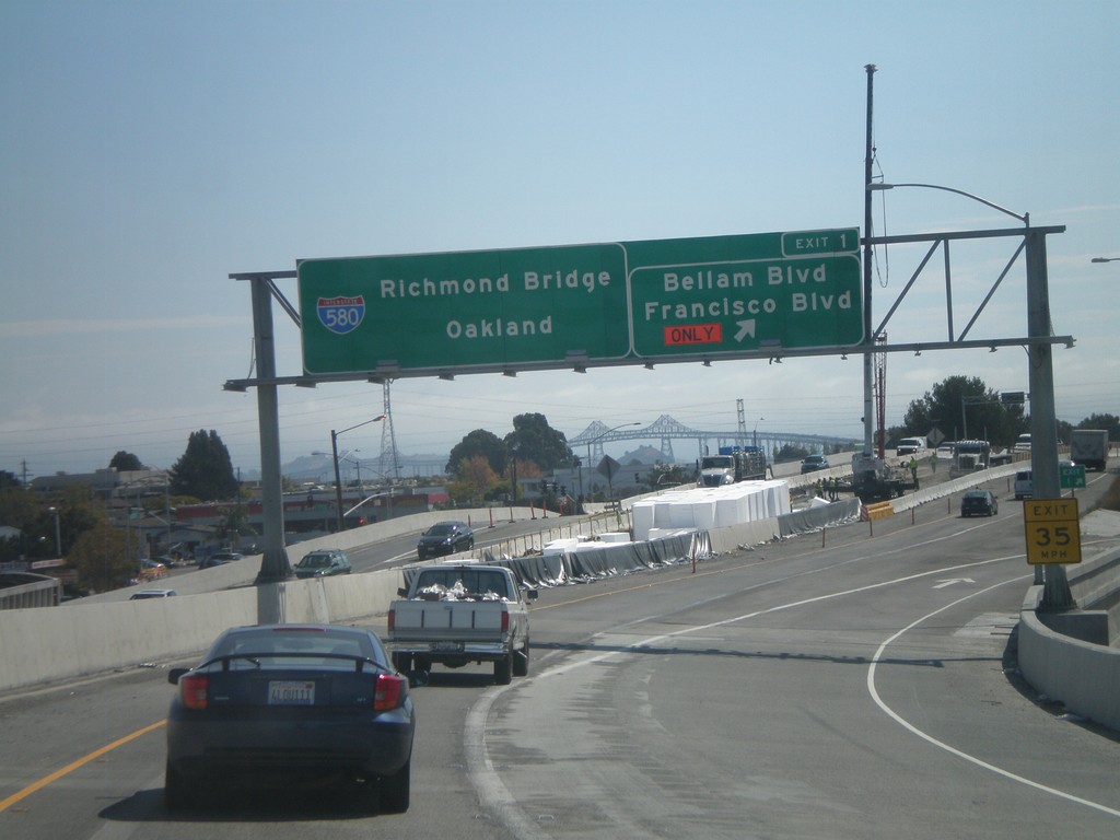
I-580 East - Exit 1
I-580 East at Exit 1 - Bellam Blvd/Francisco Blvd. I-580 continues east towards the Richmond Bridge and Oakland. The Richmond Bridge can be seen in the background.
Taken 10-01-2010
San Rafael
Marin County
California
United States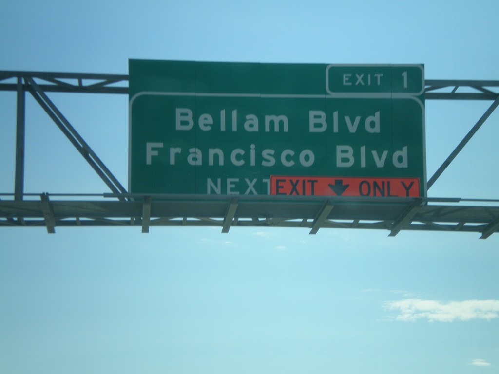
I-580 East - Exit 1
I-580 east approaching Exit 1 - Bellam Blvd./Francisco Blvd. Due to road construction the right lane is an exit only lane for Exit 1.
Taken 10-01-2010
San Rafael
Marin County
California
United States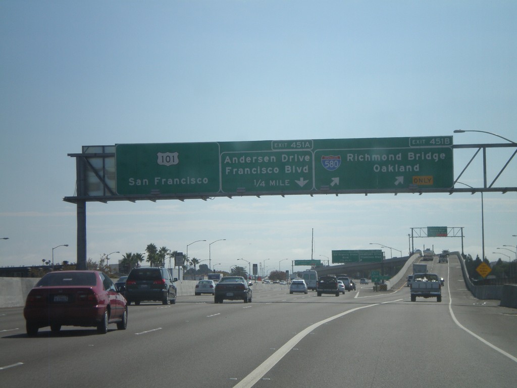
US-101 South - Exits 451B and 451A
US-101 south at Exit 451B - I-580/Richmond Bridge/Oakland. Approaching Exit 451A - Andersen Drive/Francisco Blvd. This is the western end of I-580.
Taken 10-01-2010
 San Rafael
Marin County
California
United States
San Rafael
Marin County
California
United States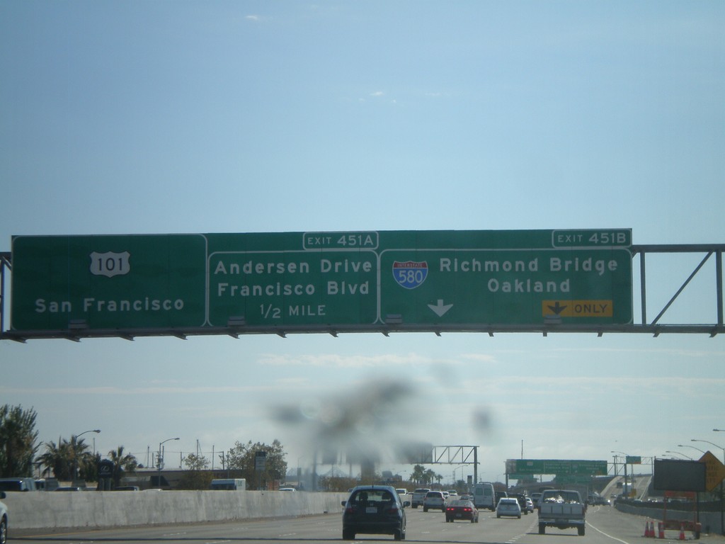
US-101 South - Exits 451B and 451A
US-101 south at Exit 451B - I-580/Richmond Bridge/Oakland. Approaching Exit 451A - Andersen Drive/Francisco Blvd. US-101 continues south towards San Francisco.
Taken 10-01-2010
San Rafael
Marin County
California
United States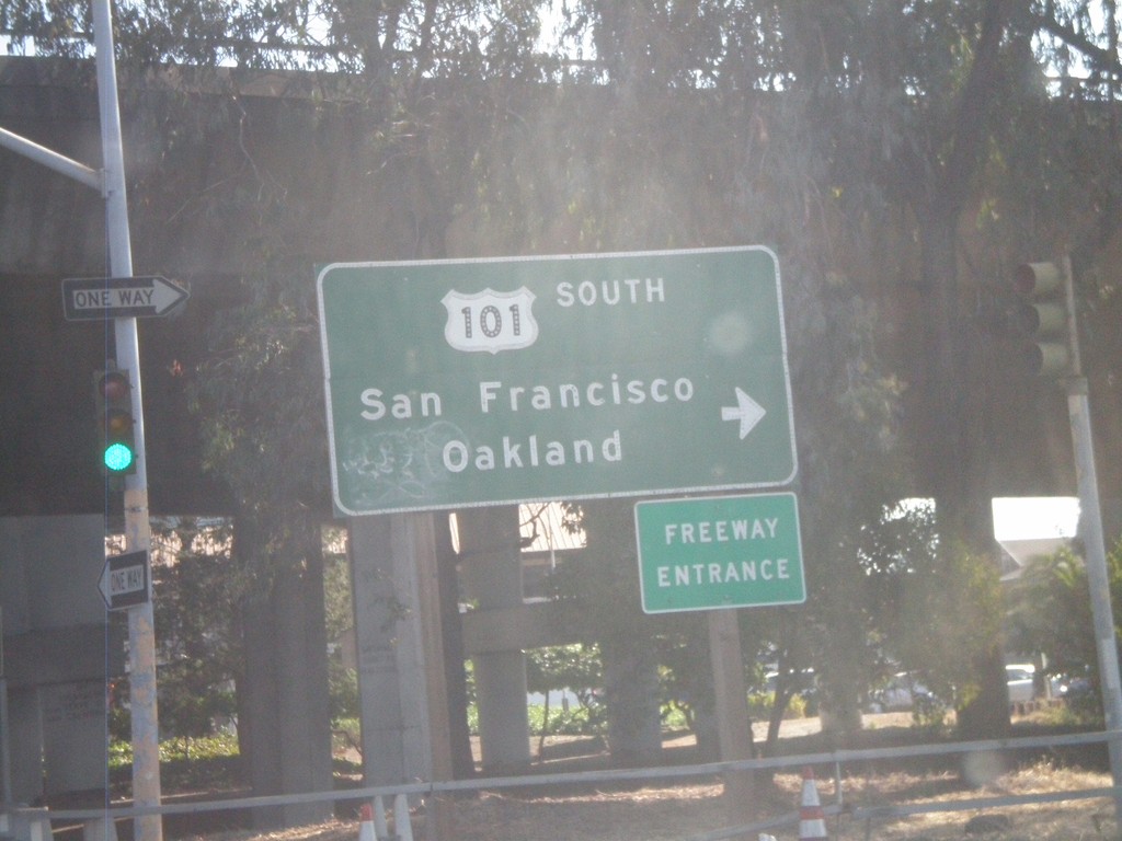
4th St. East at US-101 South
4th St. east at US-101 South to San Francisco and Oakland. This is the Exit 452 onramp.
Taken 10-01-2010
San Rafael
Marin County
California
United States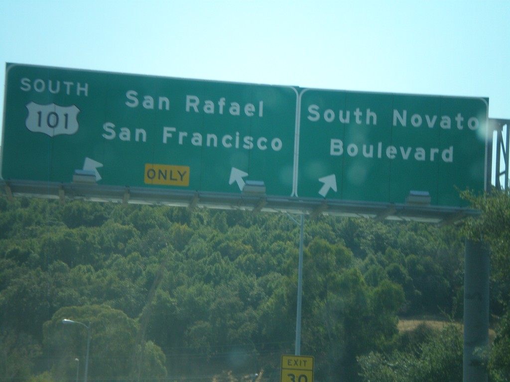
End CA-37 West at US-101
End CA-37 west at US-101. US-101 continues south for San Rafael and San Francisco. Exit right for Novato Blvd.
Taken 09-30-2010
 Novato
Marin County
California
United States
Novato
Marin County
California
United States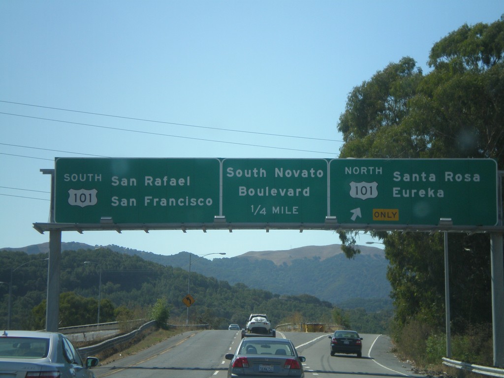
CA-37 West at US-101
CA-37 west at US-101. Use US-101 north for Santa Rosa and Eureka. Use US-101 south for San Rafael and San Francisco. Also approaching the Novato Blvd. exit. US-101 marks the western end of CA-37.
Taken 09-30-2010
Novato
Marin County
California
United States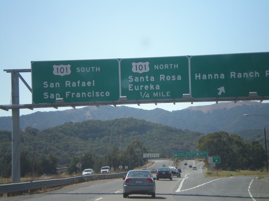
CA-37 West - Hanna Ranch Road Exit
CA-37 west at Hanna Ranch Road exit. Approaching US-101. Use US-101 north for Santa Rosa and Eureka. Use US-101 south for San Rafael and San Francisco.
Taken 09-30-2010
Novato
Marin County
California
United States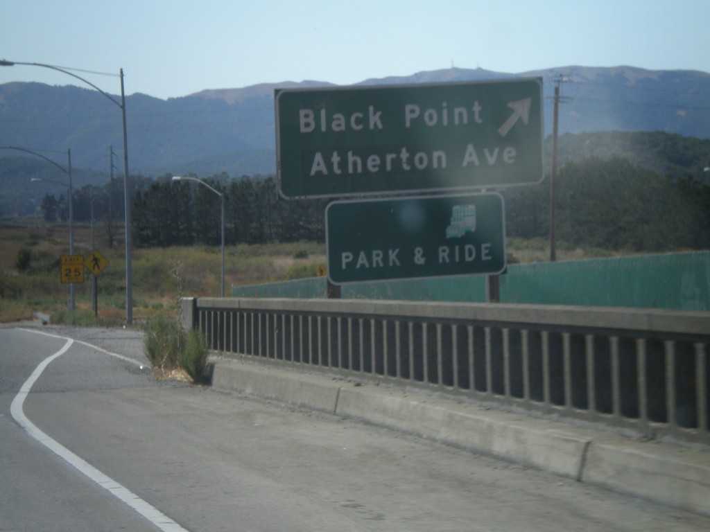
CA-37 West - Black Point Exit
CA-37 west at Black Point/Atherton Ave. interchange
Taken 09-30-2010
Novato
Marin County
California
United States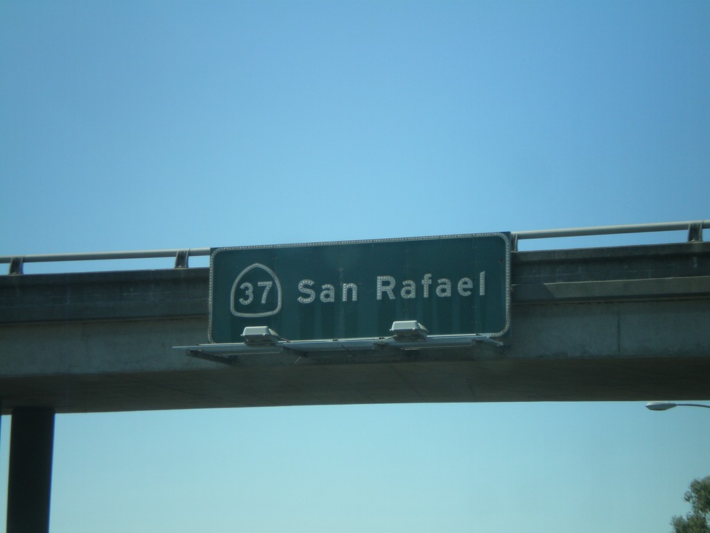
CA-37 - San Rafael
CA-37 - San Rafael overhead on CA-37 west.
Taken 09-30-2010
Vallejo
Solano County
California
United States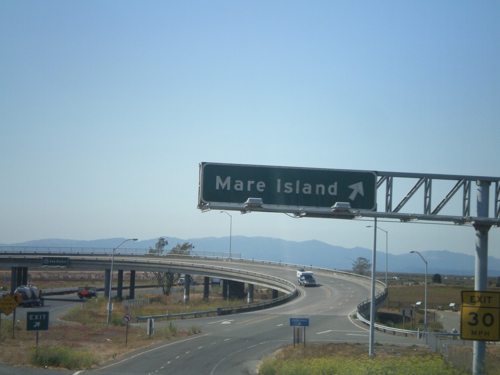
CA-37 West - Exit 17
CA-37 west at Exit 17 - Mare Island.
Taken 09-30-2010
Vallejo
Solano County
California
United States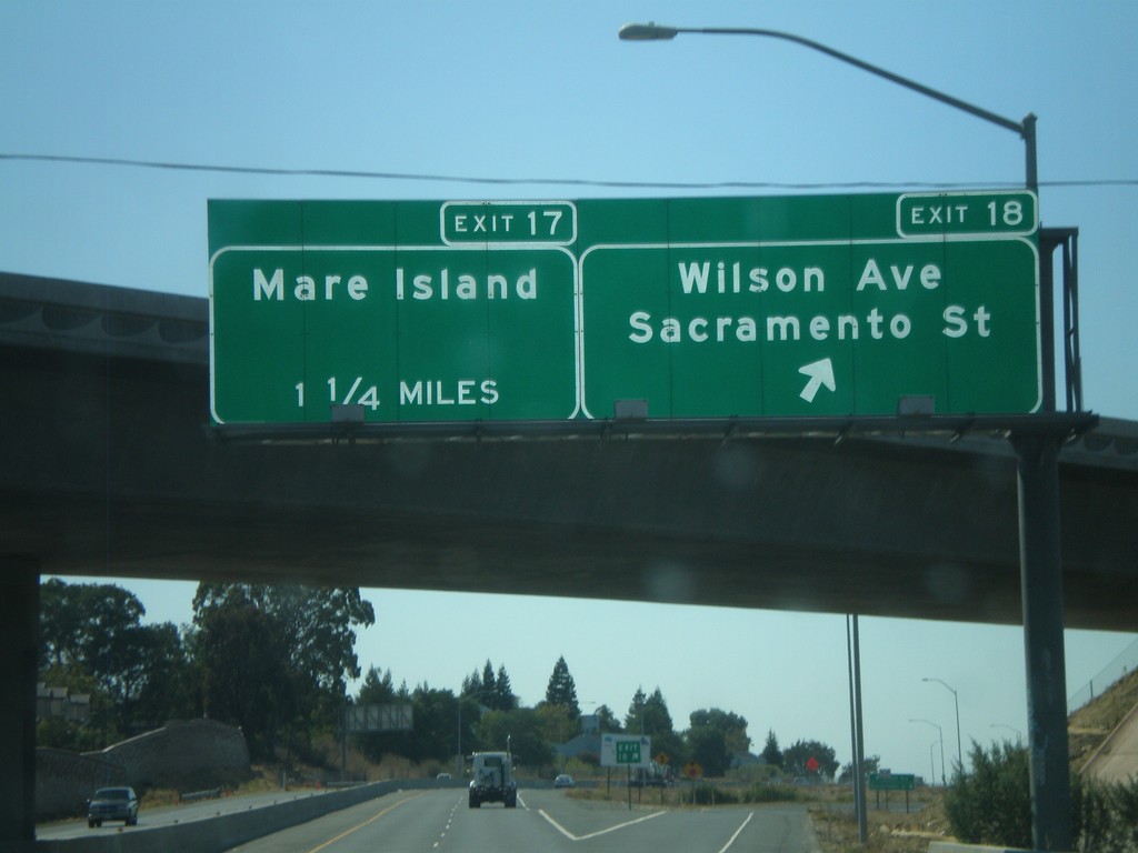
CA-37 West - Exits 18 and 17
CA-37 west at Exit 18 - Wilson Ave./Sacramento St. Approaching Exit 17 - Mare Island.
Taken 09-30-2010
Vallejo
Solano County
California
United States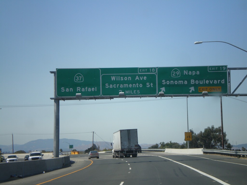
CA-37 West at Exits 19 and 18
CA-37 west at Exit 19 - CA-29/Napa/Sonoma Blvd. Approaching Exit 18 - Wilson Ave./Sacramento St. CA-37 continues west towards San Rafael.
Taken 09-30-2010
 Vallejo
Solano County
California
United States
Vallejo
Solano County
California
United States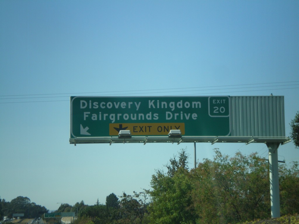
CA-37 West - Exit 20
CA-37 west approaching Exit 20 - Discovery Kingdom/Fairgrounds Drive. Use Exit 20 for the Six Flags Discovery Kingdom theme park.
Taken 09-30-2010
Vallejo
Solano County
California
United States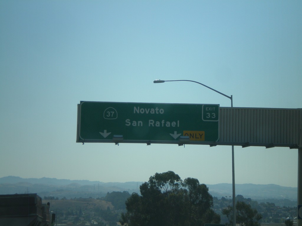
I-80 West - Exit 33
I-80 west at Exit 33 - CA-37/Novato/San Rafael. CA-37 crosses the north end of San Pablo Bay, connecting US-101 (Novato) and I-80 (Vallejo).
Taken 09-30-2010
Vallejo
Solano County
California
United States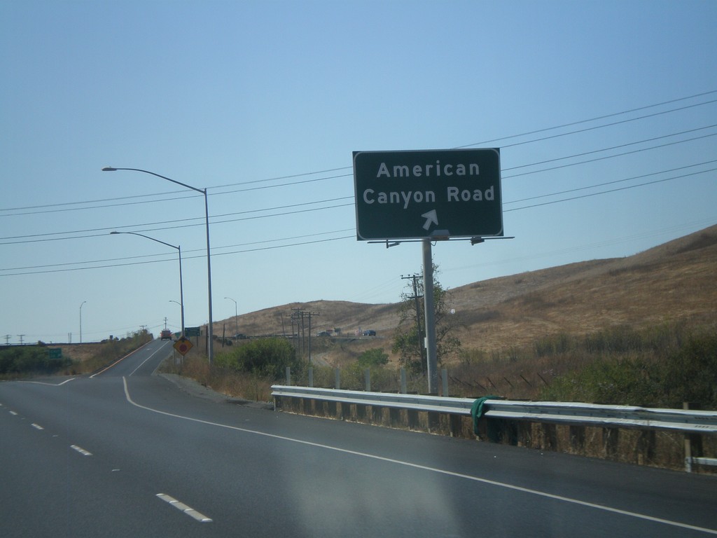
I-80 West - Exit 36
I-80 west at Exit 36 - American Canyon Road. American Canyon Road connects I-80 with CA-29 in Napa County.
Taken 09-30-2010
Vallejo
Solano County
California
United States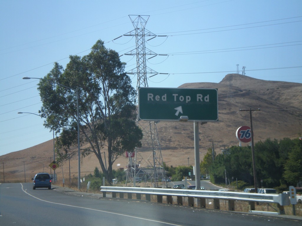
I-80 West - Exit 39A
I-80 west at Exit 39A - Red Top Road.
Taken 09-30-2010
Fairfield
Solano County
California
United States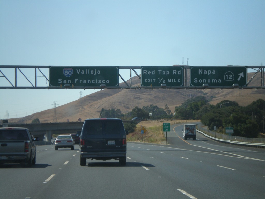
I-80 West - Exits 39B and 39A
I-80 west at Exit 39B - CA-12 West/Napa/Sonoma. Approaching Exit 39A - Red Top Road. CA-12 west leaves I-80 here, and crosses into the Napa Valley. I-80 continues west towards Vallejo and San Francisco.
Taken 09-30-2010
 Fairfield
Solano County
California
United States
Fairfield
Solano County
California
United States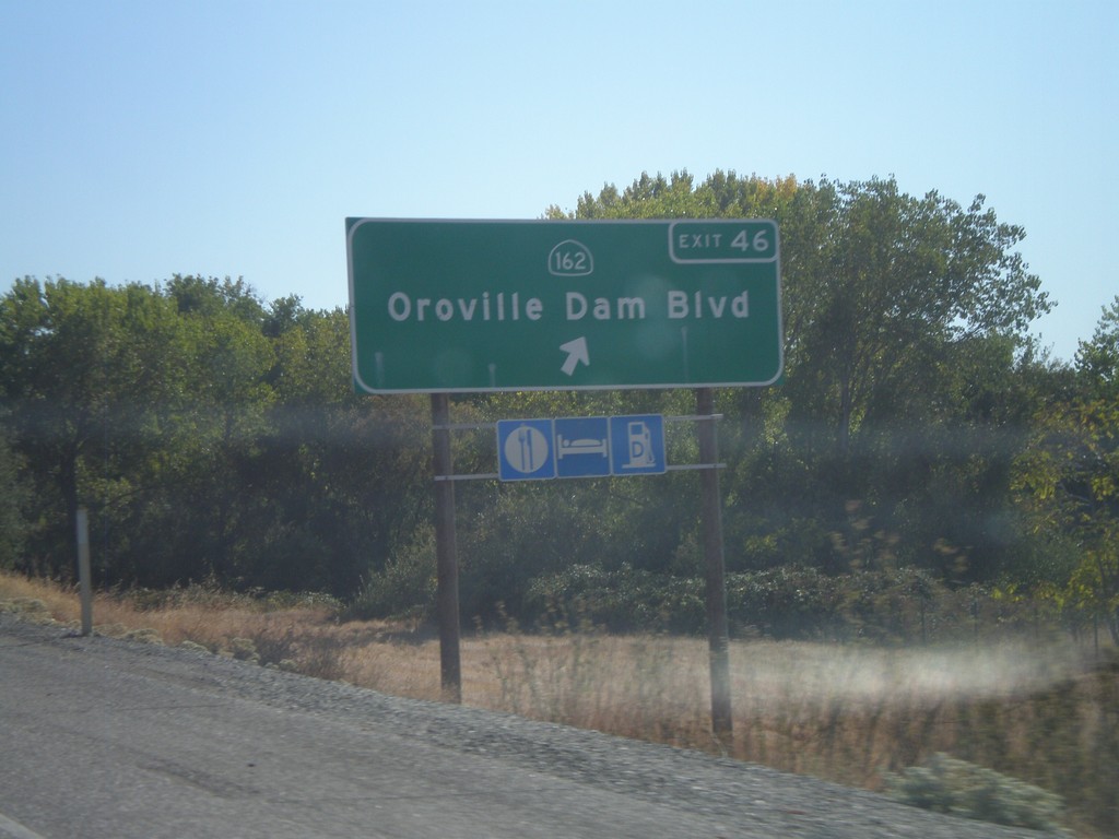
CA-70 South - Exit 46
CA-70 south at Exit 46 - CA-162/Oroville Dam Blvd.
Taken 09-25-2010

 Oroville
Butte County
California
United States
Oroville
Butte County
California
United States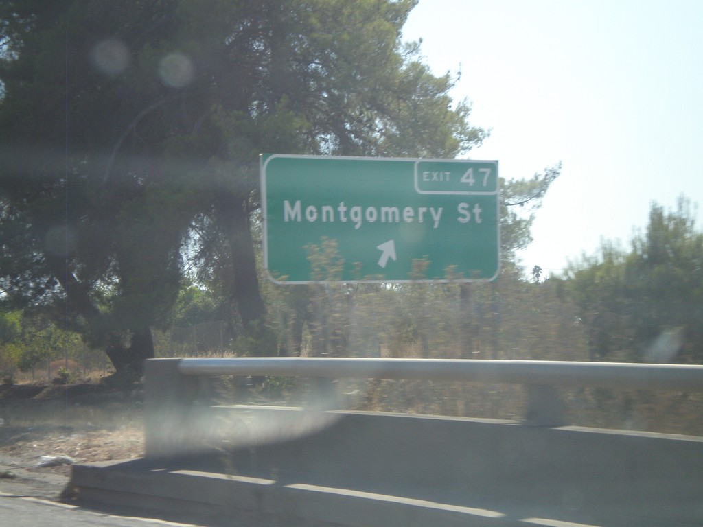
CA-70 South - Exit 47
CA-70 south at Exit 47 - Montgomery St.
Taken 09-25-2010
Oroville
Butte County
California
United States