Signs Tagged With Interchange
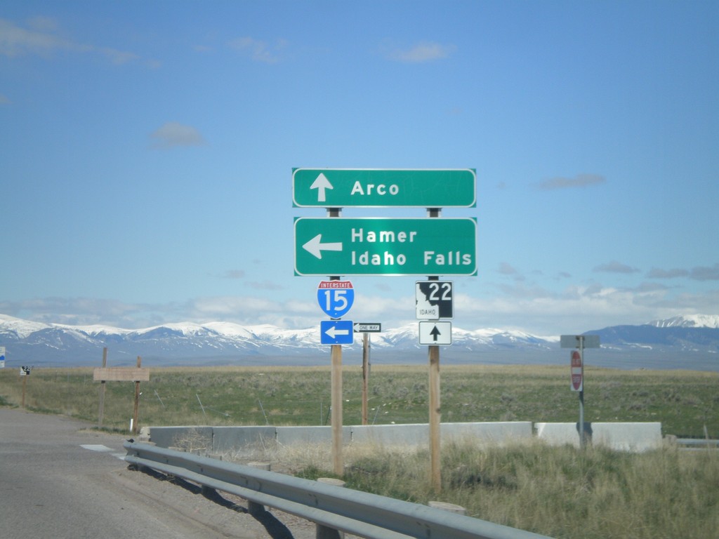
ID-22 West at I-15 South Onramp
ID-22 west at I-15 south Exit 167 onramp to Hamer and Idaho Falls. Continue west on ID-22 for Arco.
Taken 05-02-2010


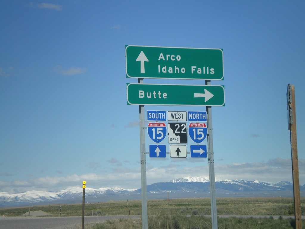
Begin ID-22 West at I-15
Begin ID-22 west at I-15 north to Butte. ID-22 continues west towards Arco. Use I-15 south for Idaho Falls.
Taken 05-02-2010
End ID-22 East at I-15
End ID-22 at I-15 north to Butte.
Taken 05-02-2010
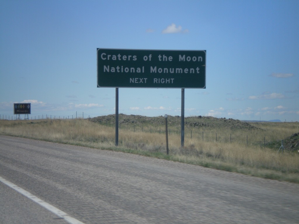
I-15 Exit 167 Offramp at ID-22
I-15 south at ID-22. Use ID-22 west for Arco, and Craters of the Moon National Monument.
Taken 05-02-2010
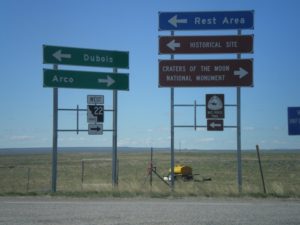
I-15 South - Exit 167
I-15 south at Exit 167 - ID-22 West/CR-A2/Dubois.
Taken 05-02-2010
I-15 South Approaching Exit 167
I-15 south approaching Exit 167. Use Exit 167 for Craters of the Moon National Monument.
Taken 05-02-2010
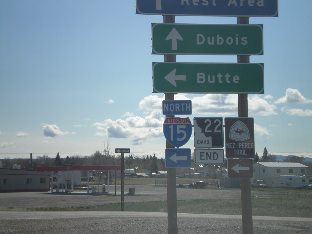
Dubois
Clark County
Idaho
United States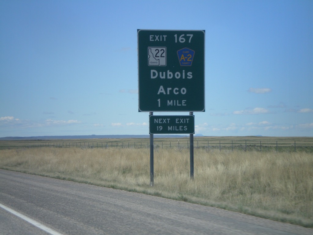
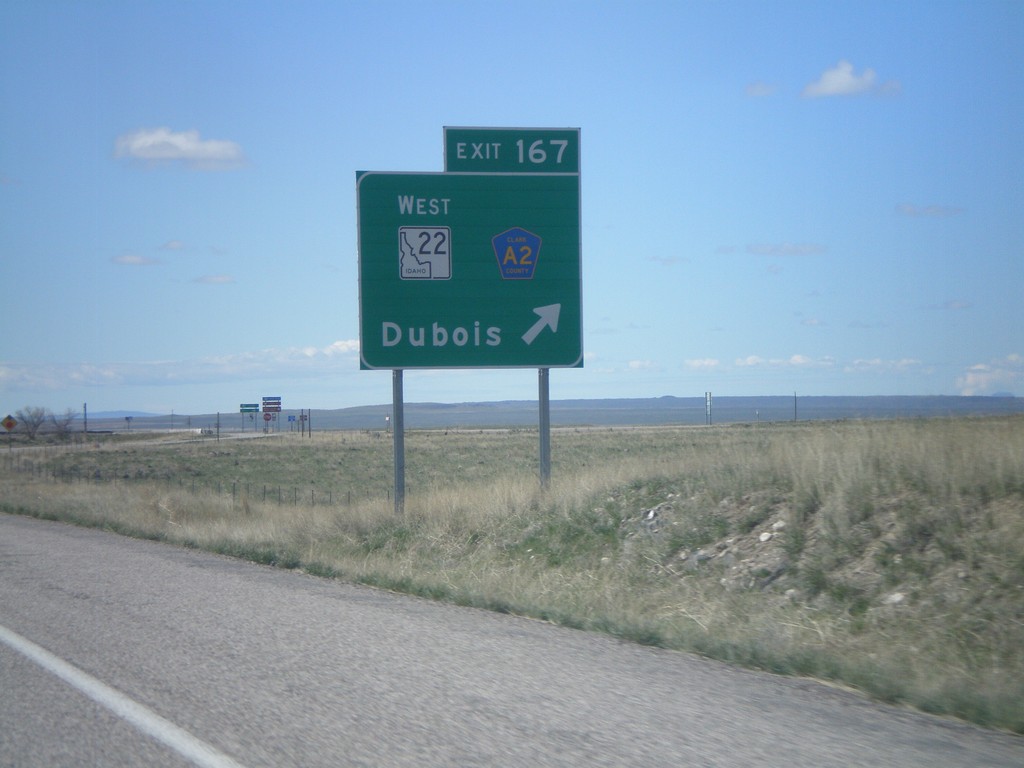
I-15 South - Exit 167
I-15 South approaching Exit 167 - ID-22/Clark County A2/Dubois/Arco. The actual sign at the exit omits Arco from the destination.
Taken 05-02-2010
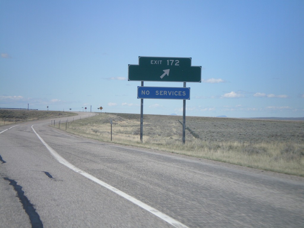
I-15 South - Exit 172
I-15 south at Exit 172. Exit 172 was formerly signed as US Sheep Experiment Station
Taken 05-02-2010
Dubois
Clark County
Idaho
United States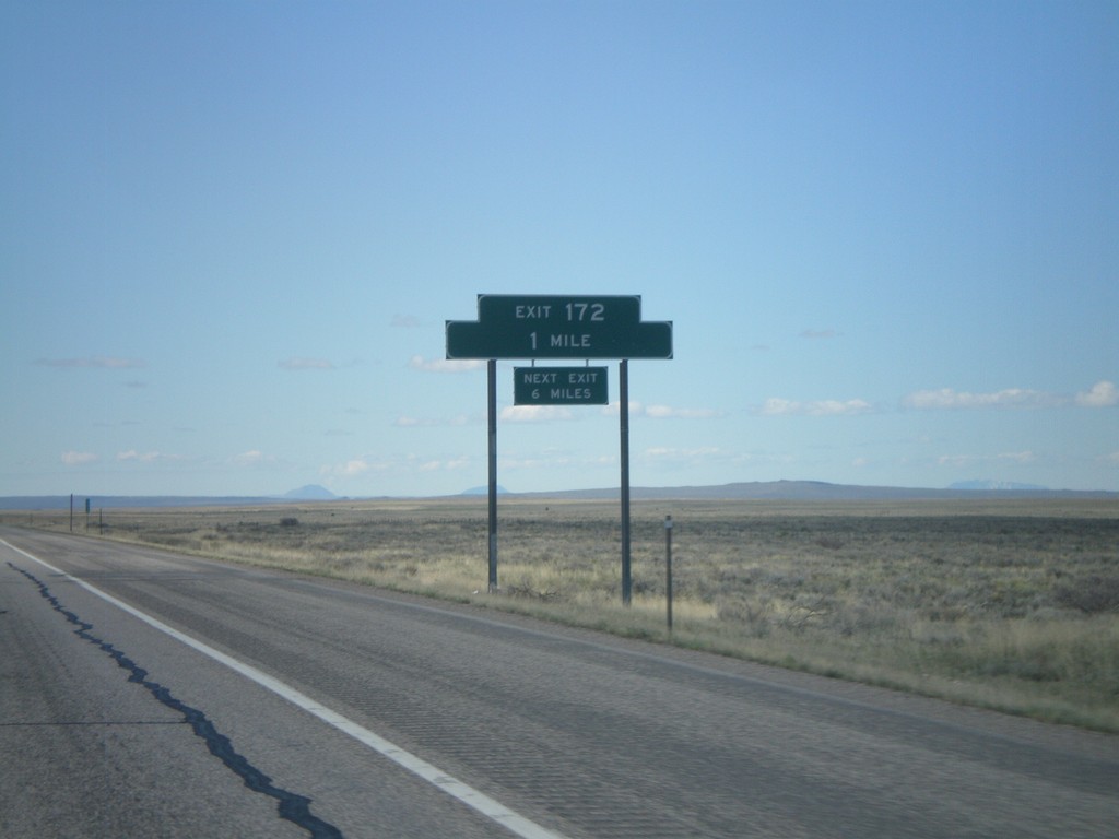
I-15 South - Exit 172
I-15 south approaching Exit 172. Exit 172 does not have a destination, but it formerly had a destination to the US Sheep Experiment Station.
Taken 05-02-2010
Dubois
Clark County
Idaho
United States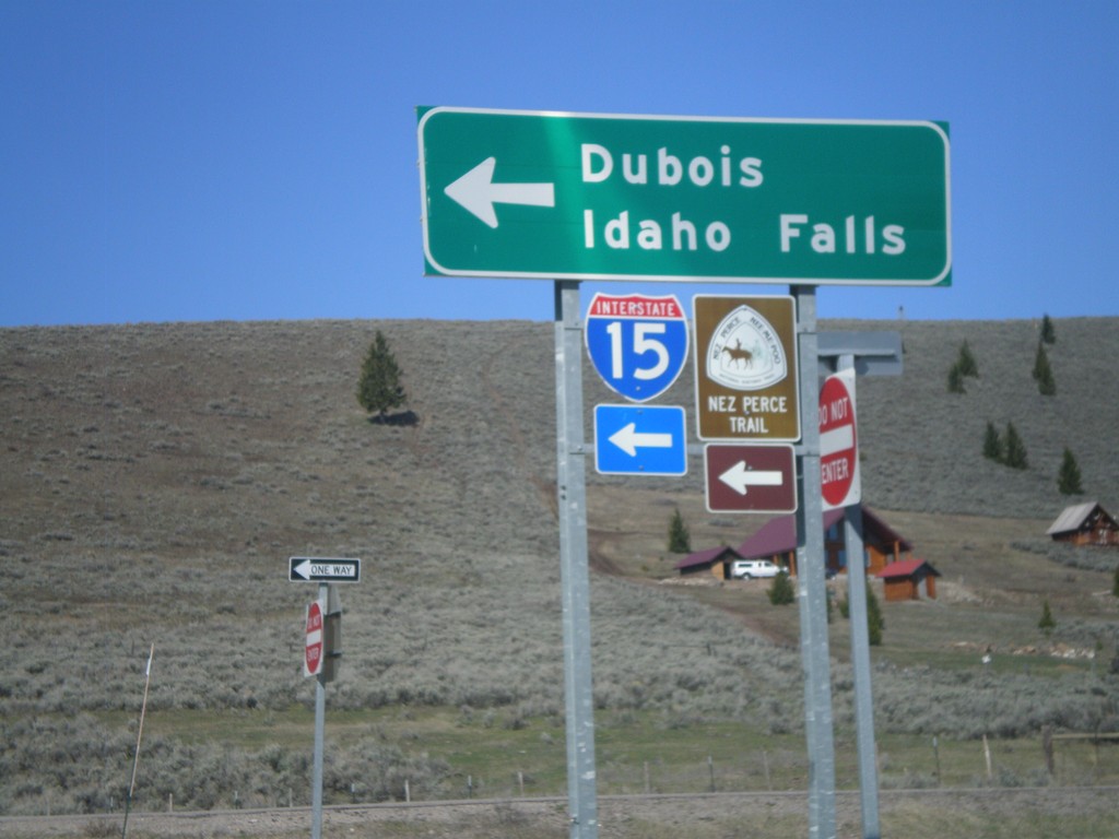
I-15 South Onramp at Exit 180
I-15 south onramp at Exit 180 to Dubois and Idaho Falls.
Taken 05-02-2010
Spencer
Clark County
Idaho
United States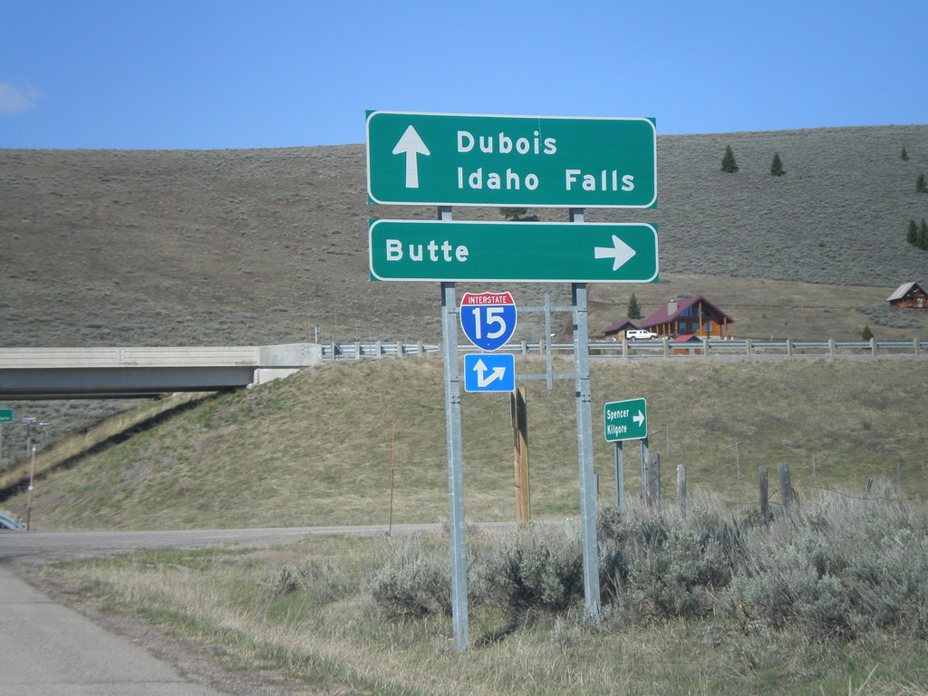
I-15 Exit 180 Onramp
I-15 north onramp at Exit 180 to Butte. Use I-15 south for Dubois and Idaho Falls.
Taken 05-02-2010
Spencer
Clark County
Idaho
United States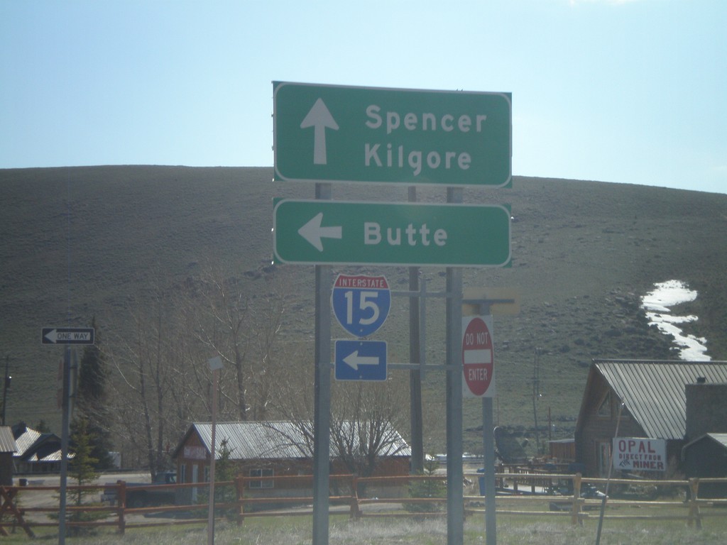
I-15 Exit 180 Onramp
I-15 north onramp at Exit 180 to Butte (Montana).
Taken 05-02-2010
Spencer
Clark County
Idaho
United States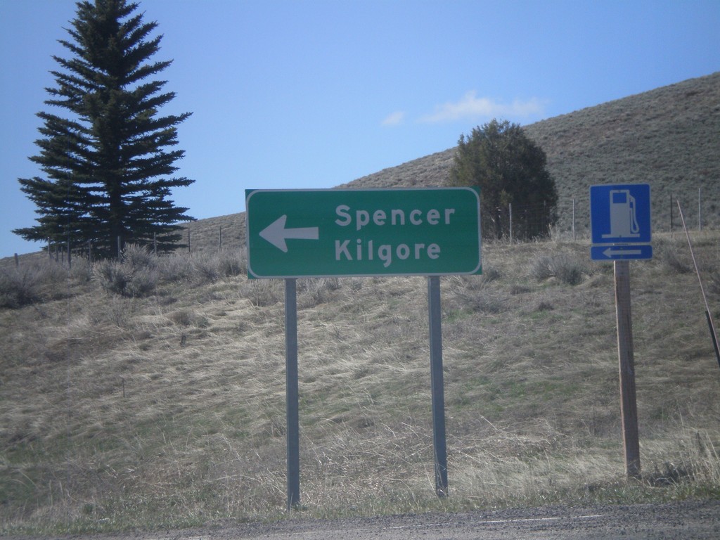
I-15 South - Exit 180 Offramp
I-15 South Exit 180 offramp. Turn left for Spencer and Kilgore.
Taken 05-02-2010
Spencer
Clark County
Idaho
United States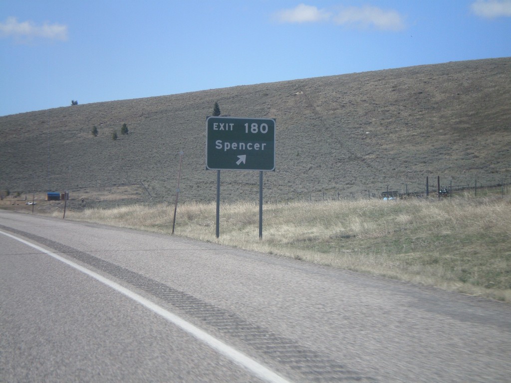
I-15 South - Exit 180
I-15 south at Exit 180 - Spencer
Taken 05-02-2010
Spencer
Clark County
Idaho
United States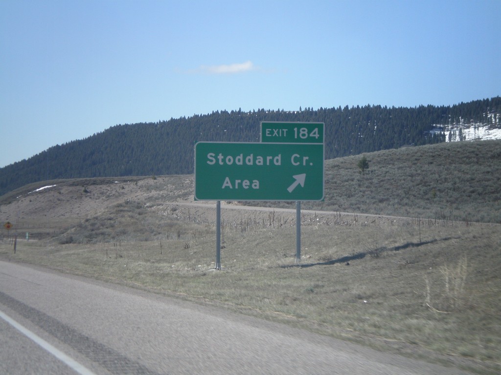
I-15 South - Exit 184
I-15 South Exit 184 - Stoddard Creek Area
Taken 05-02-2010
Spencer
Clark County
Idaho
United States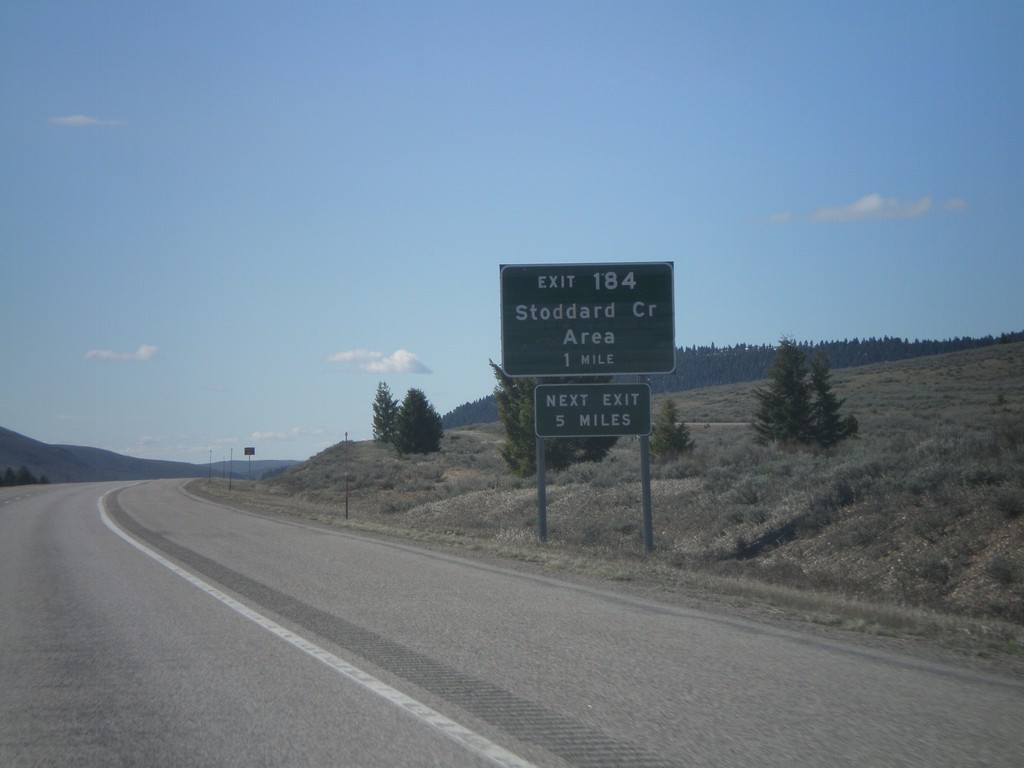
I-15 South - Exit 184
I-15 south approaching Exit 184 - Stoddard Creek Area
Taken 05-02-2010
Spencer
Clark County
Idaho
United States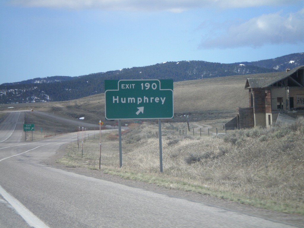
I-15 South - Exit 190
I-15 south at Exit 190 - Humphrey. This is the first exit inside Idaho on I-15 south.
Taken 05-02-2010
Humphrey
Clark County
Idaho
United States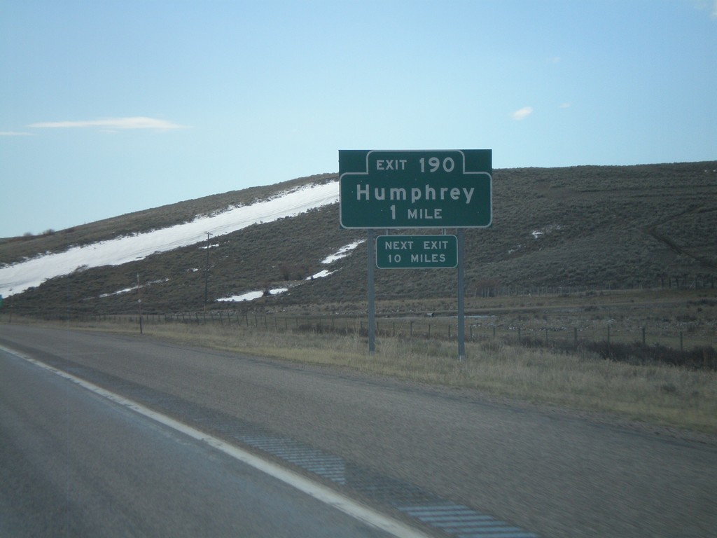
I-15 South - Exit 190
I-15 south approaching Exit 190 - Humphrey. This is the first exit on I-15 south in Idaho.
Taken 05-02-2010
Humphrey
Clark County
Idaho
United States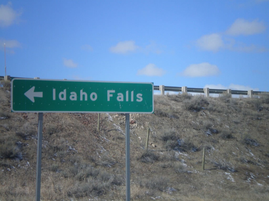
I-15 South Onramp at Exit 0
I-15 south onramp at Exit 0 to Idaho Falls.
Taken 05-02-2010
Monida
Beaverhead County
Montana
United States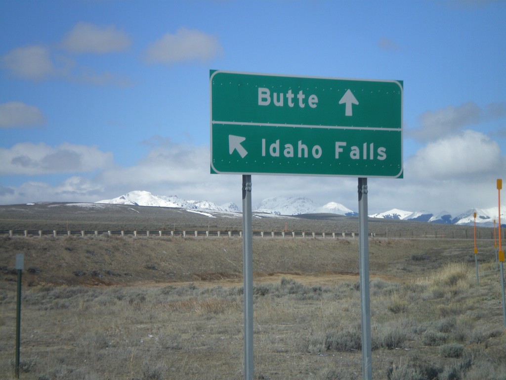
I-15 Exit 0 Onramp
I-15 Exit 0 onramp to Butte, and Idaho Falls.
Taken 05-02-2010
Lima
Beaverhead County
Montana
United States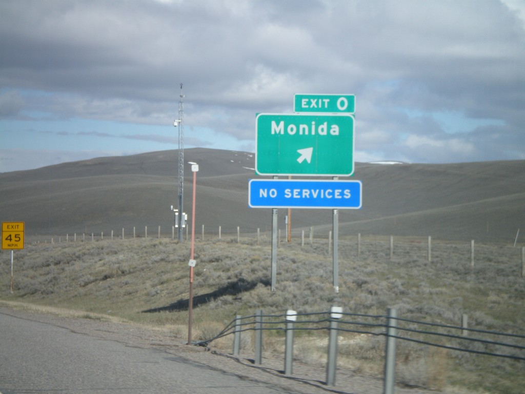
I-15 North - Exit 0
I-15 North at Exit 0 - Monida. Monida is the first exit on I-15 north in Montana.
Taken 05-02-2010
Lima
Beaverhead County
Montana
United States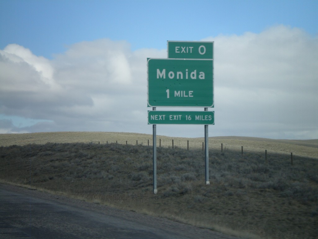
I-15 North - Exit 0 (Montana)
I-15 north approaching Montana Exit 0 - Monida. The signage is consistent with Idaho Transportation Department signs. The sign says next exit 16 miles, but the next exit is actually Exit 9, at Snowline. The next services are 16 miles in Lima.
Taken 05-02-2010
Humphrey
Clark County
Idaho
United States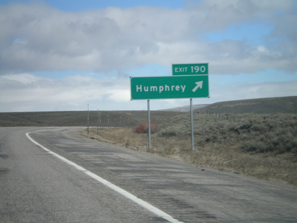
I-15 North - Exit 190
I-15 north at Exit 190 - Humphrey. This is the last exit in Idaho on I-15 north.
Taken 05-02-2010
Humphrey
Clark County
Idaho
United States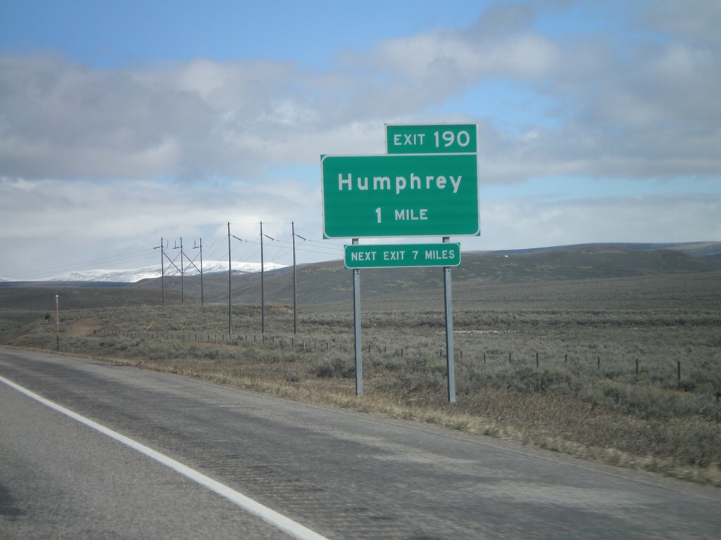
I-15 North - Exit 190
I-15 north approaching Exit 190 - Humphrey.
Taken 05-02-2010
Spencer
Clark County
Idaho
United States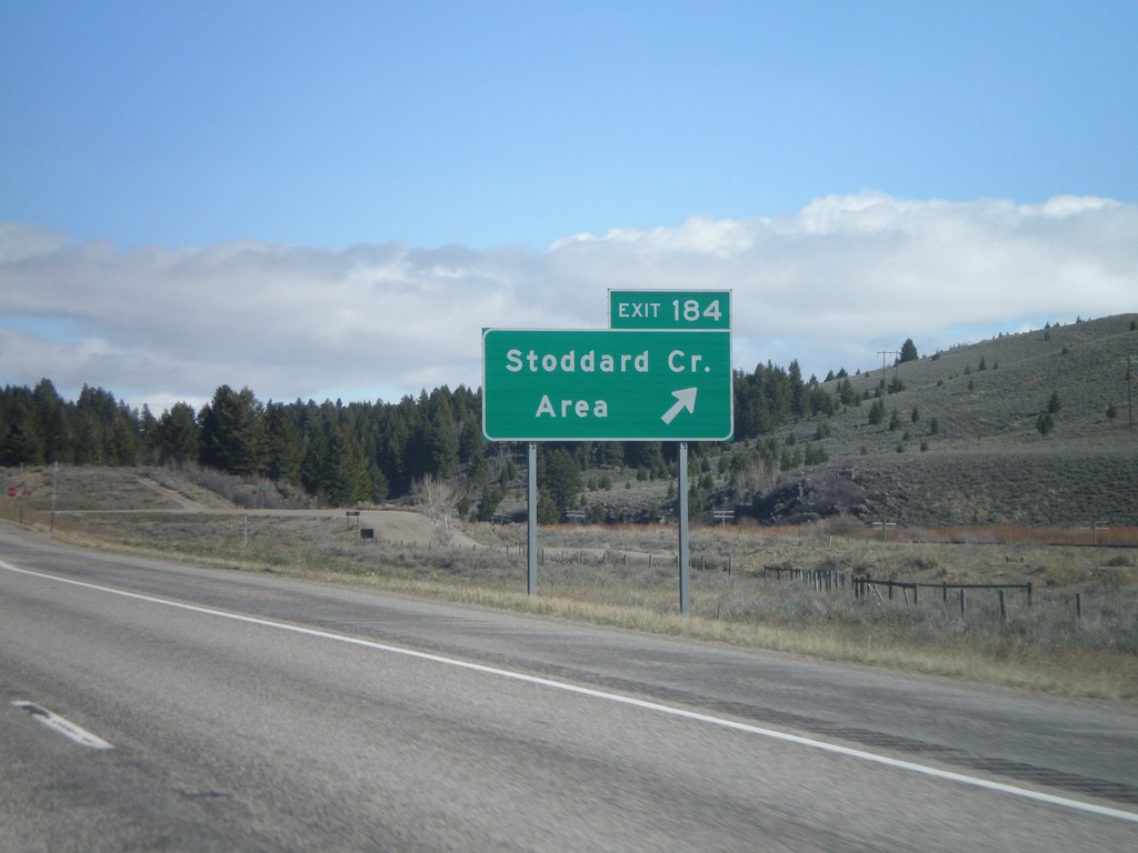
I-15 North - Exit 184
I-15 north Exit 184 - Stoddard Creek Area
Taken 05-02-2010
Spencer
Clark County
Idaho
United States