Signs Tagged With Interchange
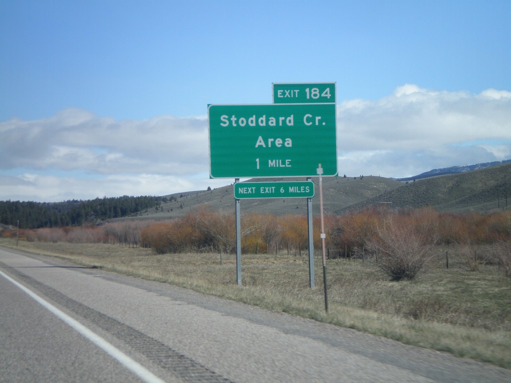
I-15 North - Exit 184
I-15 north approaching Exit 184 - Stoddard Creek Area
Taken 05-02-2010
 Spencer
Clark County
Idaho
United States
Spencer
Clark County
Idaho
United States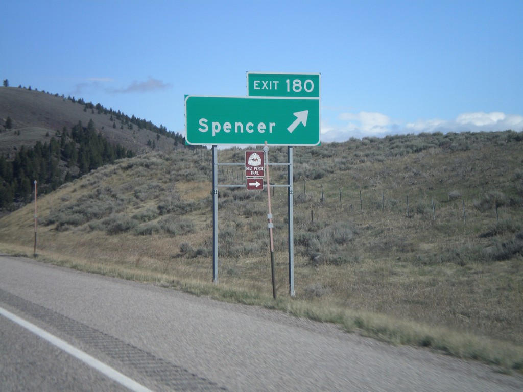
I-15 North - Exit 180
I-15 north at Exit 180 - Spencer. The Nez Perce Trail leaves I-15 here.
Taken 05-02-2010
Spencer
Clark County
Idaho
United States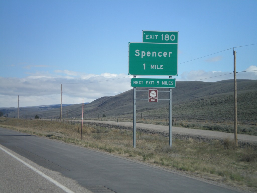
I-15 North - Exit 180
I-15 North Exit 180 - Spencer. Spencer is the last town on I-15 north in Idaho. Spencer lies at the base of Monida Pass. the Nez Perce Trail exits I-15 here as well.
Taken 05-02-2010
Spencer
Clark County
Idaho
United States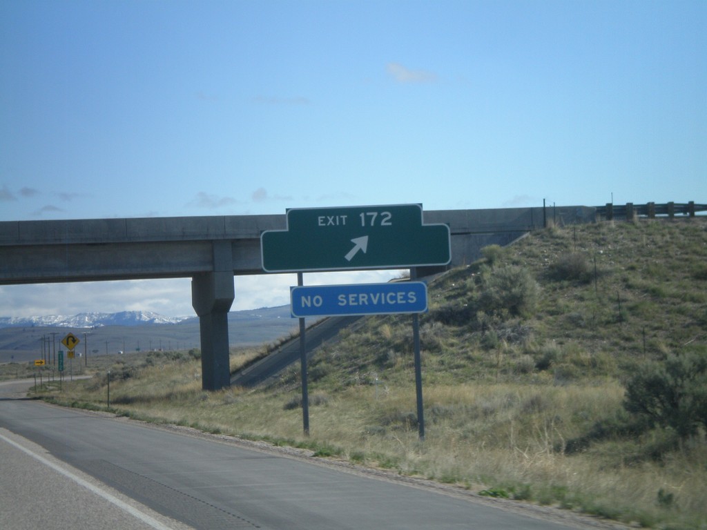
I-15 North - Exit 172
I-15 North at Exit 172. Exit 172 has no destinations, but formerly listed the US Sheep Experiment Station.
Taken 05-02-2010
Dubois
Clark County
Idaho
United States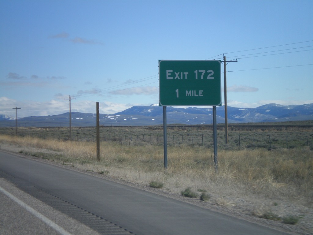
I-15 North - Exit 172
I-15 north approaching Exit 172. Exit 172 does not have a destination listed, but was formerly listed as US Sheep Experiment Station.
Taken 05-02-2010
Dubois
Clark County
Idaho
United States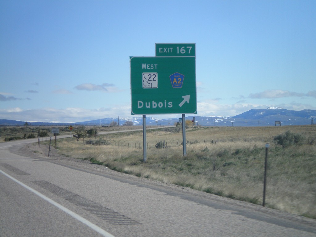
I-15 North - Exit 167
I-15 north Exit 167 - ID-22 West/Clark County A2/Dubois.
Taken 05-02-2010

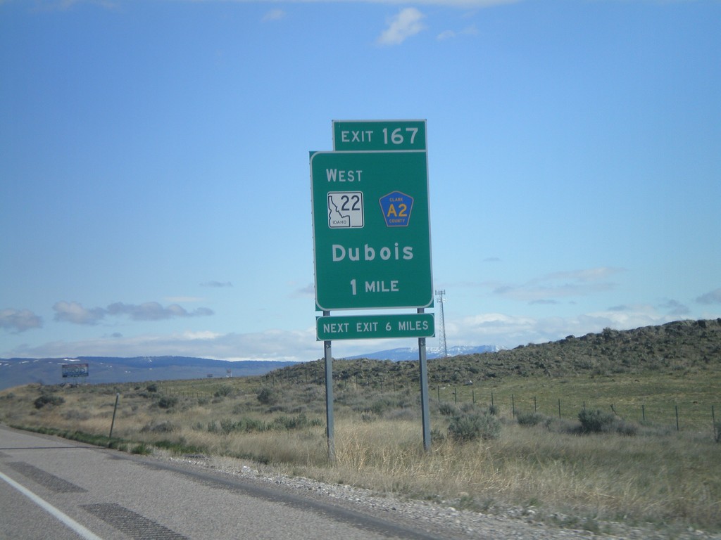
I-15 North - Exit 167
I-15 north approaching Exit 167 - ID-22 West/Clark County A2/Dubois.
Taken 05-02-2010
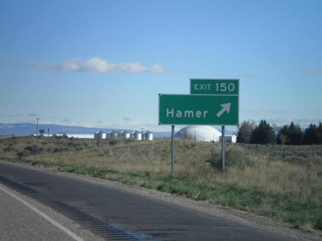
I-15 North - Exit 150
I-15 north at Exit 150 - Hamer
Taken 05-02-2010
Hamer
Jefferson County
Idaho
United States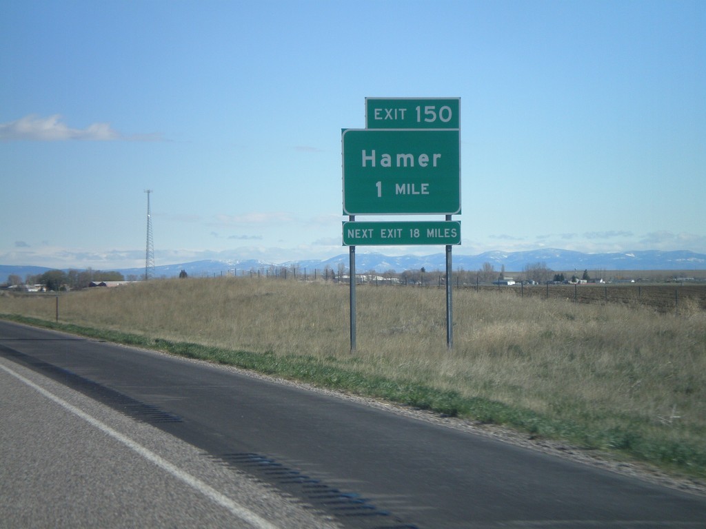
I-15 North - Exit 150
I-15 north approaching Exit 150 - Hamer
Taken 05-02-2010
Hamer
Jefferson County
Idaho
United States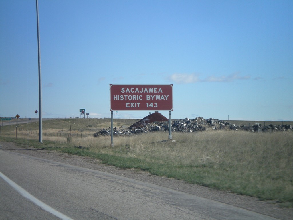
I-15 North - Exit 143
I-15 north at Exit 143. Use Exit 143 for Sacajawea Historic Byway.
Taken 05-02-2010
 Roberts
Jefferson County
Idaho
United States
Roberts
Jefferson County
Idaho
United States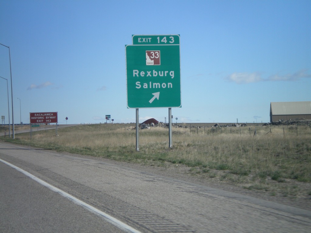
I-15 North - Exit 143
I-15 north at Exit 143 - ID-33/Rexburg/Salmon. This is the southern end of the Sacajawea Historic Byway.
Taken 05-02-2010
Roberts
Jefferson County
Idaho
United States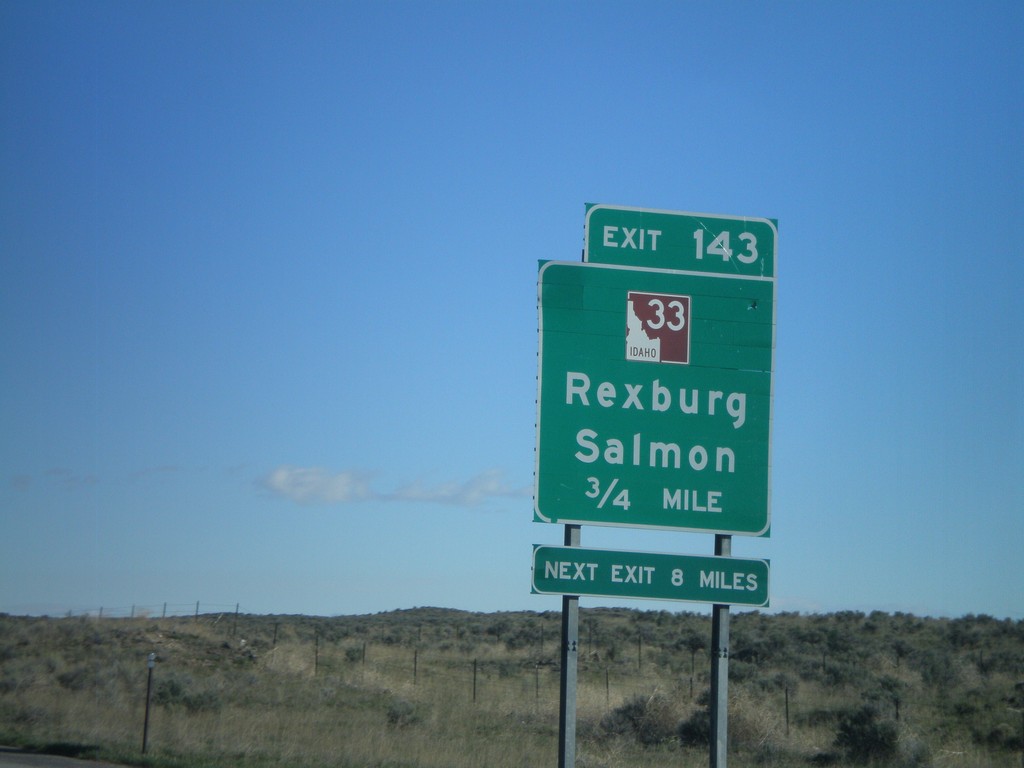
I-15 North - Exit 143
I-15 north approaching Exit 143 - ID-33/Rexburg/Salmon. This is the southern end of the Sacajawea Historic Byway.
Taken 05-02-2010
Roberts
Jefferson County
Idaho
United States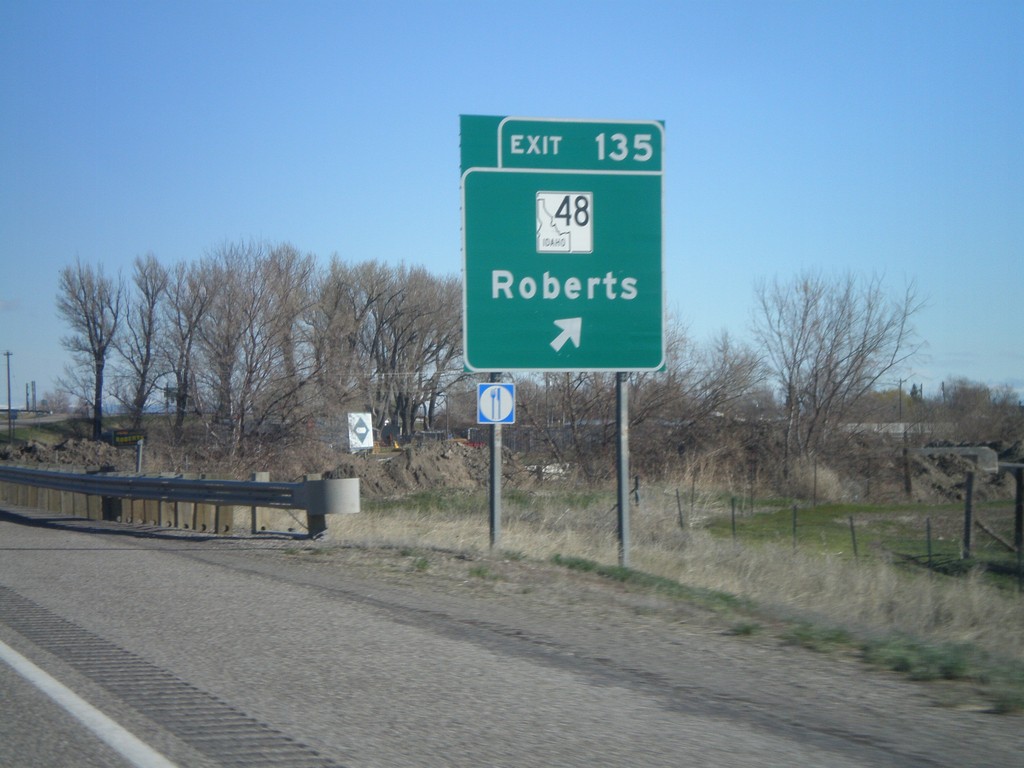
I-15 North - Exit 135
I-15 north at Exit 135 - ID-48/Roberts
Taken 05-02-2010
 Roberts
Jefferson County
Idaho
United States
Roberts
Jefferson County
Idaho
United States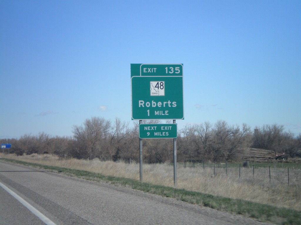
I-15 North - Exit 135
I-15 north approaching Exit 135 - ID-48/Roberts
Taken 05-02-2010
Roberts
Jefferson County
Idaho
United States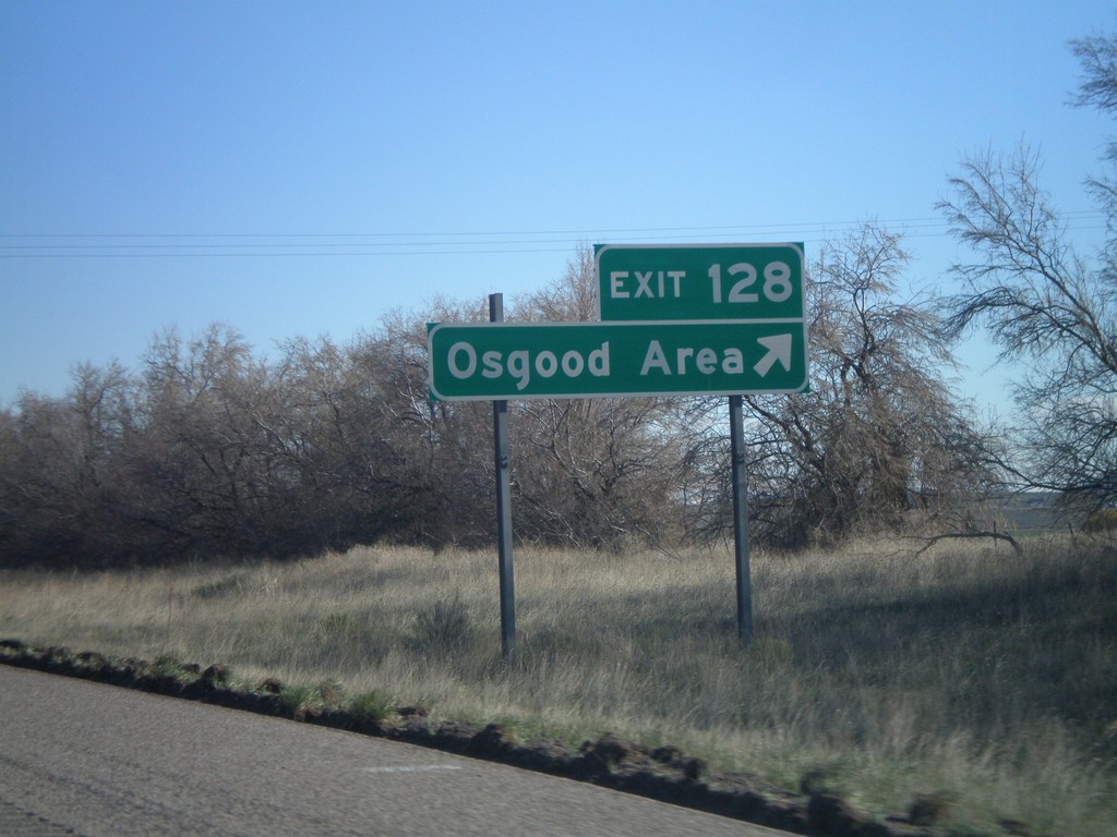
I-15 North - Exit 128
I-15 north at Exit 128 - Osgood Area
Taken 05-02-2010
Bassett
Jefferson County
Idaho
United States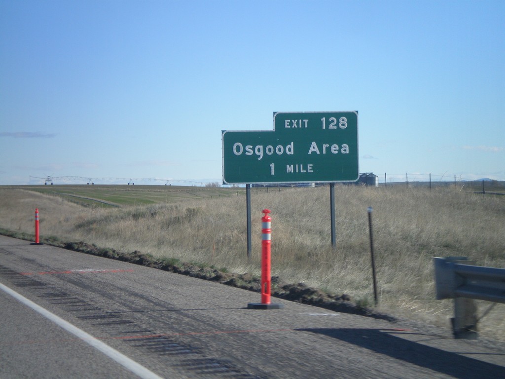
I-15 North - Exit 128
I-15 north approaching Exit 128 - Osgood Area.
Taken 05-02-2010
Idaho Falls
Bonneville County
Idaho
United States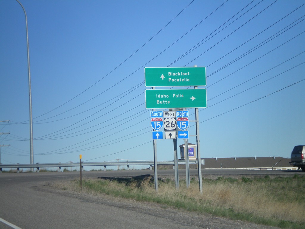
US-26 West/BL-15 South at I-15
US-26 west/BL-15 south at I-15 Exit 116. Use I-15 north for Idaho Falls and Butte. Use I-15 South/US-26 West for Blackfoot and Pocatello.
Taken 05-02-2010

 Idaho Falls
Bonneville County
Idaho
United States
Idaho Falls
Bonneville County
Idaho
United States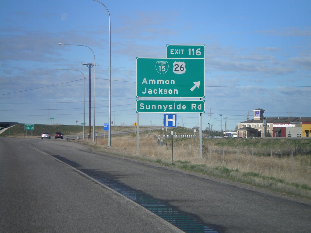
I-15 South - Exit 116
I-15 south at Exit 116, BL-15/US-26 East/Ammon/Jackson
Taken 05-02-2010
Idaho Falls
Bonneville County
Idaho
United States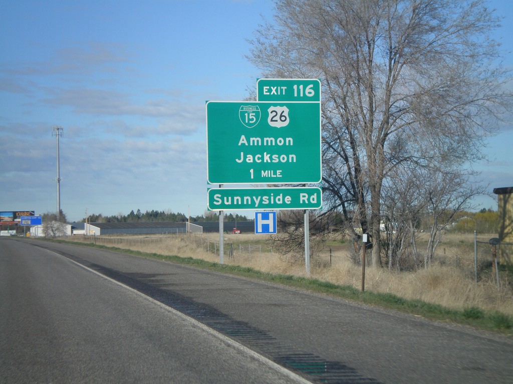
I-15 South - Exit 116
I-15 south approaching Exit 116 - BL-15/US-26/Ammon/Jackson.
Taken 05-02-2010
Idaho Falls
Bonneville County
Idaho
United States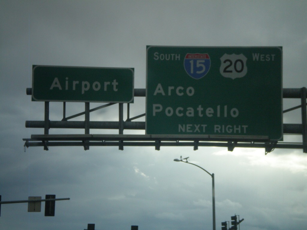
US-20 West at I-15 South
US-20 west at I-15 south to Arco and Pocatello. US-20 west joins I-15 south. Continue straight for the Idaho Falls Airport.
Taken 05-01-2010
 Idaho Falls
Bonneville County
Idaho
United States
Idaho Falls
Bonneville County
Idaho
United States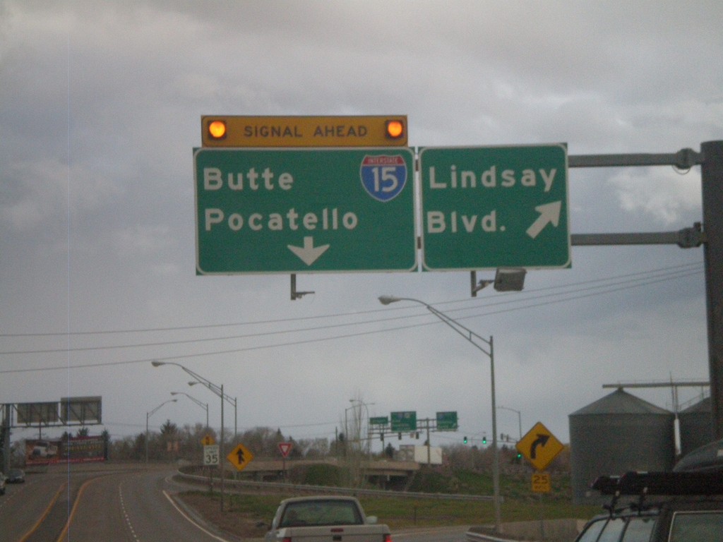
US-20 West - Lindsay Blvd
US-20 west at Lindsay Blvd (Exit 307). Approaching end of freeway at I-15 to Butte and Pocatello.
Taken 05-01-2010
Idaho Falls
Bonneville County
Idaho
United States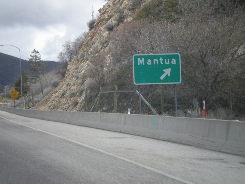
US-91/US-89 North at Mantua Exit
US-91/US-89 north at the Mantua exit.
Taken 05-01-2010

 Mantua
Box Elder County
Utah
United States
Mantua
Box Elder County
Utah
United States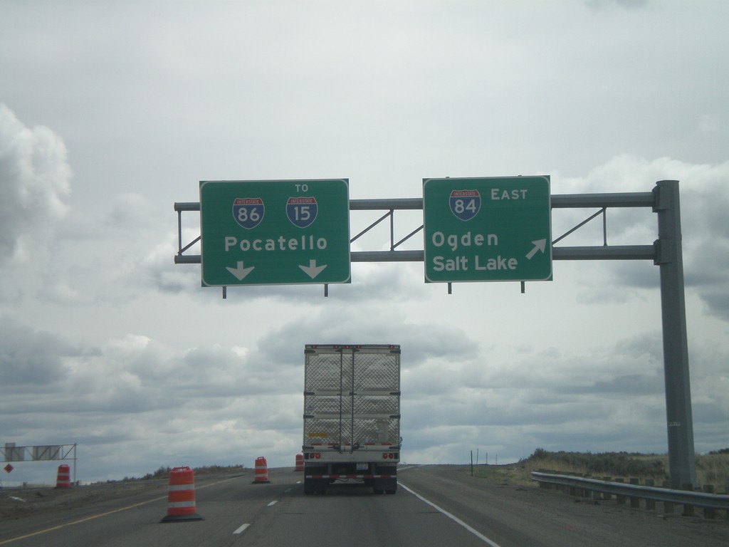
I-84 East - Exit 222
I-84 east at I-86 east to I-15 and Pocatello. Use I-84 east for Ogden and Salt Lake.
Taken 05-01-2010


 Declo
Cassia County
Idaho
United States
Declo
Cassia County
Idaho
United States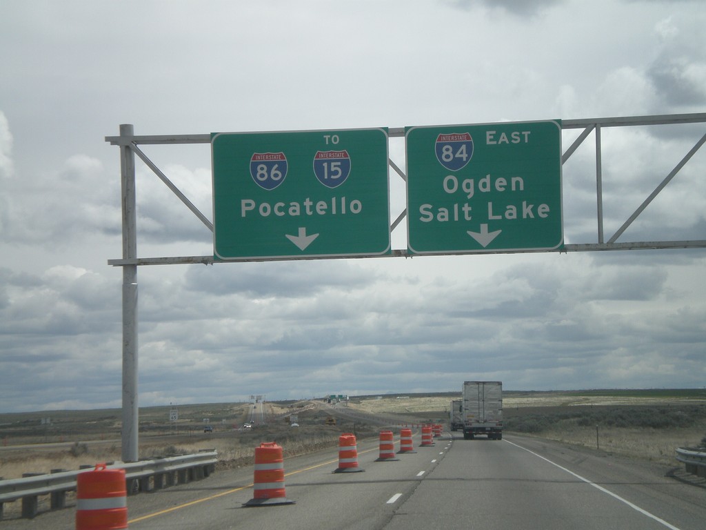
I-84 East Approaching I-86
I-84 east approaching I-86 east to I-15 and Pocatello. Use I-84 west for Ogden and Salt Lake.
Taken 05-01-2010
Declo
Cassia County
Idaho
United States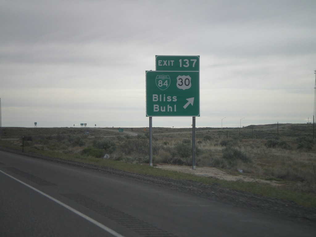
I-84 East - Exit 137
I-84 east at Exit 137 - BL-84/US-30/Bliss/Buhl. US-30 leaves I-84 here, and rejoins I-84 in Heyburn.
Taken 05-01-2010
 Bliss
Gooding County
Idaho
United States
Bliss
Gooding County
Idaho
United States