Signs Tagged With Interchange
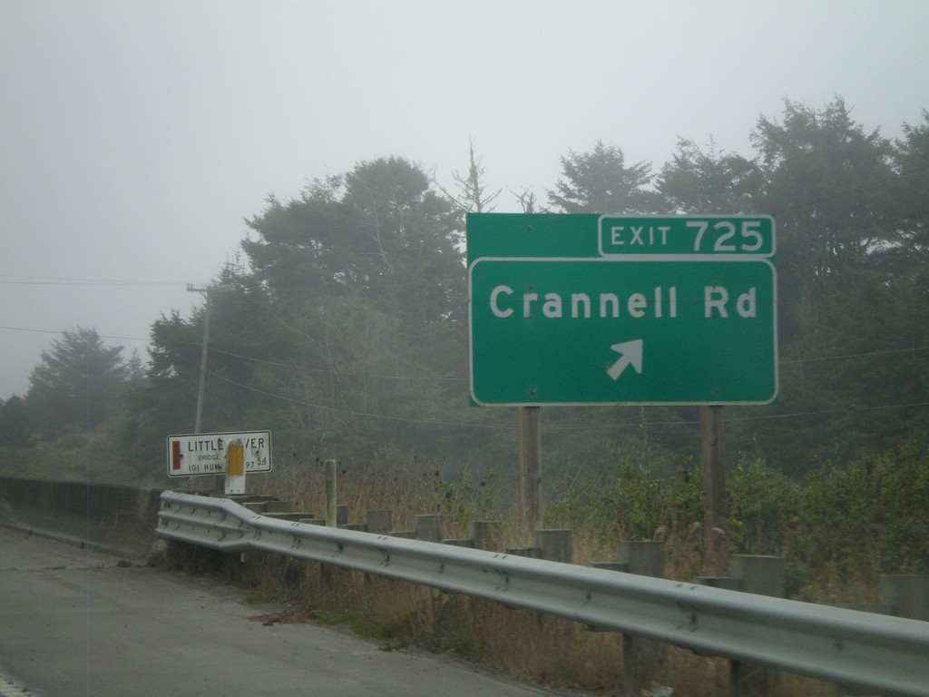
US-101 South - Exit 725
US-101 south Exit 725 - Crannell Road
Taken 09-25-2009
 McKinleyville
Humboldt County
California
United States
McKinleyville
Humboldt County
California
United States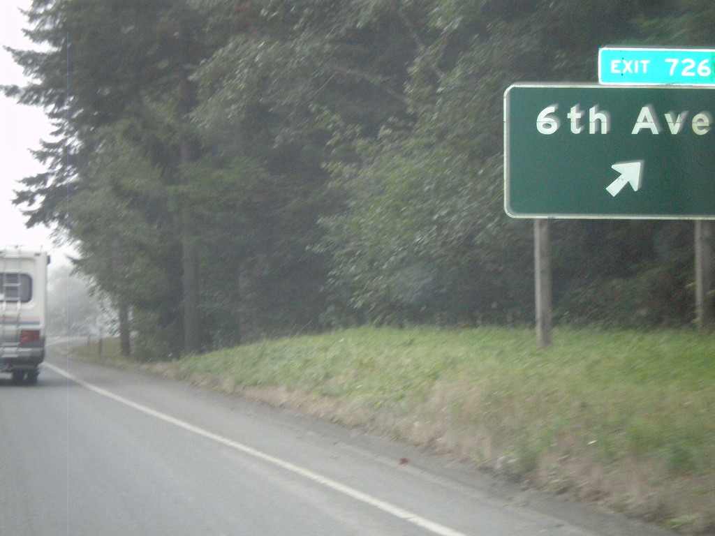
US-101 South - Exit 726
US-101 south Exit 726 - 6th Ave.
Taken 09-25-2009
Trinidad
Humboldt County
California
United States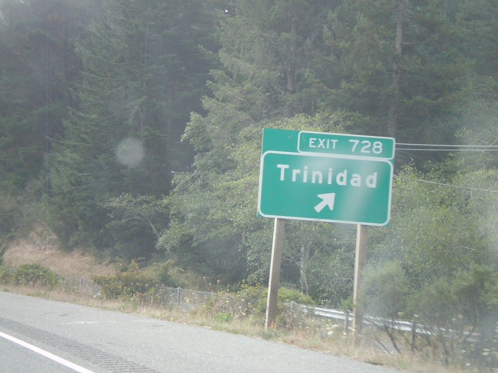
US-101 South - Exit 728
US-101 south Exit 728 - Trinidad
Taken 09-25-2009
Trinidad
Humboldt County
California
United States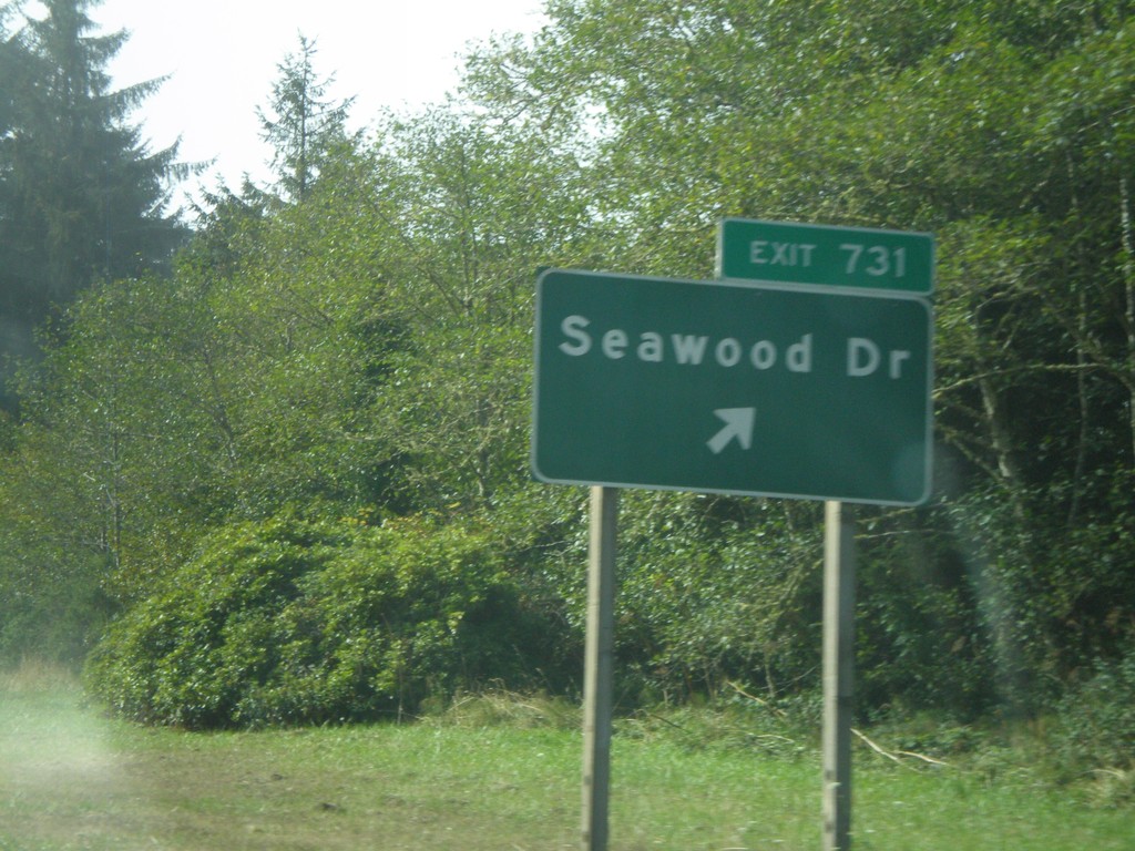
US-101 South - Exit 731
US-101 south Exit 731 -Seawood Drive
Taken 09-25-2009
Patricks Point
Humboldt County
California
United States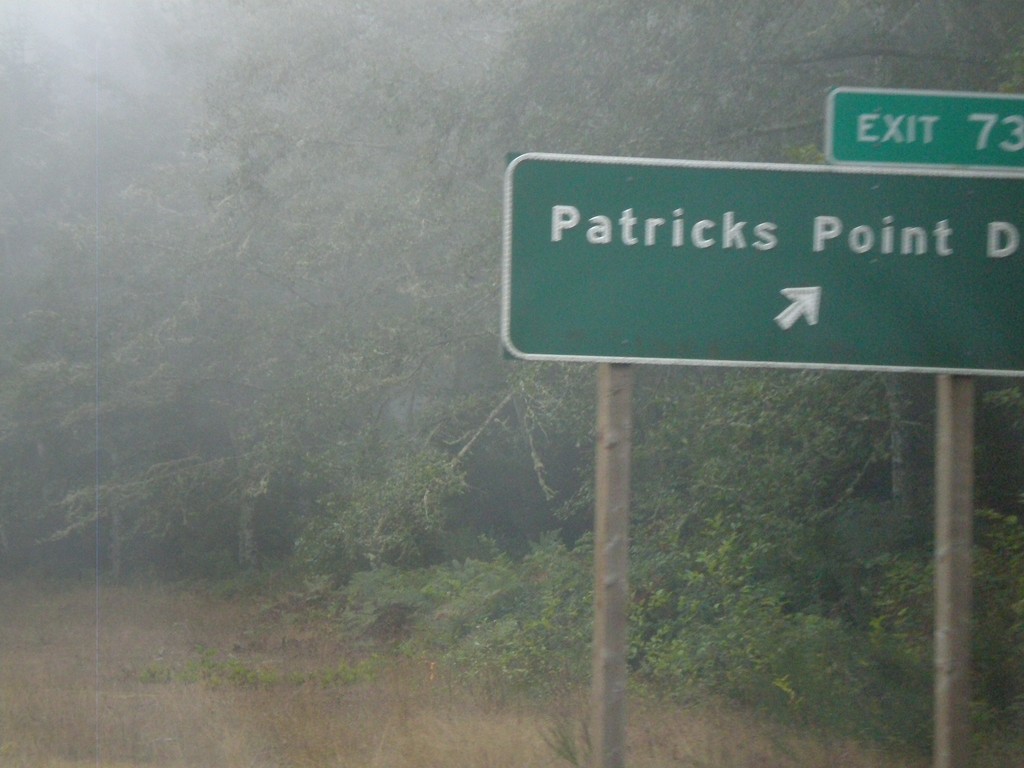
US-101 South - Exit 734
US-101 south Exit 734 -Patricks Point Drive
Taken 09-25-2009
Patricks Point
Humboldt County
California
United States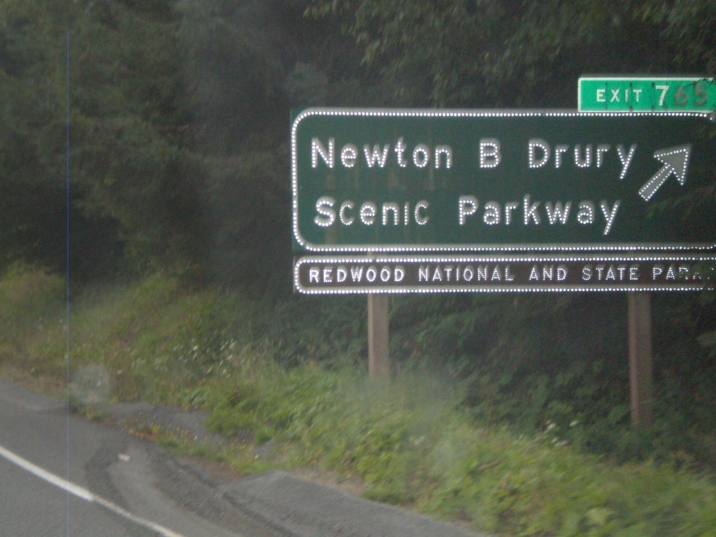
US-101 South - Exit 765
US-101 south Exit 765 - Newton B Drury Scenic Parkway
Taken 09-23-2009
Klamath
Del Norte County
California
United States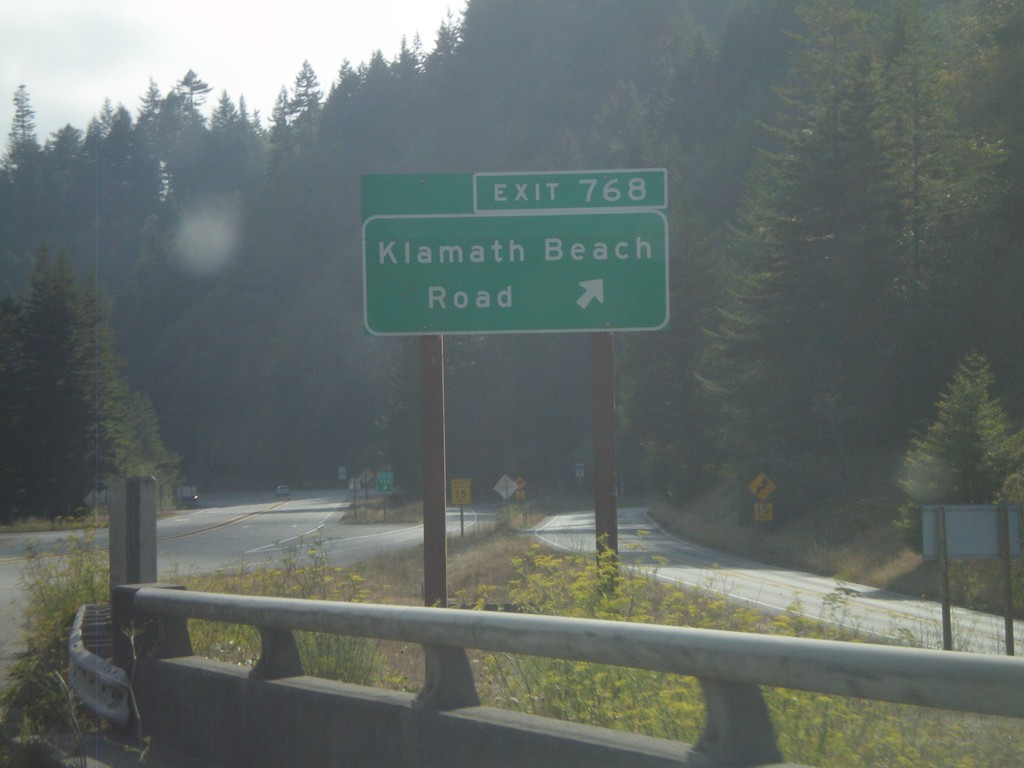
US-101 South - Exit 768
US-101 south Exit 768 - Klamath Beach Road
Taken 09-23-2009
Klamath
Del Norte County
California
United States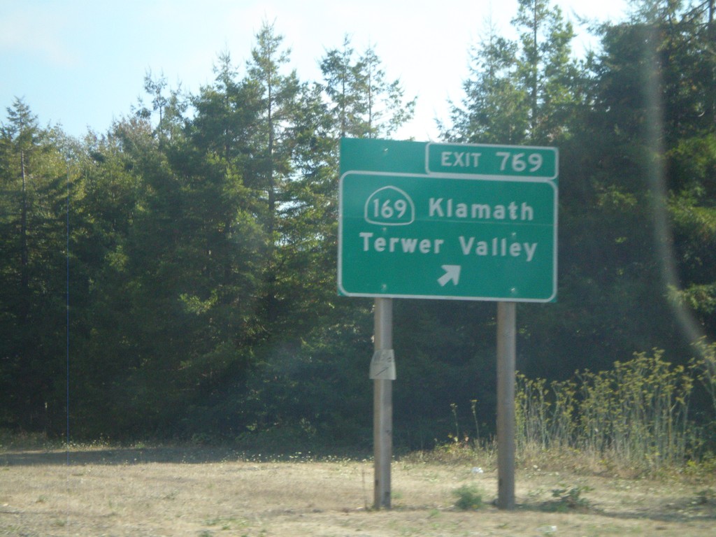
US-101 South - Exit 769
US-101 south Exit 769 - CA-169/Klamath/Terwer Valley
Taken 09-23-2009
 Klamath
Del Norte County
California
United States
Klamath
Del Norte County
California
United States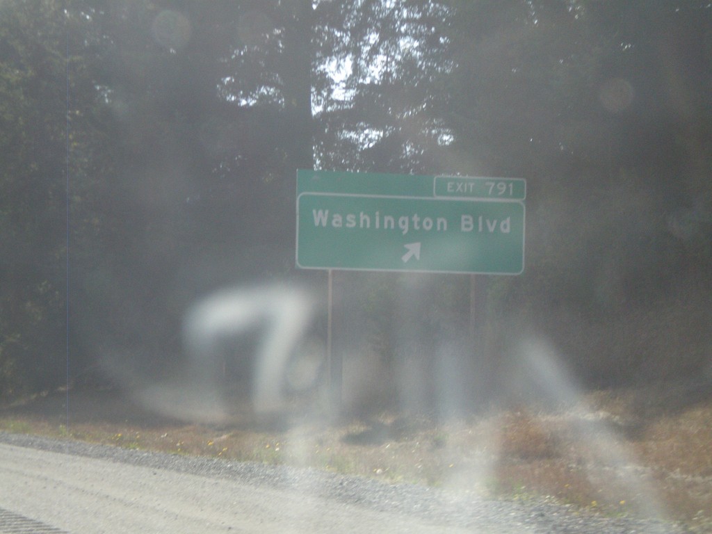
US-101 South - Exit 791
US-101 south Exit 791 - Washington Blvd.
Taken 09-23-2009
Crescent City
Del Norte County
California
United States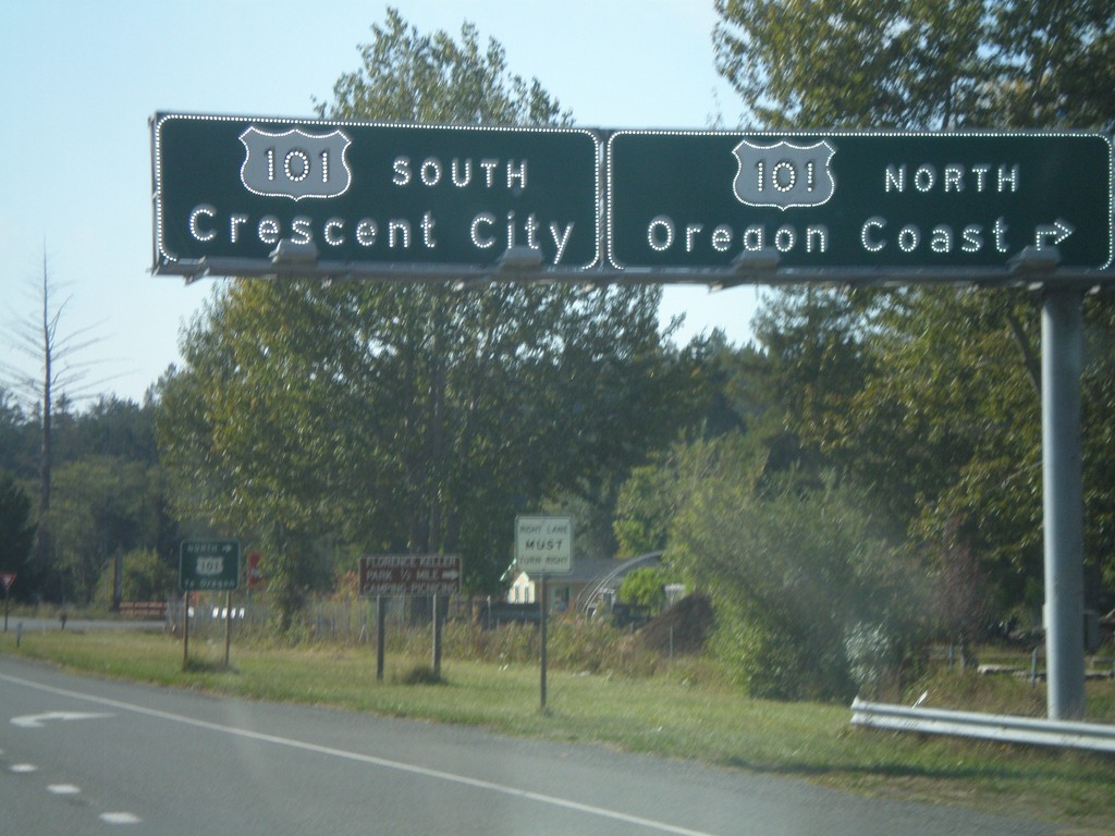
US-199 West Approaching US-101
US-199 west approaching US-101. Use US-101 north for the Oregon Coast. Use US-101 south for Crescent City. There is no direct connection to US-101 north from US-199 west. Traffic follows the Elk Valley Cross Road to reach US-101. This is the western terminus of US-199.
Taken 09-23-2009
 Crescent City
Del Norte County
California
United States
Crescent City
Del Norte County
California
United States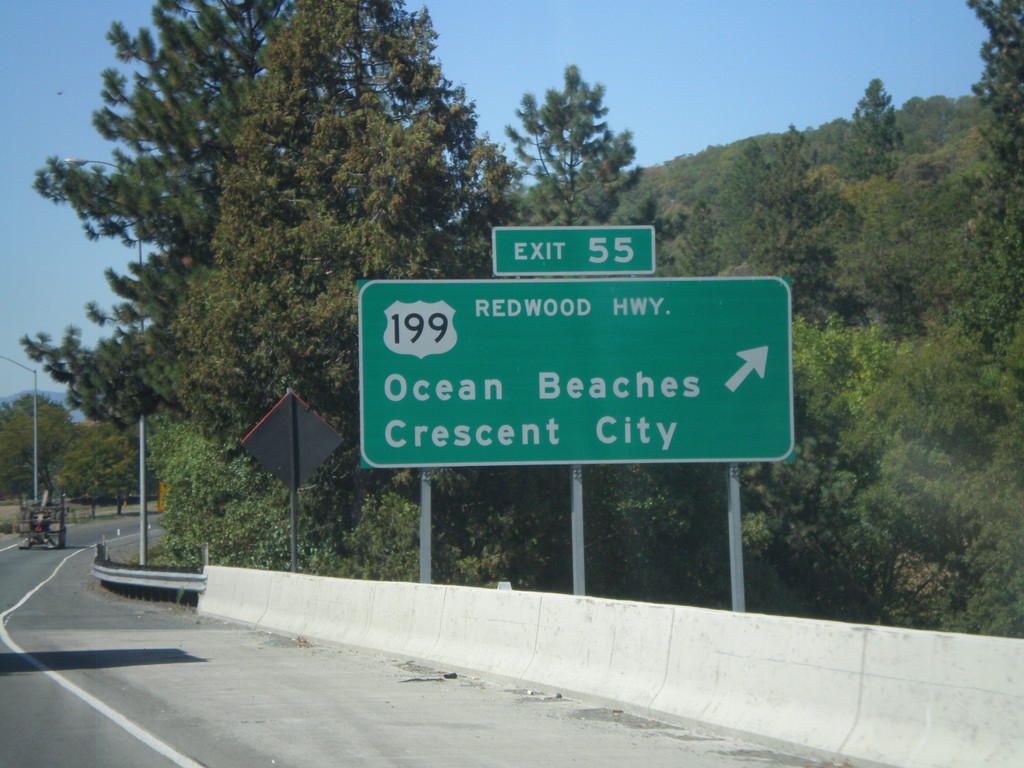
I-5 North - Exit 55
I-5 north at Exit 55- US-199/Redwood Highway/Ocean Beaches/Crescent City
Taken 09-23-2009
 Grants Pass
Josephine County
Oregon
United States
Grants Pass
Josephine County
Oregon
United States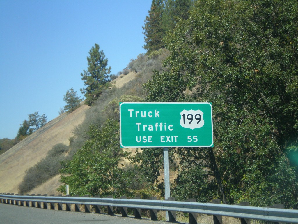
For US-199 Truck Traffic - Use Exit 55
For truck traffic on US-199 South use Exit 55.
Taken 09-23-2009
Grants Pass
Josephine County
Oregon
United States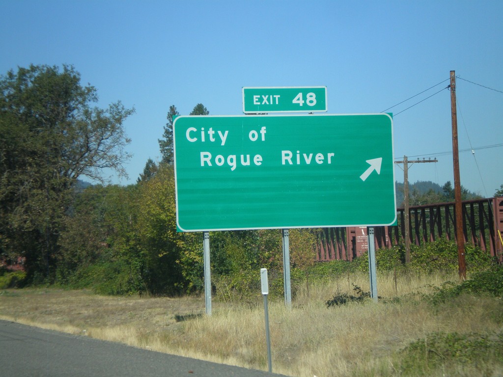
I-5 North - Exit 48
I-5 north at Exit 48 - City of Rogue River
Taken 09-23-2009
Rogue River
Jackson County
Oregon
United States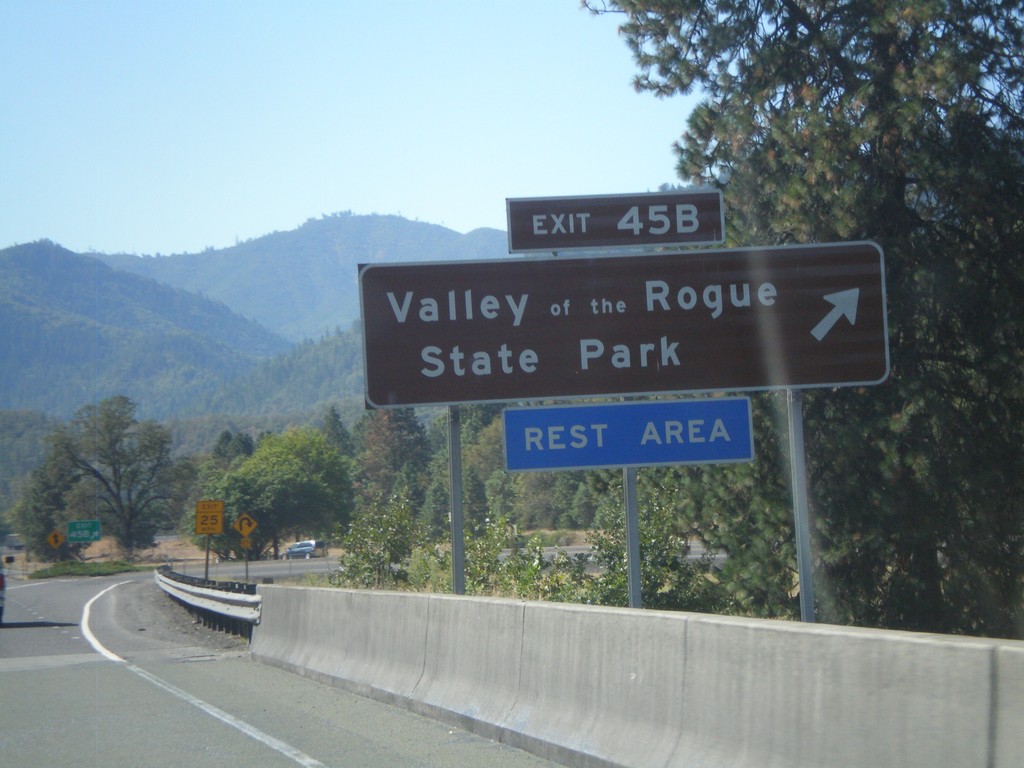
I-5 North - Exit 45B
I-5 north at Exit 45B - Valley of the Rogue State Park
Taken 09-23-2009
Gold Hill
Jackson County
Oregon
United States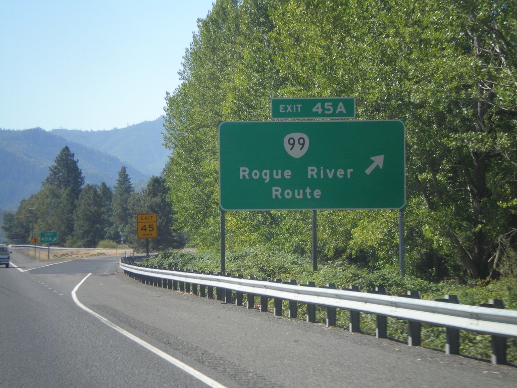
I-5 North - Exit 45A
I-5 north at Exit 45A - OR-99/Rogue River Route.
Taken 09-23-2009
 Gold Hill
Jackson County
Oregon
United States
Gold Hill
Jackson County
Oregon
United States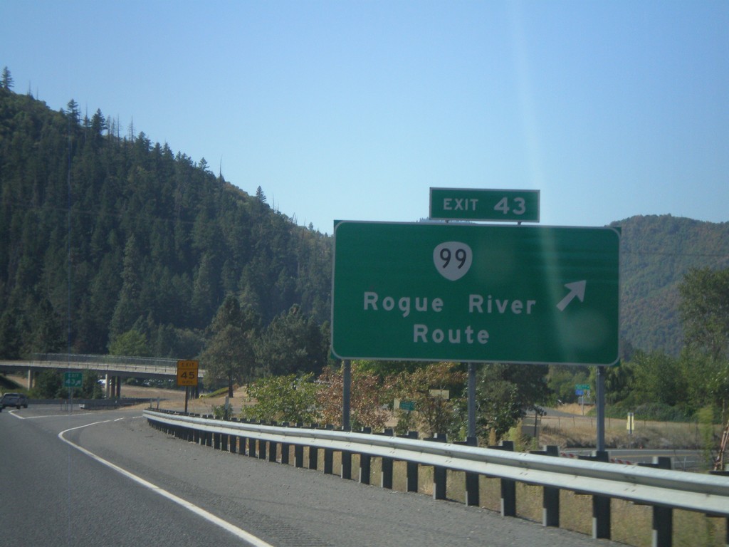
I-5 North - Exit 43
I-5 north at Exit 43 - OR-99/Rogue River Route. This exit also provides access to OR-234.
Taken 09-23-2009
Rock Point
Jackson County
Oregon
United States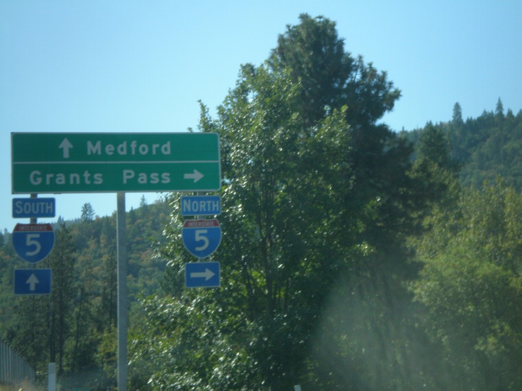
I-5 - Exit 40 Onramp
I-5 onramp at Exit 40, the eastern Gold Hill interchange. Use I-5 north for Grants Pass. Use I-5 south for Medford.
Taken 09-23-2009
Gold Hill
Jackson County
Oregon
United States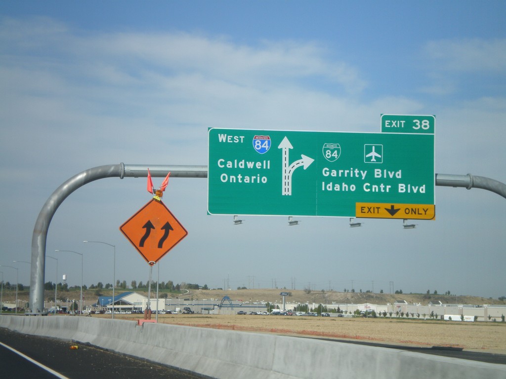
I-84 West - Exit 38
I-84/US-30 west at Exit 38 - BL-84/Garrity Blvd./Idaho Center Blvd. Westbound I-84 traffic continues towards Caldwell and Ontario (OR).
Taken 09-19-2009


 Nampa
Canyon County
Idaho
United States
Nampa
Canyon County
Idaho
United States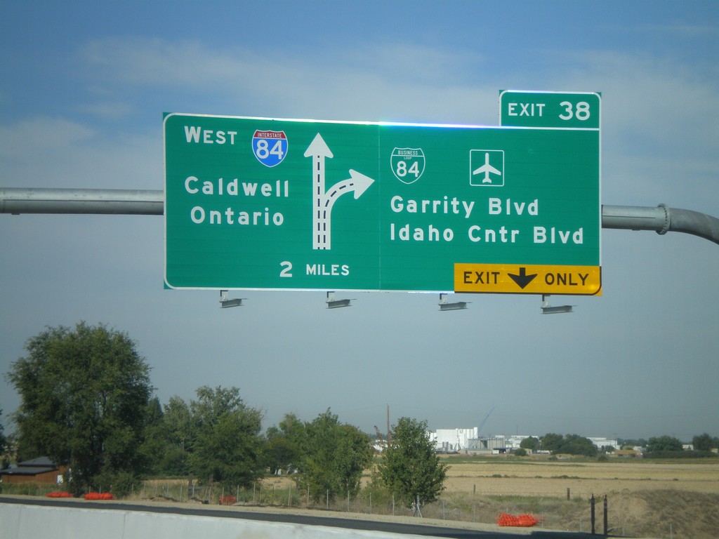
I-84 West Approaching Exit 38
I-84/US-30 west approaching Exit 38 - BL-84/Garrity Blvd./Idaho Center Blvd. Westbound I-84 traffic continues towards Caldwell and Ontario (OR). This is a new sign as part of the I-84 widening between Meridian and Nampa.
Taken 09-19-2009
Nampa
Canyon County
Idaho
United States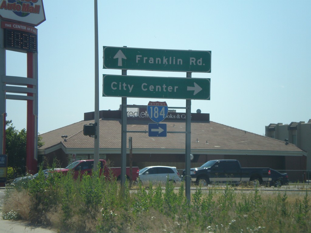
Franklin Rd. east at I-184 East Exit 1 Onramp
Franklin Road east at I-184 east Exit 1 onramp. Use I-184 east for City Center (Boise).
Taken 07-04-2009
 Boise
Ada County
Idaho
United States
Boise
Ada County
Idaho
United States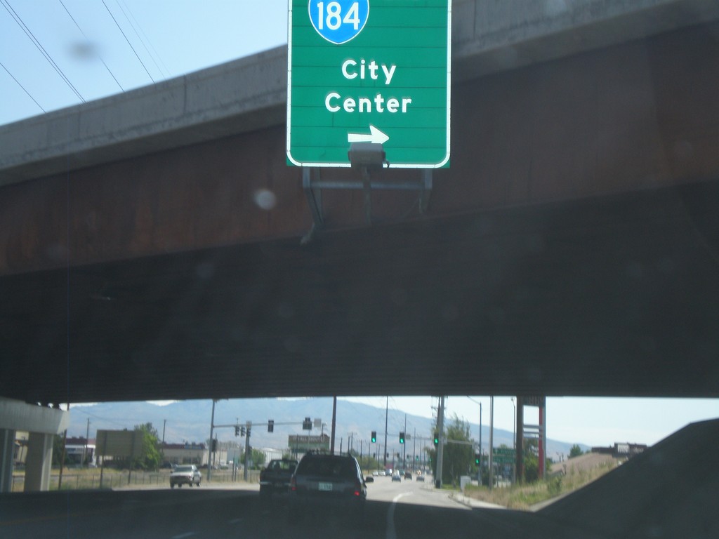
Franklin Road East at I-184 East
Franklin Road East at I-184 East - Exit 1.
Taken 07-04-2009
Boise
Ada County
Idaho
United States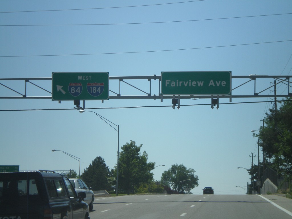
Fairview Ave. West at I-184
Fairview Ave. west at I-184 onramp. I-84 is posted on this sign, but it should read To I-84, since I-84 is still three miles away along I-184.
Taken 06-29-2009
Boise
Ada County
Idaho
United States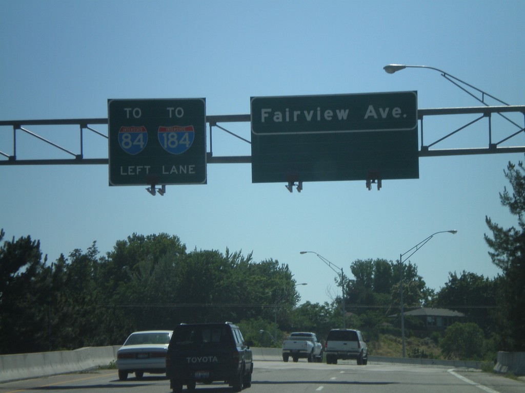
Fairview Ave. west approaching I-184
Fairview Ave. west approaching I-184 onramp.
Taken 06-29-2009
Boise
Ada County
Idaho
United States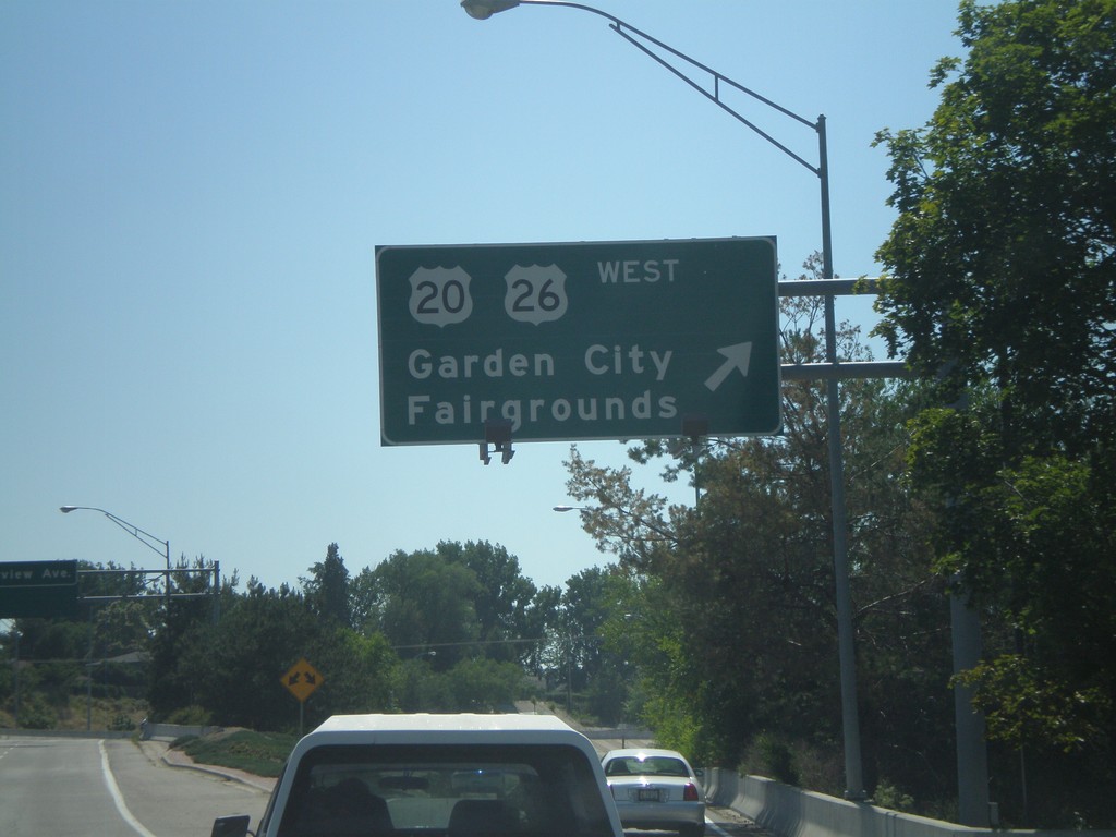
Main St. West at US-20/US-26 West
Main St. west at US-20/US-26 junction to Garden City and Fairgrounds.
Taken 06-29-2009

 Boise
Ada County
Idaho
United States
Boise
Ada County
Idaho
United States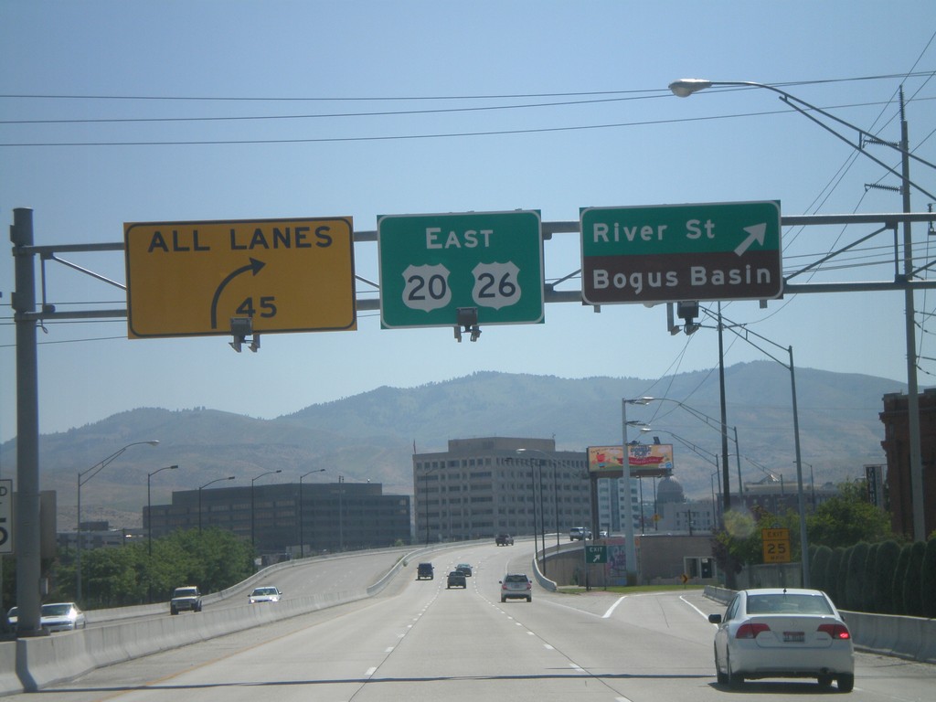
US-20/US-26 East at River St.
US-20/US-26 east at River St./Bogus Basin exit. This is the last exit eastbound on the Boise Connector.
Taken 06-28-2009
Boise
Ada County
Idaho
United States