Signs Tagged With Interchange
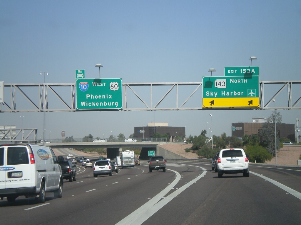
I-10 West - Exit 153A
I-10 west at Exit 153A - AZ-143 North/Sky Harbor Airport. Continue west for I-10/US-60 West/Phoenix/Wickenburg (via US-60).
Taken 03-23-2009


 Tempe
Maricopa County
Arizona
United States
Tempe
Maricopa County
Arizona
United States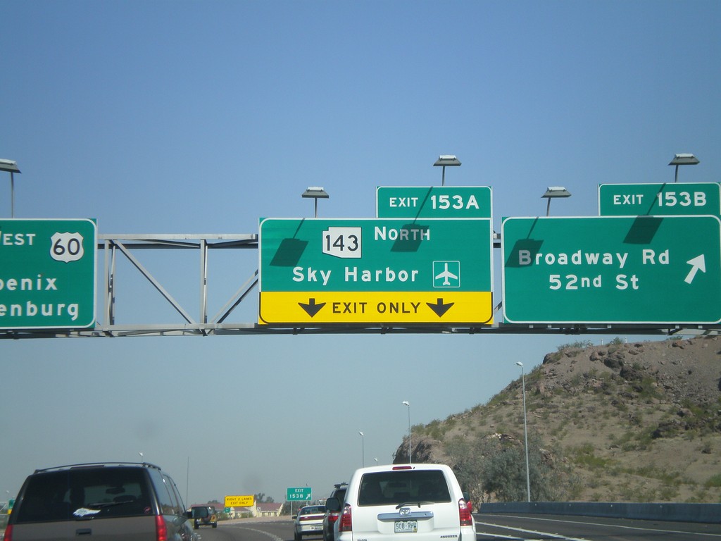
I-10 West - Exit 153B and Exit 153A
I-10 west at Exit 153B - Broadway Road/52nd St. Approaching Exit 153A - AZ-143 North/Sky Harbor Airport.
Taken 03-23-2009
Tempe
Maricopa County
Arizona
United States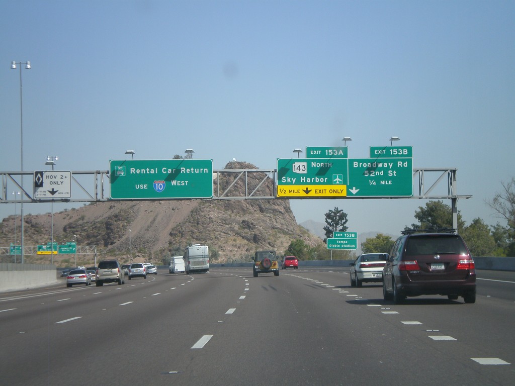
I-10 West - Exit 153A and Exit 153B
I-10 west approaching Exit 153B - Broadway Rd./52nd St. and Exit 153A - AZ-143 North/Sky Harbor Airport. Use I-10 west for Rental Car Returns.
Taken 03-23-2009
Tempe
Maricopa County
Arizona
United States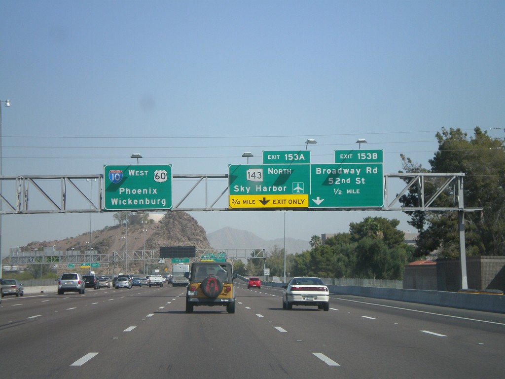
I-10 West Approaching Exit 153A and Exit 153B
I-10 west approaching Exit 153B - Broadway Road/52nd St. Approaching Exit 153A - AZ-143 North/Sky Harbor Airport. Overhead for I-10/US-60 West/Phoenix/Wickenburg (via US-60).
Taken 03-23-2009
Tempe
Maricopa County
Arizona
United States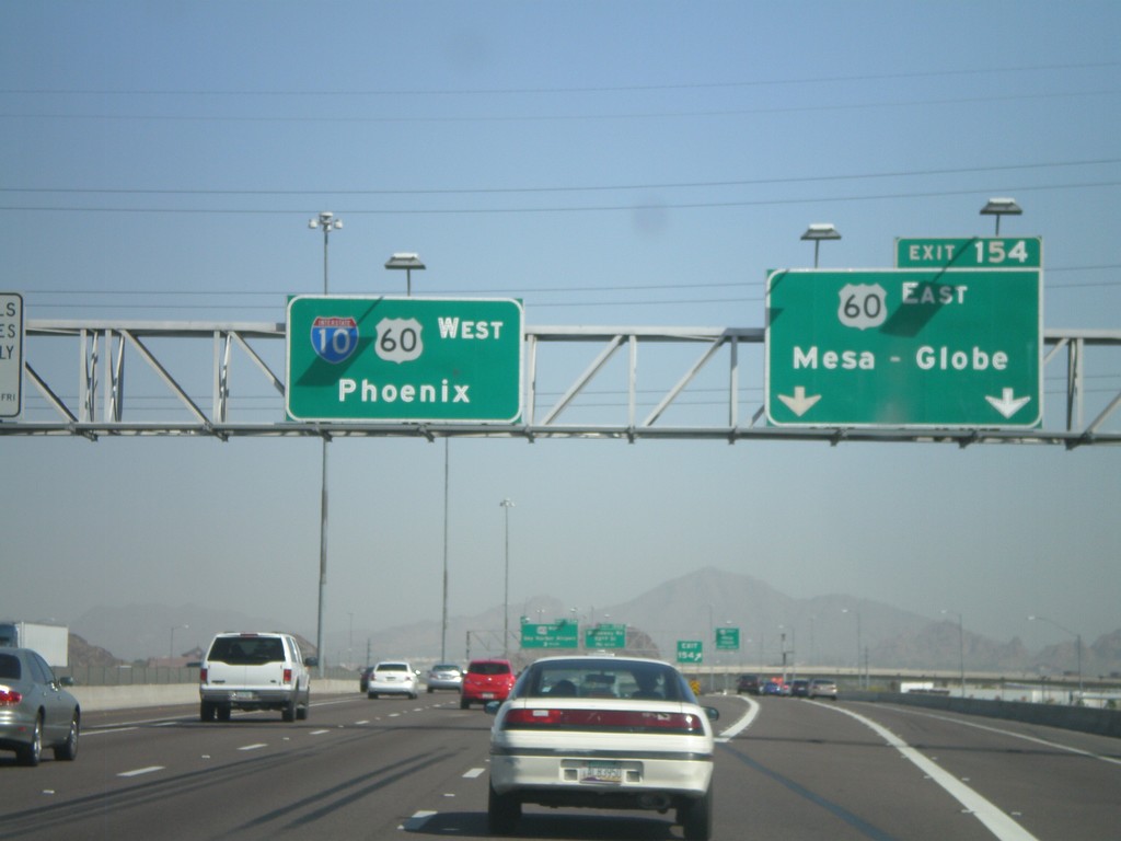
I-10 West - Exit 154
I-10 west at Exit 154 - US-60 East/Mesa-Globe. Sign for I-10/US-60 West/Phoenix. US-60 joins I-10 west through downtown Phoenix.
Taken 03-23-2009
Guadalupe
Maricopa County
Arizona
United States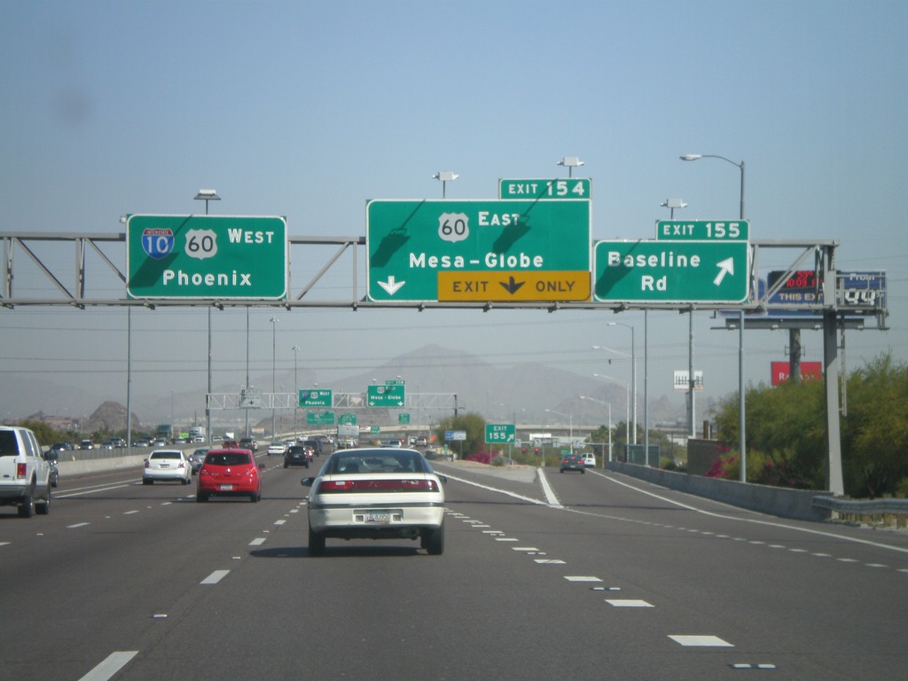
I-10 West - Exit 155 and Exit 154
I-10 west at Exit 155 - Baseline Road. Approaching Exit 154 - US-60 East/Mesa-Globe. Sign for I-10/US-60 West/Phoenix.
Taken 03-23-2009
Guadalupe
Maricopa County
Arizona
United States
I-10 West - Exit 157
I-10 west at Exit 157 - Elliot Road/Guadalupe
Taken 03-23-2009
Phoenix
Maricopa County
Arizona
United States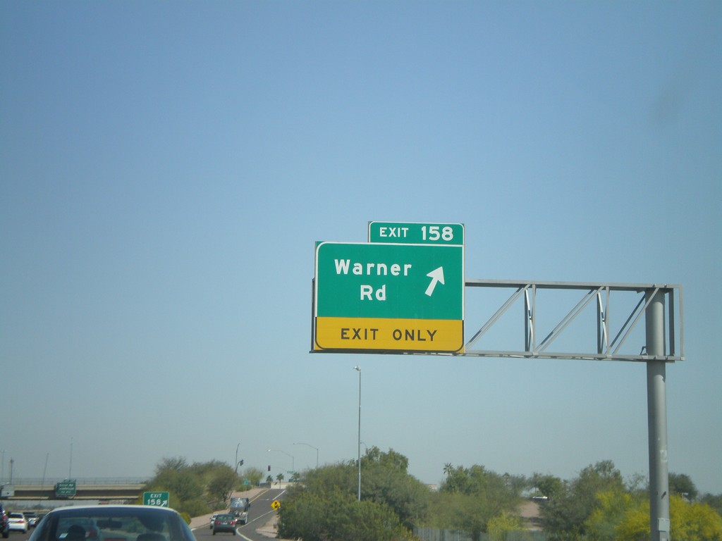
I-10 West - Exit 158
I-10 west at Exit 158 - Warner Road
Taken 03-23-2009
Phoenix
Maricopa County
Arizona
United States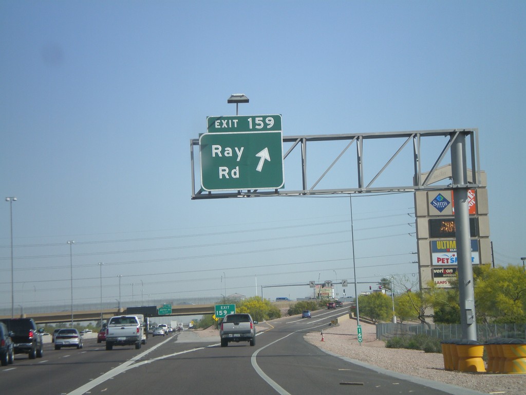
I-10 West - Exit 159
I-10 west at Exit 159 - Ray Road
Taken 03-23-2009
Chandler
Maricopa County
Arizona
United States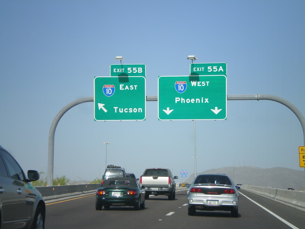
AZ-202 West - Exit 55AB
AZ-202 West Exit 55 Offramp at Exit 55B - I-10 East/Tucson and Exit 55A - I-10 West/Phoenix.
Taken 03-23-2009
 Chandler
Maricopa County
Arizona
United States
Chandler
Maricopa County
Arizona
United States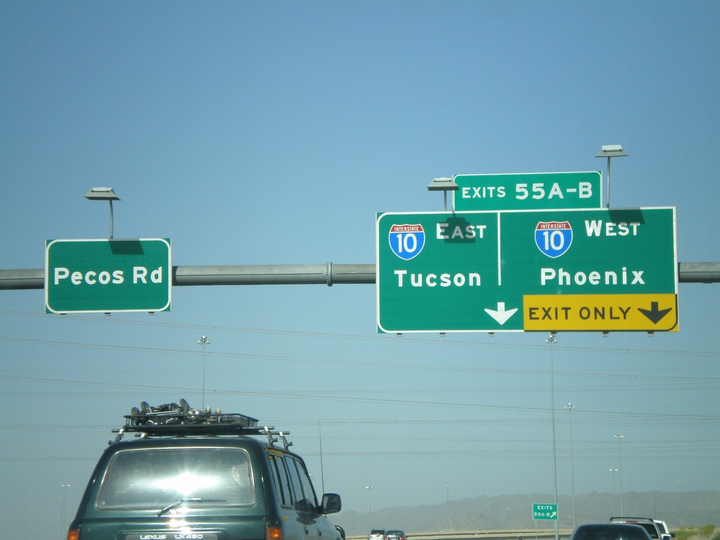
End AZ-202 West at I-10
End AZ-202 Loop west at I-10 - Exit 55AB - Tucson/Phoenix. Continue straight for Pecos Road.
Taken 03-23-2009
Chandler
Maricopa County
Arizona
United States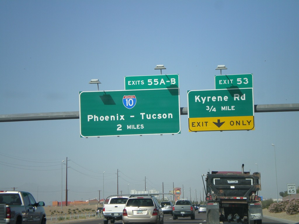
AZ-202 Loop West Approaching Exit 53 and Exit 55AB
AZ-202 Loop west approaching Exit 53 - Kyrene Road. Approaching 55AB - I-10/Phoenix-Tucson.
Taken 03-23-2009
Chandler
Maricopa County
Arizona
United States
End AZ-101 Loop at AZ-202 Loop
End AZ-101 Loop at AZ-202 Loop.
Taken 03-23-2009
 Chandler
Maricopa County
Arizona
United States
Chandler
Maricopa County
Arizona
United States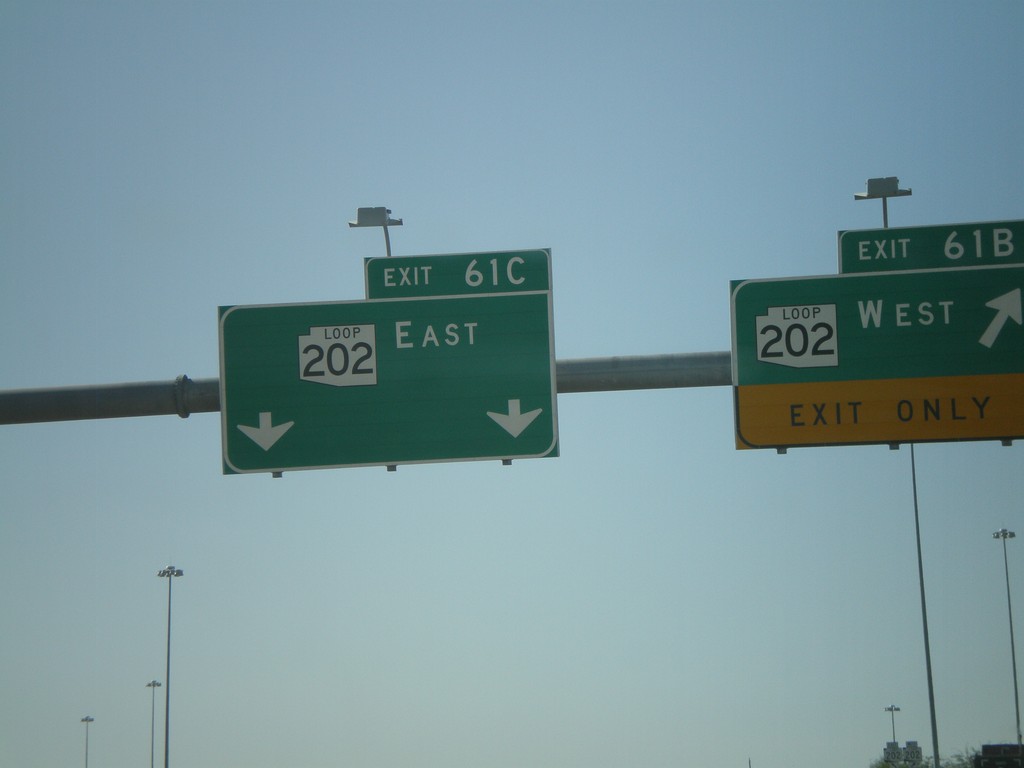
AZ-101 Loop South - Exit 61BC
AZ-101 Loop south at Exit 61B - AZ-202 Loop West and Exit 61C - AZ-202 Loop East. This is the southern end of AZ-101 Loop.
Taken 03-23-2009
Chandler
Maricopa County
Arizona
United States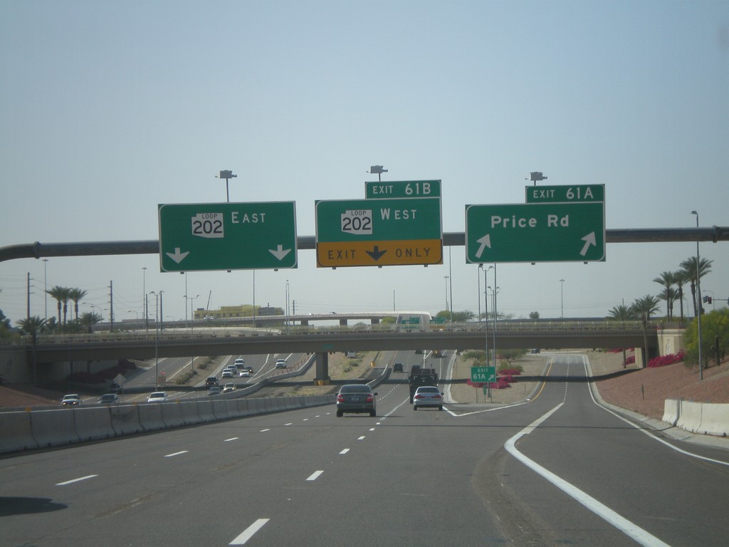
AZ-101 Loop South - Exit 61 AB
AZ-101 Loop south at Exit 61A - Price Road. Approaching Exit 61B - AZ-202 Loop West and Exit 61C - AZ-202 Loop East.
Taken 03-23-2009
Chandler
Maricopa County
Arizona
United States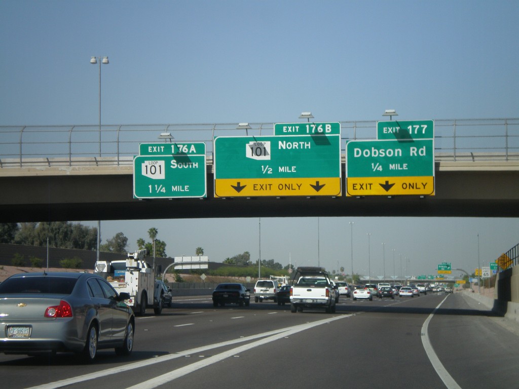
US-60 West Approaching Exit 177 and Exit 176AB
US-60 west approaching Exit 177 - Dobson Road. Approaching Exit 176B - AZ-101 Loop North and Exit 176A - AZ-101 Loop South.
Taken 03-23-2009
Mesa
Maricopa County
Arizona
United States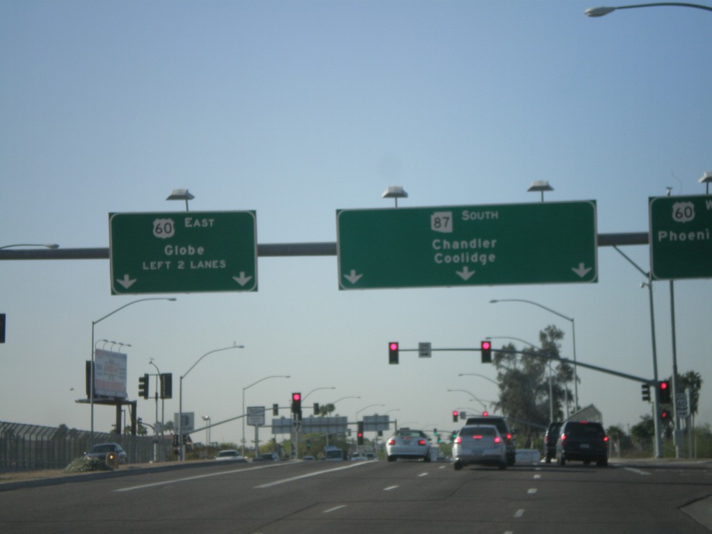
AZ-87 South at US-60
AZ-87 South (Country Club Dr) at US-60 west to Phoenix and east to Globe. Continue south on AZ-87 to Chandler and Coolidge.
Taken 03-23-2009
 Mesa
Maricopa County
Arizona
United States
Mesa
Maricopa County
Arizona
United States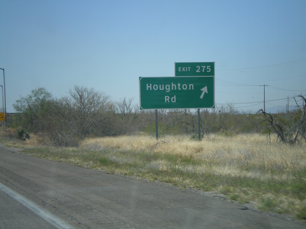
I-10 West - Exit 275
I-10 west at Exit 275 - Houghton Road
Taken 03-22-2009
Vail
Pima County
Arizona
United States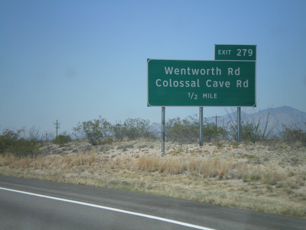
I-10 West Approaching Exit 279
I-10 west approaching Exit 279 - Wentworth Road/Colossal Cave Road.
Taken 03-22-2009
Vail
Pima County
Arizona
United States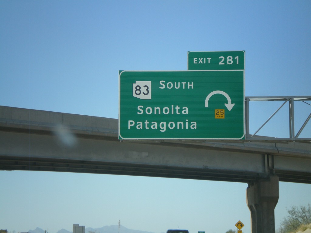
I-10 West - Exit 281
I-10 west at Exit 281 - AZ-83 South/Sonoita/Patagonia
Taken 03-22-2009
 Vail
Pima County
Arizona
United States
Vail
Pima County
Arizona
United States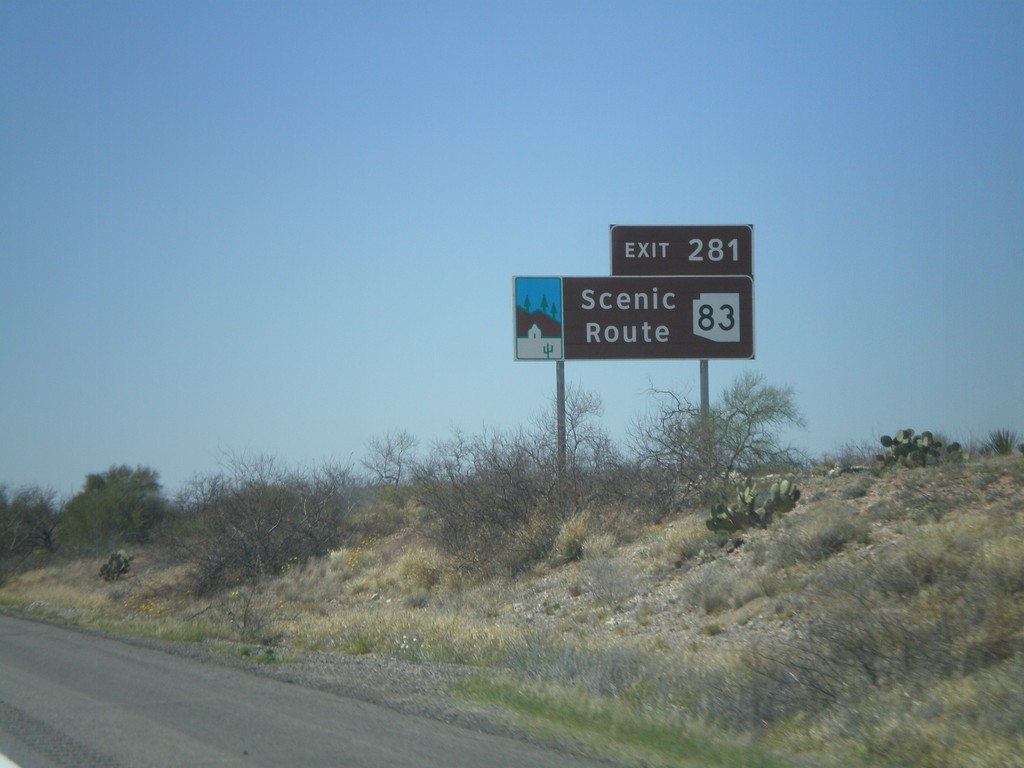
I-10 West Approaching Exit 281
I-10 west approaching Exit 281. AZ-83 is an Arizona Scenic Route.
Taken 03-22-2009
Vail
Pima County
Arizona
United States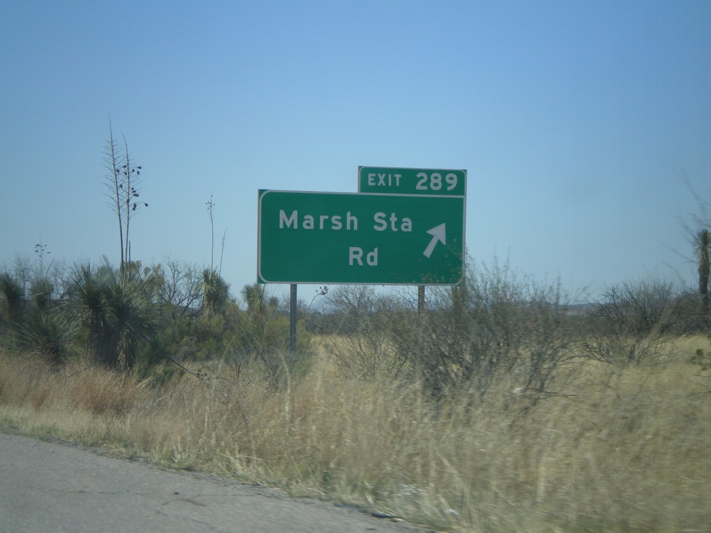
I-10 West - Exit 289
I-10 west at Exit 289 - Marsh Station Road.
Taken 03-22-2009
Vail
Pima County
Arizona
United States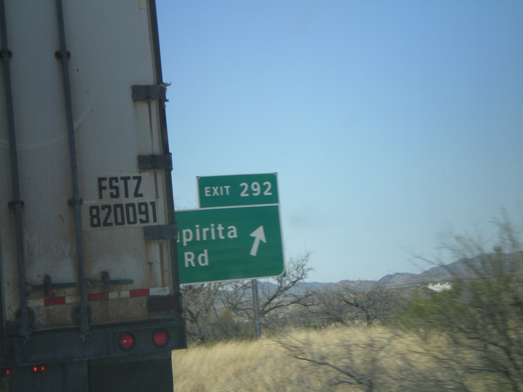
I-10 West - Exit 292
I-10 west at Exit 292 - Empirita Road.
Taken 03-22-2009
Pimaco Two
Pima County
Arizona
United States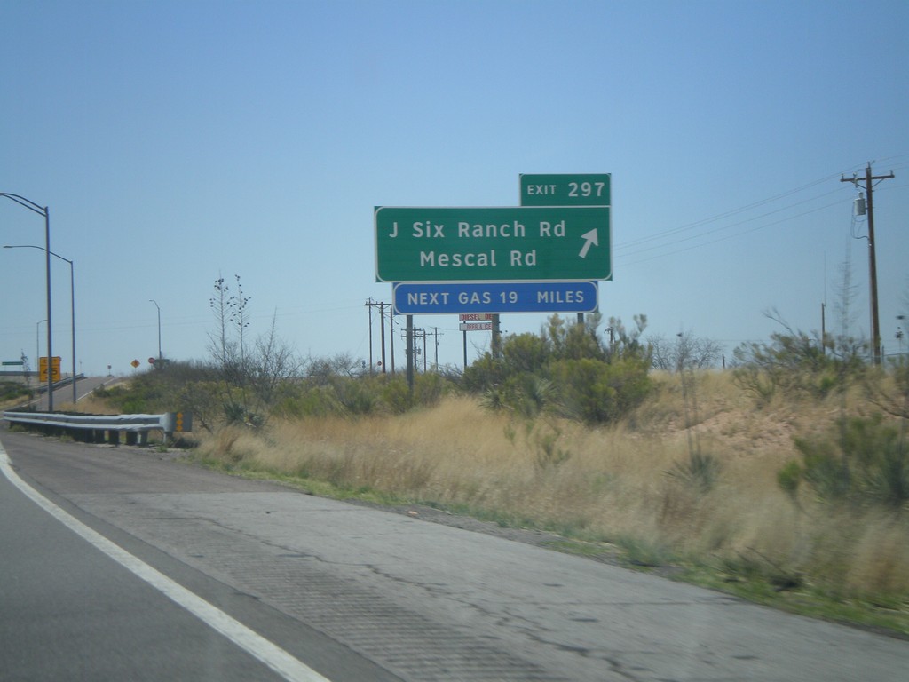
I-10 West - Exit 297
I-10 west at Exit 297 - J Six Ranch Road/Mescal Road
Taken 03-22-2009
Benson
Cochise County
Arizona
United States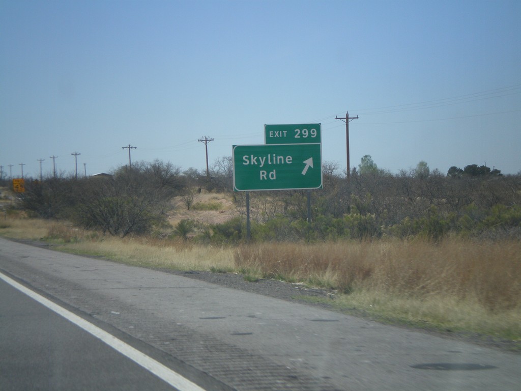
I-10 West - Exit 299
I-10 west at Exit 299 - Skyline Road.
Taken 03-22-2009
Benson
Cochise County
Arizona
United States