Signs Tagged With Interchange
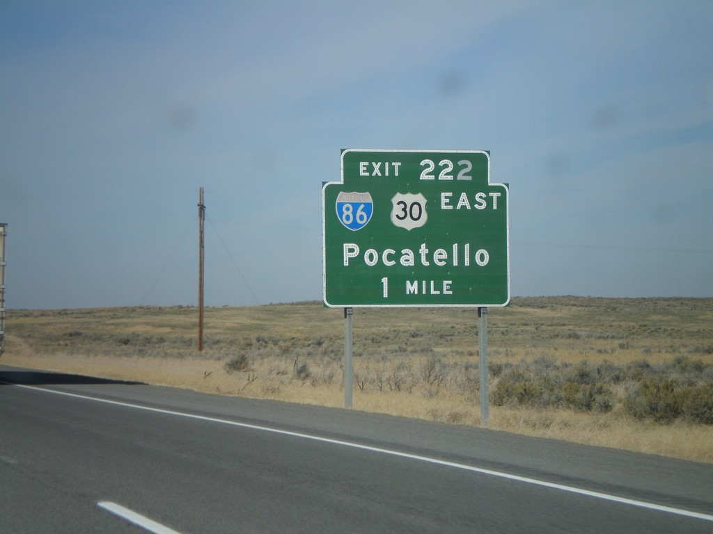
I-84 West Approaching Exit 222
I-84 west approaching Exit 222 - I-86/US-30 East/Pocatello.
Taken 10-26-2008


 Declo
Cassia County
Idaho
United States
Declo
Cassia County
Idaho
United States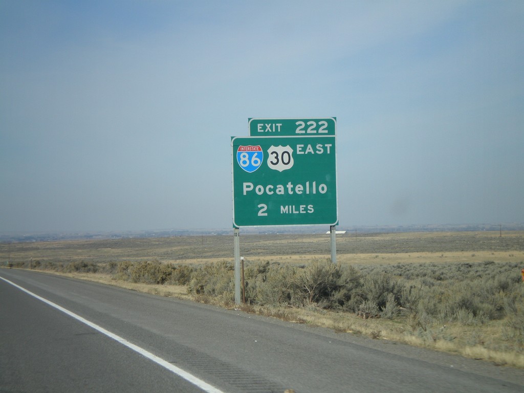
I-84 West Approaching Exit 222
I-84 west approaching Exit 222 - I-86/US-30 East/Pocatello.
Taken 10-26-2008
Declo
Cassia County
Idaho
United States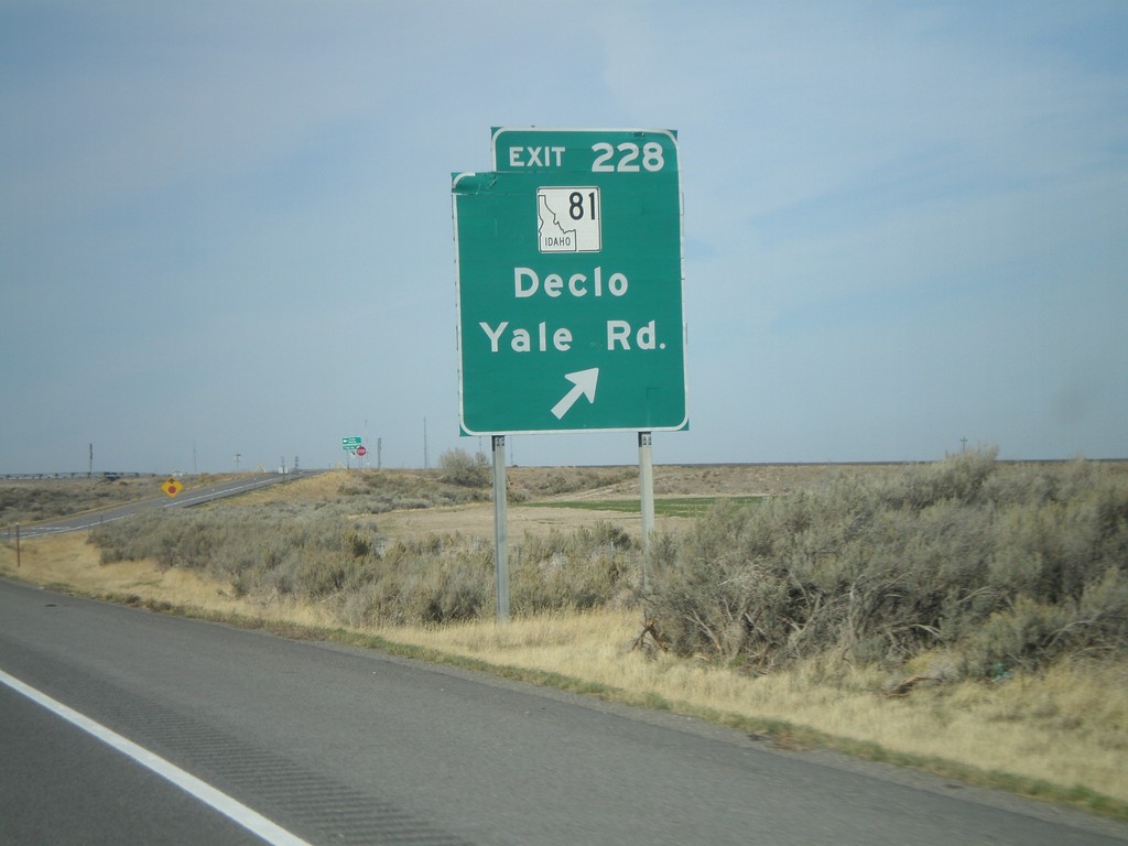
I-84 West - Exit 228
I-84 west at Exit 228 - ID-81/Declo/Yale Road.
Taken 10-26-2008
 Cotterel
Cassia County
Idaho
United States
Cotterel
Cassia County
Idaho
United States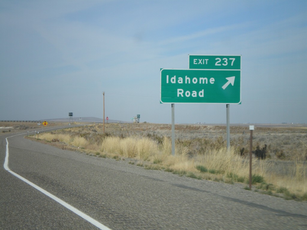
I-84 West - Exit 237
I-84 west at Exit 237 - Idahome Road.
Taken 10-26-2008
Declo
Cassia County
Idaho
United States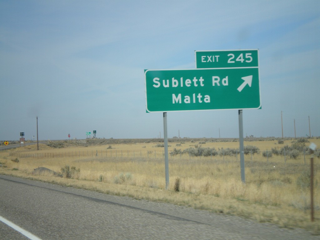
I-84 West - Exit 245
I-84 west at Exit 245 - Sublett Road/Malta.
Taken 10-26-2008
Sublett
Cassia County
Idaho
United States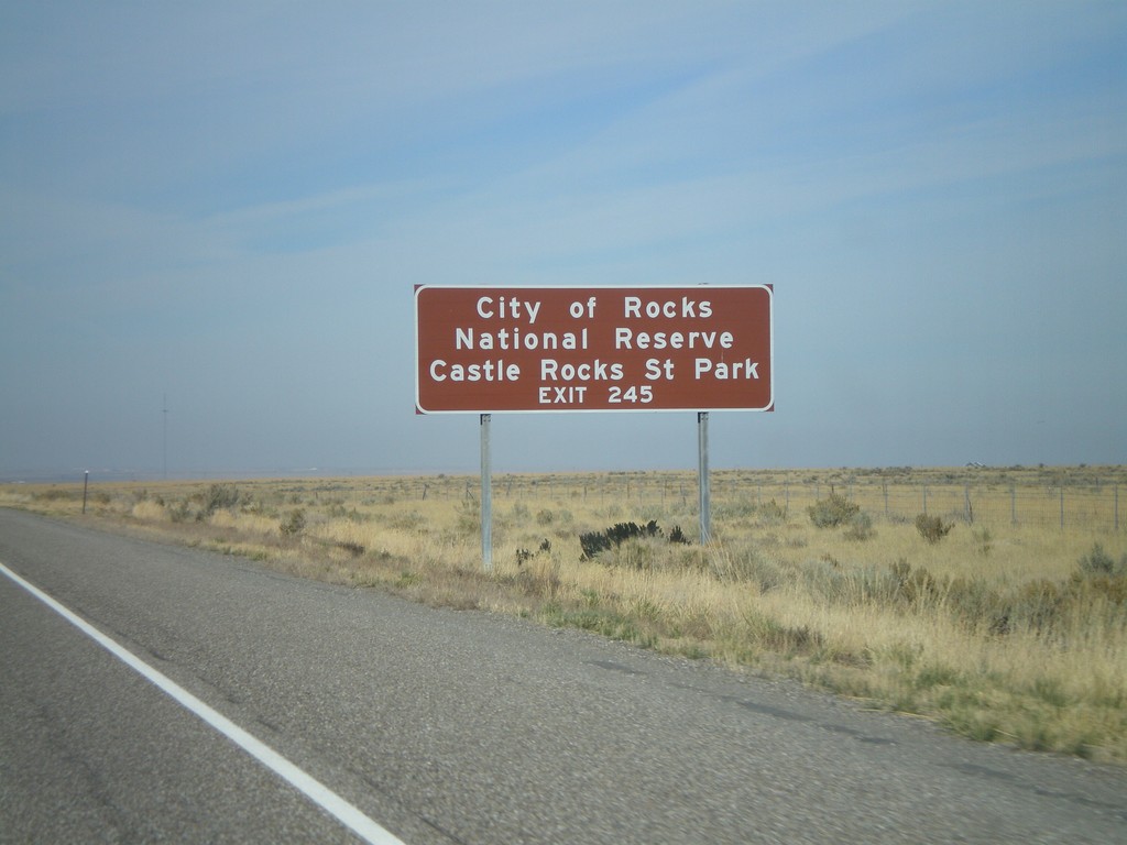
I-84 West - City of Rocks
I-84 west approaching Exit 245. Use Exit 245 for Castle Rock State Park and City of Rocks National Preserve.
Taken 10-26-2008
Malta
Cassia County
Idaho
United States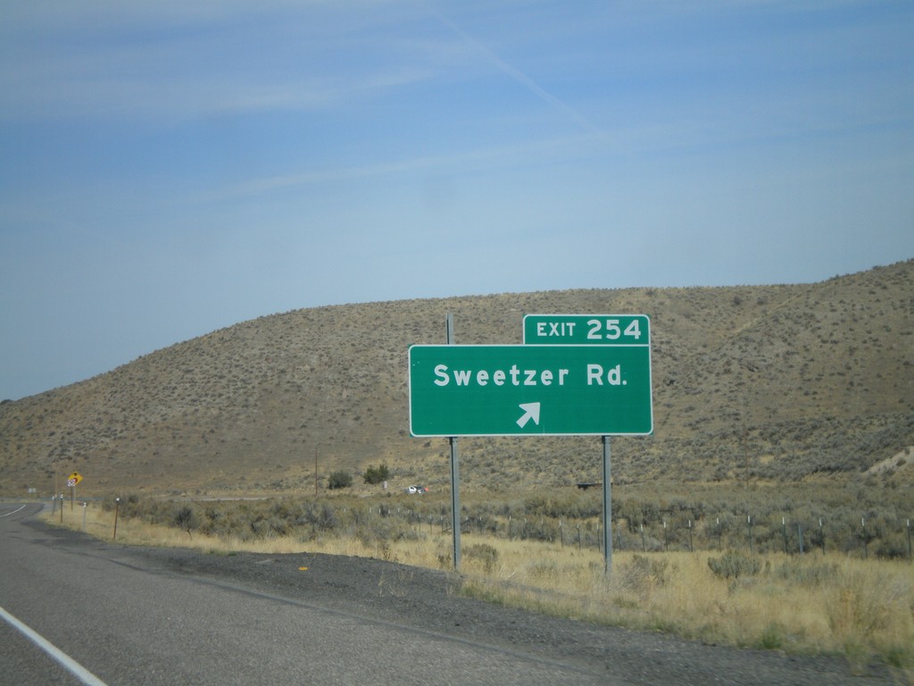
I-84 West - Exit 254
I-84 west at Exit 254 - Sweetzer Road.
Taken 10-26-2008
Sublett
Cassia County
Idaho
United States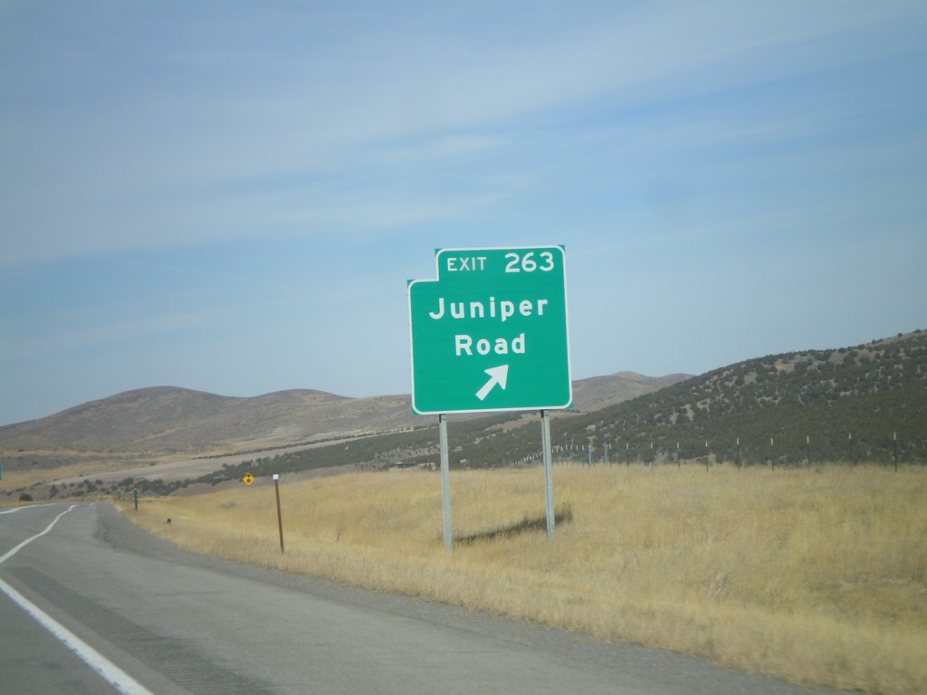
I-84 West - Exit 263
I-84 west at Exit 263 - Juniper Road.
Taken 10-26-2008
Juniper
Oneida County
Idaho
United States
UT-102 West at I-84
UT-102 west at I-84 onramp for Exit 40.
Taken 10-26-2008
 Tremonton
Box Elder County
Utah
United States
Tremonton
Box Elder County
Utah
United States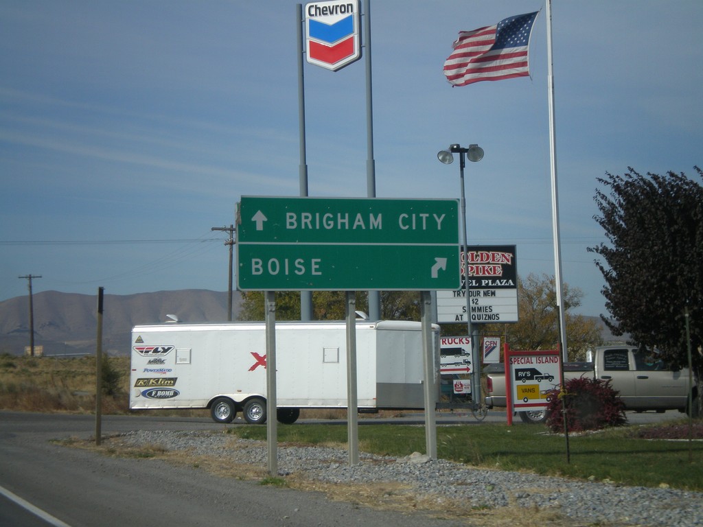
UT-102 West at I-84 Onramps
UT-102 west approaching I-84 (Exit 40). Use I-84 west for Boise. Use I-84 east for Brigham City.
Taken 10-26-2008
Tremonton
Box Elder County
Utah
United States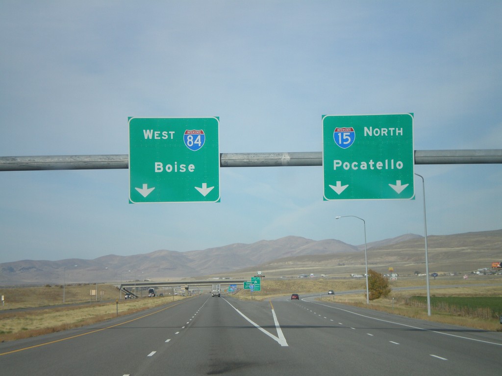
I-15 North - Exit 379
I-15 North/I-84 West Split (Exit 379) in Tremonton. Use I-15 north for Pocatello (Idaho); I-84 west for Boise (Idaho).
Taken 10-26-2008
 Tremonton
Box Elder County
Utah
United States
Tremonton
Box Elder County
Utah
United States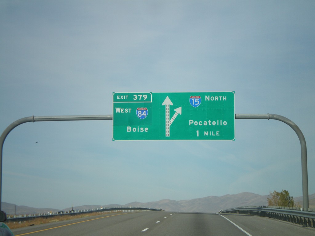
I-15 North - Exit 379
I-15 North/I-84 West approaching Exit 379 - I-84 West/Boise (Idaho). Continue north on I-15 for Pocatello (Idaho).
Taken 10-26-2008
Tremonton
Box Elder County
Utah
United States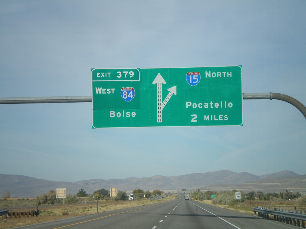
I-15 North - Exit 379
I-15 North/I-84 West approaching Exit 379 - I-84 West/Boise (Idaho). Continue north on I-15 for Pocatello (Idaho).
Taken 10-26-2008
Elwood
Box Elder County
Utah
United States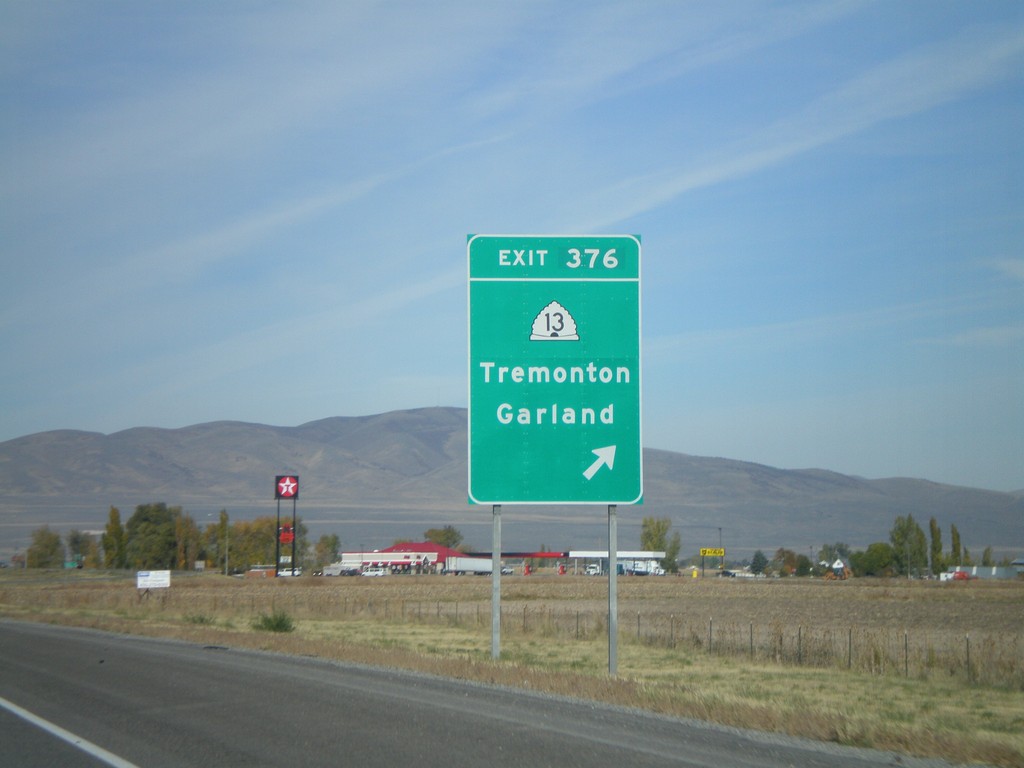
I-15 North - Exit 376
I-15 north at Exit 376 - UT-13/Tremonton/Garland
Taken 10-26-2008
 Elwood
Box Elder County
Utah
United States
Elwood
Box Elder County
Utah
United States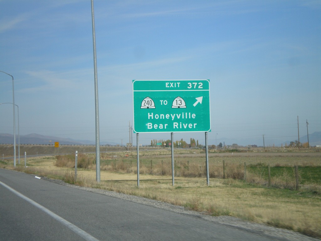
I-15 North - Exit 372
I-15 north at Exit 372 - UT-240/To UT-13/Honeyville/Bear River.
Taken 10-26-2008
 Honeyville
Box Elder County
Utah
United States
Honeyville
Box Elder County
Utah
United States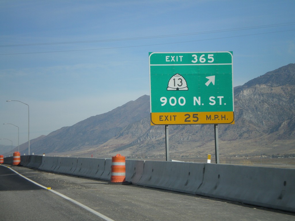
I-15 North - Exit 365
I-15 north at Exit 365 - UT-13/900 North St.
Taken 10-26-2008
Brigham City
Box Elder County
Utah
United States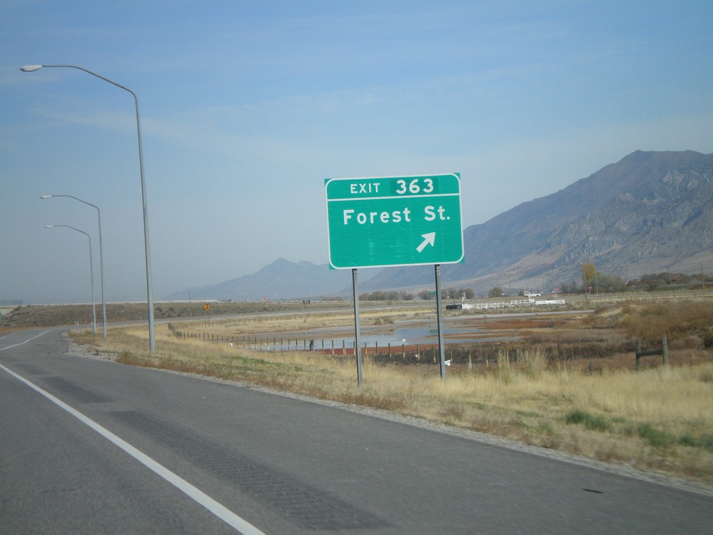
I-15 North - Exit 363
I-15 North at Exit 363 - Forest St.
Taken 10-26-2008
Brigham City
Box Elder County
Utah
United States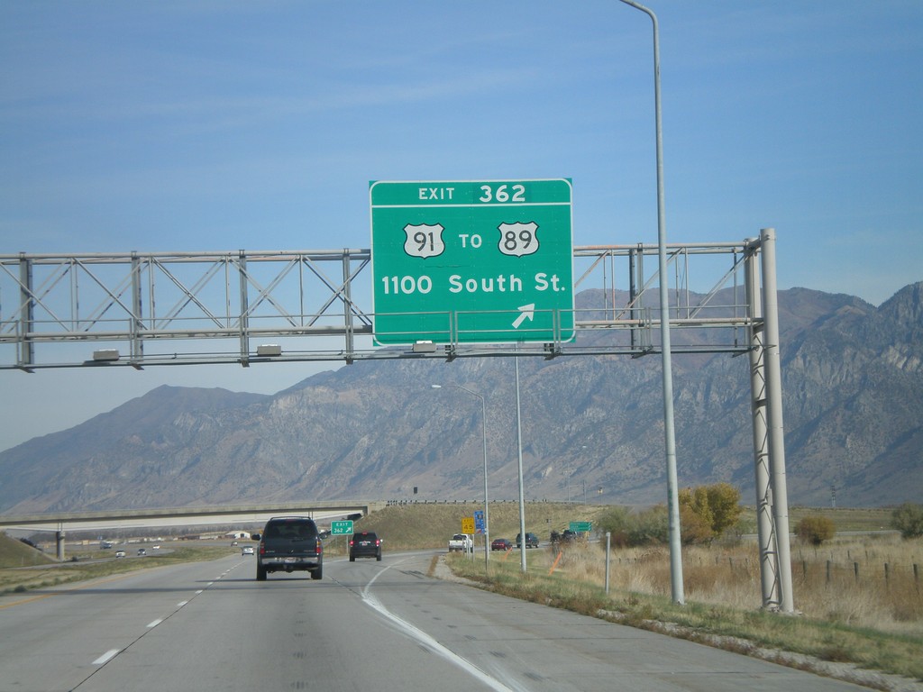
I-15 North - Exit 362
I-15 north at Exit 362 - US-91/To US-89/1100 South St.
Taken 10-26-2008

 Perry
Box Elder County
Utah
United States
Perry
Box Elder County
Utah
United States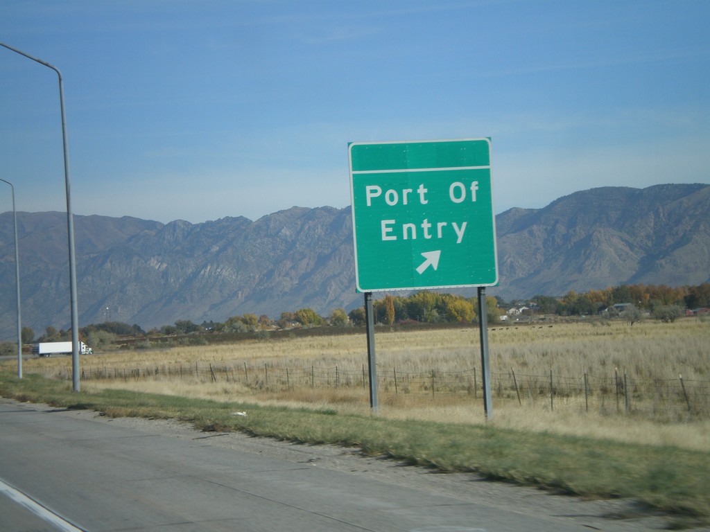
I-15 North at Port of Entry
I-15 North at (Willard) Port of Entry.
Taken 10-26-2008
Perry
Box Elder County
Utah
United States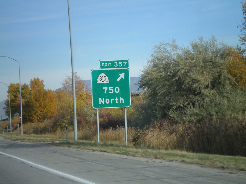
I-15 North - Exit 357
I-15 north at Exit 357 - UT-315/750 North
Taken 10-26-2008
 Willard
Box Elder County
Utah
United States
Willard
Box Elder County
Utah
United States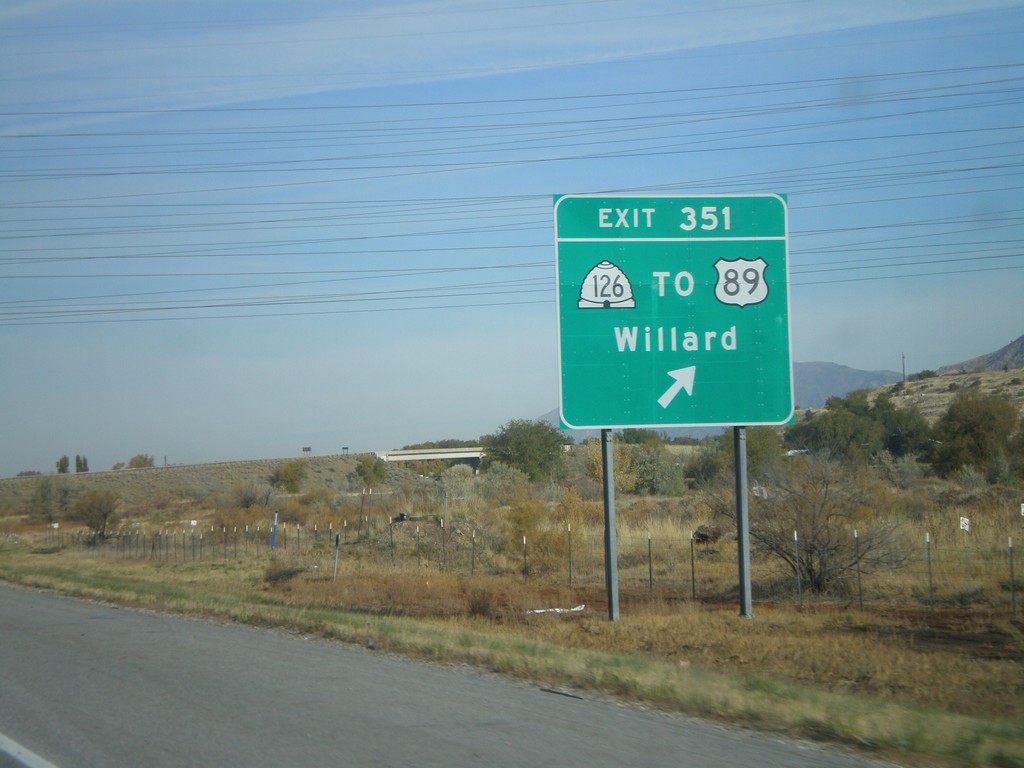
I-15 North - Exit 351
I-15 north at Exit 351 - UT-126/To US-89/Willard
Taken 10-26-2008
 South Willard
Box Elder County
Utah
United States
South Willard
Box Elder County
Utah
United States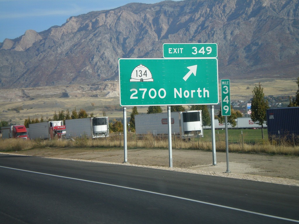
I-15 North - Exit 349
I-15 north at Exit 349 - UT-134/2700 North.
Taken 10-26-2008
 Farr West
Weber County
Utah
United States
Farr West
Weber County
Utah
United States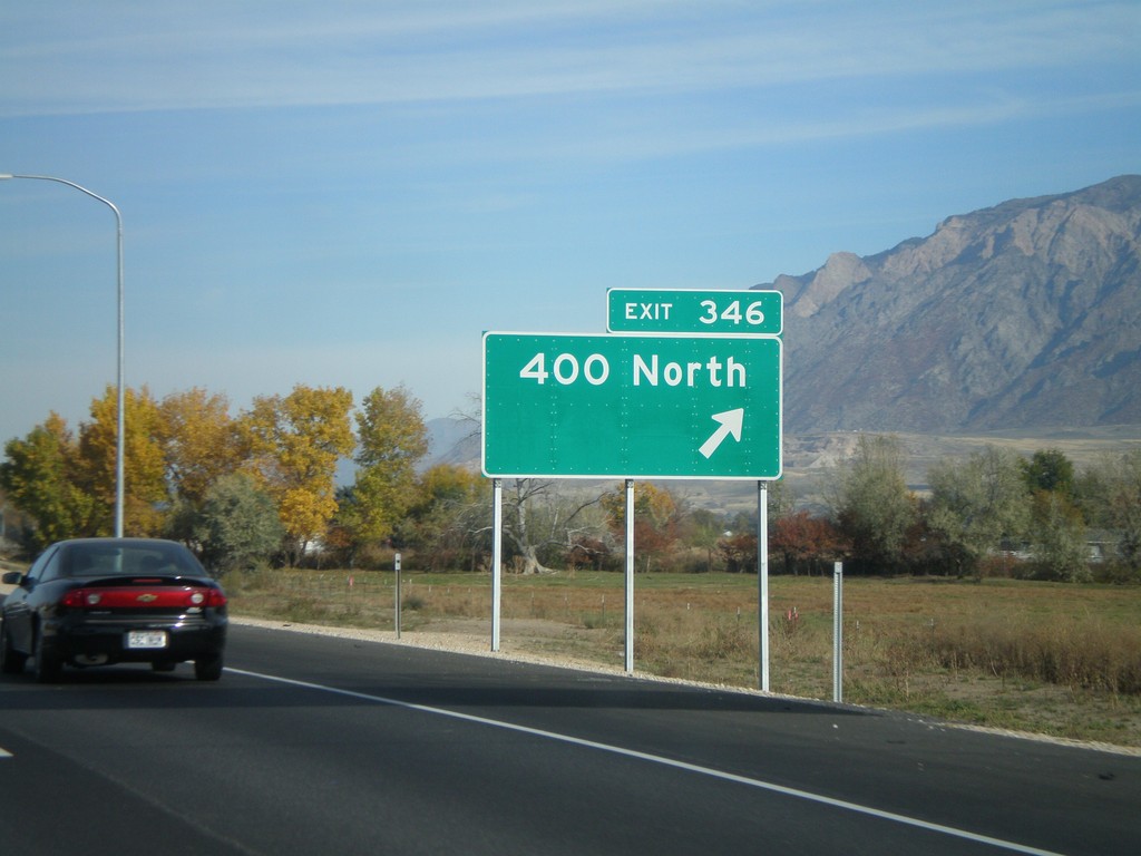
I-15 North - Exit 346
I-15 North at Exit 346 - 400 North.
Taken 10-26-2008
Ogden
Weber County
Utah
United States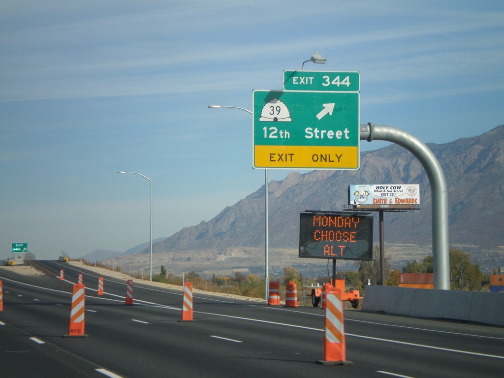
I-15 North - Exit 344
I-15 North at Exit 344 - UT-39/12th St.
Taken 10-26-2008
 Marriott-Slaterville
Weber County
Utah
United States
Marriott-Slaterville
Weber County
Utah
United States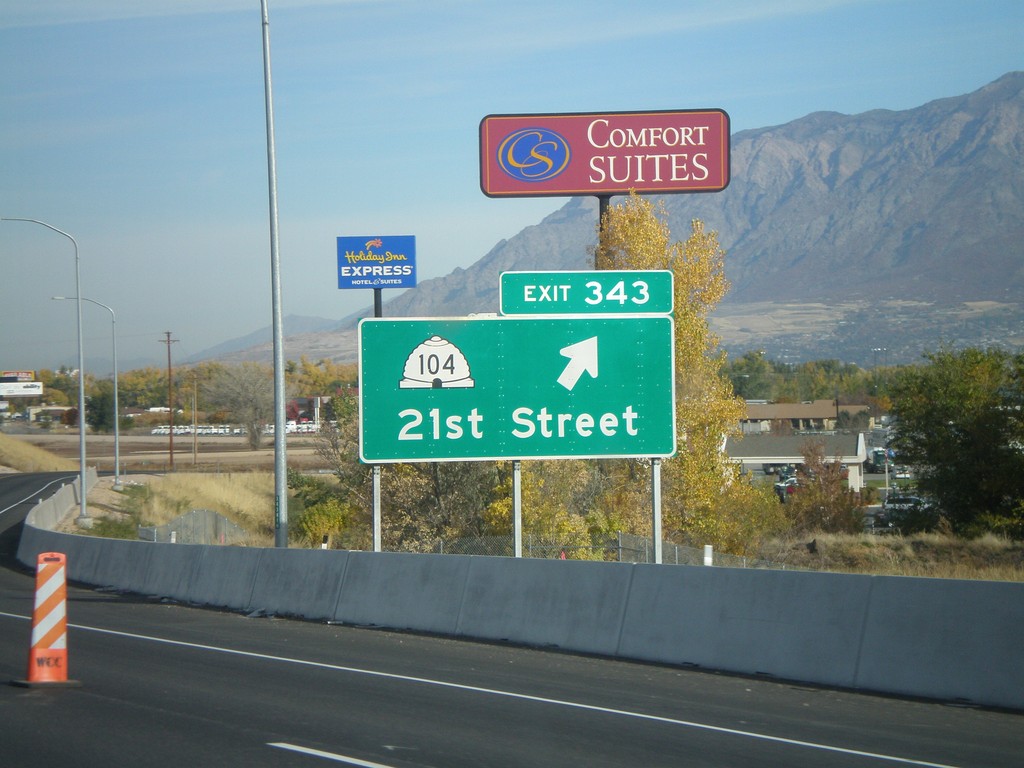
I-15 North - Exit 343
I-15 north at Exit 343 - UT-104/21st St.
Taken 10-26-2008
 Ogden
Weber County
Utah
United States
Ogden
Weber County
Utah
United States