Signs Tagged With Interchange
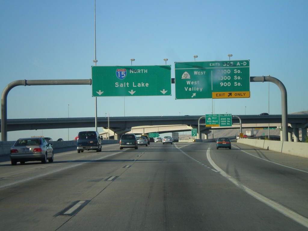
I-15 North - Exit 305 A-D
I-15 north at Exit 305 A-D - UT-201 West/West Valley and 2100 South/1300 South/900 South. Continue north on I-15 to Salt Lake.
Taken 10-25-2008

 South Salt Lake
Salt Lake County
Utah
United States
South Salt Lake
Salt Lake County
Utah
United States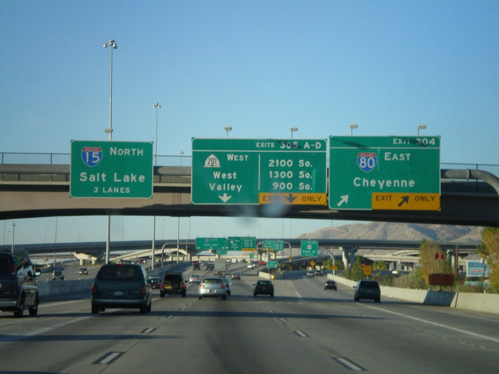
I-15 North - Exit 304 and Exit 305AD
I-15 north at Exit 304 - I-80 East/Cheyenne. Approaching Exits 305A-D - UT-201 West/West Valley and 2100 South/1300 South/900 South. I-80 west joins I-15 north through Salt Lake City. Use left three lanes for I-15 north to Salt Lake.
Taken 10-25-2008
 South Salt Lake
Salt Lake County
Utah
United States
South Salt Lake
Salt Lake County
Utah
United States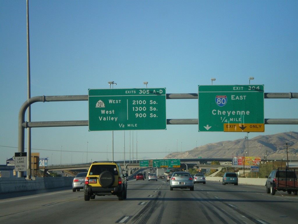
I-15 North - Approaching Exit 304 and Exit 305AD
I-15 north approaching Exit 304 - I-84 East/Cheyenne. Approaching Exit 305 A-D - UT-201 West/West Valley and 2100 South/1300 South/900 South.
Taken 10-25-2008
South Salt Lake
Salt Lake County
Utah
United States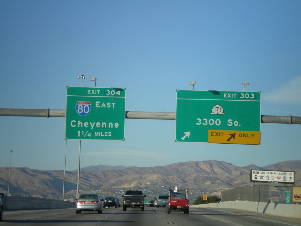
I-15 North - Exit 303 and Exit 304
I-15 north at Exit 303 - UT-171/3300 South. Approaching Exit 304 - I-80 East/Cheyenne.
Taken 10-25-2008
 South Salt Lake
Salt Lake County
Utah
United States
South Salt Lake
Salt Lake County
Utah
United States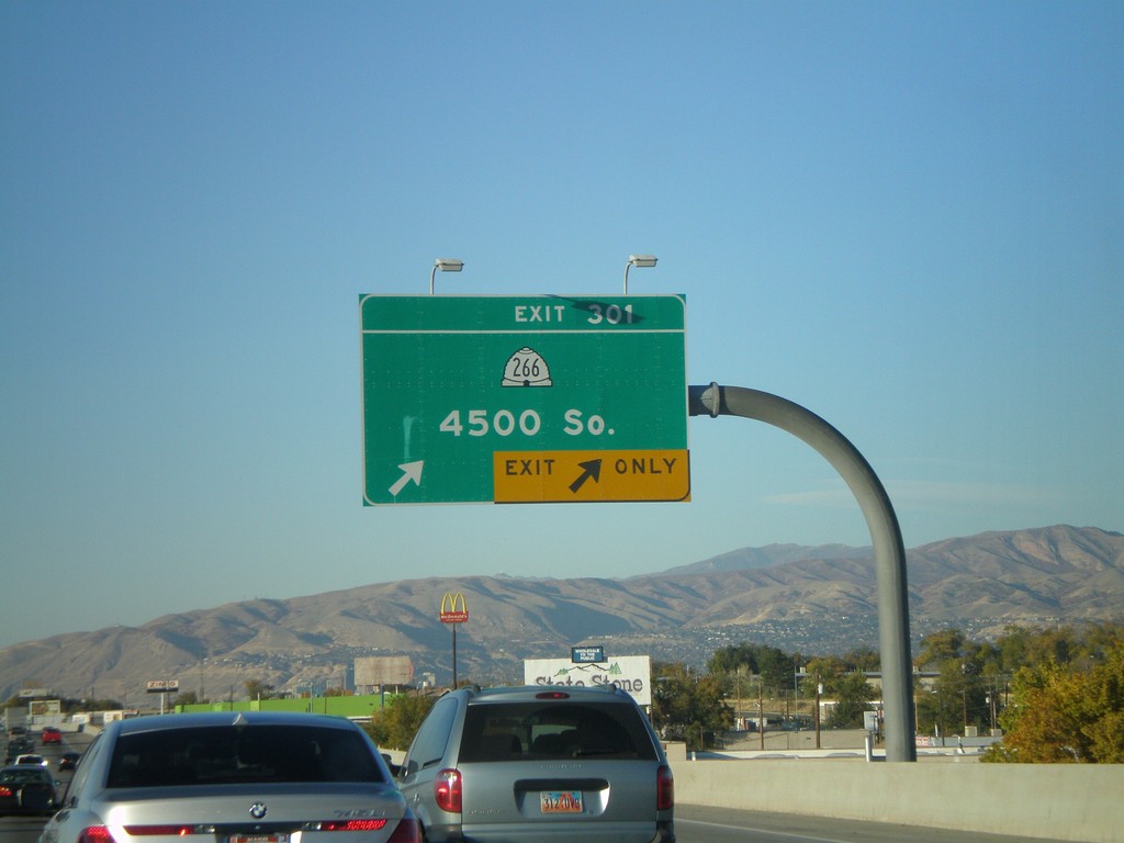
I-15 North - Exit 301
I-15 north at Exit 301 - UT-266/4500 South.
Taken 10-25-2008
 Salt Lake City
Salt Lake County
Utah
United States
Salt Lake City
Salt Lake County
Utah
United States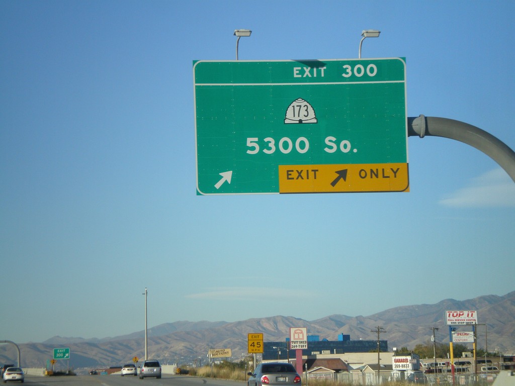
I-15 North - Exit 300
I-15 north at Exit 300 - UT-173/5300 South.
Taken 10-25-2008
 Murray
Salt Lake County
Utah
United States
Murray
Salt Lake County
Utah
United States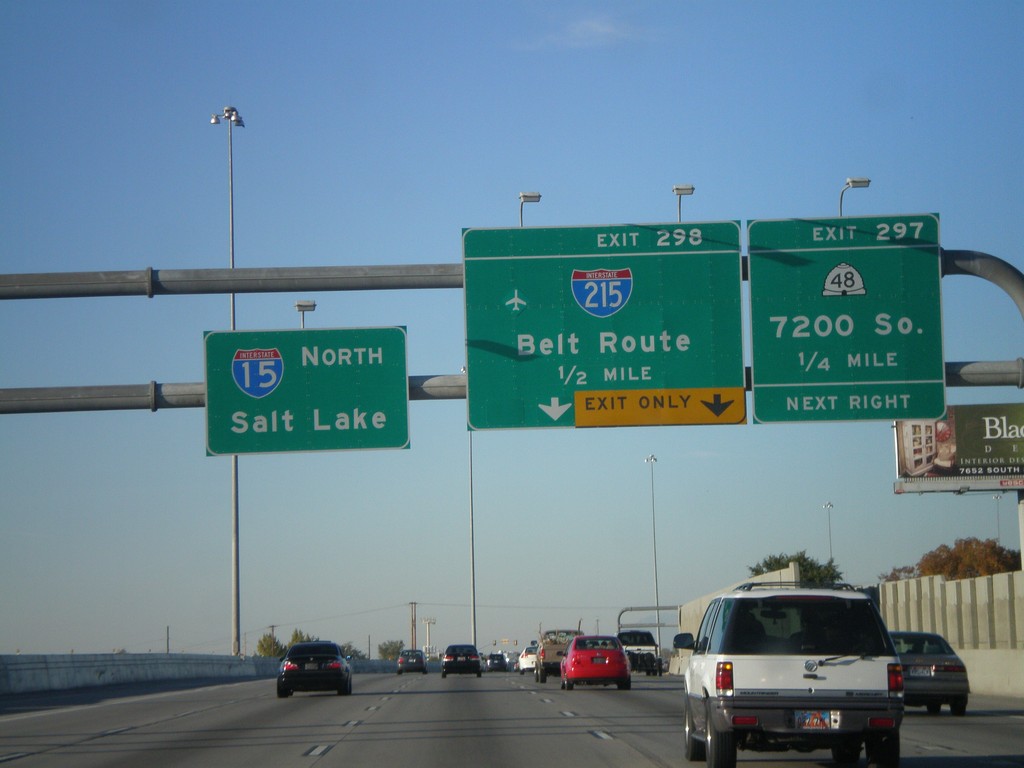
I-15 North - Exit 297 and Exit 298
I-15 north approaching Exit 297 - UT-48/7200 South. Approaching Exit 298 - I-215/Belt Route. Continue north on I-15 for Salt Lake.
Taken 10-25-2008

 Midvale
Salt Lake County
Utah
United States
Midvale
Salt Lake County
Utah
United States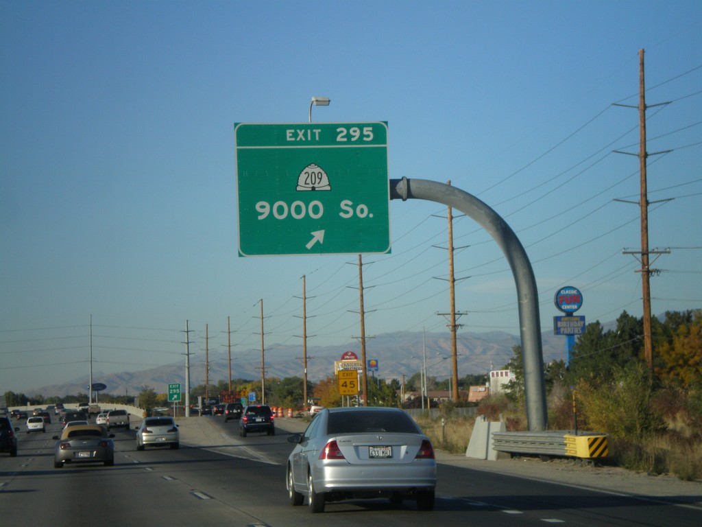
I-15 North - Exit 295
I-15 north at Exit 295 - UT-209/9000 South.
Taken 10-25-2008
 Sandy
Salt Lake County
Utah
United States
Sandy
Salt Lake County
Utah
United States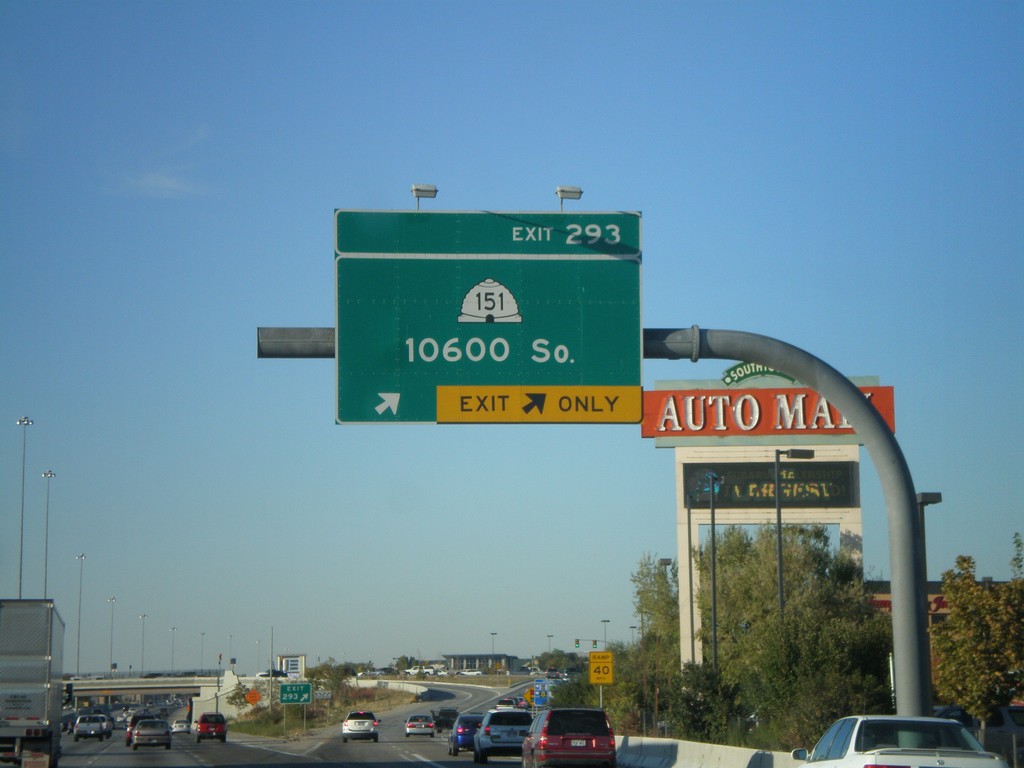
I-15 North - Exit 293
I-15 north at Exit 293 - UT-151/10600 South.
Taken 10-25-2008
 Sandy
Salt Lake County
Utah
United States
Sandy
Salt Lake County
Utah
United States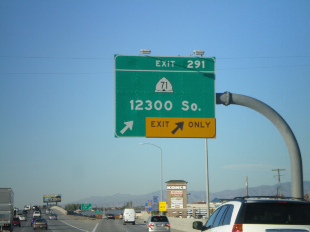
I-15 North - Exit 291
I-15 north at Exit 291 - UT-71/12300 South.
Taken 10-25-2008
 Draper
Salt Lake County
Utah
United States
Draper
Salt Lake County
Utah
United States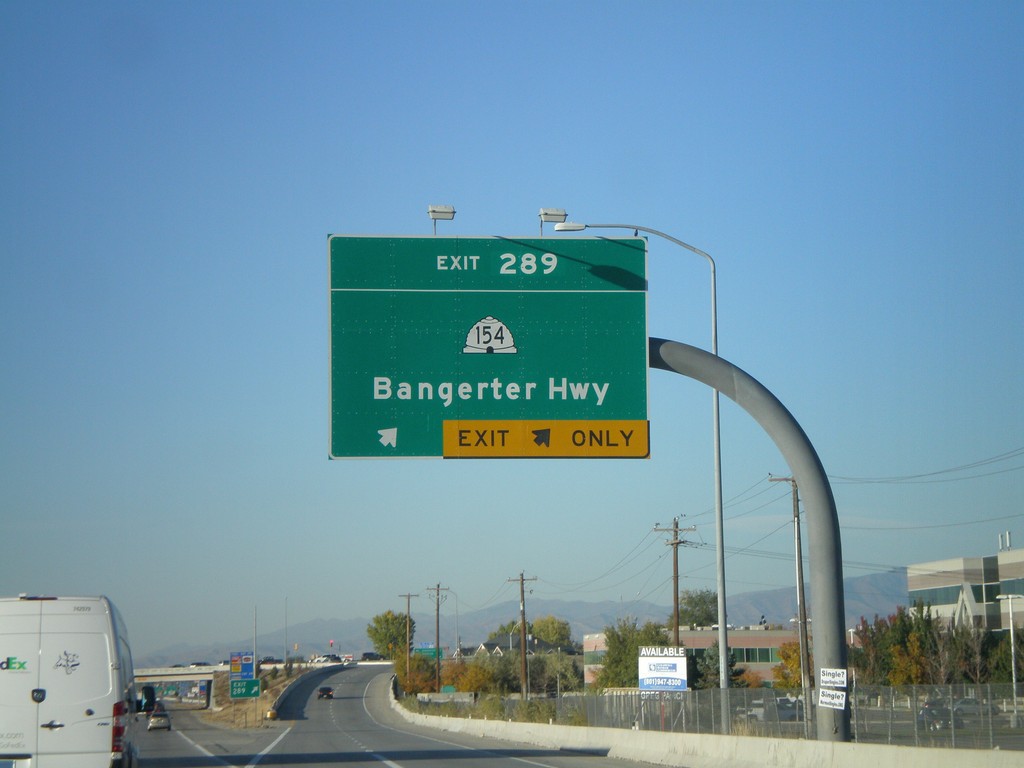
I-15 North - Exit 289
I-15 north at Exit 289 - UT-154/Bangerter Highway.
Taken 10-25-2008
 Draper
Salt Lake County
Utah
United States
Draper
Salt Lake County
Utah
United States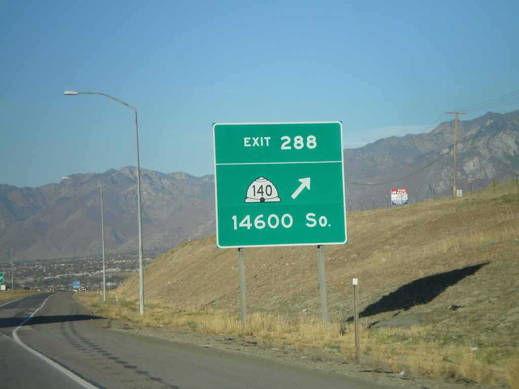
I-15 North - Exit 288
I-15 north at Exit 288 - UT-140/14600 South.
Taken 10-25-2008
 Draper
Salt Lake County
Utah
United States
Draper
Salt Lake County
Utah
United States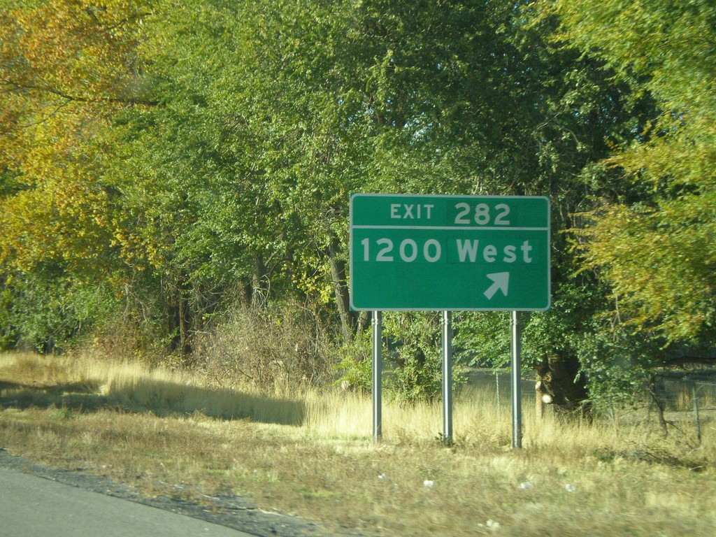
I-15 North - Exit 282
I-15 north at Exit 282 - 1200 West.
Taken 10-25-2008
Lehi
Utah County
Utah
United States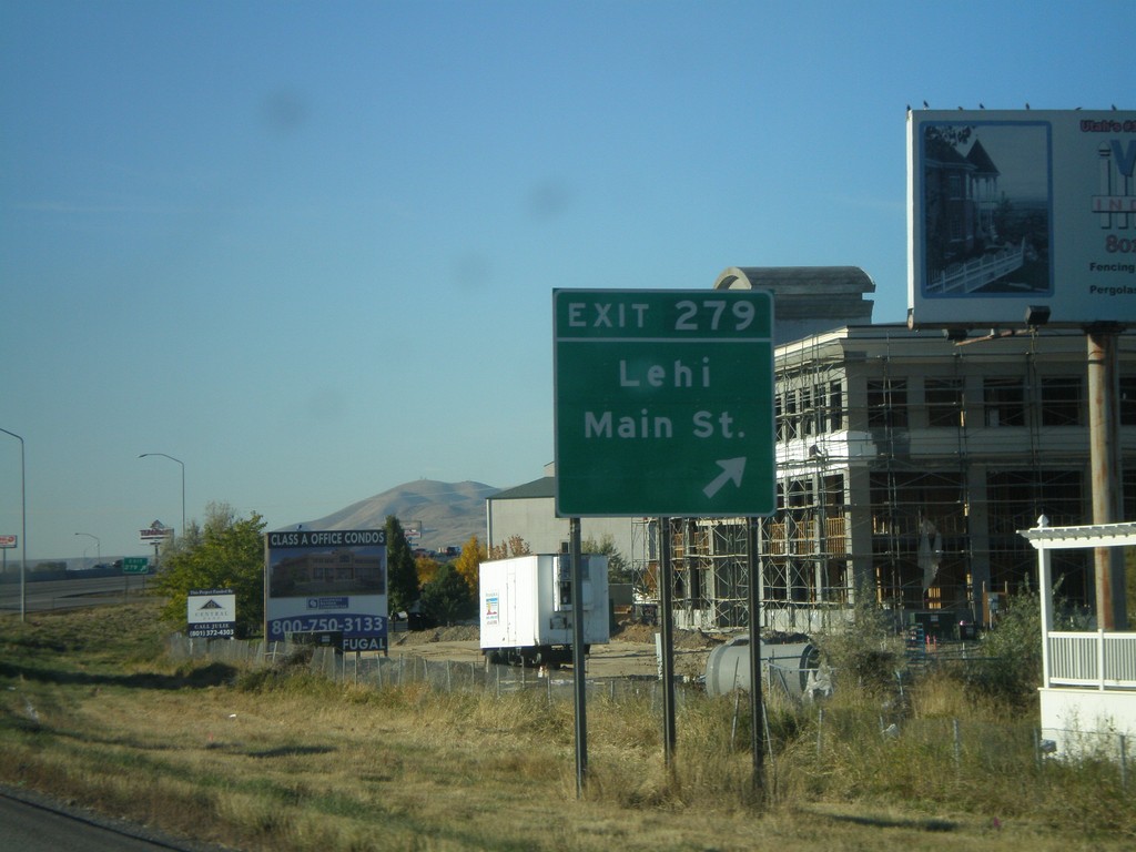
I-15 North - Exit 279
I-15 north at Exit 279 - Lehi/Main St.
Taken 10-25-2008
Lehi
Utah County
Utah
United States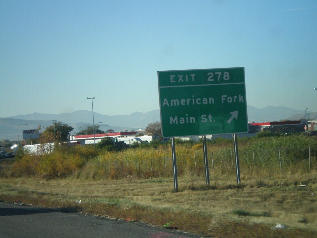
I-15 North - Exit 278
I-15 north at Exit 278 - American Fork/Main St.
Taken 10-25-2008
American Fork
Utah County
Utah
United States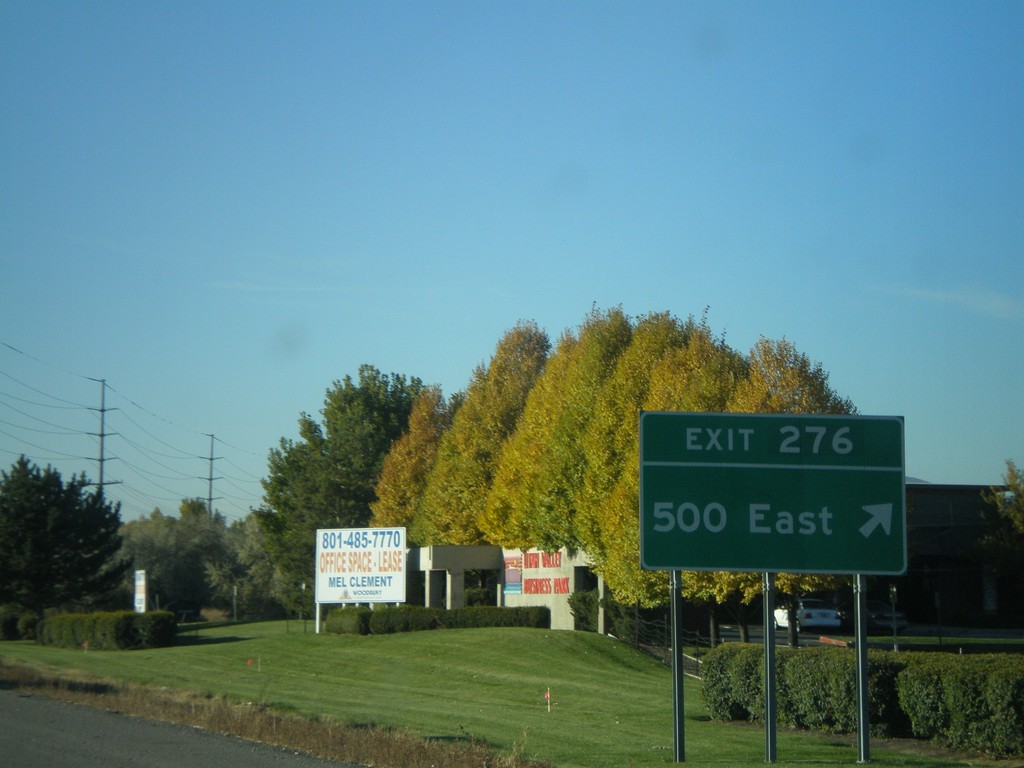
I-15 North - Exit 276
I-15 north at Exit 276 - 500 East.
Taken 10-25-2008
American Fork
Utah County
Utah
United States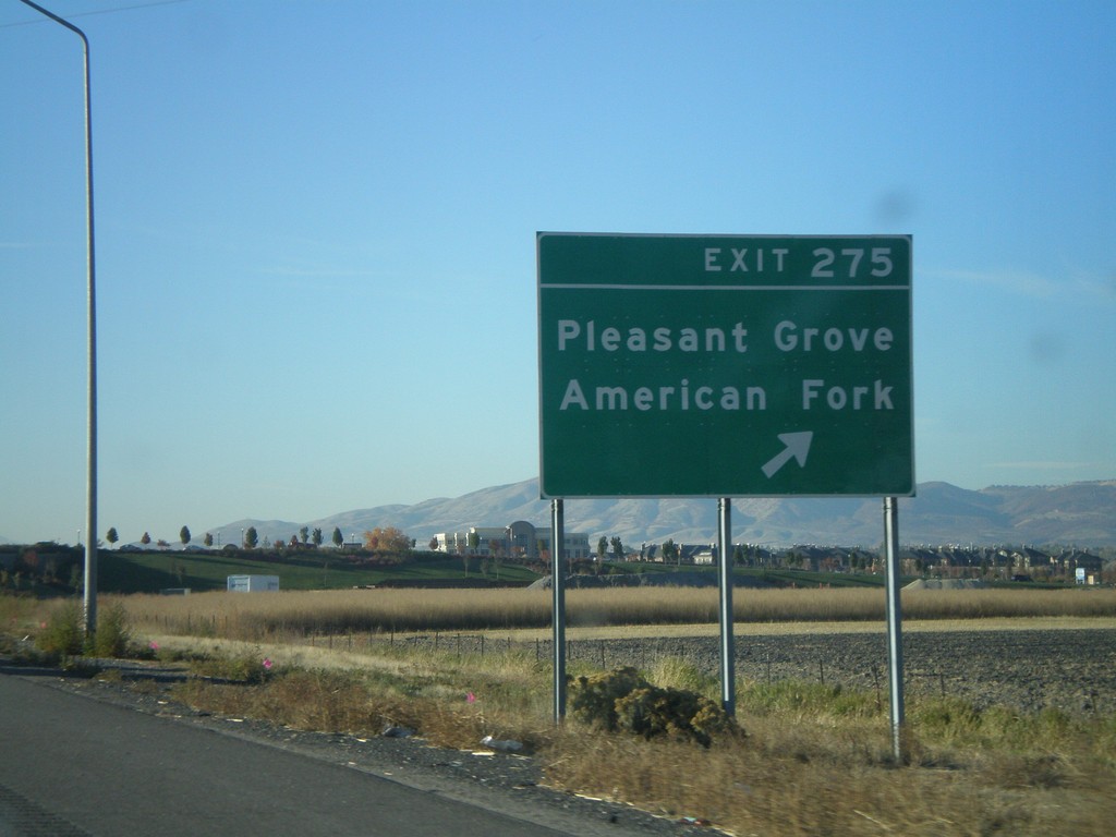
I-15 North - Exit 275
I-15 north at Exit 275 - Pleasant Grove/American Fork.
Taken 10-25-2008
Lindon
Utah County
Utah
United States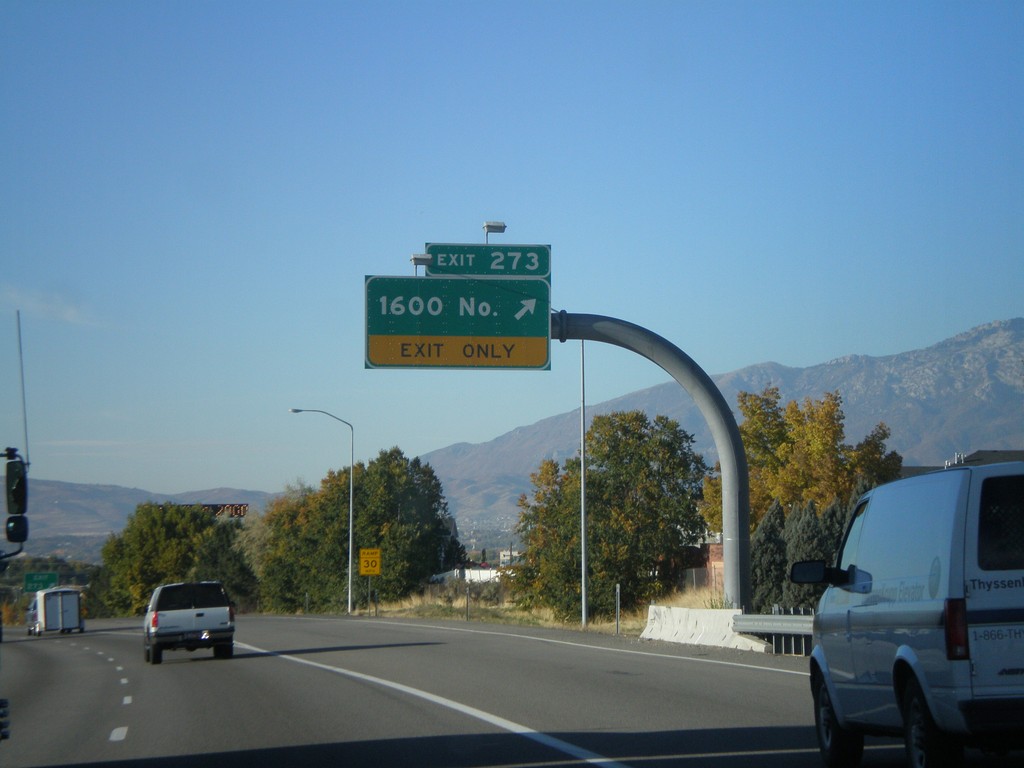
I-15 North - Exit 273
I-15 north at Exit 273 - 1600 North.
Taken 10-25-2008
Orem
Utah County
Utah
United States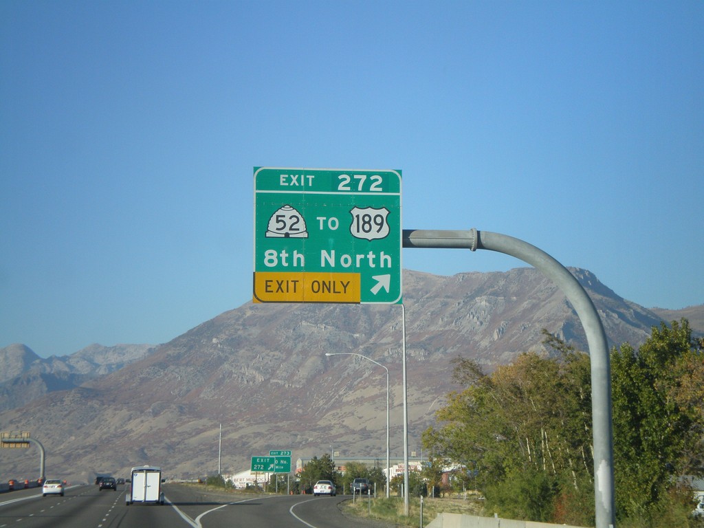
I-15 North - Exit 272
I-15 north at Exit 272 - UT-52/To US-189/8th North.
Taken 10-25-2008

 Orem
Utah County
Utah
United States
Orem
Utah County
Utah
United States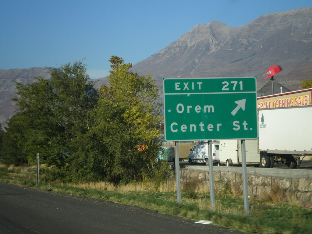
I-15 North - Exit 271
I-15 north at Exit 271 - Orem/Center St.
Taken 10-25-2008
Orem
Utah County
Utah
United States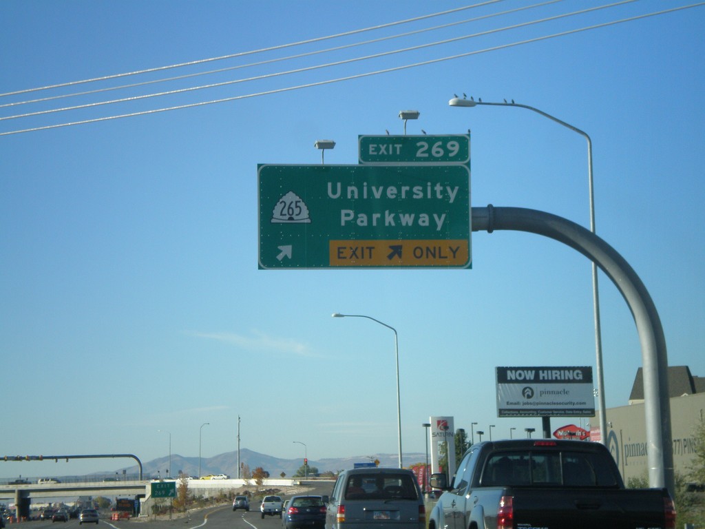
I-15 North - Exit 269
I-15 north at Exit 269 - UT-265/University Parkway.
Taken 10-25-2008
 Orem
Utah County
Utah
United States
Orem
Utah County
Utah
United States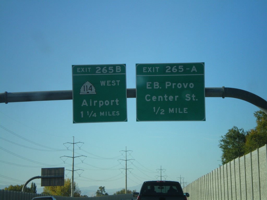
I-15 North - Exit 265A and Exit 265B
I-15 north at Exit 265A - Eastbound Provo Center St. Approaching Exit 265B - UT-114 West/Airport.
Taken 10-25-2008
 Provo
Utah County
Utah
United States
Provo
Utah County
Utah
United States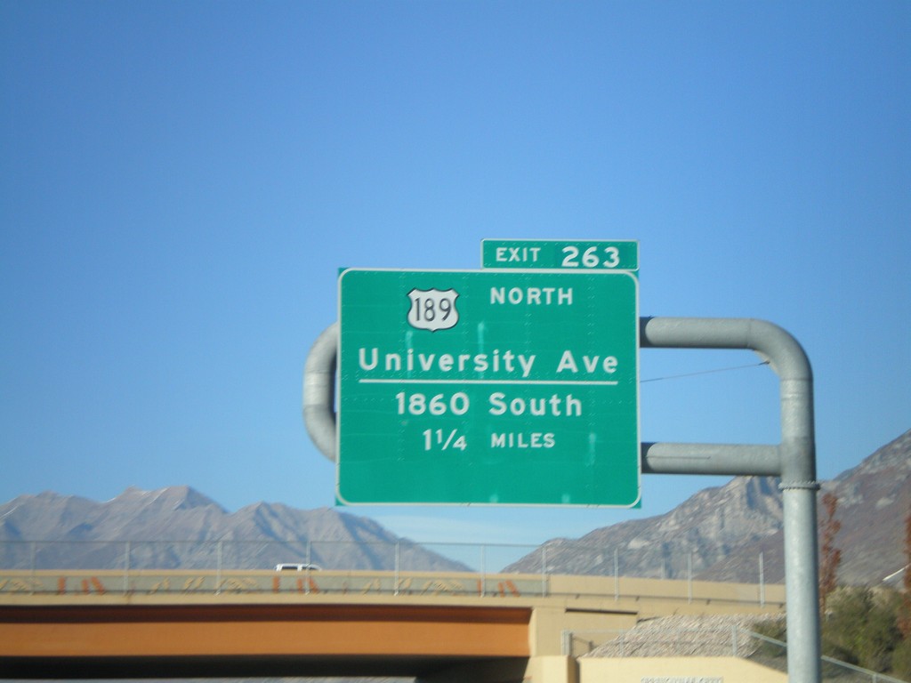
I-15 North - Exit 263
I-15 north approaching Exit 263 - US-189 North/University Ave./1860 South. This is the southern end of US-189.
Taken 10-25-2008
Springville
Utah County
Utah
United States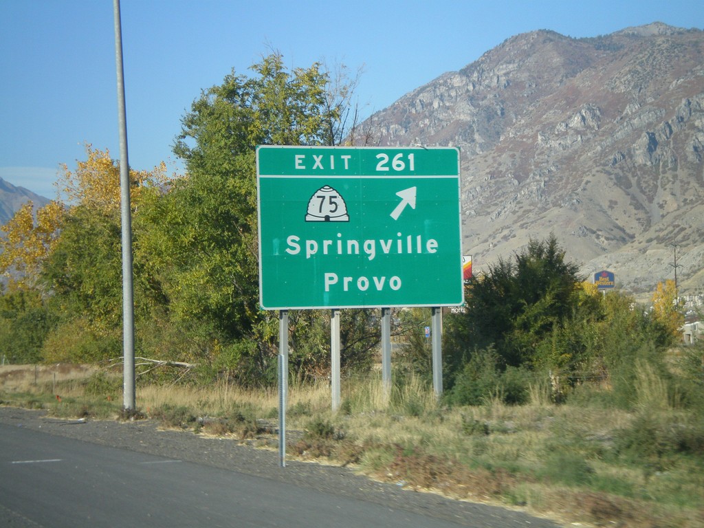
I-15 North - Exit 261
I-15 north at Exit 261 - UT-75/Springville/Provo.
Taken 10-25-2008
 Springville
Utah County
Utah
United States
Springville
Utah County
Utah
United States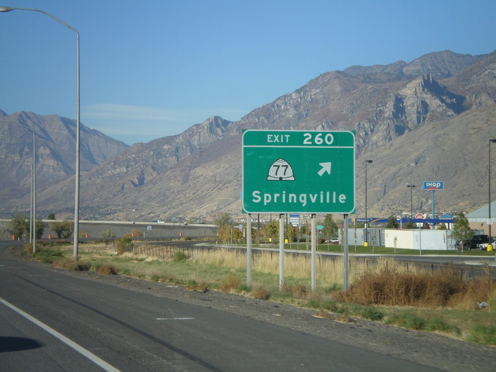
I-15 North - Exit 260
I-15 north at Exit 260 - UT-77/Springville.
Taken 10-25-2008
 Springville
Utah County
Utah
United States
Springville
Utah County
Utah
United States