Signs Tagged With Intersection
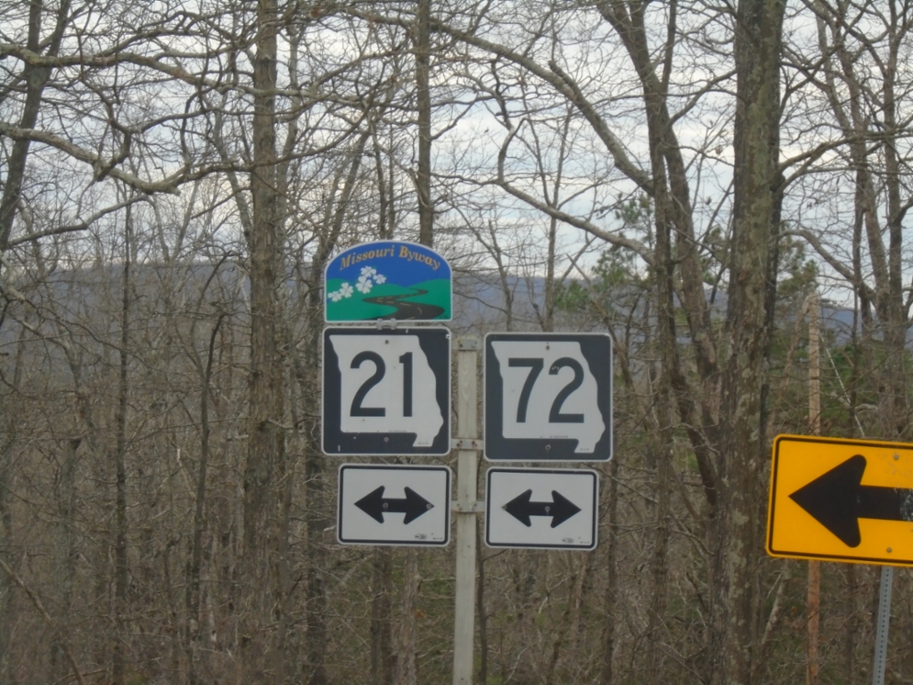
End MO-CC at MO-21/MO-72
End MO-CC at MO-21/MO-72 in Iron County. MO-21 is designated as the Ozark Run Scenic Byway.
Taken 03-27-2026


 Allen Mills
Iron County
Missouri
United States
Allen Mills
Iron County
Missouri
United States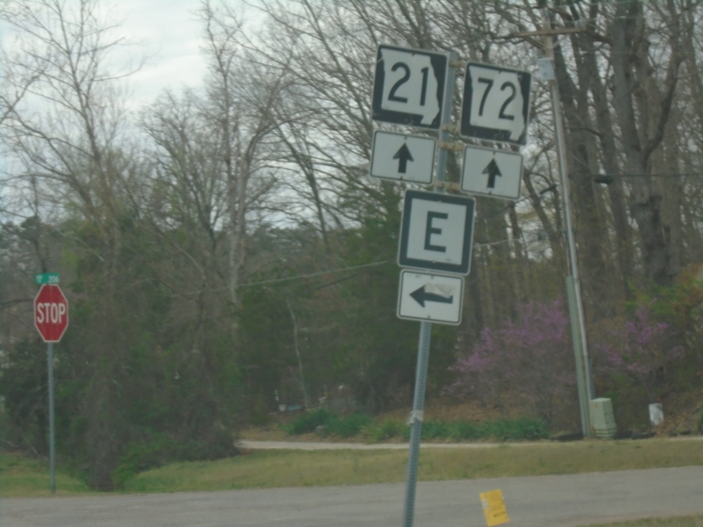
MO-21 South/MO-72 West at MO-E
MO-21 South/MO-72 West at MO-E in Iron County.
Taken 03-27-2026
 Arcadia
Iron County
Missouri
United States
Arcadia
Iron County
Missouri
United States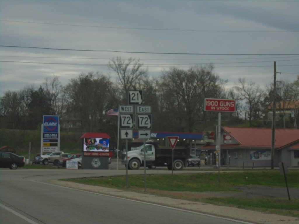
MO-21 South at MO-72 - Arcadia
MO-21 South at MO-72 in Arcadia. MO-72 West joins MO-21 southbound.
Taken 03-27-2026
Arcadia
Iron County
Missouri
United States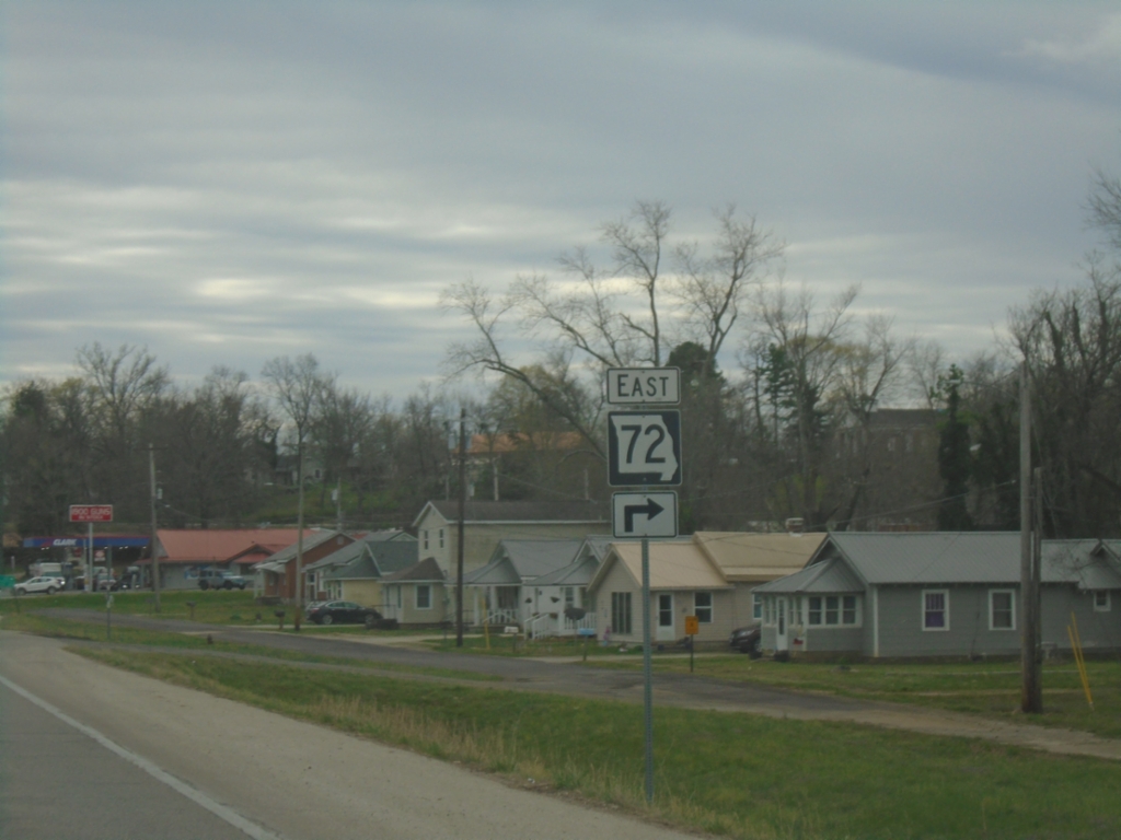
MO-21 South Approaching MO-72
MO-21 South approaching MO-72 East in Arcadia.
Taken 03-27-2026
Arcadia
Iron County
Missouri
United States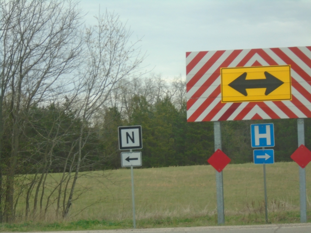
MO-21 South at MO-N
MO-21 South at MO-N in Iron County. Turn right to continue south on MO-21.
Taken 03-27-2026
 Iron
Iron County
Missouri
United States
Iron
Iron County
Missouri
United States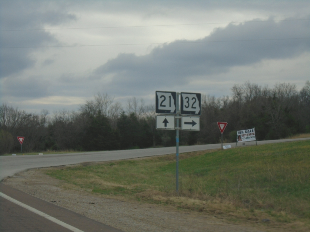
MO-21 South/MO-32 West Split
MO-21 South/MO-32 West split in Iron County.
Taken 03-27-2026
 Iron
Iron County
Missouri
United States
Iron
Iron County
Missouri
United States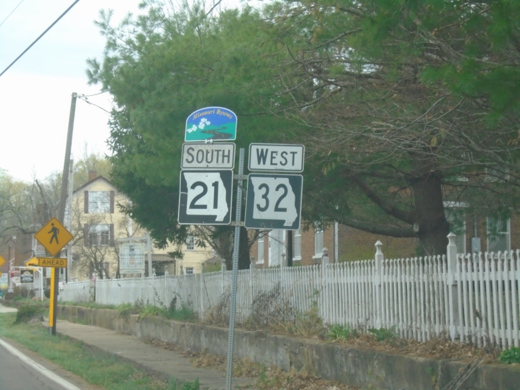
MO-21 South/MO-32 West - Caledonia
MO-21 South/MO-32 West in Caledonia. MO-21 is designated as the Ozark Run Scenic Byway
Taken 03-27-2026
Caledonia
Washington County
Missouri
United States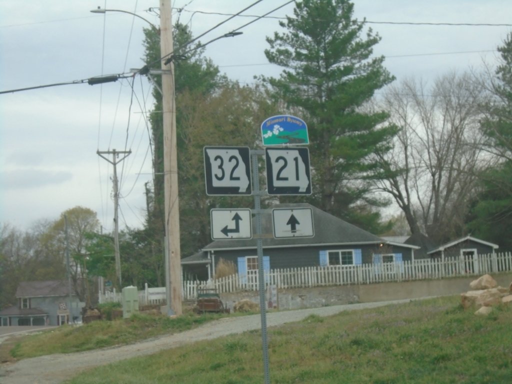
MO-21 South at MO-32 East - Caledonia
MO-21 South at MO-32 East in Caledonia. MO-32 West joins MO-21 southbound. MO-21 is designated the Ozark Run Scenic Byway.
Taken 03-27-2026
Caledonia
Washington County
Missouri
United States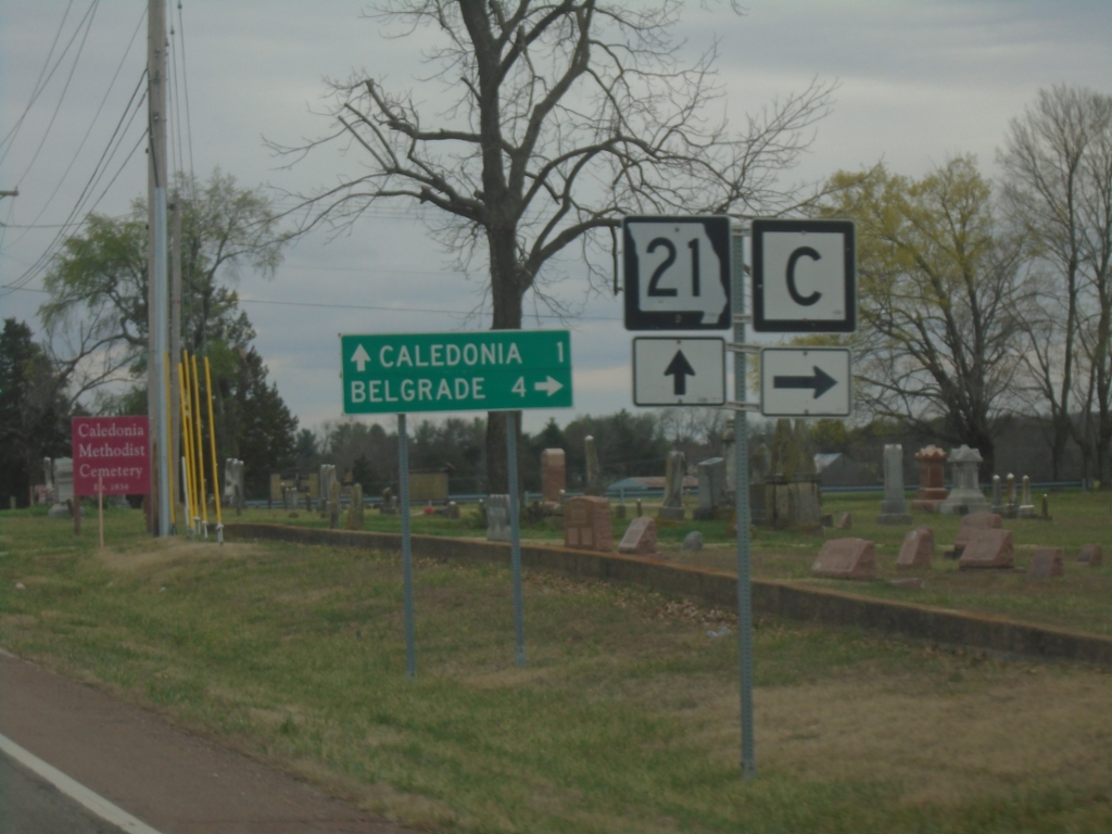
MO-21 South at MO-C
MO-21 South at MO-C in Washington County. Use MO-C West to Belgrade. Continue south on MO-21 for Caledonia.
Taken 03-27-2026
 Caledonia
Washington County
Missouri
United States
Caledonia
Washington County
Missouri
United States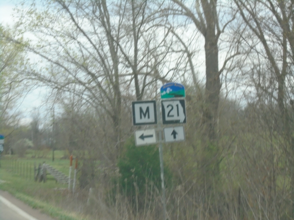
MO-21 South at MO-M
MO-21 South at MO-M. MO-21 is designated as the Ozark Run Scenic Byway.
Taken 03-27-2026
 Caledonia
Washington County
Missouri
United States
Caledonia
Washington County
Missouri
United States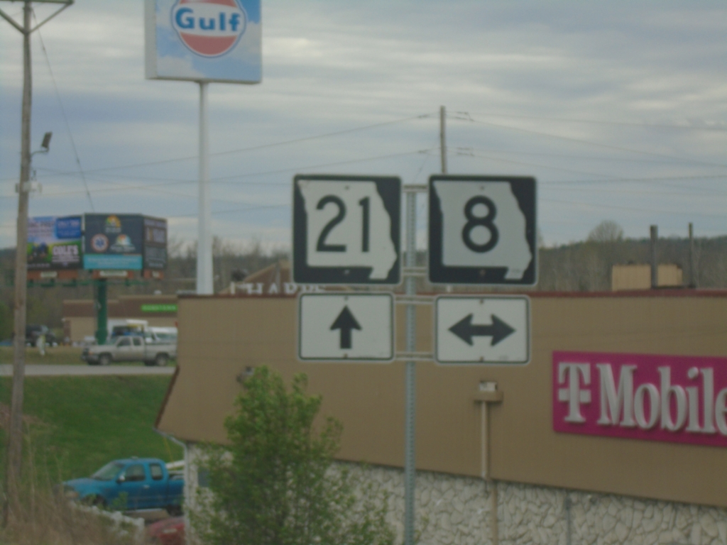
MO-21 South at MO-8
MO-21 South at MO-8 junction in Potosi.
Taken 03-27-2026
 Potosi
Washington County
Missouri
United States
Potosi
Washington County
Missouri
United States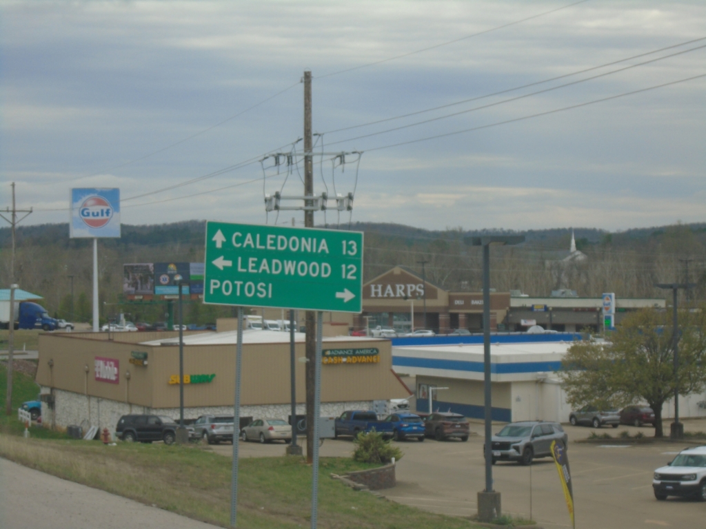
MO-21 South Approaching MO-8
MO-21 South approaching MO-8 in Potosi. Use MO-8 East to Leadwood; MO-8 West to Potosi. Continue south on MO-21 to Caledonia.
Taken 03-27-2026
Potosi
Washington County
Missouri
United States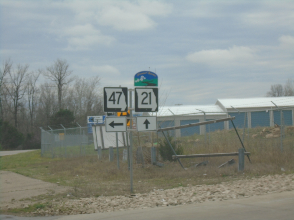
MO-21/MO-47 South - Old Mines
MO-21/MO-47 South at MO-21/MO-47 split in Old Mines. MO-21 is designated as the Ozark Run Scenic Byway
Taken 03-27-2026
 Cadet
Washington County
Missouri
United States
Cadet
Washington County
Missouri
United States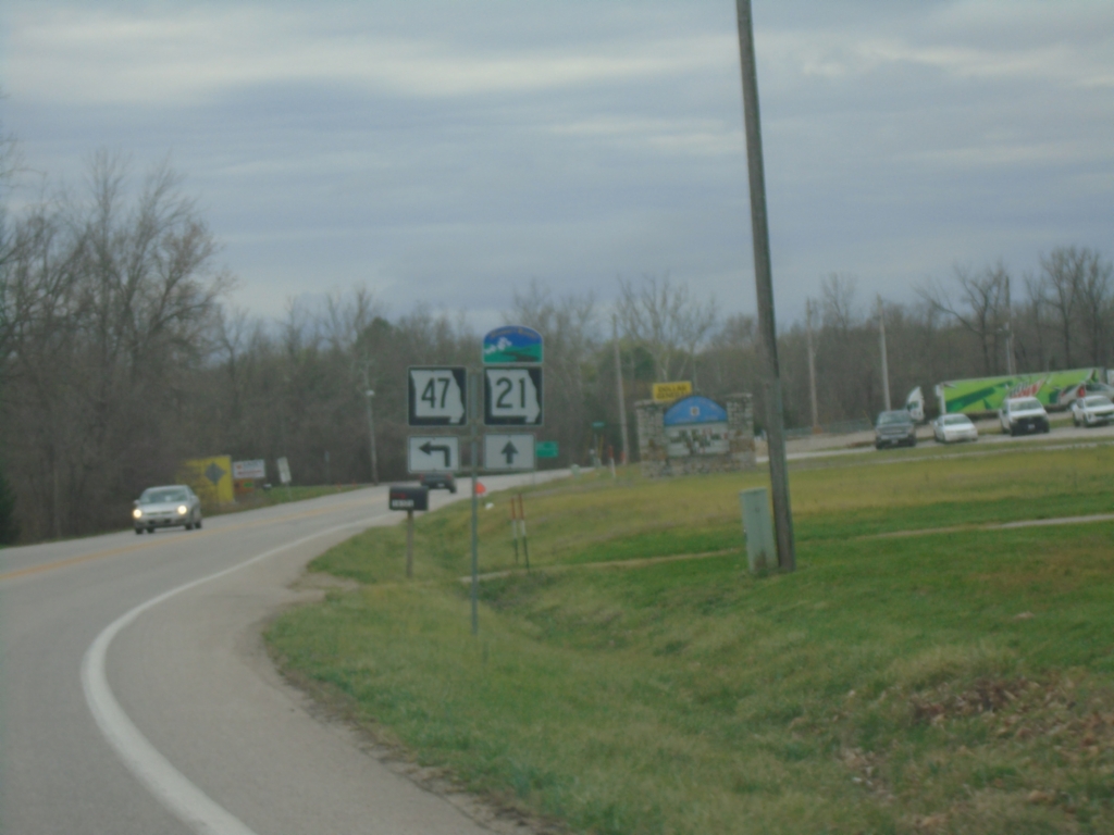
MO-21/MO-47 South at MO-21/MO-47 Split
MO-21/MO-47 South at MO-21/MO-47 split in Old Mines. MO-21 is designated the Ozark Run Scenic Byway
Taken 03-27-2026
Cadet
Washington County
Missouri
United States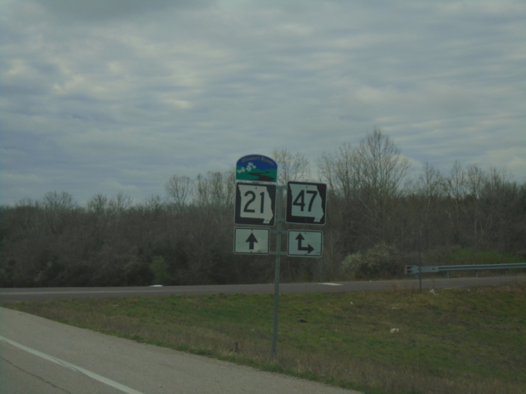
MO-21 South at MO-47 Junction
MO-21 South at MO-47 junction. MO-47 South joins MO-21 South to Old Mines. MO-21 is designated as the Ozark Run Scenic Byway.
Taken 03-27-2026
Cadet
Washington County
Missouri
United States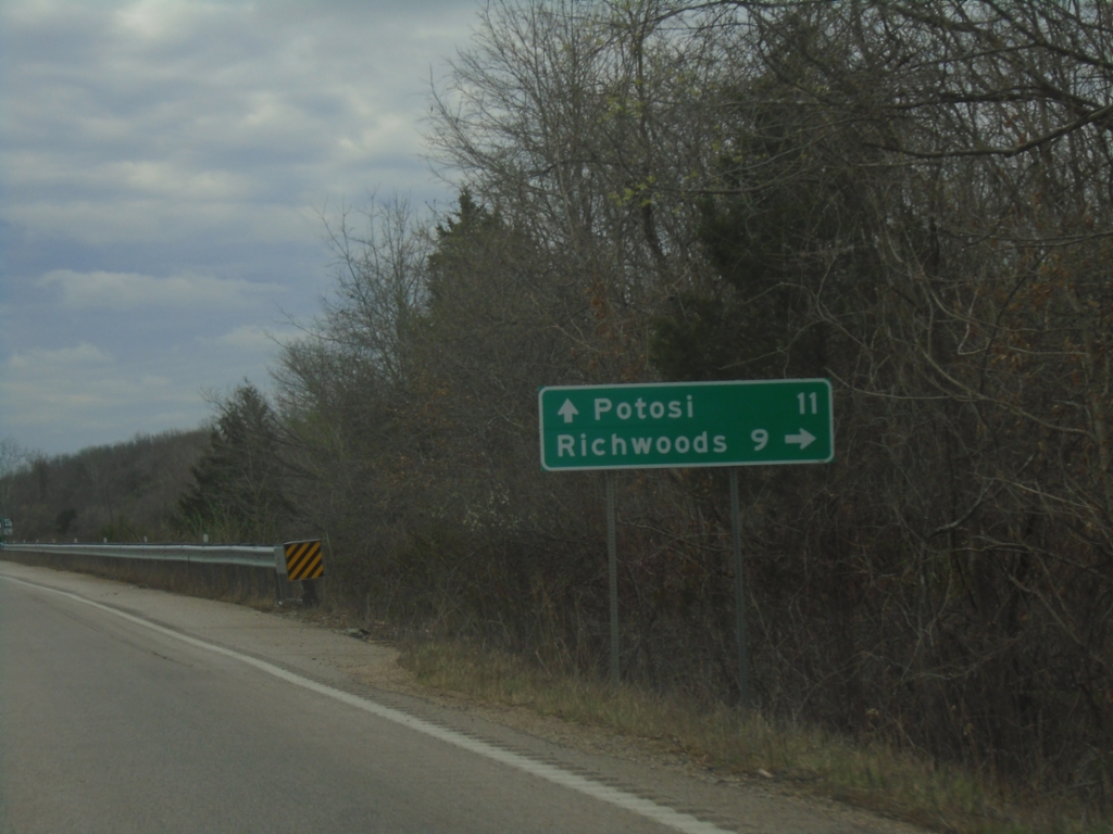
MO-21 South Approaching MO-47
MO-21 South approaching MO-47 North to Richwoods. MO-47 South joins MO-21 South towards Potosi.
Taken 03-27-2026
Cadet
Washington County
Missouri
United States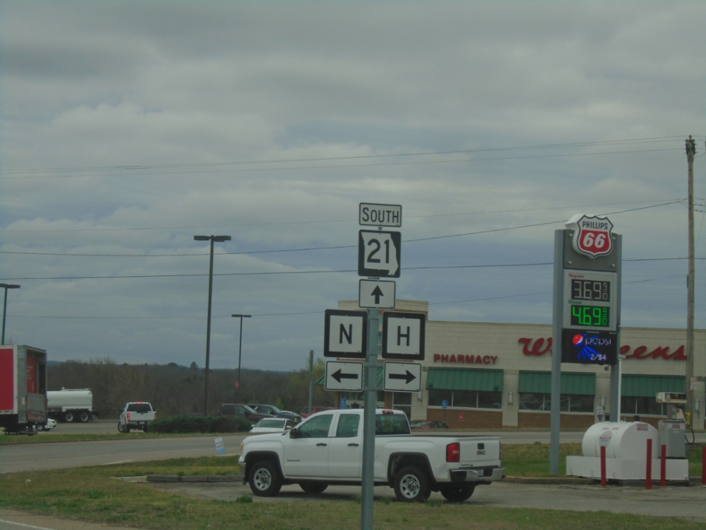
MO-21 South at MO-H and MO-N
MO-21 South at MO-H and MO-N in De Soto.
Taken 03-27-2026
 De Soto
Jefferson County
Missouri
United States
De Soto
Jefferson County
Missouri
United States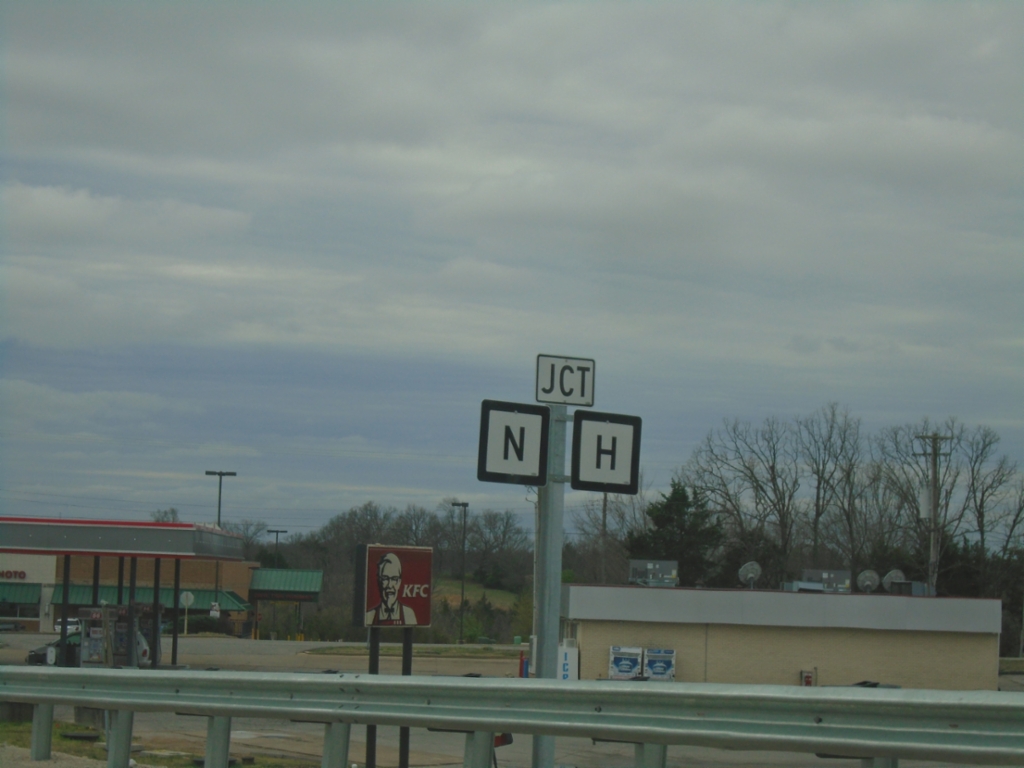
MO-21 South Approaching MO-H and MO-N
MO-21 South approaching MO-H and MO-N in De Soto.
Taken 03-27-2026
De Soto
Jefferson County
Missouri
United States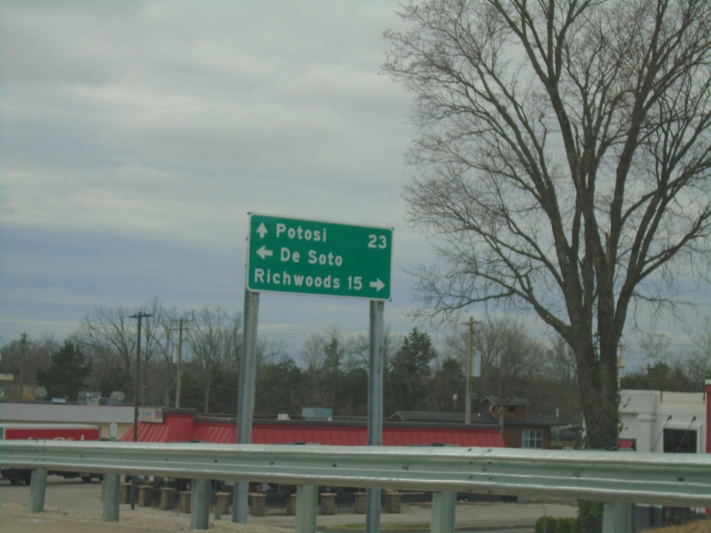
MO-21 South at MO-Y
MO-21 South at MO-Y in De Soto. Turn right for Richwoods; left for De Soto. Continue south on MO-21 for Potosi.
Taken 03-27-2026
 De Soto
Jefferson County
Missouri
United States
De Soto
Jefferson County
Missouri
United States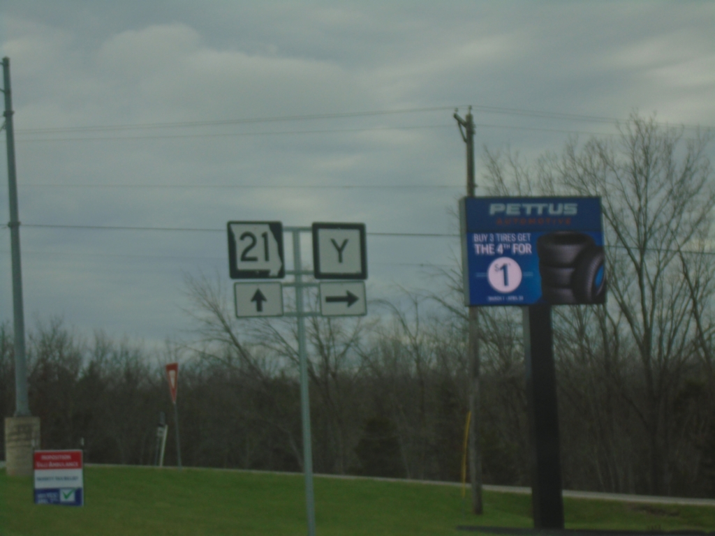
MO-21 South at MO-Y
MO-21 South at MO-Y in De Soto.
Taken 03-27-2026
De Soto
Jefferson County
Missouri
United States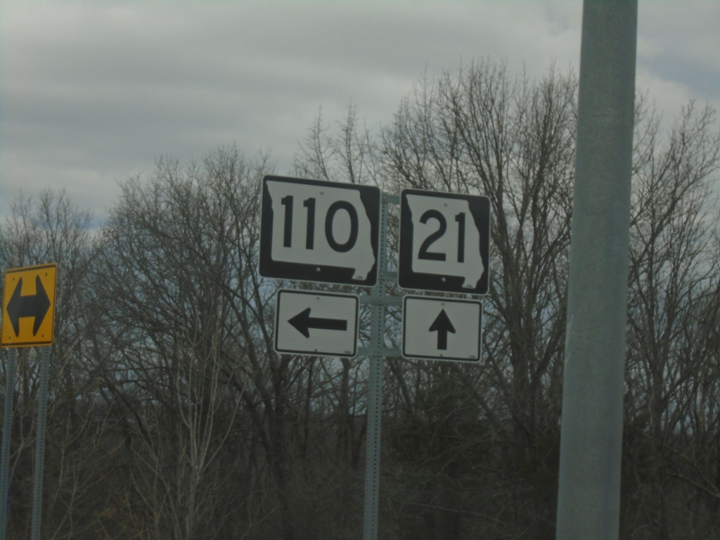
MO-21 South at MO-110
MO-21 South at MO-110 in Jefferson County
Taken 03-27-2026
 De Soto
Jefferson County
Missouri
United States
De Soto
Jefferson County
Missouri
United States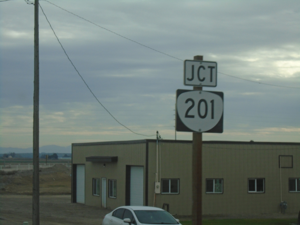
US-20/US-26 East Approaching OR-201
US-20/US-26 east approaching OR-201.
Taken 02-16-2026


 Ontario
Malheur County
Oregon
United States
Ontario
Malheur County
Oregon
United States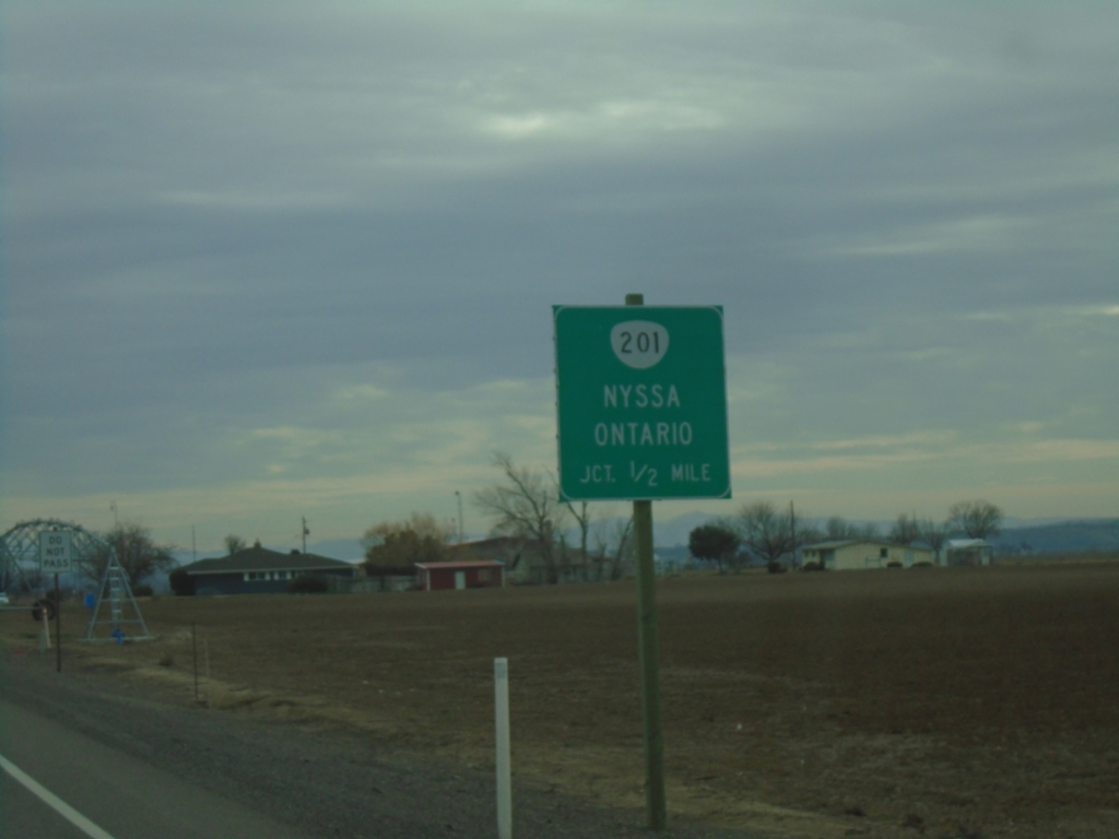
US-20/US-26 East Approaching OR-201
US-20/US-26 east approaching OR-201 to Nyssa and Ontario.
Taken 02-16-2026
Ontario
Malheur County
Oregon
United States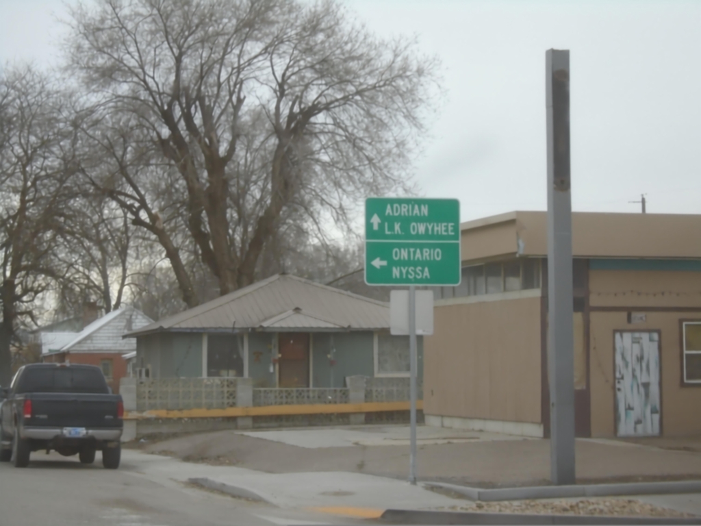
US-26 East at US-20 - Vale
US-26 East at US-20 in Vale. Turn left for US-20/US-26 East to Ontario and Nyssa; continue straight for Adrian and Lake Owyhee.
Taken 02-16-2026
Vale
Malheur County
Oregon
United States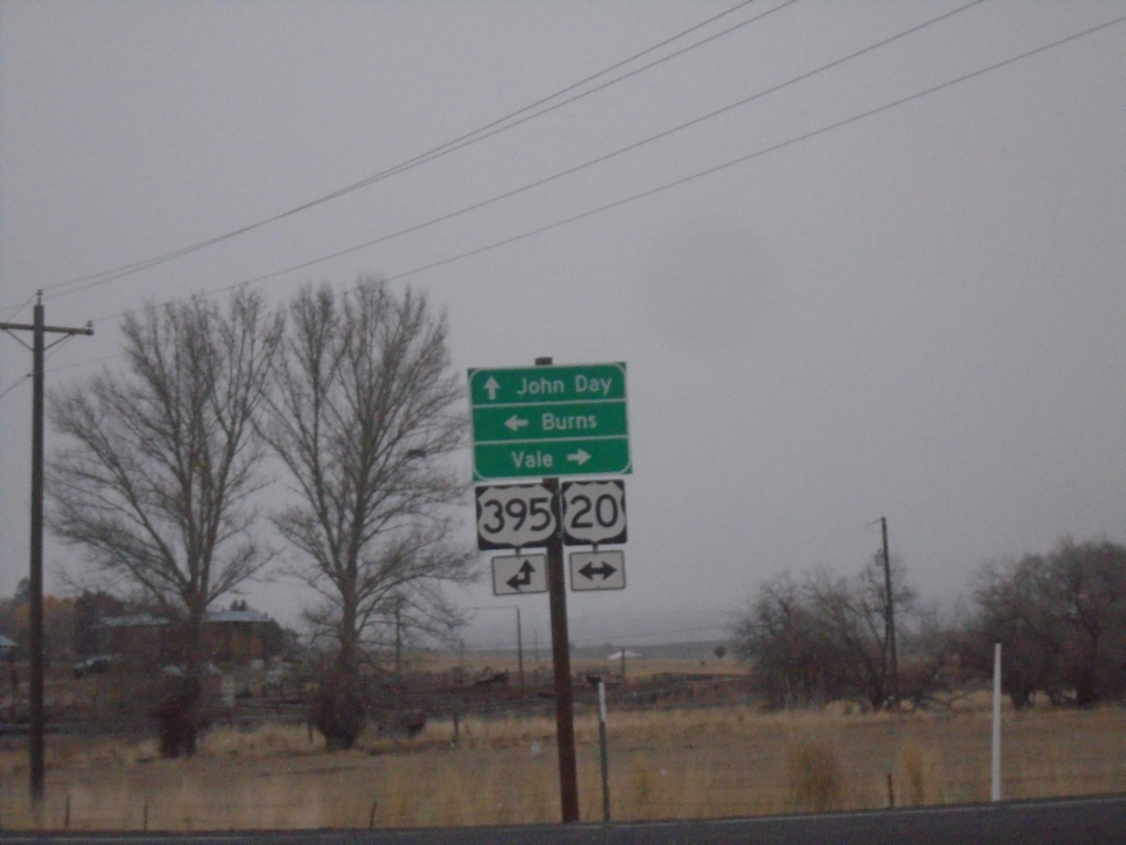
Fry Road North at US-20/US-395 Junction
Fry Road North at US-20/US-395 Junction. Turn right for US-20 East to Vale; left for US-20 West/US-395 South to Burns; continue straight for US-395 North to John Day.
Taken 02-16-2026
 Burns
Harney County
Oregon
United States
Burns
Harney County
Oregon
United States