Signs Tagged With Intersection
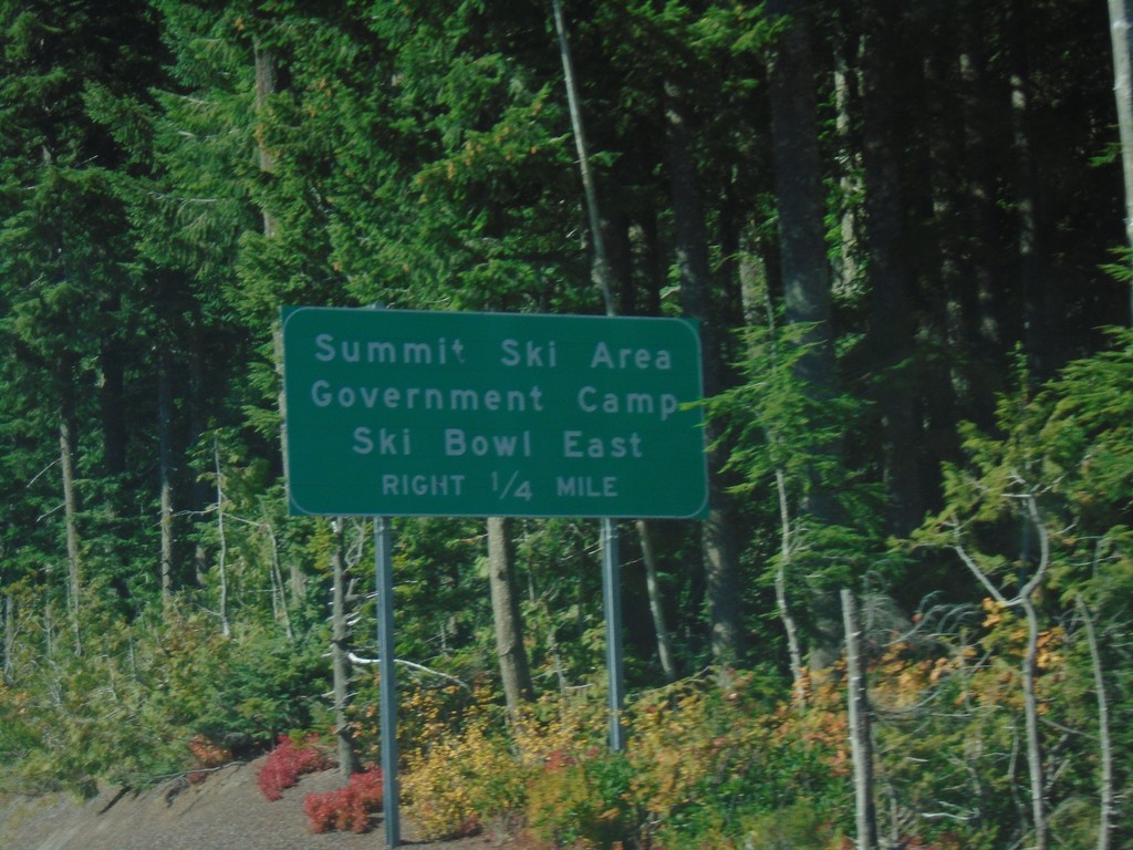
US-26 West - Government Camp
US-26 West approaching Government Camp/Summit Ski Area/Ski Bowl East.
Taken 10-13-2018
 Government Camp
Clackamas County
Oregon
United States
Government Camp
Clackamas County
Oregon
United States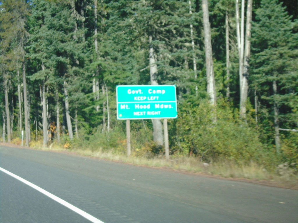
US-26 West Approaching OR-35
US-26 West approaching OR-35 in Clackamas County. Use OR-35 north for Mount Hood Meadows Ski Area; US-26 West for Government Camp.
Taken 10-13-2018
 Government Camp
Clackamas County
Oregon
United States
Government Camp
Clackamas County
Oregon
United States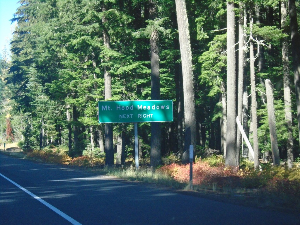
US-26 West - Mount Hood Meadows
US-26 west approaching OR-35 North. Use OR-35 north for Mount Hood Meadows Ski Area.
Taken 10-13-2018
 Government Camp
Clackamas County
Oregon
United States
Government Camp
Clackamas County
Oregon
United States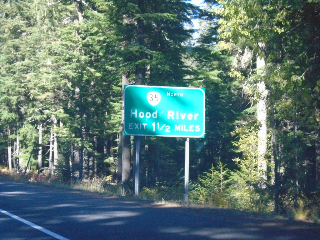
US-26 West Approaching OR-35
US-26 West approaching OR-35 North to Hood River.
Taken 10-13-2018
Government Camp
Clackamas County
Oregon
United States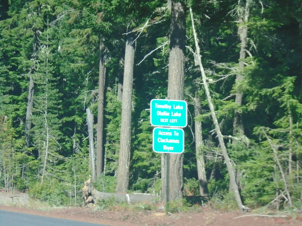
US-26 West - Timothy Lake/Olallie Lake Jct.
US-26 West approaching Timothy Lake/Olallie Lake Jct. (FS Road 42 - Skyline Road). Use FS Road 42 for access to the Clackamas River.
Taken 10-13-2018
Maupin
Wasco County
Oregon
United States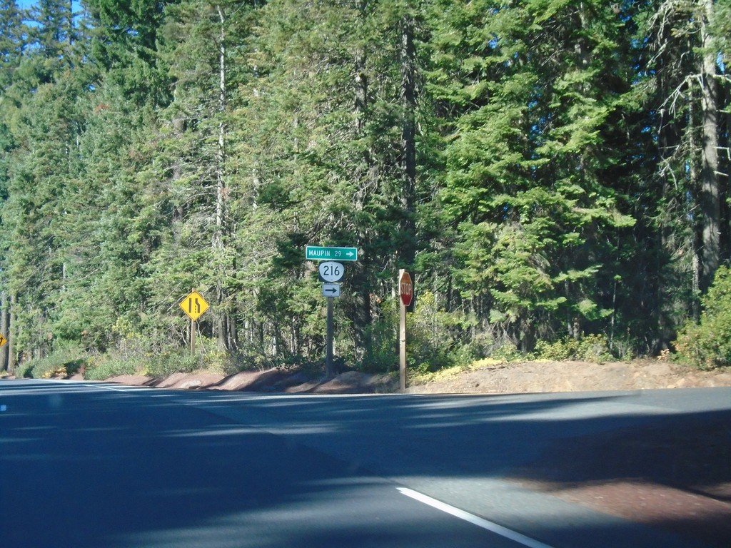
US-26 West at OR-216
US-26 West at OR-216 west to Maupin.
Taken 10-13-2018
 Maupin
Wasco County
Oregon
United States
Maupin
Wasco County
Oregon
United States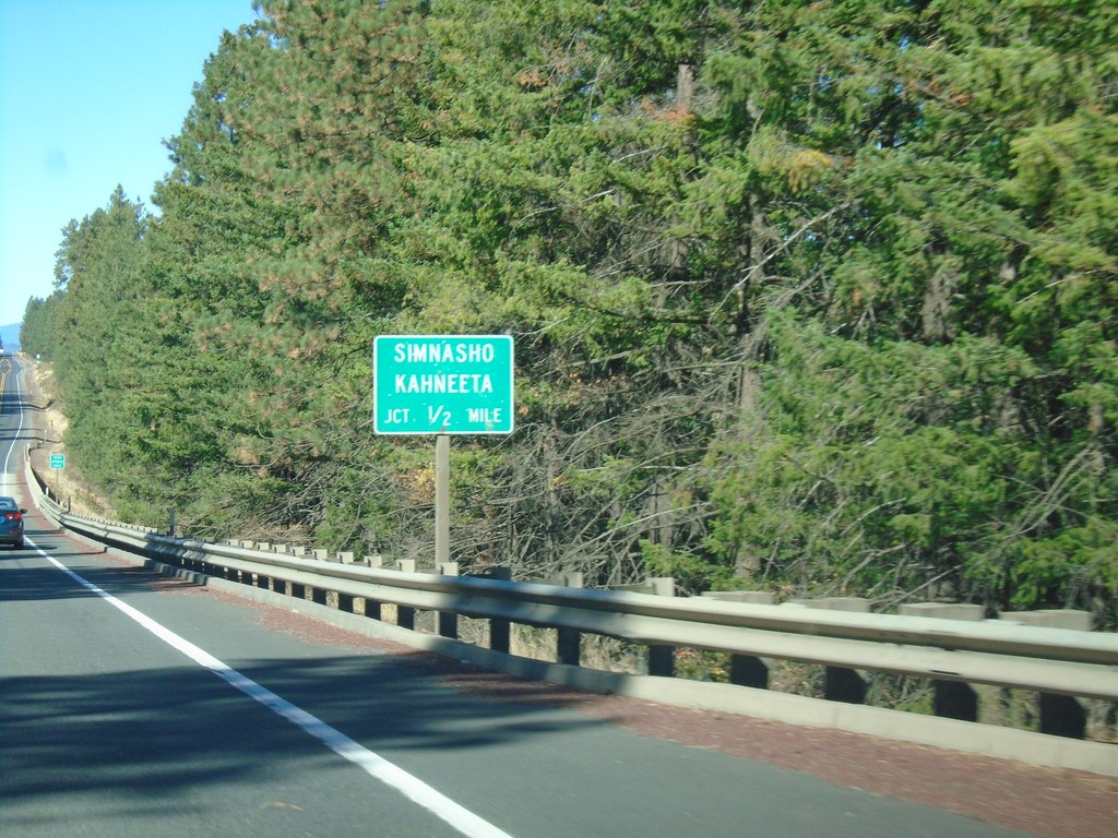
US-26 West Approaching Simhasho/Kahneeta Jct.
US-26 West approaching Simhasho/Kahneeta Jct.
Taken 10-13-2018
Warm Springs
Wasco County
Oregon
United States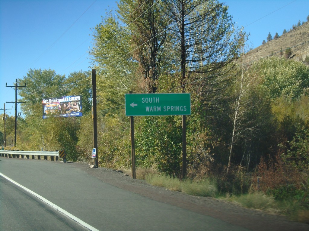
US-26 West - South Warm Springs
South Warm Springs junction on US-26 west.
Taken 10-13-2018
Warm Springs
Jefferson County
Oregon
United States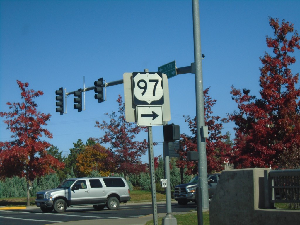
US-97 North/US-26 West at US-26/US-97 Split
US-97 North/US-26 West at US-26/US-97 Split. Turn right to continue north on US-97.
Taken 10-13-2018
 Madras
Jefferson County
Oregon
United States
Madras
Jefferson County
Oregon
United States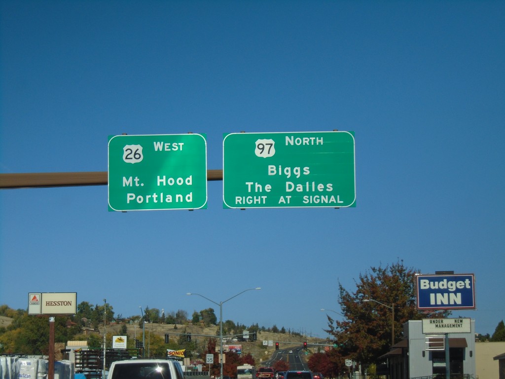
US-97 North/US-26 West Approaching US-97/US-26 Split
US-97 North/US-26 West Approaching US-97/US-26 split in Madras. Turn right for US-97 North to Biggs and The Dalles. Continue straight for US-26 West to Mount Hood and Portland.
Taken 10-13-2018
Madras
Jefferson County
Oregon
United States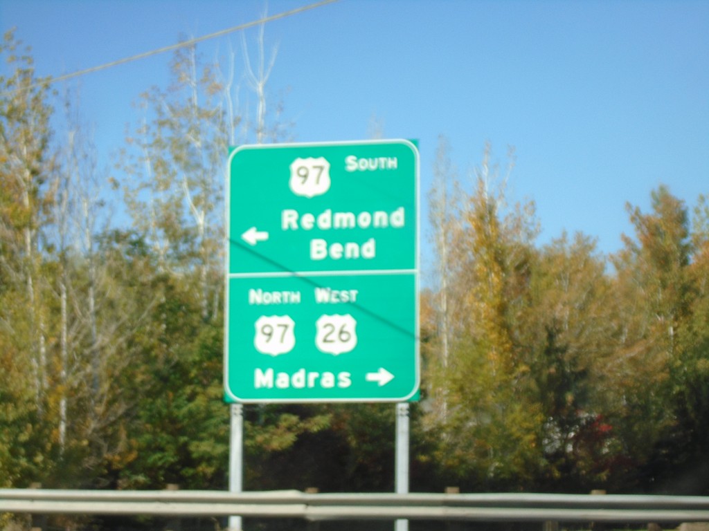
US-26 West at US-97 - Jefferson County
US-26 West at US-97 in Jefferson County. Turn left for US-97 south to Redmond and Bend; turn right for US-97 North/US-26 West to Madras. US-26 West joins US-97 North through Madras.
Taken 10-13-2018
Madras
Jefferson County
Oregon
United States
US-26 West at OR-126 - Prineville
US-26 West at OR-126 in Prineville. Turn right for US-26 west to Madras and Portland; turn left for OR-126 west to Redmond and Bend.
Taken 10-13-2018
 Prineville
Crook County
Oregon
United States
Prineville
Crook County
Oregon
United States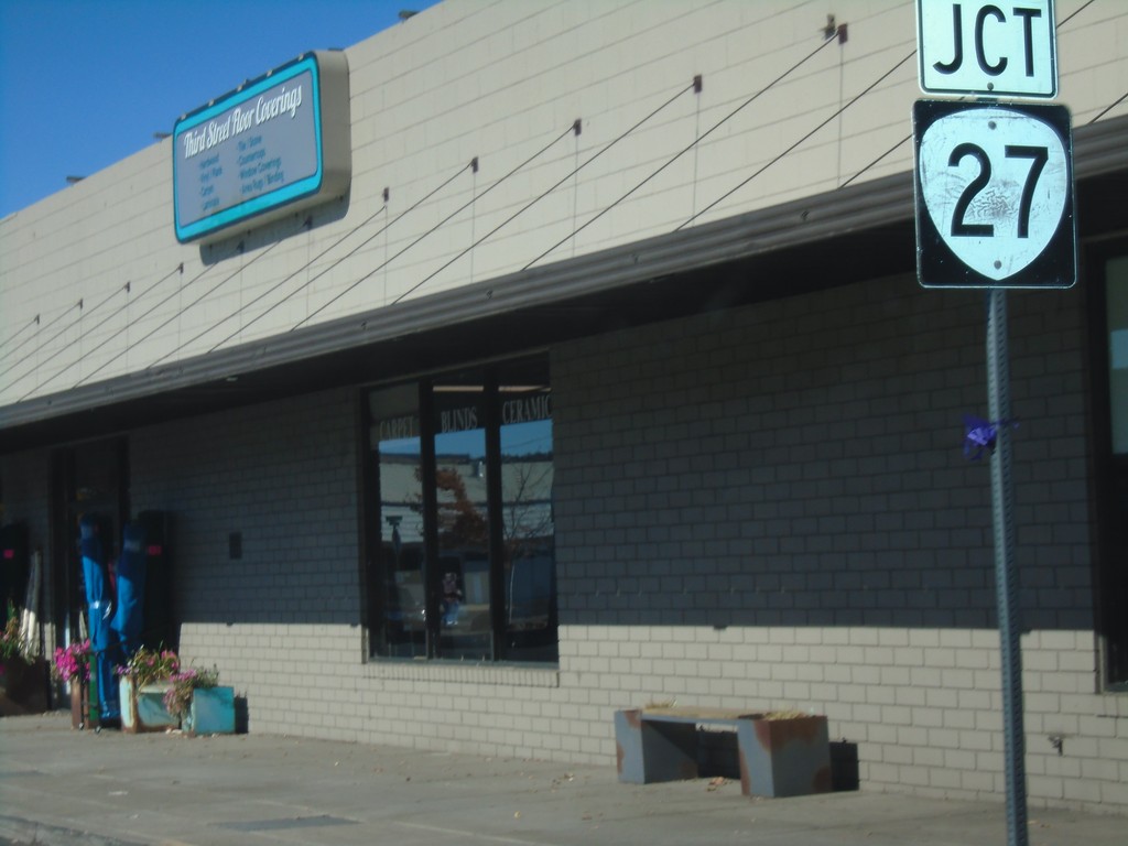
US-26 West Approaching OR-27
US-26 West approaching OR-27 in Prineville.
Taken 10-13-2018
 Prineville
Crook County
Oregon
United States
Prineville
Crook County
Oregon
United States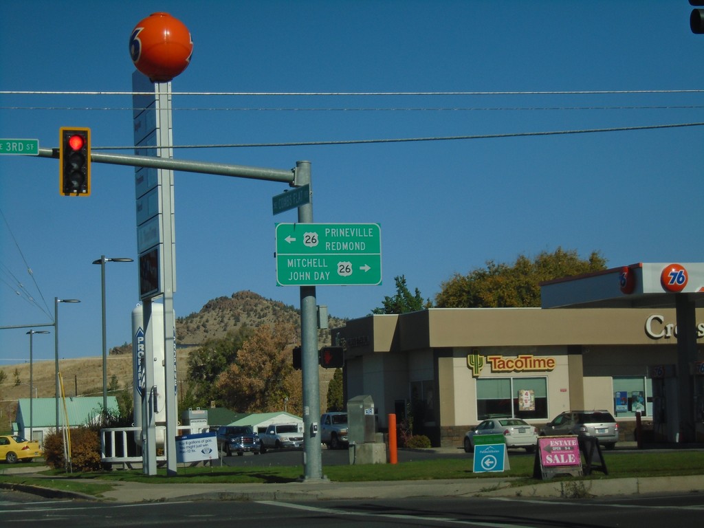
End OR-380 West at US-26
End OR-380 West at US-26 in Prineville. Use US-26 east for Mitchell and John Day; US-26 west for Prineville and Redmond (via OR-126).
Taken 10-13-2018
 Prineville
Crook County
Oregon
United States
Prineville
Crook County
Oregon
United States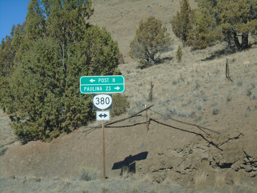
Pine Creek Road at OR-380
Pine Creek Road at OR-380. Turn left for OR-380 west to Post; right for OR-380 east to Paulina.
Taken 10-13-2018
Prineville
Crook County
Oregon
United States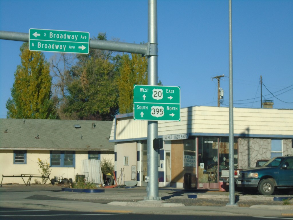
End OR-78 at US-20/US-395
End OR-78 at US-20/US-395 in Burns. Turn right for US-20 East/US-395 North; continue straight for US-20 West/US-395 South.
Taken 10-13-2018


 Burns
Harney County
Oregon
United States
Burns
Harney County
Oregon
United States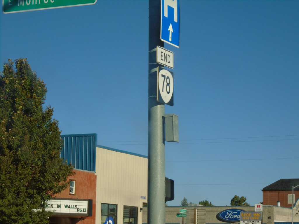
End OR-78 at US-20/US-395
End OR-78 at US-20/US-395 in Burns.
Taken 10-13-2018
Burns
Harney County
Oregon
United States
OR-78 West Approaching US-20/US-395
OR-78 West Approaching US-20/US-395 in Burns. Turn right for US-20 East/US-395 North to John Day (via US-395) and Vale (via US-20). Continue straight for US-20 West/US-395 South to Lakeview (via US-395) and Bend (via US-20).
Taken 10-13-2018
Burns
Harney County
Oregon
United States
OR-78 West Approaching US-20/US-395
OR-78 West Approaching US-20/US-395 in Burns.
Taken 10-13-2018
Burns
Harney County
Oregon
United States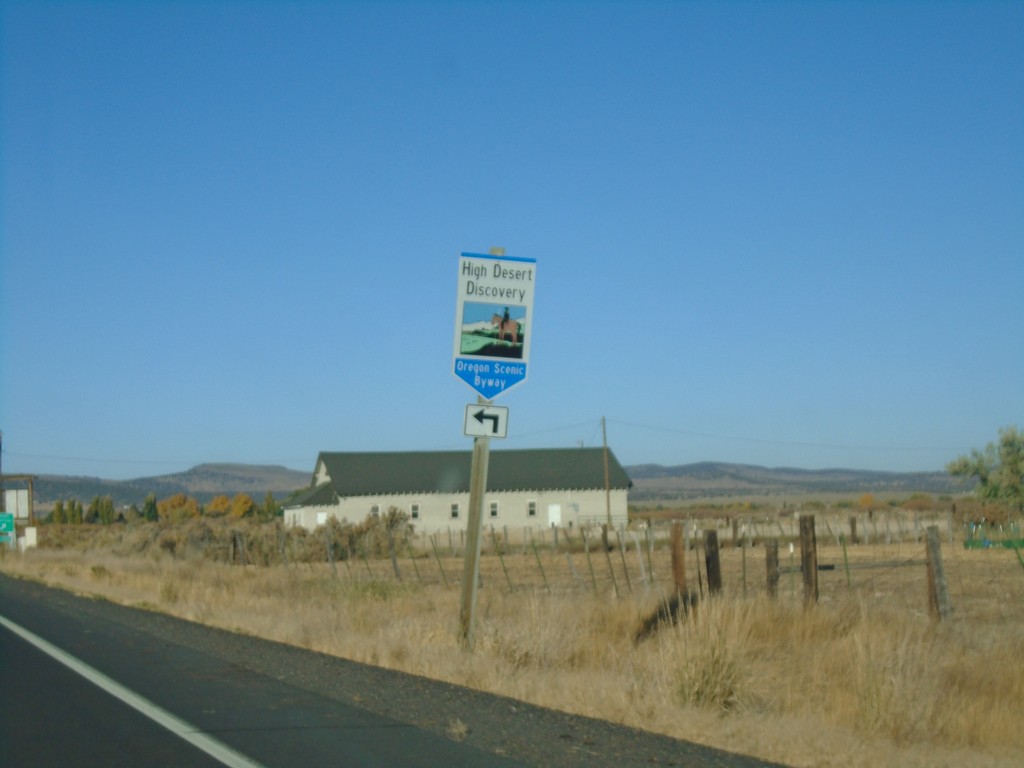
OR-78 West at OR-205 Junction
OR-78 West at OR-205 Junction. Turn left for the High Desert Discovery Scenic Byway.
Taken 10-13-2018
 Burns
Harney County
Oregon
United States
Burns
Harney County
Oregon
United States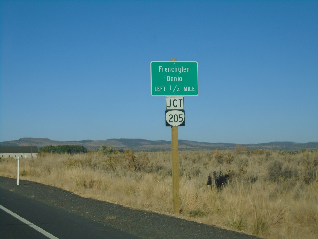
OR-78 West Approaching OR-205
OR-78 West approaching OR-205 south to Frenchglen and Denio (Nevada).
Taken 10-13-2018
Burns
Harney County
Oregon
United States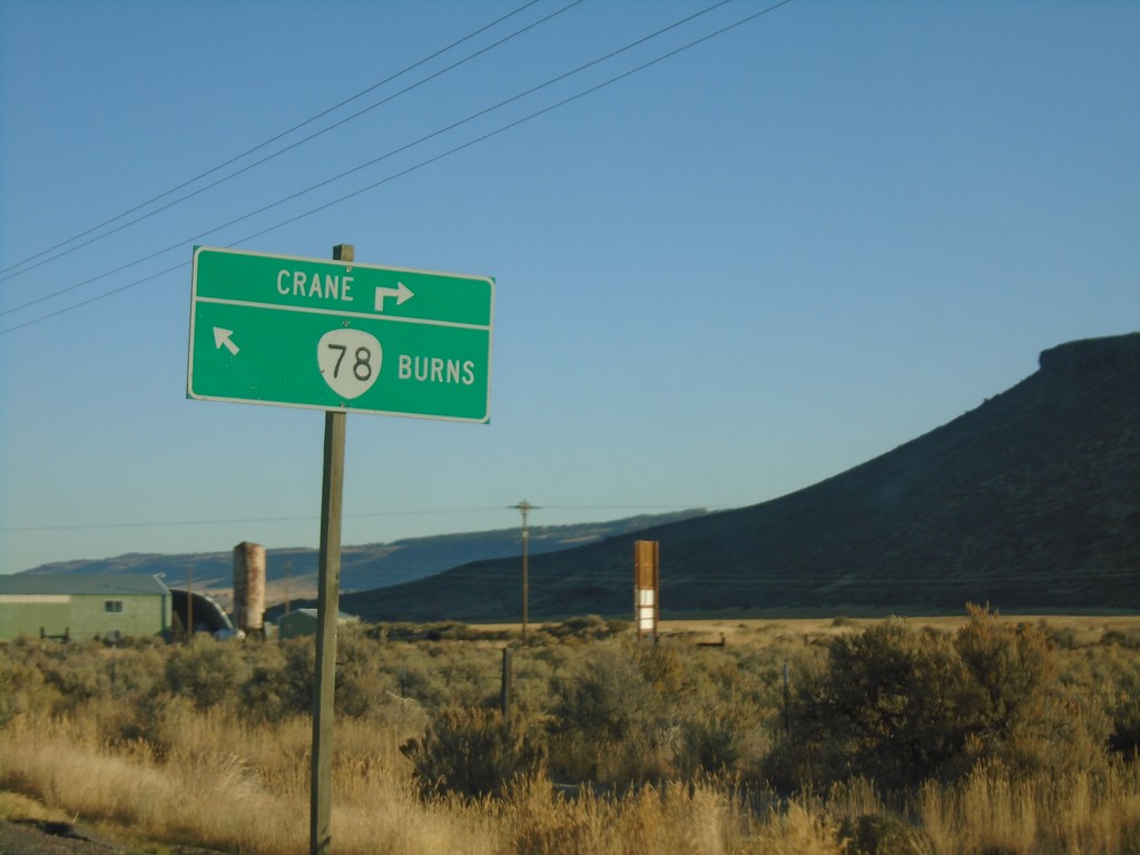
OR-78 - Crane Jct.
OR-78 at Crane Jct. Turn right for Crane, merge left for OR-78 West to Burns.
Taken 10-13-2018
Crane
Harney County
Oregon
United States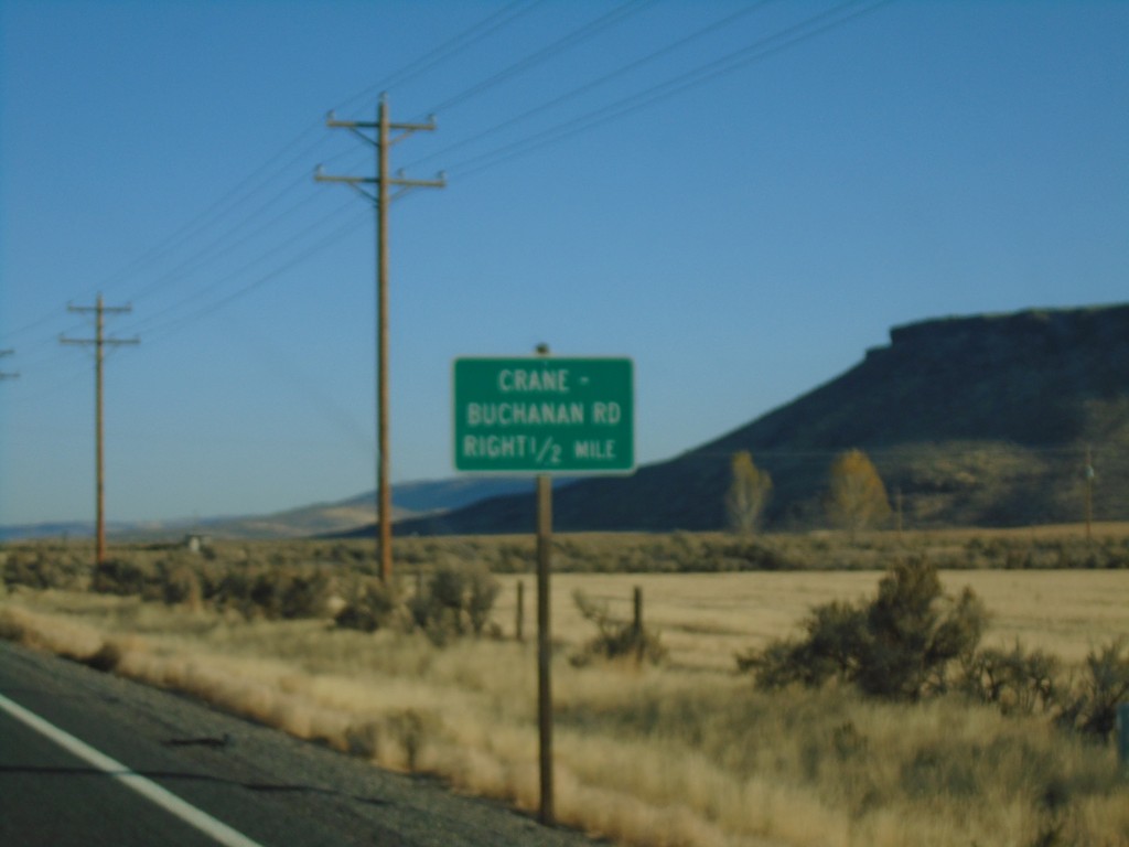
OR-78 West - Crane-Buchannan Road Jct.
OR-78 West approaching Crane-Buchannan Road Jct.
Taken 10-13-2018
Burns
Harney County
Oregon
United States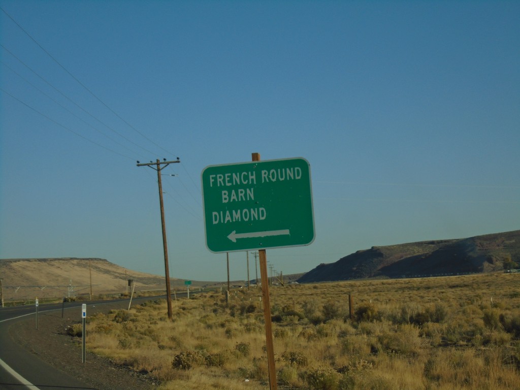
OR-78 North - French Round Barn/Diamond Jct.
OR-78 North at French Round Barn/Diamond Jct.
Taken 10-13-2018
New Princeton
Harney County
Oregon
United States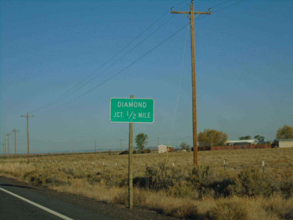
OR-78 West - Diamond Jct.
OR-78 West approaching Diamond Jct.
Taken 10-13-2018
Princeton
Harney County
Oregon
United States