Signs Tagged With Intersection
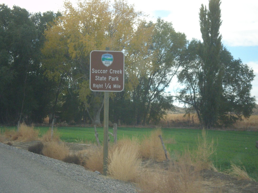
OR-201 South Approaching Succor Creek Road
OR-201 South approaching Succor Creek Road to Succor Creek State Park.
Taken 10-22-2017
 Adrian
Malheur County
Oregon
United States
Adrian
Malheur County
Oregon
United States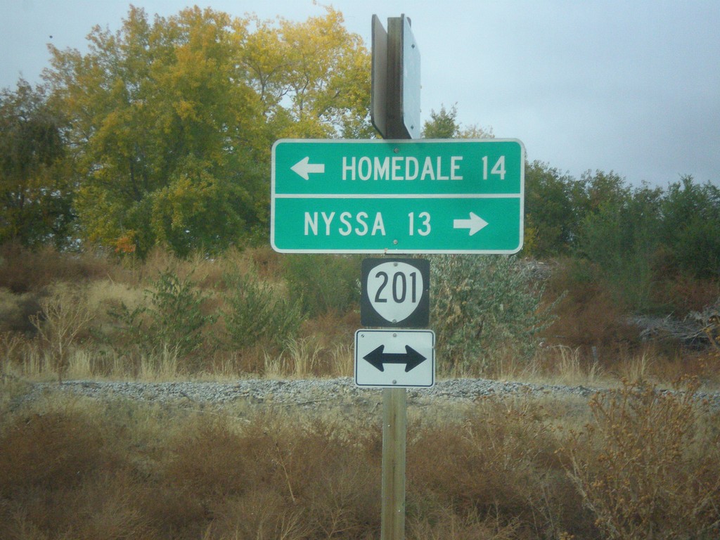
End OR-452 at OR-201
End OR-452 at OR-201 in Adrian. Turn left for OR-201 south to Homedale (Idaho); right for OR-201 north to Nyssa.
Taken 10-22-2017
 Adrian
Malheur County
Oregon
United States
Adrian
Malheur County
Oregon
United States
End OR-452 West at OR-454
End OR-452 West (unsigned) at OR-454 (unsigned). Turn right to continue west on OR-452 to Adrian. Continue straight for OR-454 West to (Big Bend Road) Caldwell (Idaho).
Taken 10-22-2017
 Adrian
Malheur County
Oregon
United States
Adrian
Malheur County
Oregon
United States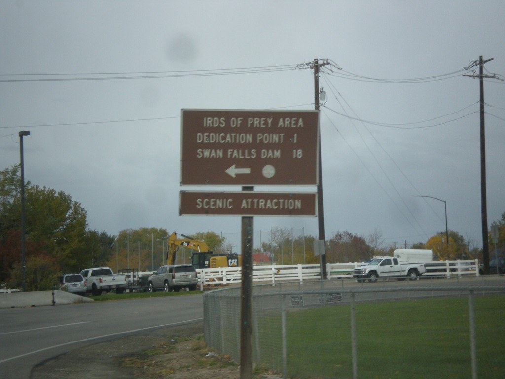
End ID-69 South at Swan Falls Road
End ID-69 South at Swan Falls Road. Turn left for Dedication Point, Birds of Prey Area and Swan Falls Dam.
Taken 10-21-2017
 Kuna
Ada County
Idaho
United States
Kuna
Ada County
Idaho
United States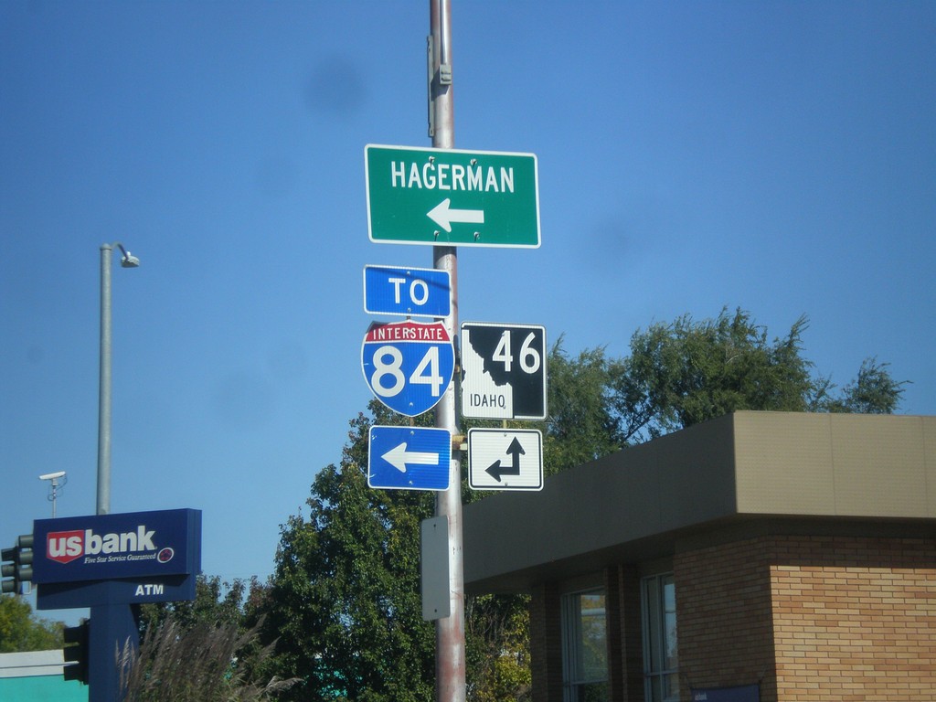
ID-46 North (Idaho St.) at ID-46 Spur to I-84
ID-46 North (Idaho St.) at ID-46 Spur (Main St.) to I-84 and Hagerman.
Taken 10-07-2017

 Wendell
Gooding County
Idaho
United States
Wendell
Gooding County
Idaho
United States
ID-46 North (Idaho St.) at Main St.
ID-46 North (Idaho St.) at Main St. in Wendell. Turn left for Main St. to I-84.
Taken 10-07-2017
Wendell
Gooding County
Idaho
United States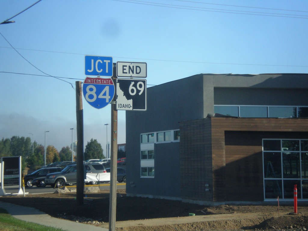
End ID-69 Approaching I-84
End ID-69 approaching I-84 in Meridian.
Taken 09-23-2017

 Meridian
Ada County
Idaho
United States
Meridian
Ada County
Idaho
United States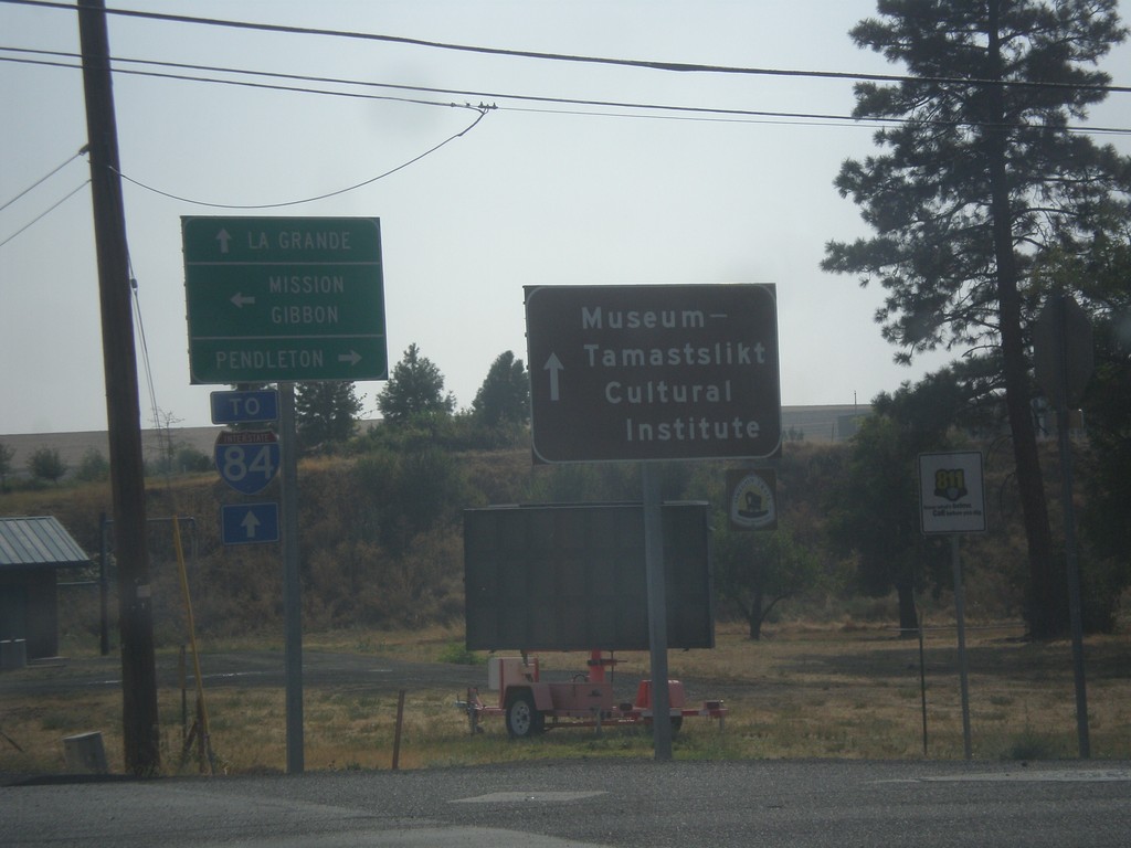
OR-331 South at Mission Road
OR-331 South at Mission Road. Turn left (east) for Misson and Gibbon; turn right (west) for Pendleton. Continue south on OR-331 for LaGrande, I-84, and the Museum-Tamastslikt Cultural Institute.
Taken 09-09-2017
 Pendleton
Umatilla County
Oregon
United States
Pendleton
Umatilla County
Oregon
United States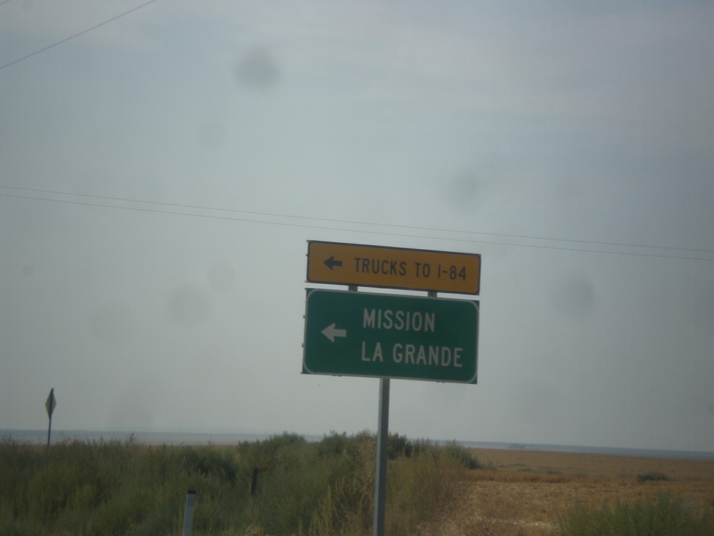
OR-11 South at OR-331
OR-11 South at OR-331 (unsigned). Use OR-331 south (Mission Highway) to Mission and LaGrande. All I-84 truck traffic use OR-331.
Taken 09-09-2017
 Pendleton
Umatilla County
Oregon
United States
Pendleton
Umatilla County
Oregon
United States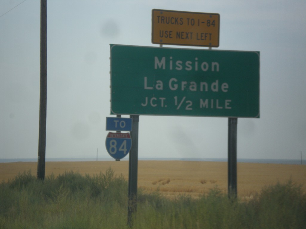
OR-11 South Approaching OR-331
OR-11 South Approaching OR-331 (Mission Highway). Use Mission Highway for Mission and LaGrande. I-84 traffic is encouraged to use the Mission Highway instead of going through Pendleton.
Taken 09-09-2017
Pendleton
Umatilla County
Oregon
United States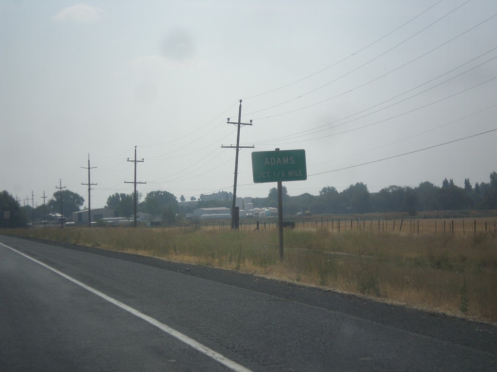
OR-11 South Approaching Adams Jct.
OR-11 South approaching Adams Jct.
Taken 09-09-2017
Adams
Umatilla County
Oregon
United States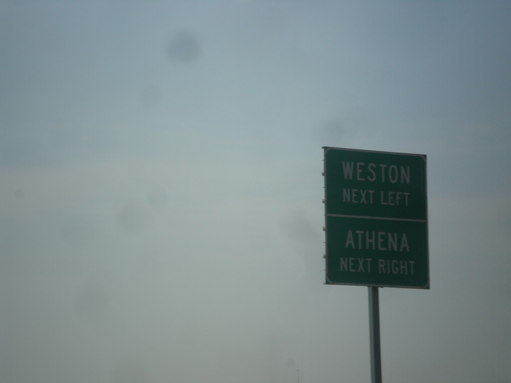
OR-11 South Approaching OR-334 and Banister Road
OR-11 South approaching (OR-334) west to Athena, and Banister Road east to Weston.
Taken 09-09-2017
 Athena
Umatilla County
Oregon
United States
Athena
Umatilla County
Oregon
United States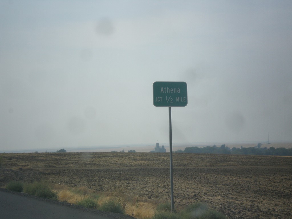
OR-11 South Approaching Athena Jct.
OR-11 South Approaching Athena Jct (unsigned OR-334).
Taken 09-09-2017
Athena
Umatilla County
Oregon
United States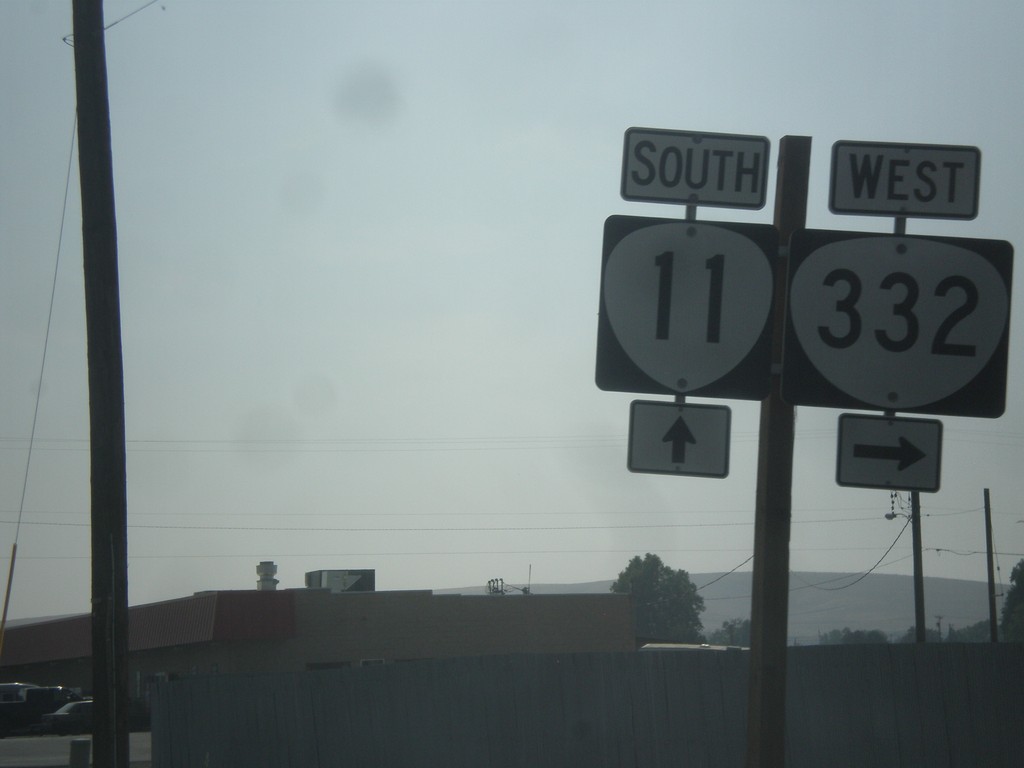
OR-11 South at OR-332
OR-11 south at OR-332 west in Umatilla County.
Taken 09-09-2017
 Milton-Freewater
Umatilla County
Oregon
United States
Milton-Freewater
Umatilla County
Oregon
United States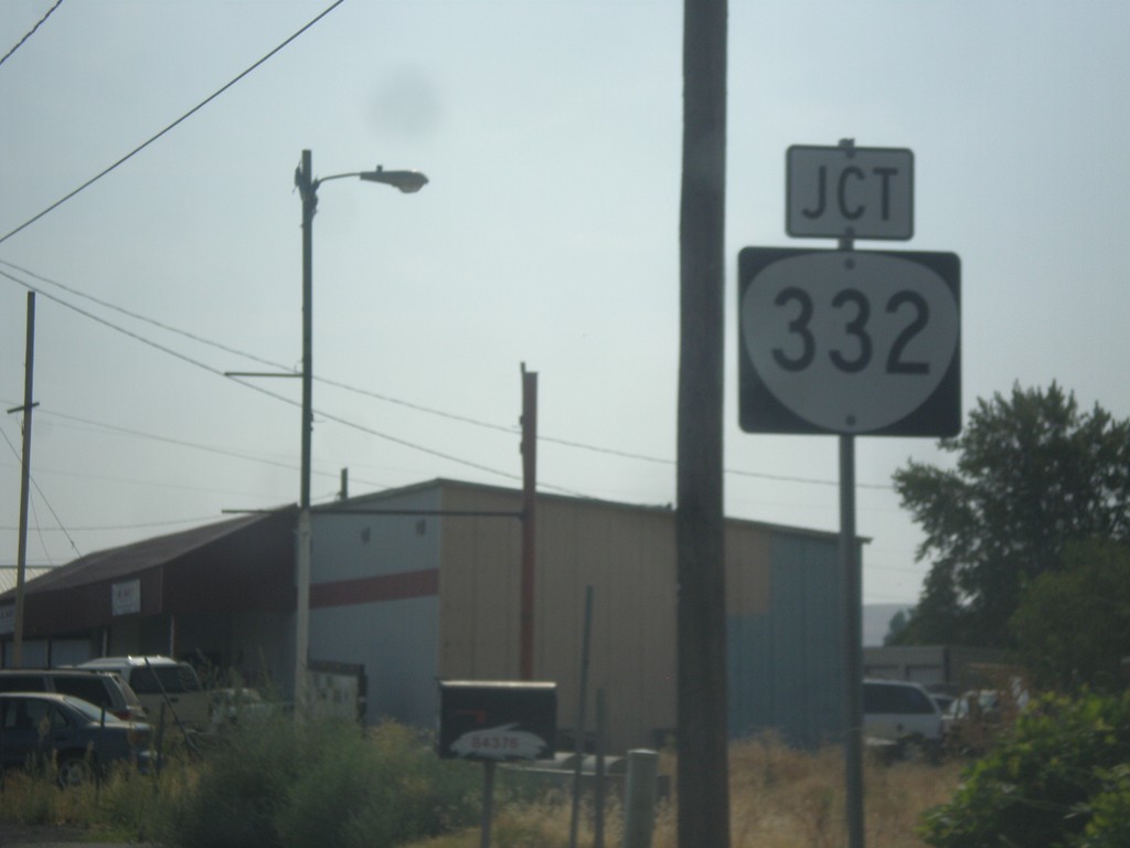
OR-11 South Approaching OR-332
OR-11 South approaching OR-332 in Umatilla County. OR-332 was recently signed as a state highway. In prior years this was just known as the Sunnyside-Umapine Highway #332, but without any route markers.
Taken 09-09-2017
Milton-Freewater
Umatilla County
Oregon
United States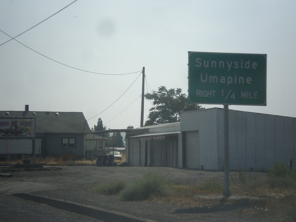
OR-11 South Approaching OR-332
OR-11 South approaching OR-332 to Sunnyside and Umapine.
Taken 09-09-2017
Milton-Freewater
Umatilla County
Oregon
United States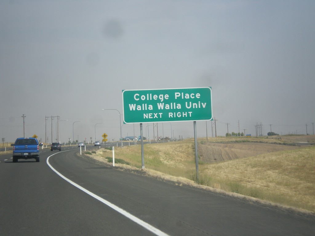
US-12 East Approaching Heritage Road
US-12 East approaching Heritage Road. Use Heritage Road for College Place and Walla Walla University.
Taken 09-09-2017
 Walla Walla
 County
Washington
United States
Walla Walla
Walla Walla County
Washington
United States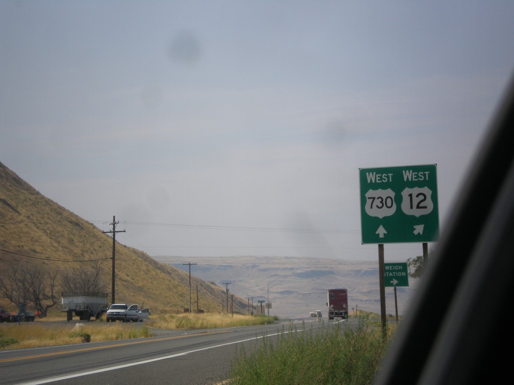
US-12 West at US-730 West
US-12 West at US-730 West in Walla Walla County. Merge right to continue west on US-12. US-730 follows the Columbia River westbound into Oregon.
Taken 09-09-2017
 Touchet
Walla Walla County
Washington
United States
Touchet
Walla Walla County
Washington
United States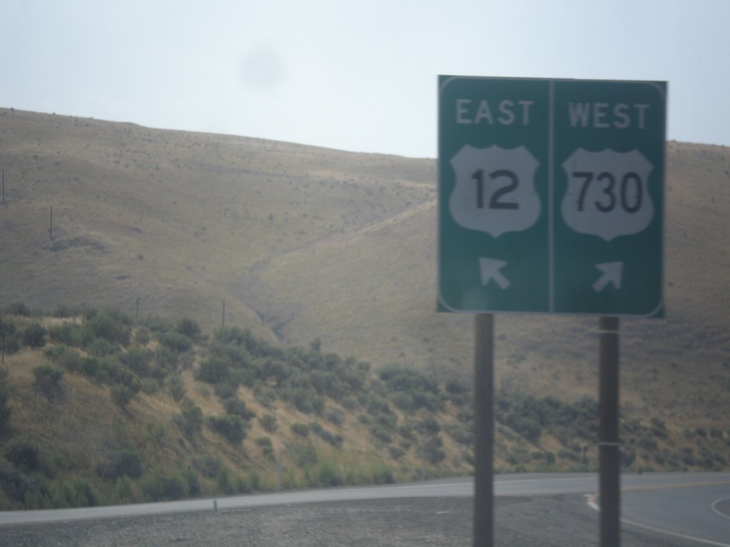
US-12 East at US-730
US-12 East at US-730. Merge right for US-730 west; left for US-12 east. This is the western end of US-730.
Taken 09-09-2017
Wallula Junction
Walla Walla County
Washington
United States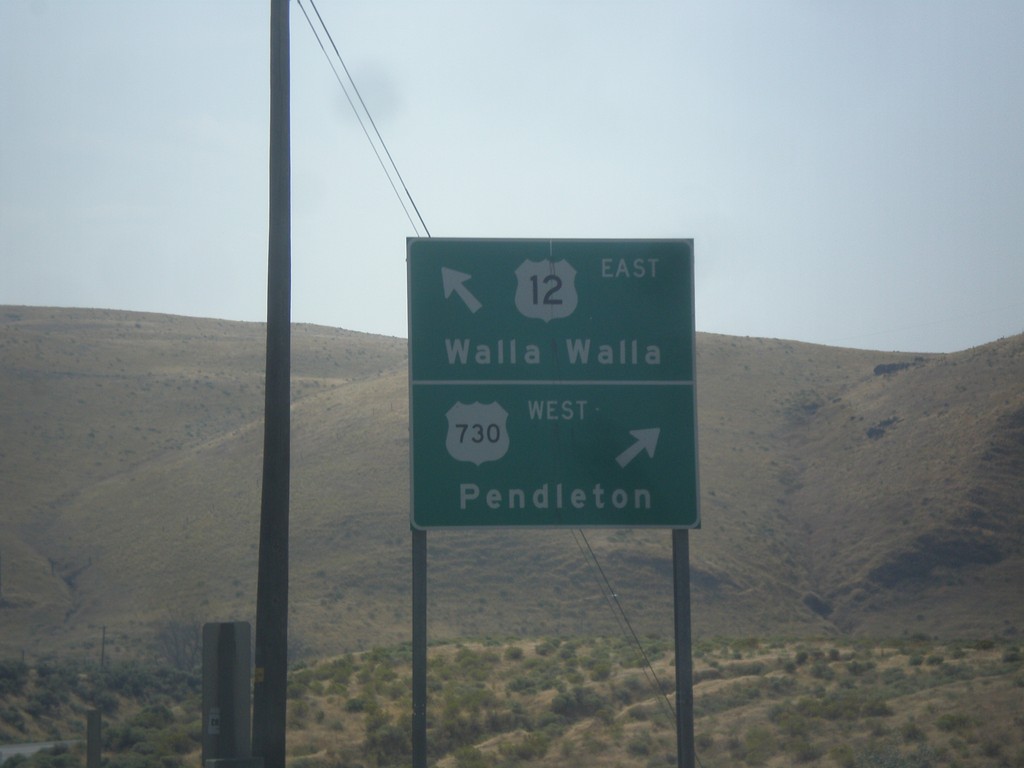
US-12 East at US-730
US-12 East at US-730. Use US-730 West to Pendleton (Oregon); US-12 East to Walla Walla.
Taken 09-09-2017
Wallula Junction
Walla Walla County
Washington
United States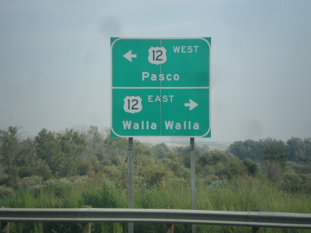
End US-730 East at US-12
End US-730 East at US-12. Turn right for US-12 east to Walla Walla; left for US-12 west to Pasco.
Taken 09-09-2017
Wallula Junction
Walla Walla County
Washington
United States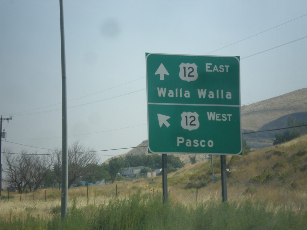
End US-730 East at US-12
End US-730 East at US-12. Merge left for US-12 west to Pasco; right for US-12 east to Walla Walla.
Taken 09-09-2017
Wallula Junction
Walla Walla County
Washington
United States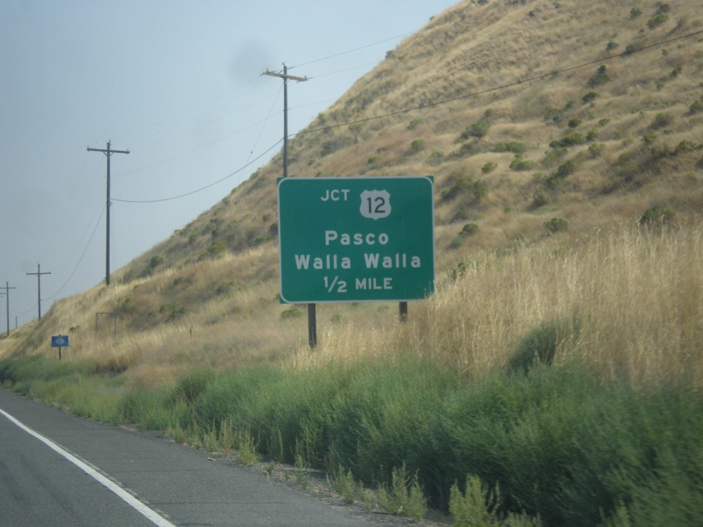
US-730 East Approaching US-12
US-730 East approaching US-12 to Pasco and Walla Walla.
Taken 09-09-2017
Wallula Junction
Walla Walla County
Washington
United States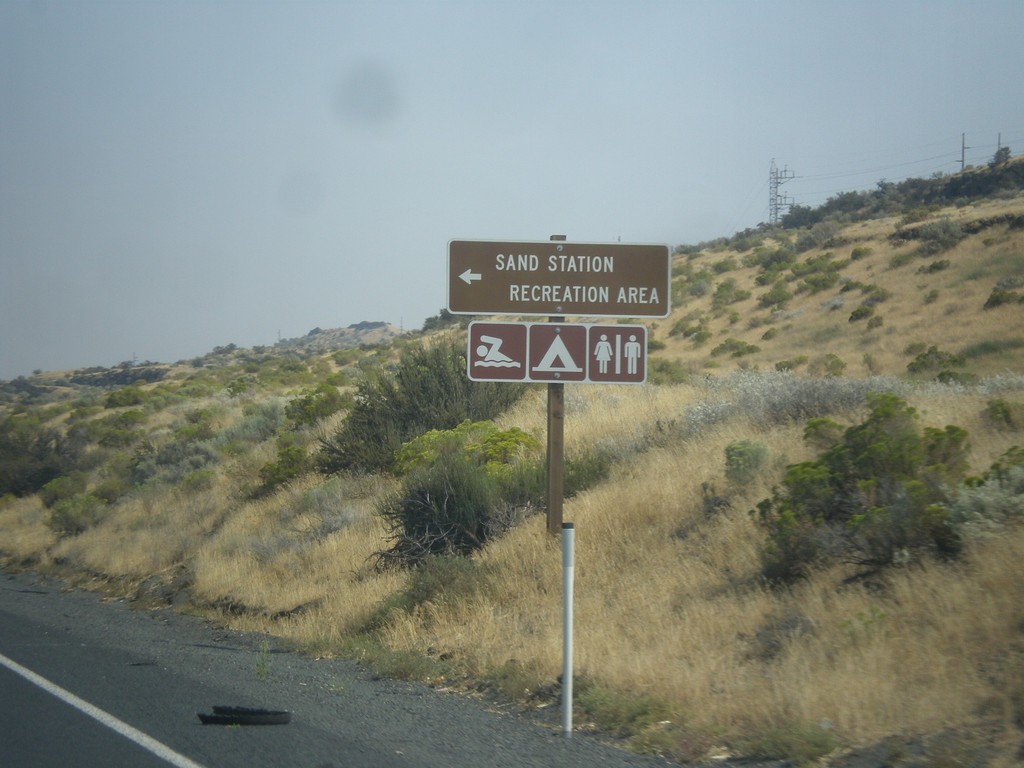
US-730 East - Sand Station Rec. Area
US-730 East at Sand Station Rec. Area on the Columbia River.
Taken 09-09-2017
Helix
Umatilla County
Oregon
United States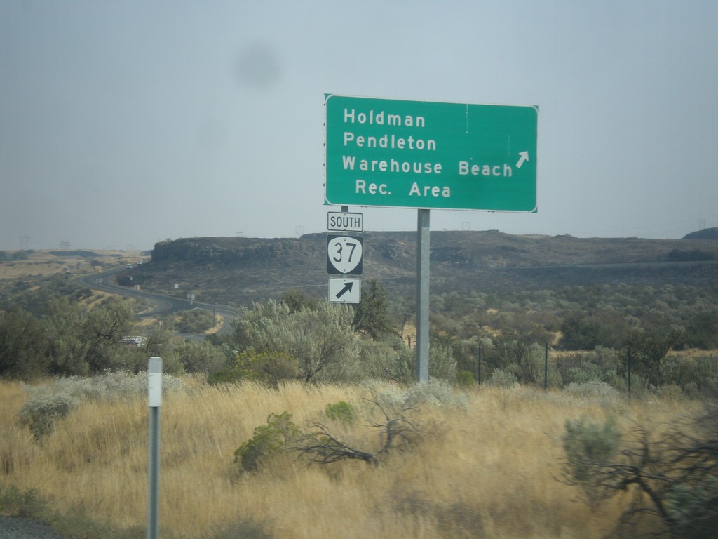
US-730 East at OR-37
US-730 East at OR-37 South at Cold Springs Junction. Use OR-37 south for Holdman, Pendleton, and Warehouse Beach Recreation Area.
Taken 09-09-2017
 Cold Springs Junction
Umatilla County
Oregon
United States
Cold Springs Junction
Umatilla County
Oregon
United States