Signs Tagged With Intersection
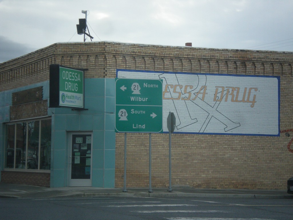
WA-28 West at WA-21 - Odessa
WA-28 West at WA-21 in Odessa. Turn right for WA-21 south to Lind; left for WA-21 north to Wilbur.
Taken 04-30-2018

 Odessa
Lincoln County
Washington
United States
Odessa
Lincoln County
Washington
United States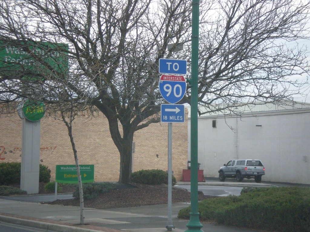
WA-28 West Approaching WA-21 to I-90
WA-28 West approaching WA-21 South to I-90
Taken 04-30-2018
 Odessa
Lincoln County
Washington
United States
Odessa
Lincoln County
Washington
United States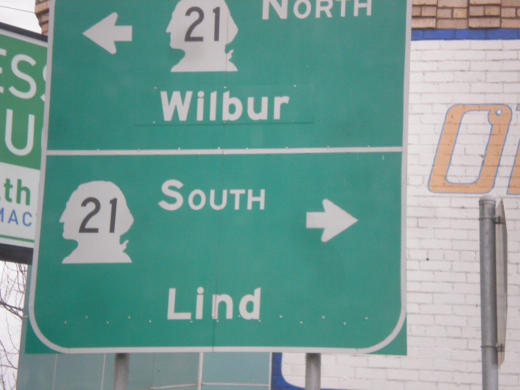
WA-28 West at WA-21 - Odessa
WA-28 West at WA-21 in Odessa. Turn right for WA-21 south to Lind; left for WA-21 north to Wilbur.
Taken 04-30-2018
Odessa
Lincoln County
Washington
United States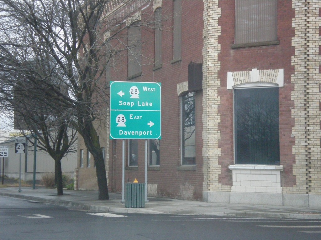
WA-21 North at WA-28 - Odessa
WA-21 North at WA-28 in Odessa. Turn right for WA-28 east to Davenport; left for WA-28 west to Soap Lake.
Taken 04-30-2018
Odessa
Lincoln County
Washington
United States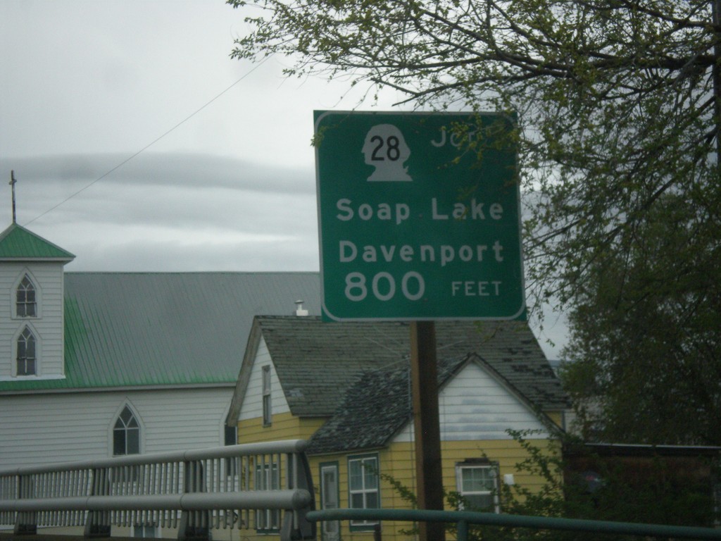
WA-21 North Approaching WA-28
WA-21 North approaching WA-28 to Davenport and Soap Lake.
Taken 04-30-2018
Odessa
Lincoln County
Washington
United States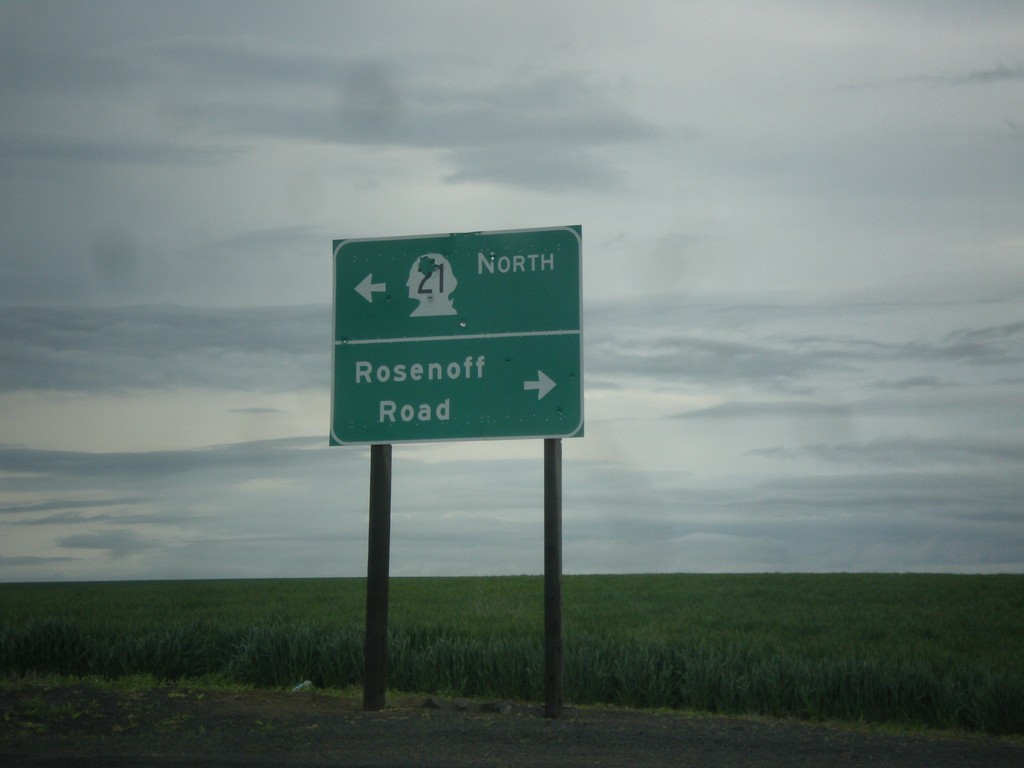
WA-21 North at Rosenoff Road
WA-21 North at Rosenoff Road. Turn right for Rosenoff Road; turn left to continue north on WA-21.
Taken 04-30-2018
Reiman
Adams County
Washington
United States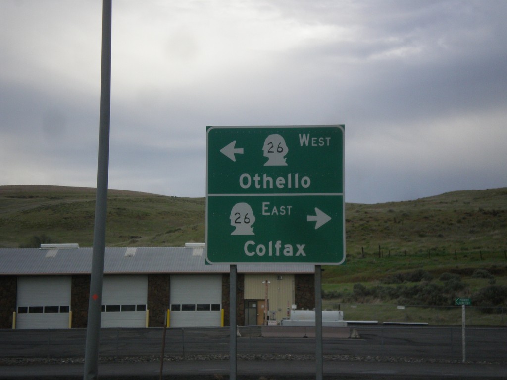
WA-260/WA-261 North at WA-26
WA-260/WA-261 North at WA-26 in Washtucna. Turn right for WA-26 east to Colfax; left for WA-26 west to Othello. This is the northern end of WA-260. WA-261 continues north towards Ritzville.
Taken 04-30-2018


 Washtucna
Adams County
Washington
United States
Washtucna
Adams County
Washington
United States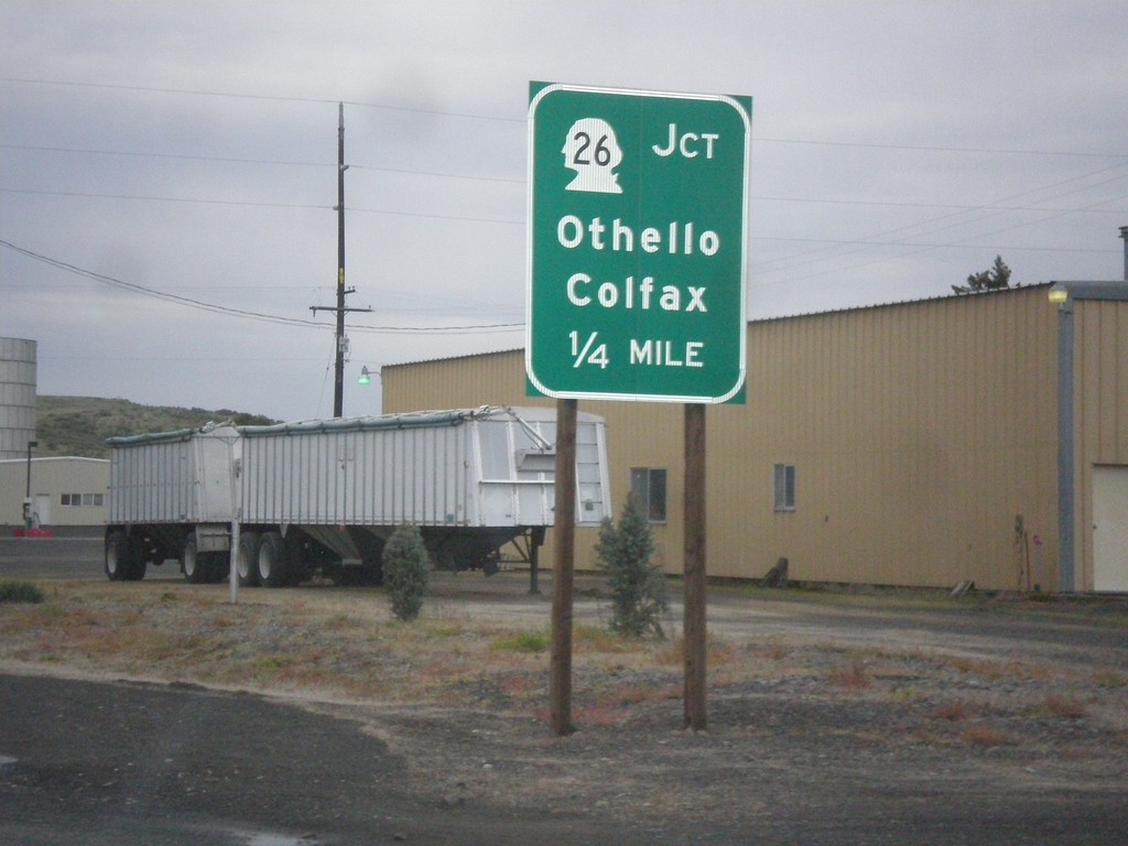
WA-260/WA-261 North Approaching WA-26
WA-260/WA-261 North approaching WA-26 to Colfax and Othello in Washtucna.
Taken 04-30-2018
Washtucna
Adams County
Washington
United States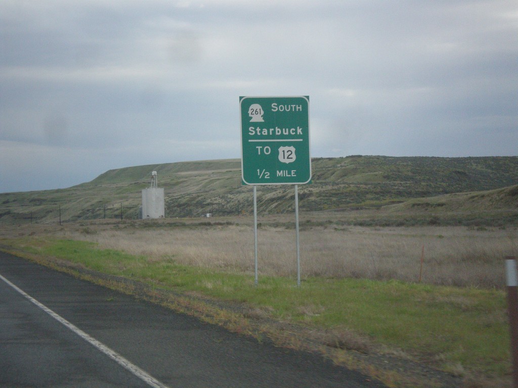
WA-260 North Approaching WA-261 South
WA-260 North Approaching WA-261 South to Starbuck and US-12. WA-261 joins WA-260 north to Washtucna.
Taken 04-30-2018
 Washtucna
Franklin County
Washington
United States
Washtucna
Franklin County
Washington
United States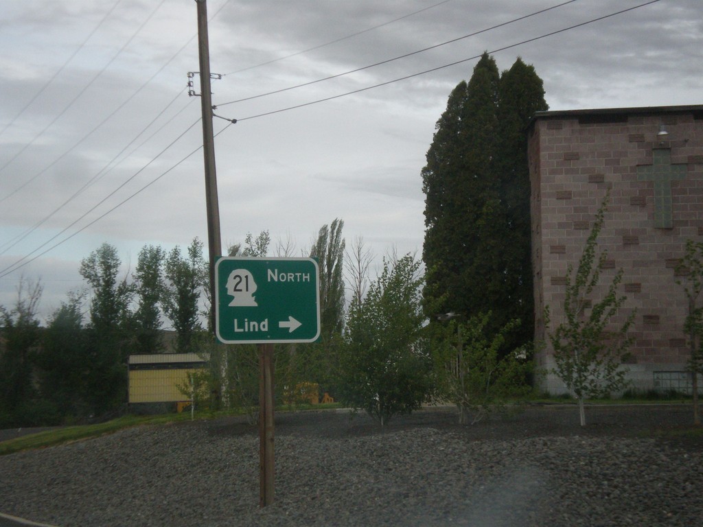
WA-260 South at WA-21 North
WA-260 South at WA-21 North to Lind in Kahlotus.
Taken 04-30-2018
Kahlotus
Franklin County
Washington
United States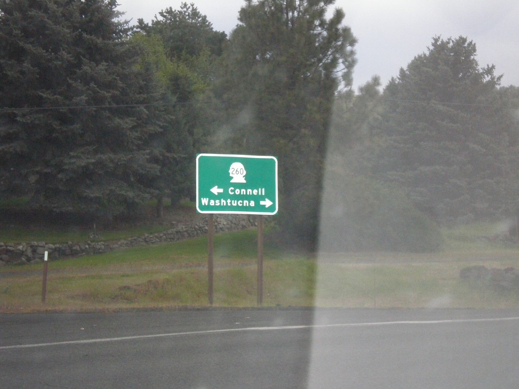
End WA-263 North at WA-260
End WA-263 North at WA-260 in Kahlotus. Turn right for WA-260 north to Washtucna; left for WA-260 south to Connell.
Taken 04-30-2018
 Kahlotus
Franklin County
Washington
United States
Kahlotus
Franklin County
Washington
United States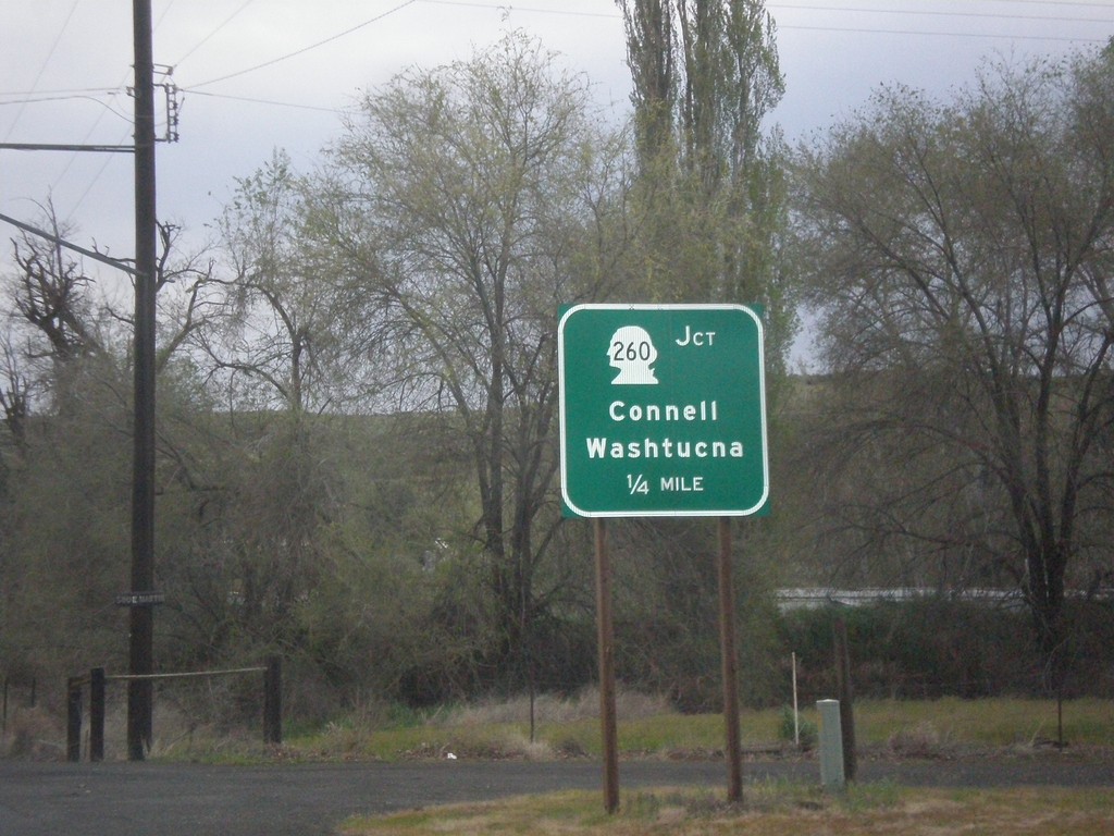
WA-263 North Approaching WA-260
WA-263 North approaching WA-260 to Connell and Washtucna in Kahlotus.
Taken 04-30-2018
Kahlotus
Franklin County
Washington
United States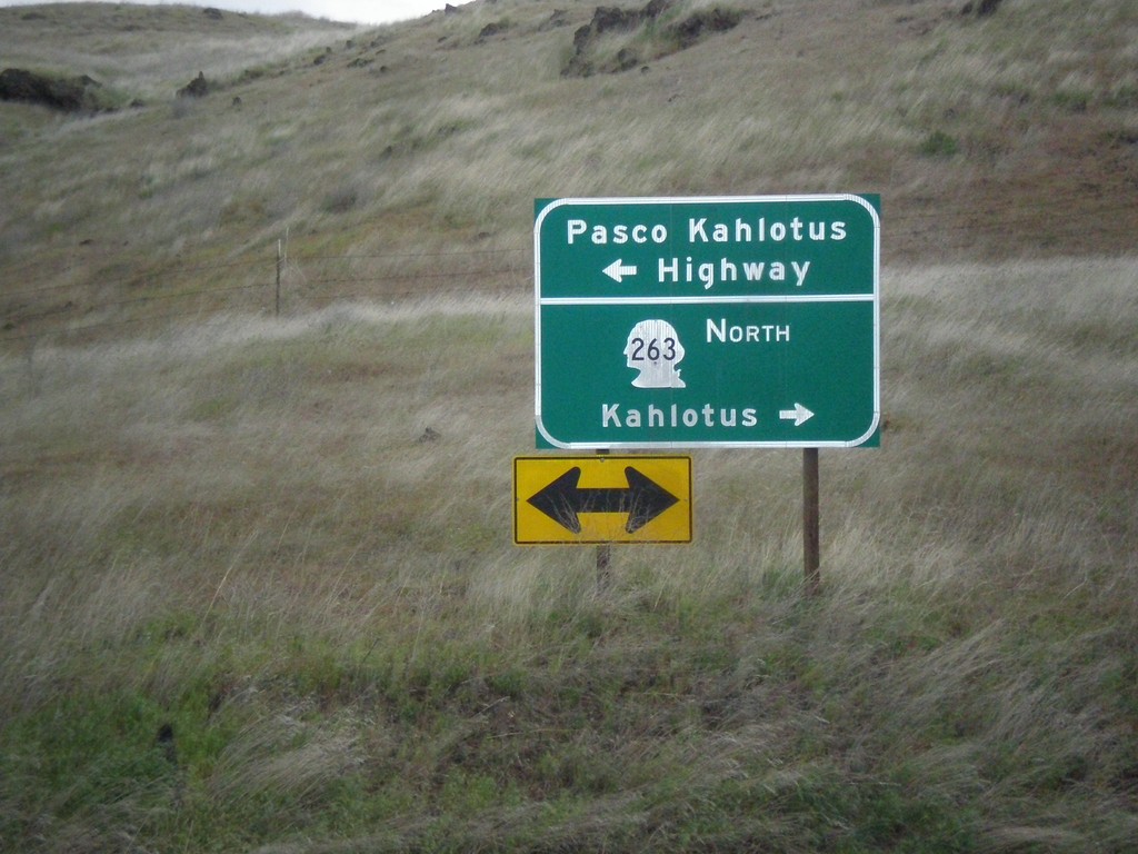
WA-263 North at Pasco Kahlotus Highway
WA-263 North at Pasco Kahlotus Highway in Franklin County. Turn left for Pasco Kahlotus Highway; right to continue north on WA-263 to Kahlotus.
Taken 04-30-2018
Pasco
Franklin County
Washington
United States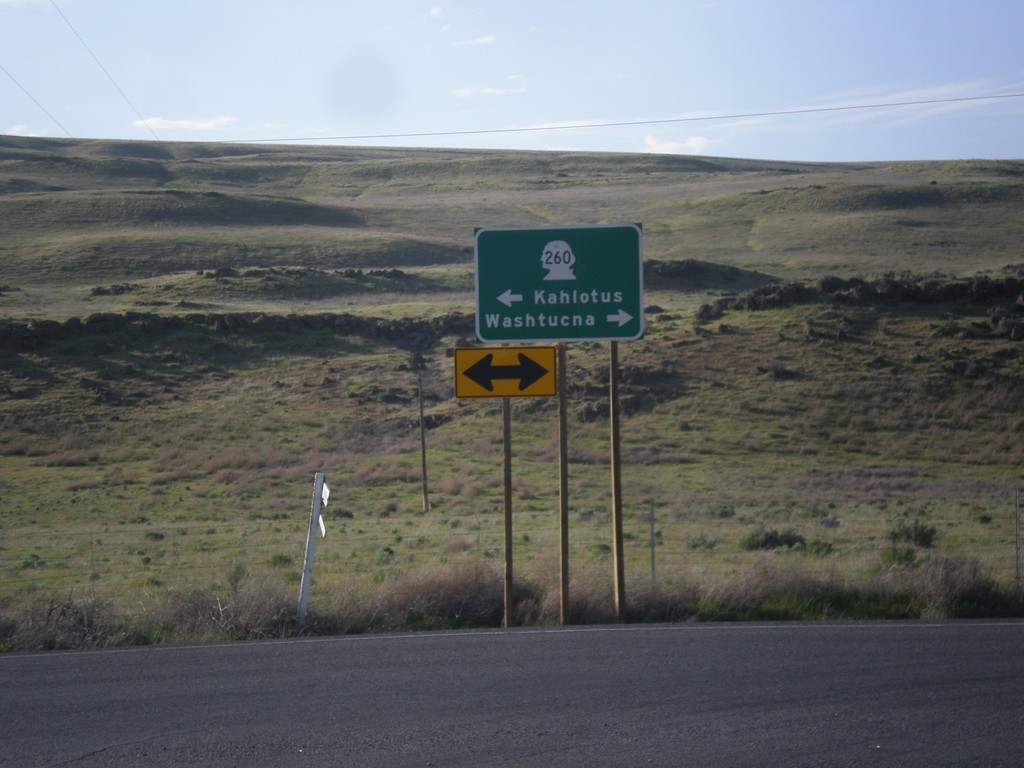
WA-261 North at WA-260
WA-261 North at WA-260 in Franklin County. Turn right for WA-260/WA-261 North to Washtucna; left for WA-261 South to Kahlotus. WA-260 joins WA-261 north to Washtucna.
Taken 04-29-2018
Washtucna
Franklin County
Washington
United States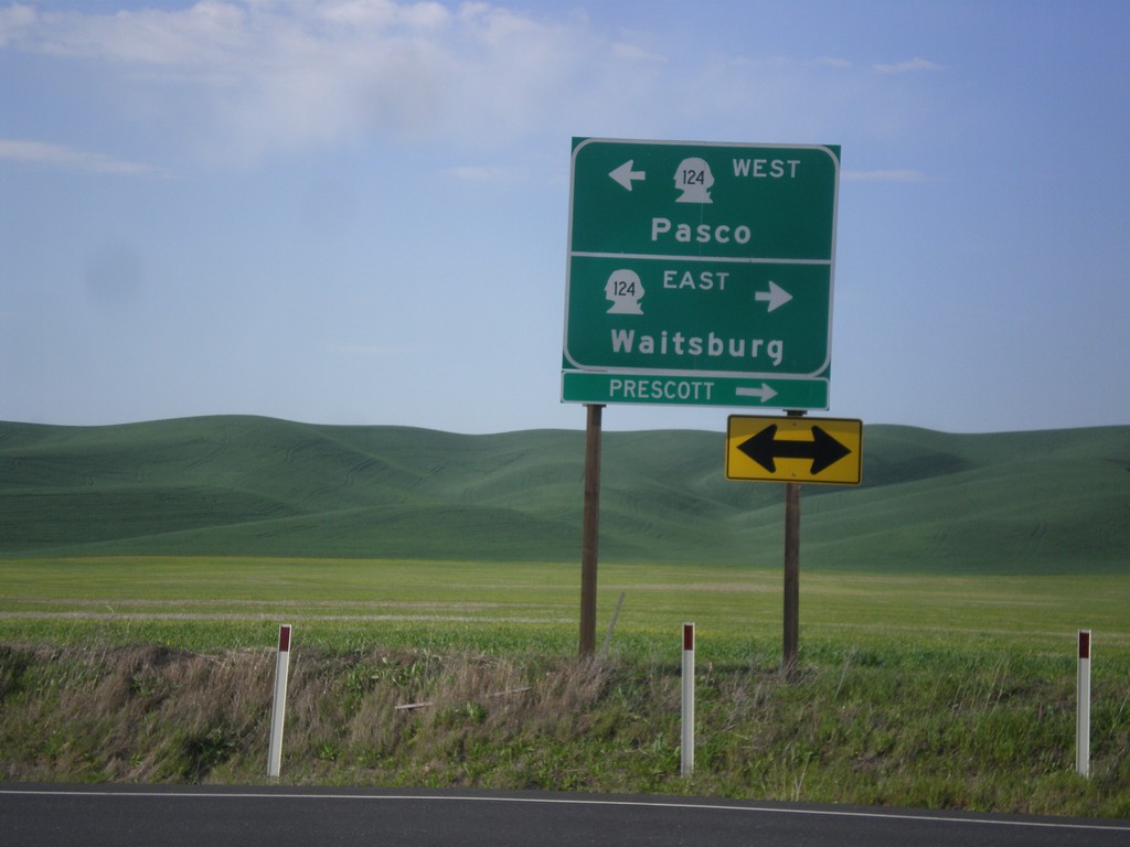
End WA-125 North at WA-124
End WA-125 North at WA-124. Turn right for WA-124 east to Waitsburg and Prescott. Turn left for WA-124 west to Pasco.
Taken 04-29-2018

 Prescott
Walla Walla County
Washington
United States
Prescott
Walla Walla County
Washington
United States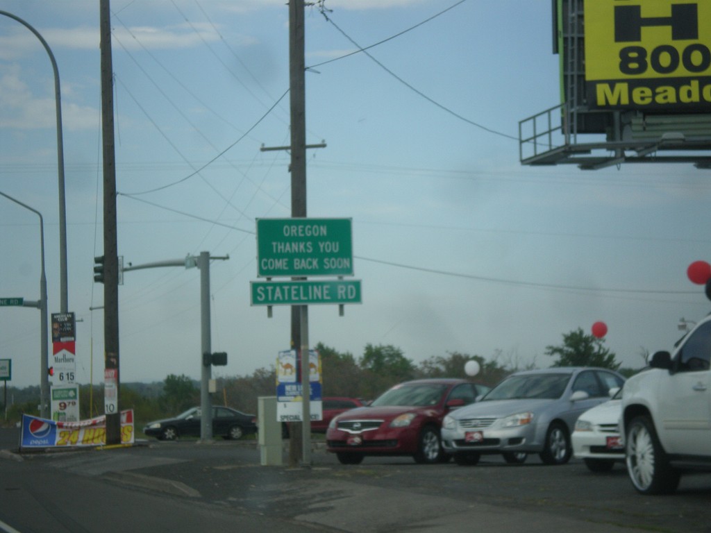
OR-11 North at Stateline Road - Leaving Oregon
OR-11 North at Stateline Road in Umatilla County. Stateline Road parallels the Oregon-Washington border. Oregon Thanks You - Come Back Soon.
Taken 04-29-2018
 Milton-Freewater
Umatilla County
Oregon
United States
Milton-Freewater
Umatilla County
Oregon
United States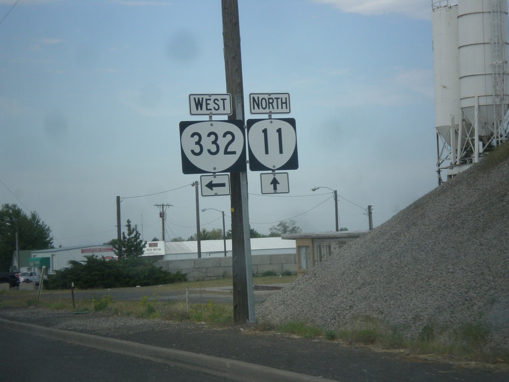
OR-11 North at OR-332 West (Sunnyside Road)
OR-11 North at OR-332 West (Sunnyside Road) in Umatilla County.
Taken 04-29-2018
 Milton-Freewater
Umatilla County
Oregon
United States
Milton-Freewater
Umatilla County
Oregon
United States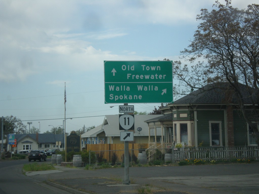
OR-11 North (Main St.) at Columbia St.
OR-11 North (Main St.) at Columbia St. Turn right on Columbia St. to continue north on OR-11 to Walla Walla (WA) and Spokane (WA). Continue straight on Main St. for Old Town Freewater.
Taken 04-29-2018
Milton-Freewater
Umatilla County
Oregon
United States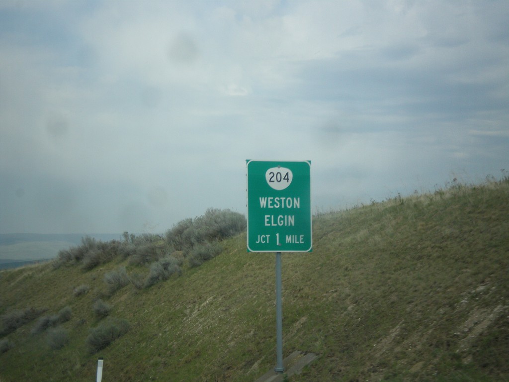
OR-11 North Approaching OR-204
OR-11 North Approaching OR-204 east to Weston and Elgin.
Taken 04-29-2018
 Weston
Umatilla County
Oregon
United States
Weston
Umatilla County
Oregon
United States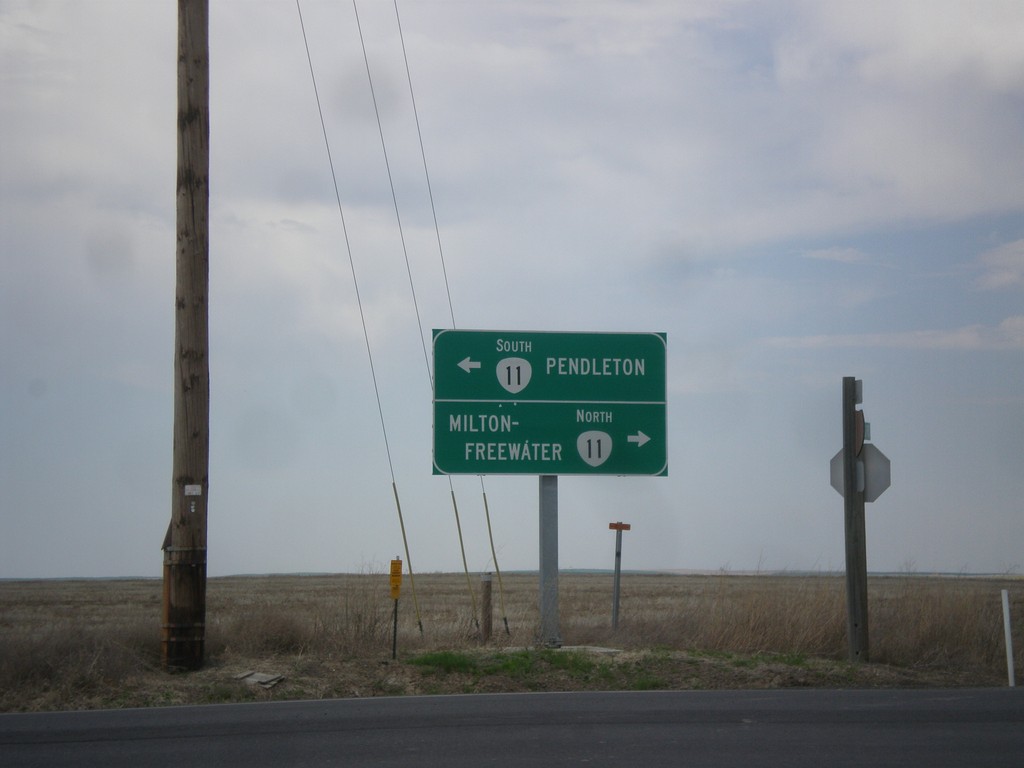
End OR-331 North at OR-11
End OR-331 North at OR-11 in Umatilla County. Turn right for OR-11 north to Milton-Freewater; turn left for OR-11 south to Pendleton.
Taken 04-29-2018
 Pendleton
Umatilla County
Oregon
United States
Pendleton
Umatilla County
Oregon
United States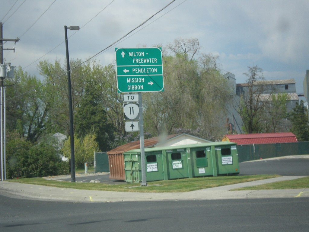
OR-331 North at Mission Road
OR-331 North at Mission Road. Turn right for Mission Road east to Mission and Gibbon. Turn left for Mission Road west to Pendleton. Continue north on OR-331 for OR-11 to Milton-Freewater.
Taken 04-29-2018
Pendleton
Umatilla County
Oregon
United States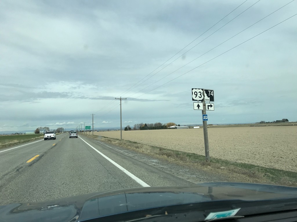
US-93 North Approaching ID-74
US-93 North approaching ID-74 in Twin Falls County.
Taken 03-31-2018

 Filer
Twin Falls County
Idaho
United States
Filer
Twin Falls County
Idaho
United States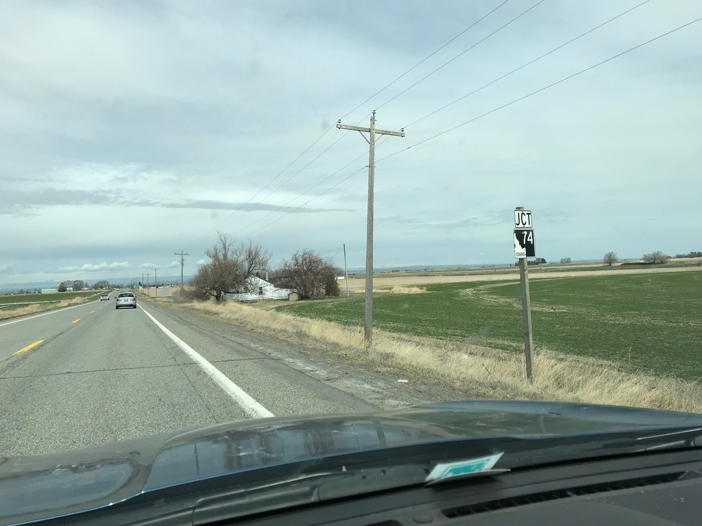
US-93 South Approaching ID-74
US-93 South approaching ID-74 in Twin Falls County.
Taken 03-31-2018
Filer
Twin Falls County
Idaho
United States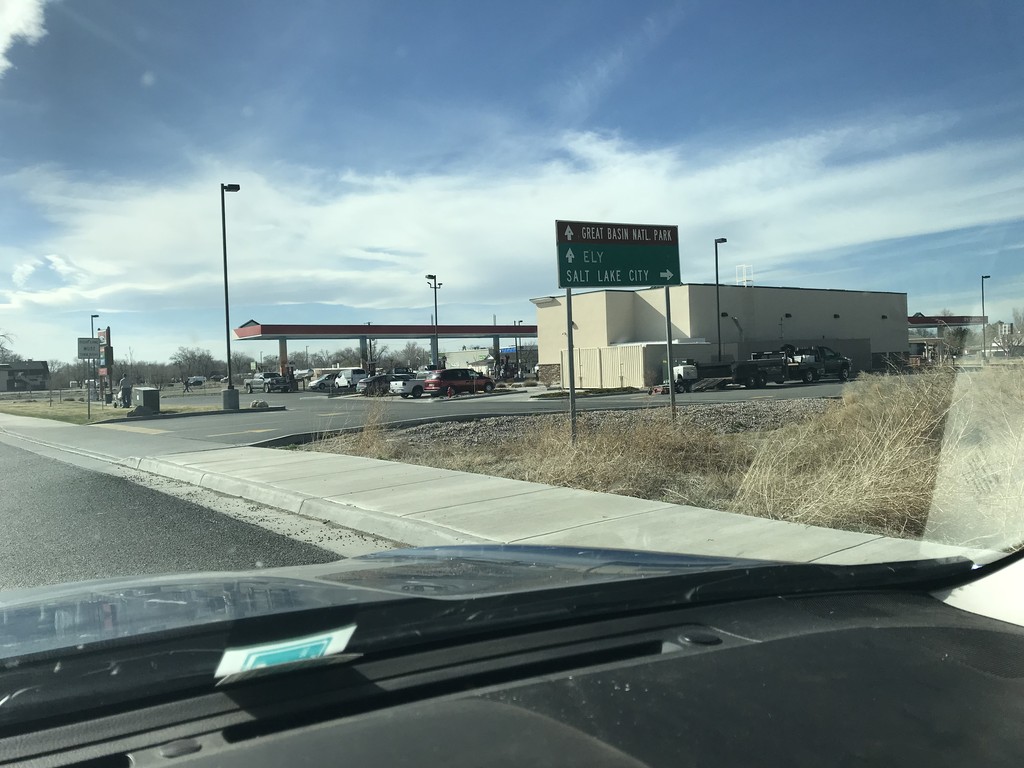
US-50 West at US-6 Jct.
US-50 west at US-6 jct. in Delta. Turn right on US-6 east for Salt Lake City. Continue west on US-6/US-50 for Ely (Nevada) and Great Basin National Park (Nevada). US-6 joins US-50 westbound to Ely.
Taken 03-30-2018

 Delta
Millard County
Utah
United States
Delta
Millard County
Utah
United States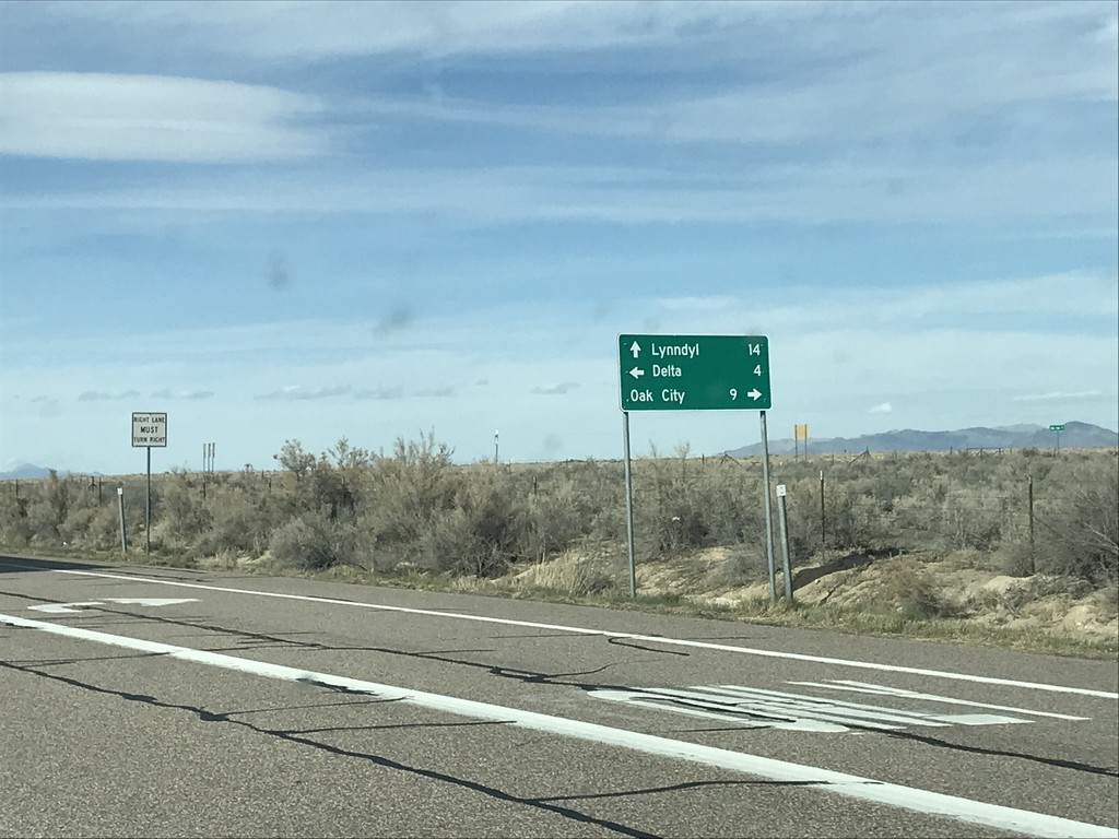
US-50 West at UT-125 and UT-136
US-50 West at UT-125 and UT-136 junction. Turn right for UT-125 east to Oak City. Continue straight for UT-136 north to Lynndyl. Turn left to continue west on US-50 towards Delta.
Taken 03-30-2018

 Delta
Millard County
Utah
United States
Delta
Millard County
Utah
United States