Signs Tagged With Intersection
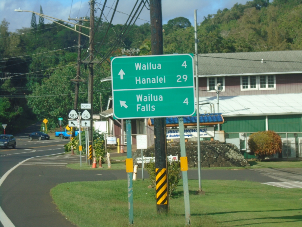
HI-56 North Approaching HI-583 (Maʻalo Road)
HI-56 North (Kūhiō Highway) approaching HI-583 (Maʻalo Road) to Wailua Falls. Continue north on HI-56 to Wailua and Hanalei.
Taken 02-17-2025

 Lihue
Kauai County
Hawaii
United States
Lihue
Kauai County
Hawaii
United States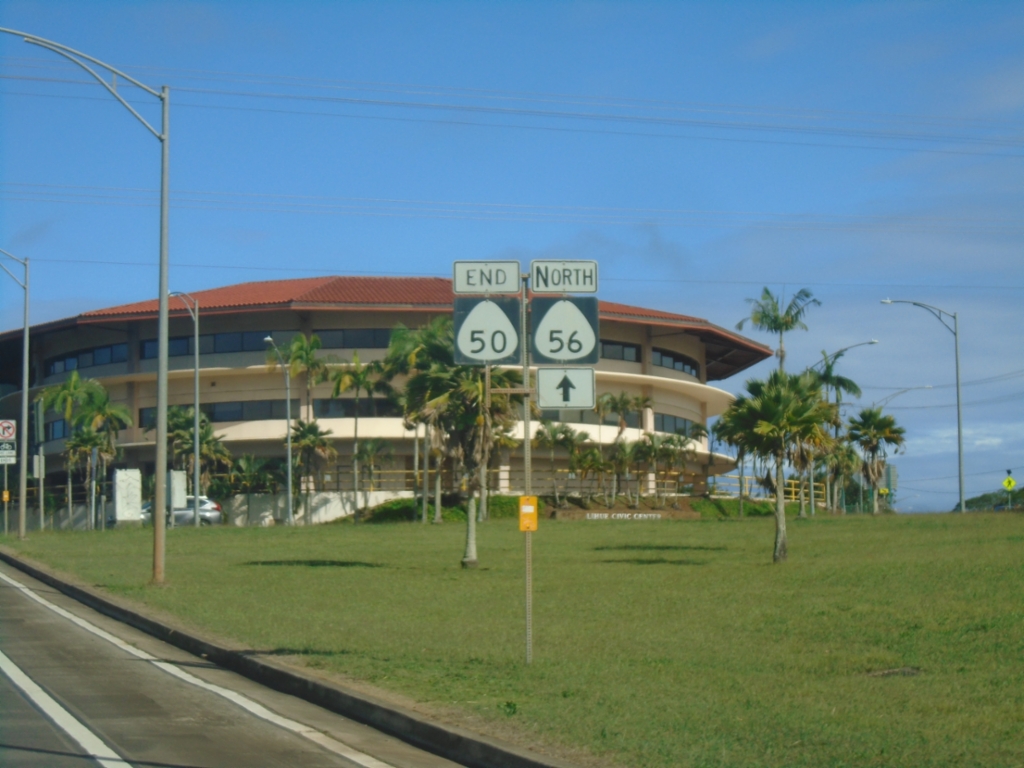
End HI-50 East at HI-56 and Rice St.
End HI-50 East (Kaumualiʻi Highway) at HI-56 North (Kūhiō Highway) and Rice St.
Taken 02-17-2025
 Lihue
Kauai County
Hawaii
United States
Lihue
Kauai County
Hawaii
United States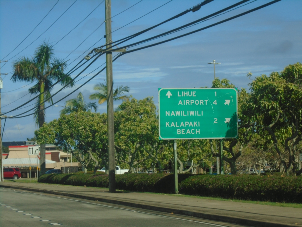
HI-50 East at HI-58 (Nāwiliwili Road)
HI-50 East (Kaumualiʻi Highway) at HI-58 (Nāwiliwili Road). Use HI-58 for Nāwiliwili and Kalapiki Beach. Continue east on HI-50 for Airport and Līhuʻe.
Taken 02-17-2025
 Lihue
Kauai County
Hawaii
United States
Lihue
Kauai County
Hawaii
United States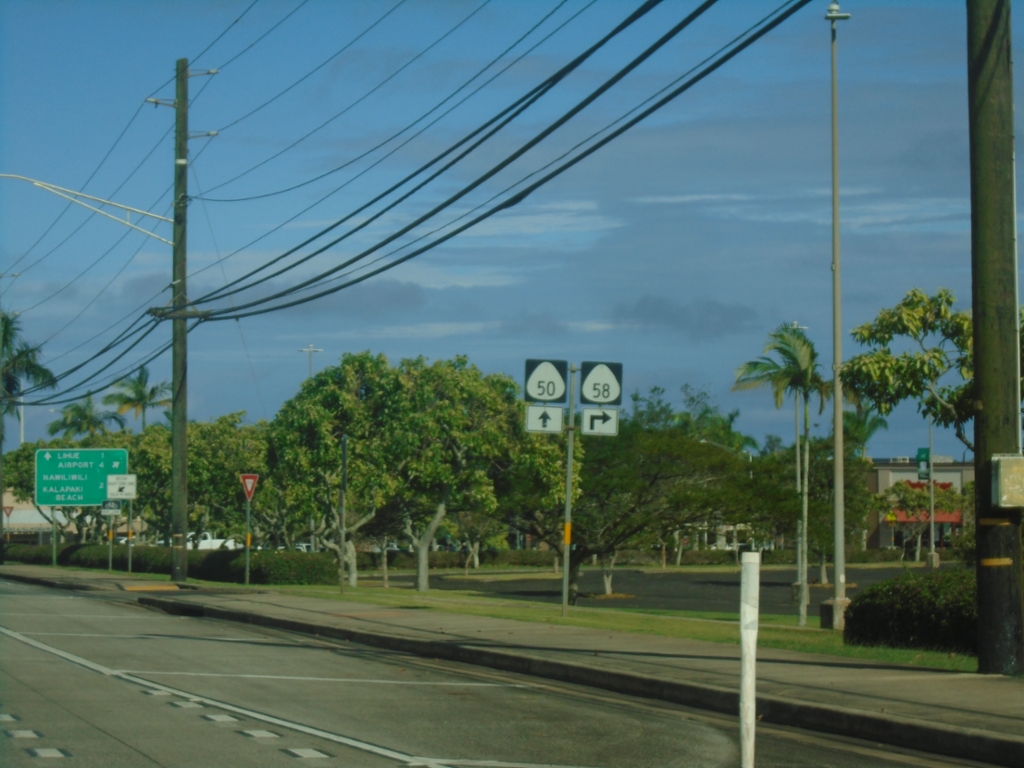
HI-50 East Approaching HI-58
HI-50 East (Kaumualiʻi Highway) approaching HI-58 (Nāwiliwili Road).
Taken 02-17-2025
Lihue
Kauai County
Hawaii
United States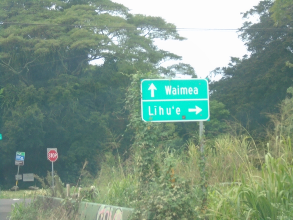
Kōloa Road West at Maluhia Road (HI-520)
Kōloa Road west at Maluhia Road (HI-520 North) to Līhuʻe. Continue straight for HI-520 South to Waimea.
Taken 02-17-2025
 Koloa
Kauai County
Hawaii
United States
Koloa
Kauai County
Hawaii
United States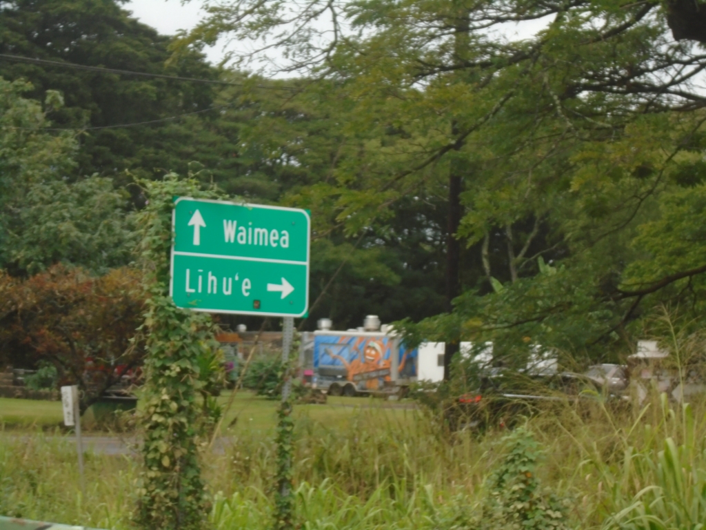
Kōloa Road West at Maluhia Road (HI-520)
Kōloa Road west at Maluhia Road (HI-520 North) to Līhuʻe. Continue straight for HI-520 South to Waimea.
Taken 02-17-2025
Koloa
Kauai County
Hawaii
United States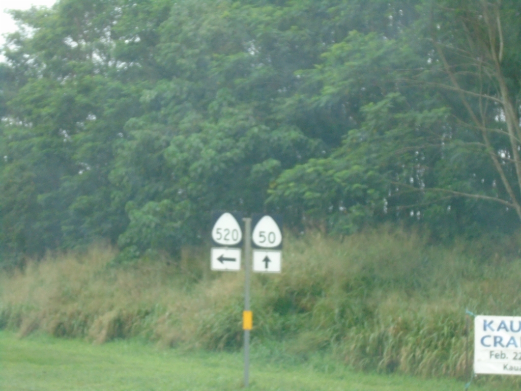
HI-50 West at HI-520 South
HI-50 West (Kaumualiʻi Highway) at HI-520 South (Maluhia Road).
Taken 02-17-2025
Kalaheo
Kauai County
Hawaii
United States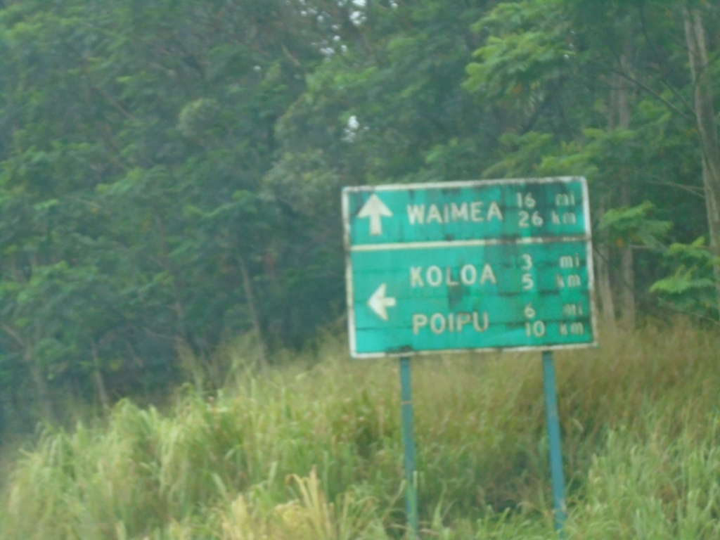
HI-50 West at HI-520
HI-50 West (Kaumualiʻi Highway) at HI-520 south (Maluhia Road) to Poʻipū and Kōloa.
Taken 02-17-2025
Kalaheo
Kauai County
Hawaii
United States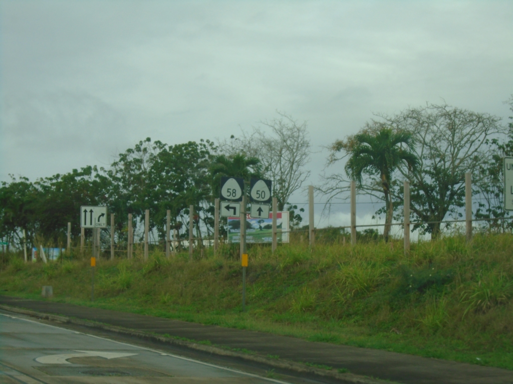
HI-50 West at HI-58 (Nawiliwili Road)
HI-50 West (Kaumualiʻi Highway) at HI-58 (Nawiliwili Road) in Līhuʻe.
Taken 02-17-2025
Lihue
Kauai County
Hawaii
United States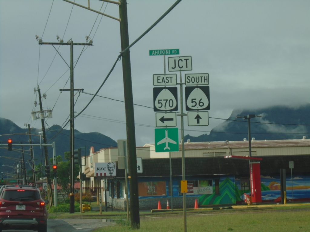
HI-56 South at HI-570 (Ahukini Road)
HI-56 South (Kūhiō Highway) at HI-570 (Ahukini Road). Use HI-570 for access to Līhuʻe Airport.
Taken 02-17-2025
 Lihue
Kauai County
Hawaii
United States
Lihue
Kauai County
Hawaii
United States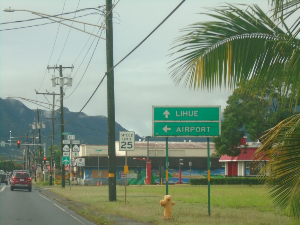
HI-56 South Approaching HI-570 (Ahukini Road)
HI-56 South (Kūhiō Highway) approaching HI-570 (Ahukini Road) to (Līhuʻe) Airport. Continue south on HI-56 to Līhuʻe.
Taken 02-17-2025
Lihue
Kauai County
Hawaii
United States
HI-56 South at HI-51
HI-56 South (Kūhiō Highway) at HI-51 (Kapule Highway). Turn right to continue south on HI-56 to Hanamāʻulu and Līhuʻe. Continue straight for HI-51 to (Līhuʻe) Airport.
Taken 02-17-2025
 Lihue
Kauai County
Hawaii
United States
Lihue
Kauai County
Hawaii
United States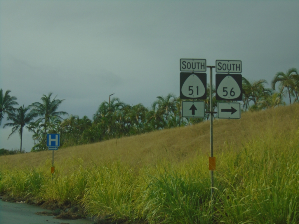
HI-56 South Approaching HI-51
HI-56 South (Kūhiō Highway) approaching HI-51 (Kapule Highway). Turn right to continue south on HI-56.
Taken 02-17-2025
Lihue
Kauai County
Hawaii
United States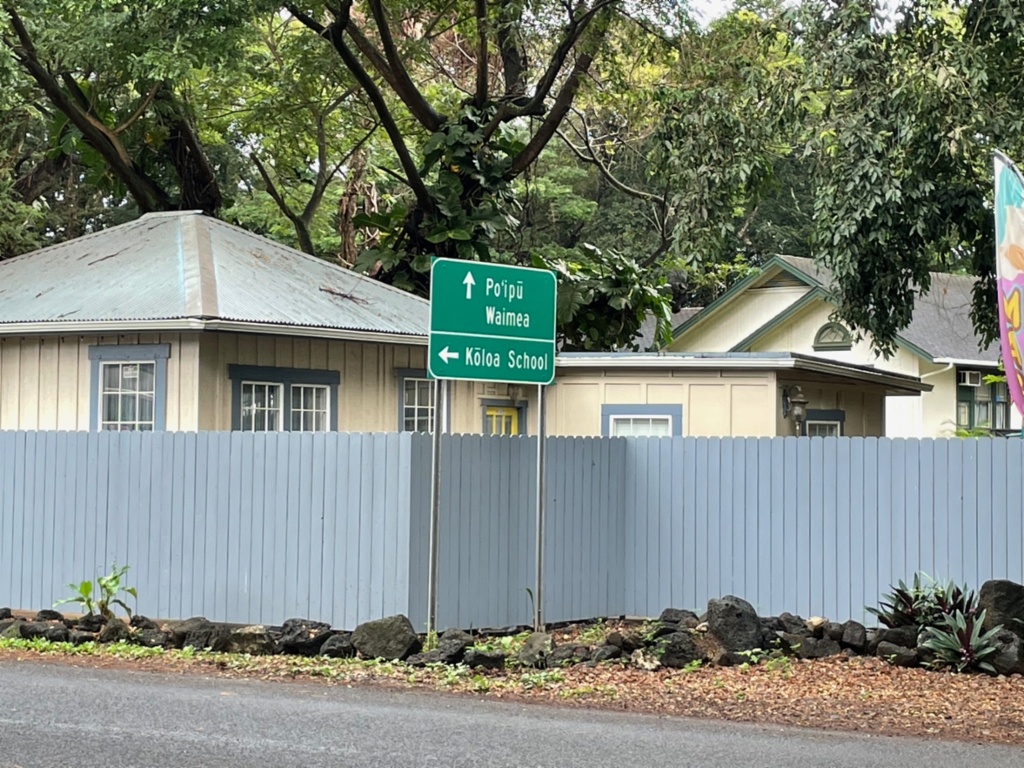
HI-520 South at HI-530
HI-520 South at HI-530. Turn left to continue south on HI-520 (Poʻipū Road) to Kōloa School. Continue straight on Kōloa for HI-530 to Poʻipū and Waimea.
Taken 02-17-2025
 Koloa
Kauai County
Hawaii
United States
Koloa
Kauai County
Hawaii
United States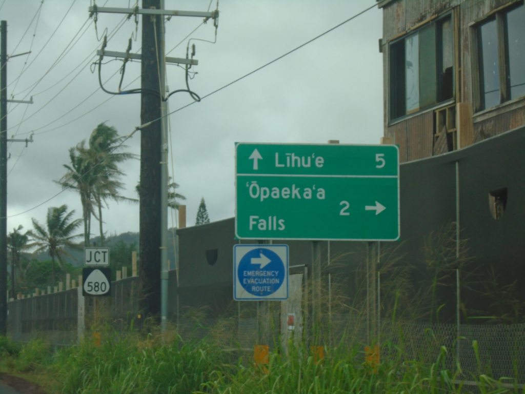
HI-56 South Approaching HI-580
HI-56 South (Kūhiō Highway) approaching HI-580 (Kuamoʻo Road) to ‘Opaeka’a Falls. Continue south on HI-56 to Līhuʻe.
Taken 02-16-2025
 Kapaʻa
Kauai County
Hawaii
United States
Kapaʻa
Kauai County
Hawaii
United States
End HI-5600 (Kapa'a Bypass) at HI-56
End HI-5600 (Kapa’a Bypass) at HI-56 (Kūhiō Highway). Use HI-56 south to Wailua and Līhuʻe. Use HI-56 north to Waipouli and Kapa’a.
Taken 02-16-2025
 Kapaʻa
Kauai County
Hawaii
United States
Kapaʻa
Kauai County
Hawaii
United States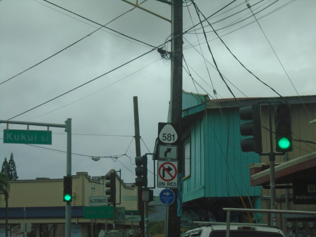
HI-56 South at HI-581
HI-56 South (Kūhiō Highway) at HI-581 (Kukui Street) in Kapa’a.
Taken 02-16-2025
 Kapaʻa
Kauai County
Hawaii
United States
Kapaʻa
Kauai County
Hawaii
United States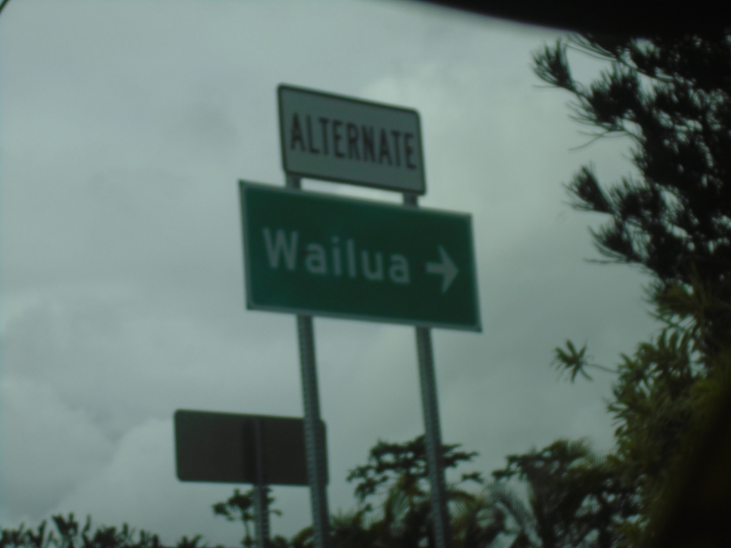
HI-56 South at HI-5600 (Kapa'a Bypass)
HI-56 South (Kūhiō Highway) at HI-5600 (Kapa’a Bypass). Use HI-5600 as an alternate route to Wailua.
Taken 02-16-2025
Kapaʻa
Kauai County
Hawaii
United States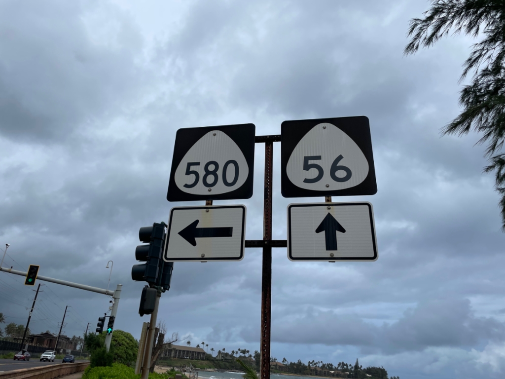
HI-56 North at HI-580
HI-56 north (Kūhiō Highway) at HI-580 (Kuamoʻo Road) in Wailua.
Taken 02-16-2025
Kapaʻa
Kauai County
Hawaii
United States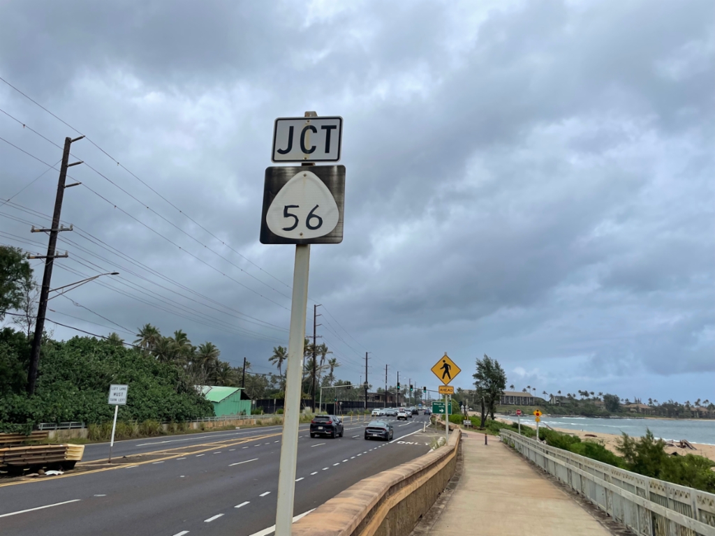
HI-56 North Approaching HI-580
HI-56 North (Kūhiō Highway) approaching HI-580 - crossing the Wailua River bridge. The sign indicates that the junction is with HI-56, but the junction is with HI-580.
Taken 02-16-2025
Kapaʻa
Kauai County
Hawaii
United States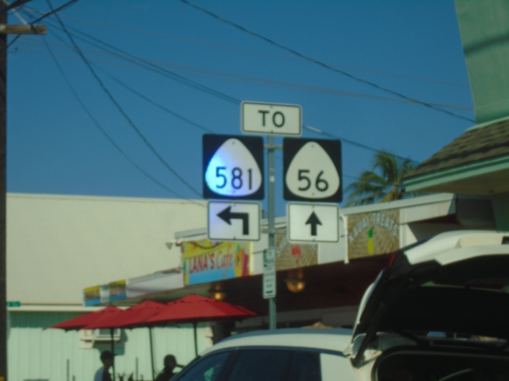
HI-56 North at HI-581 in Kapa'a
HI-56 north (Kūhiō Highway) at HI-581 (Kukui St.) in Kapa’a. The intersection is marked as “TO” but both routes intersect here.
Taken 02-15-2025
Kapaʻa
Kauai County
Hawaii
United States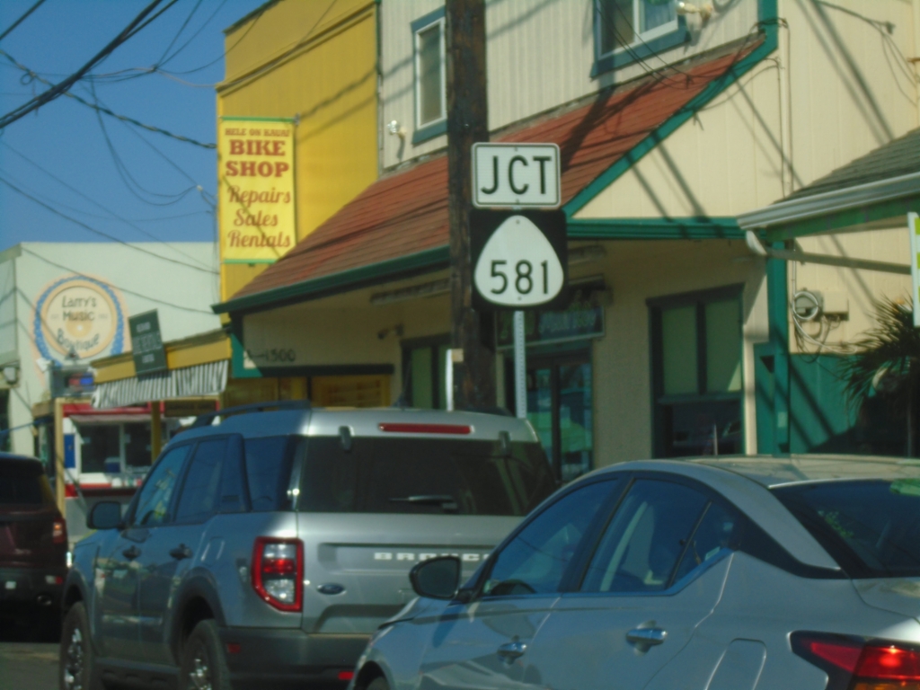
HI-56 North Approaching HI-581
HI-56 North (Kūhiō Highway) approaching HI-581 (Kukui St.) in Kapa’a.
Taken 02-15-2025
Kapaʻa
Kauai County
Hawaii
United States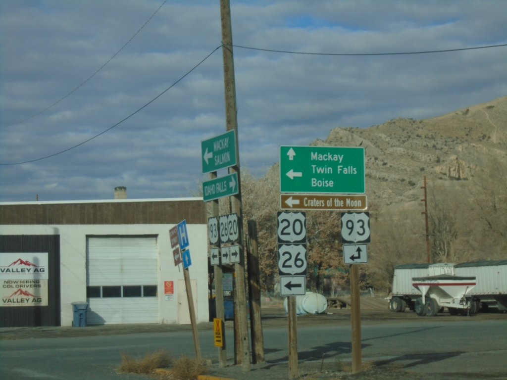
US-20/US-26 West at US-93
US-20/US-26 west at US-93. Use US-93 north for Mackay. Use US-20/US-26 west/US-93 south for Twin Falls, Boise, and Craters of the Moon National Monument.
Taken 12-01-2024


 Arco
Butte County
Idaho
United States
Arco
Butte County
Idaho
United States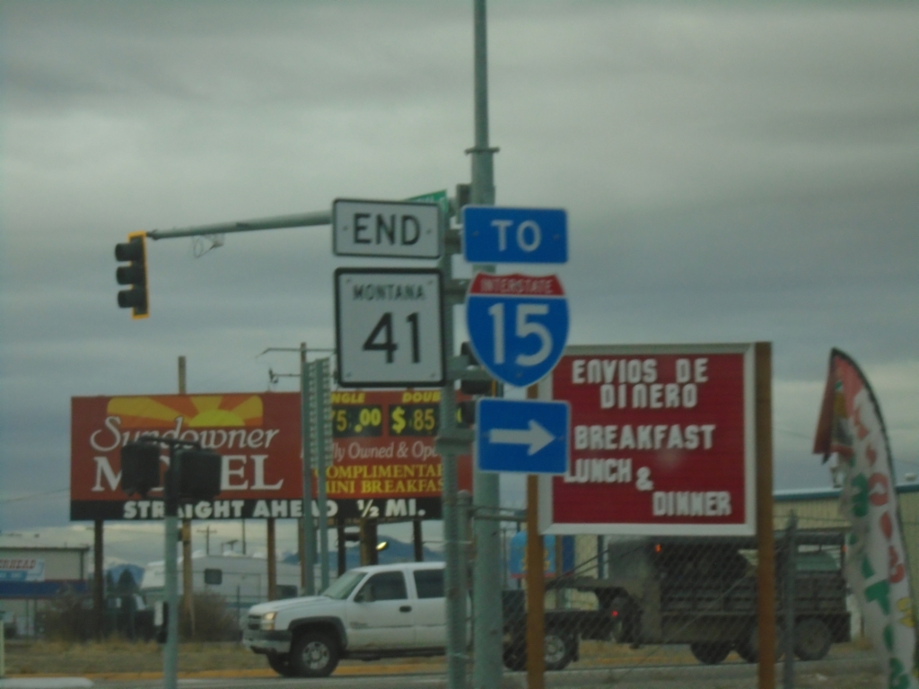
End MT-41 South at BL-15
End MT-41 South at BL-15 - To I-15 in Dillon.
Taken 12-01-2024


 Dillon
Beaverhead County
Montana
United States
Dillon
Beaverhead County
Montana
United States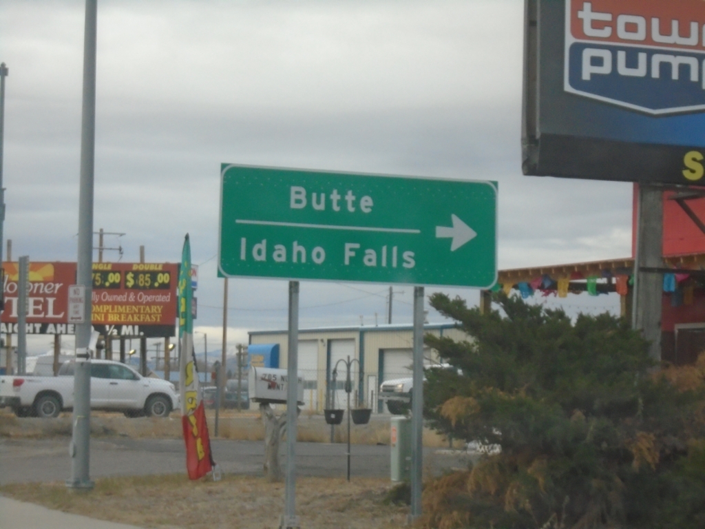
End MT-41 South at BL-15
End MT-41 South at BL-15 in Dillon. Turn right for BL-15 North for access to I-15 to Butte and Idaho Falls (Idaho).
Taken 12-01-2024
Dillon
Beaverhead County
Montana
United States