Signs Tagged With Intersection
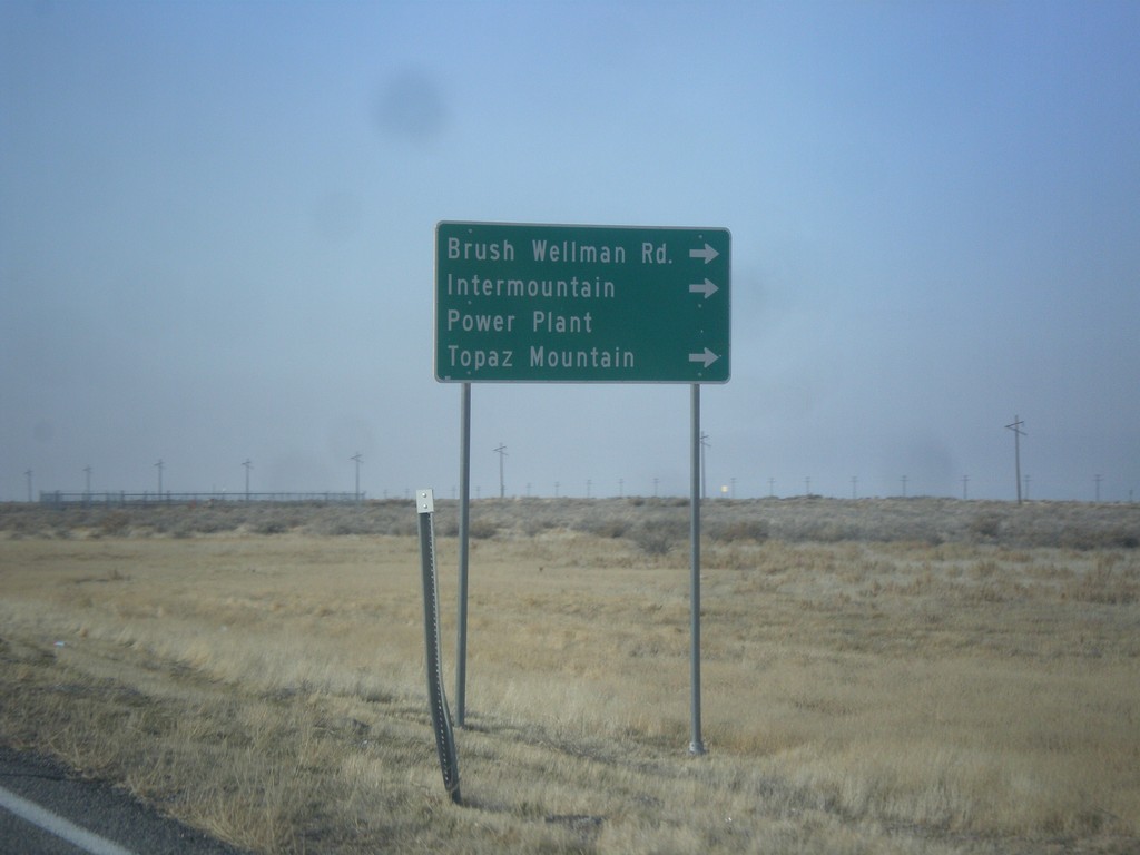
US-6 West Approaching UT-174
US-6 West approaching UT-174/Brush Wellman Road to Intermountain Power Plant, and Topaz Mountain.
Taken 02-13-2018

 Delta
Millard County
Utah
United States
Delta
Millard County
Utah
United States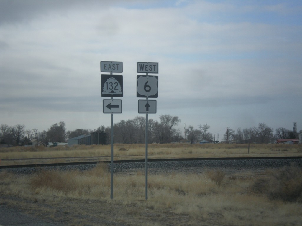
US-6 West at UT-132 West
US-6 West at UT-132 East in Lynndyl.
Taken 02-13-2018
 Lynndyl
Millard County
Utah
United States
Lynndyl
Millard County
Utah
United States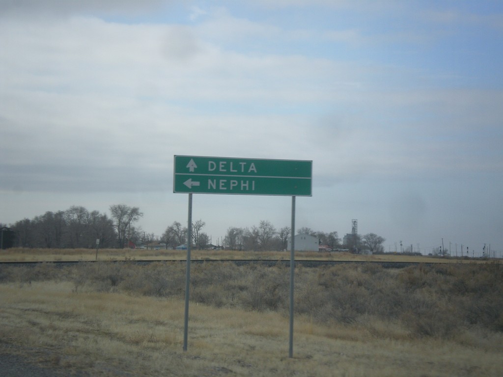
US-6 West Approaching UT-132
US-6 West approaching UT-132 east to Nephi. Continue west on US-6 for Delta.
Taken 02-13-2018
Lynndyl
Millard County
Utah
United States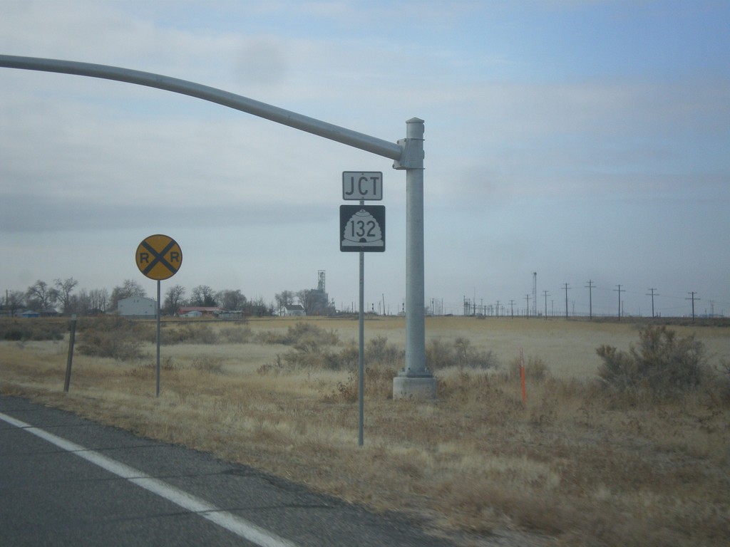
US-6 West Approaching UT-132
US-6 West approaching UT-132 in Lynndyl.
Taken 02-13-2018
Lynndyl
Millard County
Utah
United States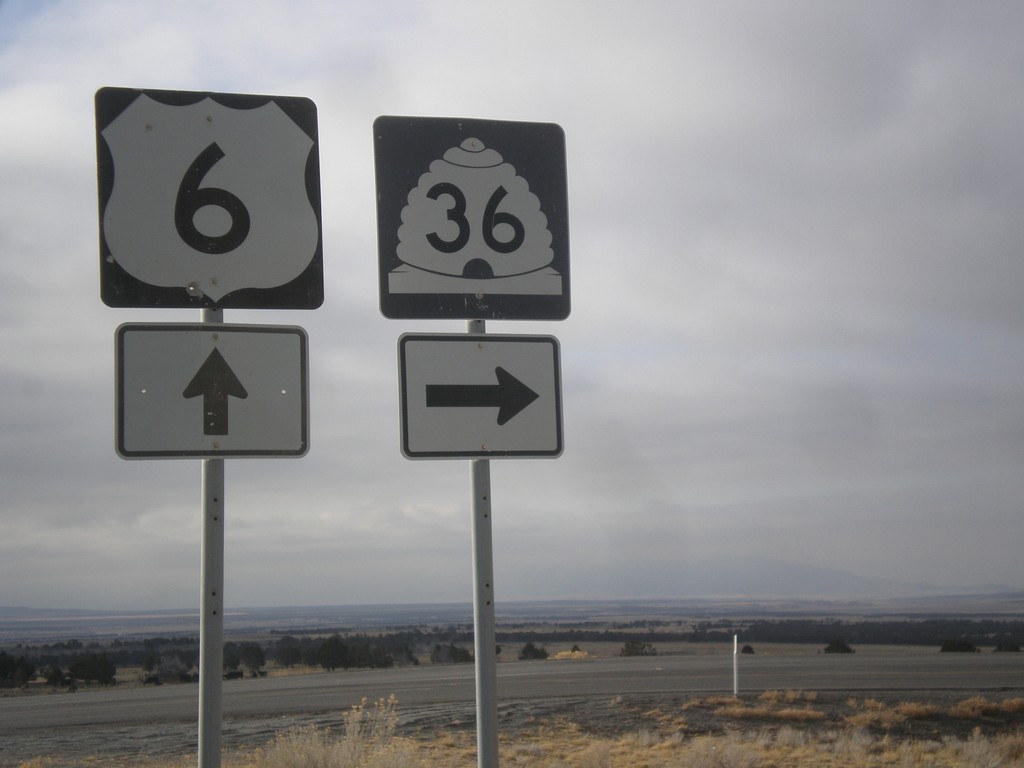
US-6 West at UT-36
US-6 West at UT-36 north to Tooele.
Taken 02-13-2018
 Silver City
Juab County
Utah
United States
Silver City
Juab County
Utah
United States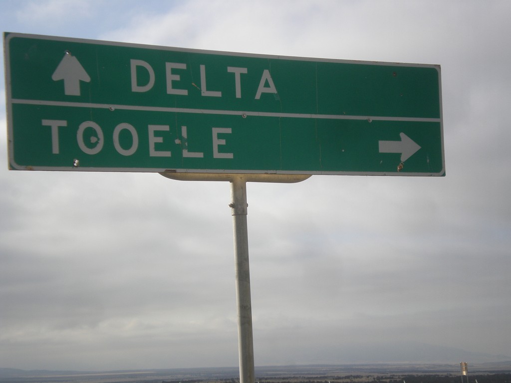
US-6 West Approaching UT-36
US-6 West approaching UT-36 to Tooele. Continue west on US-6 for Delta.
Taken 02-13-2018
Eureka
Juab County
Utah
United States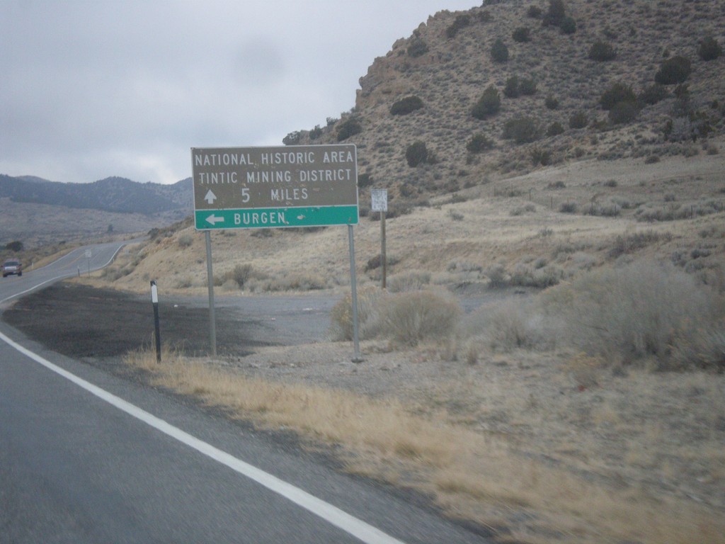
US-6 West - Bergen Jct.
US-6 West at Bergen Jct. Continue west on US-6 for National Historic Area/Tintic Mining District.
Taken 02-13-2018
Elberta
Utah County
Utah
United States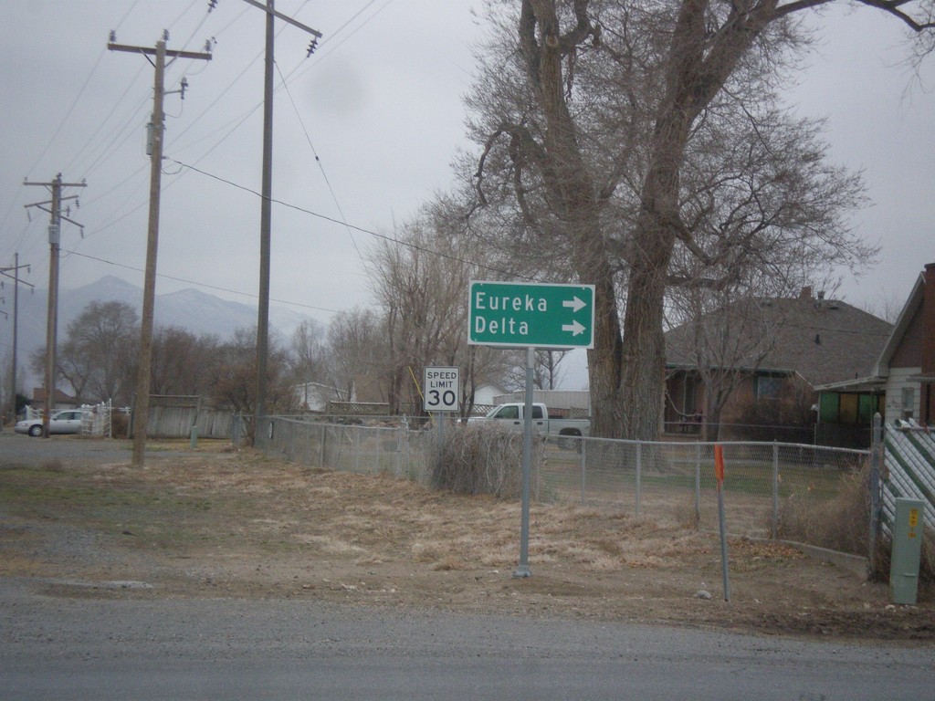
End UT-68 South at US-6
End UT-68 south at US-6 in Elberta. Turn right on US-6 west for Eureka and Delta.
Taken 02-13-2018
 Elberta
Utah County
Utah
United States
Elberta
Utah County
Utah
United States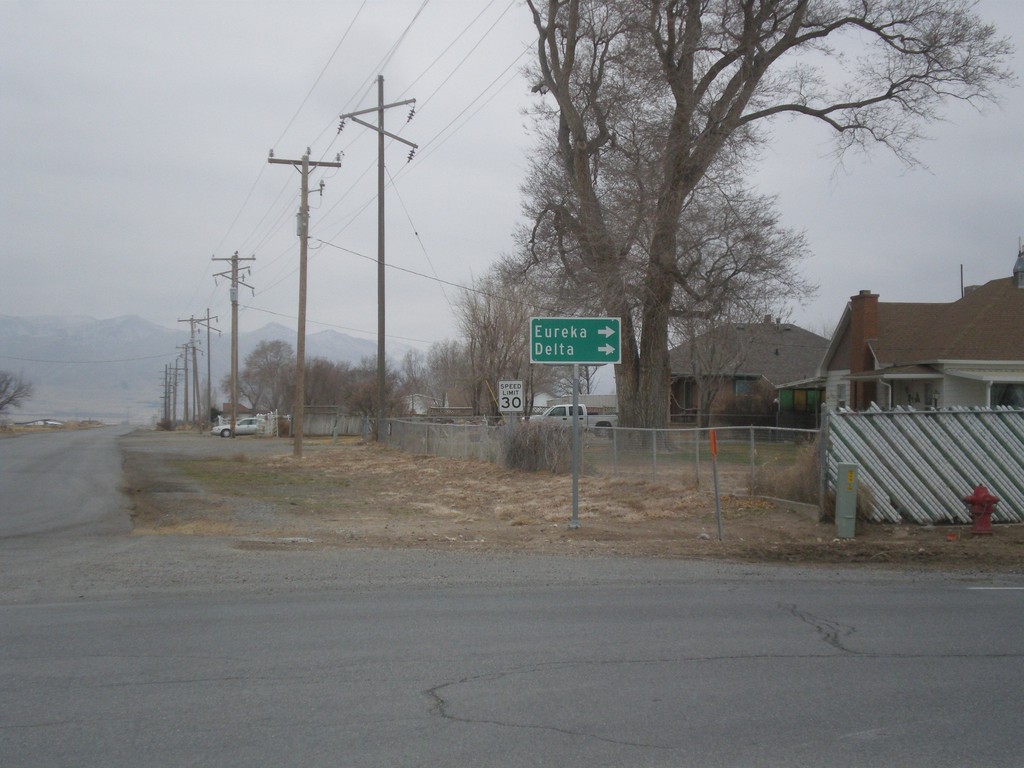
End UT-68 South at US-6
End UT-68 south at US-6 in Elberta. Turn right on US-6 west for Eureka and Delta.
Taken 02-13-2018
Elberta
Utah County
Utah
United States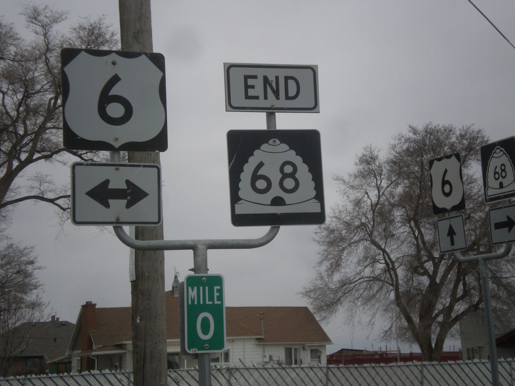
End UT-68 South at US-6
End UT-68 South at US-6 in Elberta.
Taken 02-13-2018
Goshen
Utah County
Utah
United States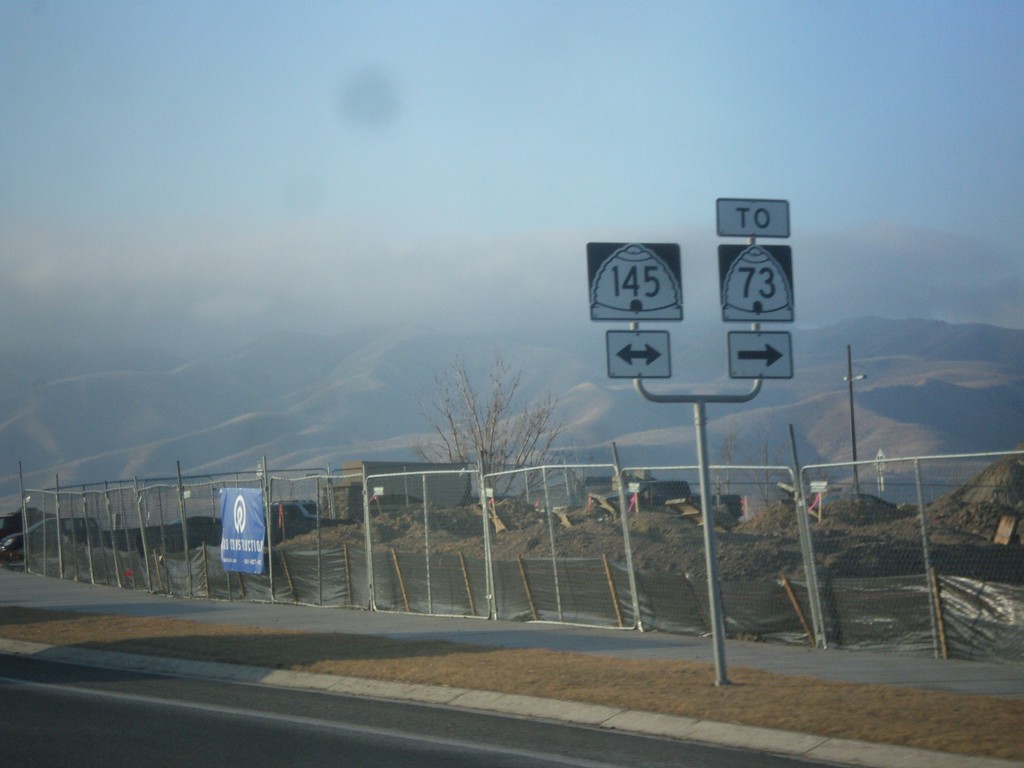
UT-68 South at UT-145 (Pioneer Crossing)
UT-68 South at UT-145 (Pioneer Crossing). Turn right on UT-145 for access to UT-73.
Taken 02-13-2018

 Saratoga Springs
Utah County
Utah
United States
Saratoga Springs
Utah County
Utah
United States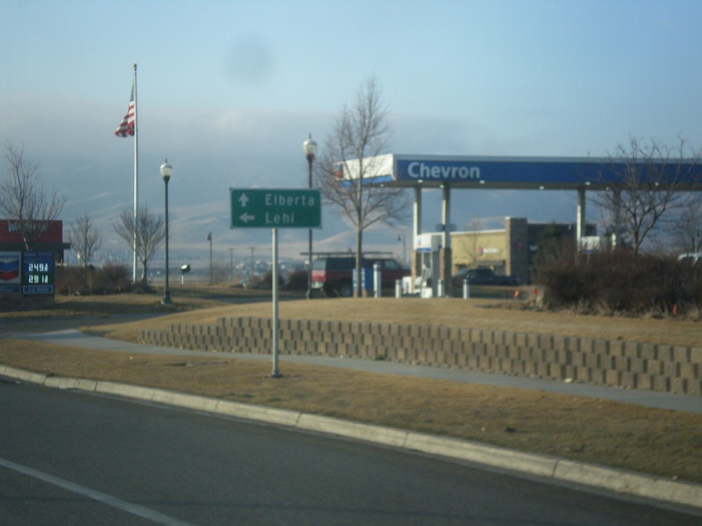
UT-68 South at West 8570 North to Lehi
UT-68 South at West 8570 North to Lehi. Continue south on UT-68 to Elberta.
Taken 02-13-2018
Saratoga Springs
Utah County
Utah
United States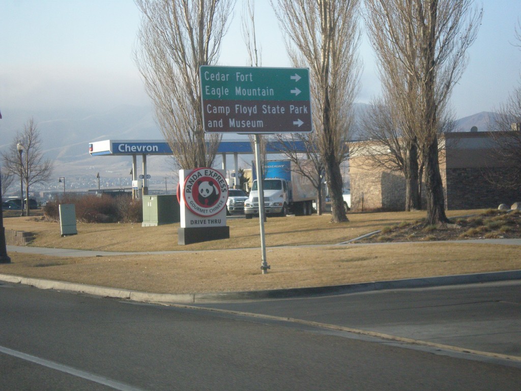
UT-68 South at West 8750 North
UT-68 South at West 8750 North to Cedar Fort, Eagle Mountain, and Camp Floyd State Park and Museum.
Taken 02-13-2018
Saratoga Springs
Utah County
Utah
United States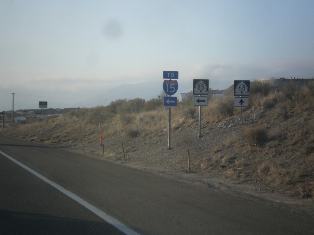
UT-68 South at UT-85 South to I-15
UT-68 South at UT-85 South to I-15. This stretch of UT-85 between UT-68 and I-15 at Lehi is the southern part of the Mountain View Corridor.
Taken 02-13-2018

 Saratoga Springs
Utah County
Utah
United States
Saratoga Springs
Utah County
Utah
United States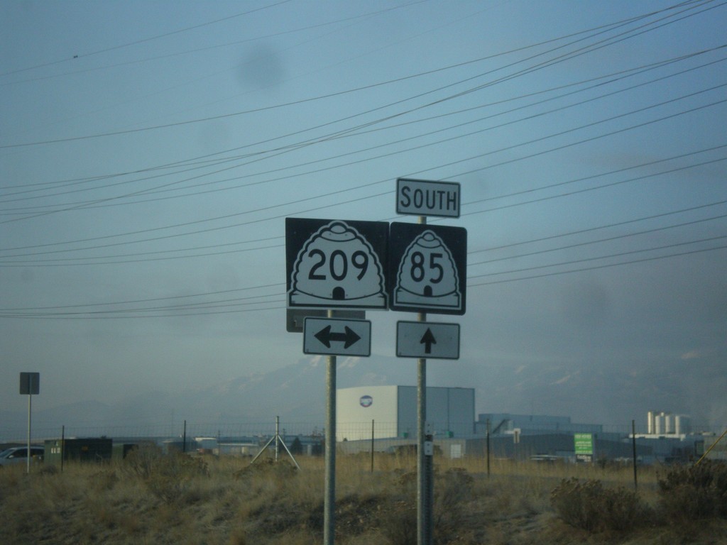
UT-85 South at UT-209
UT-85 South at UT-209 (9000 South) in West Jordan.
Taken 02-13-2018
 West Jordan
Salt Lake County
Utah
United States
West Jordan
Salt Lake County
Utah
United States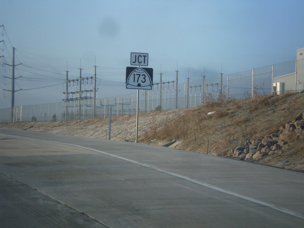
UT-85 South Approaching UT-173
UT-85 South approaching UT-173 (5400 South).
Taken 02-13-2018
 West Valley City
Salt Lake County
Utah
United States
West Valley City
Salt Lake County
Utah
United States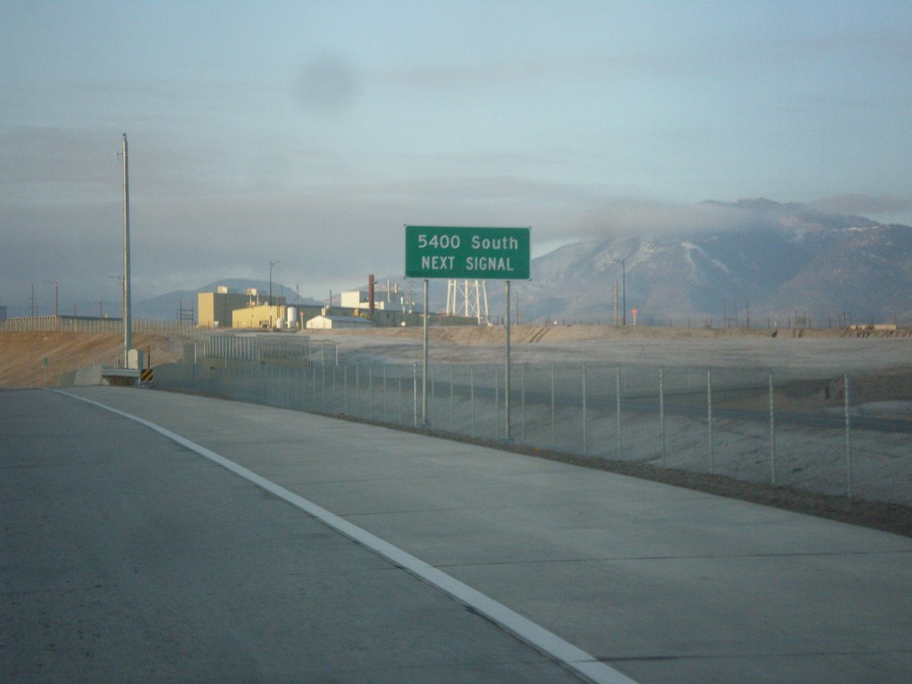
UT-85 South Approaching 5400 South (UT-173)
UT-85 South approaching 5400 South (UT-173)
Taken 02-13-2018
West Valley City
Salt Lake County
Utah
United States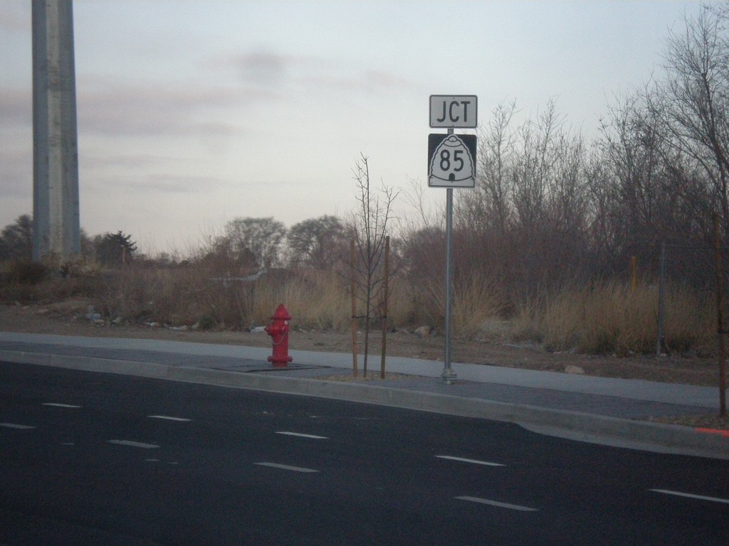
West 4100 South Approaching UT-85
West 4100 South Approaching UT-85 (Mountain View Corridor).
Taken 02-13-2018
West Valley City
Salt Lake County
Utah
United States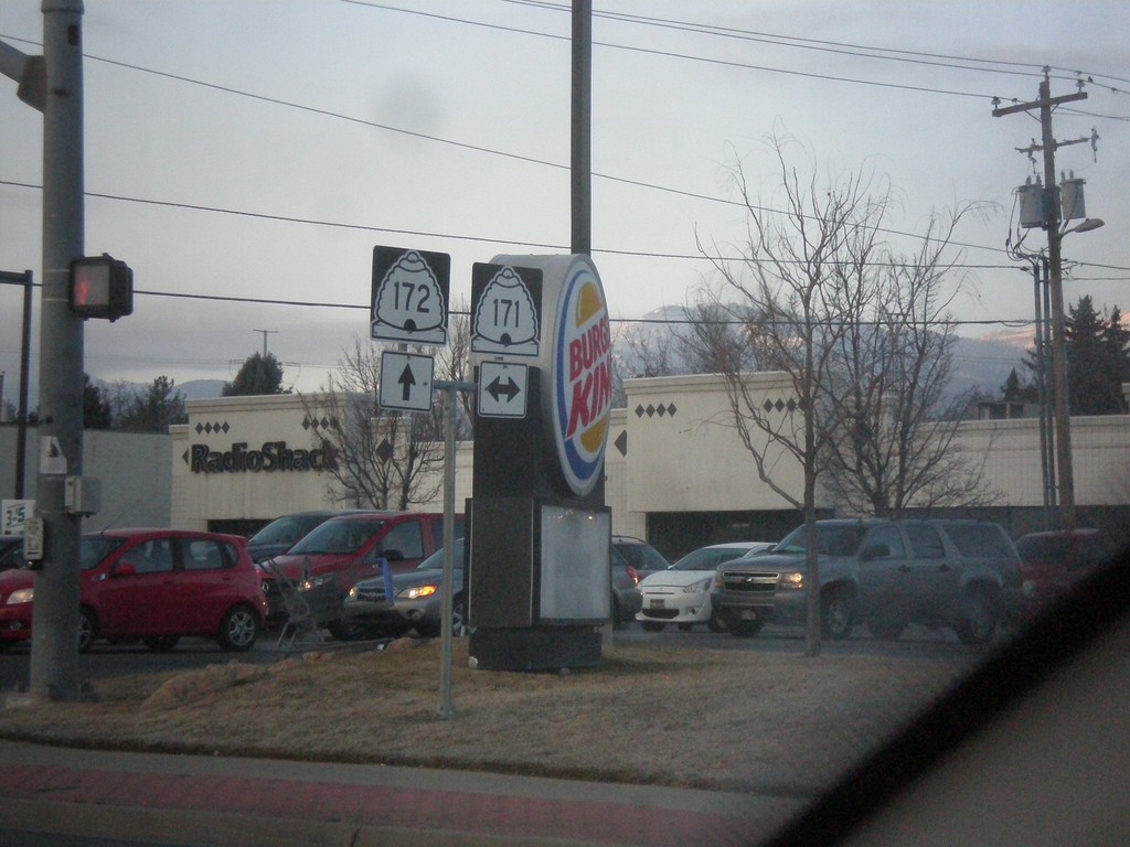
UT-172 South at UT-171 (3500 South)
UT-172 South (5600 West) at UT-171 (3500 South)
Taken 02-13-2018

 West Valley City
Salt Lake County
Utah
United States
West Valley City
Salt Lake County
Utah
United States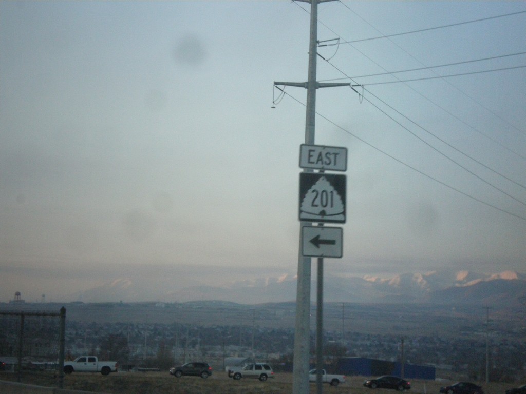
UT-172 South at UT-201 East Onramp
UT-172 South at UT-201 East onramp (Exit 11).
Taken 02-13-2018
 West Valley City
Salt Lake County
Utah
United States
West Valley City
Salt Lake County
Utah
United States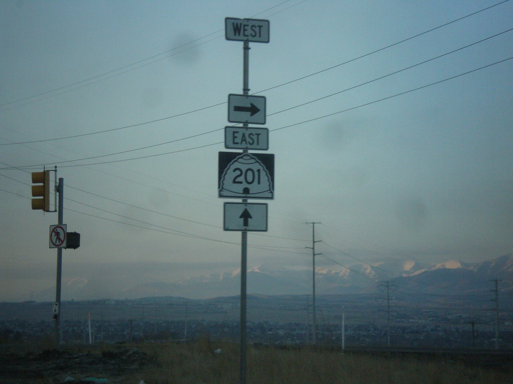
UT-172 South at UT-201 West (Exit 11 Onramp)
UT-172 South at UT-201 West (Exit 11 Onramp)
Taken 02-13-2018
Salt Lake City
Salt Lake County
Utah
United States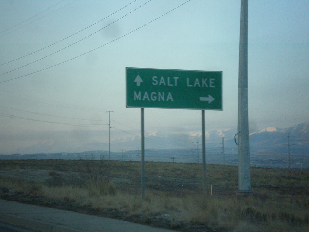
UT-172 South Approaching UT-201
UT-172 South approaching UT-201. Use UT-201 west to Magna; UT-201 east to Salt Lake.
Taken 02-13-2018
Salt Lake City
Salt Lake County
Utah
United States
South 7200 West at I-80 (Exit 111) Onramp
South 7200 West at I-80 (Exit 111) Onramp.
Taken 02-13-2018
 Salt Lake City
Salt Lake County
Utah
United States
Salt Lake City
Salt Lake County
Utah
United States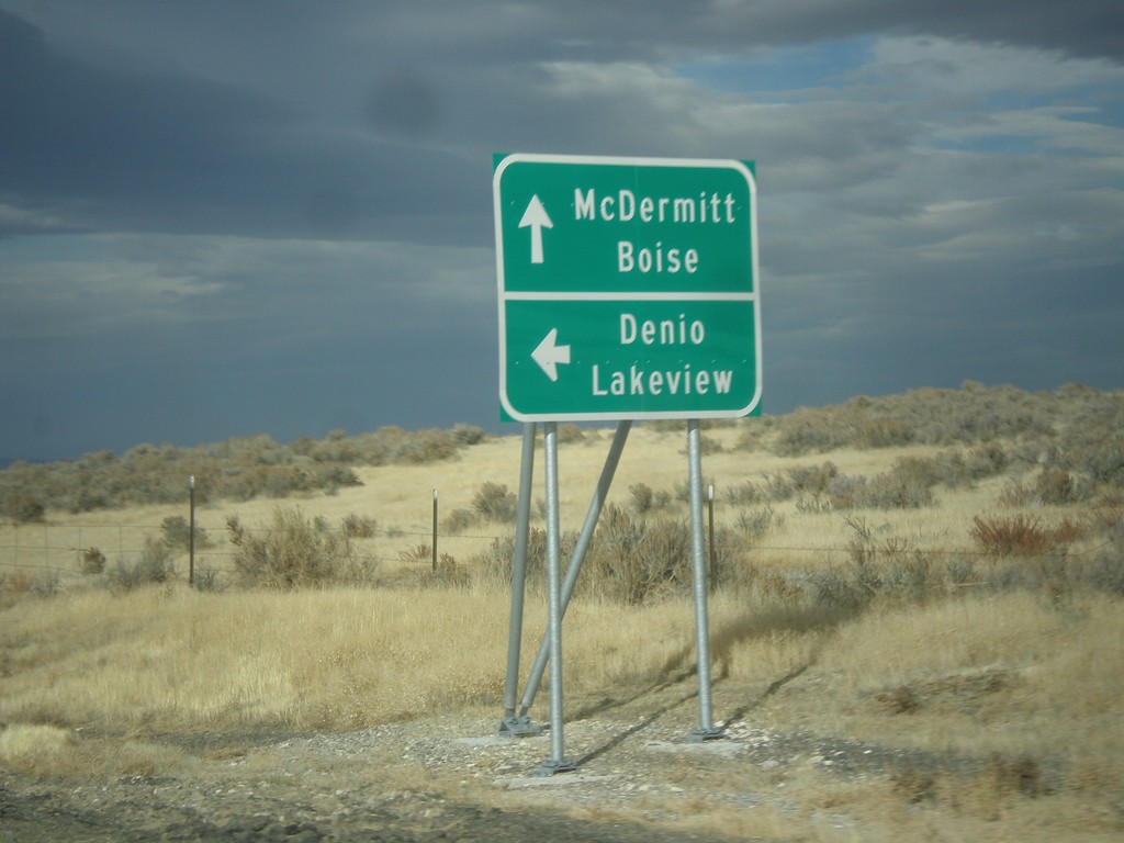
US-95 North at NV-140 West
US-95 north at NV-140 west to Denio and Lakeview (Oregon). Continue north on US-95 for McDermitt (Nevada-Oregon State Line) and Boise (Idaho).
Taken 11-26-2017

 Humboldt County
Nevada
United States
Humboldt County
Nevada
United States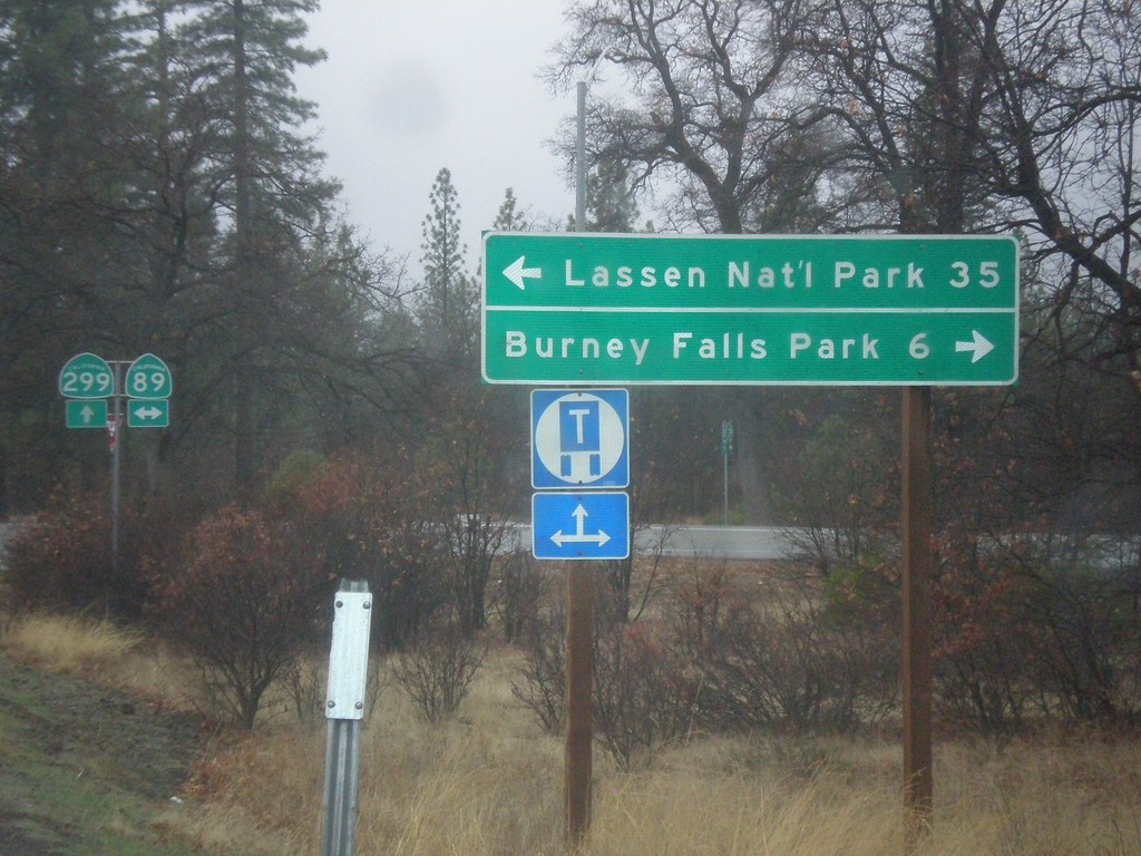
CA-299 West at CA-89
CA-299 west at CA-89 north to Burney Falls State Park, and south to Lassen National Park.
Taken 11-20-2017

 Cassel
Shasta County
California
United States
Cassel
Shasta County
California
United States