Signs Tagged With Intersection
CA-299 West at CA-89
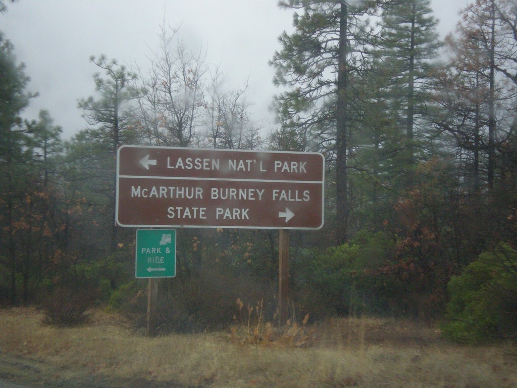
CA-299 west approaching CA-89 north to McArthur Burney Falls State Park, and south to Lassen National Park.
Taken 11-20-2017

 Cassel
Shasta County
California
United States
Cassel
Shasta County
California
United States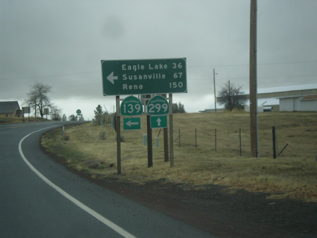
CA-139 South/CA-299 West at CA-139/CA-299 Split
CA-139 South/CA-299 West at CA-139/CA-299 Split. Turn left for CA-139 South to Eagle Lake, Susanville, and Reno (Nevada).
Taken 11-20-2017
 Adin
Modoc County
California
United States
Adin
Modoc County
California
United States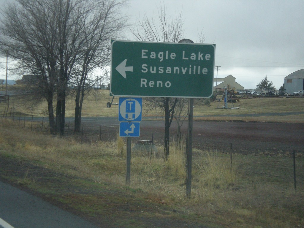
CA-139 South/CA-299 West Approaching CA-139/CA-299 Split
CA-139 South/CA-299 West Approaching CA-139/CA-299 split. Turn left for CA-139 south to Eagle Lake, Susanville, and Reno (Nevada).
Taken 11-20-2017
Adin
Modoc County
California
United States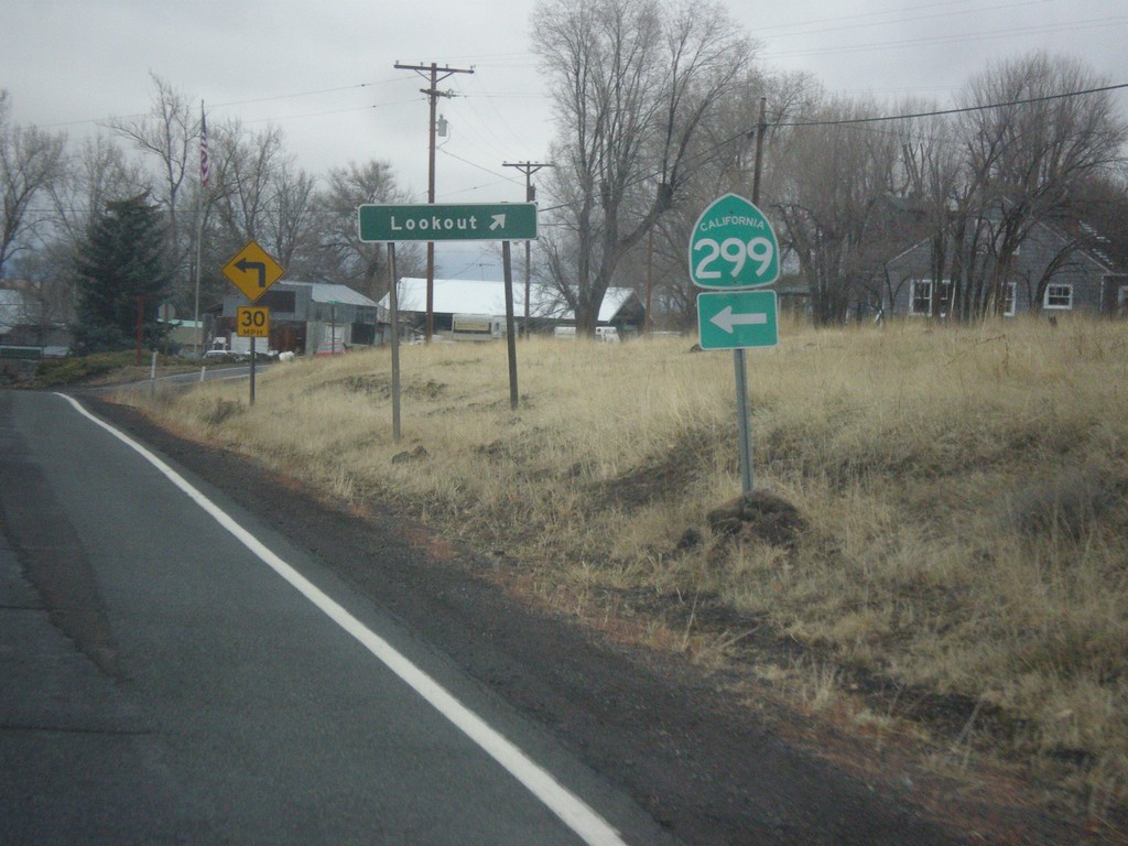
CA-139 South/CA-299 West - Lookout Jct.
CA-139 South/CA-299 West at Lookout Jct. Merge left to continue west on CA-299 (and south on CA-139).
Taken 11-20-2017
Adin
Modoc County
California
United States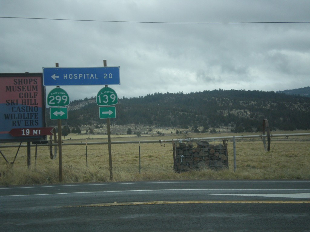
CA-139 South at CA-299
CA-139 South at CA-299. Turn left for CA-299 East and Hospital (in Alturas); turn right for CA-299 West/CA-139 South. CA-139 joins CA-299 west to Adin.
Taken 11-20-2017
Canby
Modoc County
California
United States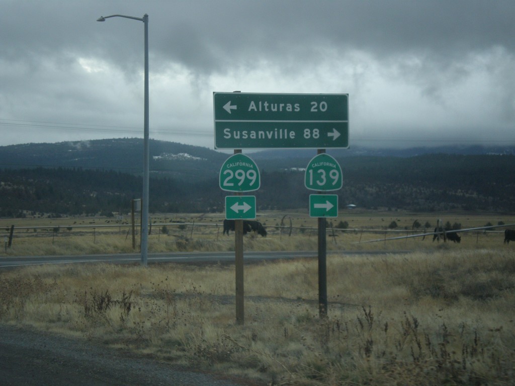
CA-139 South at CA-299
CA-139 South at CA-299. Turn left for CA-299 east to Alturas; right for CA-299 West/CA-139 South to Susanville.
Taken 11-20-2017
Canby
Modoc County
California
United States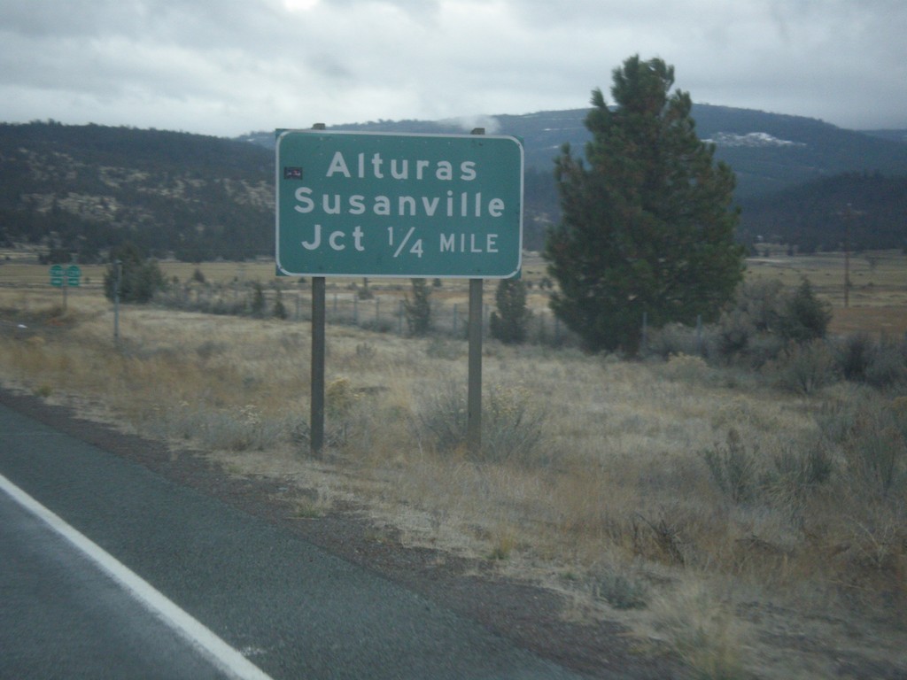
CA-139 South Approaching CA-299
CA-139 South approaching CA-299 to Susanville and Alturas.
Taken 11-20-2017
Canby
Modoc County
California
United States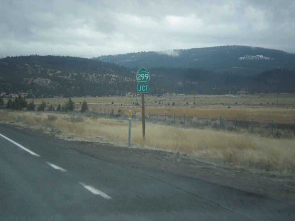
CA-139 South Approaching CA-299
CA-139 South approaching CA-299 in Modoc County.
Taken 11-20-2017
Canby
Modoc County
California
United States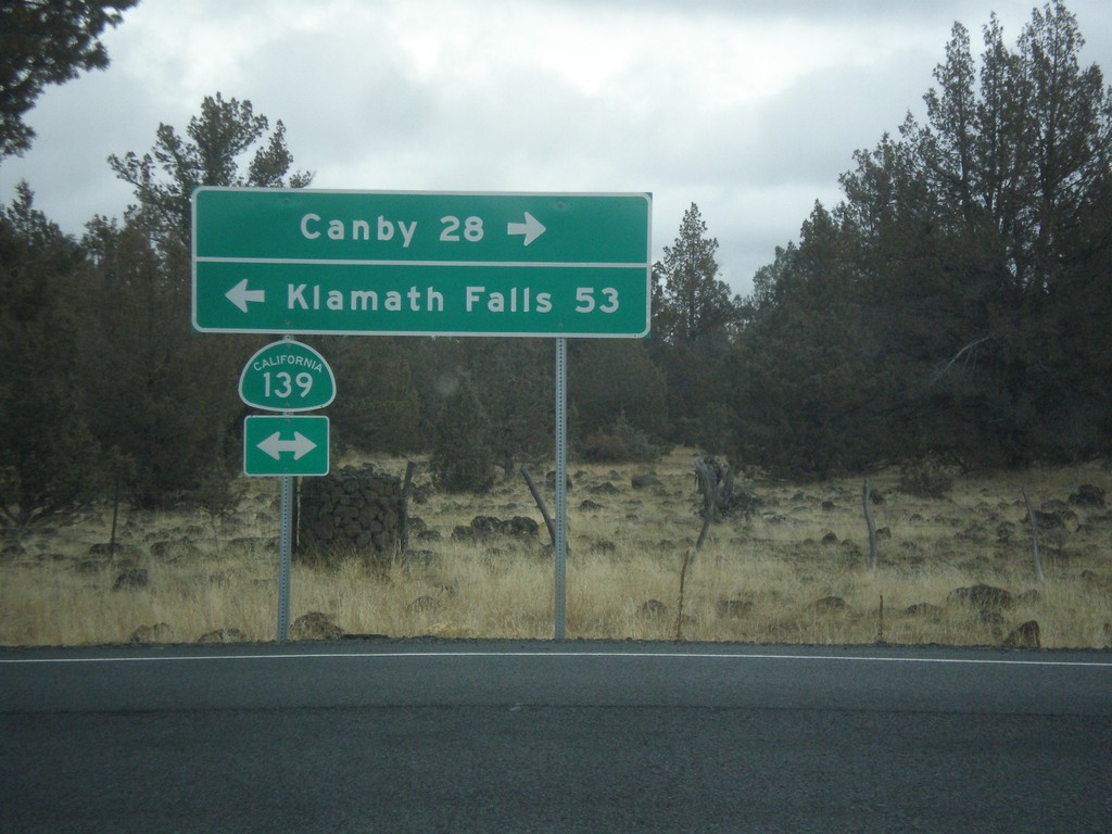
Forest Road 97 at CA-139
Forest Road 97 at CA-139 in Modoc County. Turn right for CA-139 south to Canby; left for CA-139 north to Klamath Falls (Oregon).
Taken 11-20-2017
Perez
Modoc County
California
United States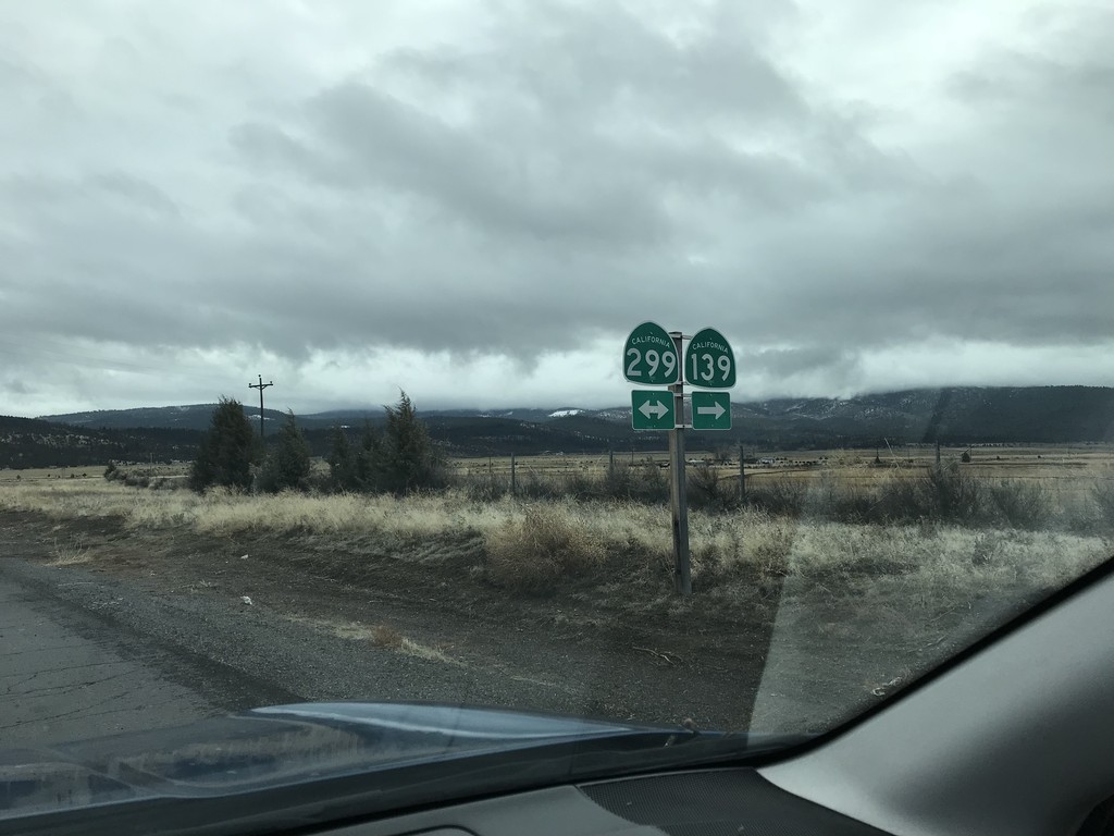
CA-139 South at CA-299
CA-139 South at CA-299 in Canby. CA-139 south joins CA-299 west to Adin.
Taken 11-20-2017
Canby
Modoc County
California
United States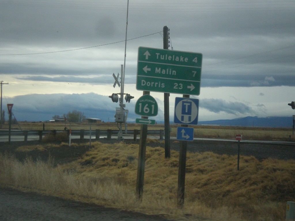
OR-39 South at CA-139 and CA-161
OR-39 south at CA-139 and CA-161. Turn right for CA-161 West to Dorris (California). Turn left on State Line Road to Malin (Oregon). Continue straight on CA-139 south to Tulelake (California). The California-Oregon state line runs along the CA-161 and State Line Road. OR-39 becomes CA-139 at the state line.
Taken 11-20-2017

 Merrill
Klamath County
Oregon
United States
Merrill
Klamath County
Oregon
United States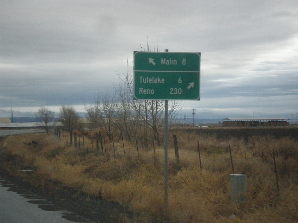
OR-39 South at Malin Jct.
OR-39 South at Malin Jct. Turn right to continue south on OR-39 for Tulelake (California) and Reno (Nevada). Continue ahead to for Malin. The Klamath Falls-Malin Highway continues towards Malin. OR-39 follows the Hatfield highway southbound.
Taken 11-20-2017
Merrill
Klamath County
Oregon
United States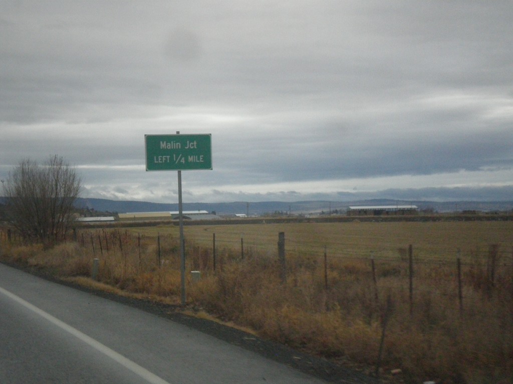
OR-39 South - Malin Jct.
OR-39 South approaching Malin Jct.
Taken 11-20-2017
Merrill
Klamath County
Oregon
United States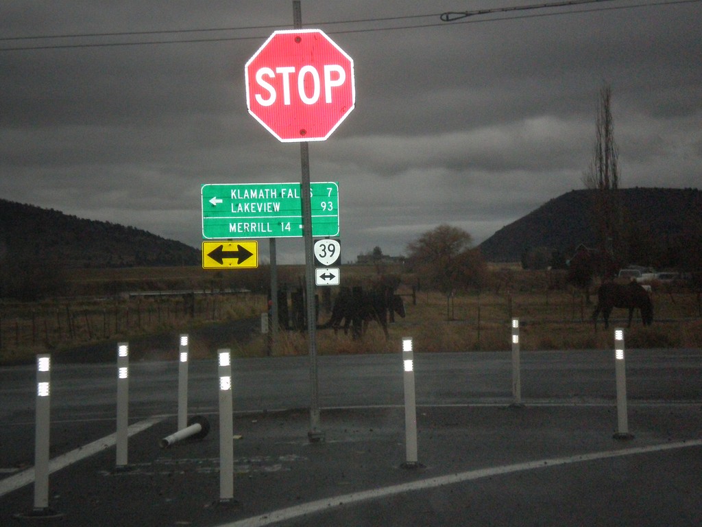
OR-140 East at OR-39
OR-140 East at OR-39 in Klamath County. Turn right for OR-39 south to Merrill. Turn left for OR-140 East (Unsigned)/OR-39 North to Klamath Falls and Lakeview.
Taken 11-20-2017
 Klamath Falls
Klamath County
Oregon
United States
Klamath Falls
Klamath County
Oregon
United States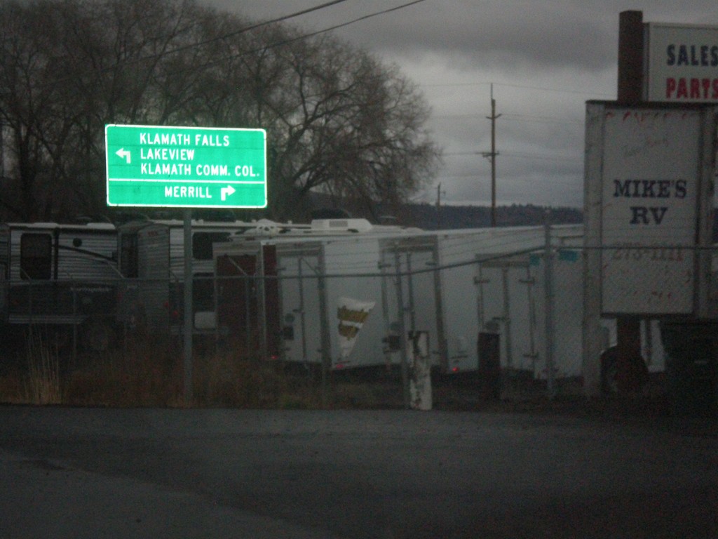
OR-140 West Approaching OR-39
OR-140 West approaching OR-39. Use OR-39 south for Merrill; use OR-39 North/OR-140 East for Klamath Falls, Lakeview, and Klamath Falls Community College. OR-140 east joins OR-39 north.
Taken 11-20-2017
Klamath Falls
Klamath County
Oregon
United States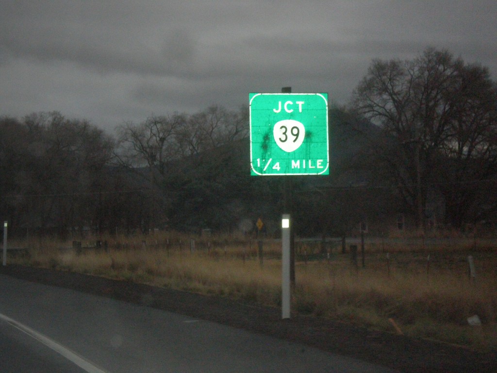
OR-140 East Approaching OR-39
OR-140 East approaching OR-39.
Taken 11-20-2017
Klamath Falls
Klamath County
Oregon
United States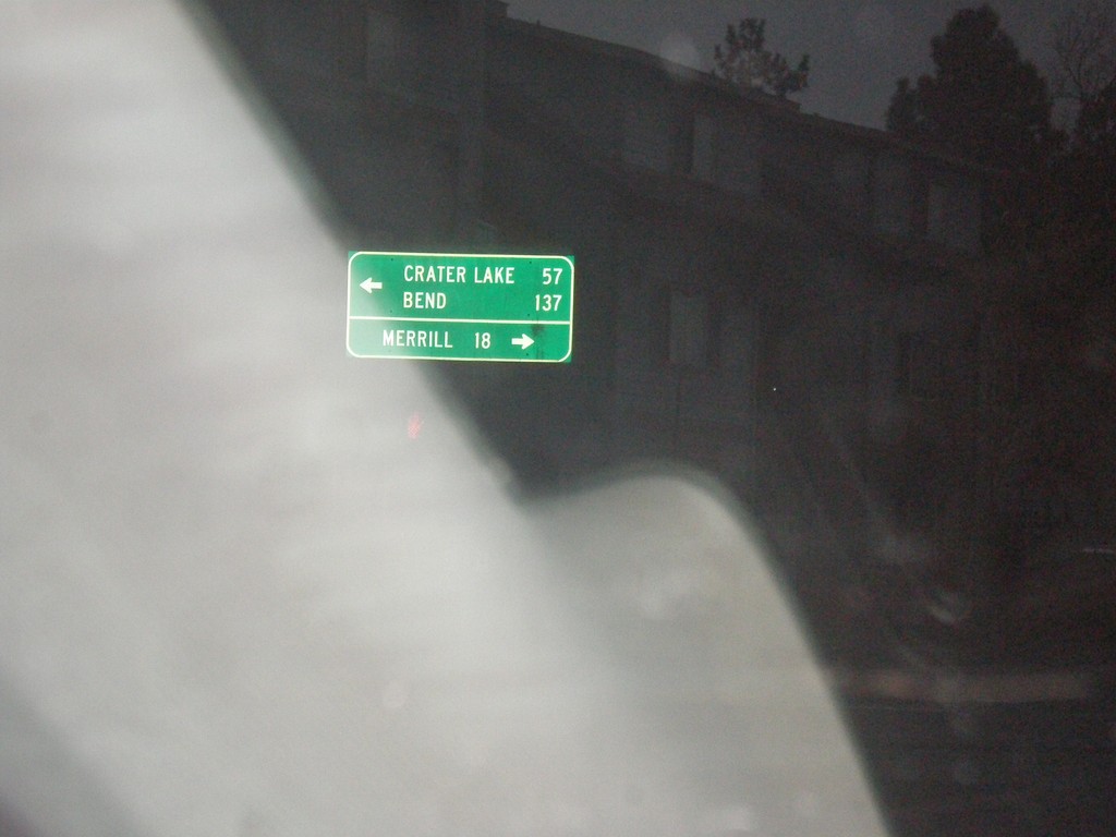
Main St. at OR-39
Main St. at OR-39 (Crater Lake Parkway) in Klamath Falls. Turn left for OR-39 north to Bend and Crater Lake (both via US-97). Turn right for OR-39 south to Merrill.
Taken 11-20-2017
Klamath Falls
Klamath County
Oregon
United States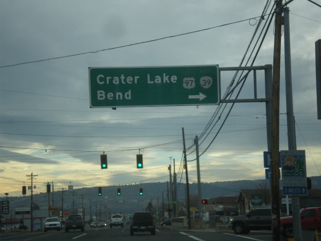
OR-39 North (6th St.) at Crater Lake Parkway
OR-39 North (6th St.) at Crater Lake Parkway. Turn right to continue north on OR-39 to US-97, Crater Lake, and Bend.
Taken 11-19-2017
 Klamath Falls
Klamath County
Oregon
United States
Klamath Falls
Klamath County
Oregon
United States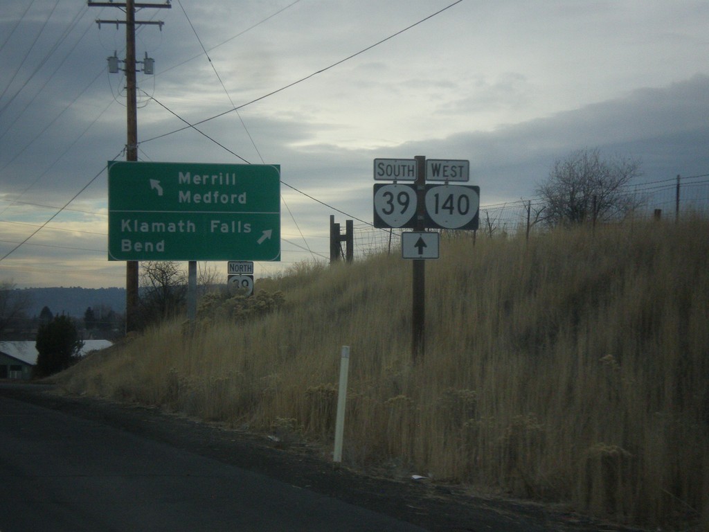
OR-140 West at OR-39
OR-140 west at OR-39 near Klamath Falls. Turn right for OR-39 north to Klamath Falls and Bend. Continue straight for OR-39 South/OR-140 West to Merrill (OR-39) and Medford (OR-140).
Taken 11-19-2017
Klamath Falls
Klamath County
Oregon
United States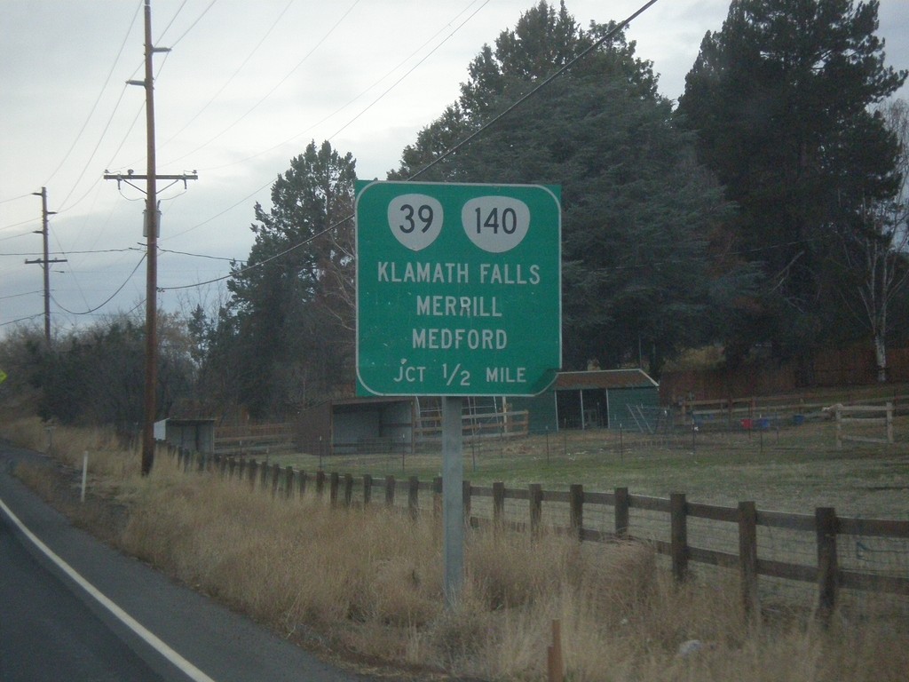
OR-140 West Approaching OR-39
OR-140 West Approaching OR-39 to Klamath Falls, Merril, and Medford. OR-140 joins OR-39 south.
Taken 11-19-2017
Klamath Falls
Klamath County
Oregon
United States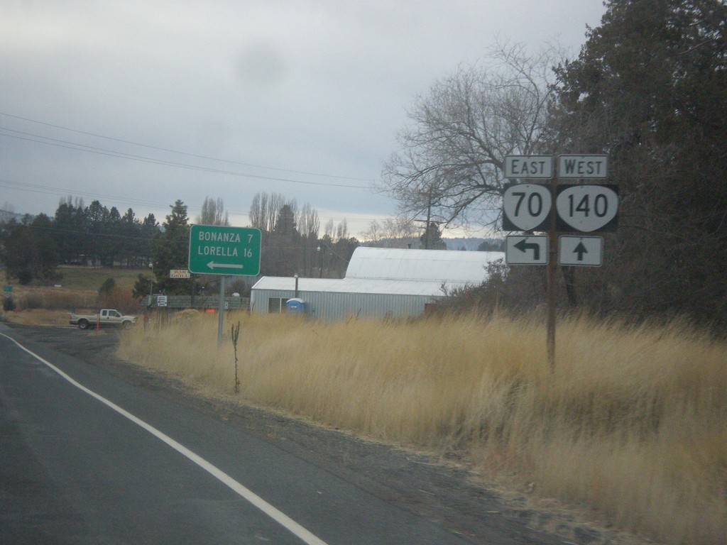
OR-140 West at OR-70
OR-140 West at OR-70 East to Bonanza and Lorella.
Taken 11-19-2017
 Dairy
Klamath County
Oregon
United States
Dairy
Klamath County
Oregon
United States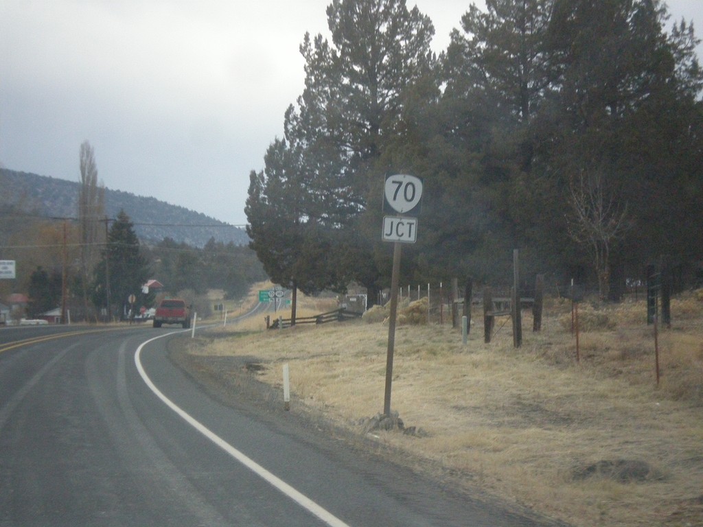
OR-140 West Approaching OR-70
OR-140 West approaching OR-70 in Dairy.
Taken 11-19-2017
Dairy
Klamath County
Oregon
United States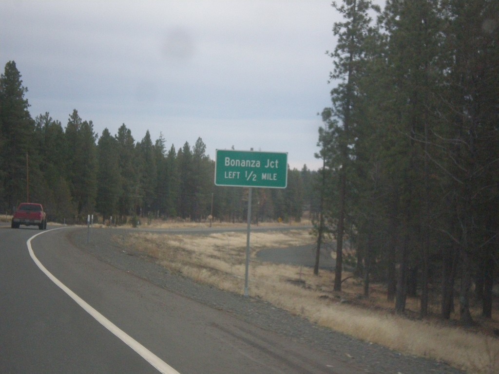
OR-140 West - Bonanza Junction
OR-140 west approaching Bonanza Junction.
Taken 11-19-2017
Bonanza
Klamath County
Oregon
United States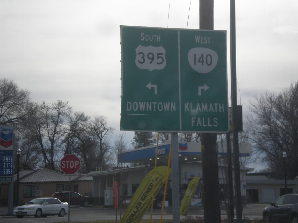
US-395 South/OR-140 West Approaching Split
US-395 South/OR-140 West approaching US-395/OR-140 split. Turn right for OR-140 west to Klamath Falls. Turn left for US-395 to Downtown (Lakeview).
Taken 11-19-2017
 Lakeview
Lake County
Oregon
United States
Lakeview
Lake County
Oregon
United States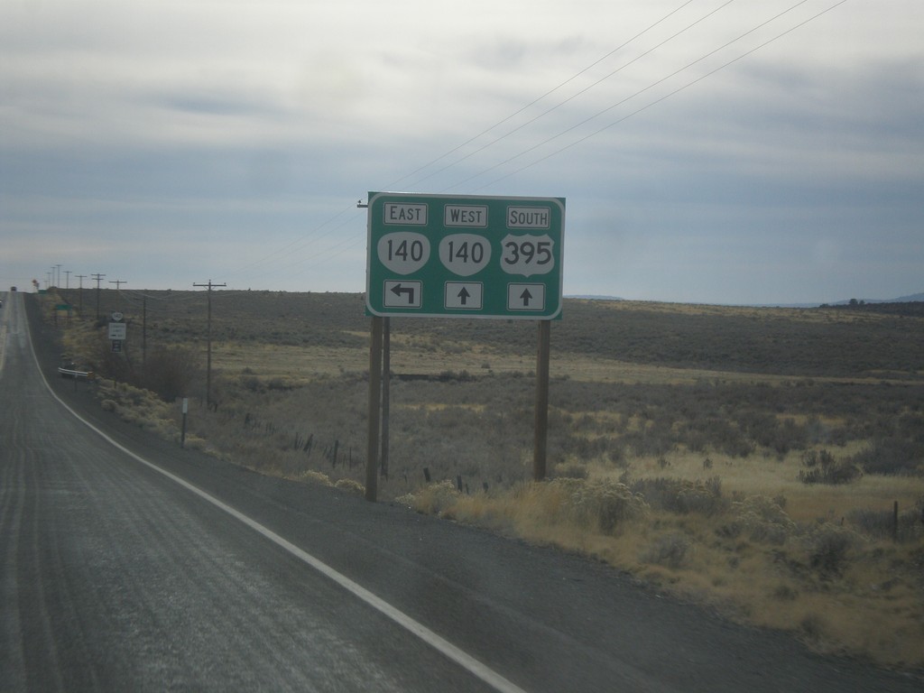
US-395 South Approaching OR-140
US-395 south approaching OR-140. OR-140 west joins US-395 south into Lakeview.
Taken 11-19-2017
Lakeview
Lake County
Oregon
United States