Signs Tagged With Intersection
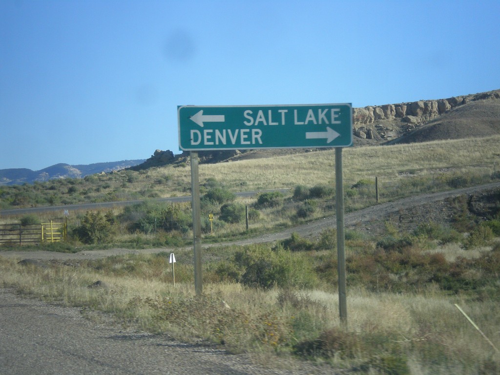
Redwash Road North at US-40
Redwash Road North at US-40 to Salt Lake City and Denver. This sign is odd in that destinations for far away locations are used on a county road.
Taken 10-09-2016
 Jensen
Uintah County
Utah
United States
Jensen
Uintah County
Utah
United States
CO-64 North Approaching US-40
End CO-64 at US-40 in Dinosaur. Turn left for US-40 west to Vernal (Utah). Turn right for US-40 east to Craig.
Taken 10-09-2016
 Dinosaur
Moffat County
Colorado
United States
Dinosaur
Moffat County
Colorado
United States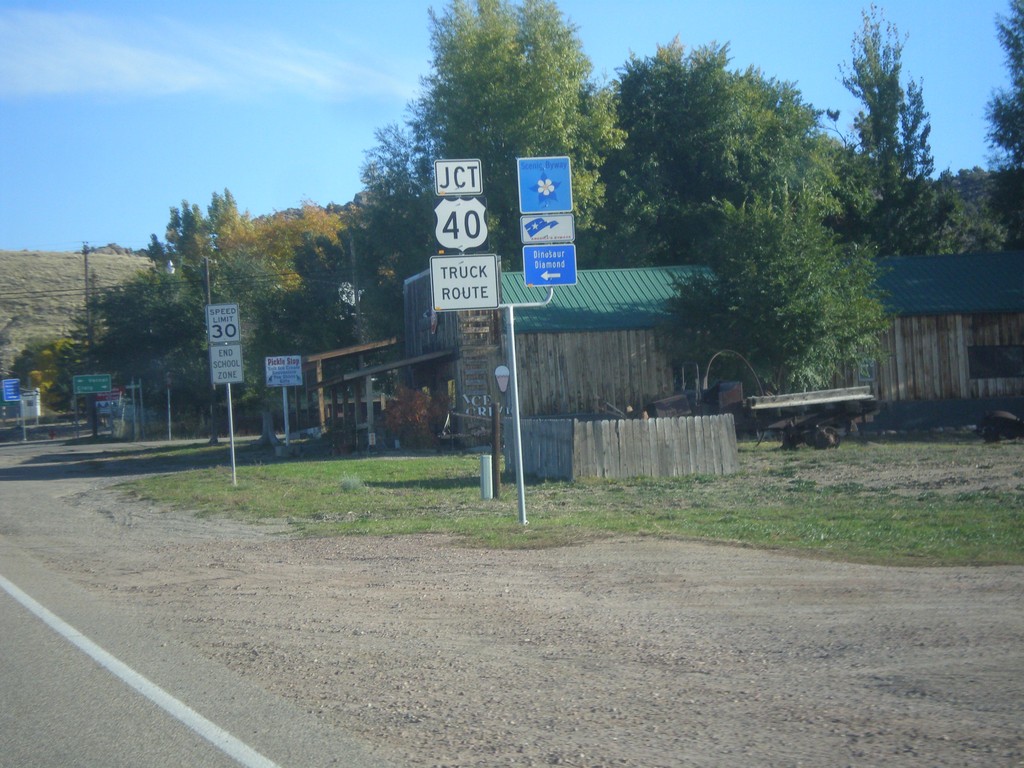
Jct. US-40 on CO-64 North
Jct. US-40 at western end of CO-64 in Dinosaur. Turn left for the Dinosaur Diamond Scenic Byway.
Taken 10-09-2016
Dinosaur
Moffat County
Colorado
United States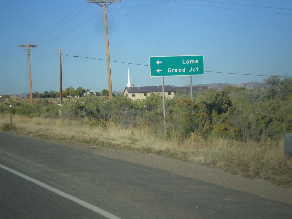
CO-64 West at CO-139 South
CO-64 West at CO-139 South to Loma and Grand Junction.
Taken 10-09-2016
 Rangely
Rio Blanco County
Colorado
United States
Rangely
Rio Blanco County
Colorado
United States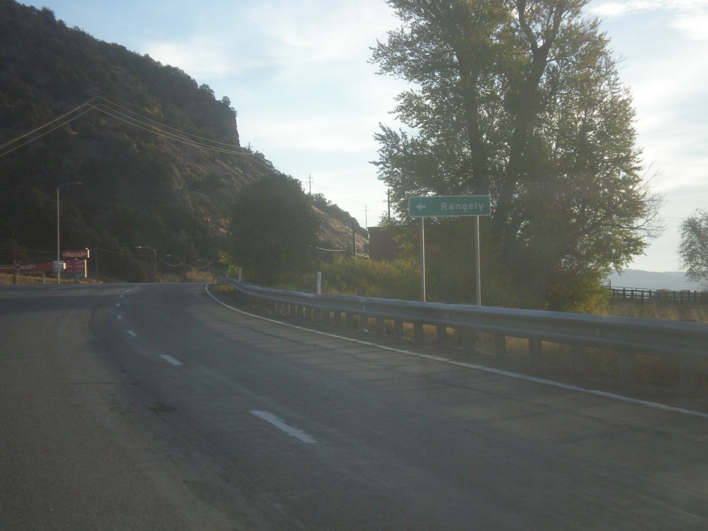
CO-13 North at CO-64 Junction
CO-13 North at CO-64 west to Rangely.
Taken 10-09-2016
 Meeker
Rio Blanco County
Colorado
United States
Meeker
Rio Blanco County
Colorado
United States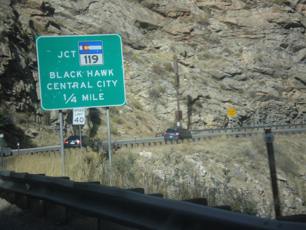
US-6 East at CO-119
US-6 East at CO-119. Turn left for CO-119 West to Black Hawk and Central City.
Taken 10-08-2016

 Golden
Clear Creek County
Colorado
United States
Golden
Clear Creek County
Colorado
United States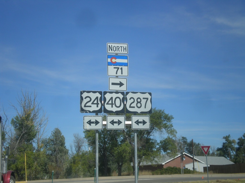
CO-71 North at US-24/US-40/US-287
CO-71 North at US-24/US-40/US-287 in Limon. Turn right to continue north on CO-71.
Taken 10-08-2016


 Limon
Lincoln County
Colorado
United States
Limon
Lincoln County
Colorado
United States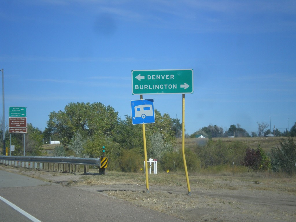
CO-71 North at US-24/US-40/US-287
CO-71 North at US-24/US-40/US-287 in Limon. Turn right for Burlington (via I-70); turn left for Denver (via I-70).
Taken 10-08-2016
Limon
Lincoln County
Colorado
United States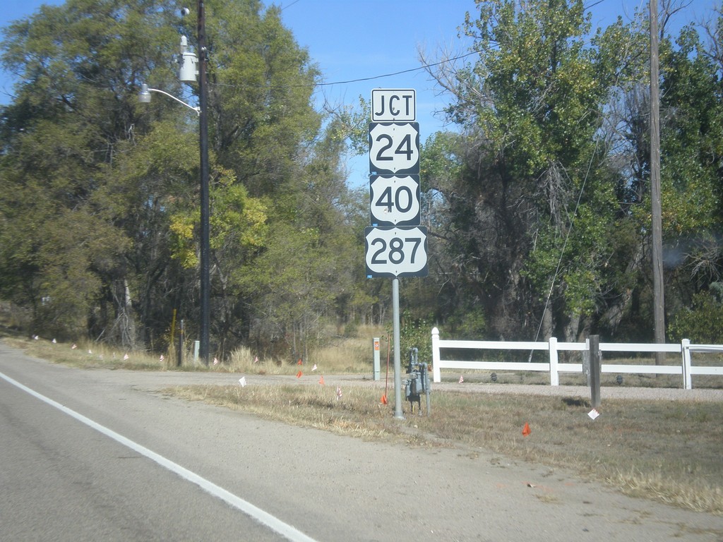
CO-71 North Approaching US-24/US-40/US-287
CO-71 North Approaching US-24/US-40/US-287 in Limon.
Taken 10-08-2016
Limon
Lincoln County
Colorado
United States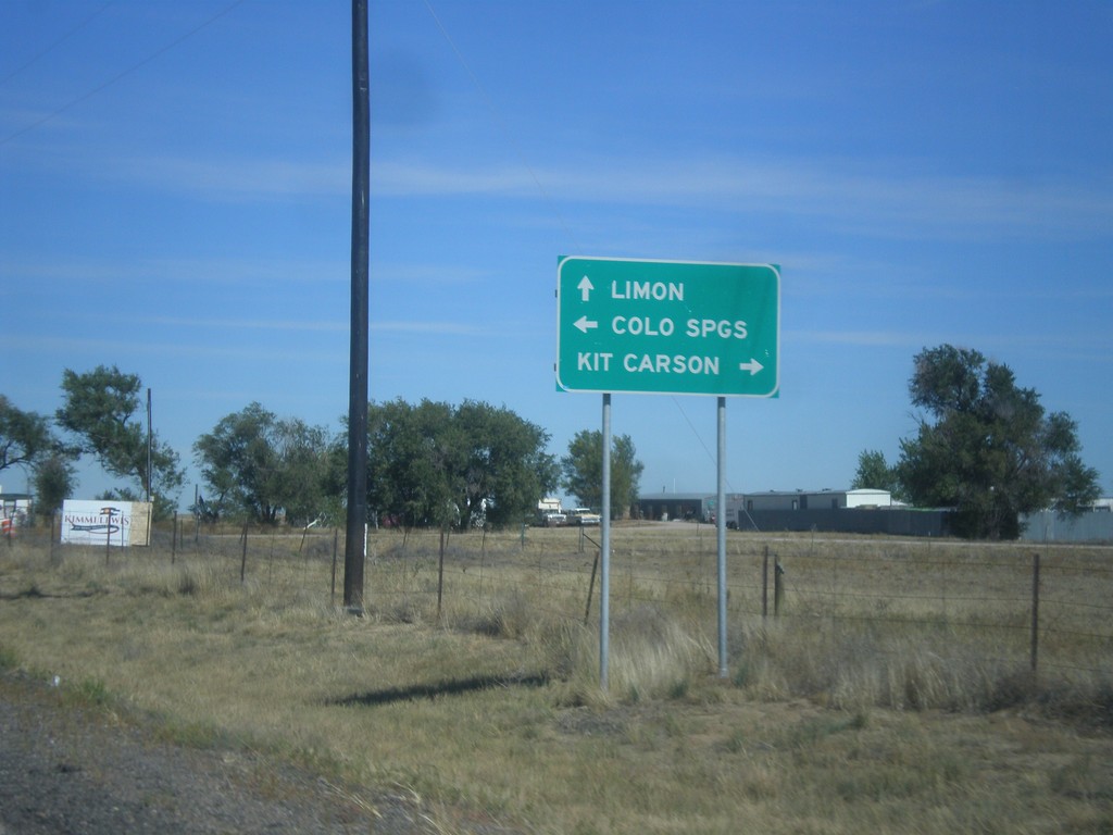
CO-71 North at CO-94
CO-71 North at CO-94 in Punkin Center. Turn right for CO-94 east to Kit Carson; left for CO-94 west to Limon. Continue straight on CO-71 north for Limon.
Taken 10-08-2016
 Hugo
Lincoln County
Colorado
United States
Hugo
Lincoln County
Colorado
United States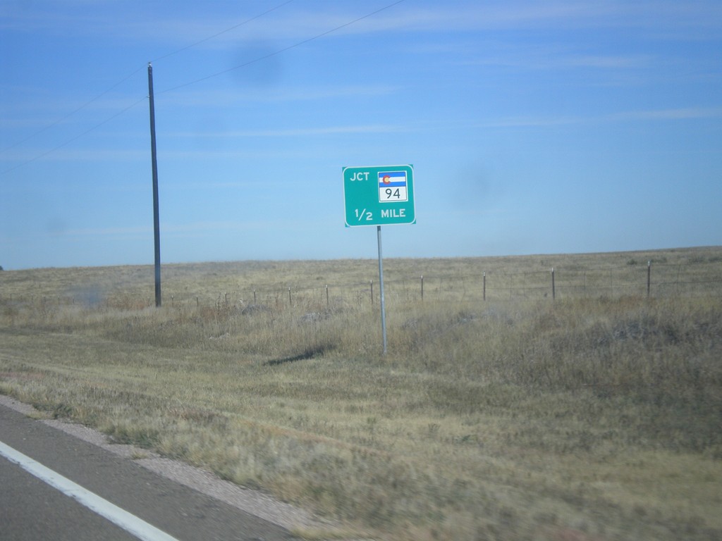
CO-71 North Approaching CO-94
CO-71 North Approaching CO-94 at Punkin Center.
Taken 10-08-2016
Hugo
Lincoln County
Colorado
United States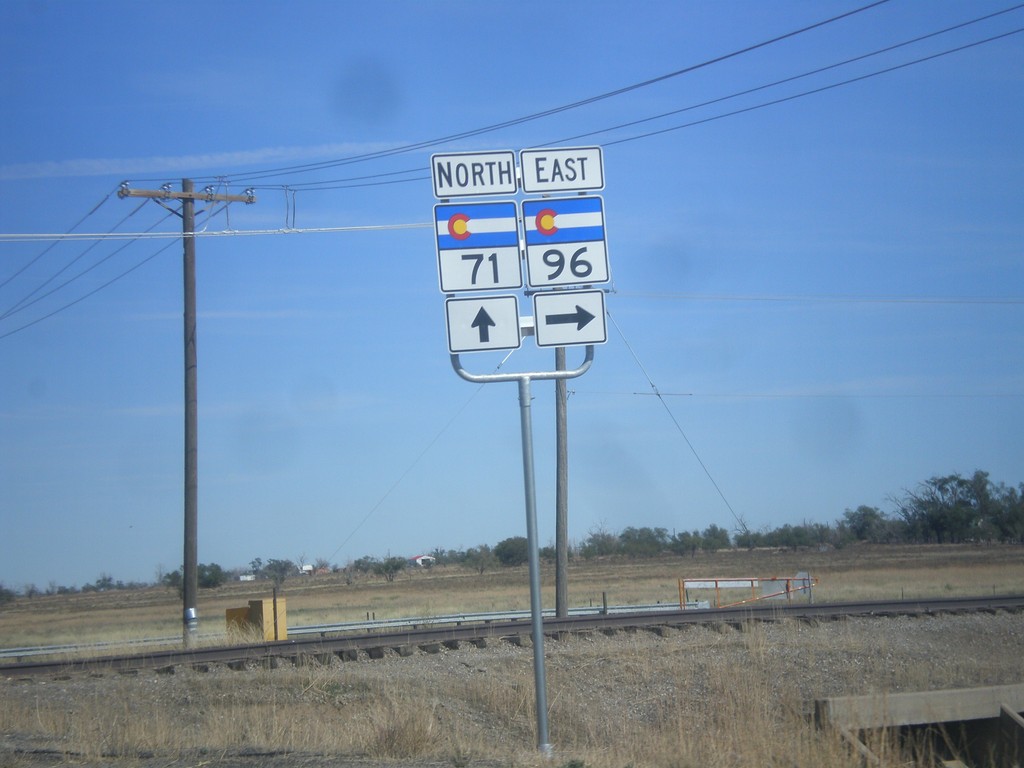
CO-71 North/CO-96 East at CO-71/CO-96 Split
CO-71 North/CO-96 East at CO-71/CO-96 split. Turn right to continue east on CO-96.
Taken 10-08-2016
 Ordway
Crowley County
Colorado
United States
Ordway
Crowley County
Colorado
United States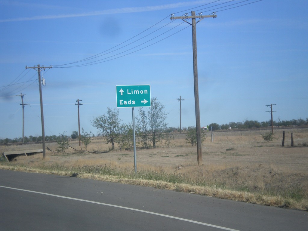
CO-71 North/CO-96 East at CO-71/CO-96 Junction
CO-71 North/CO-96 East at CO-71/CO-96 junction. Turn right on CO-96 East for Eads; continue north on CO-71 to Limon.
Taken 10-08-2016
Ordway
Crowley County
Colorado
United States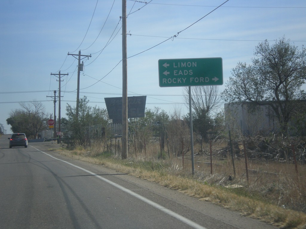
CO-96 East at CO-71
CO-96 East at CO-71 in Ordway. CO-96 East joins CO-71 North through Ordway. Turn right for CO-71 south to Rocky Ford. Turn left for CO-71 North/CO-96 East to Limon (via CO-71) and Eads (via CO-96).
Taken 10-08-2016
Ordway
Crowley County
Colorado
United States
CO-96 East Approaching CO-71
CO-96 East approaching CO-71 in Ordway.
Taken 10-08-2016
Ordway
Crowley County
Colorado
United States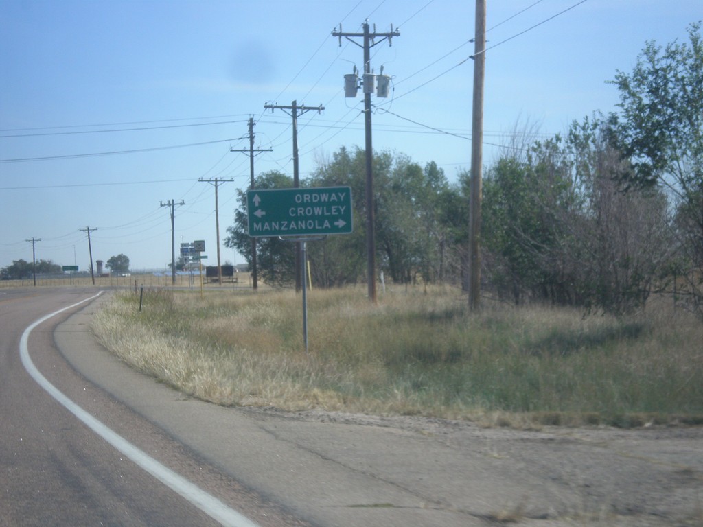
CO-96 East at CO-207
CO-96 East at CO-207 south to Manzanola. Turn left for Crowley; continue east on CO-96 for Ordway.
Taken 10-08-2016
 Olney Springs
Crowley County
Colorado
United States
Olney Springs
Crowley County
Colorado
United States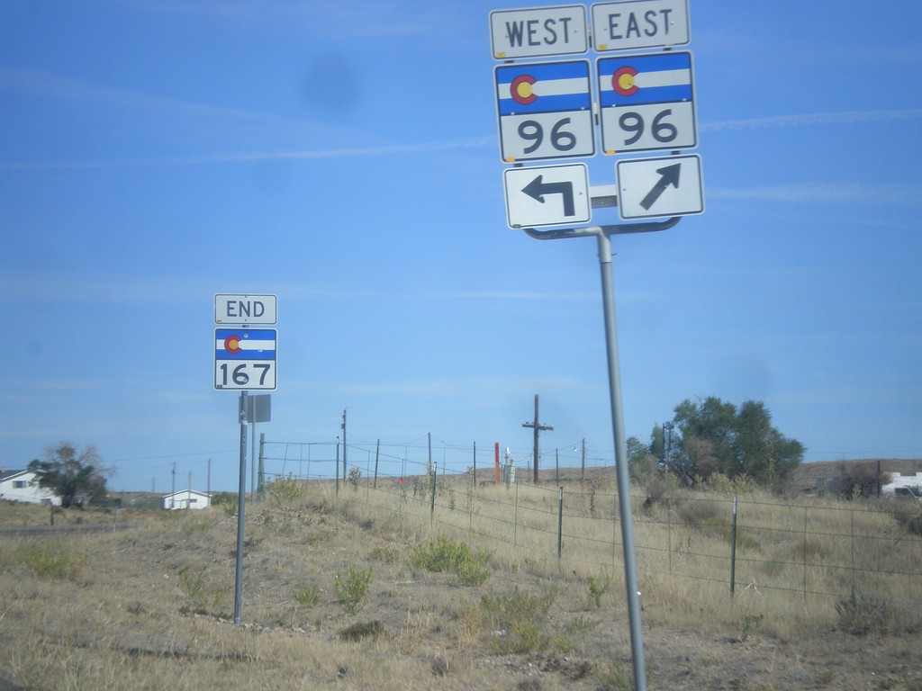
End CO-167 North at CO-96
End CO-167 North at CO-96 in Crowley County.
Taken 10-08-2016
 Fowler
Crowley County
Colorado
United States
Fowler
Crowley County
Colorado
United States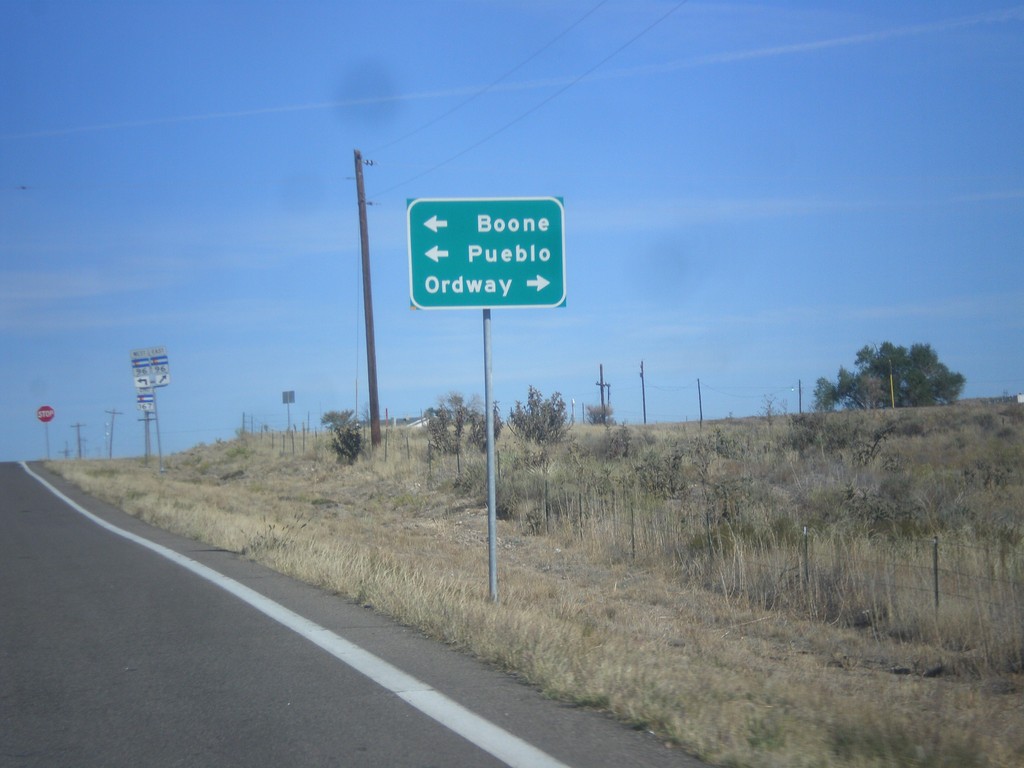
CO-167 North Approaching CO-96
CO-167 North approaching CO-96. Turn left for CO-96 west to Boone and Pueblo; right for CO-96 east to Ordway.
Taken 10-08-2016
Fowler
Crowley County
Colorado
United States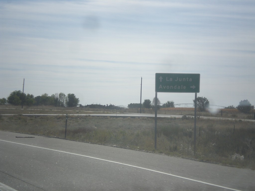
US-50 East at Bus. US-50 West
US-50 East at Bus. US-50 West to Avondale. This is the eastern end of the Pueblo business loop. Continue east on US-50 for La Junta.
Taken 10-08-2016

 Boone
Pueblo County
Colorado
United States
Boone
Pueblo County
Colorado
United States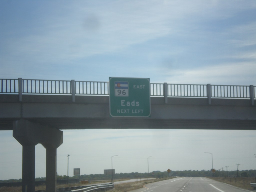
US-50 East/CO-96 East Approaching US-50/CO-96 Split
US-50 East/CO-96 East approaching US-50/CO-96 split. Use left lane for CO-96 East to Eads.
Taken 10-08-2016
Pueblo
Pueblo County
Colorado
United States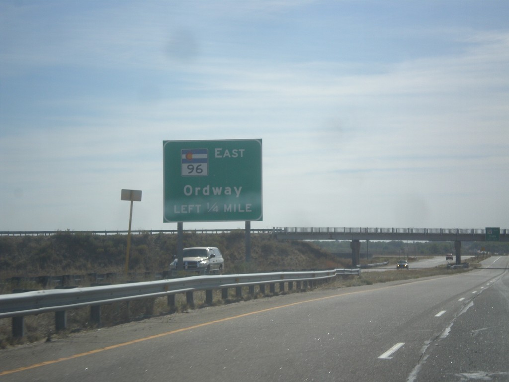
US-50 East/CO-96 East Approaching US-50/CO-96 Split
US-50 East/CO-96 East approaching US-50/CO-96 split. Use left lane for CO-96 East to Ordway.
Taken 10-08-2016
Avondale
Pueblo County
Colorado
United States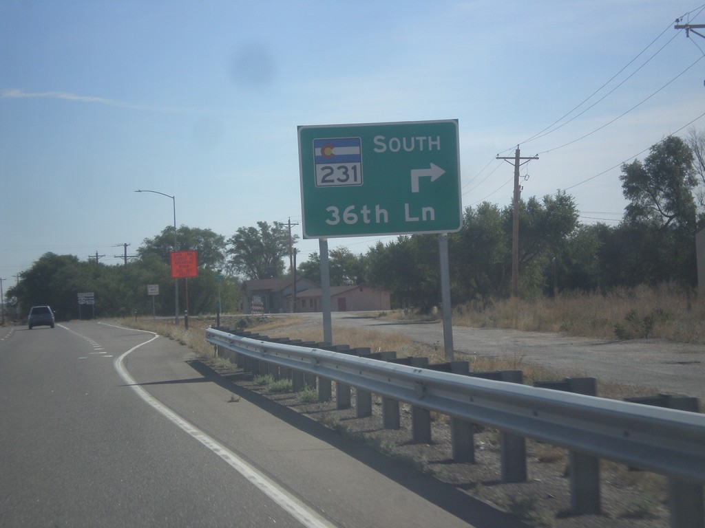
US-50 East at CO-231 South
US-50 East at CO-231 South/36th Lane.
Taken 10-08-2016
 Pueblo
 County
Colorado
United States
Pueblo
Pueblo County
Colorado
United States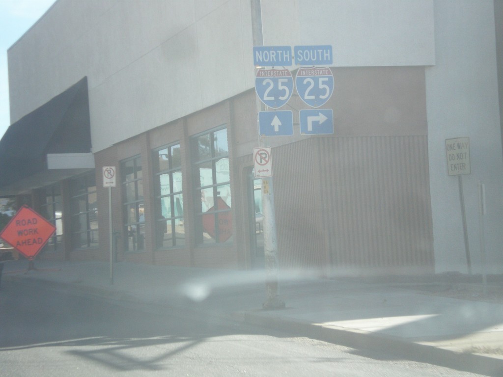
CO-96 East (4th St.) at Santa Fe Ave.
CO-96 East (4th St.) at Santa Fe Ave. in Pueblo. Turn right for I-25 southbound; continue east on 4th St. for I-25 north.
Taken 10-08-2016

 Pueblo
 County
Colorado
United States
Pueblo
Pueblo County
Colorado
United States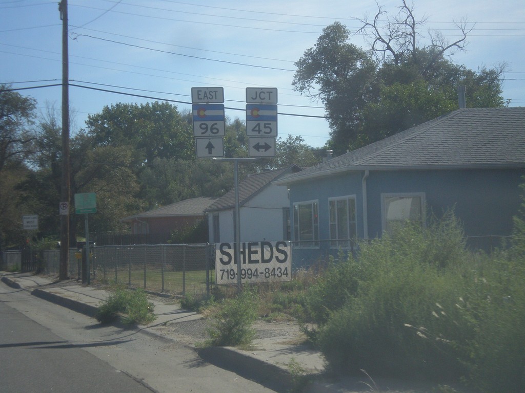
CO-96 East at CO-45
CO-96 East at CO-45 (South Pueblo Blvd.)
Taken 10-08-2016
 Pueblo
 County
Colorado
United States
Pueblo
Pueblo County
Colorado
United States
End CO-67 South at CO-96
End CO-67 South at CO-96 in Wetmore.
Taken 10-08-2016
 Silver Cliff
Custer County
Colorado
United States
Silver Cliff
Custer County
Colorado
United States