Signs Tagged With Intersection
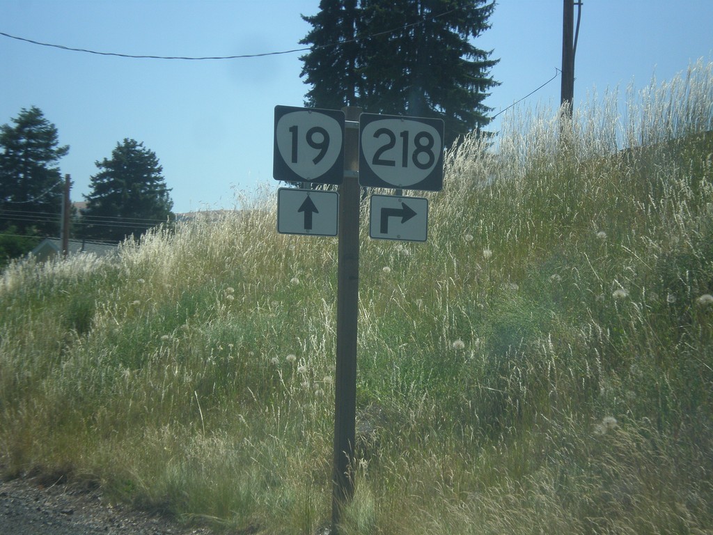
OR-19 South at OR-218
OR-19 south at OR-218 in Fossil
Taken 07-15-2017

 Fossil
Wheeler County
Oregon
United States
Fossil
Wheeler County
Oregon
United States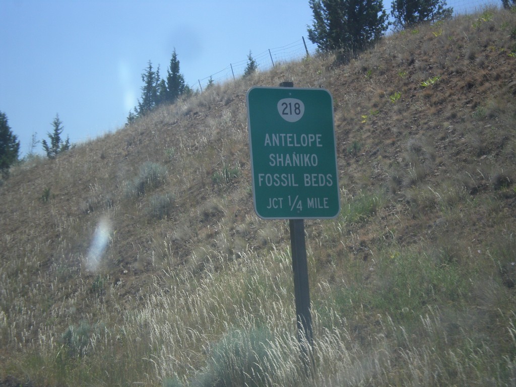
OR-19 South Approaching OR-218
OR-19 South approaching OR-218 to Antelope, Shaniko, and (John Day) Fossil Beds (Clarno Unit).
Taken 07-15-2017
Fossil
Wheeler County
Oregon
United States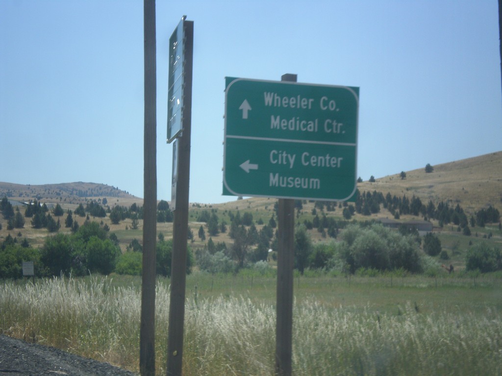
OR-19 South - First St.
OR-19 south at First St. in Fossil. Turn left for First St. to City Center and Museum. Continue south on OR-19 for Wheeler County Medical Center.
Taken 07-15-2017
Fossil
Wheeler County
Oregon
United States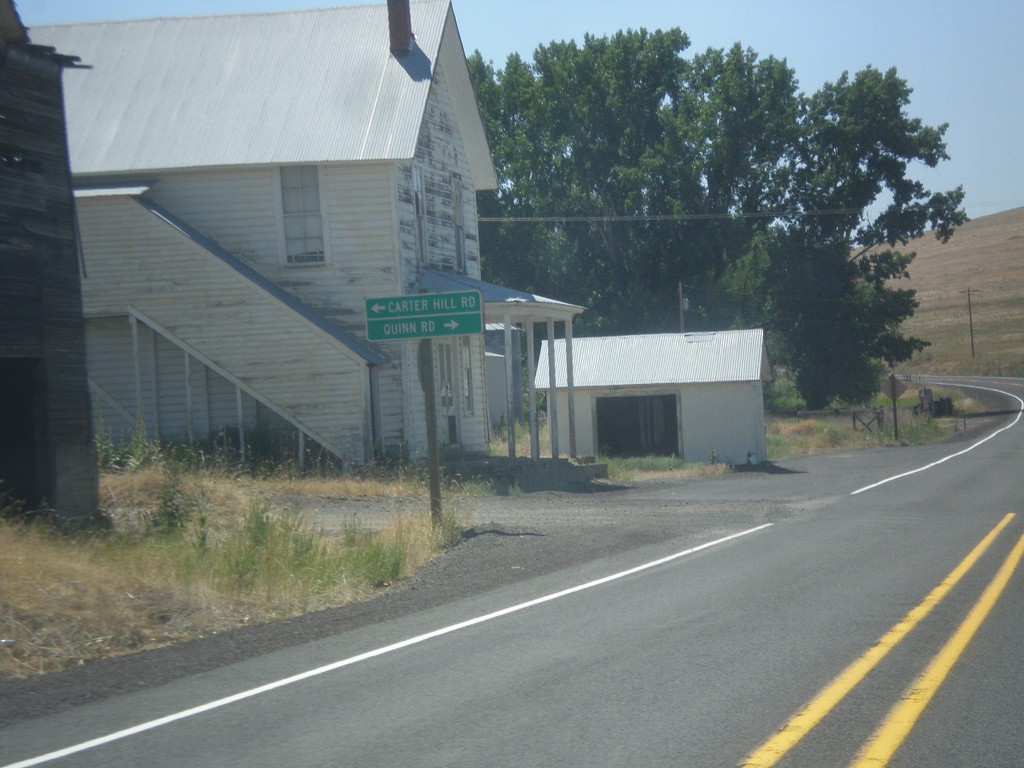
OR-19 South - Quinn Road/Carter Hill Road.
OR-19 South at Quinn Road/Carter Hill Road.
Taken 07-15-2017
Mayville
Gilliam County
Oregon
United States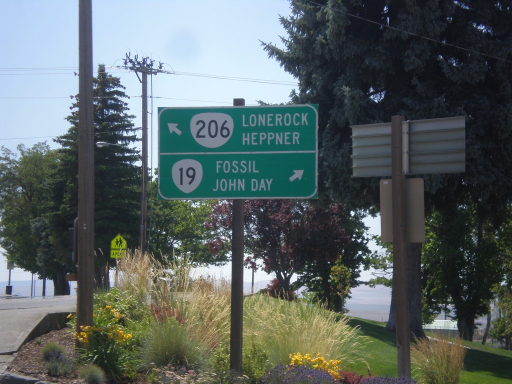
OR-19 South/OR-206 East at OR-19/OR-206 Split
OR-19 South/OR-206 East at OR-19/OR-206 split in Condon. Turn left for OR-206 east to Lonerock and Heppner. Merge right for OR-19 south to Fossil and John Day.
Taken 07-15-2017
 Condon
Gilliam County
Oregon
United States
Condon
Gilliam County
Oregon
United States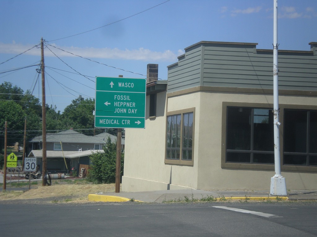
OR-19 South at OR-206 - Condon
OR-19 South at OR-206 in Condon. Continue straight for OR-206 west to Wasco. Turn left for OR-19 South/OR-206 east to Fossil, Heppner, and John Day. Turn right on Main St. for the Medical Center.
Taken 07-15-2017
Condon
Gilliam County
Oregon
United States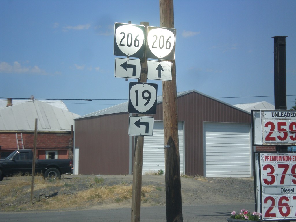
OR-19 South at OR-206 - Condon
OR-19 South at OR-206 in Condon. Continue straight for OR-206 west; turn left for OR-19 South/OR-206 east. OR-206 joins OR-19 south through Condon.
Taken 07-15-2017
Condon
Gilliam County
Oregon
United States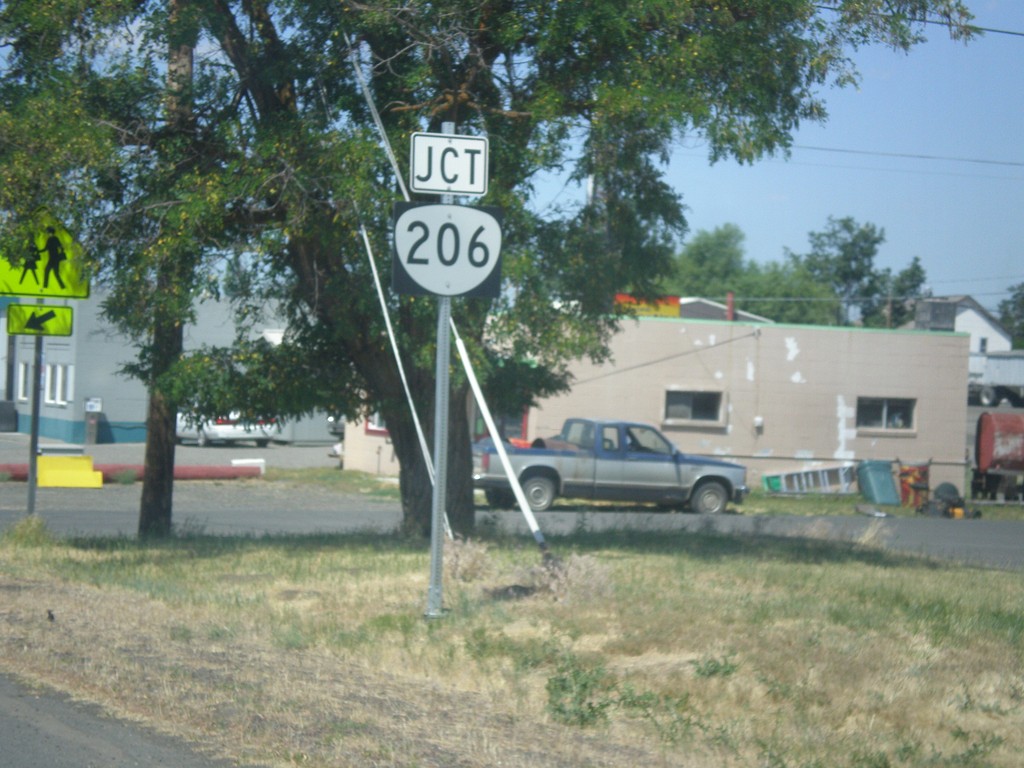
OR-19 South Approaching OR-206
OR-19 South approaching OR-206 in Condon.
Taken 07-15-2017
Condon
Gilliam County
Oregon
United States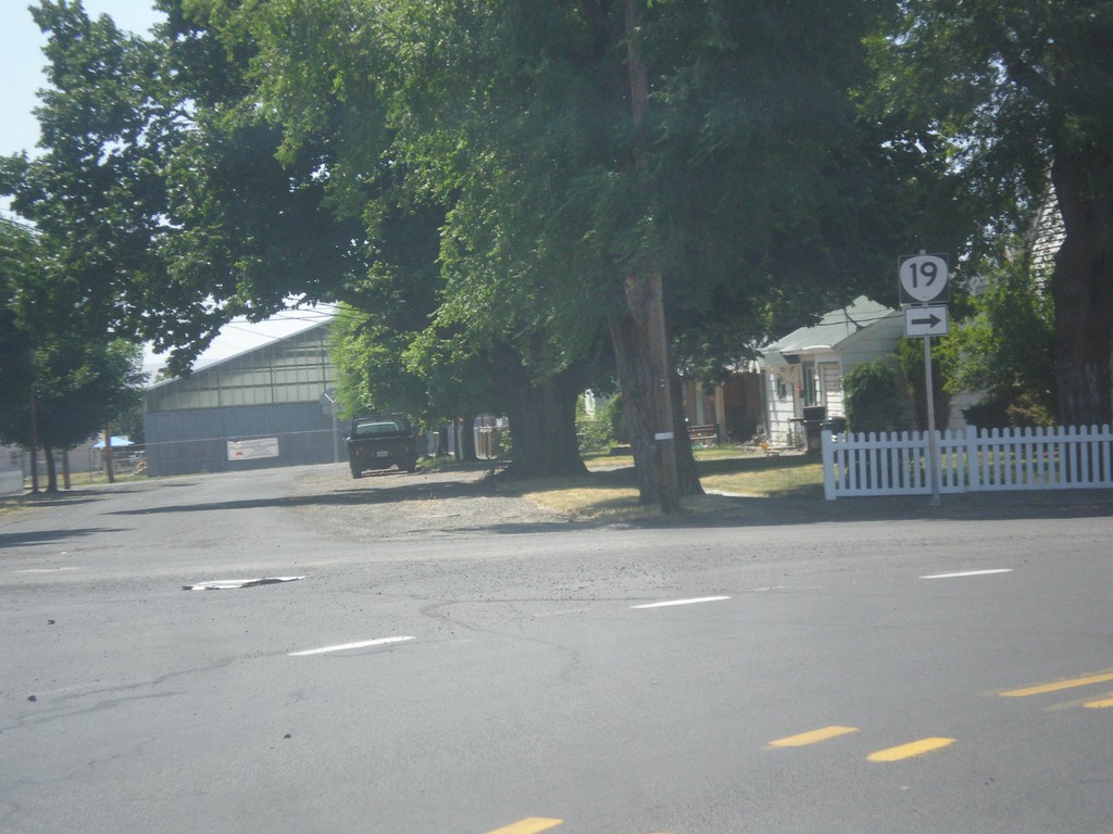
OR-19 South - Condon
OR-19 South at Washington St./Walnut St. junction in Condon. Merge left to continue south on OR-19.
Taken 07-15-2017
Condon
Gilliam County
Oregon
United States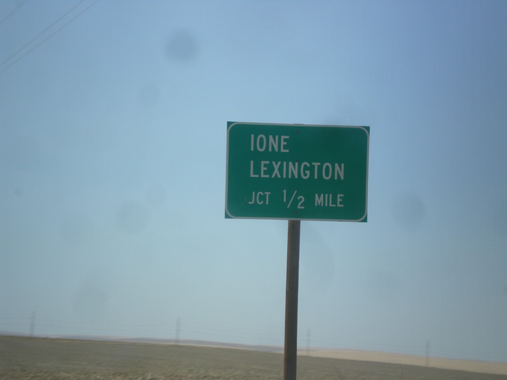
OR-19 South - Ione/Lexington Jct.
OR-19 South approaching Ione/Lexington Jct. (Baseline Road).
Taken 07-15-2017
Arlington
Gilliam County
Oregon
United States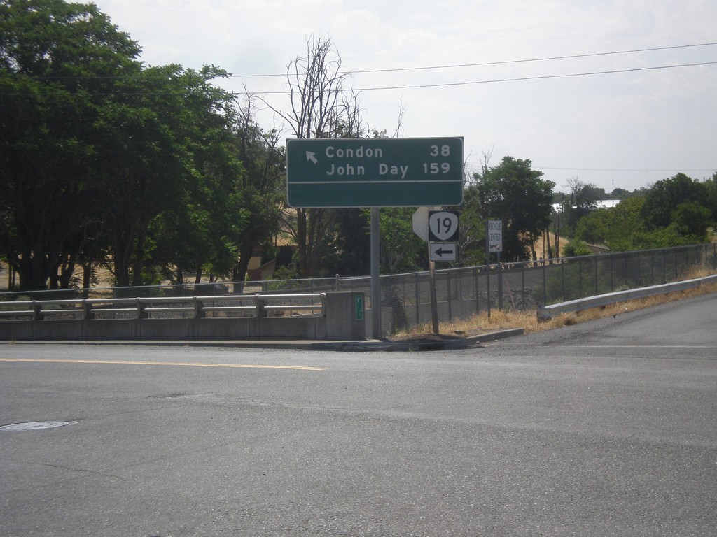
OR-19 South (Cottonwood St.) at Locust St.
OR-19 South (Cottonwood St.) at Locust St. in Arlington. Turn left to continue south on OR-19 for Condon and John Day.
Taken 07-15-2017
Arlington
Gilliam County
Oregon
United States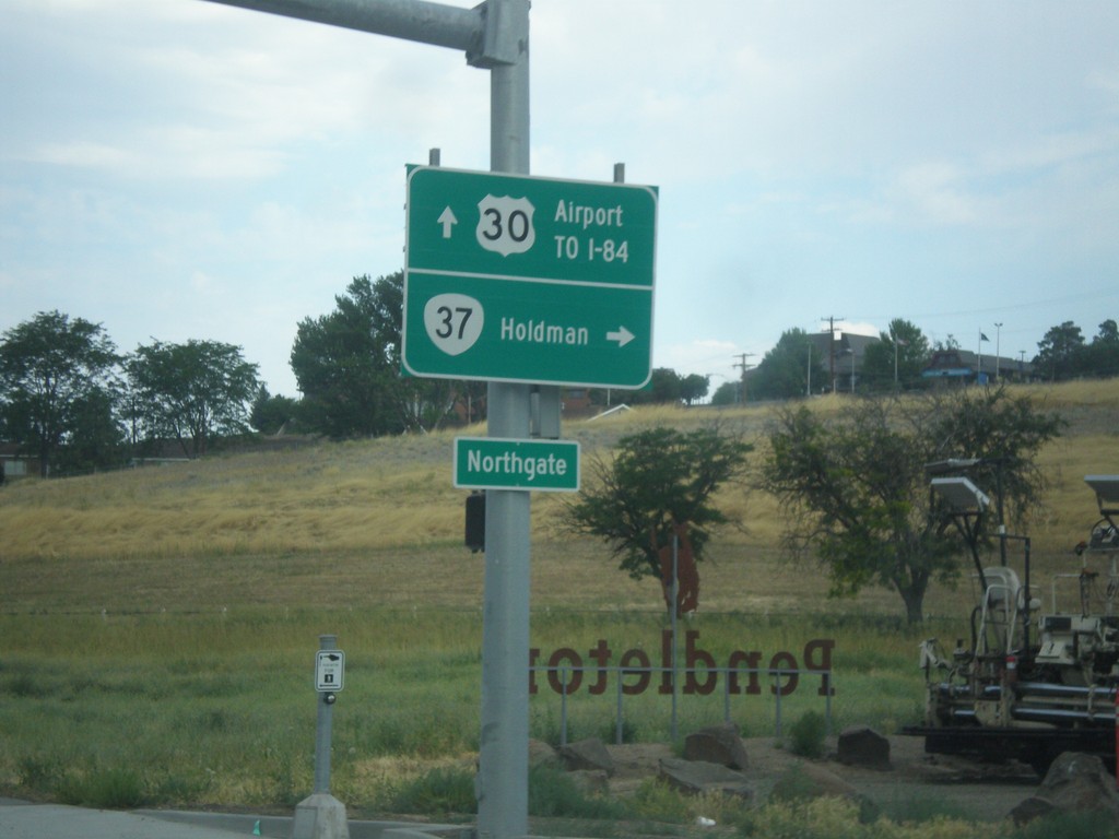
US-30 West at OR-37 North
US-30 west at OR-37 north to Holdman. Continue west on US-30 for Airport and I-84.
Taken 07-15-2017

 Pendleton
Umatilla County
Oregon
United States
Pendleton
Umatilla County
Oregon
United States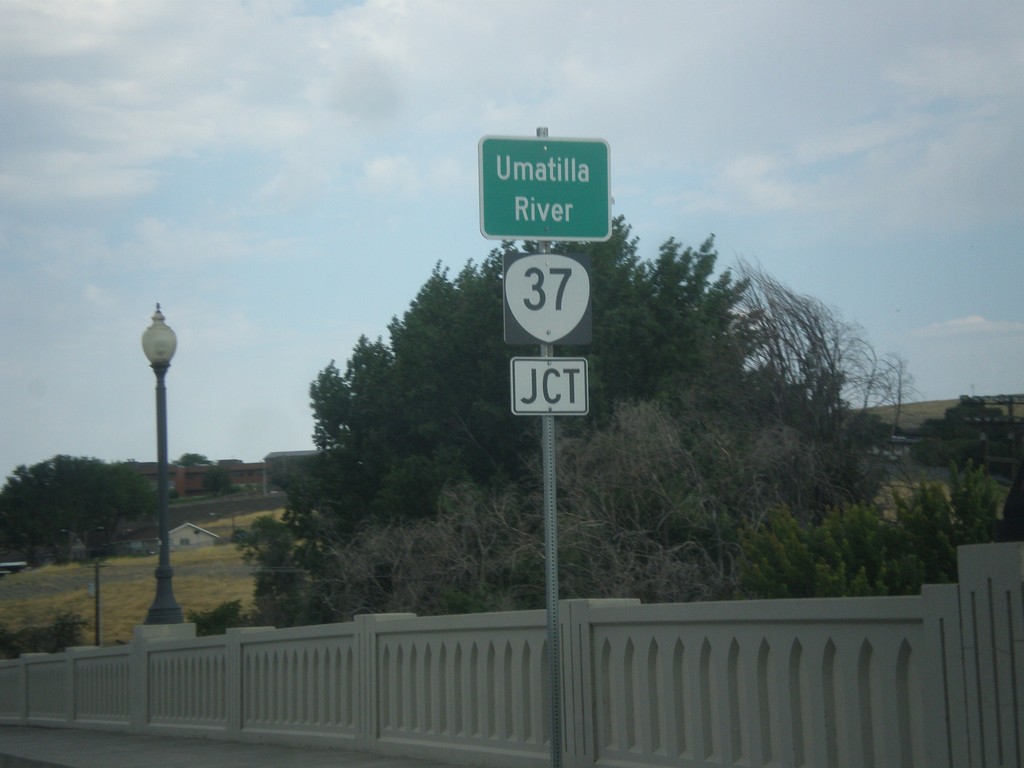
US-30 West Approaching OR-37 Jct. at Umatilla River Bridge.
US-30 West approaching OR-37 Jct. crossing the Umatilla River bridge.
Taken 07-15-2017
Pendleton
Umatilla County
Oregon
United States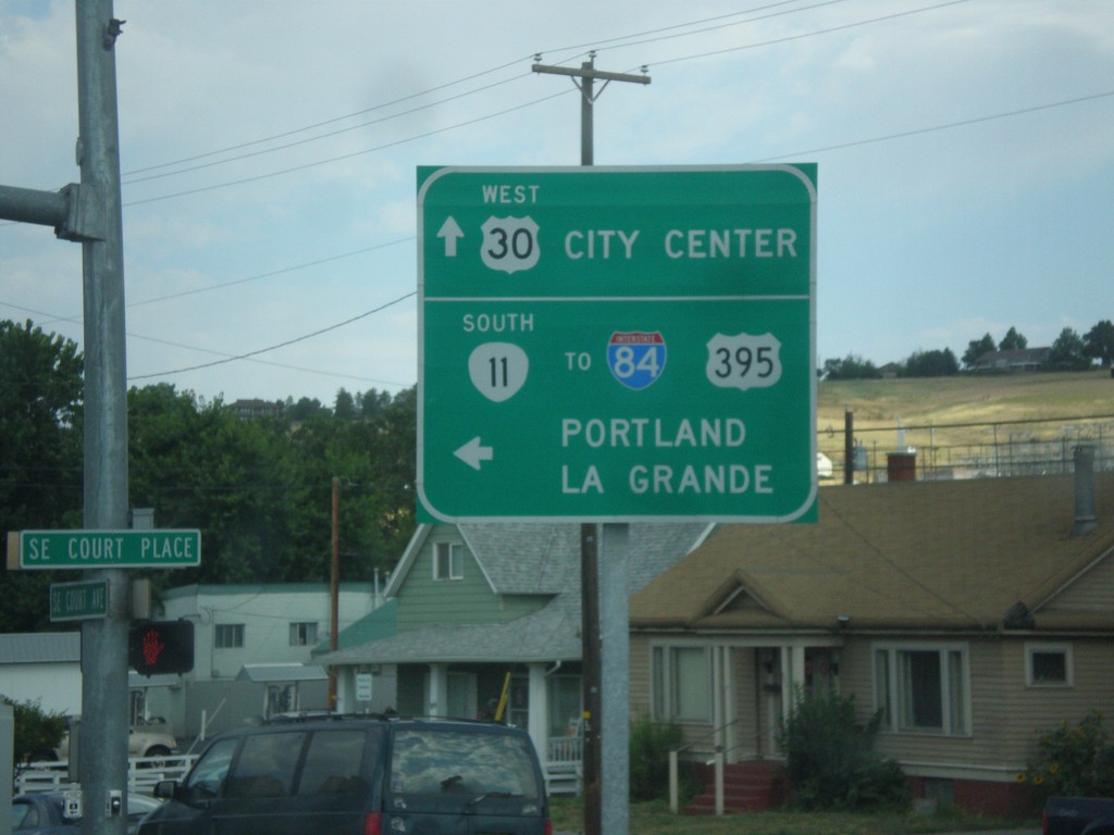
US-30 West/OR-11 South at US-30/OR-11 Split
US-30 West/OR-11 South at US-30/OR-11 Split in Pendleton. Turn left for OR-11 south to I-84/US-395 to Portland and La Grande. Continue straight for US-30 West to City Center.
Taken 07-15-2017


 Pendleton
Umatilla County
Oregon
United States
Pendleton
Umatilla County
Oregon
United States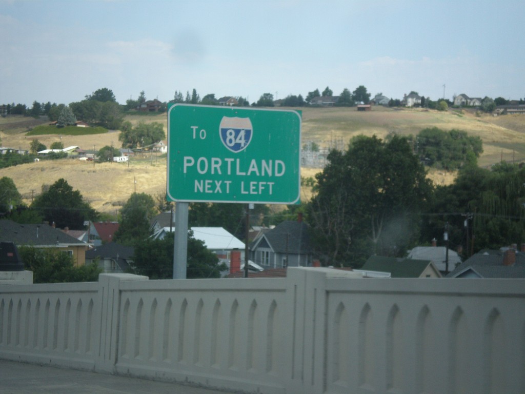
US-30 West/OR-11 South - I-84 West Next Left
US-30 West/OR-11 South approaching US-30/OR-11 Split in Pendleton. Turn left for I-84 West to Portland.
Taken 07-15-2017
Pendleton
Umatilla County
Oregon
United States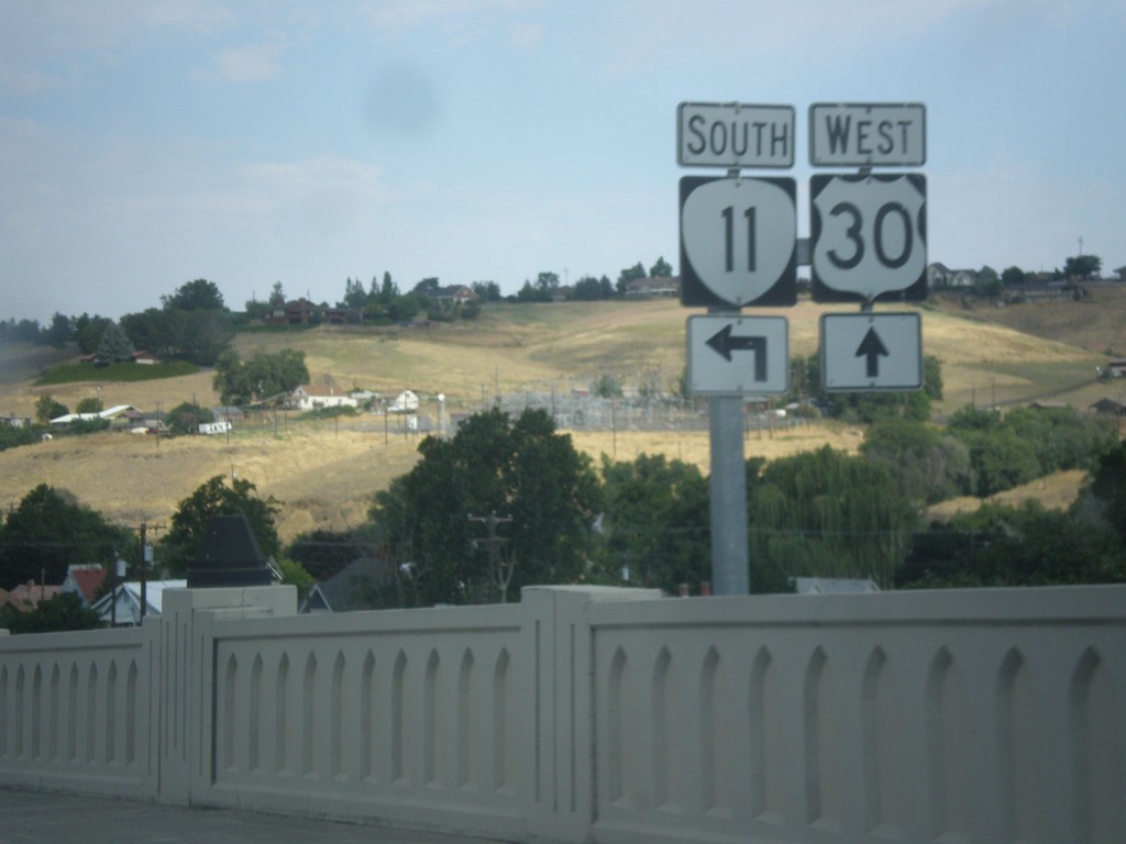
US-30 West/OR-11 South (Court St.) at US-30/OR-11 Split
US-30 West/OR-11 South (Court St.) at US-30/OR-11 split in Pendleton.
Taken 07-15-2017
Pendleton
Umatilla County
Oregon
United States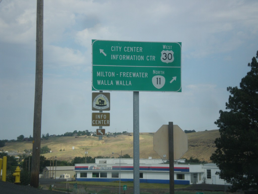
US-30 West at OR-11
US-30 West at OR-11. Use OR-11 north for Milton-Freewater and Walla Walla (Washington). Continue west on US-30 for City Center and Information Center. OR-11 south joins US-30 west for a short distance through Pendleton.
Taken 07-15-2017
Pendleton
Umatilla County
Oregon
United States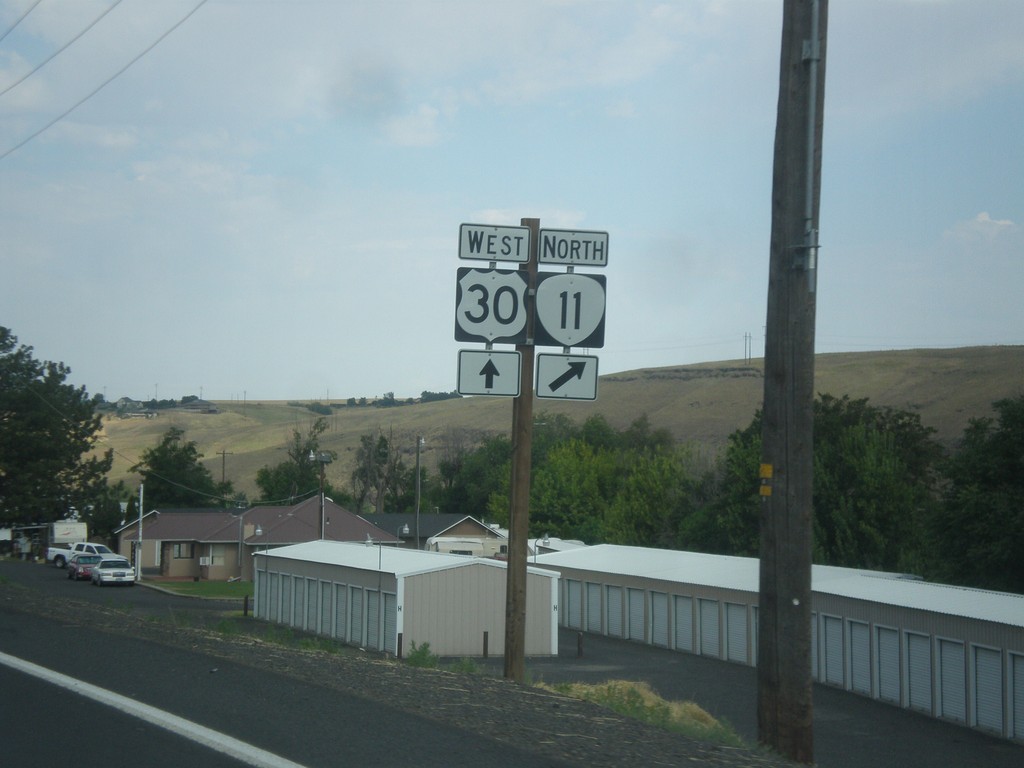
US-30 West Approaching OR-11
US-30 West approaching OR-11 North in Pendleton.
Taken 07-15-2017
Pendleton
Umatilla County
Oregon
United States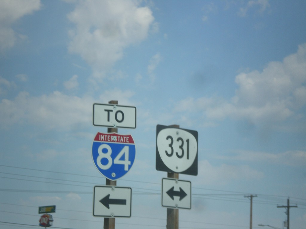
Kusi Road at OR-331
Kusi Road at OR-331. Turn left on OR-331 for I-84.
Taken 07-15-2017
 Pendleton
Umatilla County
Oregon
United States
Pendleton
Umatilla County
Oregon
United States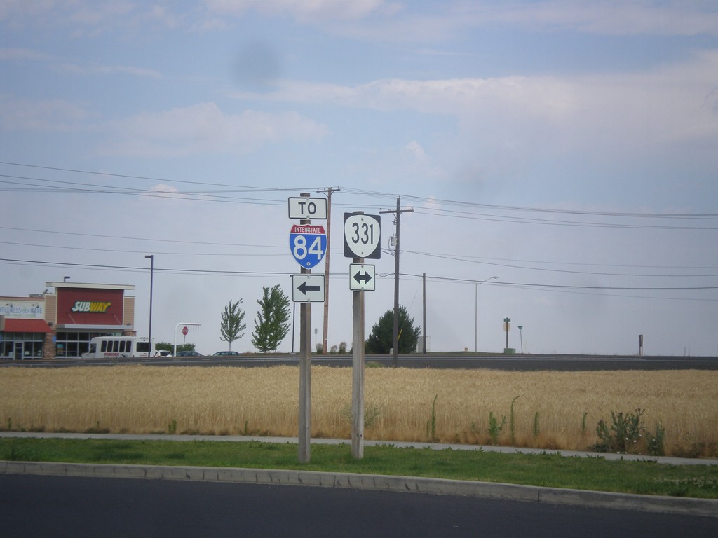
Kusi Road at OR-331
Kusi Road at OR-331. Turn left on OR-331 for I-84.
Taken 07-15-2017
Pendleton
Umatilla County
Oregon
United States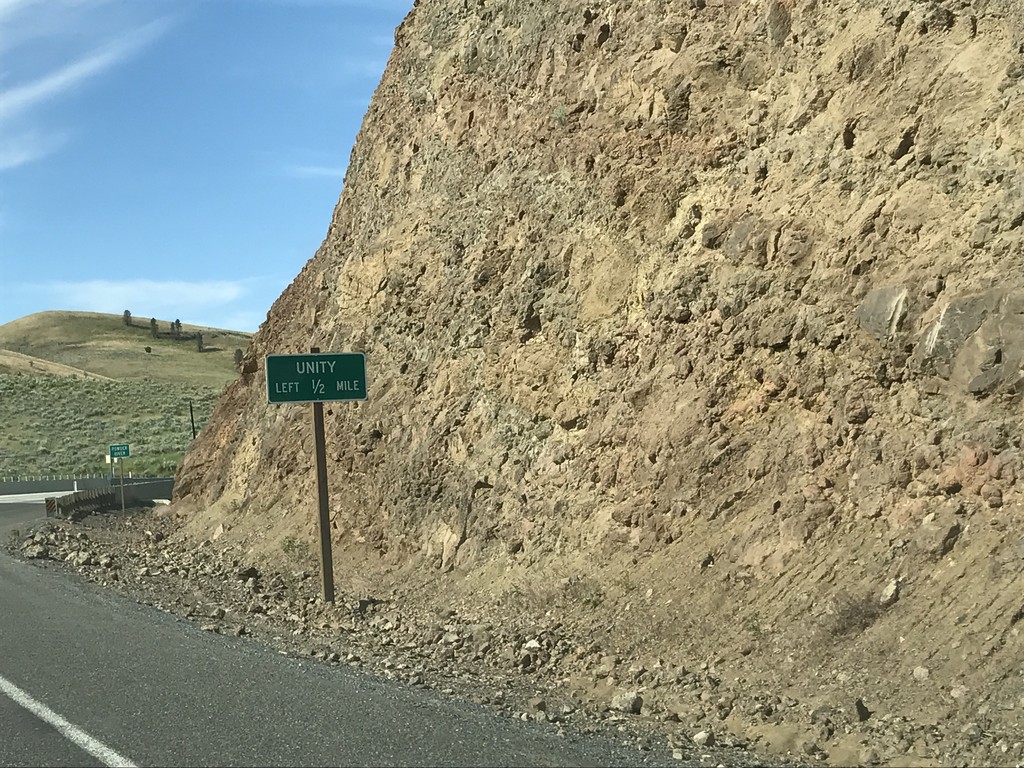
OR-7 West Approaching OR-245
OR-7 West approaching OR-245 in Baker County. Use OR-245 west for Unity.
Taken 07-04-2017

 Baker City
Baker County
Oregon
United States
Baker City
Baker County
Oregon
United States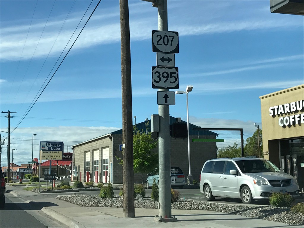
US-395 South at OR-207
US-395 south at OR-207 in Hermiston.
Taken 04-30-2017
 Hermiston
Umatilla County
Oregon
United States
Hermiston
Umatilla County
Oregon
United States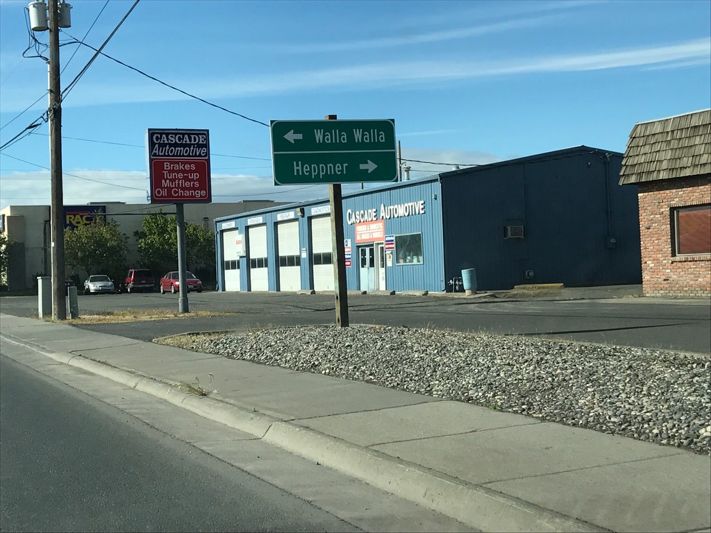
US-395 South Approaching OR-207
US-395 South approaching OR-207 in Hermiston. Use OR-207 south for Heppner; OR-207 north for Walla Walla (Washington).
Taken 04-30-2017
Hermiston
Umatilla County
Oregon
United States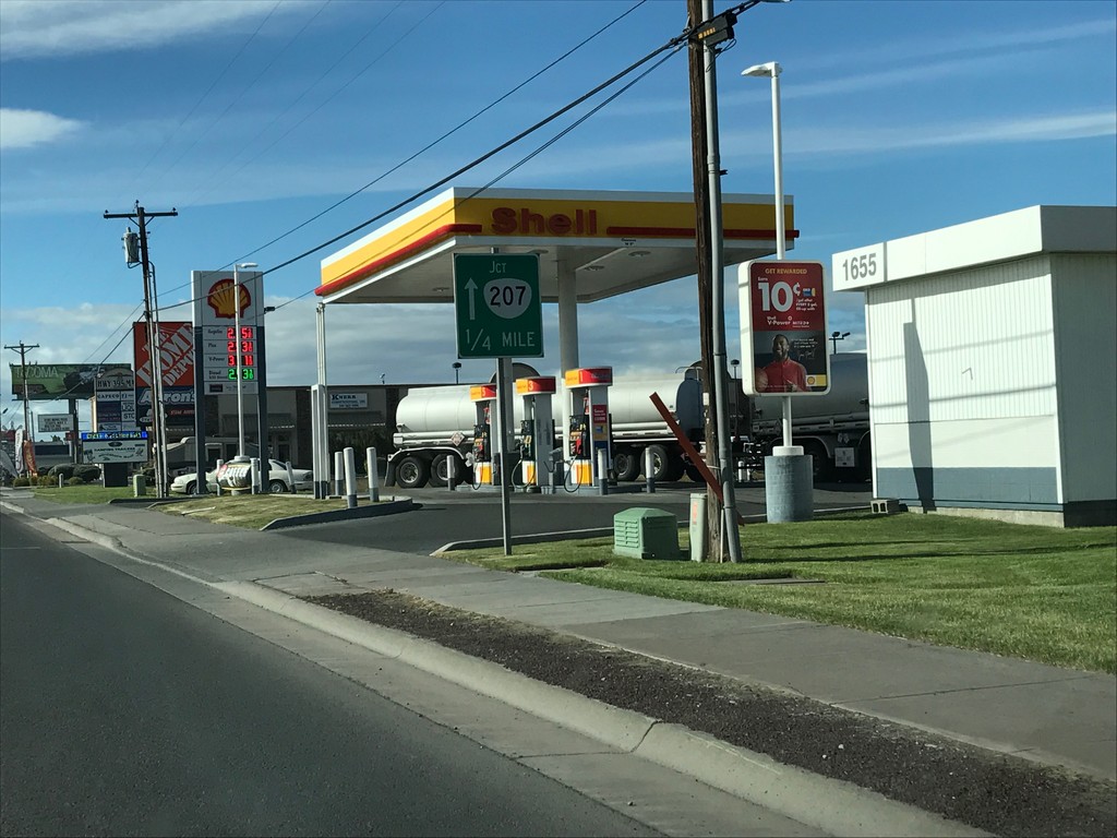
US-395 South Approaching OR-207
US-395 South approaching OR-207 in Hermiston.
Taken 04-30-2017
Hermiston
Umatilla County
Oregon
United States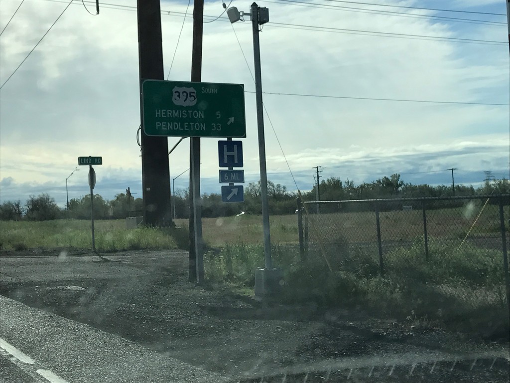
US-730 East/US-395 South at US-730/US-395 Split
US-730 East/US-395 South at US-730/US-395 Split in Umatilla. Merge right to continue south on US-395 to Hermiston and Pendleton.
Taken 04-30-2017
 Umatilla
 County
Oregon
United States
Umatilla
Umatilla County
Oregon
United States