Signs Tagged With Intersection
Miller Road West at Sea Island Way Ramps
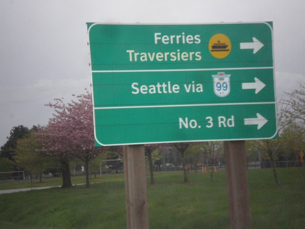
Miller Road West at Sea Island Way onramp. Turn right onto Sea Island Way for Ferries, Seattle via BC-99, and No. 3 Road.
Taken 04-29-2017
 Richmond
Metro Vancouver
British Columbia
Canada
Richmond
Metro Vancouver
British Columbia
Canada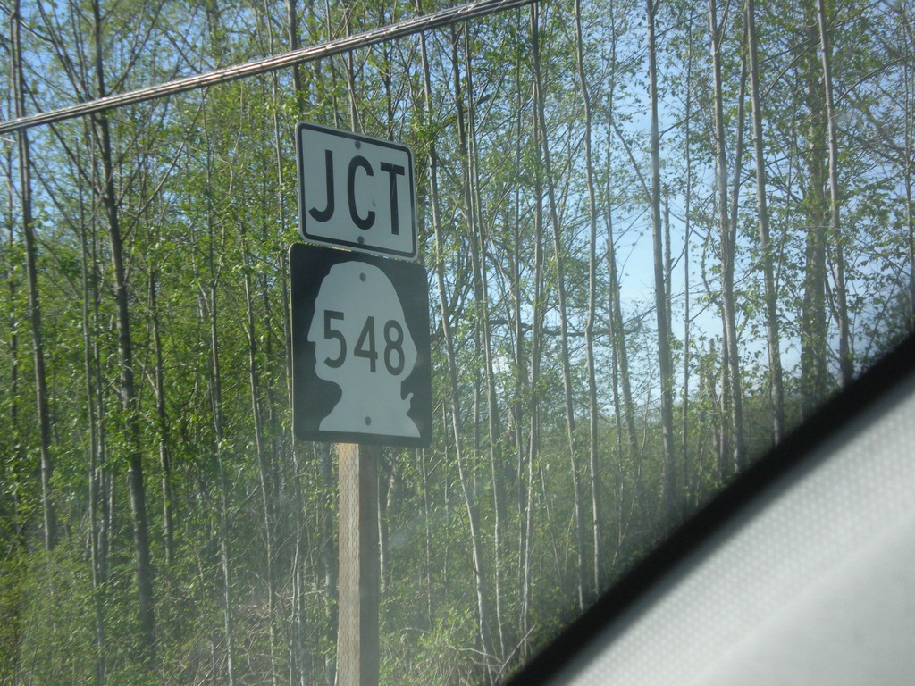
Birch Bay-Lynden Road at WA-548
Birch Bay-Lynden Road at WA-548 (Blaine Road) Junction.
Taken 04-28-2017
 Blaine
Whatcom County
Washington
United States
Blaine
Whatcom County
Washington
United States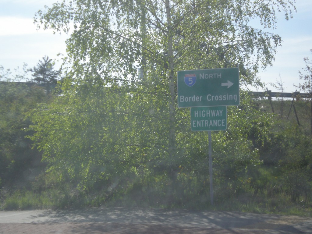
WA-548 South at I-5 North
WA-548 South at I-5 North to (Peace Arch) Border Crossing. Note the Highway Entrance, instead of Freeway Entrance.
Taken 04-28-2017
 Blaine
Whatcom County
Washington
United States
Blaine
Whatcom County
Washington
United States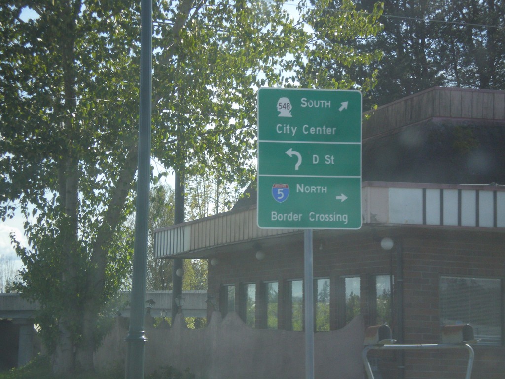
Begin WA-548 South at I-5
Begin WA-548 South at I-5. Turn right for I-5 north to (Peace Arch) Border Crossing. Continue through roundabout for D St., and WA-548 South/(Blaine)City Center.
Taken 04-28-2017
Blaine
Whatcom County
Washington
United States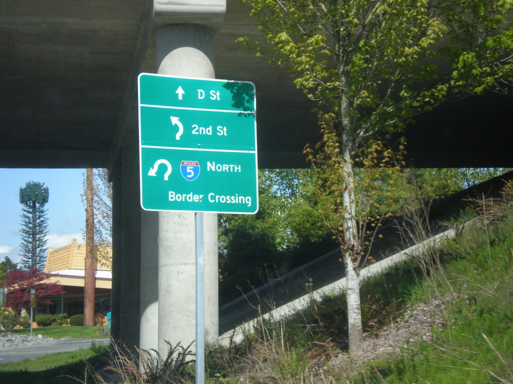
WA-548 North Approaching I-5 North Onramp
WA-548 North approaching I-5 North Onramp. Use I-5 north for (Peace Arch) Border Crossing. Continue through roundabout for 2nd St. (to Peace Arch State Park) and D St.
Taken 04-28-2017
Blaine
Whatcom County
Washington
United States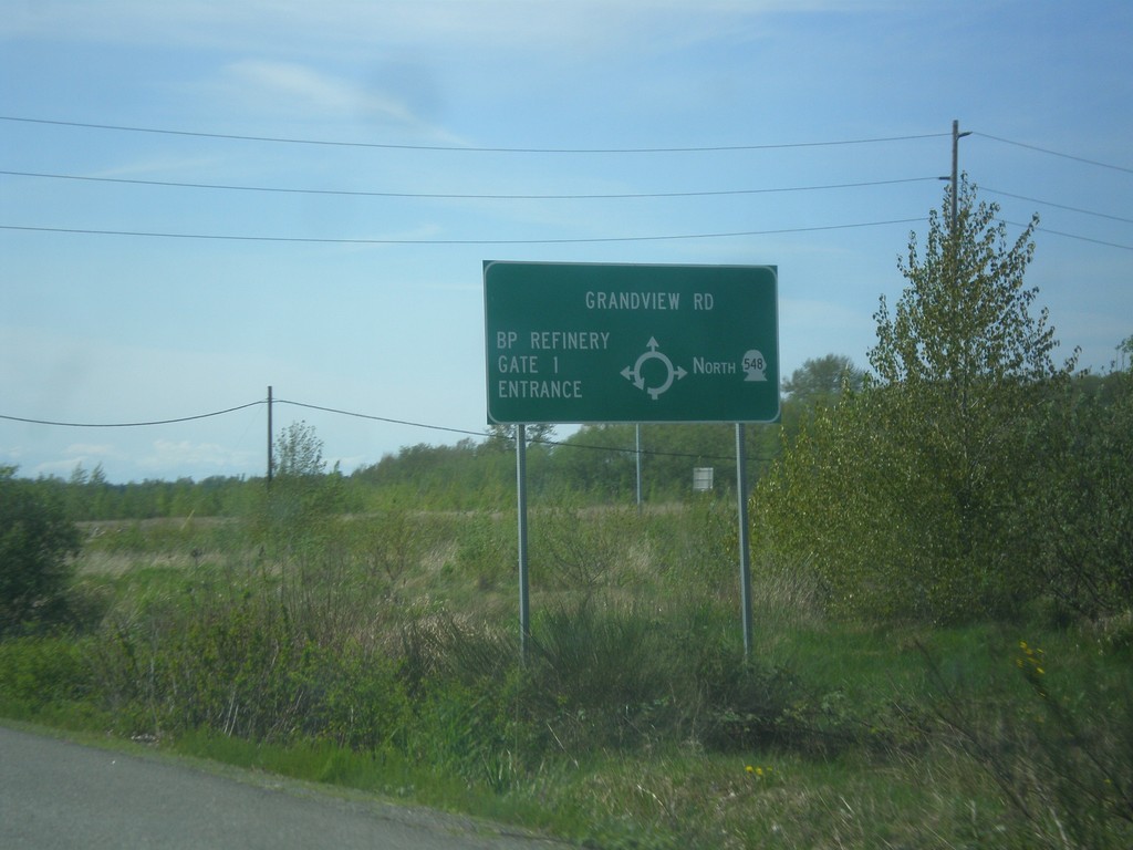
WA-548 - Grandview Road Roundabout
Roundabout on WA-548 (Grandview Road). Go north on roundabout to continue north on WA-548; west to continue on Grandview Road; north for the (Cherry Point) BP Refinery.
Taken 04-28-2017
Birch Bay
Whatcom County
Washington
United States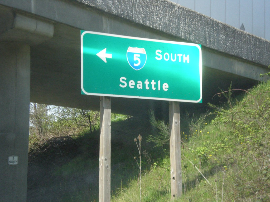
WA-11 South at I-5 South
WA-11 South at I-5 South to Seattle.
Taken 04-28-2017
 Bellingham
Whatcom County
Washington
United States
Bellingham
Whatcom County
Washington
United States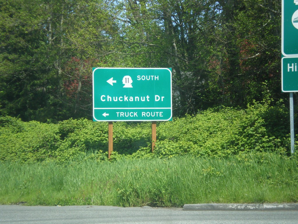
I-5 North - Exit 250 Offramp at WA-11
I-5 North - Exit 250 Offramp at WA-11. Use WA-11 South to Chuckanut Drive and the truck route.
Taken 04-28-2017
Bellingham
Whatcom County
Washington
United States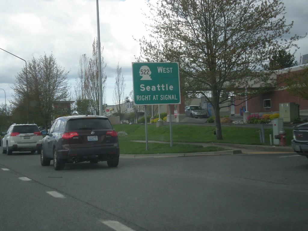
US-2 West at WA-522 West
US-2 West at WA-522 West to Seattle.
Taken 04-28-2017

 Monroe
Snohomish County
Washington
United States
Monroe
Snohomish County
Washington
United States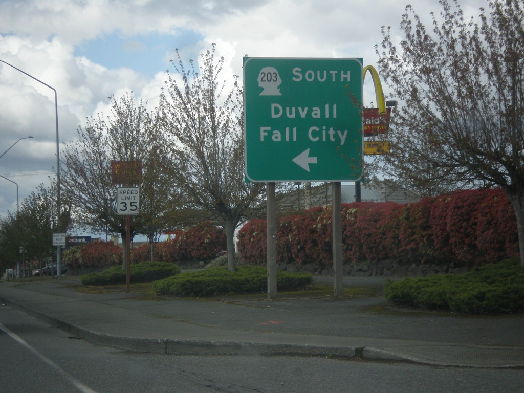
US-2 West at WA-203 South
US-2 West at WA-203 South to Duvall and Fall City.
Taken 04-28-2017
 Monroe
Snohomish County
Washington
United States
Monroe
Snohomish County
Washington
United States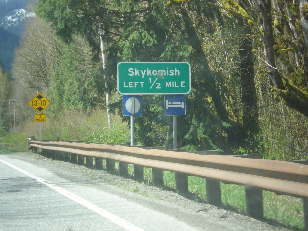
US-2 West - Skykomish Jct
US-2 West approaching Skykomish Jct
Taken 04-28-2017
Skykomish
King County
Washington
United States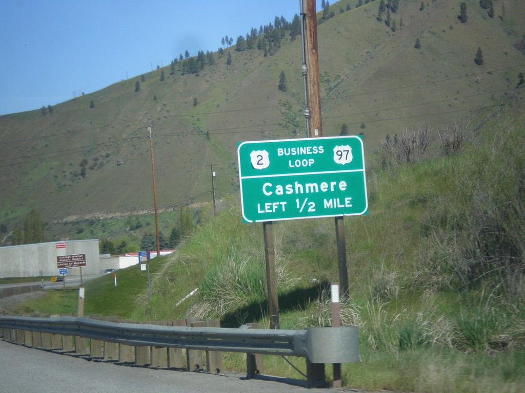
US-2 West/US-97 South - Bus. US-2/US-97
US-2 West/US-97 South - Bus. US-2/US-97 Junction to Cashmere.
Taken 04-28-2017


 Cashmere
Chelan County
Washington
United States
Cashmere
Chelan County
Washington
United States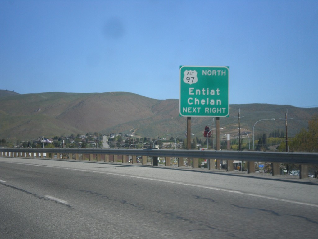
WA-285 North Approaching US-2/US-97 Jct.
WA-285 North Approaching US-2/US-97 Jct. Use right lane for access to Alt. US-97 to Chelan and Entiat.
Taken 04-28-2017

 Wenatchee
Chelan County
Washington
United States
Wenatchee
Chelan County
Washington
United States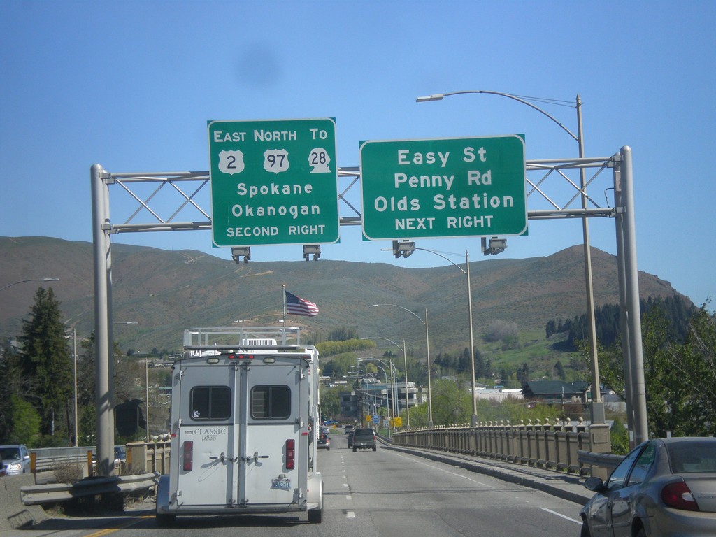
WA-285 North Approaching US-2/US-97/To WA-28
WA-285 North approaching US-2 East/US-97 North/To WA-28 to Spokane and Seattle. Also approaching Easy St., Penny Road, and Olds Station junction in Wenatchee.
Taken 04-28-2017
 Wenatchee
Chelan County
Washington
United States
Wenatchee
Chelan County
Washington
United States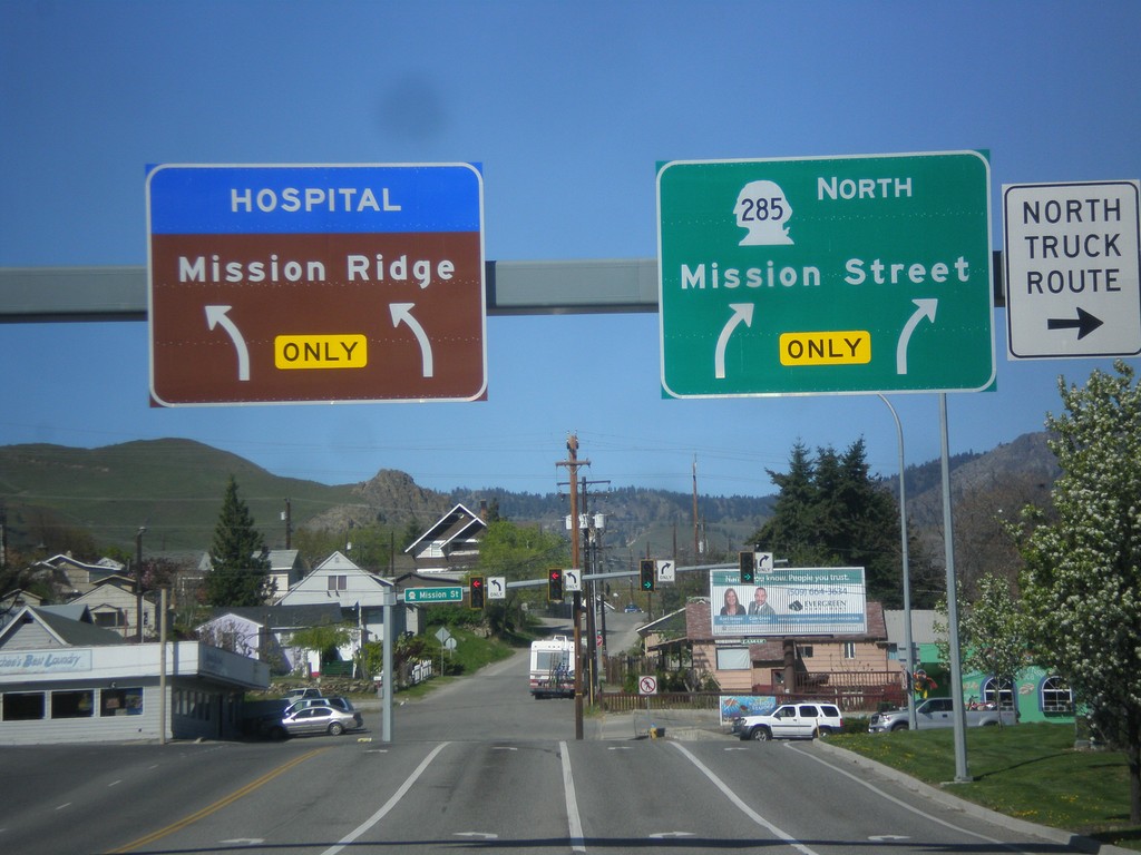
WA-285 North - Mission St. Jct.
WA-285 North (Stevens St.) at Mission St. junction. Turn right to continue north on WA-285. Turn left for Mission Ridge (Ski Area) and the hospital.
Taken 04-28-2017
Wenatchee
Chelan County
Washington
United States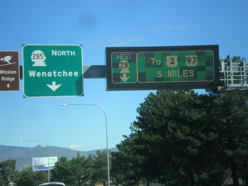
WA-28 West at WA-285 - East Wenatchee
WA-28 West at WA-285 in East Wenatchee. Turn left for WA-285 North to Wenatchee. Continue west on WA-28 to US-2 and US-97. The signs directing traffic on WA-28 are an electronic sign.
Taken 04-28-2017
East Wenatchee
Douglas County
Washington
United States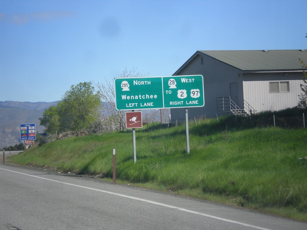
WA-28 West approaching WA-285
WA-28 West approaching WA-285 in East Wenatchee. Turn left for WA-285. Continue straight for WA-28 to US-2 and US-97.
Taken 04-28-2017
East Wenatchee
Douglas County
Washington
United States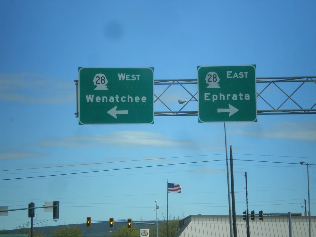
End WA-281 North at WA-28
End WA-281 North at WA-28 in Quincy. Use WA-28 west for Wenatchee; WA-28 east for Ephrata.
Taken 04-28-2017
 Quincy
Grant County
Washington
United States
Quincy
Grant County
Washington
United States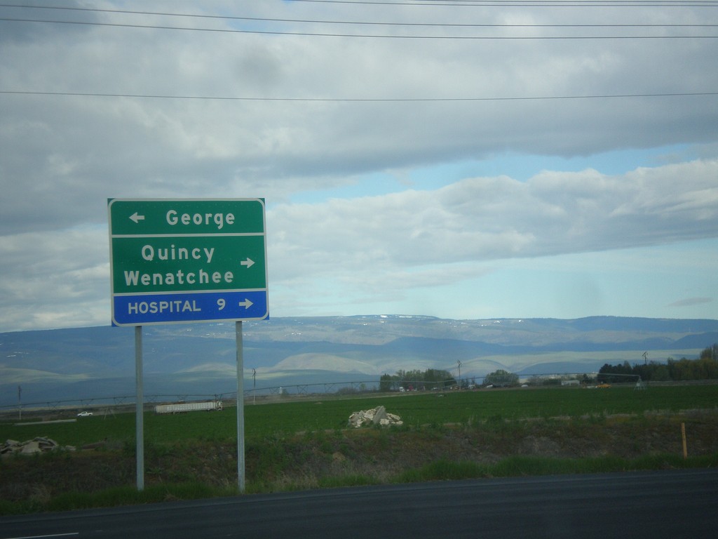
End WA-281 Spur North at WA-281
End WA-281 Spur North at WA-281. Use WA-281 north for Quincy and Wenatchee. Use WA-281 south for George.
Taken 04-28-2017
Quincy
Grant County
Washington
United States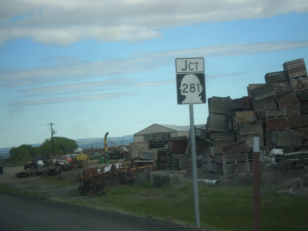
WA-281 Spur North at WA-281
WA-281 Spur North at WA-281 in Grant County.
Taken 04-28-2017
Quincy
Grant County
Washington
United States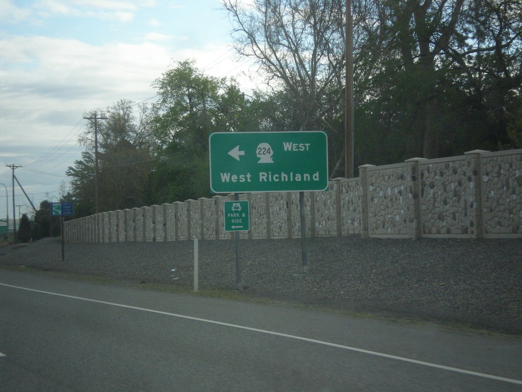
WA-240 West at WA-224 West
WA-240 West at WA-224 West to West Richland.
Taken 04-28-2017

 Richland
Benton County
Washington
United States
Richland
Benton County
Washington
United States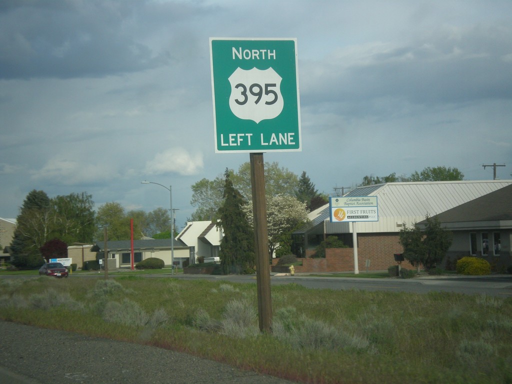
US-395 North - Kennewick
US-395 north Kennewick near beginning of freeway. Use left lane to continue north on US-395.
Taken 04-27-2017
 Kennewick
Benton County
Washington
United States
Kennewick
Benton County
Washington
United States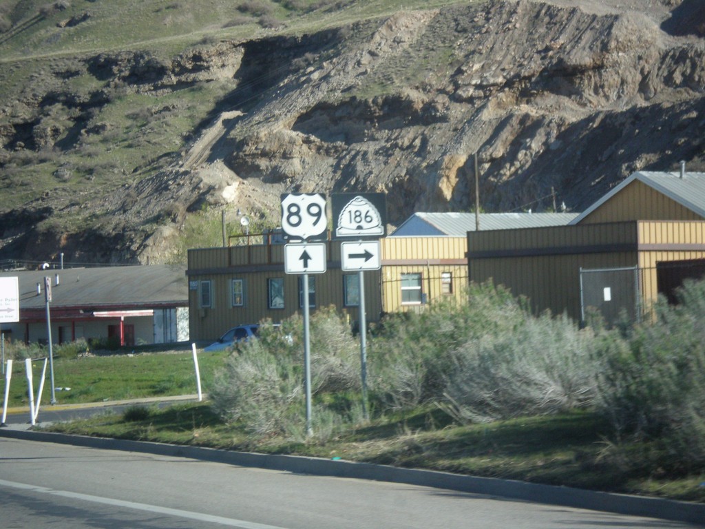
US-89 North at UT-186
US-89 North at UT-186 (Victory Way) in Salt Lake City.
Taken 04-01-2017

 Salt Lake City
Salt Lake County
Utah
United States
Salt Lake City
Salt Lake County
Utah
United States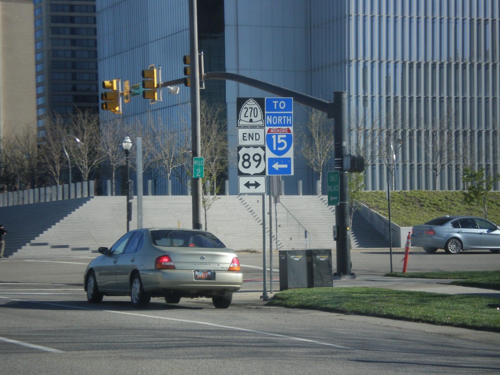
End UT-270 North (West Temple) at US-89 (400 South)
End UT-270 North (West Temple) at US-89 (400 South). Use 400 South for I-15 north.
Taken 04-01-2017

 Salt Lake City
Salt Lake County
Utah
United States
Salt Lake City
Salt Lake County
Utah
United States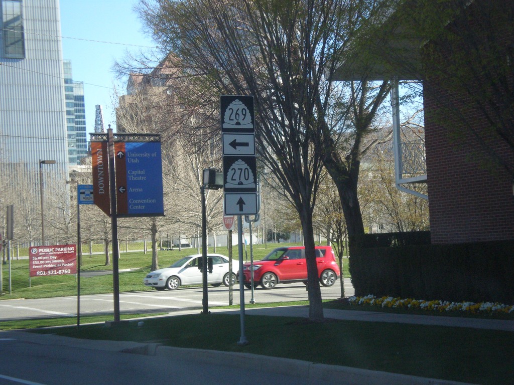
UT-270 North (West Temple) at UT-269 West (500 South)
UT-270 North (West Temple) at UT-269 West (500 South) in Salt Lake City.
Taken 04-01-2017
 Salt Lake City
Salt Lake County
Utah
United States
Salt Lake City
Salt Lake County
Utah
United States