Signs Tagged With Intersection
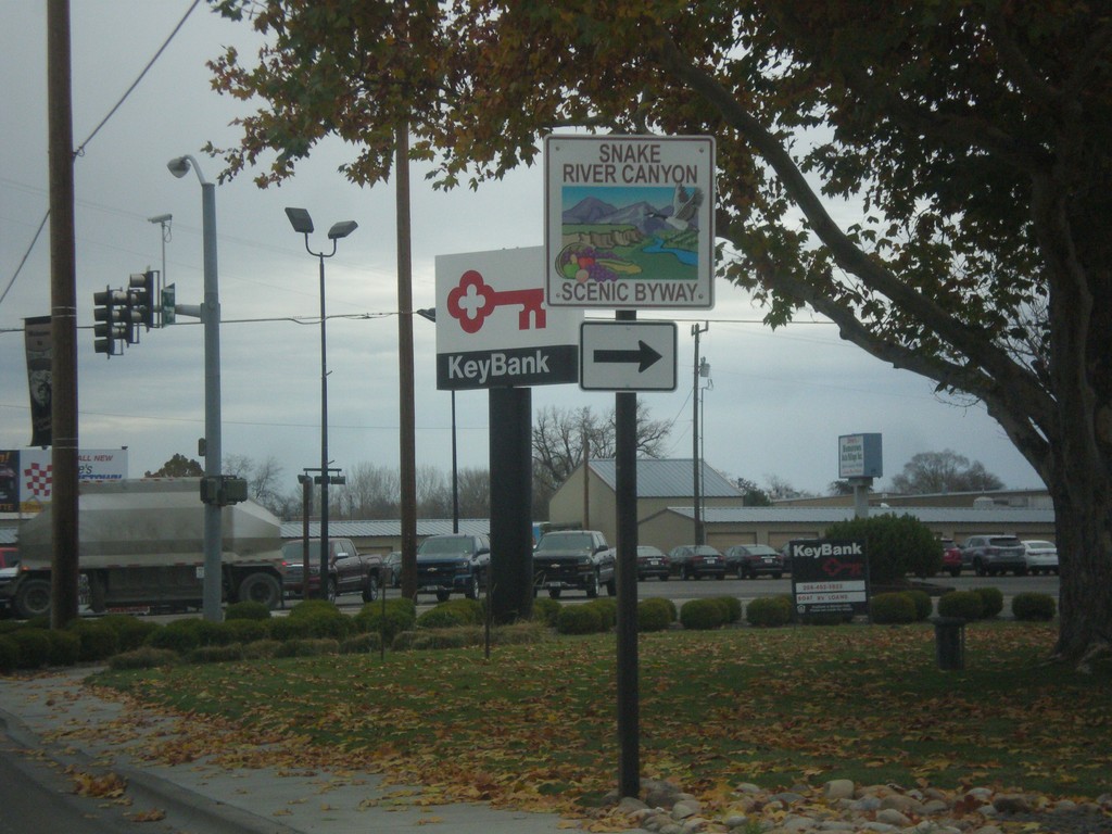
US-30 East Approaching US-95 - Snake River Canyon Scenic Byway
US-30 East approaching US-95. Turn right to continue on the Snake River Canyon Scenic Byway.
Taken 11-19-2016

 Fruitland
Payette County
Idaho
United States
Fruitland
Payette County
Idaho
United States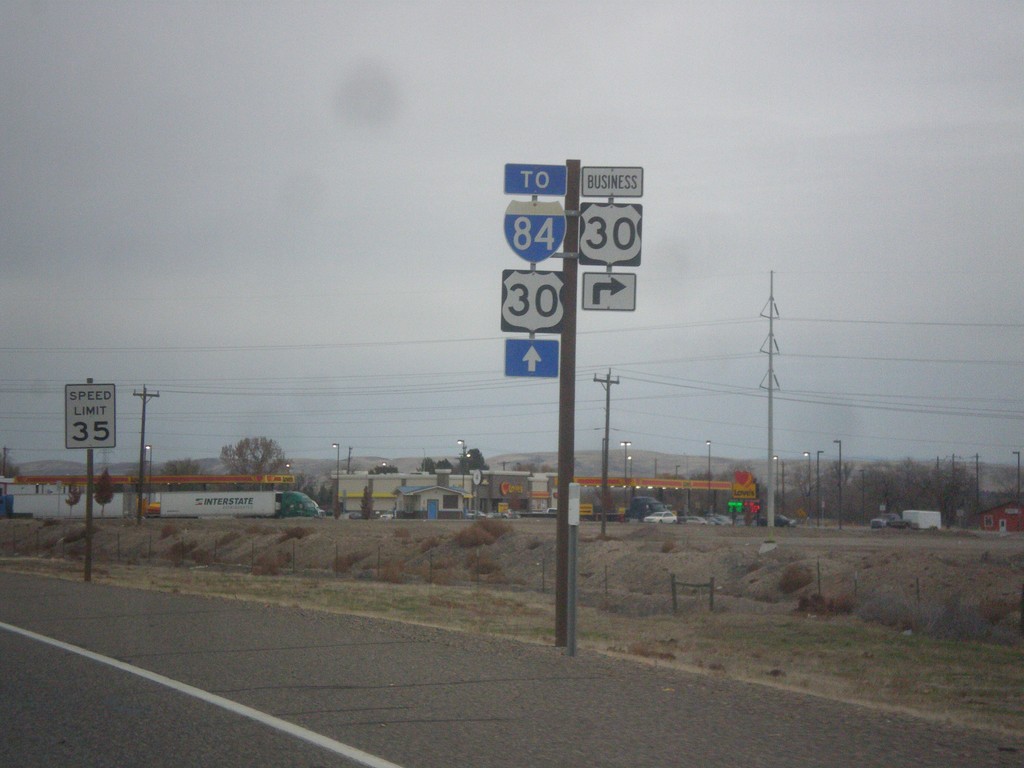
OR-201 North at Bus. US-30 East
OR-201 North at Bus. US-30 East. Continue north on OR-201 for I-84 and US-30.
Taken 11-19-2016


 Ontario
Malheur County
Oregon
United States
Ontario
Malheur County
Oregon
United States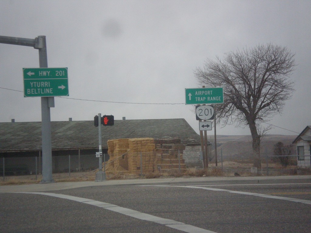
SW 4th Ave. West at OR-201
SW 4th Ave. West at OR-201. Continue straight on SW 4th Ave. for the Ontario Airport and Trap Range.
Taken 11-19-2016
Ontario
Malheur County
Oregon
United States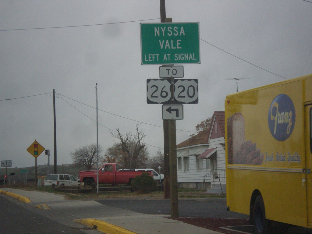
SW 4th Ave. West at OR-201
SW 4th Ave. West at OR-201. Turn left at signal for OR-201 South to US-20/US-26/Nyssa/Vale.
Taken 11-19-2016

 Ontario
Malheur County
Oregon
United States
Ontario
Malheur County
Oregon
United States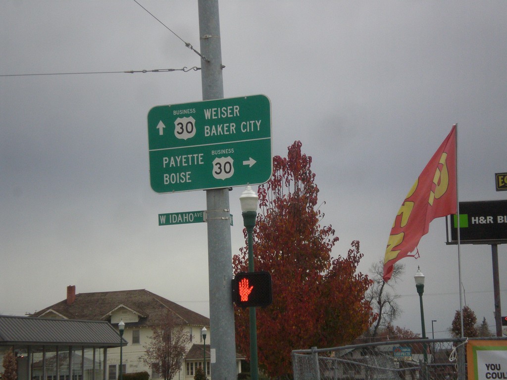
Oregon St. North at Idaho Ave. - Bus. US-30 Jct.
Oregon St. North at Idaho Ave. - Bus. US-30 Jct. in Ontario. Turn right on Bus. US-30 East for Payette (Idaho) and Boise (Idaho). Continue north on Oregon St. for Bus. US-30 West to Baker City and Weiser (Idaho).
Taken 11-19-2016
Ontario
Malheur County
Oregon
United States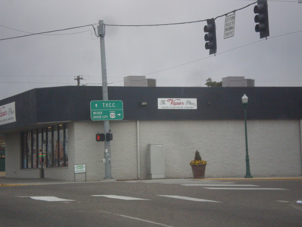
Bus. US-30 West (Idaho Ave.) at Oregon St.
Bus. US-30 West (Idaho Ave.) at Oregon St. in Ontario. Turn right to continue west on Bus. US-30 towards Weiser (Idaho) and Baker City. Continue straight on Idaho Ave. for Treasure Valley Community College.
Taken 11-19-2016
Ontario
Malheur County
Oregon
United States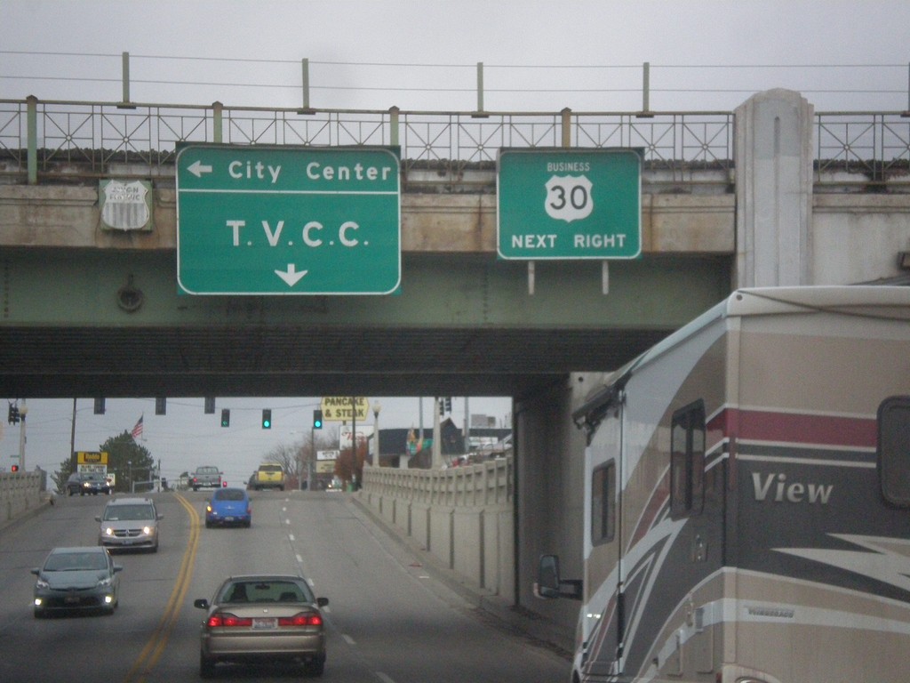
Bus. US-30 West - Ontario
Bus. US-30 West (Idaho Ave.) approaching Oregon St. in Ontario. Turn right on Oregon St. to continue west on Bus. US-30. Turn left on Oregon St. for (Ontario) City Center; continue west on Idaho St. for Treasure Valley Community College. Signs are attached to railroad overpass.
Taken 11-19-2016
Ontario
Malheur County
Oregon
United States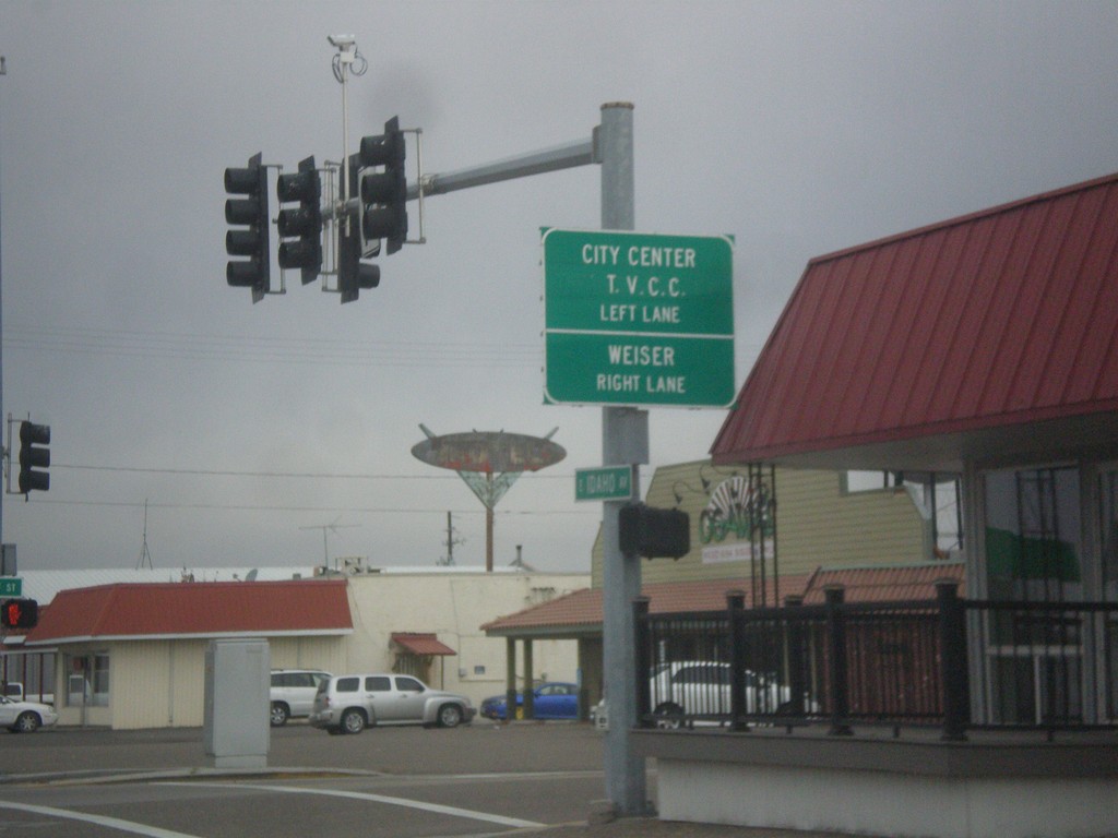
Bus. US-30 (Idaho Ave.) Approaching Oregon St.
Bus. US-30 (Idaho Ave.) approaching Oregon St. in Ontario. Turn right to continue west on Bus. US-30 towards Weiser (Idaho). Turn left on Oregon St. for City Center and Treasure Valley Community College.
Taken 11-19-2016
Ontario
Malheur County
Oregon
United States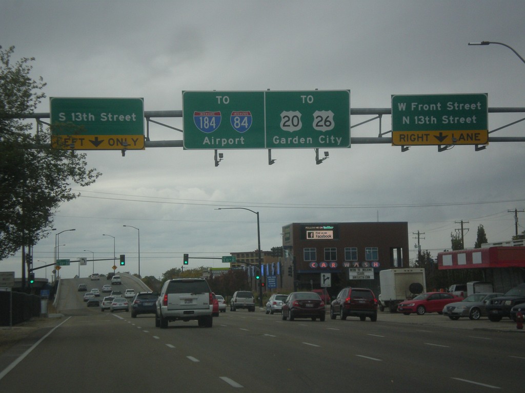
US-20/US-26 West Front St. at 13th St.
US-20/US-26 West (Front St.) at 13th St. After 13th St. US-20/US-26 becomes a freeway, locally known as The Connector. Use the connector for Garden City, I-84, and I-184.
Taken 10-15-2016
 Boise
Ada County
Idaho
United States
Boise
Ada County
Idaho
United States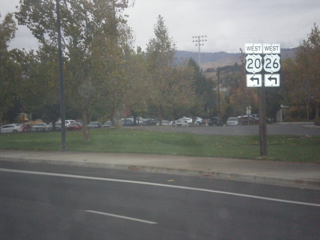
US-20/US-26 West (Broadway Ave.) at Front St.
US-20/US-26 West (Broadway Ave.) at Front St. Turn left on Front St. to continue west on US-20/US-26.
Taken 10-15-2016
Boise
Ada County
Idaho
United States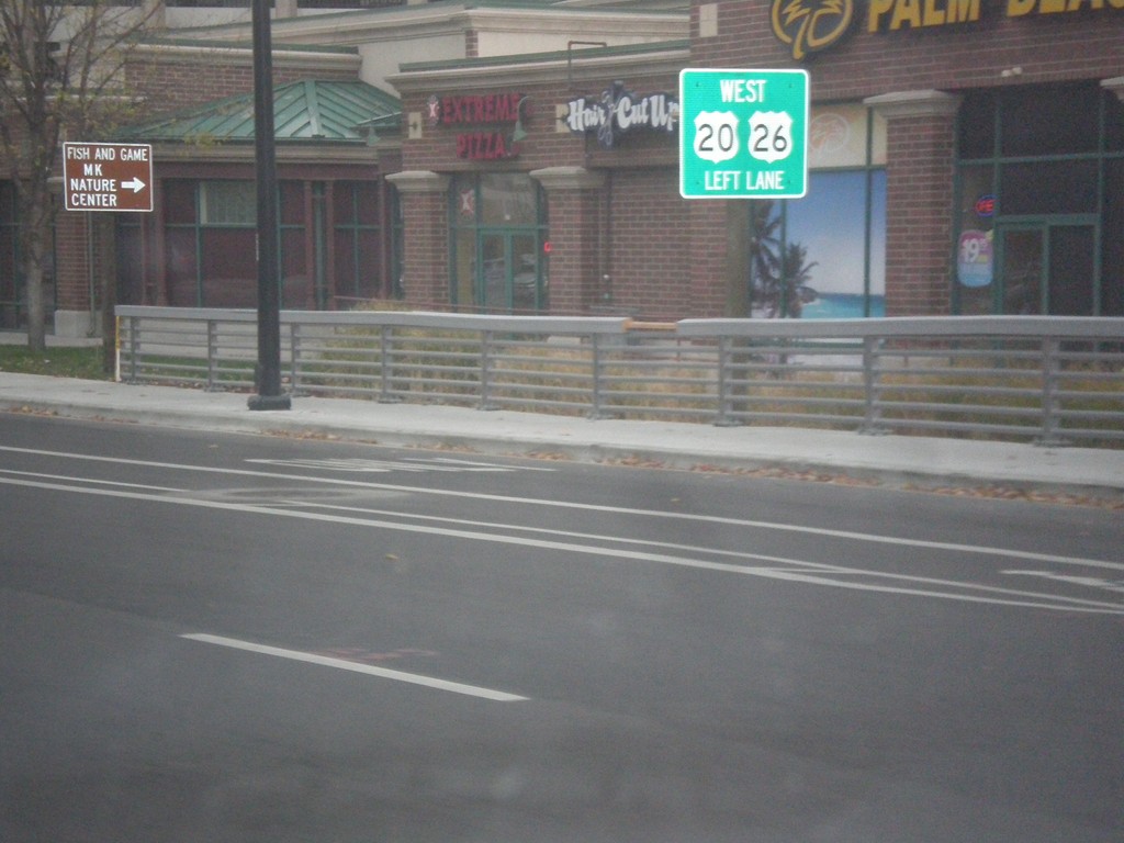
US-20/US-26 West - Broadway Ave at Front St
US-20/US-26 west (Broadway Ave.) approaching Front St. Use left lanes to continue west on US-20/US-26.
Taken 10-15-2016
Boise
Ada County
Idaho
United States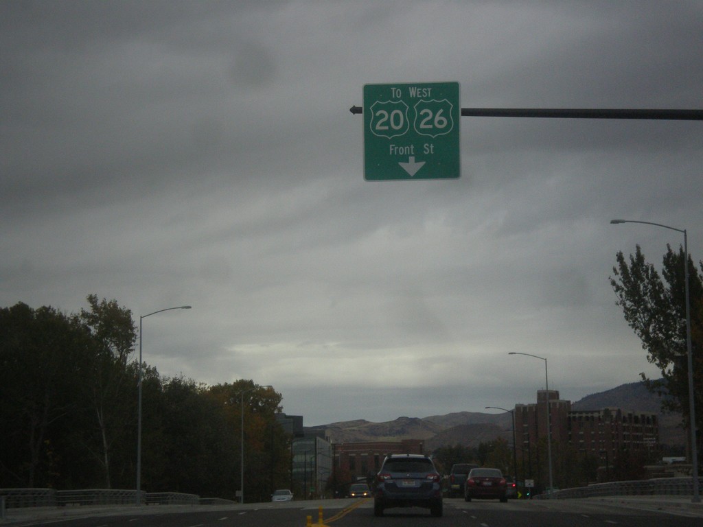
US-20/US-26 West - Broadway Ave Approaching Front St
US-20/US-26 West (Broadway Ave.) approaching Front St. Use left lanes for Front St. These types of US shields are not at all common in Idaho. Almost all US shields are shown as solid white, not just white outlines. These signs appeared after the new bridge over the Boise River was completed here.
Taken 10-15-2016
Boise
Ada County
Idaho
United States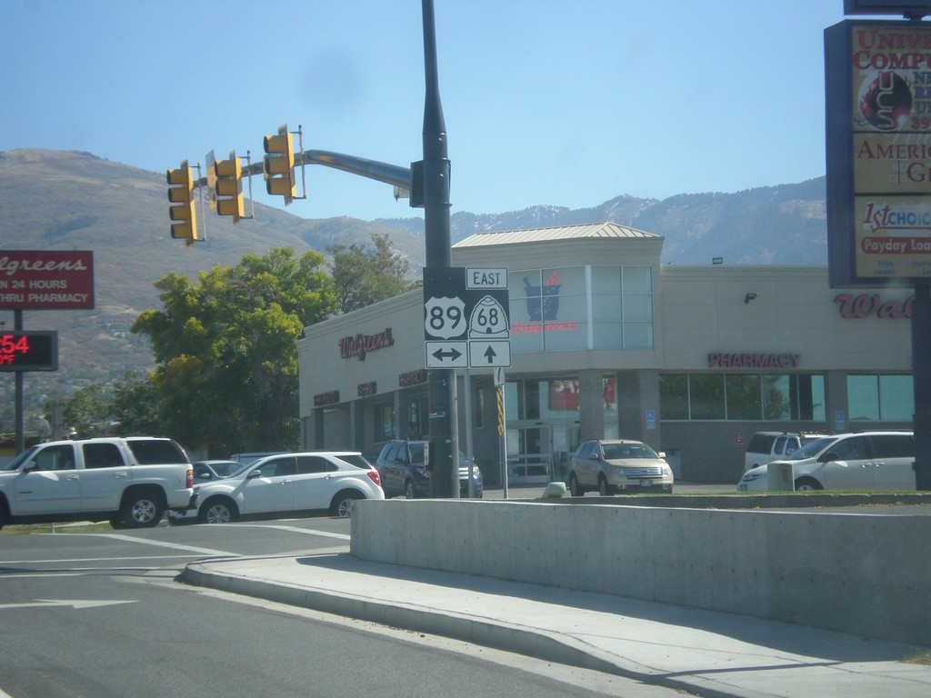
UT-68 East at US-89
UT-68 East at US-89 in Bountiful.
Taken 10-09-2016

 Bountiful
Davis County
Utah
United States
Bountiful
Davis County
Utah
United States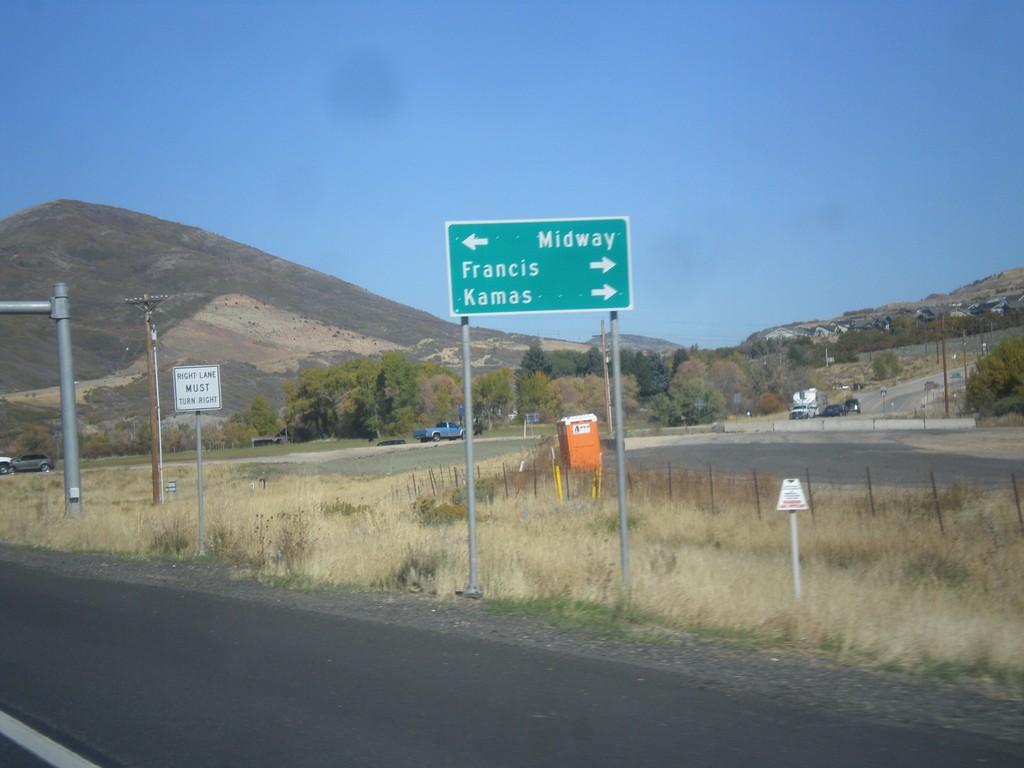
US-40 West Approaching UT-32
US-40 West Approaching UT-32 to Francis and Kamas. Turn left on River Road for Midway.
Taken 10-09-2016

 Heber City
Wasatch County
Utah
United States
Heber City
Wasatch County
Utah
United States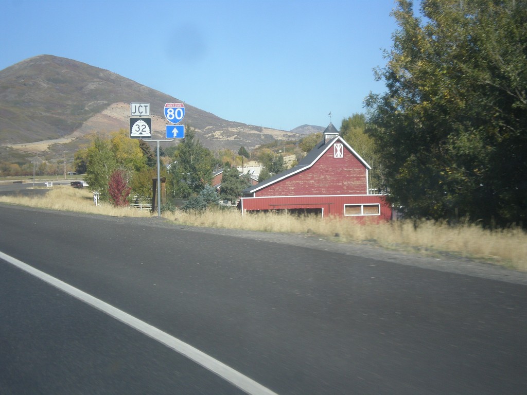
US-40 West at UT-32
US-40 west at UT-32 in Wasatch County. Continue west on US-40 for I-80.
Taken 10-09-2016
 Heber City
Wasatch County
Utah
United States
Heber City
Wasatch County
Utah
United States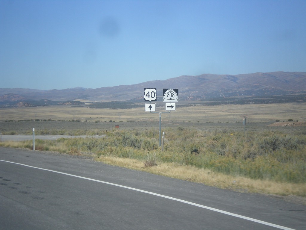
US-40 West at UT-208
US-40 west at UT-208 north in Duchesne county.
Taken 10-09-2016
 Strawberry
Duchesne County
Utah
United States
Strawberry
Duchesne County
Utah
United States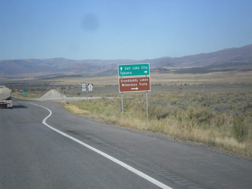
US-40 West Approaching UT-208
US-40 West approaching UT-208 to Tabiona and Granddaddy Lakes Wilderness Trails.
Taken 10-09-2016
Duchesne
Duchesne County
Utah
United States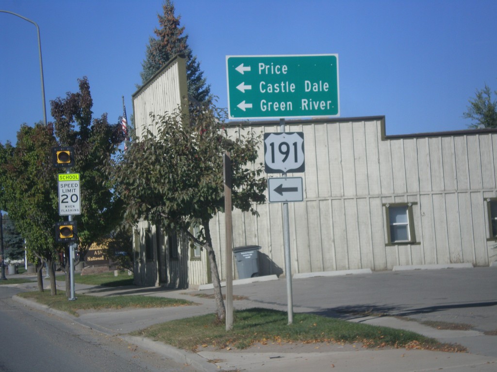
US-40 West/US-191 South at US-191 South
US-40 West/US-191 South at US-191 South in Duchesne. Turn left on US-191 south for Price, Castle Dale, and Green River. US-191 north joins US-40 east to Vernal.
Taken 10-09-2016
 Duchesne
 County
Utah
United States
Duchesne
Duchesne County
Utah
United States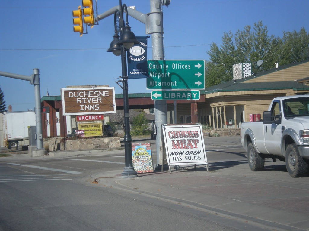
US-40 West/US-191South at UT-87
US-40 West/US-191 South at UT-87 to Altamont, (Duchesne) County Offices, and Airport.
Taken 10-09-2016
 Duchesne
 County
Utah
United States
Duchesne
Duchesne County
Utah
United States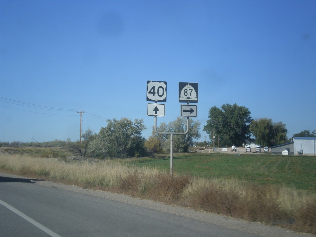
US-40 West/US-191 South at UT-87
US-40 West/US-191 South at UT-87 in Duchesne County.
Taken 10-09-2016
Roosevelt
Duchesne County
Utah
United States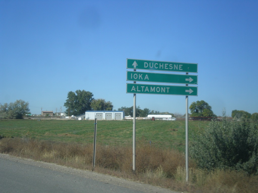
US-40 West/US-191 South Approaching UT-87
US-40 West/US-191 South approaching UT-87 to Ioka and Altamont. Continue west on US-40/US-191 for Duchesne.
Taken 10-09-2016
Roosevelt
Duchesne County
Utah
United States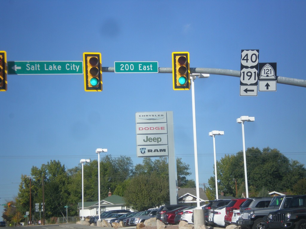
US-40 West/US-191 South at UT-121
US-40/US-191 at UT-121 junction in Roosevelt. Turn left on 200 East to continue on US-40/US-191 towards Salt Lake City.
Taken 10-09-2016
 Roosevelt
Duchesne County
Utah
United States
Roosevelt
Duchesne County
Utah
United States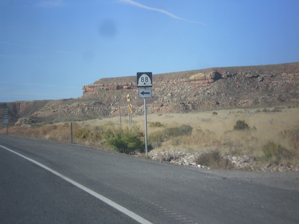
US-40 West at UT-88 South
US-40 West at UT-88 South in Uintah County.
Taken 10-09-2016
 Lapoint
Uintah County
Utah
United States
Lapoint
Uintah County
Utah
United States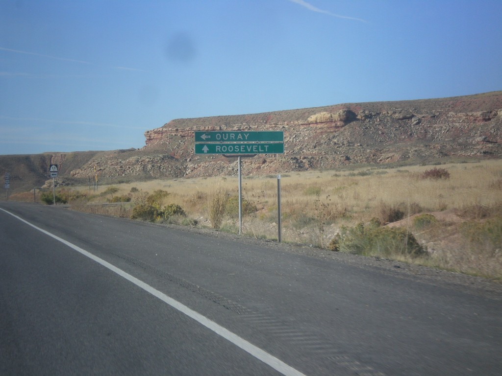
US-40 West Approaching UT-88
US-40 West approaching UT-88 south to Ouray in Uintah County. Continue west on US-40 for Roosevelt.
Taken 10-09-2016
Vernal
Uintah County
Utah
United States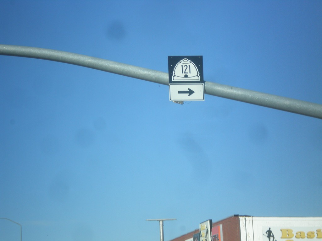
US-40 East at UT-121 West
US-40 east at UT-121 west in Vernal.
Taken 10-09-2016
Vernal
Uintah County
Utah
United States