Signs Tagged With Intersection
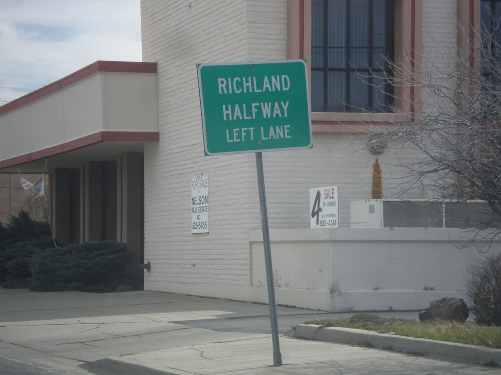
US-30 East Approaching OR-7
US-30 east approaching OR-7. Use left lane for Richland and Halfway. Both of these communities are along OR-86 between Baker City and Hells Canyon.
Taken 03-20-2016

 Baker City
Baker County
Oregon
United States
Baker City
Baker County
Oregon
United States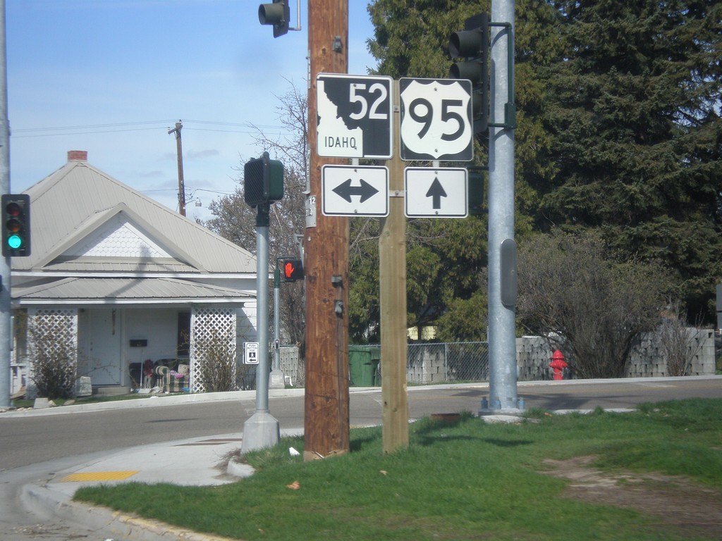
US-95 North at ID-52
US-95 North at ID-52 in Payette.
Taken 03-18-2016
 Payette
 County
Idaho
United States
Payette
Payette County
Idaho
United States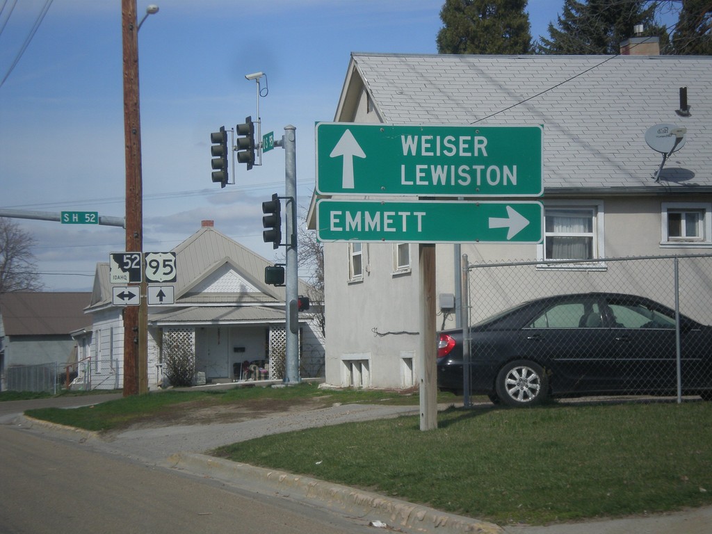
US-95 North at ID-52
US-95 north at ID-52. Use ID-52 east to Emmett. Use US-95 north to Weiser and Lewiston.
Taken 03-18-2016
 Payette
 County
Idaho
United States
Payette
Payette County
Idaho
United States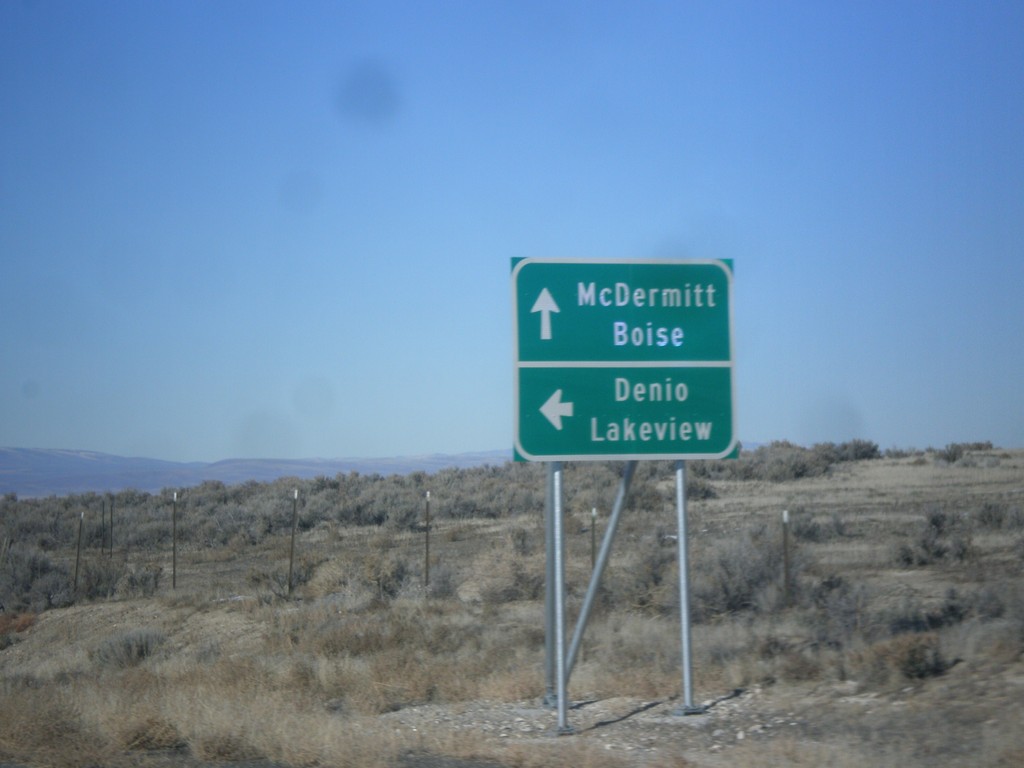
US-95 North at NV-140 West
US-95 north at NV-140 west to Denio and Lakeview (Oregon). Continue north on US-95 for McDermitt (Nevada-Oregon State Line) and Boise (Idaho).
Taken 11-29-2015
 Humboldt County
Nevada
United States
Humboldt County
Nevada
United States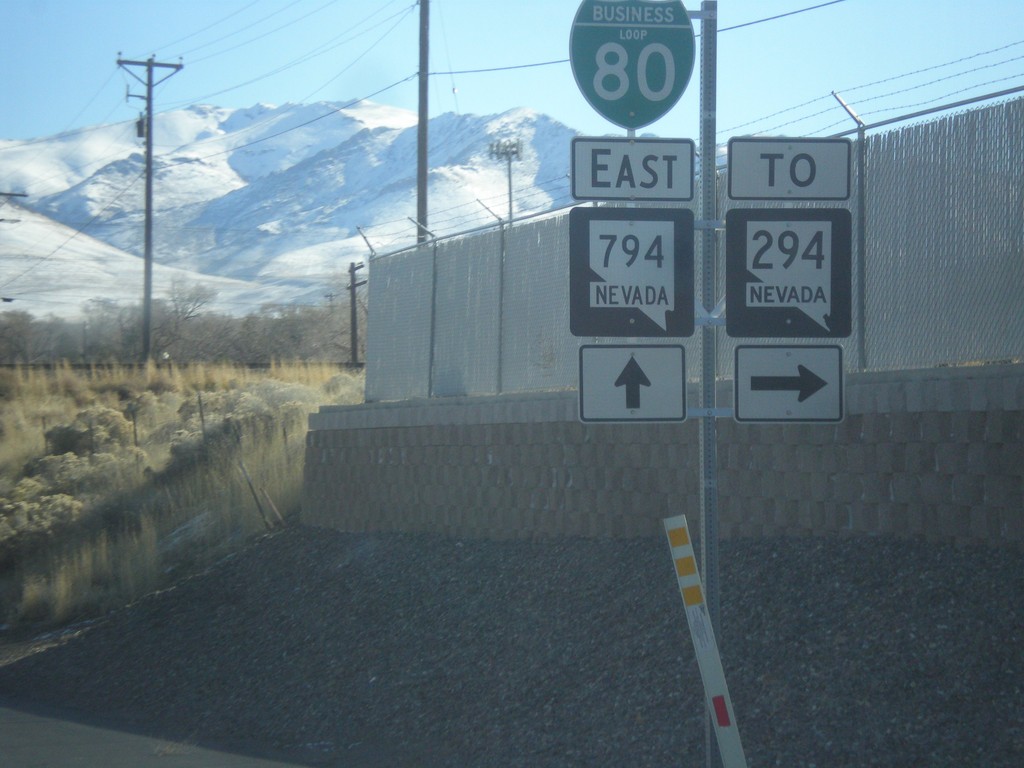
BL-80/NV-794 East at Haskell St.
BL-80/NV-794 East (Winnemucca Blvd.) at Haskell St. to NV-294
Taken 11-29-2015


 Winnemucca
Humboldt County
Nevada
United States
Winnemucca
Humboldt County
Nevada
United States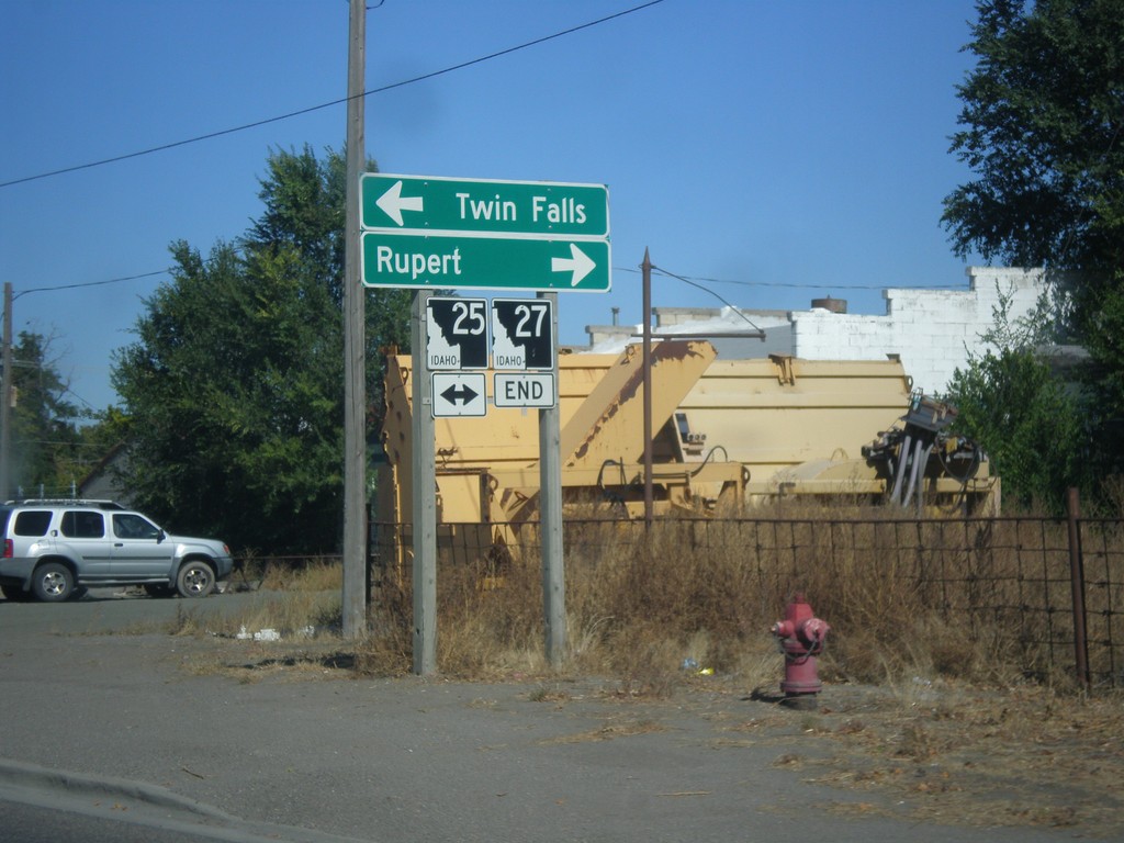
End ID-27 North at ID-25
End ID-27 North at ID-25. Use ID-25 east for Rupert; ID-25 west for Twin Falls.
Taken 10-04-2015

 Paul
Minidoka County
Idaho
United States
Paul
Minidoka County
Idaho
United States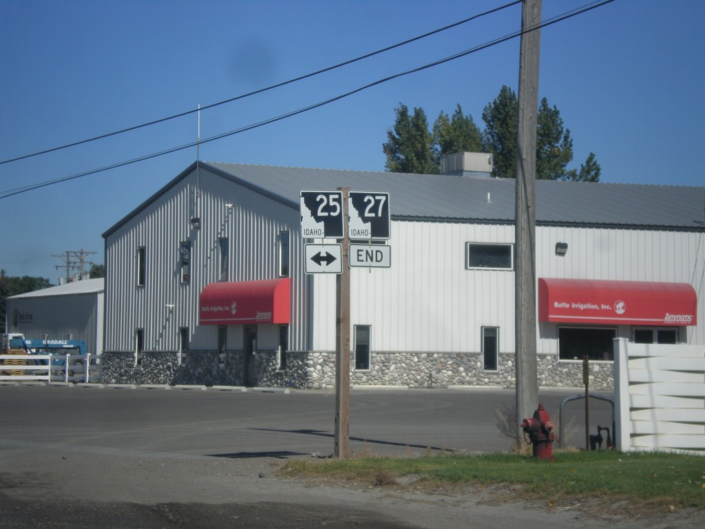
End ID-27 North at ID-25
End ID-27 North at ID-25 in Paul.
Taken 10-04-2015
Paul
Minidoka County
Idaho
United States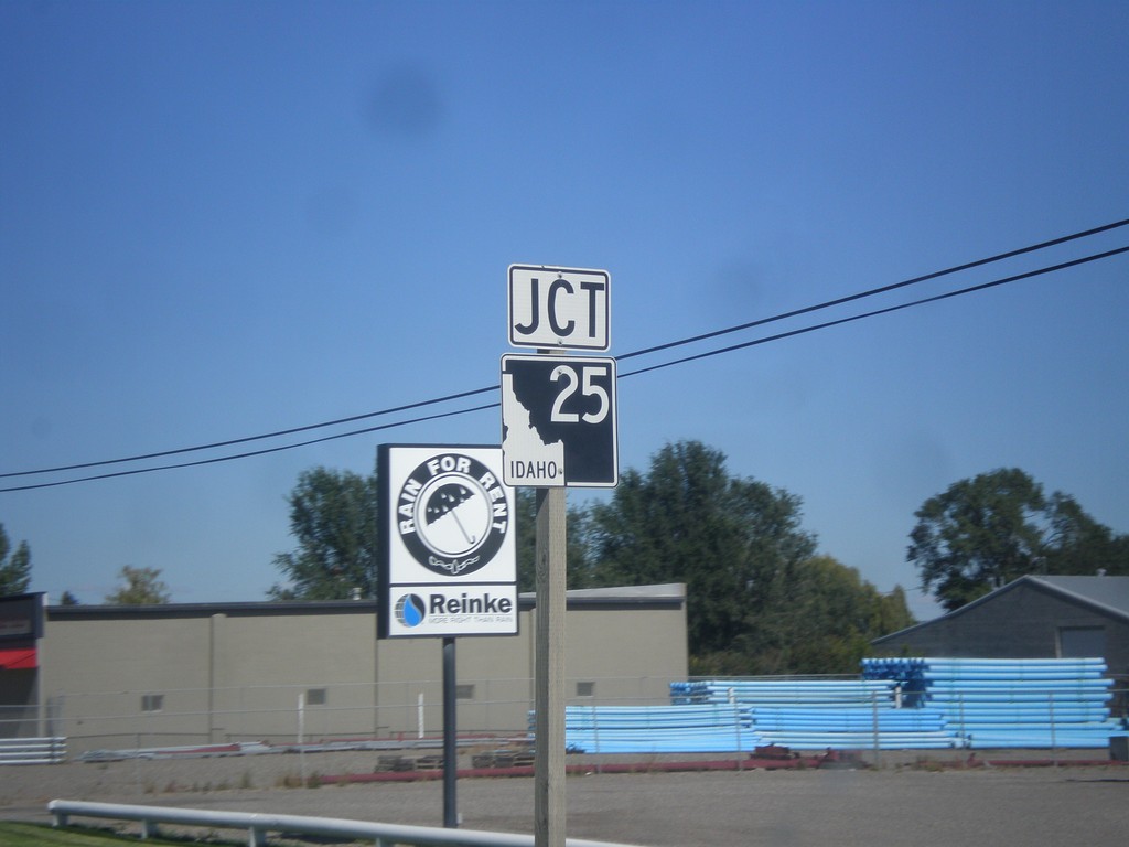
ID-27 North Approaching ID-25
ID-27 North approaching ID-25 in Paul.
Taken 10-04-2015
Paul
Minidoka County
Idaho
United States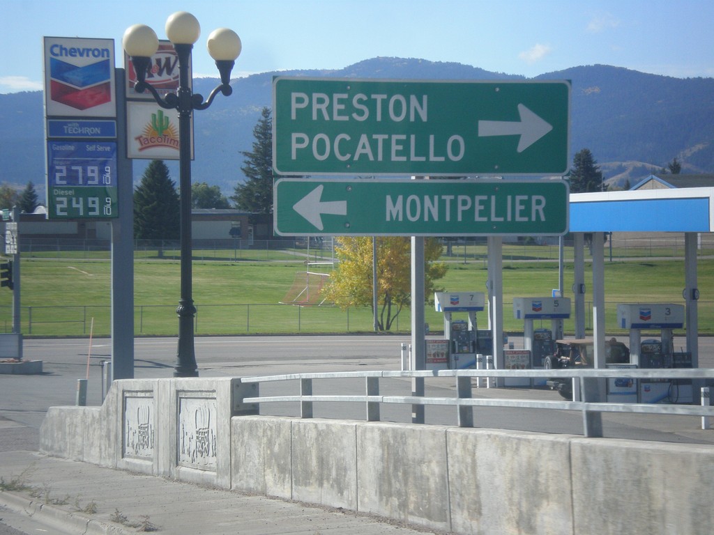
ID-34 South at US-30
ID-34 South at US-30. Turn left for US-30 west to Montpelier. Turn right for US-30 east to Pocatello and ID-34 south to Preston.
Taken 10-04-2015
 Soda Springs
Caribou County
Idaho
United States
Soda Springs
Caribou County
Idaho
United States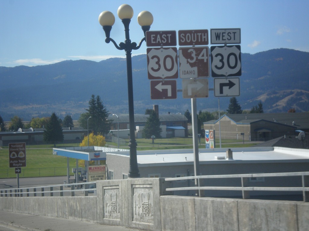
ID-34 South Approaching US-30
ID-34 South approaching US-30 in Soda Springs. ID-34 south joins US-30 east through Soda Springs.
Taken 10-04-2015
Soda Springs
Caribou County
Idaho
United States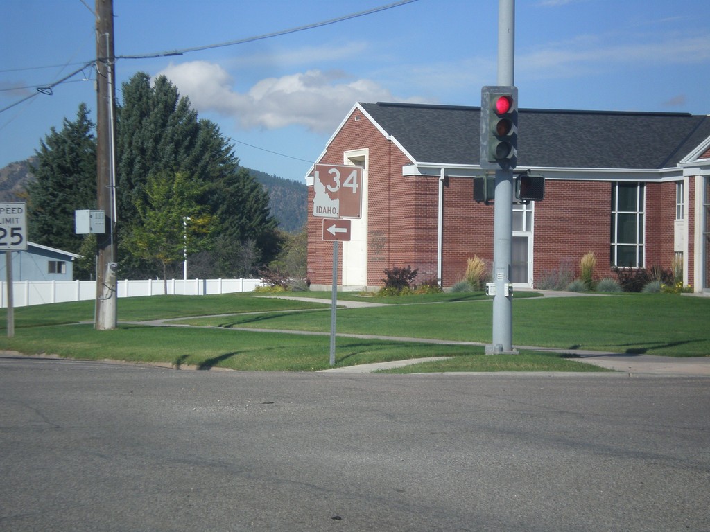
ID-34 South - Soda Springs
ID-34 south (East Hooper Ave.) at S. 3rd St. Turn left to continue south on ID-34.
Taken 10-04-2015
Soda Springs
Caribou County
Idaho
United States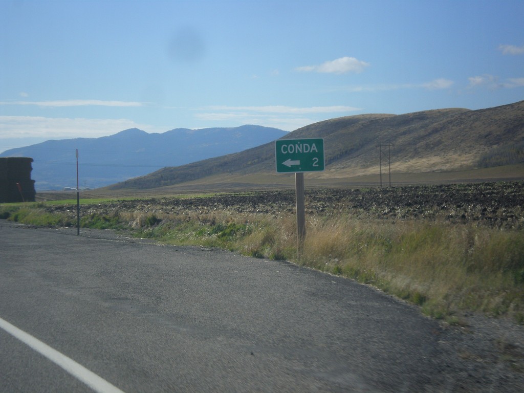
ID-34 South - Conda Jct.
ID-34 south at Conda Jct.
Taken 10-04-2015
Soda Springs
Caribou County
Idaho
United States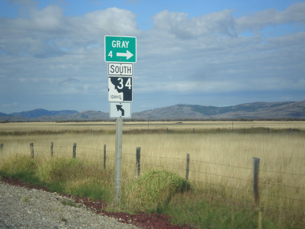
ID-34 South - Gray
ID-34 south at Grays Lake Road north to Gray.
Taken 10-04-2015
Wayan
Caribou County
Idaho
United States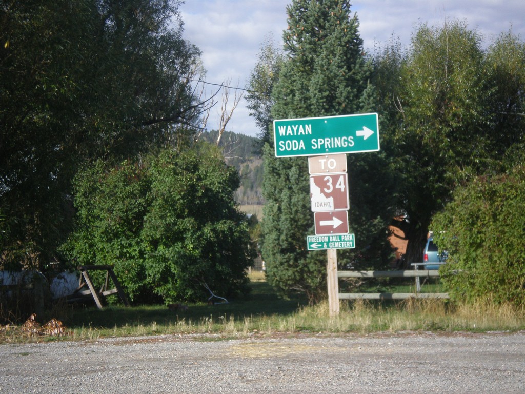
End WY-239 at Stateline Road
Turn right on Stateline Road to access ID-34 to Soda Springs and Wayan (both in Idaho). This sign assembly appears to have been erected by the Idaho Transportation Department. The west side of Stateline Road is in Idaho.
Taken 10-04-2015
 Freedom
Lincoln County
Wyoming
United States
Freedom
Lincoln County
Wyoming
United States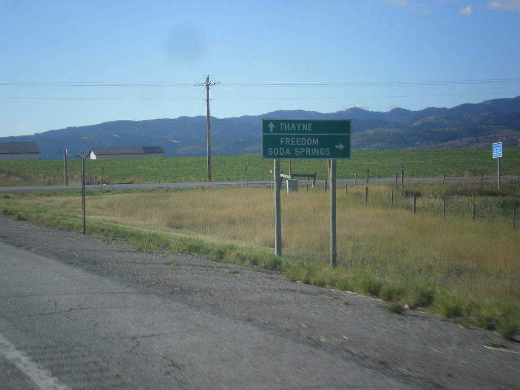
US-89 South at WY-239 West
US-89 South at WY-239 West to Freedom and Soda Springs (Idaho). Continue south on US-89 for Thayne. WY-239 is a short connecting route between US-89 and ID-34. There is no direct connection between ID-34 and WY-239 on the state highway system. There is a short stretch of county road running along the stateline between these two highways.
Taken 10-04-2015
 Freedom
Lincoln County
Wyoming
United States
Freedom
Lincoln County
Wyoming
United States
US-89 South Approaching WY-289
US-89 South approaching WY-289 near Freedom.
Taken 10-04-2015
Freedom
Lincoln County
Wyoming
United States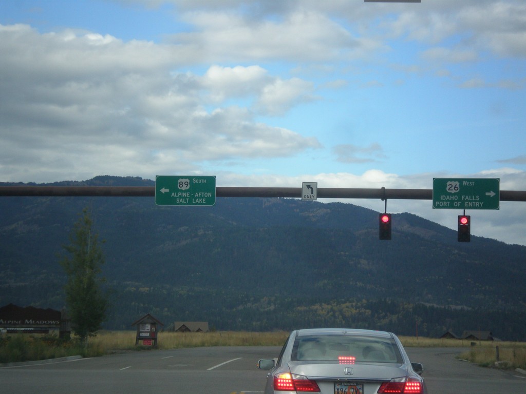
US-26 West/US-89 South - Alpine Junction
US-26 West/US-89 South at Alpine Junction. Turn right for US-26 West to Idaho Falls (ID) and the (Wyoming) Port of Entry. Turn left for US-89 south to Alpine, Afton, and Salt Lake (Utah).
Taken 10-04-2015
 Alpine
Lincoln County
Wyoming
United States
Alpine
Lincoln County
Wyoming
United States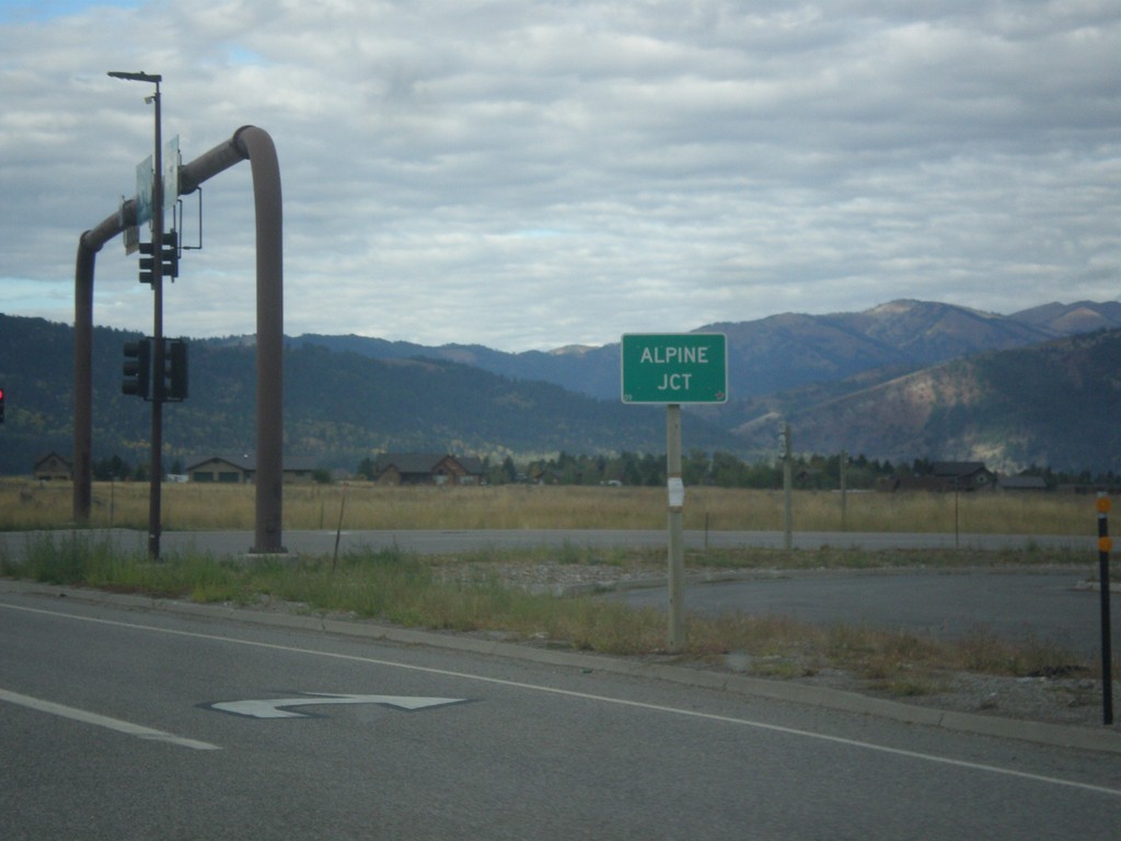
US-26 West/US-89 South - Alpine Junction
US-26 West/US-89 South at Alpine Junction. Alpine Junction is the name of the intersection of US-89 and US-26, which is across the Snake River from the town of Alpine.
Taken 10-04-2015
Alpine
Lincoln County
Wyoming
United States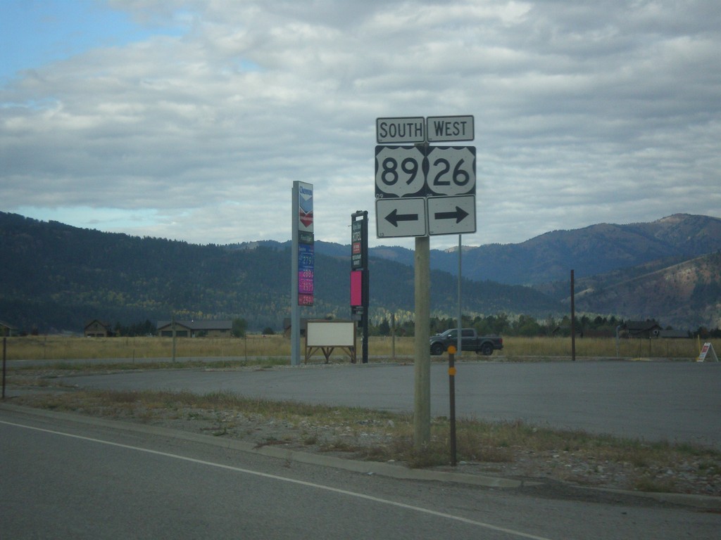
US-26 West/US-89 South at Split
US-26 West/US-89 South at split in Alpine Junction. Turn right for US-26 West; left for US-89 south.
Taken 10-04-2015
Alpine
Lincoln County
Wyoming
United States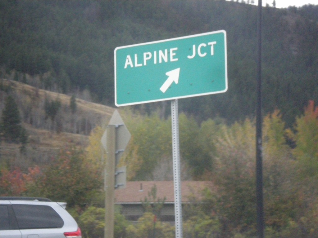
US-26 West - US-89/US-189/US-191 South in Hoback Jct. Roundabout
US-26 West - US-89/US-189/US-191 South in Hoback Jct. roundabout. Merge right for (US-26 West/US-89 South) Alpine Junction.
Taken 10-04-2015

 Jackson
Teton County
Wyoming
United States
Jackson
Teton County
Wyoming
United States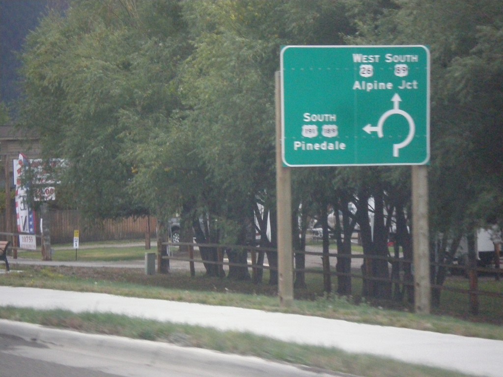
US-26 West - US-89/US-189/US-191 South - Roundabout
US-26 West - US-89/US-189/US-191 South entering roundabout at Hoback Junction. Use US-26 West/US-89 South for Alpine Jct.; use US-189/US-191 South for Pinedale. This intersection was converted to a roundabout in 2012.
Taken 10-04-2015
Jackson
Teton County
Wyoming
United States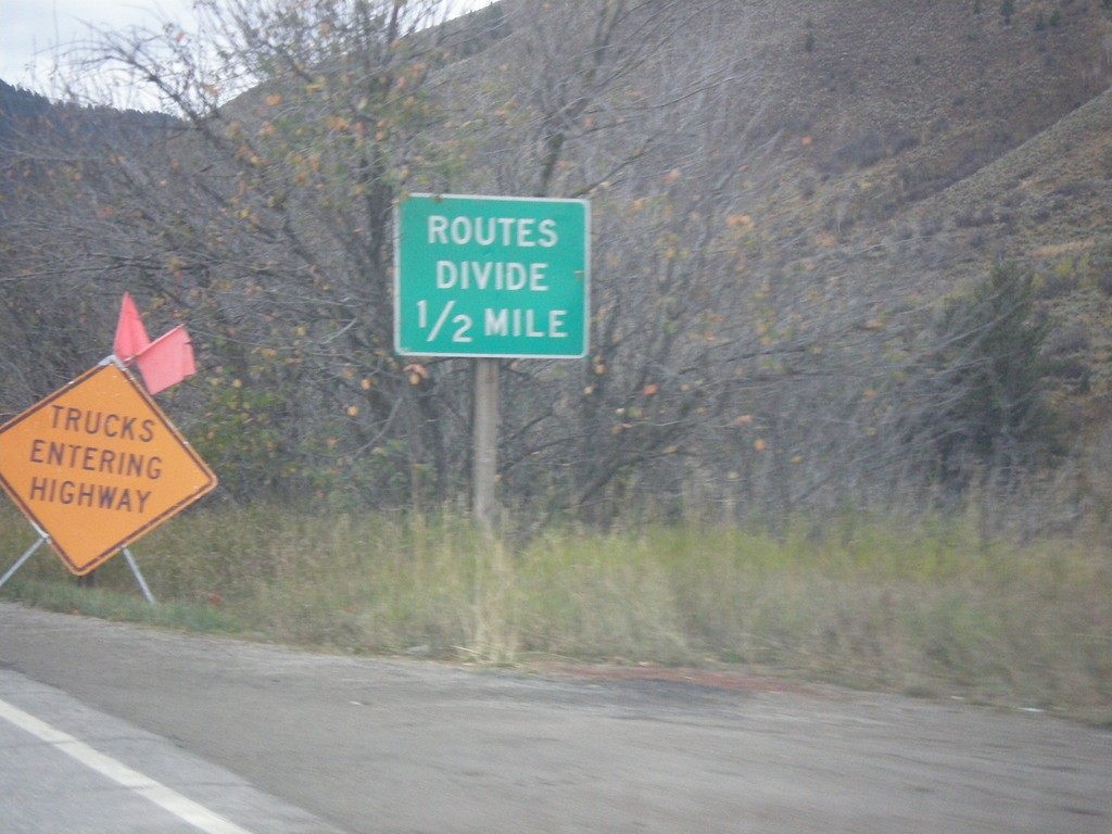
US-26 West - US-89/US-189/US-191 South - Routes Divide
US-26 West - US-89/US-189/US-191 South - Routes Divide. Approaching Hoback Jct., where US-189/US-191 separate from US-26/US-89. The Routes Divide sign in Wyoming is common in this situation where one route splits from another route.
Taken 10-04-2015
Jackson
Teton County
Wyoming
United States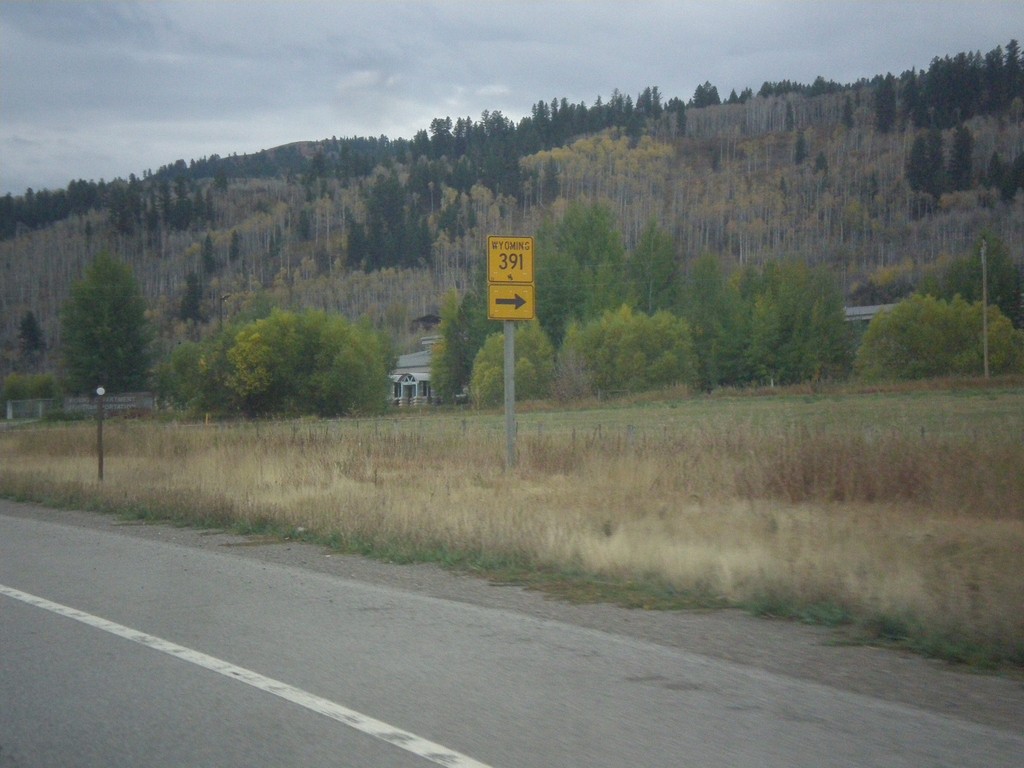
US-26 West - US-89/US-189/US-191 South at WY-391
US-26 West - US-89/US-189/US-191 South at WY-391 junction.
Taken 10-04-2015
 Jackson
Teton County
Wyoming
United States
Jackson
Teton County
Wyoming
United States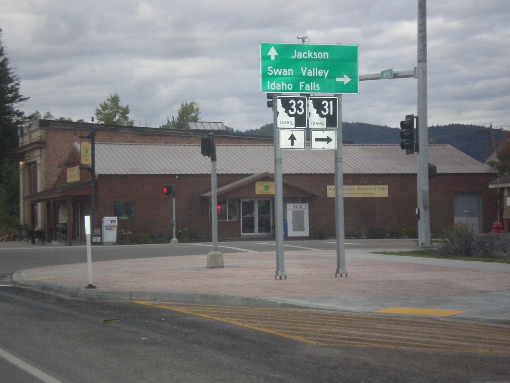
ID-33 East at ID-31
ID-33 East at ID-31 in Victor. Turn right on ID-31 south for Swan Valley and Idaho Falls. Continue straight on ID-33 for Jackson (Wyoming). Teton Scenic Byway leaves ID-33 here and follows ID-31 south.
Taken 10-04-2015

 Victor
Teton County
Idaho
United States
Victor
Teton County
Idaho
United States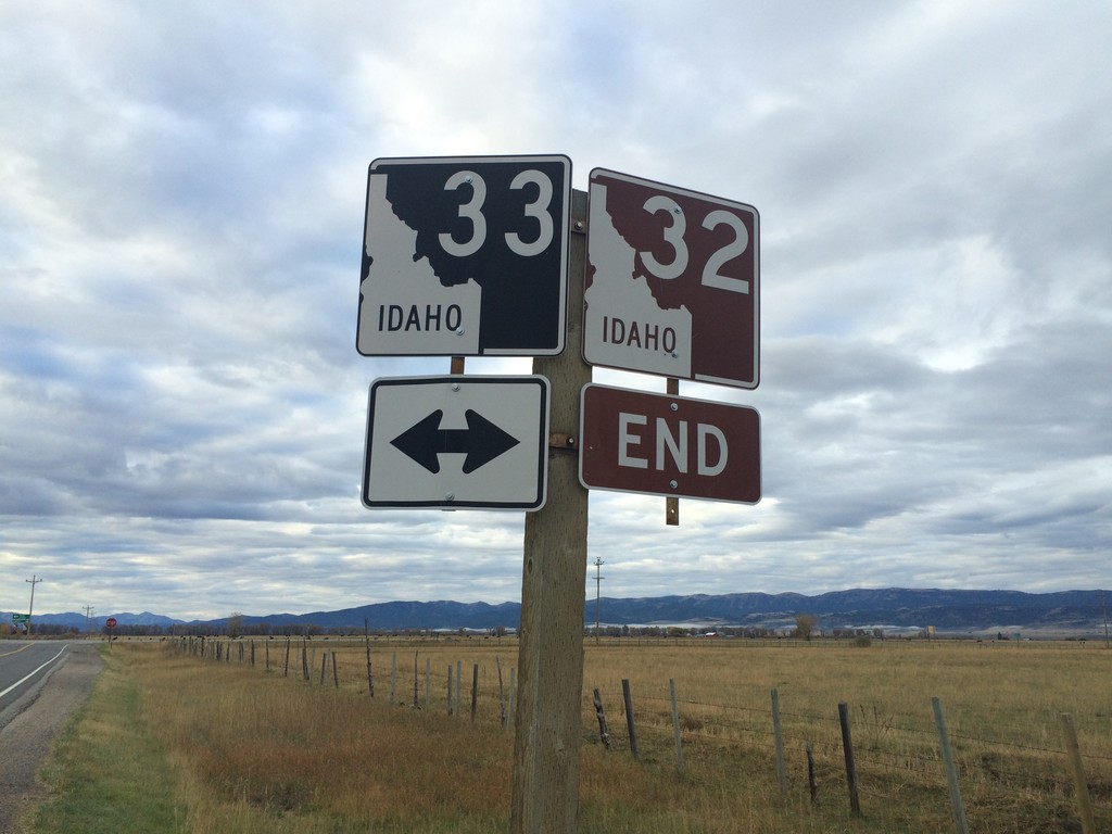
End ID-32 at ID-33
End ID-32 south at ID-33 near Tetonia. The Teton Scenic Byway continues onto ID-33 east, towards Driggs.
Taken 10-04-2015
 Tetonia
Teton County
Idaho
United States
Tetonia
Teton County
Idaho
United States