Signs Tagged With Intersection
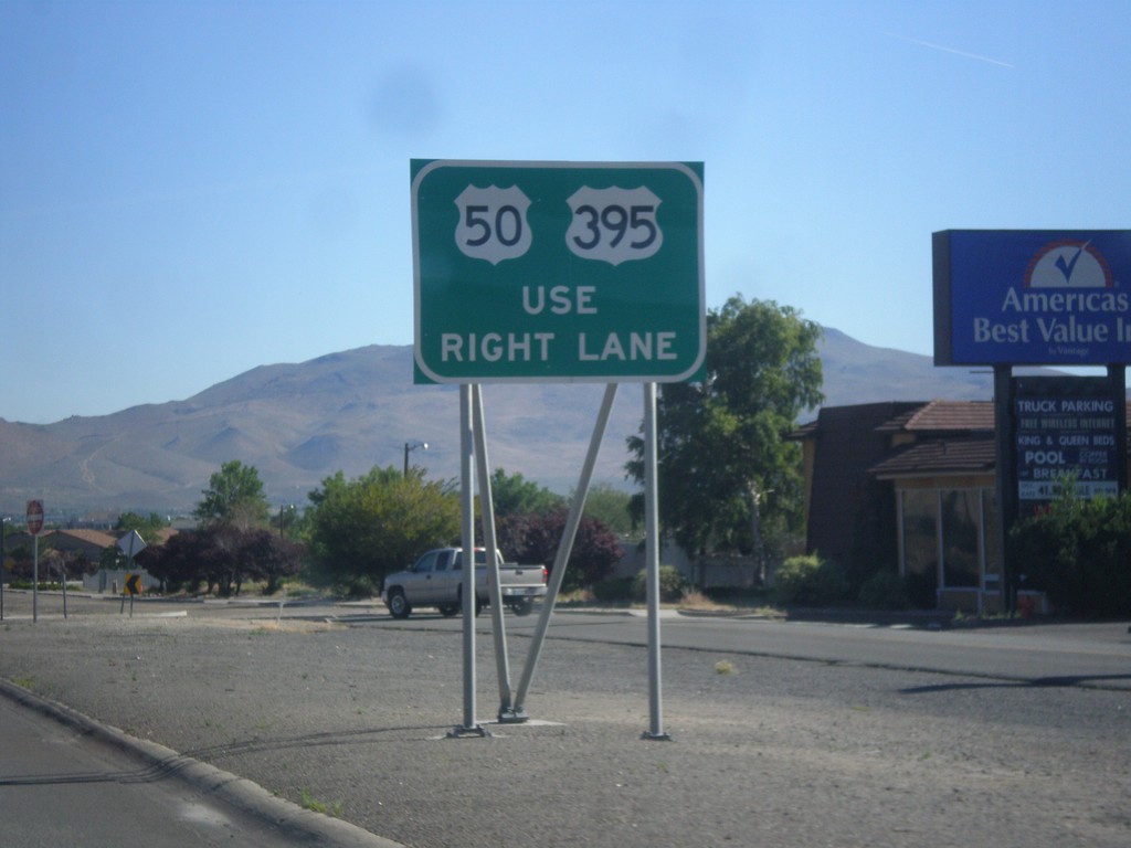
US-395 North/US-50 East Approaching Fairview Lane
US-395 North/US-50 East approaching Fairview Lane. Use right lane to continue on US-395/US-50.
Taken 06-15-2015

 Carson City
Nevada
United States
Carson City
Nevada
United States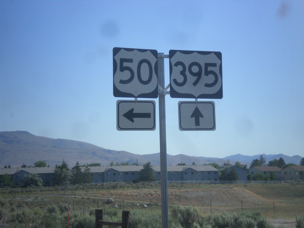
US-395 North at US-50
US-395 north at US-50 in Carson City. US-50 East joins US-395 North to Fairview Ave.
Taken 06-15-2015
Carson City
Nevada
United States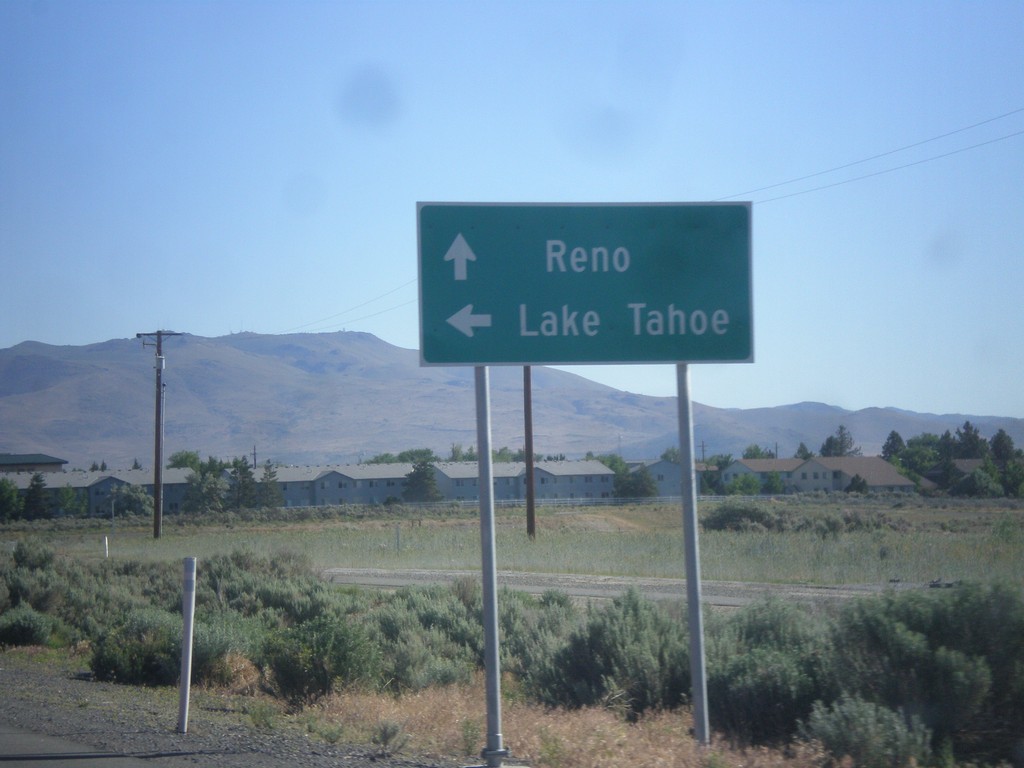
US-395 North at US-50
US-395 north at US-50. Use US-50 west for Lake Tahoe. Use US-50 East/US-395 North for Reno. US-50 East joins US-395 for a short distance north of this intersection. This will be the southern terminus of the Carson City Freeway.
Taken 06-15-2015
Carson City
Nevada
United States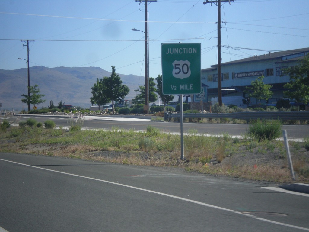
US-395 North Approaching US-50
US-395 North approaching US-50 in Carson City.
Taken 06-15-2015
Carson City
Nevada
United States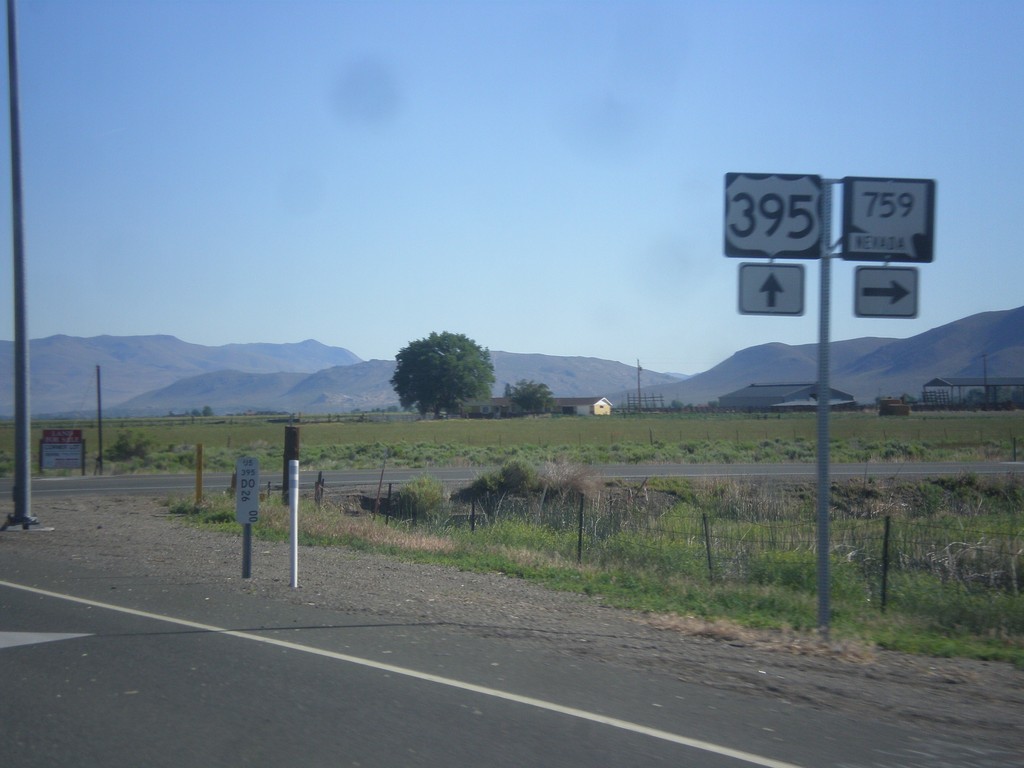
US-395 North at NV-759
US-395 north at NV-759 East (Airport Road).
Taken 06-15-2015
 Minden
Douglas County
Nevada
United States
Minden
Douglas County
Nevada
United States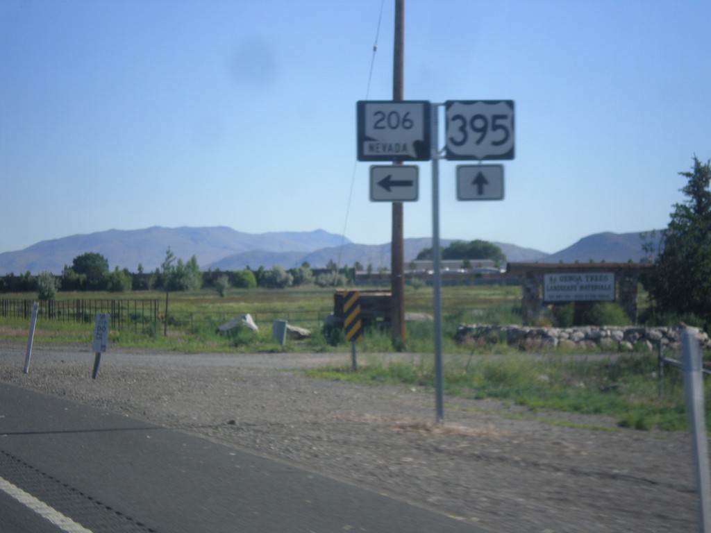
US-395 North at NV-206
US-395 North at NV-206 (Genoa Lane) jct.
Taken 06-15-2015
 Minden
Douglas County
Nevada
United States
Minden
Douglas County
Nevada
United States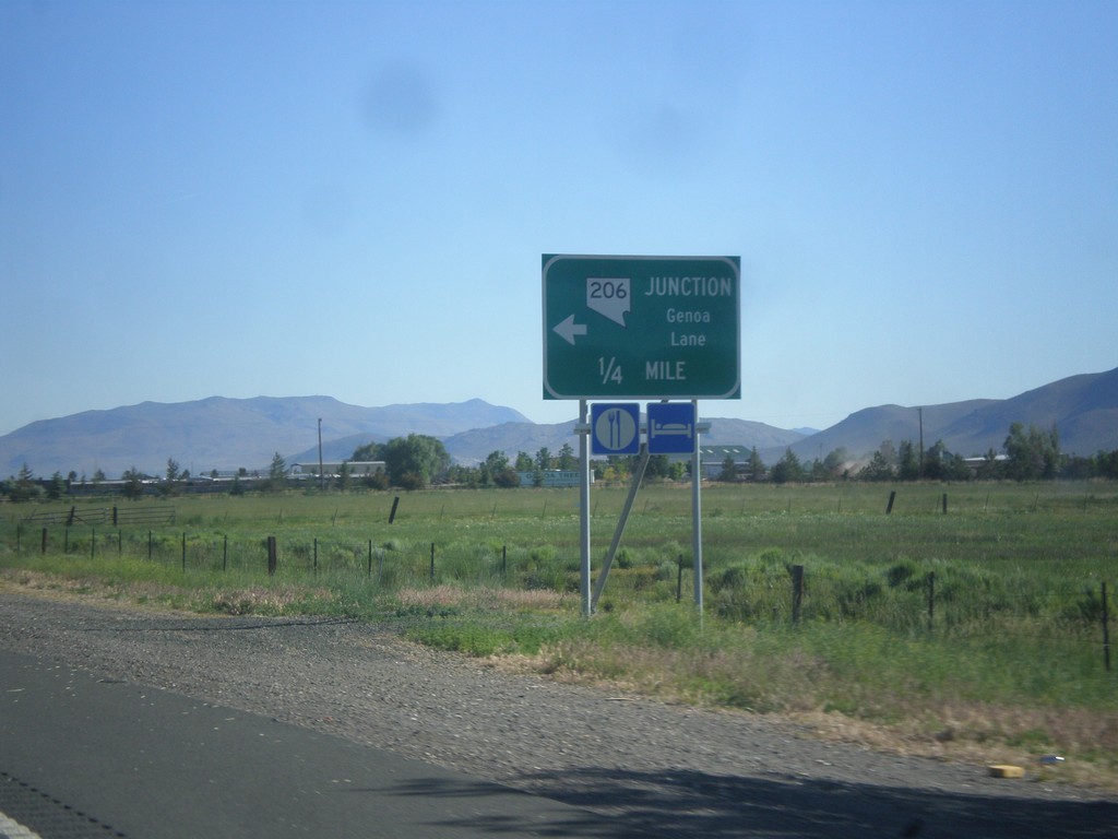
US-395 North Approaching NV-206
US-395 north approaching NV-206 - Genoa Lane.
Taken 06-15-2015
Minden
Douglas County
Nevada
United States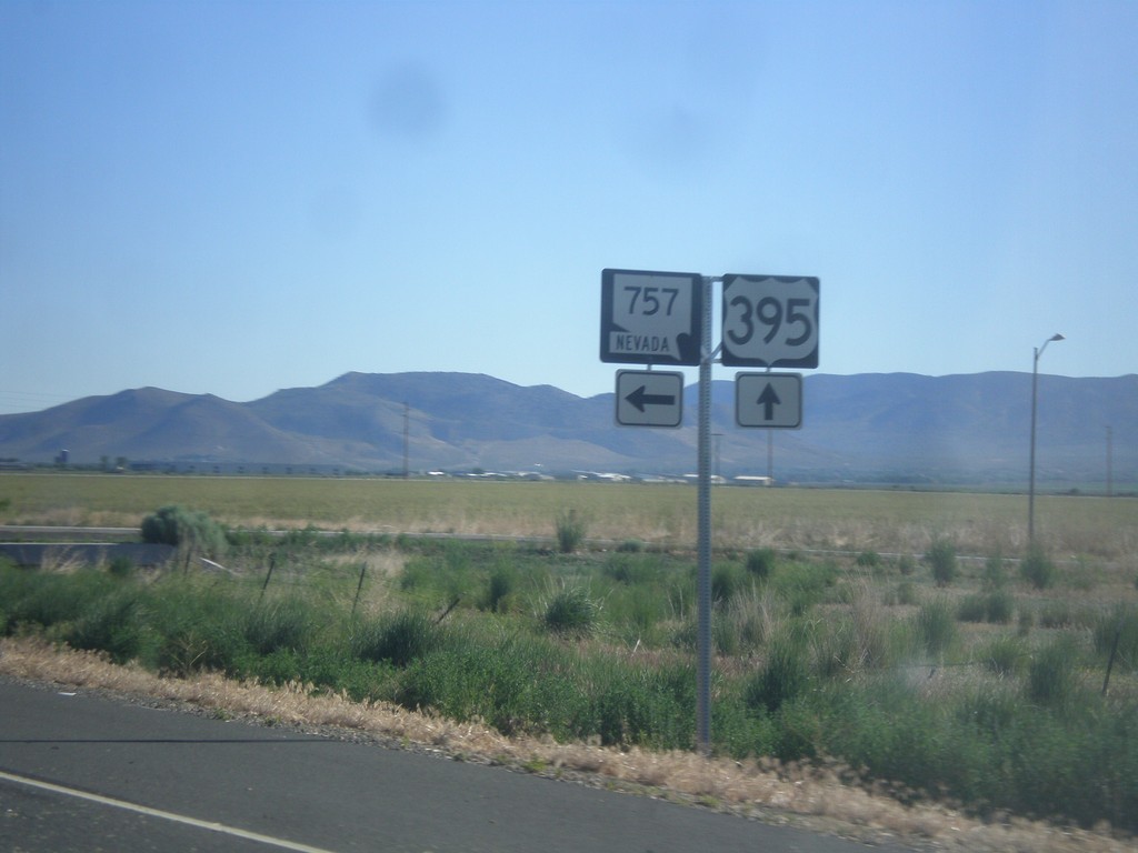
US-395 North at NV-757
US-395 north at NV-757 west.
Taken 06-15-2015
 Minden
Douglas County
Nevada
United States
Minden
Douglas County
Nevada
United States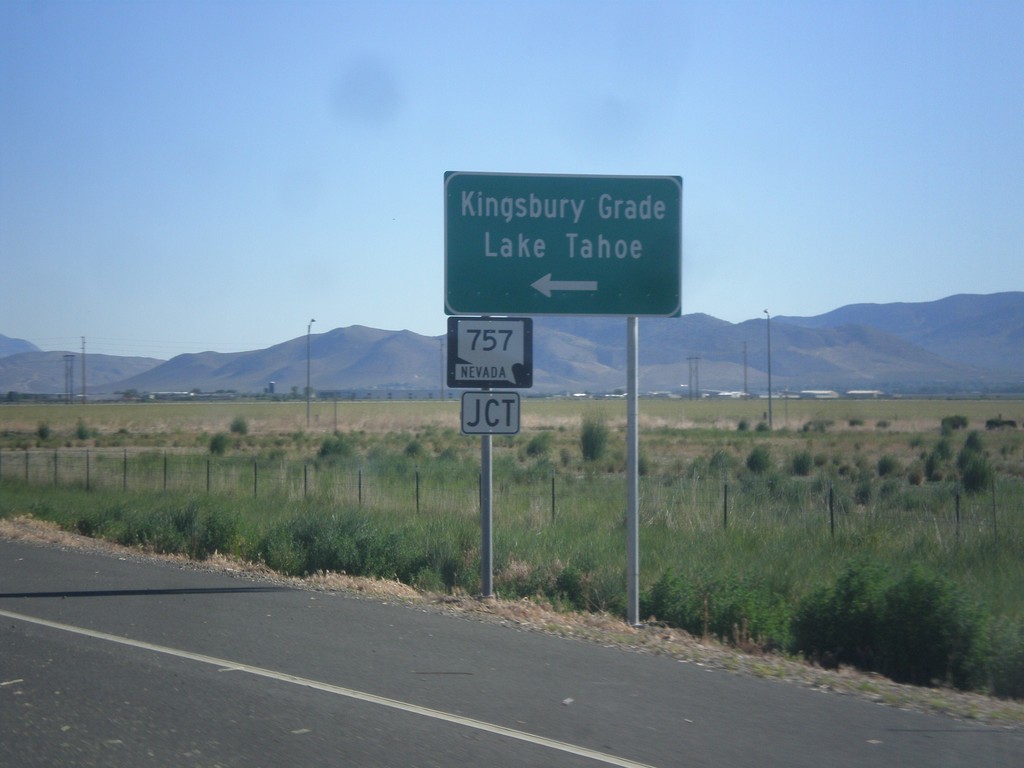
US-395 North Approaching NV-757
US-395 North approaching NV-757 west to Kingsbury Grade and Lake Tahoe.
Taken 06-15-2015
Minden
Douglas County
Nevada
United States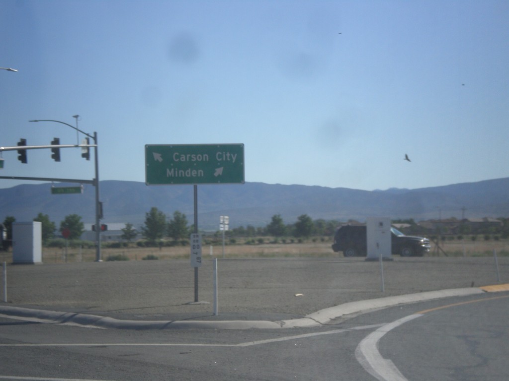
End NV-88 North at US-395
End NV-88 North at US-395 in Minden. Use US-395 north for Carson City; US-395 south for Minden.
Taken 06-15-2015
 Minden
Douglas County
Nevada
United States
Minden
Douglas County
Nevada
United States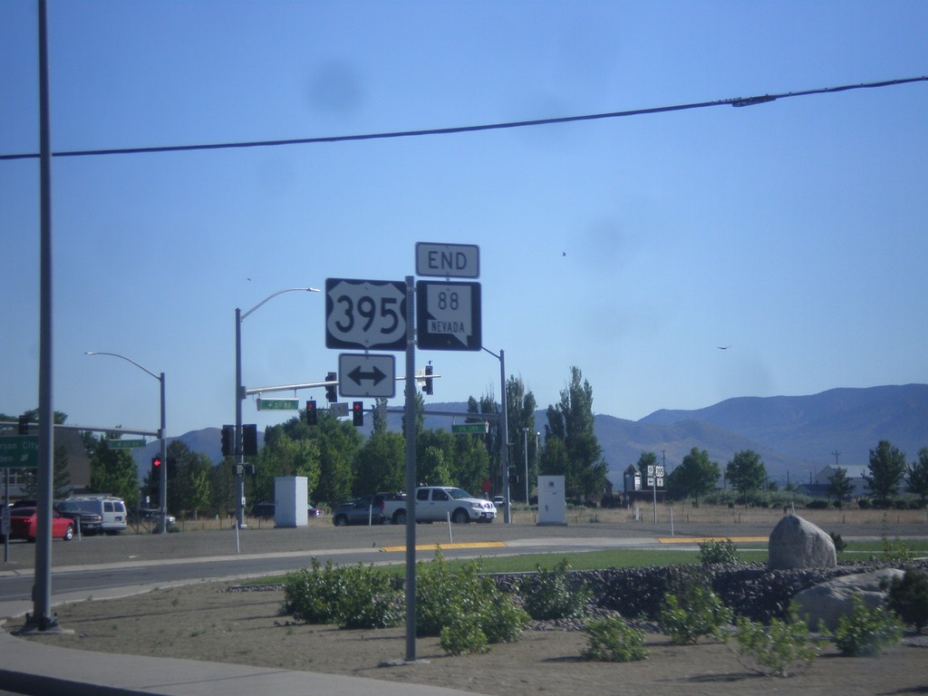
End NV-88 North at US-395
End NV-88 at US-395 in Minden.
Taken 06-15-2015
Minden
Douglas County
Nevada
United States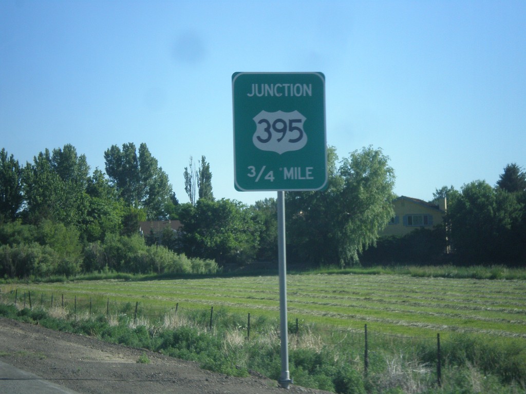
NV-88 North Approaching US-395
NV-88 North approaching US-395 in Minden.
Taken 06-15-2015
Minden
Douglas County
Nevada
United States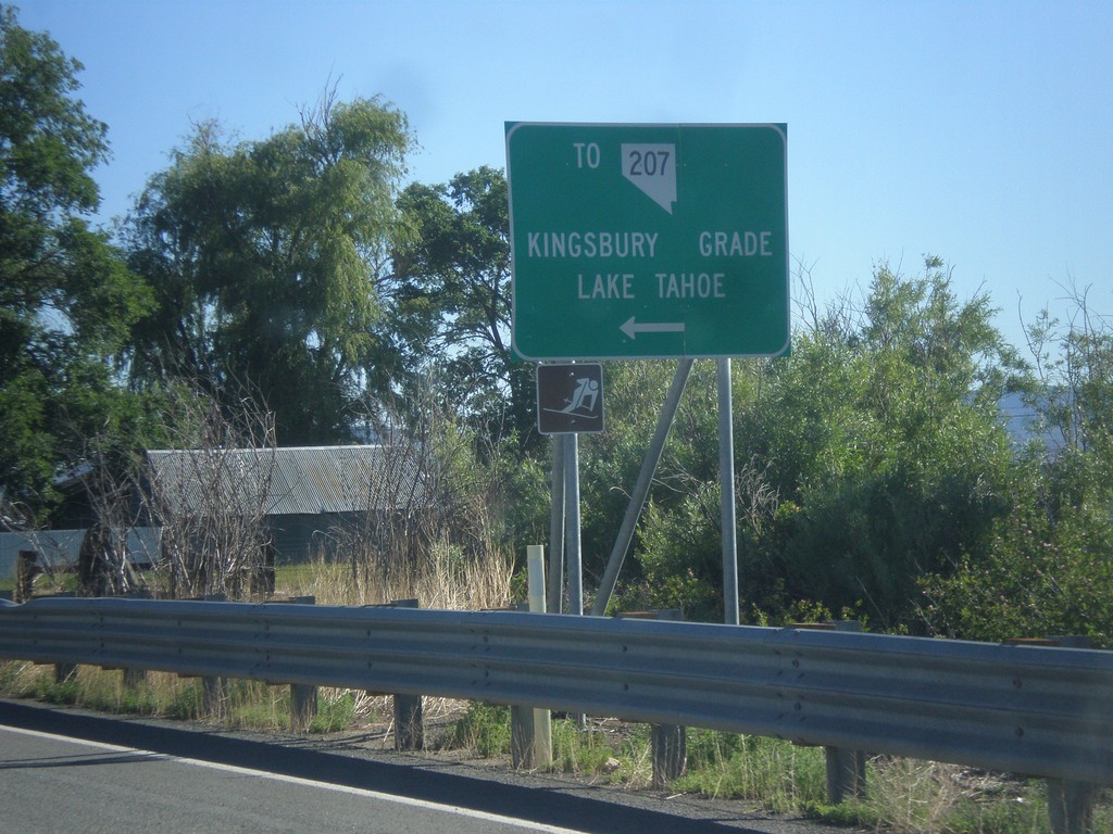
NV-88 North at Mottsville Lane/Waterloo Lane
NV-88 North at Mottsville Lane/Waterloo Lane. Use Mottsville Lane west for NV-207/Kingsbury Grade/Lake Tahoe.
Taken 06-15-2015
 Gardnerville
Douglas County
Nevada
United States
Gardnerville
Douglas County
Nevada
United States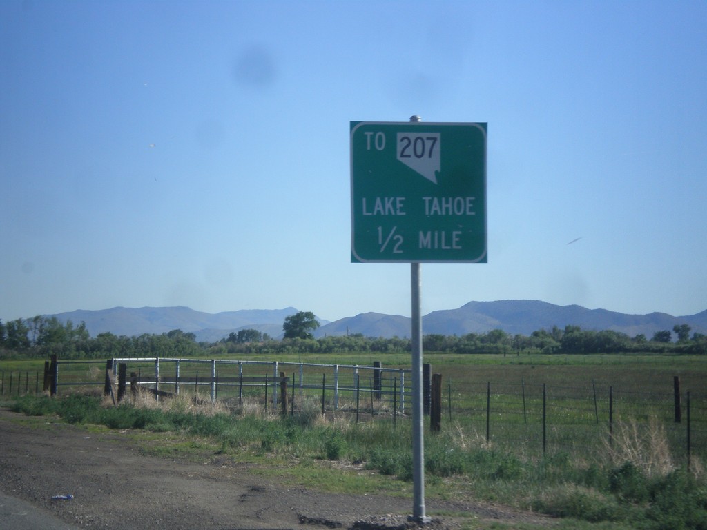
NV-88 North approaching Mottsville Lane/Waterloo Lane Jct.
NV-88 North approaching Mottsville Lane/Waterloo Lane junction. Use Mottsville Lane west for NV-207 and Lake Tahoe (via Kingsbury Grade).
Taken 06-15-2015
Gardnerville
Douglas County
Nevada
United States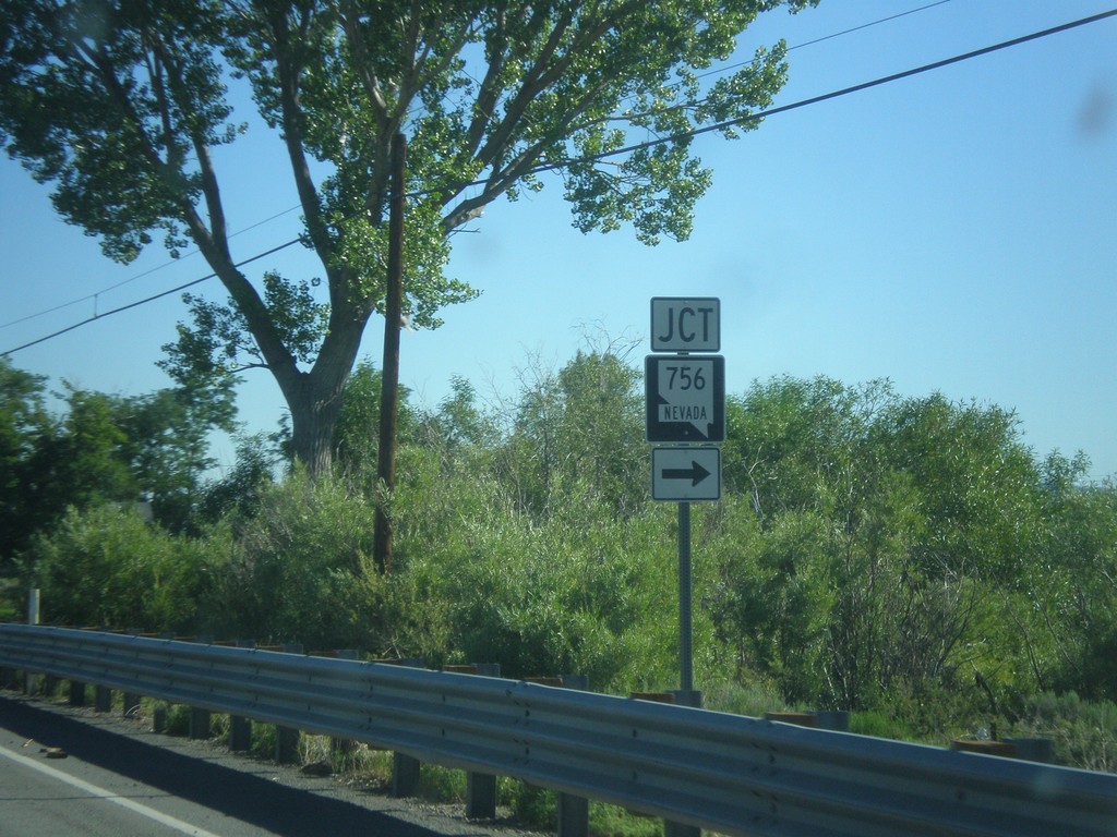
NV-88 North at NV-756
NV-88 north at NV-756 (Centerville Lane) in Gardnerville.
Taken 06-15-2015
 Gardnerville
Douglas County
Nevada
United States
Gardnerville
Douglas County
Nevada
United States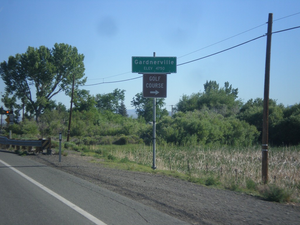
NV-88 North - Gardnerville
Gardnerville - Elevation 4750 Feet on NV-88 North. Approaching NV-756 junction (Centerville Lane) for access to Golf Course.
Taken 06-15-2015
Gardnerville
Douglas County
Nevada
United States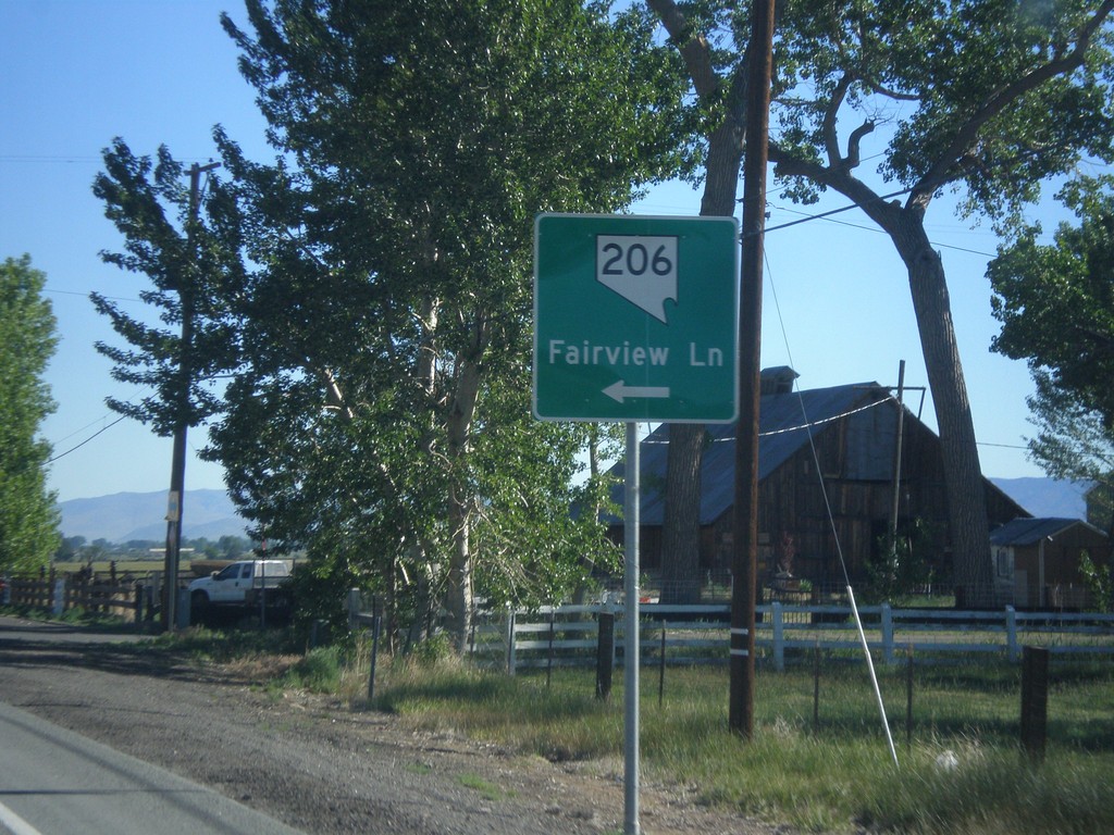
NV-88 North at NV-206
NV-88 north at NV-206/Fairview Lane.
Taken 06-15-2015
Gardnerville
Douglas County
Nevada
United States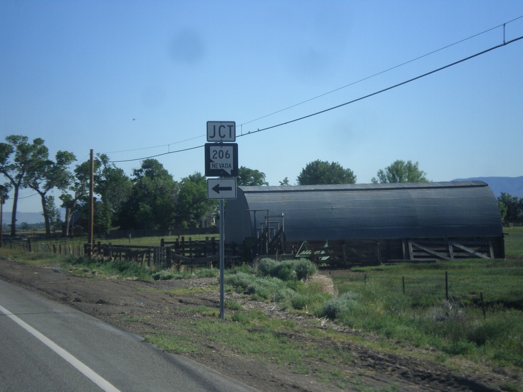
NV-88 North Approaching NV-206
NV-88 North approaching NV-206 in Douglas County.
Taken 06-15-2015
Gardnerville
Douglas County
Nevada
United States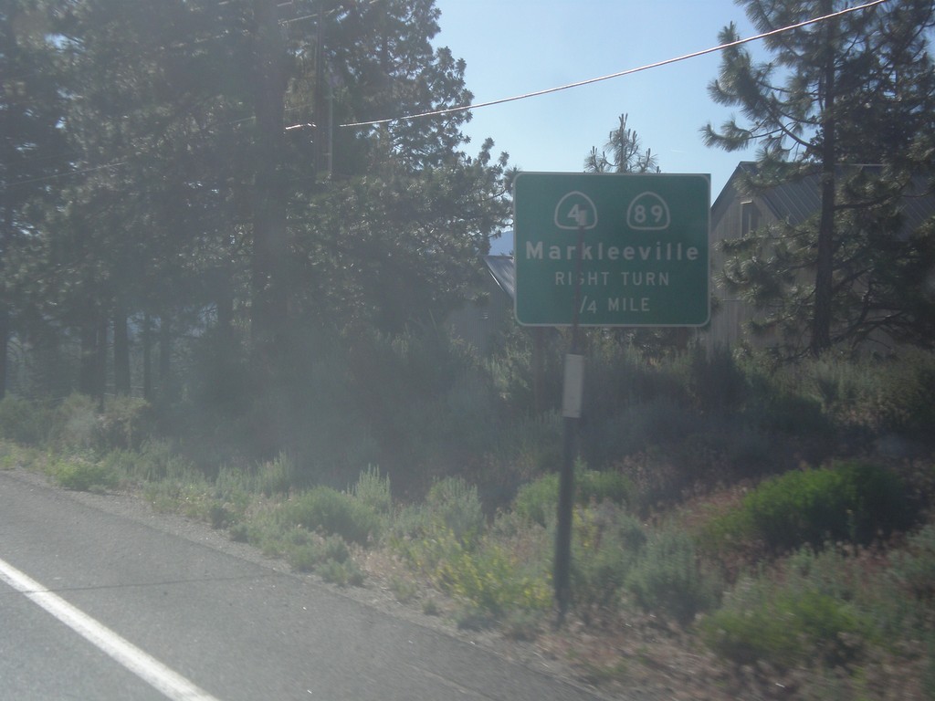
CA-88 East/CA-89 South Approaching CA-89 Jct.
CA-88 East/CA-89 South approaching CA-89/(To) CA-4 junction. Use CA-89 south for CA-4 and Markleeville.
Taken 06-15-2015


 Markleeville
Alpine County
California
United States
Markleeville
Alpine County
California
United States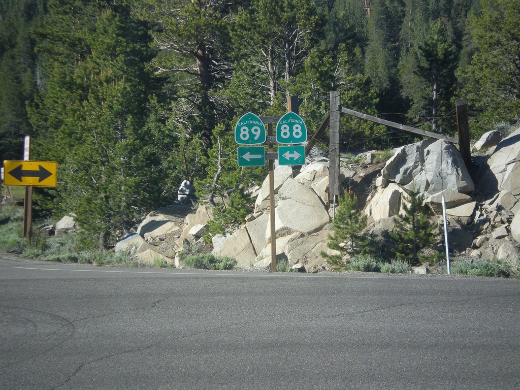
CA-89 South at CA-88
CA-89 south at CA-88 junction. Turn right for CA-88 west; turn left for CA-88 East/CA-89 South.
Taken 06-15-2015
Markleeville
Alpine County
California
United States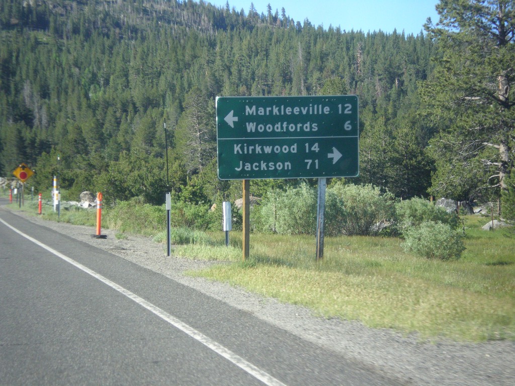
CA-89 South Approaching CA-88
CA-89 South approaching CA-88. Use CA-88 west for Kirkwood and Jackson. Use CA-89 South/CA-89 East for Markleeville and Woodfords. CA-89 south joins CA-88 east to Woodfords.
Taken 06-15-2015
Markleeville
Alpine County
California
United States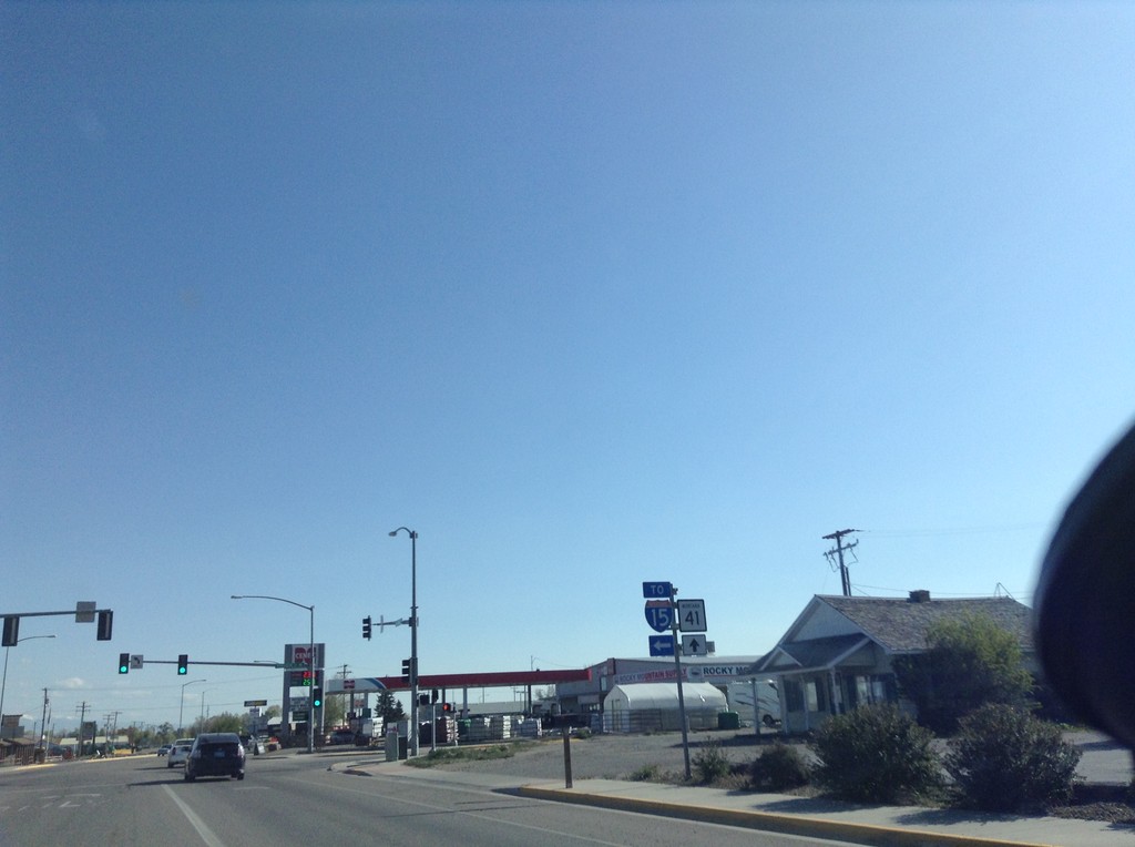
BL-15 North at MT-41 - Dillon
BL-15 North at MT-41 in Dillon. Turn left for BL-15 (To I-15); straight for MT-41.
Taken 05-10-2015


 Dillon
Beaverhead County
Montana
United States
Dillon
Beaverhead County
Montana
United States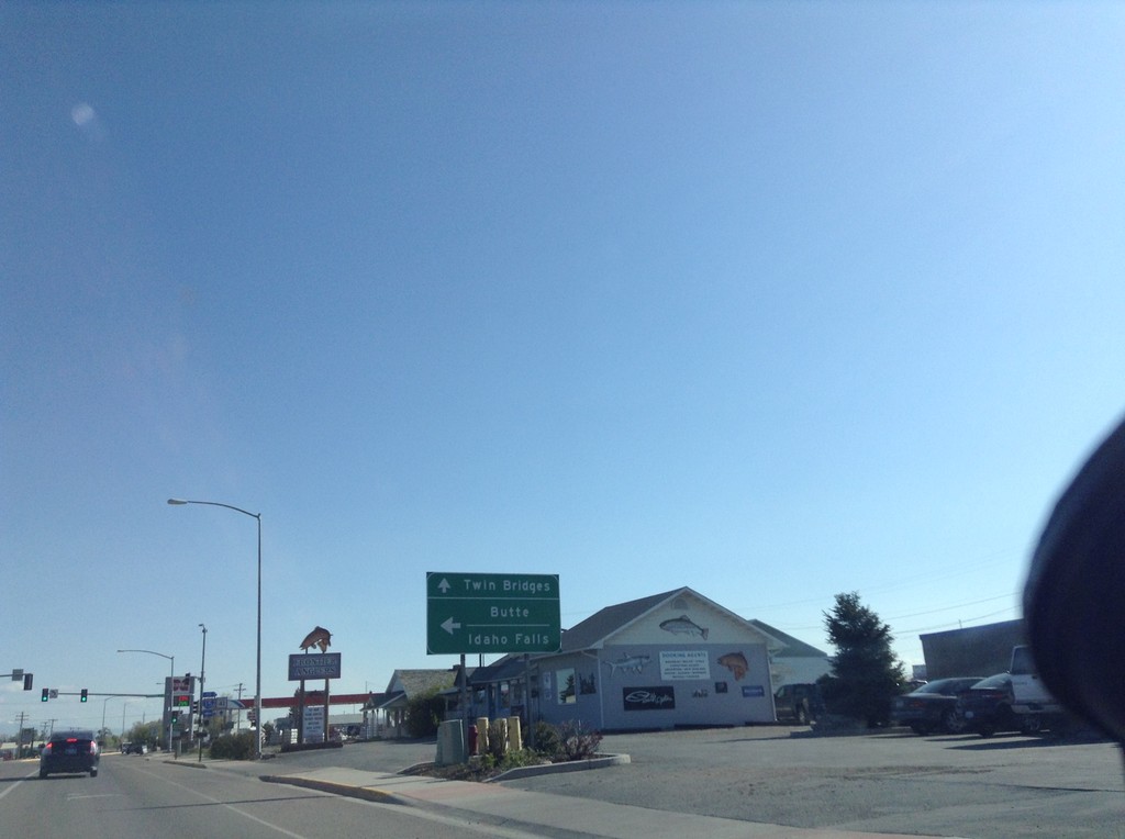
BL-15 North at MT-41
BL-15 north at MT-41 in Dillon. Turn left for I-15 to Butte and Idaho Falls. Continue straight for MT-41 north to Twin Bridges.
Taken 05-10-2015
Dillon
Beaverhead County
Montana
United States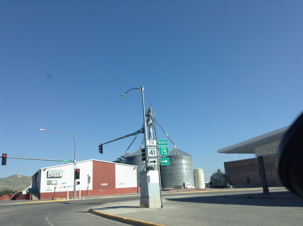
BL-15 North/To MT-41 - Dillon
BL-15 North/To MT-41 on Helena St. at Montana St. Turn left on Montana St. to continue north on BL-15.
Taken 05-10-2015
Dillon
Beaverhead County
Montana
United States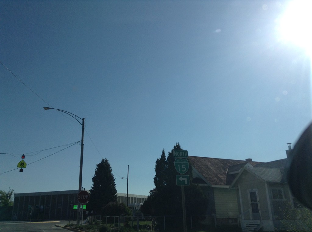
BL-15 North - Dillon
BL-15 North (Atlantic St.) at Helena St. Turn left on Helena St. to continue north on BL-15.
Taken 05-10-2015
Dillon
Beaverhead County
Montana
United States