Signs Tagged With Intersection
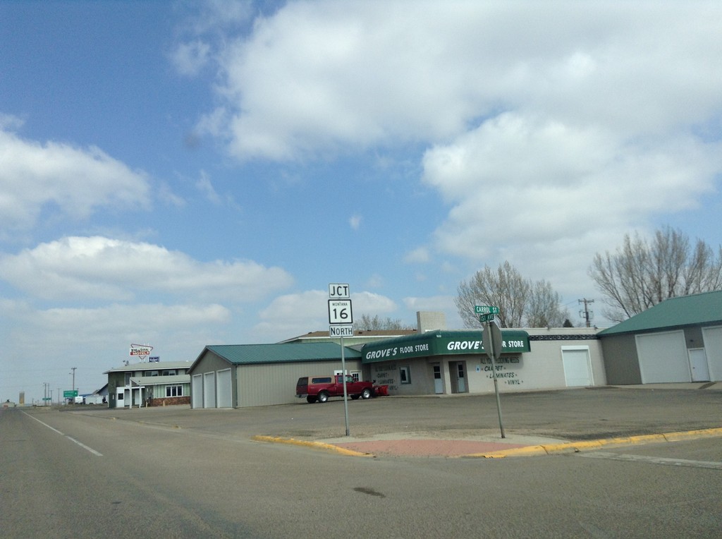
MT-16 North/MT-5 West Approaching Split
MT-16 North/MT-5 West Approaching MT-16/MT-5 split in Plentywood.
Taken 05-09-2015

 Plentywood
Sheridan County
Montana
United States
Plentywood
Sheridan County
Montana
United States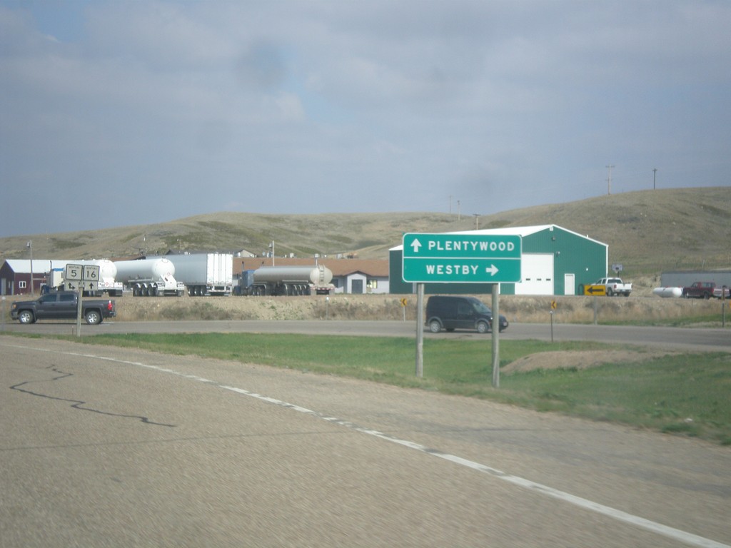
MT-16 North at MT-5
MT-16 north at MT-5. Use MT-5 east to Westby. MT-5 west joins MT-16 north through Plentywood.
Taken 05-09-2015
Plentywood
Sheridan County
Montana
United States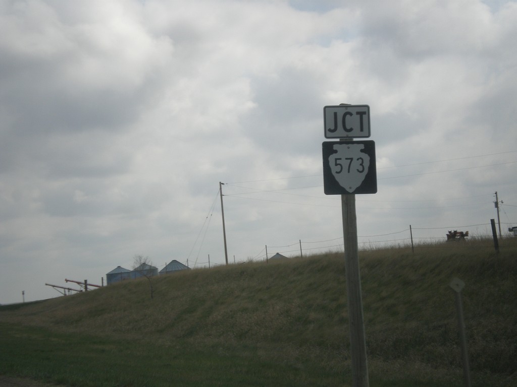
MT-16 North Approaching MTS-573
MT-16 North approaching MTS-573 in Medicine Lake.
Taken 05-09-2015
 Medicine Lake
Sheridan County
Montana
United States
Medicine Lake
Sheridan County
Montana
United States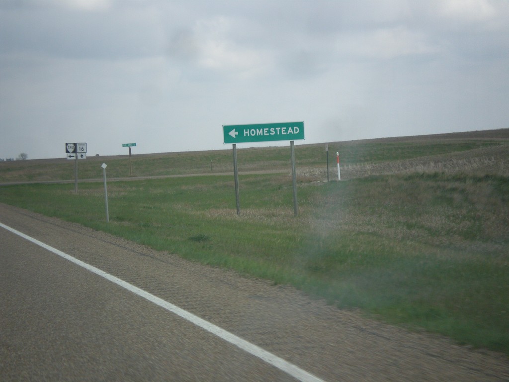
MT-16 North at MTS-350 West
MT-16 North at MTS-350 West to Homestead.
Taken 05-09-2015
 Homestead
Sheridan County
Montana
United States
Homestead
Sheridan County
Montana
United States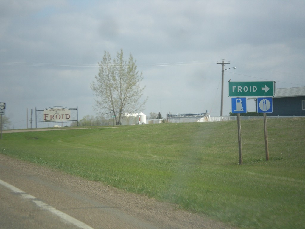
MT-16 North at MTS-405
MT-16 North at MTS-405 to Froid.
Taken 05-09-2015
 Homestead
Roosevelt County
Montana
United States
Homestead
Roosevelt County
Montana
United States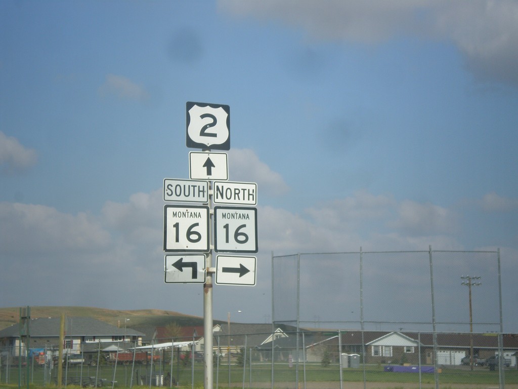
US-2 West at MT-16 North
US-2 West at MT-16 North. Turn right for MT-16 north; continue straight for US-2 West/MT-16 South.
Taken 05-09-2015
 Culbertson
Roosevelt County
Montana
United States
Culbertson
Roosevelt County
Montana
United States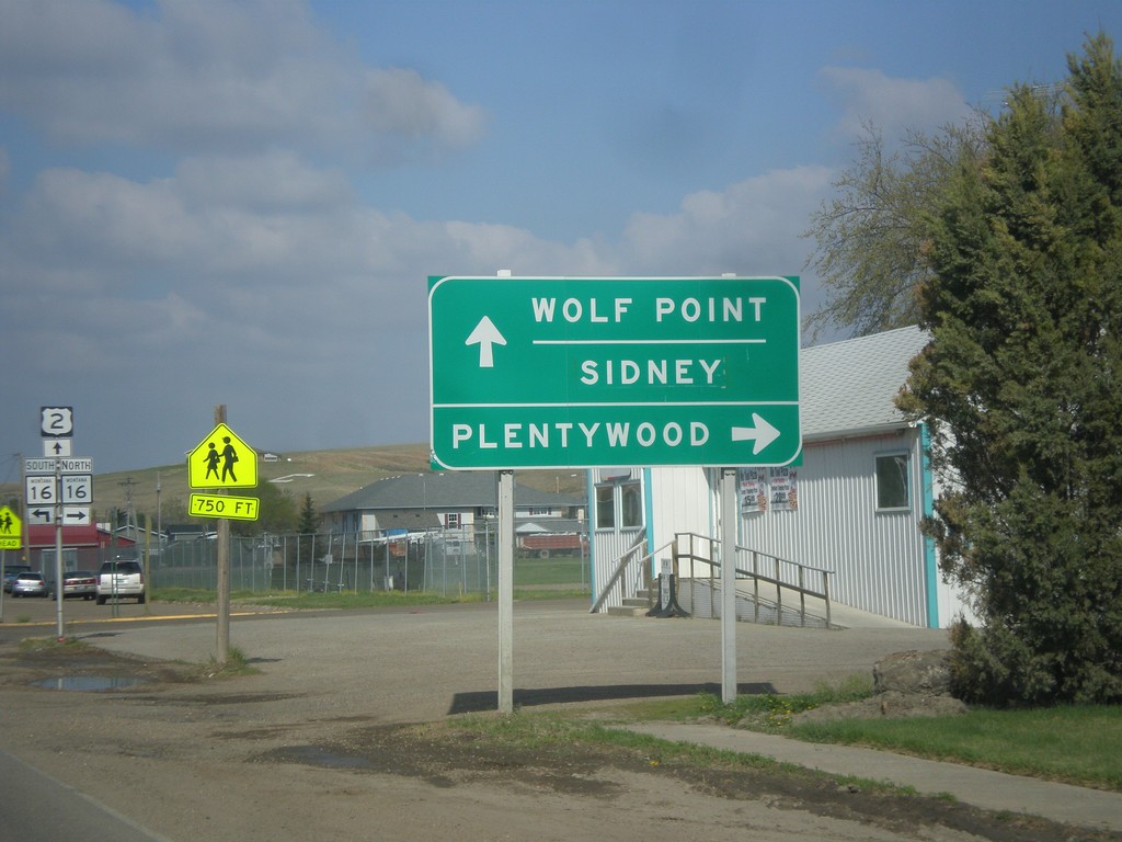
US-2 West Approaching MT-16
US-2 West Approaching MT-16 north to Plentywood. MT-16 south joins US-2 west through Culbertson. Use US-2 west for Wolf Point and Sidney (via MT-16 south).
Taken 05-09-2015
Culbertson
Roosevelt County
Montana
United States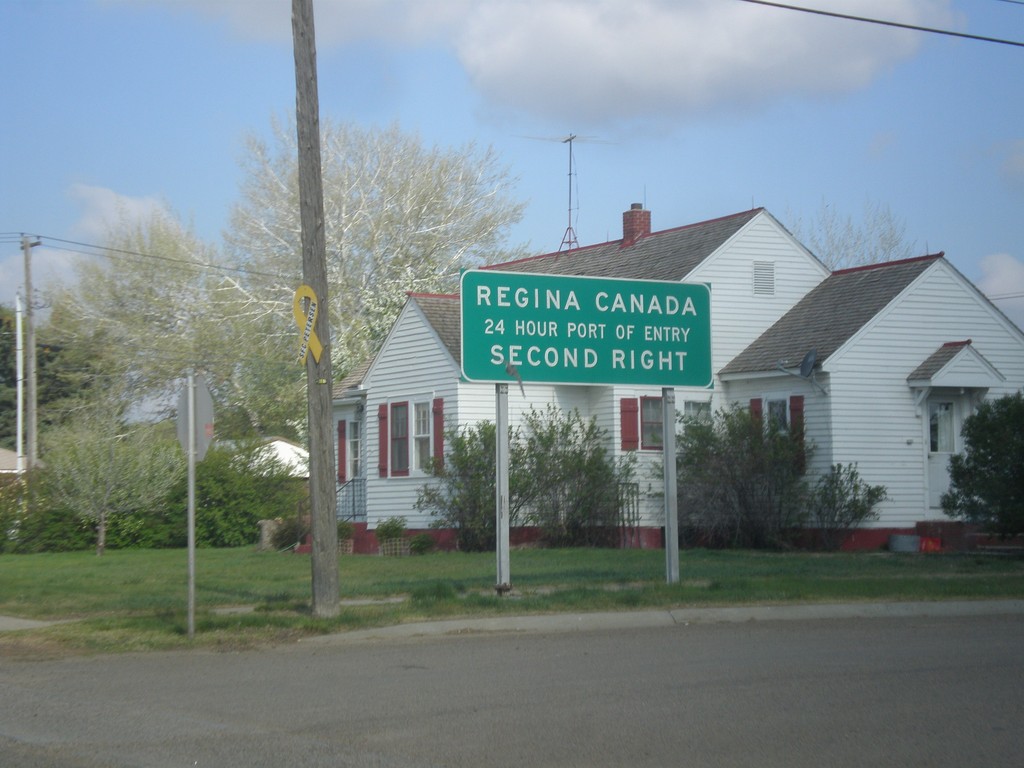
US-2 West - Port of Entry Information For MT-16
US-2 West - Regina Canada 24 Hour Port of Entry, via MT-16 north. The next 24 hour port of entry westbound into Canada is on I-15 at Sweetgrass.
Taken 05-09-2015
Culbertson
Roosevelt County
Montana
United States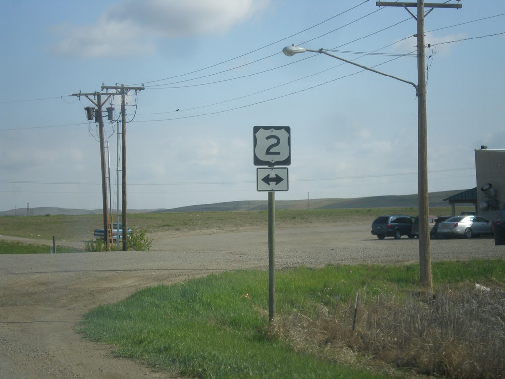
End MTS-327 North at US-2
End MTS-327 North at US-2 in Bainville.
Taken 05-09-2015
 Bainville
Roosevelt County
Montana
United States
Bainville
Roosevelt County
Montana
United States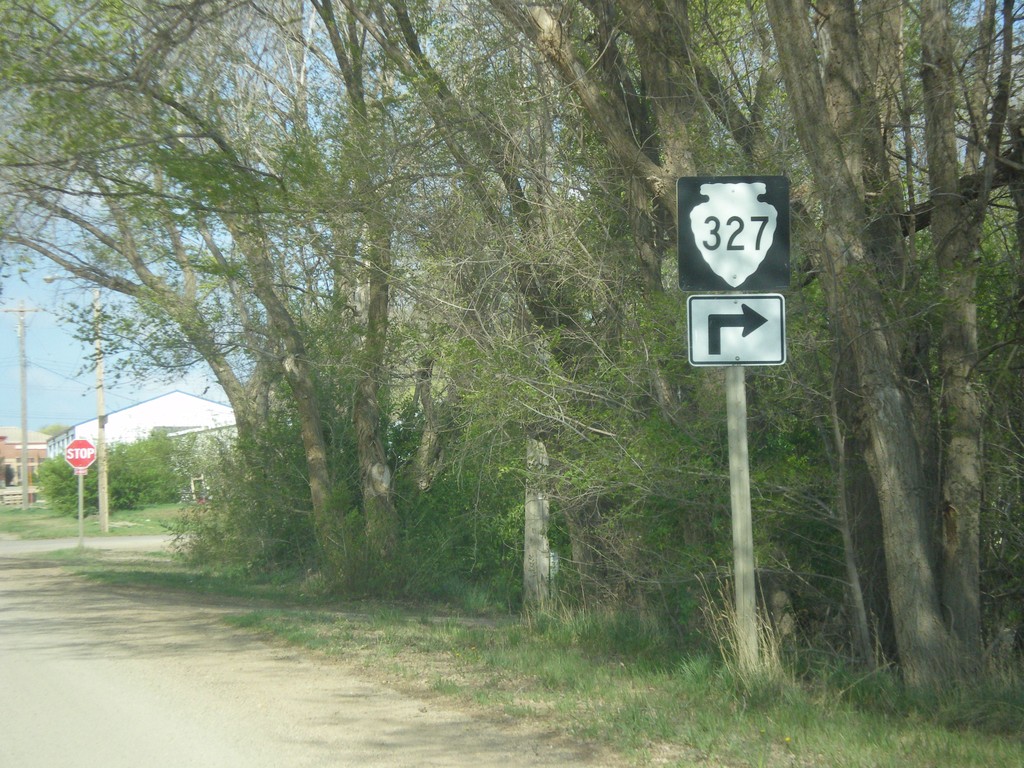
MTS-327 East - Bainville
MTS-327 east (5th Ave.) at Clinton St. Turn right on Clinton St. to continue on MTS-327.
Taken 05-09-2015
Bainville
Roosevelt County
Montana
United States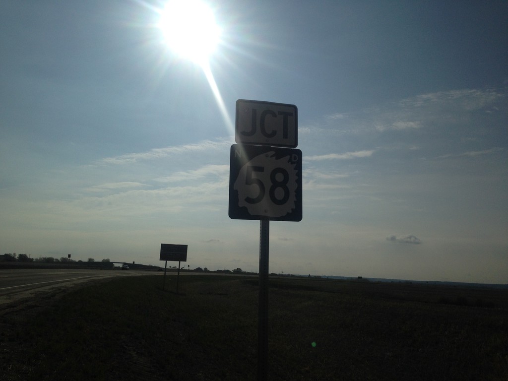
ND-1804 East at ND-58
ND-1804 East at ND-58 in Williams County. Turn right for ND-58 South; left for ND-1804 East.
Taken 05-09-2015

 Williston
Williams County
North Dakota
United States
Williston
Williams County
North Dakota
United States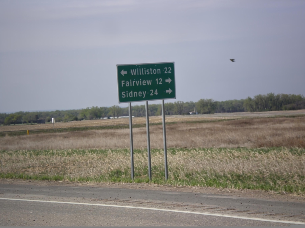
ND-1804 East Approaching ND-58
ND-1804 East approaching ND-58. Use ND-58 south for Fairview (MT) and Sidney (MT). Continue east on ND-1804 for Williston.
Taken 05-09-2015
Williston
Williams County
North Dakota
United States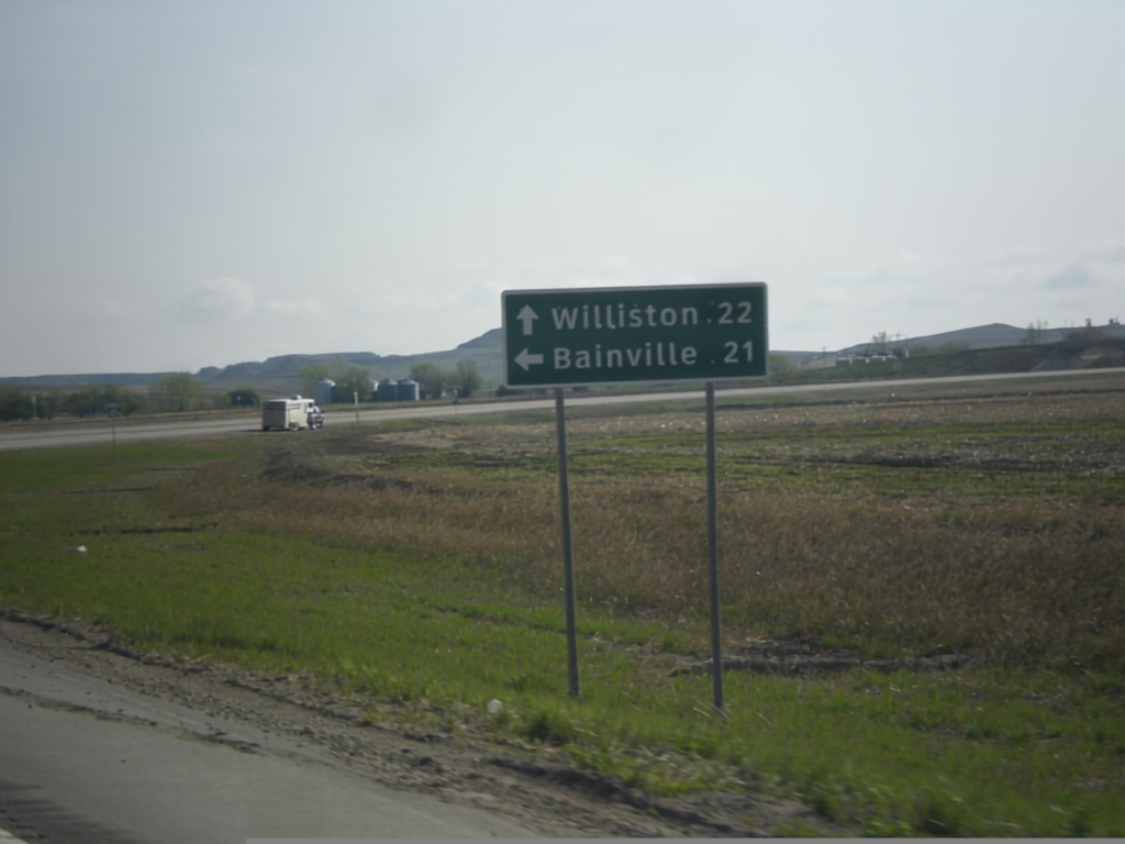
End ND-58 North at ND-1804
End ND-58 North at ND-1804. Use ND-1804 east for Williston; ND-1804 west for Bainville (MT).
Taken 05-09-2015
Williston
Williams County
North Dakota
United States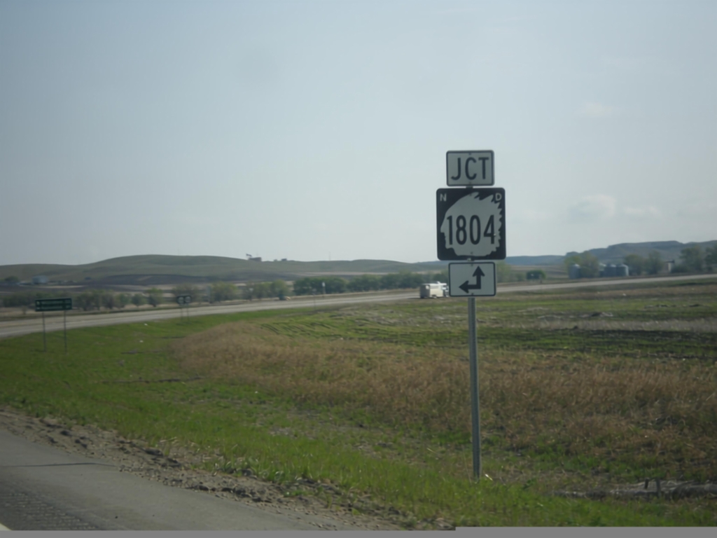
ND-58 North Approaching ND-1804
ND-58 north approaching ND-1804 in Williams County.
Taken 05-09-2015
Williston
Williams County
North Dakota
United States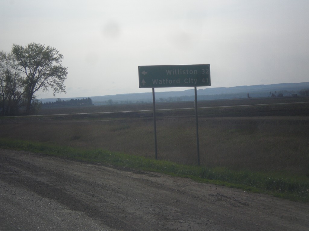
ND-200 East at ND-58 North
ND-200 East at ND-58 North to Williston. Continue east on ND-200 for Watford City.
Taken 05-09-2015
 Fairview
McKenzie County
North Dakota
United States
Fairview
McKenzie County
North Dakota
United States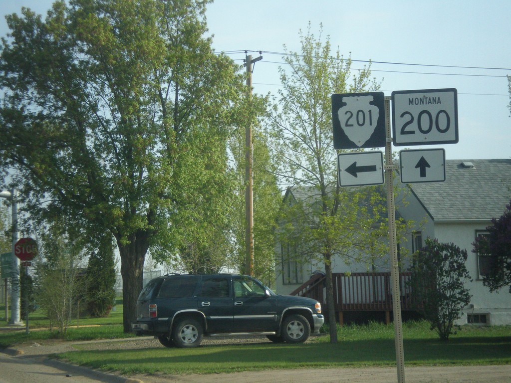
MT-200 East at MTS-201
MT-200 East at MTS-201 in Fairview.
Taken 05-09-2015

 Fairview
Richland County
Montana
United States
Fairview
Richland County
Montana
United States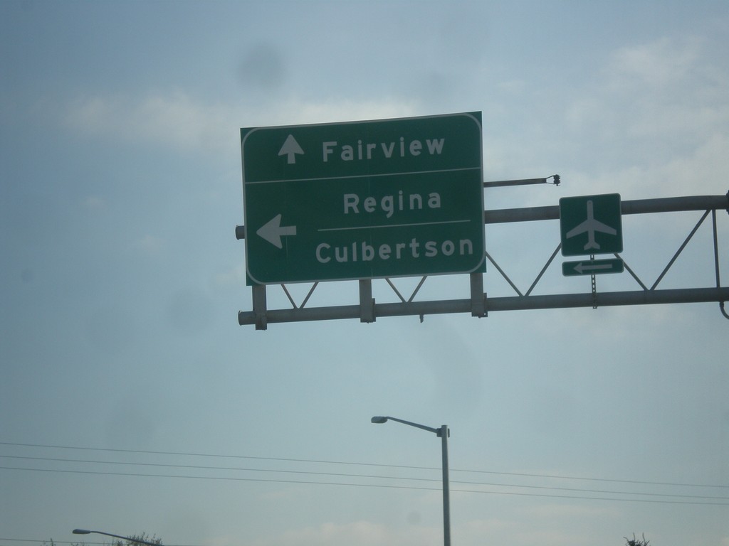
MT-200 East/MT-16 North Split - Sidney
MT-200 East/MT-16 North Split in Sidney. Turn left for MT-16 north to Regina (SK, Canada) and Culbertson. Continue straight for MT-200 East to Fairview.
Taken 05-09-2015
Sidney
Richland County
Montana
United States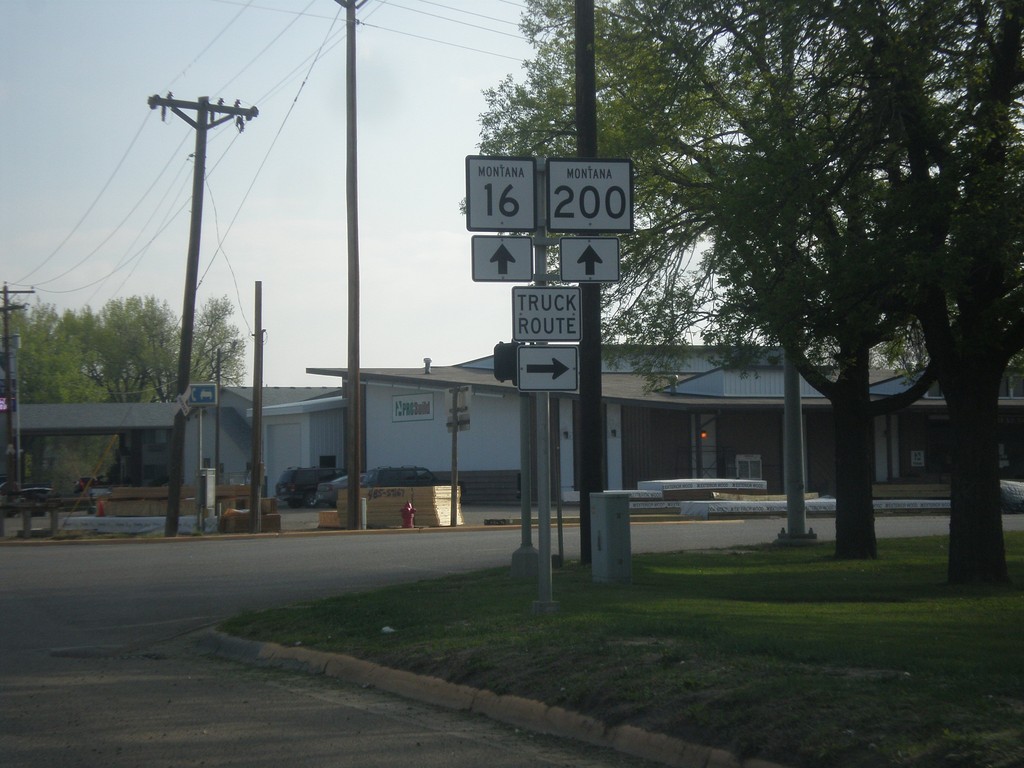
MT-200 East/MT-16 North - Sidney Truck Route
MT-200 East/MT-16 North at 14th St. Use 14th St. east for the truck route through Sidney.
Taken 05-09-2015
Sidney
Richland County
Montana
United States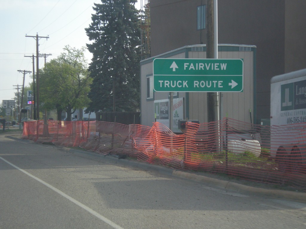
MT-200 East/MT-16 North at Sidney Truck Route
MT-200 East/MT-16 North at Sidney Truck Route. Continue on MT-200/MT-16 for Fairview.
Taken 05-09-2015
Sidney
Richland County
Montana
United States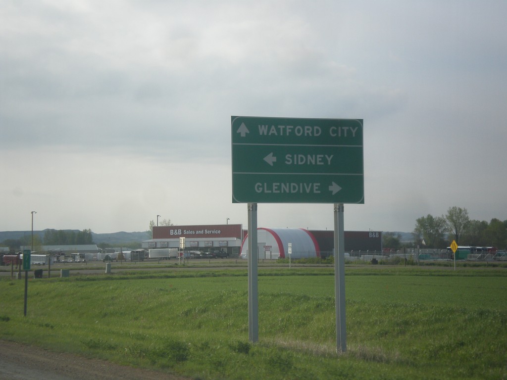
MT-200 East at MT-16 and MT-23
MT-200 East at MT-16 and MT-23. Turn right for MT-16 south to Glendive. Continue straight for MT-23 east to Watford City (ND); left for MT-16 North/MT-200 East to Sidney.
Taken 05-09-2015
 Sidney
Richland County
Montana
United States
Sidney
Richland County
Montana
United States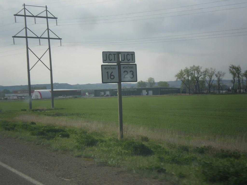
MT-200 East Approaching MT-16/MT-23 Junction
MT-200 East Approaching MT-16/MT-23 Junction in Richland County.
Taken 05-09-2015
Sidney
Richland County
Montana
United States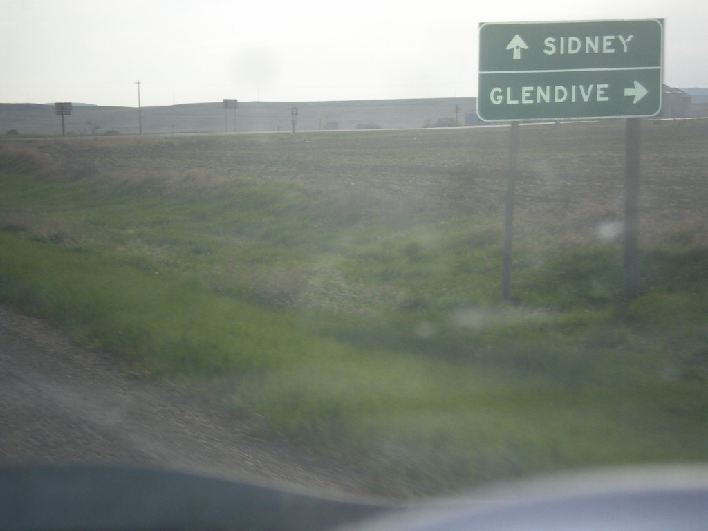
MT-200 East at MTS-254
MT-200 east at MTS-254 south to Glendive. Continue east on MT-200 for Sidney.
Taken 05-09-2015
 Richey
Dawson County
Montana
United States
Richey
Dawson County
Montana
United States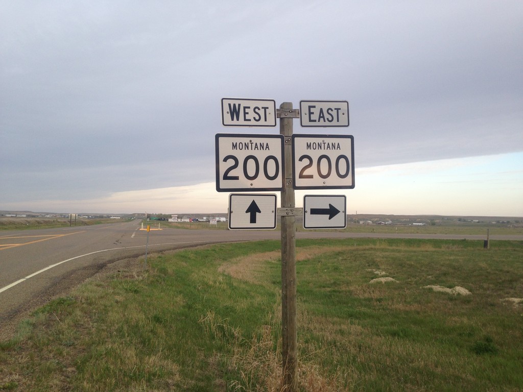
MT-200 West at MT-200S
MT-200 West at MT-200S. Turn right to continue west on MT-200; left for MT-200S east.
Taken 05-09-2015
 Circle
McCone County
Montana
United States
Circle
McCone County
Montana
United States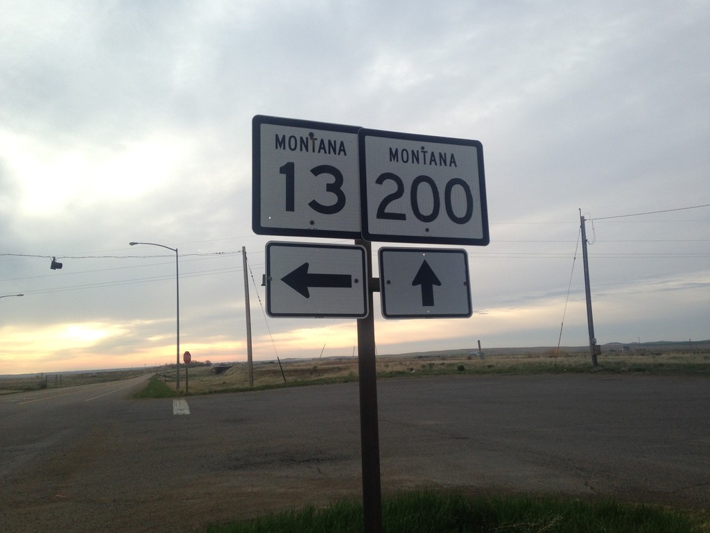
MT-200 East at MT-13
MT-200 East at MT-13 in Circle.
Taken 05-09-2015
 Circle
McCone County
Montana
United States
Circle
McCone County
Montana
United States
MT-200 East at MT-200S East
MT-200 East at MT-200S East. Turn left on MT-200 for Richey and Sidney. Continue straight for MT-200S to Glendive.
Taken 05-09-2015
Circle
McCone County
Montana
United States