Signs Tagged With Intersection
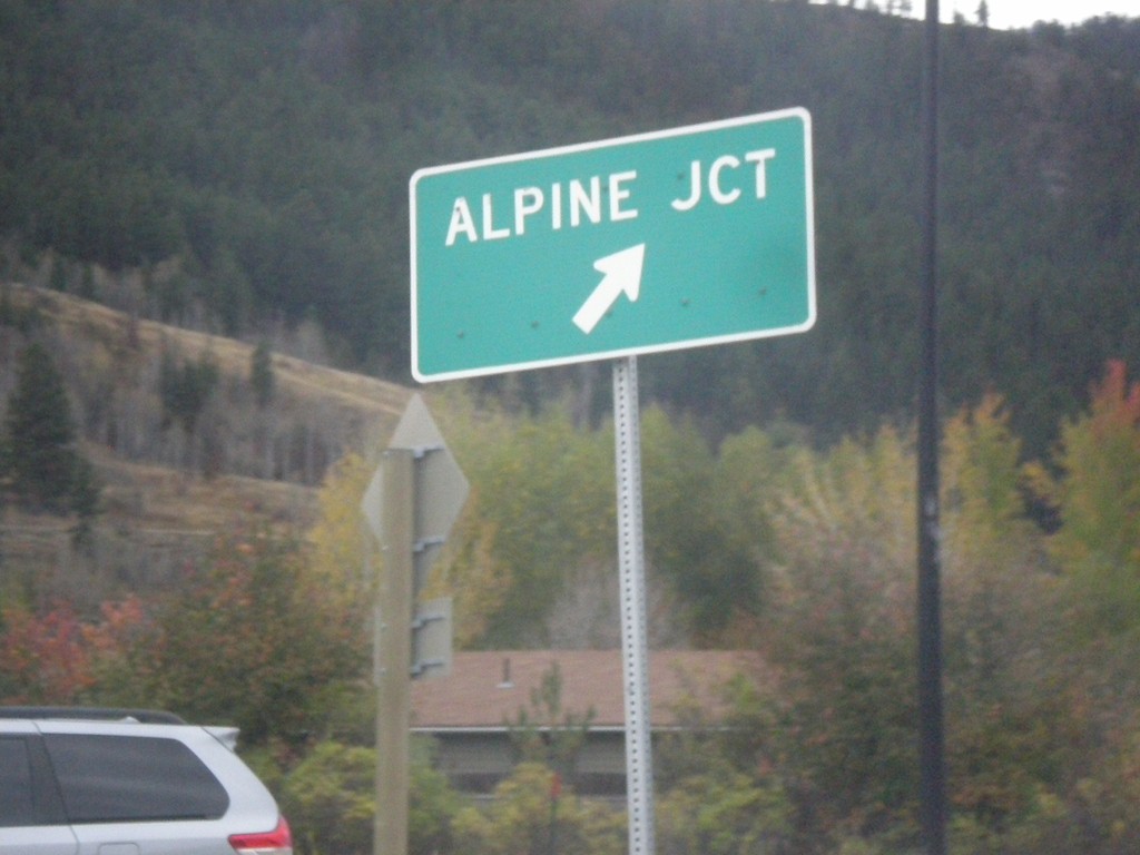
US-26 West - US-89/US-189/US-191 South in Hoback Jct. Roundabout
US-26 West - US-89/US-189/US-191 South in Hoback Jct. roundabout. Merge right for (US-26 West/US-89 South) Alpine Junction.
Taken 10-04-2015


 Jackson
Teton County
Wyoming
United States
Jackson
Teton County
Wyoming
United States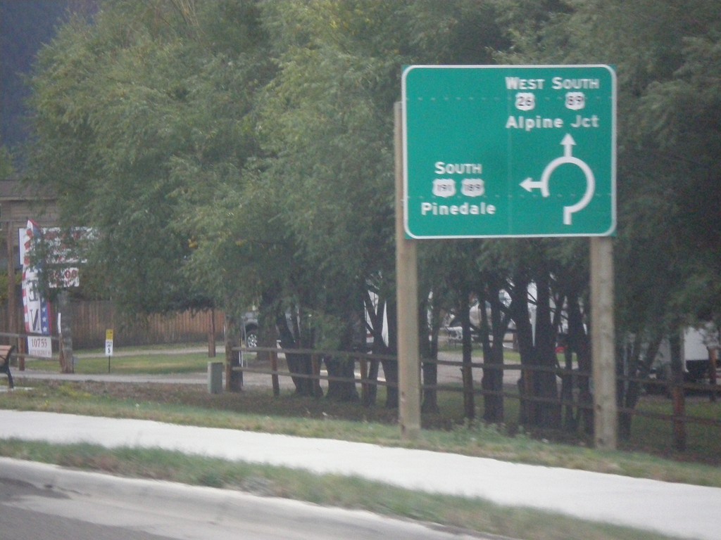
US-26 West - US-89/US-189/US-191 South - Roundabout
US-26 West - US-89/US-189/US-191 South entering roundabout at Hoback Junction. Use US-26 West/US-89 South for Alpine Jct.; use US-189/US-191 South for Pinedale. This intersection was converted to a roundabout in 2012.
Taken 10-04-2015
Jackson
Teton County
Wyoming
United States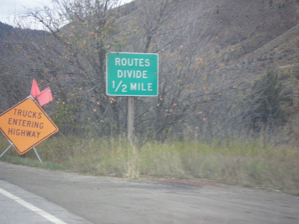
US-26 West - US-89/US-189/US-191 South - Routes Divide
US-26 West - US-89/US-189/US-191 South - Routes Divide. Approaching Hoback Jct., where US-189/US-191 separate from US-26/US-89. The Routes Divide sign in Wyoming is common in this situation where one route splits from another route.
Taken 10-04-2015
Jackson
Teton County
Wyoming
United States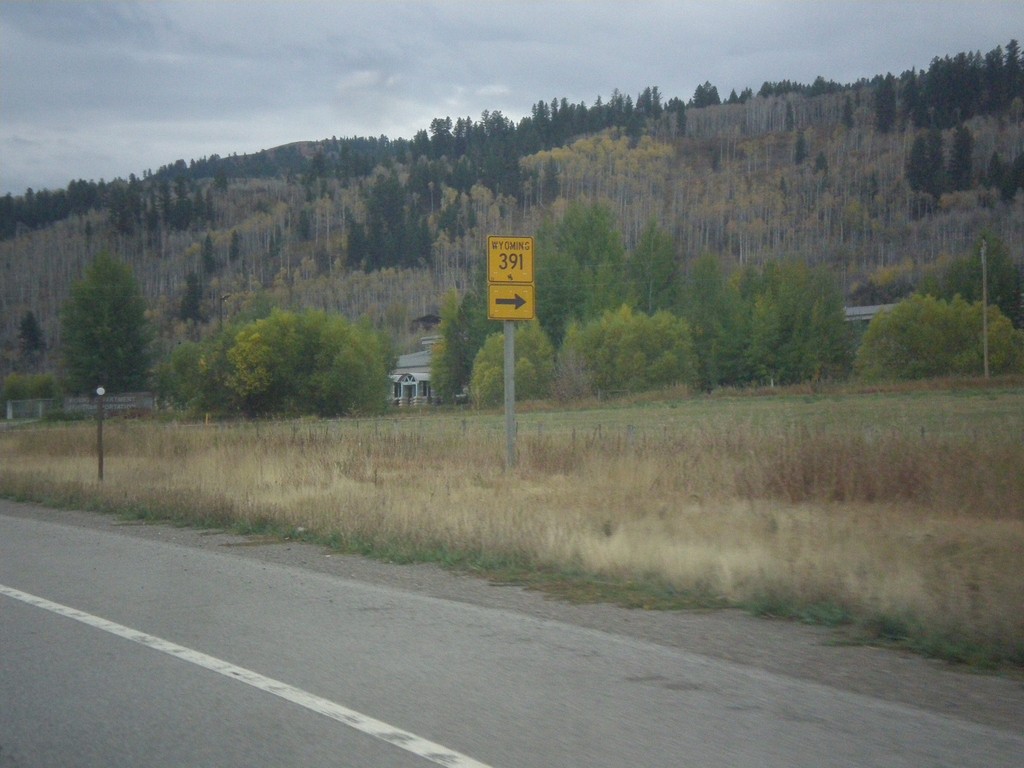
US-26 West - US-89/US-189/US-191 South at WY-391
US-26 West - US-89/US-189/US-191 South at WY-391 junction.
Taken 10-04-2015
 Jackson
Teton County
Wyoming
United States
Jackson
Teton County
Wyoming
United States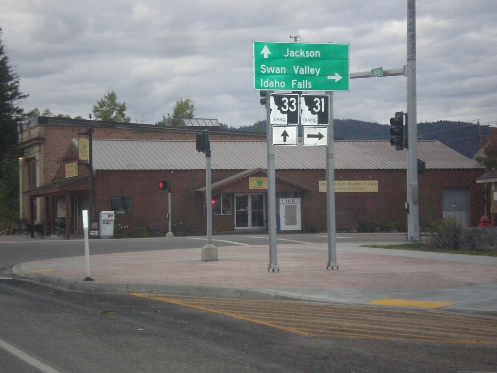
ID-33 East at ID-31
ID-33 East at ID-31 in Victor. Turn right on ID-31 south for Swan Valley and Idaho Falls. Continue straight on ID-33 for Jackson (Wyoming). Teton Scenic Byway leaves ID-33 here and follows ID-31 south.
Taken 10-04-2015

 Victor
Teton County
Idaho
United States
Victor
Teton County
Idaho
United States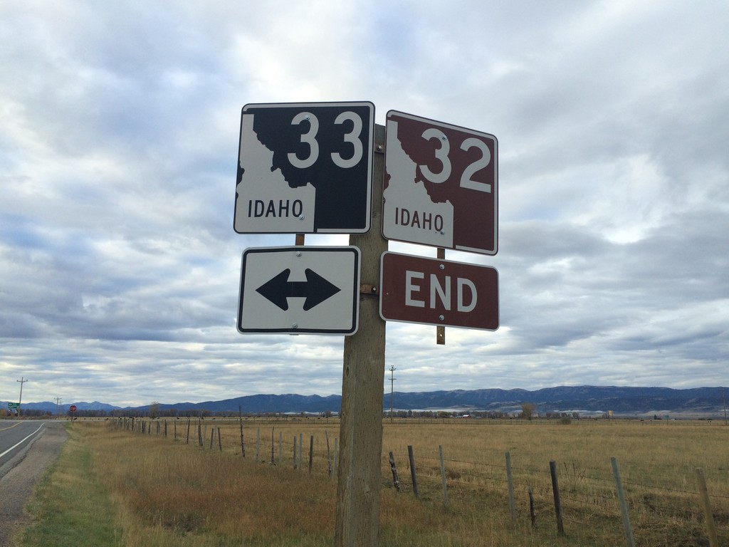
End ID-32 at ID-33
End ID-32 south at ID-33 near Tetonia. The Teton Scenic Byway continues onto ID-33 east, towards Driggs.
Taken 10-04-2015
 Tetonia
Teton County
Idaho
United States
Tetonia
Teton County
Idaho
United States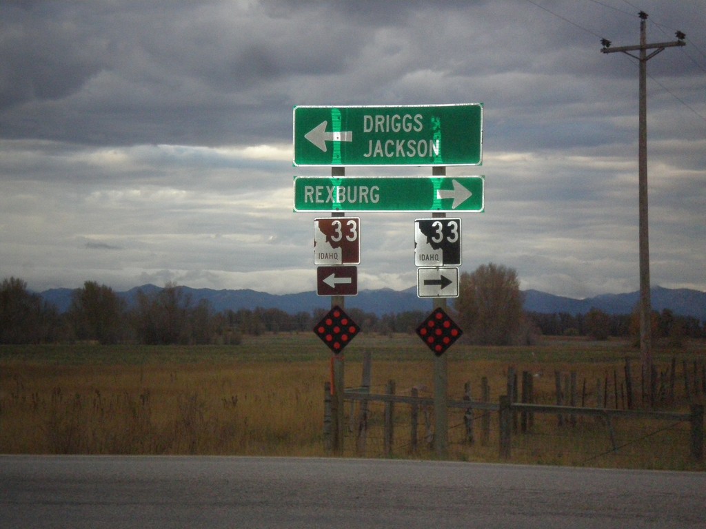
End ID-32 South at ID-33
End ID-32 south at ID-33. Use ID-33 west for Rexburg. Use ID-33 east for Driggs and Jackson (Wyoming). Use ID-33 east to continue on the Teton Scenic Byway.
Taken 10-04-2015
Tetonia
Teton County
Idaho
United States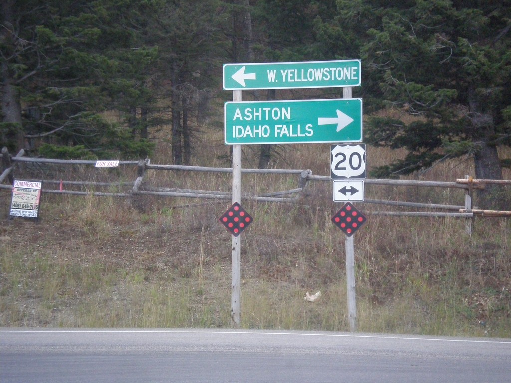
End ID-87 South at US-20
End ID-87 south at US-20, to Ashton, Idaho Falls, and W. Yellowstone.
Taken 10-03-2015

 Island Park
Fremont County
Idaho
United States
Island Park
Fremont County
Idaho
United States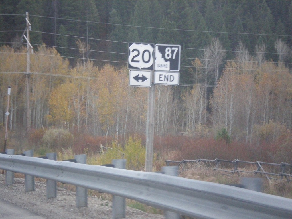
End ID-87 South at US-20
End ID-87 South at US-20 in Island Park.
Taken 10-03-2015
Island Park
Fremont County
Idaho
United States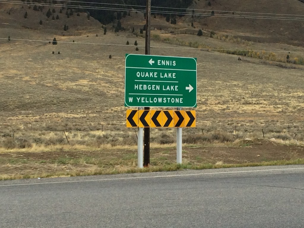
End MT-87 North at US-287
End MT-87 North at US-287. Use US-287 north for Ennis; use US-287 south for Quake Lake, Hebgen Lake, and West Yellowstone.
Taken 10-03-2015

 Schusters Place
Madison County
Montana
United States
Schusters Place
Madison County
Montana
United States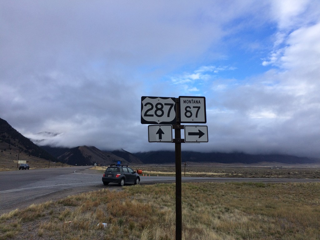
US-287 South at MT-87
US-287 South at MT-87 in Madison County.
Taken 10-03-2015
Schusters Place
Madison County
Montana
United States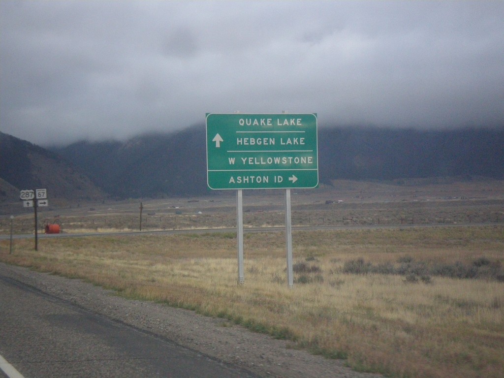
US-287 South at MT-87
US-287 South at MT-87 South. Turn right for MT-87 south to Ashton, ID. Continue south on US-287 for Quake Lake, Hebgen Lake, and West Yellowstone.
Taken 10-03-2015
Schusters Place
Madison County
Montana
United States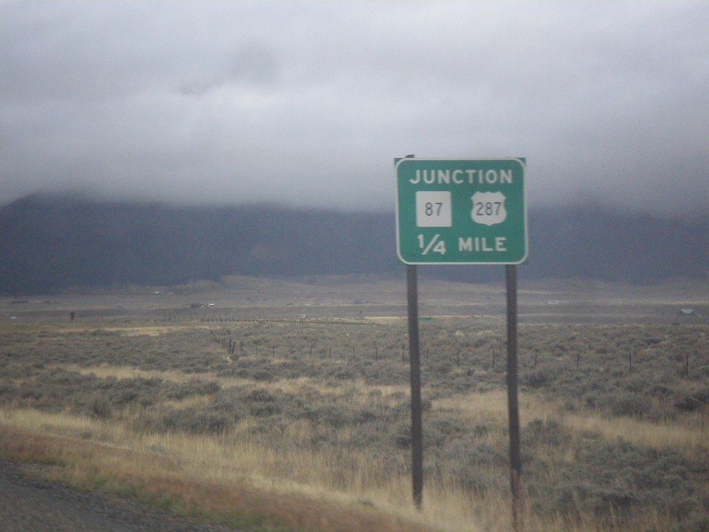
US-287 South Approaching MT-87
US-287 South approaching MT-87 in Madison County.
Taken 10-03-2015
Schusters Place
Madison County
Montana
United States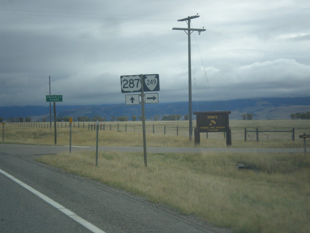
US-287 South at MTS-249
US-287 South at MTS-249 West in Madison County.
Taken 10-03-2015
 Varney
Madison County
Montana
United States
Varney
Madison County
Montana
United States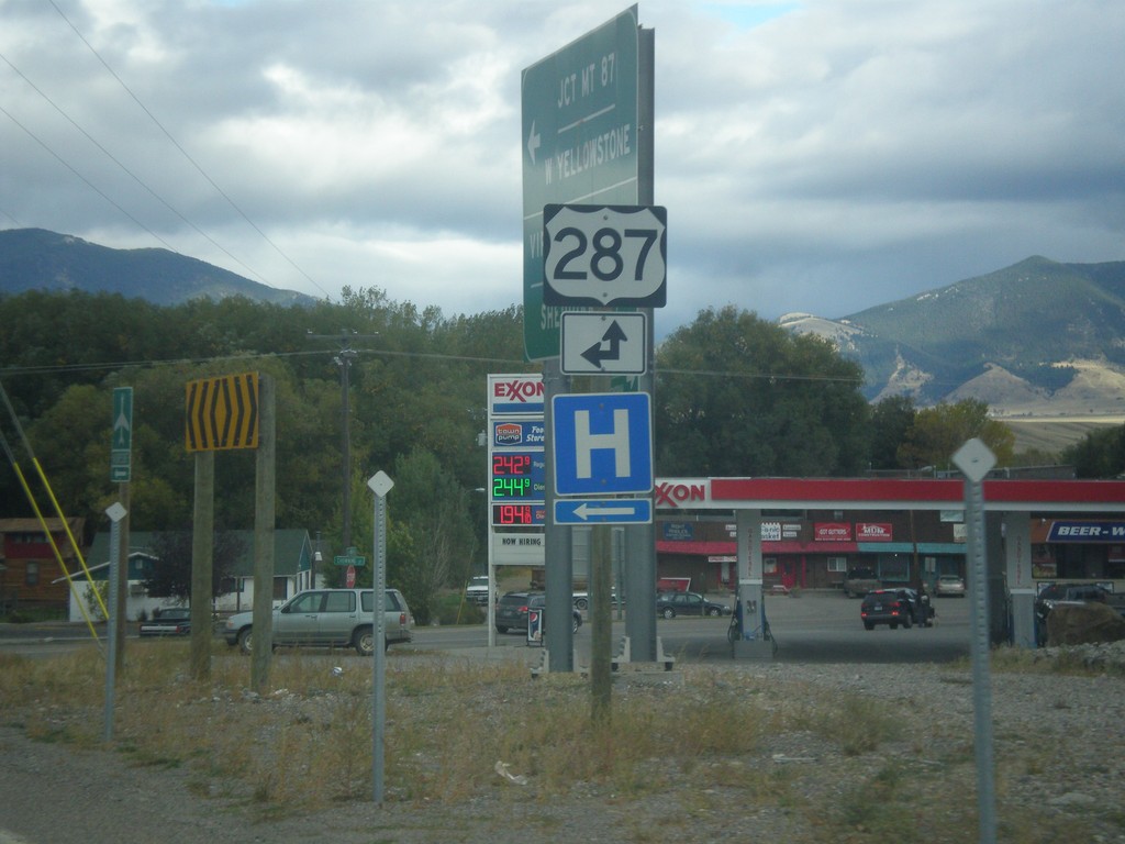
End MT-287 South at US-287
End MT-287 south at US-287 in Ennis. Turn left for US-287 north; straight for US-287 south.
Taken 10-03-2015
 Ennis
Madison County
Montana
United States
Ennis
Madison County
Montana
United States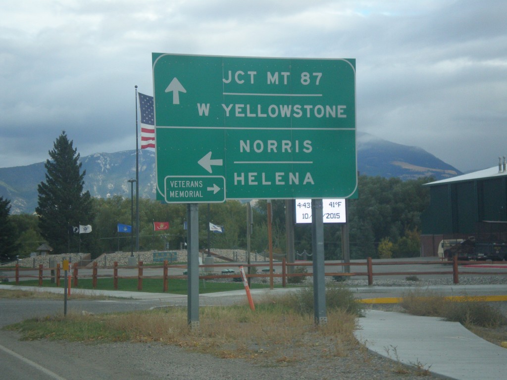
End MT-287 South at US-287
End MT-287 South at US-287. Turn left for US-287 north to Norris and Helena. Continue straight for US-287 south to West Yellowstone and Jct. MT-87. Turn right for the Madison Valley Veterans’ Memorial.
Taken 10-03-2015
Ennis
Madison County
Montana
United States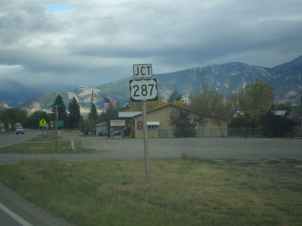
MT-287 South Approaching US-287
MT-287 South approaching US-287 in Ennis.
Taken 10-03-2015
Ennis
Madison County
Montana
United States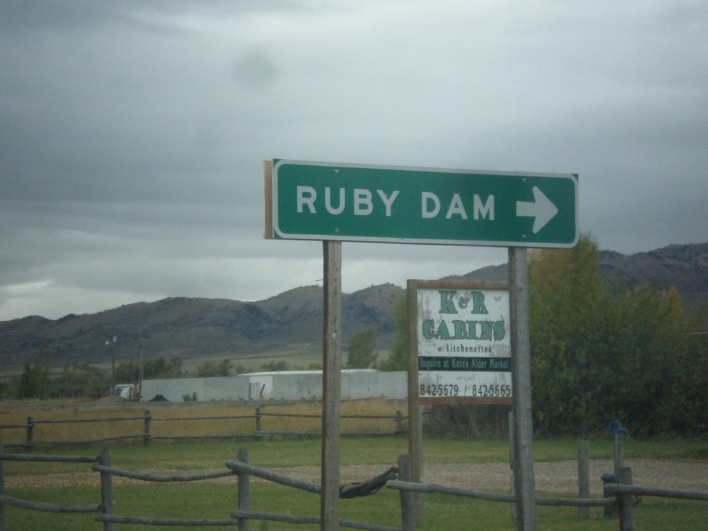
MT-287 South at MTS-357
MT-287 south at MTS-357 to Ruby Dam.
Taken 10-03-2015
 Alder
Madison County
Montana
United States
Alder
Madison County
Montana
United States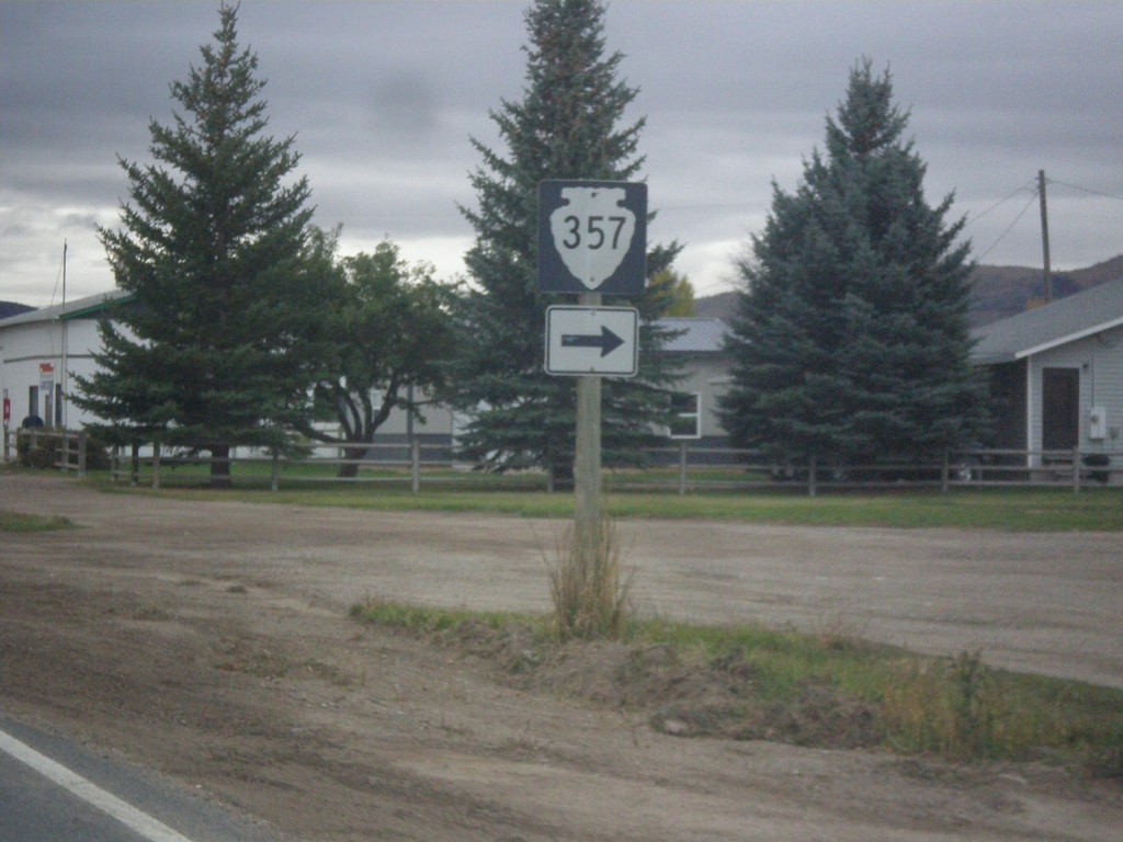
MT-287 South Approaching MTS-357
MT-287 South approaching MTS-357 in Alder.
Taken 10-03-2015
Alder
Madison County
Montana
United States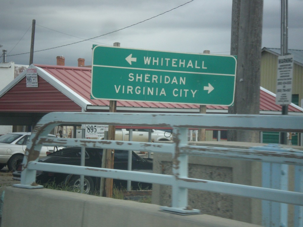
MT-41 North at MT-287
MT-41 North at MT-287 south to Sheridan and Virginia City. Turn left to continue north on MT-41 to Whitehall.
Taken 10-03-2015
 Twin Bridges
Madison County
Montana
United States
Twin Bridges
Madison County
Montana
United States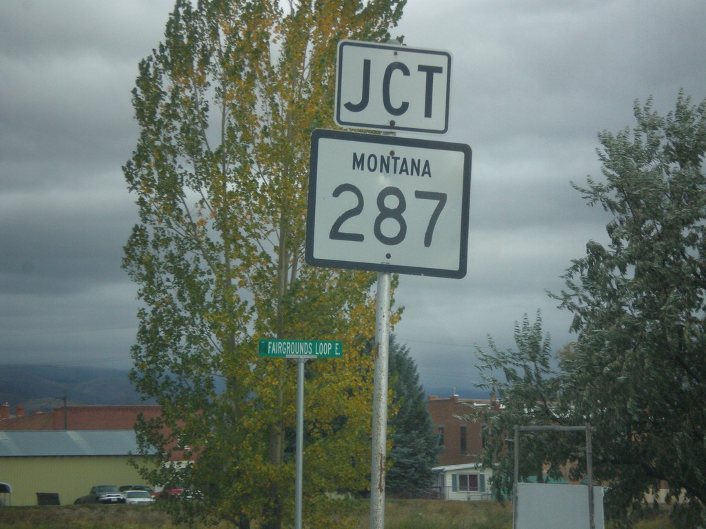
MT-41 North Approaching MT-287
MT-41 North approaching MT-287 in Twin Bridges.
Taken 10-03-2015
Twin Bridges
Madison County
Montana
United States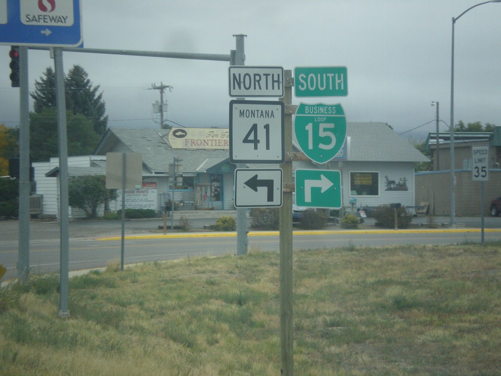
BL-15 South at MT-15
BL-15 South at MT-15 in Dillon. Turn right to continue south on BL-15; left for MT-41 north.
Taken 10-03-2015
 Dillon
Beaverhead County
Montana
United States
Dillon
Beaverhead County
Montana
United States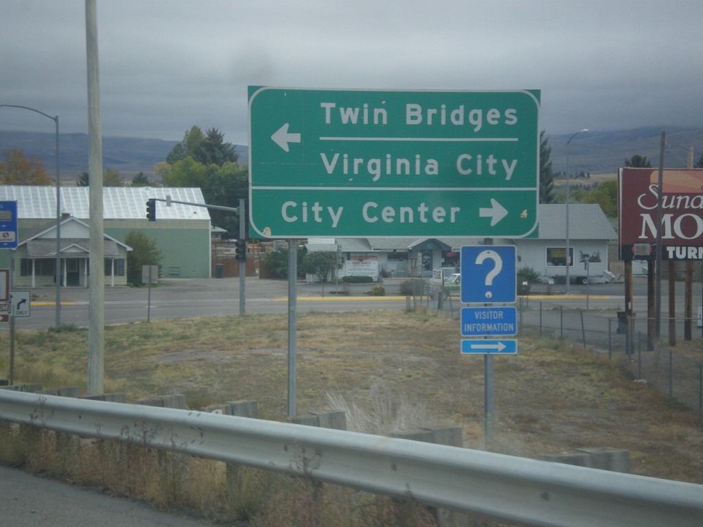
BL-15 South at MT-41
BL-15 at MT-41 in Dillon. Turn right to continue south on BL-15 for City Center (Dillon); left for MT-41 north to Twin Bridges and Virginia City.
Taken 10-03-2015
Dillon
Beaverhead County
Montana
United States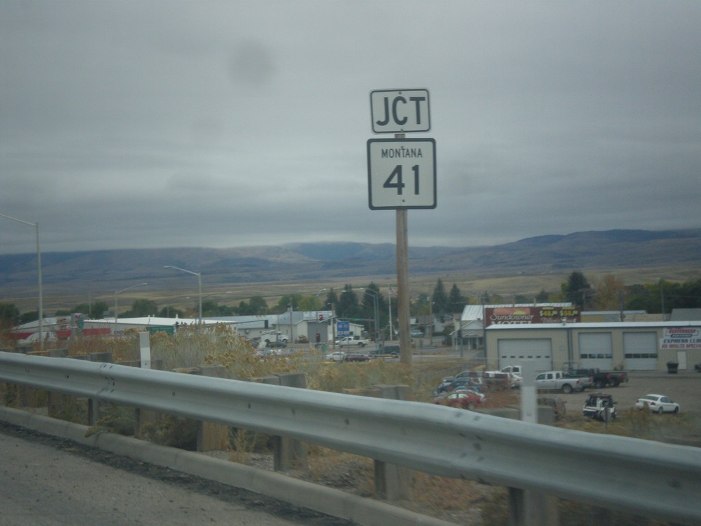
BL-15 South Approaching MT-41
BL-15 South approaching MT-41 in Dillon.
Taken 10-03-2015
Dillon
Beaverhead County
Montana
United States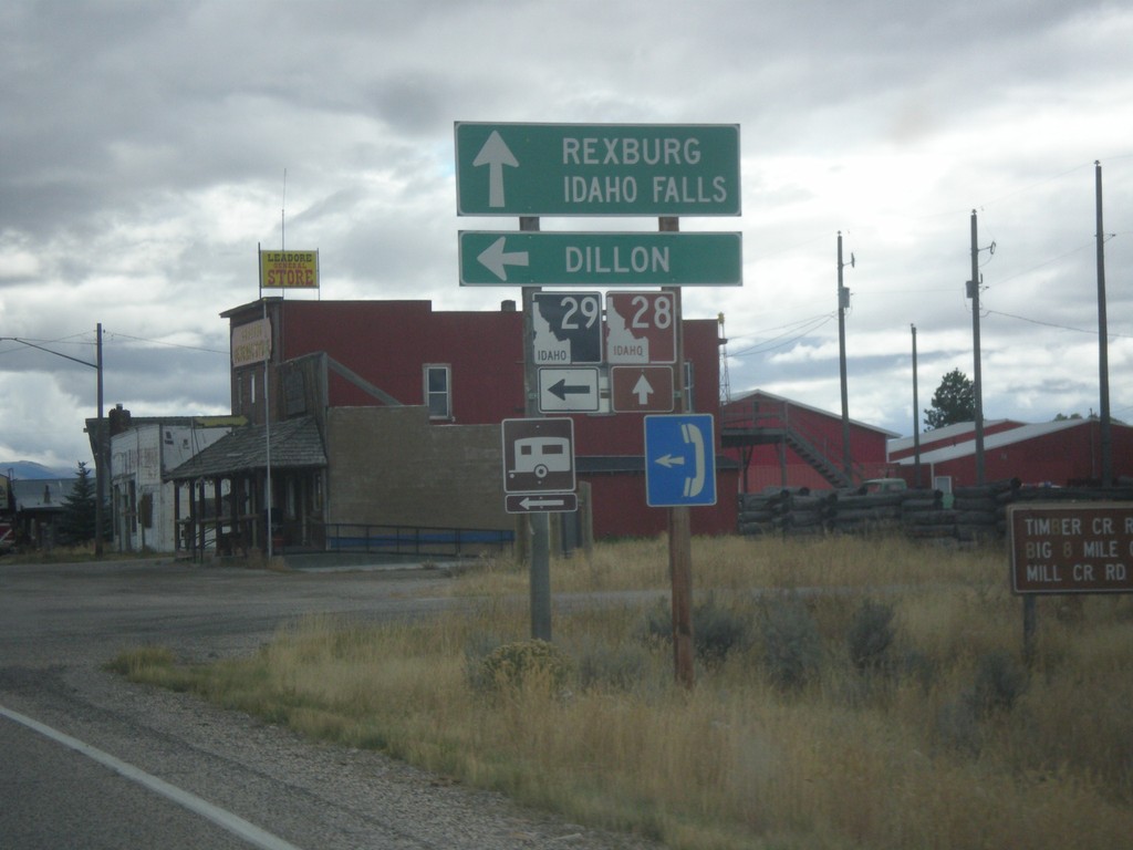
ID-28 South at ID-29
ID-28 south at ID-29 east to Dillon (Montana). Continue south on ID-28 for Rexburg and Idaho Falls.
Taken 10-03-2015

 Leadore
Lemhi County
Idaho
United States
Leadore
Lemhi County
Idaho
United States