Signs Tagged With Intersection
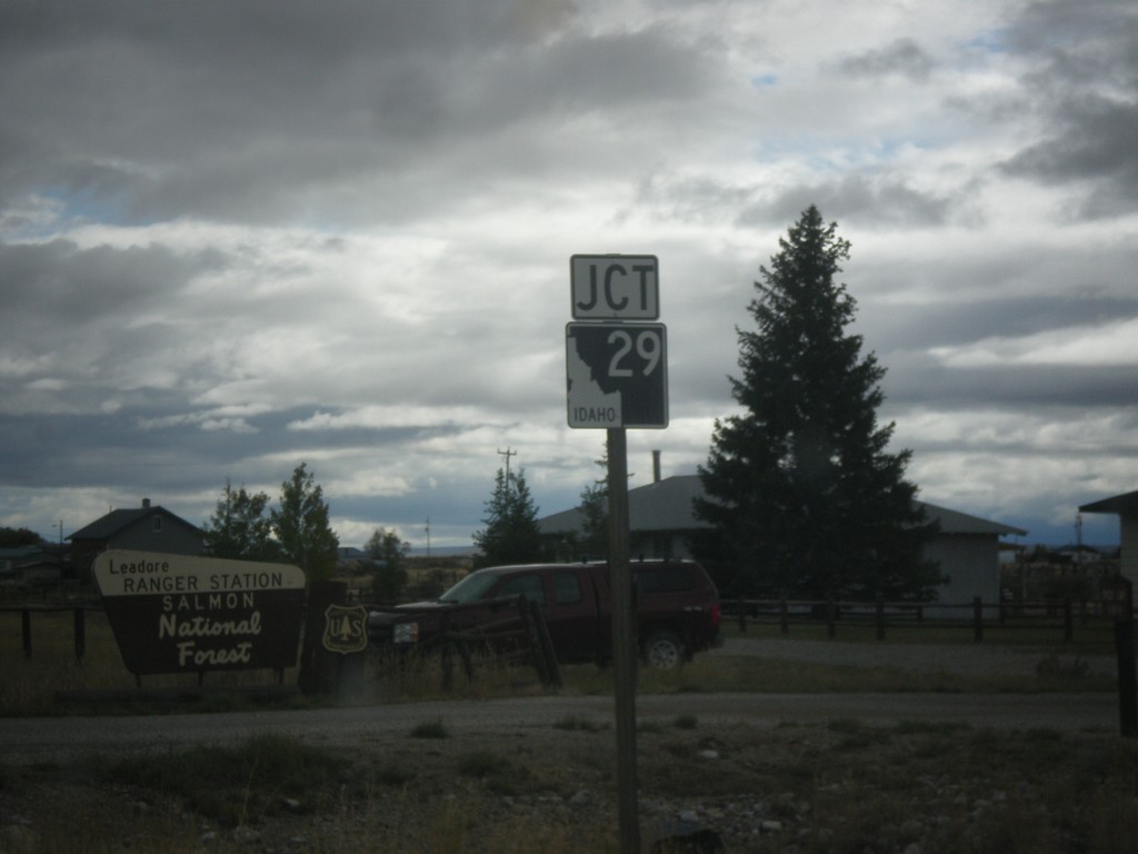
ID-28 South Approaching ID-29
ID-28 South approaching ID-29 in Leadore.
Taken 10-03-2015

 Leadore
Lemhi County
Idaho
United States
Leadore
Lemhi County
Idaho
United States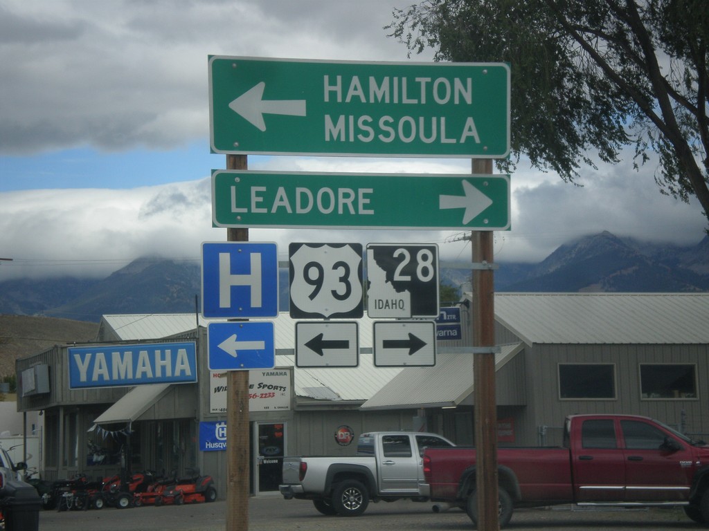
US-93 North at ID-28
US-93 North at ID-28 south to Leadore. Turn left to continue north on US-93 to Hamilton (MT) and Missoula (MT).
Taken 10-03-2015
 Salmon
Lemhi County
Idaho
United States
Salmon
Lemhi County
Idaho
United States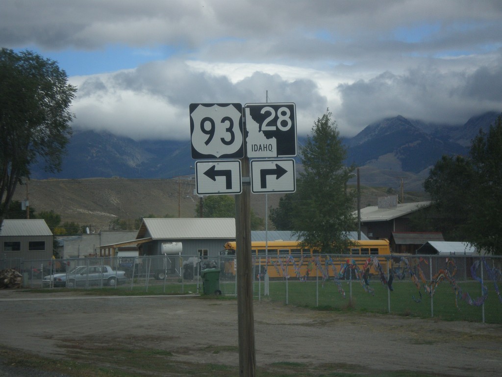
US-93 North Approaching ID-28
US-93 North approaching ID-28 in Salmon. Turn left to continue north on US-93; right for ID-28 south.
Taken 10-03-2015
Salmon
Lemhi County
Idaho
United States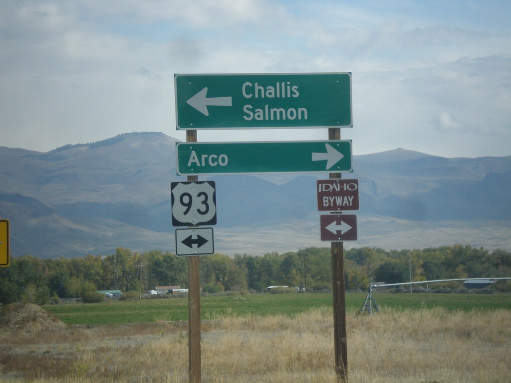
End ID-75 North at US-93
End ID-75 at US-93. Turn left for US-93 north to Challis and Salmon. Turn right for US-93 south to Arco. US-93 north is part of the Salmon River Scenic Byway; US-93 south is part of the Peaks to Craters Scenic Byway.
Taken 10-03-2015
 Challis
Custer County
Idaho
United States
Challis
Custer County
Idaho
United States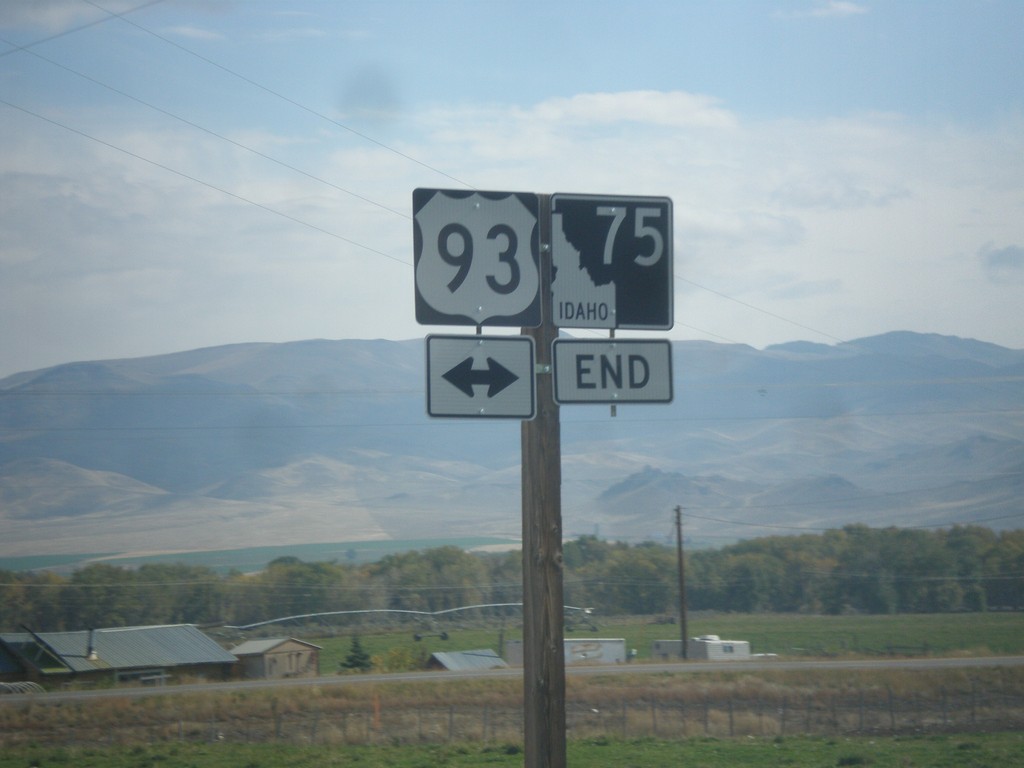
End ID-75 North at US-93
End ID-75 North at US-93 in Custer County.
Taken 10-03-2015
Challis
Custer County
Idaho
United States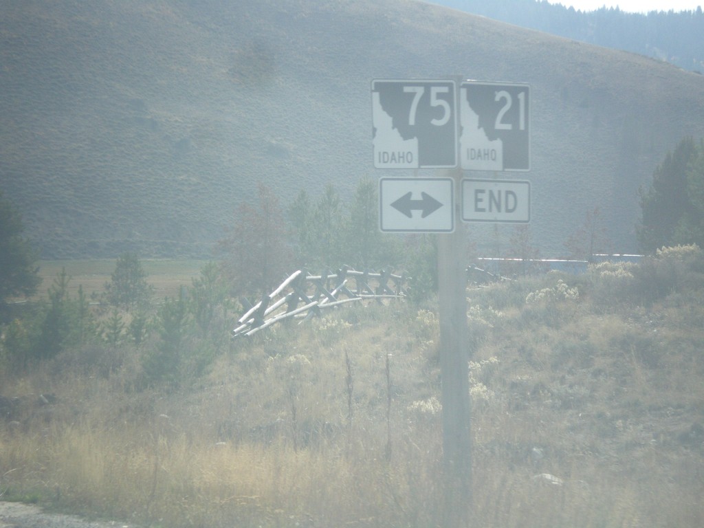
End ID-21 East at ID-75
End ID-21 East at ID-75 in Stanley.
Taken 10-03-2015
 Stanley
Custer County
Idaho
United States
Stanley
Custer County
Idaho
United States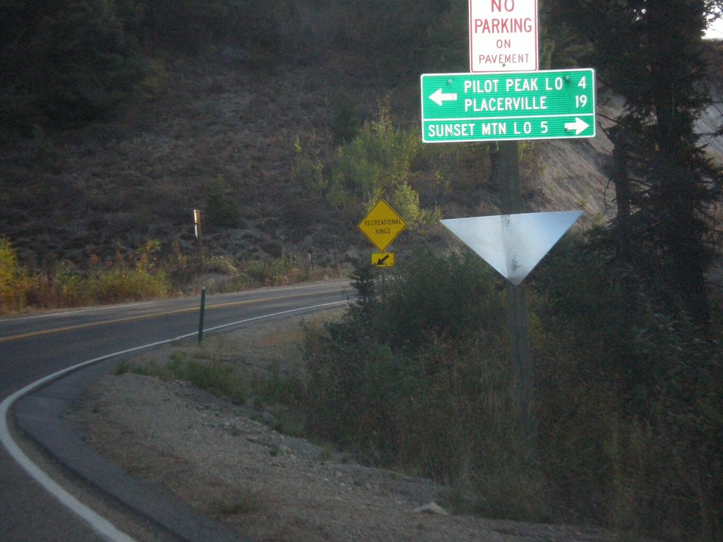
ID-21 East at Mores Creek Summit
ID-21 east at Mores Creek Summit. Turn left for Pilot Peak Lookout and Placerville; right for Sunset Mountain Lookout.
Taken 10-03-2015
Idaho City
Boise County
Idaho
United States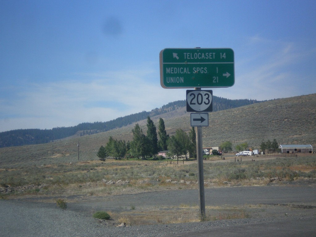
OR-203 North - Telocaset Lane
OR-203 North at Telocaset Lane to Telocaset. Turn right to continue north on OR-203 to Medical Springs and Union.
Taken 09-13-2015
 Baker City
Union County
Oregon
United States
Baker City
Union County
Oregon
United States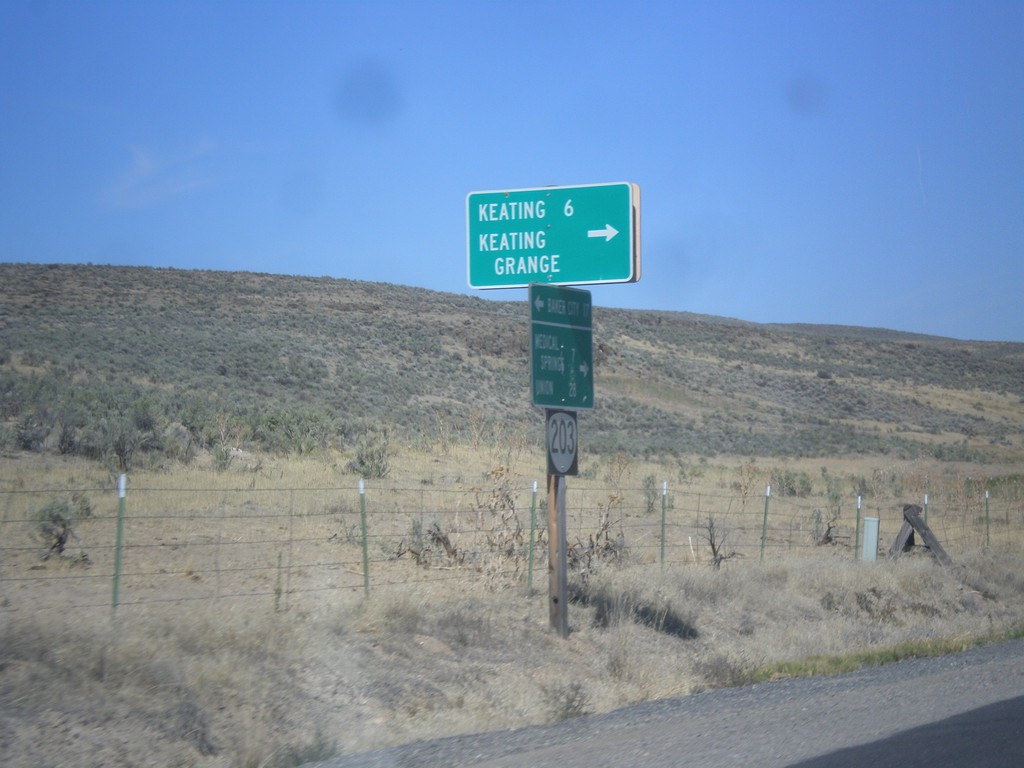
OR-203 North - Keating Jct.
OR-203 north at Miles Bridge Road to Keating and Keating Grange.
Taken 09-13-2015
Baker City
Baker County
Oregon
United States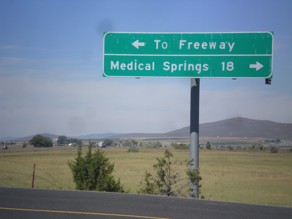
Airport Road North - OR-203 Jct.
Airport Road north at OR-203. Turn right for Medical Springs; left for (I-84) Freeway.
Taken 09-13-2015
Baker City
Baker County
Oregon
United States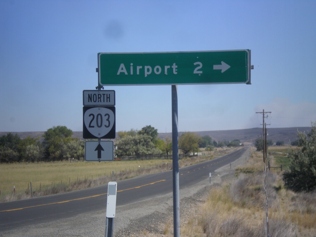
OR-203 North - Airport Road
OR-203 north at Airport Road jct.
Taken 09-13-2015
Baker City
Baker County
Oregon
United States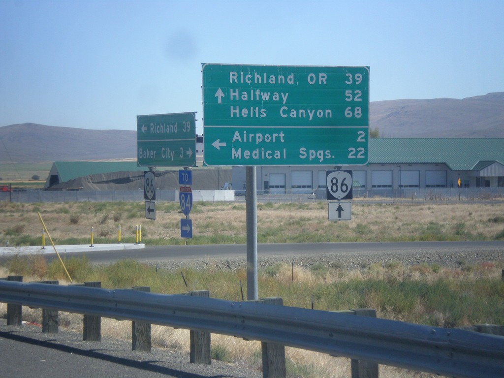
OR-86 East at West Airport Road (Medical Springs Highway)
OR-86 east West Airport Road (Medical Springs Highway) to the (Baker City) Airport and Medical Springs (via OR-203). Continue east on OR-86 for Richland, OR, Halfway and Hells Canyon. West Airport Road is a Frontage Road that extends south from the junction of OR-203 to OR-86. It is part of the Oregon State Highway system as the Medical Springs Highway but is not signed with a number.
Taken 09-13-2015
 Baker City
Baker County
Oregon
United States
Baker City
Baker County
Oregon
United States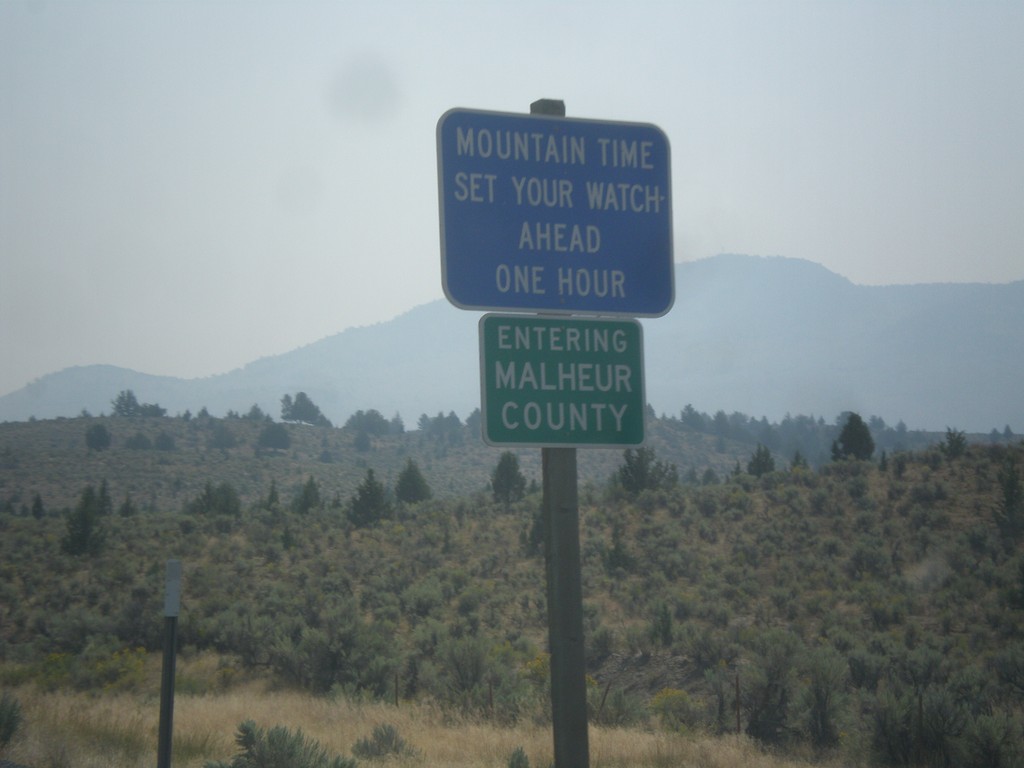
US-20 East - Malheur County/Mountain Time Zone
Entering Malheur County and Mountain Time Zone on US-20 East. The northern portion of Malheur County is the only area in Oregon that follows Mountain Time. From my travels in Oregon, this is the only blue time zone sign in the state. The rest are the standard green color.
Taken 08-23-2015
 Drewsey
Malheur County
Oregon
United States
Drewsey
Malheur County
Oregon
United States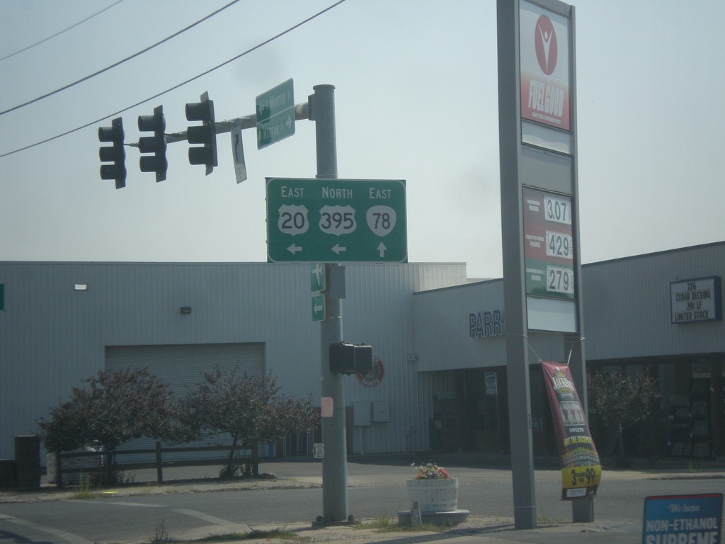
US-20 East/US-395 North at OR-78
US-20 East/US-395 north at OR-78 in Burns.
Taken 08-23-2015

 Burns
Harney County
Oregon
United States
Burns
Harney County
Oregon
United States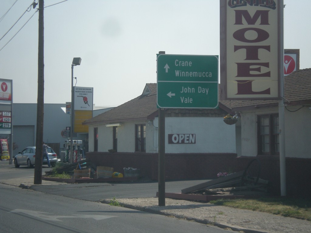
US-20 East/US-395 North Approaching OR-78
US-20 East/US-395 North approaching OR-78. Turn left for US-20 East/US-395 North to John Day (via US-395) and Value (via US-20). Continue straight for OR-78 East to Crane and Winnemucca (Nevada).
Taken 08-23-2015
Burns
Harney County
Oregon
United States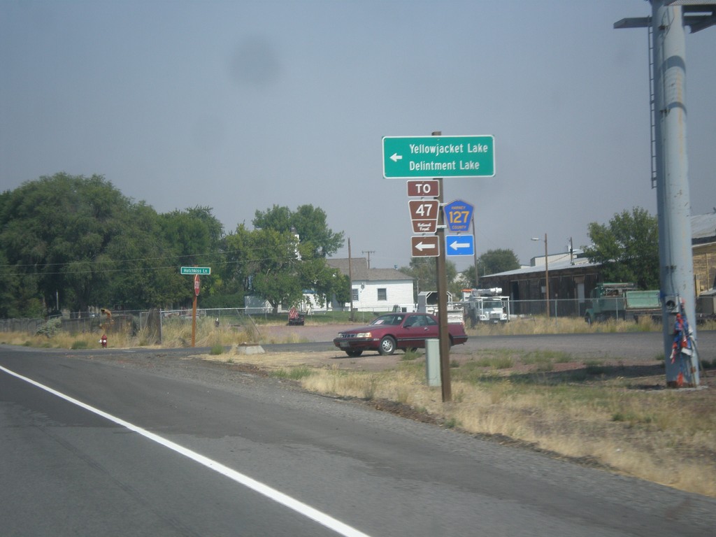
US-20 East/US-395 North - Hines Logging Road
US-20 East/US-395 North -at CR-127 Jct (Hines Logging Road). Use CR-127 for FR-47, Yellowjacket Lake, and Delintment Lake in the Malheur National Forest.
Taken 08-23-2015
Hines
Harney County
Oregon
United States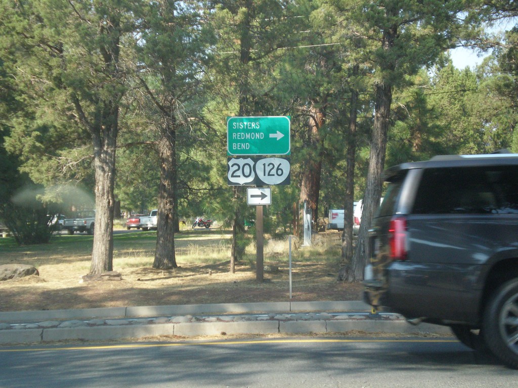
End OR-242 East at US-20/OR-126
End OR-242 East at US-20/OR-126. Use US-20/OR-126 East for Sisters, Bend, and Redmond.
Taken 08-22-2015

 Sisters
Deschutes County
Oregon
United States
Sisters
Deschutes County
Oregon
United States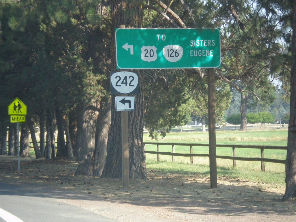
OR-242 East at Hood St. (To US-20/OR-126)
OR-242 East at Hood St. (To US-20/OR-126). Turn left to connect with US-20/OR-126 for Eugene and Sisters. Traffic can also continue east on current street for US-20/OR-126 East.
Taken 08-22-2015
Sisters
Deschutes County
Oregon
United States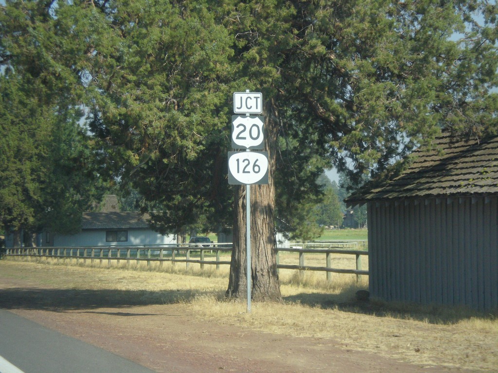
OR-242 East Approaching US-20/OR-126
OR-242 East approaching US-20/OR-126 in Sisters.
Taken 08-22-2015
Sisters
Deschutes County
Oregon
United States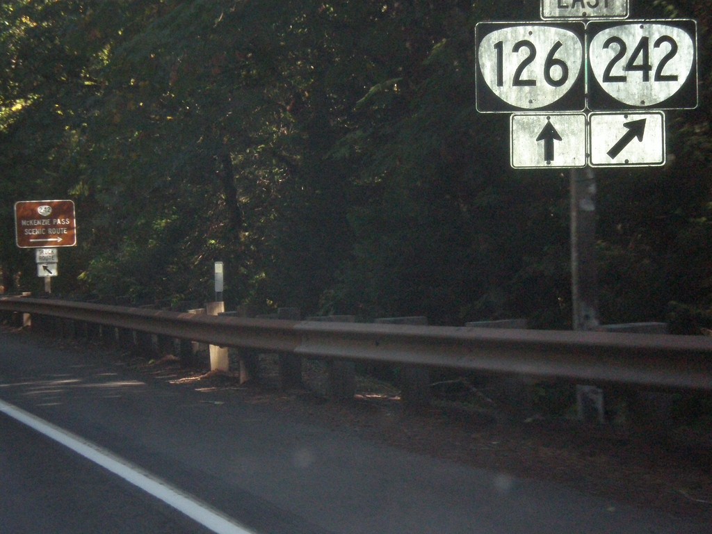
OR-126 East at OR-242
OR-126 East at OR-242. OR-126 east turns north towards Santiam Pass and OR-242 crosses the Cascades at McKenzie Pass. McKenzie Highway follows OR-242 over the pass and rejoins OR-126 in Sisters.
Taken 08-22-2015
Belknap Springs
Lane County
Oregon
United States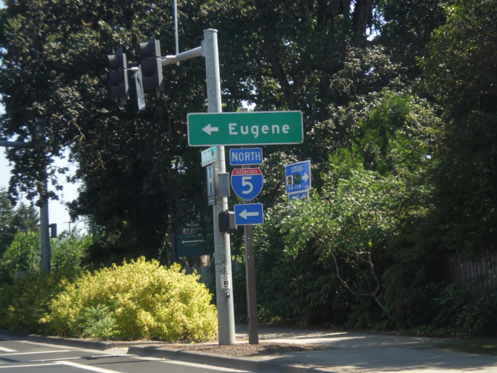
Row River Road East at I-5 North
Row River Road East at I-5 North to Eugene.
Taken 08-22-2015
 Cottage Grove
Lane County
Oregon
United States
Cottage Grove
Lane County
Oregon
United States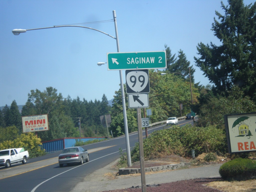
OR-99 North at Row River Road
OR-99 North at Row River Road in Cottage Grove. Merge left to continue north to OR-99 to Saginaw.
Taken 08-22-2015
 Cottage Grove
Lane County
Oregon
United States
Cottage Grove
Lane County
Oregon
United States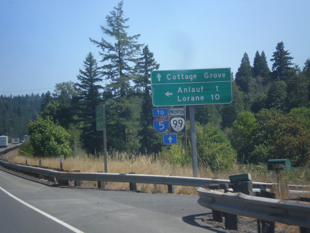
OR-38 East/OR-99 North at Curtin Road Jct.
OR-38 East/OR-99 North at Curtin Road Jct north to Anlauf and Lorane. Continue east on OR-38/OR-99 for Cottage Grove and I-5. The OR-38 shield is not displayed on this sign post, only OR-99.
Taken 08-22-2015
 Drain
Douglas County
Oregon
United States
Drain
Douglas County
Oregon
United States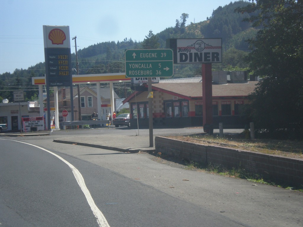
OR-38 East at OR-99
OR-38 east at OR-99 (not signed) in Drain. Turn right for OR-99 south to Yoncalla and Roseburg. Continue straight on OR-38 East/OR-99 North to Eugene. This stretch of OR-99 south of Drain was formerly the Drain-Yoncalla Highway #236.
Taken 08-22-2015
Drain
Douglas County
Oregon
United States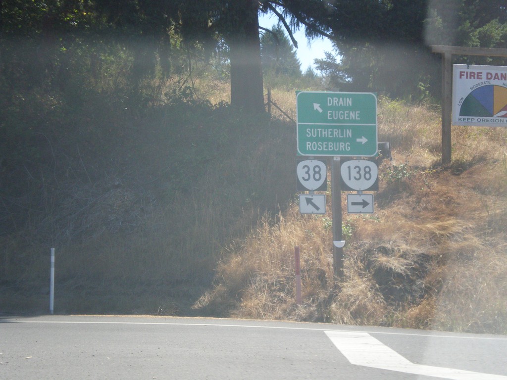
OR-38 East at OR-138
OR-38 east at OR-138. Turn right for OR-138 east to Roseburg and Sutherlin. Turn left for OR-38 east to Drain and Eugene.
Taken 08-22-2015
 Elkton
Douglas County
Oregon
United States
Elkton
Douglas County
Oregon
United States